Saltar al contenido principal
icon-intereses-turismo-low-cost

Albergue Las Nogueras Hostel

Submitted by brandcode_deweloper on
Id
2155530
Redes sociales
Facebook
https://www.facebook.com/Las-Nogueras-106590816068963/
Descripción
Breve descripción

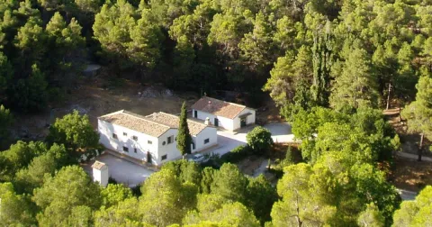
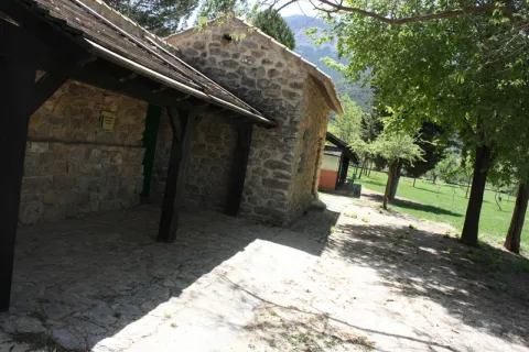
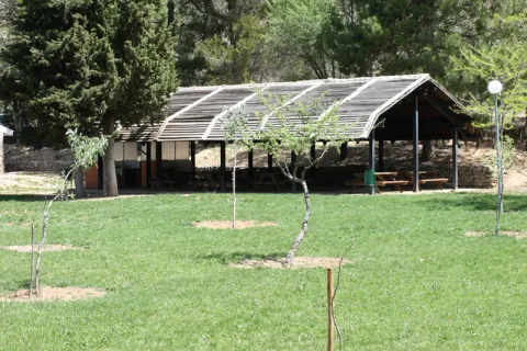
Las Nogueras, is a large-school, multi-adventure center, located on a 40-hectare farm in the natural park of Despeñacolos (Jaén) that has been developing school visits, camps and celebrations since 1992.

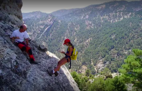
The magnificent facilities of the estate - horses, swimming pools, basketball courts, squash, football fields, rocodrome, archery, tyrolin, lake, pyroguas, canteens and dormitories -, its splendid natural and cultural environment and the wide range of activities that the monitors develop, specifically formed in our facilities, will make your stay an unforgettable sports, natural and cultural experience.
Información de contacto
Teléfono
915 730 565
Sitio web
www.lasnogueras.com
Correo electrónico
info@lasnogueras.com
Ubicación
Código Postal
23213
Latitud
38.367011
Longitud
-3.597238
Dirección
Ctra. de Miranda del Rey, s/n
Distrito
Municipio
Ubicación en el mapa
POINT (-3.597238 38.367011)
Tipo de alojamiento
Imágenes
imagen
Image
las-nogueras.png
Imagen principal
Activado
imagen
Image
albergue_10.jpg
Imagen principal
Desactivado
Aforo
150
Loading map
Preparing points of interest and routes...
El Hotel

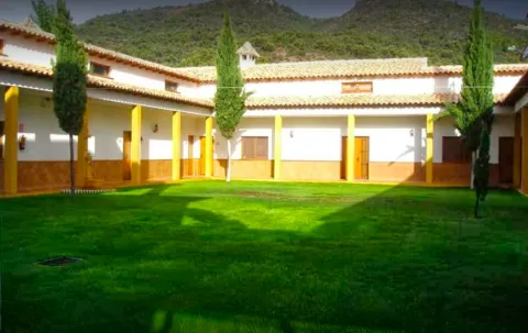
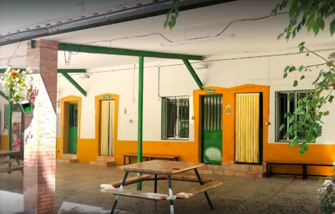
The school of Nature Las Nogueras has an area of 40 hectares and a total capacity of 150 children. It has porches for activities in the event of rain. A splendid kitchen in which our cooks take care to serve the traditional Mediterranean cuisine and dining. 10 individual bathroom apartments (8 children per apartment), 6 rooms (8 to 14 children per room) sharing 6 bathrooms, teacher residence with meeting room and exclusive bathrooms. See flat rooms.

Nursing. Swimming pool, children's kitchen workshop and art workshop, indoor basketball court, football field, archery field, rocodrome, lake with embarkation, rocodrome tirolina, horse stew, blocks, cocheries, corrals, orchard and fruit tree field.

La Posada del Perchel Hostel

Submitted by brandcode_deweloper on
Id
7883868
Redes sociales
Facebook
https://www.facebook.com/posadadelperchel/
Descripción
Breve descripción

It arises as a response to the needs of the area to host numerous groups or people alone, who want to enjoy our saw. It consists of living room, kitchen, bathrooms and three bedrooms.

Información de contacto
Teléfono
651 971 498
Sitio web
www.posadadelperchel.com
Correo electrónico
raulpontones@hotmail.com
Ubicación
Código Postal
23291
Latitud
38.118401
Longitud
-2.670419
Dirección
C/ Perchel III
Distrito
Municipio
Ubicación en el mapa
POINT (-2.670419 38.118401)
Tipo de alojamiento
Imágenes
imagen
Image
87809589_2581652608716085_3635034988170182656_o.jpg
Imagen principal
Activado
imagen
Image
21617810_1987334391481246_6866714007948312917_n.jpg
Imagen principal
Desactivado
imagen
Image
19756451_1952988354915850_8385144139503839718_n.jpg
Imagen principal
Desactivado
imagen
Image
72039852_2452081078339906_8350488245397618688_n.jpg
Imagen principal
Desactivado
Loading map
Preparing points of interest and routes...
El Hotel

In the hostel there are 20 places distributed in three bedrooms made up of bunks.
The house is divided into, living room kitchen, a male bathroom and another female bathroom, and three bedrooms, two of them with four bunks (8 beds each bedroom.) and one with two bunks. (4 beds)

Cazorla Youth Hostel

Submitted by brandcode_deweloper on
Id
2157272
Descripción
Breve descripción

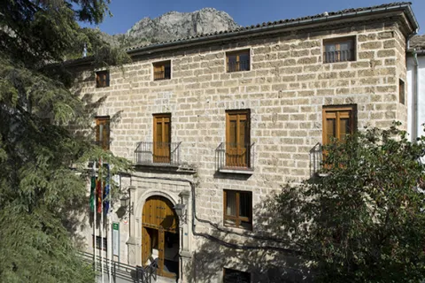
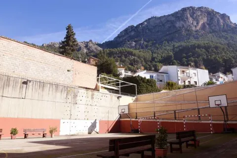
The Youth Inturyoung Hostel Cazorla is located in the historic building of an old convent. An unusual place that offers interesting services to the visitor: swimming pool, sports courts, rocodrome, tourist services, buffet dining...

Información de contacto
Sitio web
www.inturjoven.com/albergues/jaen/albergue-inturjoven-cazorla
Correo electrónico
cazorla.itj@juntadeandalucia.es
Ubicación
Código Postal
23470
Latitud
37.912493
Longitud
-3.001043
Dirección
Plaza Mauricio Martínez, 6
Municipio
Ubicación en el mapa
POINT (-3.001043 37.912493)
Tipo de alojamiento
Imágenes
imagen
Image
albergue-inturjoven.jpg
Imagen principal
Activado
imagen
Image
Cazorla_2017_Habitaci%C3%B3n%202PC.jpg
Imagen principal
Desactivado
imagen
Image
Cazorla_2019_Piscina%20remodelada.jpg
Imagen principal
Desactivado
imagen
Image
Cazorla_2017_Pistas.jpg
Imagen principal
Desactivado
imagen
Image
Cazorla_2017_Sal%C3%B3n.jpg
Imagen principal
Desactivado
imagen
Image
Cazorla_2017_Piscina.jpg
Imagen principal
Desactivado
Aforo
129
Loading map
Preparing points of interest and routes...
El Hotel

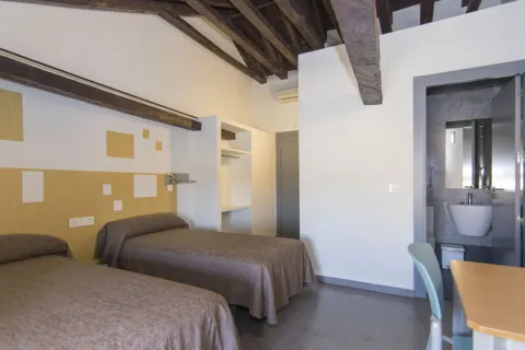
An important renovation has been undertaken on this hostel, with all its rooms with the bathroom inside.

This hostel is very well located in the centre of the village, so it becomes a perfect place to explore the Natural Park of Cazorla and enjoy the many possibilities of tourist, ecological and sports routes of this natural space: a luxury to breathe pure air and enjoy the leisure in a healthy, fun and young way.

Adventures and nature await you in Cazorla!

Albergue El Hornico Hostel

Submitted by brandcode_deweloper on
Id
2162143
Descripción
Breve descripción

The hostel El Hornico is located in the middle of the mountain within the Natural Park Sierras de Cazorla, Segura and Las Villas. They are located 10 Km from Pozo Alcón, in Jaén Province.

Antigua Casa Forestal rehabilitated and owned by the Consejeria de Medio Ambiente has facilities that are perfectly adapted to accommodate groups and develop Environmental Education Programs, as well as activities of Active Tourism for both its infrastructure and its location.

Información de contacto
Teléfono
667 227 275
Sitio web
www.aventurocio.com
Correo electrónico
info@aventurocio.com
Ubicación
Código Postal
23485
Latitud
37.774551
Longitud
-2.923538
Dirección
Pantano de la Bolera, s/n
Municipio
Ubicación en el mapa
POINT (-2.923538 37.774551)
Tipo de alojamiento
Imágenes
imagen
Image
el-hornico.png
Imagen principal
Activado
imagen
Image
habitaciones-hornico.jpeg
Imagen principal
Desactivado
imagen
Image
albergue%20%281%29.jpg
Imagen principal
Desactivado
imagen
Image
el-hornico.jpeg
Imagen principal
Desactivado
imagen
Image
turismo%20%281%29.png
Imagen principal
Desactivado
Aforo
48
Las habitaciones

2 rooms with 6 places with bunk beds, with 2 double for disabled. All with spring mattresses, protective and wardrobe for clothes and luggage. They also have sheets and blankets. All rooms have a bathroom with service, sink and shower.

Loading map
Preparing points of interest and routes...
El Hotel

It has two facilities: an old rehabilitated forest house located next to a Botanical Garden and a newly built Training Center located next to the Pantano de la Bolera, one of the most beautiful areas of Andalusia.

Albergue Complejo Las Palmeras Hostel

Submitted by brandcode_deweloper on
Id
2162048
Redes sociales
Facebook
https://www.facebook.com/granjaescuelalaspalmeras/photos/?tab=albums
Descripción
Breve descripción

The Las Palmeras complex is located in Porcilla. This beautiful hostel is ideal for enjoying the natural and cultural wealth of the environment as well as numerous sports activities. The hostel is careful and ideal if you are looking to spend a few days on holiday and get to know the area. Do not hesitate to contact you to request additional information.

Información de contacto
Teléfono
655 549 069
Correo electrónico
granjaescuela@granjaescuelalaspalmeras.com
Ubicación
Código Postal
23790
Latitud
37.873468
Longitud
-4.168270
Dirección
Ctra. de Arjona, km. 1
Distrito
Municipio
Ubicación en el mapa
POINT (-4.16827 37.873468)
Tipo de alojamiento
Imágenes
imagen
Image
858983_556869907739312_426254770_o.jpg
Imagen principal
Activado
imagen
Image
1082392_556869361072700_780864218_o.jpg
Imagen principal
Desactivado
Aforo
60
Loading map
Preparing points of interest and routes...
El Hotel

Enjoy an unforgettable experience at the Las Palmeras School Farm. One-day visits, accommodation and summer camps.

Our team of professionals has a long experience in the sector, supported by the more than five years of activity in the Farm School of Porcella. A place of meeting, exchange and training through the participation of the different workshops, where children and adults will develop attitudes of commitment and respect for the environment.

Recreational Zone río San Juan

Submitted by brandcode_deweloper on
Id
1909649
Descripción
Descripción larga

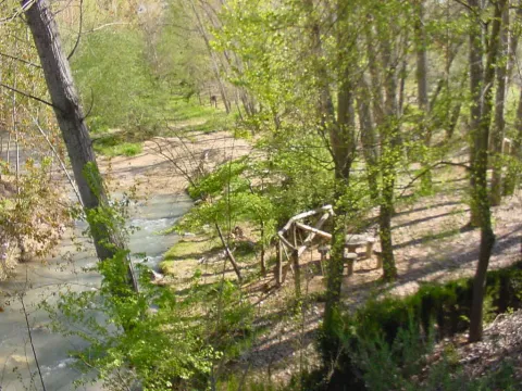
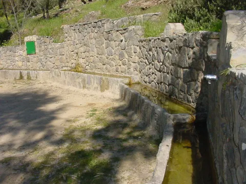
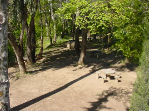
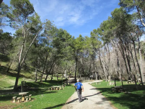
It is a very quiet area, surrounded by endless olive fields, where there are fountains with drinking water, barbecues, tables and seats. In the river you can practice, in season, fishing of the common trout and the barb, or practice swimming.

Breve descripción

This recreational area is located in the area known as the Palomillas Bridge

Ubicación
Latitud
37.540246
Longitud
-4.039030
Dirección
Carretera comarcal JV-2236 de Sabariego a La Rábita, en su cruce con la carretera N-432 Granada - Badajoz.
Distrito
Municipio
Ubicación en el mapa
POINT (-4.03903 37.540246)
Imágenes carrusel
imagen
Image
4%20%281%29.jpg
Imagen principal
Desactivado
imagen
Image
1%20%281%29.jpg
Imagen principal
Desactivado
imagen
Image
10.jpg
Imagen principal
Desactivado
Imágenes cabecera
imagen
Image
3%20%281%29.jpg
Imagen principal
Activado
Microsite al que pertenece
Loading map
Preparing points of interest and routes...

Recreational Zone La Cañada

Submitted by brandcode_deweloper on
Id
4691127
Descripción
Breve descripción

It is a perfectly equipped road that has an interesting look, a water source and an information panel on landscape interpretation.

Telecomunicaciones
Sitio web
www.pinademontalgrao.es/content/complejo-la-canada
Teléfono de contacto
953 781 500
Correo electrónico
ayuntamiento@larva.es
Ubicación
Código Postal
23591
Latitud
37.758500
Longitud
-3.200520
Dirección
C/ Conde Torrerando, 22
Distrito
Municipio
Ubicación en el mapa
POINT (-3.20052 37.7585)
Tipos de punto de interés
Imágenes carrusel
imagen
Image
Area%20Recreativa%20La%20Ca%C3%B1ada.jpg
Imagen principal
Desactivado
Imágenes cabecera
imagen
Image
9085_0nw5ulj32ahczt4o.jpg
Imagen principal
Activado
Horario
24 h.
Microsite al que pertenece
Loading map
Preparing points of interest and routes...

Mágina Peaks and Miramundos Zone

Submitted by brandcode_deweloper on
Id
5846349
Descripción
Breve descripción

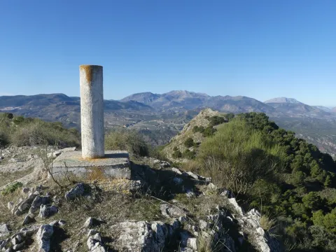
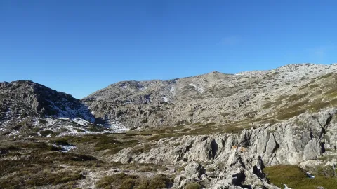
In this summit crest is the roof of the province: the Pico Magina, with 2,167 meters of height, which is the third highest altitude of Andalusia, after the massizos of Sierra Nevada and the Sierra de Baza. The vegetation and conditions are typical of the high Mediterranean mountain.

Ubicación
Latitud
37.730270
Longitud
-3.445830
Distrito
Ubicación en el mapa
POINT (-3.44583 37.73027)
Tipos de punto de interés
Imágenes carrusel
imagen
Image
17%20Magina.JPG
Imagen principal
Desactivado
imagen
Image
naturaleza_14268337_20191208114422%20%281%29.jpg
Imagen principal
Desactivado
imagen
Image
9788440Master%20%282%29.jpg
Imagen principal
Desactivado
Imágenes cabecera
imagen
Image
P1240066%20%282%29.jpg
Imagen principal
Activado
Microsite al que pertenece
Loading map
Preparing points of interest and routes...

Hondacabras Camping Area

Submitted by brandcode_deweloper on
Id
2980330
Descripción
Descripción larga

The landscape surrounding this equipment, located on the rest of a pecuary road, is typically olive-growing and invites hiking. The facilities, with a capacity for a hundred people, have areas for tents, roofed dining, kitchen, toilets and showers.

Breve descripción

It is accessed from the JA-1107 road that goes from Torres to Albanchez de Magina; after walking about two km, in the middle of a curve, to the right, it connects a lane that, with a total length of one kilometre, leads us directly to this camping area of the Sierra Magina Natural Park called Hondacabras.

Telecomunicaciones
Sitio web
www.juntadeandalucia.es
Teléfono de contacto
953 363 011
Correo electrónico
informacion@juntadeandalucia.es
Ubicación
Código Postal
23540
Latitud
37.768770
Longitud
-3.495980
Dirección
Carretera JA-3107
Distrito
Municipio
Ubicación en el mapa
POINT (-3.49598 37.76877)
Tipos de punto de interés
Imágenes carrusel
imagen
Image
acampada%20Hondacabras.jpg
Imagen principal
Desactivado
imagen
Image
acampada%20Hondacabras%202.jpg
Imagen principal
Desactivado
imagen
Image
acampada%20Hondacabras%203.jpg
Imagen principal
Desactivado
Imágenes cabecera
imagen
Image
acampada%20Hondacabras%204.jpg
Imagen principal
Activado
Microsite al que pertenece
Loading map
Preparing points of interest and routes...

Roman Villa of Bruñel

Submitted by brandcode_deweloper on
Id
919543
Descripción
Descripción larga

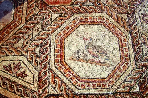
Most of these buildings are based as a second residence during the High Empire, although with the crisis of the third century and the insecurity of the cities many great aristocrats withdraw to their villages. As the residence becomes, the luxury and refinement of which the rich mosaics and the beginning of the walls of the different rooms are preserved as a testimony. Next to the Palaciega area there were other units with stables, with forges, alfares and, ultimately, everything necessary to be self-sufficient away from the city. Over time, the cities lost their importance, had to wafer to avoid dangers and the cultural spotlights that had gone out.

If we know nothing about the inhabitants of these luxurious rooms, we know less about those people who left the city to take refuge in these villas. They helped defend property in exchange for being able to cultivate a piece of land with which to get what is necessary to feed. Here is the origin of what would be the vasalage in the Middle Ages. Nor do we know how the craftsmen made these great mosaics, nor their living conditions, would they know that they represented the images they reproduced with the tesels? and the last inhabitants at the end of the fourth century?

Breve descripción

The villa of Bruñel represents the typical model of Roman villa that begins to extend during the Lower Empire.

Ubicación
Latitud
37.842982
Longitud
-3.066921
Municipio
Ubicación en el mapa
POINT (-3.066921 37.842982)
Tipos de punto de interés
Imágenes carrusel
imagen
Image
Mon167.jpg
Imagen principal
Desactivado
imagen
Image
quesada.jpg
Imagen principal
Desactivado
Imágenes cabecera
imagen
Image
DQxszNiU8AAV39W.jpg
Imagen principal
Activado
Loading map
Preparing points of interest and routes...
Marcas de calidad