Saltar al contenido principal
icon-intereses-turismo-low-cost

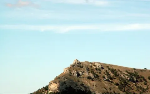
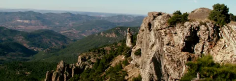
Chasm / Sinkhole of Pinar Negro

Submitted by brandcode_deweloper on
Id
877405
Descripción
Descripción larga

The total power of the section is over 150 m. On a few sucrose dolomies attributed to the lower and medium Jurassic we find materials from the upper Kimmeridgian; they are limeals with large gastropods and corals that end up on an erosive surface with a crusts of iron oxides.

The following are limestones, locally sandy and margas, with various levels of interspersed calcrets; these materials are being decrified and dolomitised, giving way to stoned dolomies with abundant carbonous remains; this whole set of materials is of the age Hauteriviense- Barremiense. The lower Aptiense is characterized by the presence of sands, calcareous sandstone and sandy limestone with laminations and cross stratifications as well as orbitolins at various levels. The materials of the upper Aptiense have abundant rudists and orbitolins. The Albibe is represented by dolomies with black songs and ghosts of rudists.

Source: Inventory of Georresources of Andalusia. Environmental Council. Junta de Andalusia.

Breve descripción

Black Pinar Sima

Ubicación
Latitud
38.298857
Longitud
-2.651877
Distrito
Ubicación en el mapa
POINT (-2.651877 38.298857)
Tipos de punto de interés
Imágenes carrusel
imagen
Image
P1050513.JPG
Imagen principal
Desactivado
imagen
Image
V04.jpeg
Imagen principal
Desactivado
Imágenes cabecera
imagen
Image
pinar-negro.jpg
Imagen principal
Activado
Loading map
Preparing points of interest and routes...

Mountain Range of the Trigo

Submitted by brandcode_deweloper on
Id
4867768
Descripción
Breve descripción

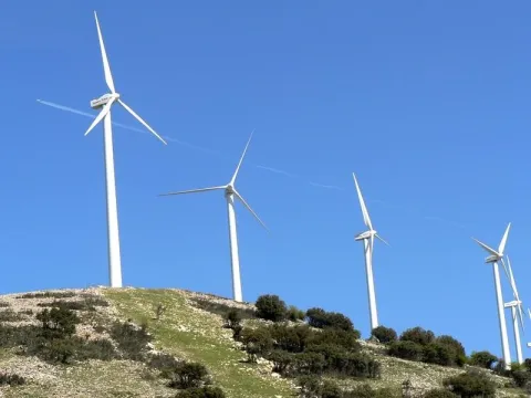
This is an important mountain port, from where we can seestunning panoramicSierra Sur, Sierra Mágina, Sierra de Arana and Sierra Nevada. In two of his tops,The NevazosandCerro del Hoyo Cigarronesdifferent phases of thewind park.

Ubicación
Código Postal
23140
Latitud
37.515210
Longitud
-3.738680
Distrito
Municipio
Ubicación en el mapa
POINT (-3.73868 37.51521)
Tipos de punto de interés
Imágenes carrusel
imagen
Image
SierraTrigo.jpg
Imagen principal
Desactivado
Imágenes cabecera
imagen
Image
Sierra_del_Trigo01.jpg
Imagen principal
Activado
Microsite al que pertenece
Loading map
Preparing points of interest and routes...

Mountain Range of the Oro

Submitted by brandcode_deweloper on
Id
8090429
Descripción
Descripción larga

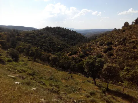
This saw welcomes the typical Mediterranean forest, with the rich and typical varied flora and fauna. Areas of pedestal steep, others with typical river vegetation, and the serrana area characteristic of Sierra Morena. As for its fauna, typical of Sierra Morena, we find many species of cynegetic species such as deer, boar, muflon, go, foxes, rabbits, perdices, hares, doves, etc. Its flora is made up of low mountain and native Mediterranean forest of oak, juniper, madroño, acebuchs, alcornoques, torviscos, complaints, rosemary, thyme, pellet, lentils, cornicabra, zarzas; large and large areas of jars, shrubs, some coniferous areas, reduced presence of areas of dehesa, fruit such as pomegranate, fig tree, membranel, typical talleds, chopos, juncos, canyizales and other river vegetation.

Breve descripción

This saw is the jewel enjoyed by the citizens of Castellar thanks to the Scriptures of Concordia signed by the three peoples and the Marquis. Unfortunately, man's hand has transformed this lung with the fire a few years ago, although it is gradually trying to recover its lost image.

Telecomunicaciones
Sitio web
www.castellar.es/patrimonio-natural
Teléfono de contacto
953 460 005
Ubicación
Código Postal
23260
Latitud
38.252940
Longitud
-3.130944
Distrito
Municipio
Ubicación en el mapa
POINT (-3.130944 38.25294)
Tipos de punto de interés
Imágenes carrusel
imagen
Image
sierra%20del%20oro.jpg
Imagen principal
Desactivado
Imágenes cabecera
imagen
Image
f503c72bd5e3adfce980be013ef81cf0_720x560.jpg
Imagen principal
Activado
Loading map
Preparing points of interest and routes...

Mountain Range of Campillo

Submitted by brandcode_deweloper on
Id
4555300
Descripción
Descripción larga

Mediterranean mountain area, also called Sierra de Alta Coloma, with high-value geological and vegetable formations such as oaks, complaints, junips and savannas. The following enclaves are highlighted: the Monastery ravine, the Quebrajano reservoir, the Valdecarazos river, the Palo Stone, the Netherlands Prados cortijo or the Alberquilla lookout.

Location: Sector west of the municipal term.

Distance: 3-7 km.

Medium: by all-terrain vehicle, by bike and on foot.

Access route: By the JV-2.228, which leaves directly from the urban centre, and through agricultural and forestry roads.

Ubicación
Latitud
37.555995
Longitud
-3.635602
Distrito
Municipio
Ubicación en el mapa
POINT (-3.635602 37.555995)
Tipos de punto de interés
Imágenes carrusel
imagen
Image
sierracampillo1.jpg
Imagen principal
Desactivado
Imágenes cabecera
imagen
Image
sierracampillo.jpg
Imagen principal
Activado
Microsite al que pertenece
Loading map
Preparing points of interest and routes...

Mountain Range of Ahillos

Submitted by brandcode_deweloper on
Id
1918729
Descripción
Breve descripción

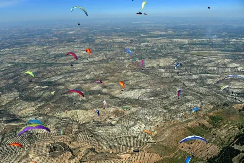
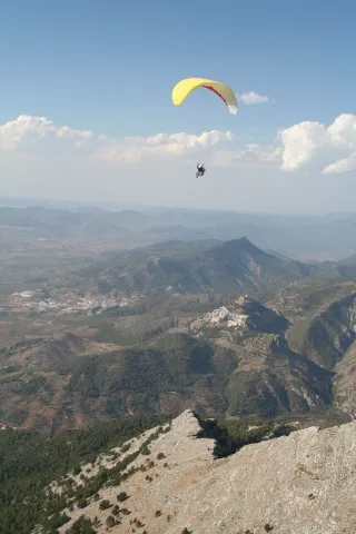
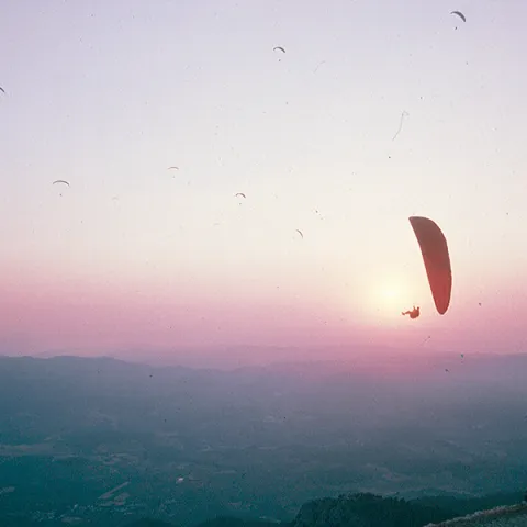
Innailed in the Sierra Sur region, the Achillos saw has take-off areas in all directions of the wind, so here the opportunities to fly multiply. In the second half of July a concentration of paragliding and paramotor is held.

Telecomunicaciones
Teléfono de contacto
650 621 081
Ubicación
Código Postal
23660
Latitud
37.599690
Longitud
-4.033650
Dirección
C/ Alta, 1
Distrito
Municipio
Ubicación en el mapa
POINT (-4.03365 37.59969)
Imágenes carrusel
imagen
Image
106571953_373426606961168_8043577217586885911_n.jpg
Imagen principal
Desactivado
imagen
Image
12341580_968660439848652_2638285071187591491_n.jpg
Imagen principal
Desactivado
Imágenes cabecera
imagen
Image
IMG_2667.jpeg
Imagen principal
Activado
Loading map
Preparing points of interest and routes...

Small Mountain Range of Pegalajar

Submitted by brandcode_deweloper on
Id
5848471
Descripción
Breve descripción

Landscape of high interest to be located in the vicinity of Pegalajar, where the cave house district is located, some of them for rent. On the northern side there are stunning views of the capital, Jaén, and the Guadalquivir River countryside. To the south the Serrezuela looks at the massif of Sierra Magina and the valley of the Guadalbullion River.

Ubicación
Latitud
37.742398
Longitud
-3.661094
Distrito
Municipio
Ubicación en el mapa
POINT (-3.661094 37.742398)
Tipos de punto de interés
Imágenes carrusel
imagen
Image
serrezuelapegalajar1.png
Imagen principal
Desactivado
Imágenes cabecera
imagen
Image
serrezuelapegalajar.png
Imagen principal
Activado
Microsite al que pertenece
Loading map
Preparing points of interest and routes...

Small Mountain Range of Bedmar

Submitted by brandcode_deweloper on
Id
5845460
Descripción
Breve descripción

A very steep limestone formation that is located east of the town of Bedmar and above it. On the other side of these scarves is the neighbouring town of Jódar. The climbing lovers will find here magnificent ways to practice their favorite sport. In the center of it you can see an obscene with an Arab wall known as the Air Cave.

Ubicación
Latitud
37.832416
Longitud
-3.423530
Distrito
Municipio
Ubicación en el mapa
POINT (-3.42353 37.832416)
Tipos de punto de interés
Imágenes carrusel
imagen
Image
serrezuelabedmar1.png
Imagen principal
Desactivado
Imágenes cabecera
imagen
Image
serrezuelabedmar.png
Imagen principal
Activado
Microsite al que pertenece
Loading map
Preparing points of interest and routes...

Jurassic-Lower Cretaceous Series of Navalperal

Submitted by brandcode_deweloper on
Id
877361
Descripción
Descripción larga

The total power of the section is over 150 m. On a few sucrose dolomies attributed to the lower and medium Jurassic we find materials from the upper Kimmeridgian; they are limeals with large gastropods and corals that end up on an erosive surface with a crusts of iron oxides.

The following are limestones, locally sandy and margas, with various levels of interspersed calcrets; these materials are being decrified and dolomitised, giving way to stoned dolomies with abundant carbonous remains; this whole set of materials is of the age Hauteriviense- Barremiense. The lower Aptiense is characterized by the presence of sands, calcareous sandstone and sandy limestone with laminations and cross stratifications as well as orbitolins at various levels. The materials of the upper Aptiense have abundant rudists and orbitolins. The Albibe is represented by dolomies with black songs and ghosts of rudists.

Source: Inventory of Georresources of Andalusia. Environmental Council. Junta de Andalusia.

Breve descripción

Navalperal

Ubicación
Latitud
38.298857
Longitud
-2.651877
Distrito
Ubicación en el mapa
POINT (-2.651877 38.298857)
Tipos de punto de interés
Imágenes carrusel
imagen
Image
1%20%285%29.jpg
Imagen principal
Desactivado
imagen
Image
561_img.png
Imagen principal
Desactivado
Imágenes cabecera
imagen
Image
561_img.png
Imagen principal
Activado
Loading map
Preparing points of interest and routes...

Jurassic-Cretaceous Series of El Yelmo

Submitted by brandcode_deweloper on
Id
877317
Descripción
Descripción larga

From the view of Segura de la Sierra you have a magnificent panoramic view of the relief of El Yelmo (its northern slope), one of the most emblematic of the Sierra de Segura. This relief has a synchronal structure, with a rich succession of marine and continental sedimentary rocks of Jurassic-Cretaceous age.

In addition to vertical succession, there are important side changes in the stratigraphic architecture, observable in the panorama, which consist of remarkable changes of powers, culminating in the coining of formations. These exceptional characteristics are due to the paleogeographical position on the margin of a marine basin (sudiberic paleomargen) during the Mesozoic. The observations on the northern side of the Yelmo are complemented, from the same viewpoint, by that of the "Segura de la Sierra Court," which shows a section covering the Jurassic and Cretaceous, and which is accessible by the asphalt forest track that leads inside the Segura Sierra from the Segura de la Sierra population.

Source: Inventory of Georresources of Andalusia. Environmental Council. Junta de Andalusia.

Breve descripción

Jurassic Series - El Yelmo Cretaceous

Ubicación
Latitud
38.298857
Longitud
-2.651877
Distrito
Ubicación en el mapa
POINT (-2.651877 38.298857)
Tipos de punto de interés
Imágenes carrusel
imagen
Image
1%20%285%29.jpg
Imagen principal
Desactivado
imagen
Image
2%20%284%29.jpg
Imagen principal
Desactivado
imagen
Image
Natu204.jpg
Imagen principal
Desactivado
Imágenes cabecera
imagen
Image
560_img%20%281%29.png
Imagen principal
Activado
Horario
Monday's closed. Tuesday to Friday: 10: 00 - 13: 00 and 18: 00 - 21: 00. Saturday: 10: 00 - 14: 00 and 18: 00 - 21: 00. Sunday and holidays: 10: 00 - 14: 00.
Loading map
Preparing points of interest and routes...

Cretaceous Series of the southern Yelmo

Submitted by brandcode_deweloper on
Id
877273
Descripción
Descripción larga

The stratigraphic section of the South Yelm is a magnificent example of the materials of the Aptiene-Ambient of the Prebetic. The Aptiense is essentially represented by limestone, of facies that vary between lacustre / palustres (carbonous) and of somere platform, both protected (lagoon), and open (coral reef).

The Albibe is made up of an alternation of carbonates (limestones and dolomies) and terrogenes (margas, clays and sands), from coastal to shallow marine environments. The faces represented are very rich and varied, at certain levels with a very well developed cyclicity. The content in fossils is extraordinarily rich, both in marine fauna and corals, lamelibranchios (rudists and ostreides), foraminiferous (e.g. orbitolinides), as well as fresh water (caraceous algae).

Source: Inventory of Georresources of Andalusia. Environmental Council. Junta de Andalusia.

Breve descripción

South Yelm Cretaceous Series

Ubicación
Latitud
38.298857
Longitud
-2.651877
Distrito
Ubicación en el mapa
POINT (-2.651877 38.298857)
Tipos de punto de interés
Imágenes carrusel
imagen
Image
2%20%284%29.jpg
Imagen principal
Desactivado
imagen
Image
1%20%285%29.jpg
Imagen principal
Desactivado
Imágenes cabecera
imagen
Image
sur-yelmo.png
Imagen principal
Activado
Loading map
Preparing points of interest and routes...