Saltar al contenido principal
icon-intereses-turismo-low-cost

Segura de la Sierra

Submitted by brandcode_deweloper on
Id
919387
Descripción
Descripción larga

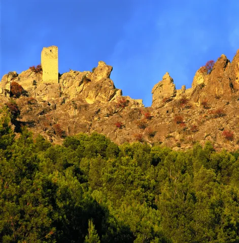
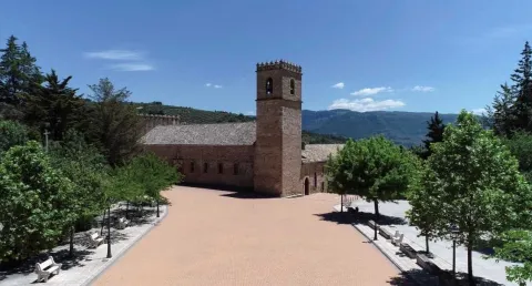
These lines correspond to the Treaty of the Mountain, studied by the Duke of Almazan, a document that some researchers attribute to Jorge Manrique. To talk about the 15th century in the Sierra de Segura is to talk about the Manrique family and the border period. A situation in which attacks and responses by Christians and Muslims were frequent. This danger and the border situation can only be seen by entering Segura de la Sierra: remains of walls, towers, entrance doors and on top of the hill, the watchful castle.

The Visits Books of the Order of Santiago described in the late 15th century the castle of Segura de la Sierra as a military compound with weapons to face a siege or, if necessary, to organize a village to attack the enemy. We cannot forget that in 1434 Rodrigo Manrique organized a village to conquer Huécar in the Altiplano granadino.

In Segura de la Sierra, taking advantage of this privileged position and under the security offered by its walls is where Jorge Manrique was raised under the care of his mother, Mrs. Mencía de Figueroa, in the house that still today is preserved five hundred years later.

Breve descripción

A candle on an oak table, a tintero with a pen and a half-write piece of paper. A figure draws attention to the rest of the room dedicated to the Manrique family on the second floor of the tower of tribute in the castle of Segura. Jorge Manrique is a character closely linked to Segura de la Sierra. If we were to imagine the poet in front of the paper, we might think that the text might start like this: "remind me to be very noble, Mr. Brother, having once said, in they are closer to mockery, you will see if you wanted me to write you something about the work of the Montaria."

Ubicación
Latitud
38.298857
Longitud
-2.651877
Distrito
Ubicación en el mapa
POINT (-2.651877 38.298857)
Tipos de punto de interés
Imágenes cabecera
imagen
Image
1517663098_978370_1517663226_noticia_normal.jpg
Imagen principal
Activado
Loading map
Preparing points of interest and routes...

Sanctuary of the Virgen de la Fuensanta

Submitted by brandcode_deweloper on
Id
12131034
Descripción
Descripción larga

Today we see olive trees around the sanctuary but we must think of forest areas with some clear for cultivation, highlighting on the high Iznatoraf as the most important villa of the advance to the north of the Guadalquivir.

Little by little this situation of danger is disappearing, new inhabitants arrive and places are beginning to live outside the walls of the villa until it is necessary to disconnect them from the municipality. The inhabitants of the Moraleja in 1396 knew the autonomy with respect to Iznatoraf, going on to be called since then Villanueva del Archbishop.

It tells an ancient legend that in Muslim times there was a group of MozArabs in Iznatoraf with a great devotion to the virgin Mary. The king's wife showed some interest in the Christian religion by helping them in all that she could. When her husband, known as Alimenon, found out, he ordered that they take his wife into the forest and cut off her hands and take her eyes out to die in the most absolute solitude. The woman called on the virgin Mary, who presented herself and made a fountain sprout to wash her wounds. Miraculously he healed and the virgin ordered him to go up to her husband so that, being aware of the miracle, they would be baptized in the fountain and set up a temple in his honor.

The Sanctuary and the virgin of the Fuensana is one of the oldest in Spain and it is known that it existed in 1291 already as an important pilgrimage center on the border lands. The building is of three Gothic-style ships, although there are still some Romanesque reminiscent, such as a beautiful medieval mudejar tile. The virgin of the Fuensana is sold in a baroque shrimp of the 17th century.

Breve descripción

Contemplating the sanctuary building comes to mind memories of border life. The almenada tower and the robustness of the walls refer to other times when the danger of war was present in the daily lives of the people who lived in the village of the Moraleja. Without ever losing sight of Iznatoraf as a villa from which the different places that have ended up giving rise to the Sierra de las Cuatro Villas were torn.

Telecomunicaciones
Sitio web
https://villanuevadelarzobispo.es/turismo/
Teléfono de contacto
607 184 628
Correo electrónico
turismovillanuevadelarzobispo@gmail.com
Ubicación
Código Postal
23330
Latitud
38.163020
Longitud
-2.994220
Ubicación en el mapa
POINT (-2.99422 38.16302)
Tipos de punto de interés
Imágenes cabecera
imagen
Image
1604769448440107388872821794175587.jpg
Imagen principal
Activado
Horario
May - ago: Wednesday to Saturday 09: 00 - 14: 00 and 18: 00 - 21: 00, Sunday 10: 00 - 13: 00. Sept - abr: Wednesday to Saturday 10: 00 - 14: 00 and 16: 00 - 20: 00, Sunday 10: 00 - 13: 00.
Otros servicios
Guided tours under reservation in Tourist Office
Loading map
Preparing points of interest and routes...

Santa Catalina

Submitted by brandcode_deweloper on
Id
2190698
Descripción
Descripción larga

The predominant geology is the secondary limestone that causes soils of generally poor characteristics and occupied by populations of Pinus halepensis (Pino carrasco), performed during the 1950s.

This is a natural space that traditionally provides a public service for leisure activities, especially to the municipality of Jaén.

Breve descripción

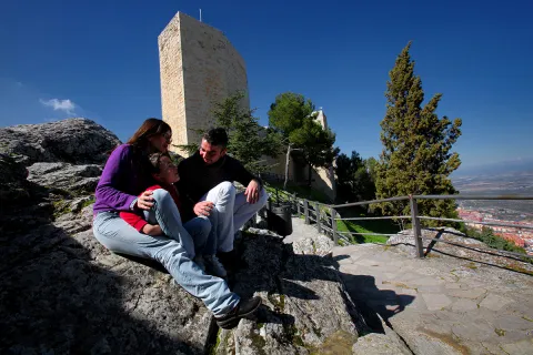
The Santa Catalina peri-urban park has an area of 196.85 hectares and is located on Mount Santa Catalina, El Neveral, La Imora and the Almendral, of the municipality of Jaén, which is owned by the City of Jaén, although it is consonated with the Environmental Council.

Ubicación
Latitud
37.768770
Longitud
-3.807000
Distrito
Municipio
Ubicación en el mapa
POINT (-3.807 37.76877)
Tipos de punto de interés
Imágenes carrusel
imagen
Image
Natu162.jpg
Imagen principal
Desactivado
imagen
Image
castillo_santa_catalina3.jpg
Imagen principal
Desactivado
Imágenes cabecera
imagen
Image
Natu307.jpg
Imagen principal
Activado
Microsite al que pertenece
Loading map
Preparing points of interest and routes...

San José Salt Flats

Submitted by brandcode_deweloper on
Id
4885101
Descripción
Breve descripción

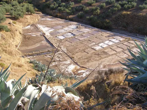
Old saline exploited from the Roman era to well in the 1990s. They are now out of activity.

Ubicación
Código Postal
23600
Latitud
37.757460
Longitud
-4.003260
Distrito
Municipio
Ubicación en el mapa
POINT (-4.00326 37.75746)
Tipos de punto de interés
Imágenes carrusel
imagen
Image
Salinas-de-San-Jose.jpg
Imagen principal
Desactivado
Imágenes cabecera
imagen
Image
3%20%284%29.jpg
Imagen principal
Activado
Microsite al que pertenece
Loading map
Preparing points of interest and routes...

Juniper and Savin Forests rastreros

Submitted by brandcode_deweloper on
Id
923306
Descripción
Descripción larga

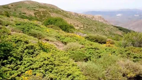
When we enter the fields of Hernán Pelea we are open to the landscape, and we will discover true vegetable monuments that charge a large extent of soil.

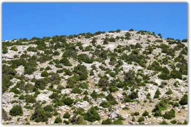
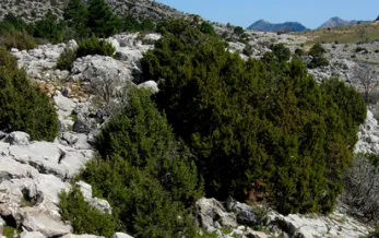
The rake savannas colonize the rocky soils, so we find them in the scarves and cresteries, as well as in the highest of the summits. On the contrary, rake juniors prefer more developed soils, although it is not difficult to see them together. They are very long-lived species, being able to reach 1000 years of age. They do not raise much from the ground, rarely more than a meter high, but a single example can extend more than 20 m ².

They are almost mono-specific plant formations, that is, of a single dominant species, to which only some salgarean pine (Pinus nigra salzmannii), thorns (Berberis vulgaris australis) and on the slopes some maple (Acer granatense) or mustard (Sobus aria) are accompanied. But in the summit areas, the rareras are the queens of the landscape, competing with piornal and lastonar.

These two species came to our saws with the glaciations of the Quaternary. Today, with a more arid climate, they only survive in the highest and coldest of the mountains. Their regeneration is difficult and scarce, and they are also used as food by herbivores, so their future is not the most flattering.

LOCATION

Following the track that goes into the fields of Hernán Perea from Don Domingo, we take the one that goes through the rample of Juan Fría, in which is the Galapan pine, we overcome it and as we pass through the cortijo of the Pinadilla, we are opened a splendid sabinar rastrero.

Breve descripción

Campos de Hernán Pelea

We cannot speak of the high mountains, their summits, their stony slopes and cresteries, without mention of one of their most emblematic inhabitants, the hillbillies or chaspines (Juniperus sabina) and the hillbillies (Juniperus comunnis hemisphaerica), true vegetable monuments of our mountains, to which can be given the qualification of The Elders of the Summits. They are plants that cover our summits in dark green and give shelter to a number of animals.

Ubicación
Latitud
37.772886
Longitud
-3.788329
Ubicación en el mapa
POINT (-3.788329 37.772886)
Imágenes carrusel
imagen
Image
4.png
Imagen principal
Desactivado
Imágenes cabecera
imagen
Image
86746483001_5836777155001_5826845296001-vs.jpg
Imagen principal
Activado
Loading map
Preparing points of interest and routes...

Juniper Forests of Sabina Mora

Submitted by brandcode_deweloper on
Id
881711
Descripción
Descripción larga

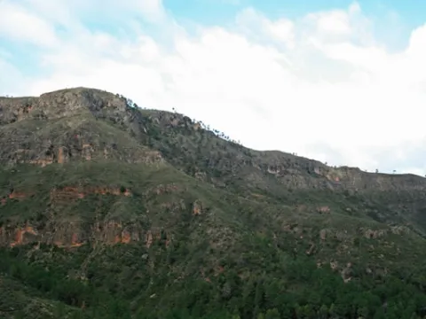
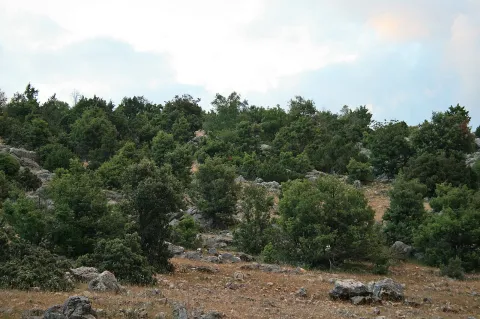
One of the most important plant formations of the park is the Sabinar of Sabina mora or simply of Sabina (Juniperus phoenicea). It is very important for its extension, for the habitat it occupies - rocks and dolomitic sandals - and for the large number of endemic species that it houses, including the most emblematic, the Cazorla violet (Viola cazorlensis) and the endemism of the Serra de Segura Jasione crispa seguridad. This training is therefore declared a Habitat of Community Interest in Natura 2000 Network.

It is presented to us in the form of clear sketches, where the black savina is the dominant plant element. We can find it in many areas of the Park, colonizing those places where other trees have not been able to develop, rocky, dry, wind-beat and with strong solar irradiation. You can say that sabina is the essence of hardness. We can also find it in isolation in almost all the forest formations of the Park, missing only in the high summits, so in many places we can see small sabinars more or less dense or scattered.

Inside Las Villas, on any side we will find sabinares. We've chosen the Wolf's boat. Once on the Sloth Hill, we will walk on the side of your left, according to the direction of the march. It is populated by savannas, juniperus oxicedrus, salgary and black pines (Pinus nigra salzmannii and Pinus pinaster), in a sparse and scattered manner, complaints and oinas (Quercus faginea and Quercus ilex ballota), thorns of dyes (Rhamnus saxatilis) and piorns (Erinacea anthyllis and Echinospartum boissierii). We are on this hill at the foot of the Blanquillo, the highest summit of the Las Villas saw.

Of the same characteristics as the one described - sabinar en rota - but with more cornicabra, are the sabinars of the Zumeta River, which extend throughout the left side in the sense of the waters. The sabinar is also seen from the other side, on the side of Albacete. We will see it from further, but in return we are compensated with the panoramic view of the Old Age reservoir.

LOCATION OF THE LOBO

We take the road that goes from the reservoir of Aguascebas to the Recreative Area of Gil Cobo. A little before we reach this area, we take a crossing that comes to our right, preferably on foot. We followed the track to a detour and took the one from the left, in gentle ascent, until we reached the Collado del Perenoso. To our left is the great lapiaz of the Lobo Boat.

ZUMETA LOCATION

In the village of Vites you have to head towards the Cortijo del Torcal.

Breve descripción

Lobo boat and Zumeta river

Ubicación
Latitud
37.912893
Longitud
-3.003887
Municipio
Ubicación en el mapa
POINT (-3.003887 37.912893)
Tipos de punto de interés
Imágenes carrusel
imagen
Image
622_img.png
Imagen principal
Desactivado
imagen
Image
unnamed.jpg
Imagen principal
Desactivado
Imágenes cabecera
imagen
Image
2%20%281%29.jpg
Imagen principal
Activado
Loading map
Preparing points of interest and routes...

Jandulilla River

Submitted by brandcode_deweloper on
Id
8114425
Descripción
Descripción larga

Former Xandulilla. Influent on the left bank of the Guadalquivir River. Collect the waters from the northeastern face of the Sierra Magina massif. The associated valley is given the same name. Unwind in the Guadalquivir River, in the area of Ubeda the old one. The Arab geographer Al-Zuhrí, mentions him by the name of Wadi-l-Ard, or Rio de la Tierra.

He named the former population of Xandulilla, of which there are many archaeological remains of great importance spread throughout the area. In the 17th century it was known as "Villa de Felix" with its own jurisdiction. It is a river with a normally low and variable flow rate and without regulatory structures. It is born under the Port of the Gallardos, also known in its first stretch as Rio Huelma, its main tributaries, both on the left are the Gualijar River and the Garganton River that are born in the main massif of Magina and after a very short journey they result in the Jandulilla, apart from numerous intermittent rags and ramps.

Breve descripción

The Jandulilla River is a short river in the south of Spain, tributary to the left bank of the Guadalquivir River that runs through the province of Jaén and collects the waters of the northeastern face of the Sierra Magina massif. The associated valley is given the same name. Unwind in the Guadalquivir River, in the area of Ubeda la Vieja.

Telecomunicaciones
Teléfono de contacto
953 390 210
Ubicación
Código Postal
23560
Latitud
37.650300
Longitud
-3.459550
Distrito
Municipio
Ubicación en el mapa
POINT (-3.45955 37.6503)
Imágenes carrusel
imagen
Image
r%C3%ADo%20Jandulilla%202%20%281%29.jpg
Imagen principal
Desactivado
Imágenes cabecera
imagen
Image
r%C3%ADo%20Jandulilla.jpg
Imagen principal
Activado
Microsite al que pertenece
Loading map
Preparing points of interest and routes...

Río Guadalimar

Submitted by brandcode_deweloper on
Id
4528704
Descripción
Descripción larga
It crosses the Sierra de Cazorla, Segura y las Villas, collecting the waters of numerous smaller streams and rivers: its course receives water from the Onsares, Guadalmena, Guadalén, Cortillas, Frío, Carrizas, Morles and Trujala rivers. The river and its main tributaries have a gentle slope and a rather limited flow, but among its streams are spots of spectacular beauty. Its waters slow down at the Giribaile reservoir, the second most important reservoir in the province, where barbel, carp, largemouth bass and pike can be fished. It marks the boundary of the Torreblascopedro district along its entire north-eastern side, giving rise to a typical riparian ecosystem and creating a fertile plain characterised by cotton and wheat farming. It is accessible via the JV-3003/4 and must be crossed via its bridge to reach Linares from our municipality.
Breve descripción
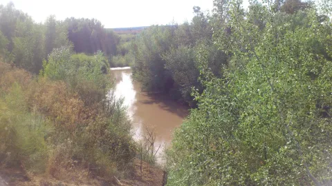
The Guadalimar river rises at the foot of the Almenara hill, at an altitude of 1,200 m, in the Sierra de Alcaraz, in Albacete, and flows towards the Natural Park of the Sierras de Cazorla, Segura y las Villas, joining the Guadalquivir river within the municipal district of Torreblascopedro. It takes its name from the colour of its waters, as "Guadalimar" derives from wad al-Ihmar, "red river".
Ubicación
Municipio
Imágenes carrusel
imagen
Image
guadalimar.jpg
Imagen principal
Desactivado
Imágenes cabecera
imagen
Image
4%20%281%29.jpg
Imagen principal
Activado

Guadalén River

Submitted by brandcode_deweloper on
Id
6552251
Descripción
Descripción larga

It receives from the right to the rivers Onsares, Guadalmena and Guadalén. On the left to the rivers Cotillas, Arroyo Frio, Carrizas, Morles, Trujala and the creek of Peñolite. On its way through the Sierra de Segura.

In Roman times it was called the Tago, Tagus or Tugio River, just as its birth was the Sierra de Tugia. Its Arabic name "wad al-ihmar" means "red river," which is curiously as it is called in the area, by the red color of its waters.

Breve descripción

The Guadalimar River is a river in the south of Spain, a tributary of the Guadalquivir River that is born at the foot of the Sarga peak (1770 m.), in the Alcaraz Sierra, in the province of Albacete, resulting from the confluence of several streams in the surroundings of Villaverde de Guadalimar. It provides its waters to the Guadalquivir in the municipality of Jabalfifth (Jaén province).

Ubicación
Latitud
38.180950
Longitud
-3.427055
Distrito
Municipio
Ubicación en el mapa
POINT (-3.427055 38.18095)
Imágenes carrusel
imagen
Image
7e0b619bb599cba0f135d1f24a105a0f.jpg
Imagen principal
Desactivado
imagen
Image
00945f1.jpg
Imagen principal
Desactivado
Imágenes cabecera
imagen
Image
5678744Master.jpg
Imagen principal
Activado
Microsite al que pertenece
Loading map
Preparing points of interest and routes...

River Aguamulas

Submitted by brandcode_deweloper on
Id
913807
Descripción
Descripción larga

The forest track, 9 km long, is very pleasant to travel and has no loss, as it is only to follow right, and is also marked as GR-7. It always runs by the river, with very little level, except in a section where it is separated by forming several elevation curves.

It is not necessary to travel throughout to enjoy these places, but if you arrive at the end you will find a lookout with unforgettable views of the Reco del Aguamulas. It is the rocky amphitheatre where this river is born, on whose base there are abandoned meadows and gardens.

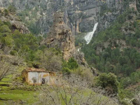
You will also see the cords - already ruin - of La Fresneilla. In them lived the last inhabitant of these valleys, called Máximo Fernández Cruz, nicknamed "the Cojo de la Fresnedilla." This serrano character fought for thirty years not to leave the land he was born, from which were expelled the close to a hundred neighbors of the Aguamulas environment who suffered expropriation when the National Cote of Hunting was created in 1960. In 1982, Maximo paid for his resistance with the prison.

We suggest...

  • Be attentive to see some example of the dark green Valverde lizard, endemic to the Park and discovered in 1958 very close to here.
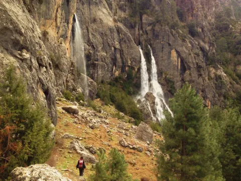
  • Continue beyond the lookout and take a walk in the La Fresnedilla area. If the water abounds, you will see the waterfalls of the birth of the Aguamulas.

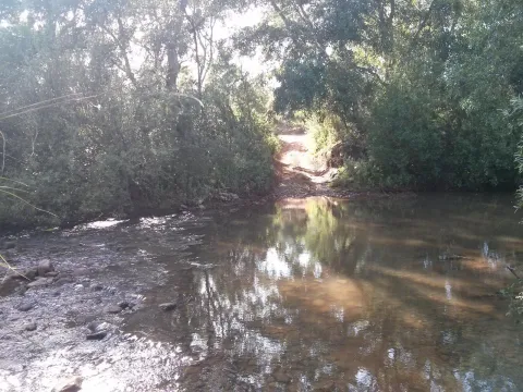
In the campsite Llanos de Arance (road A-319) you have to take the forest track that crosses the Guadalquivir. At 3 km, after wading the Aguamulas, the crossing is taken to the right and followed 1 km to the barrier in the forest house of Los Bonal, where you can leave the car.

Breve descripción

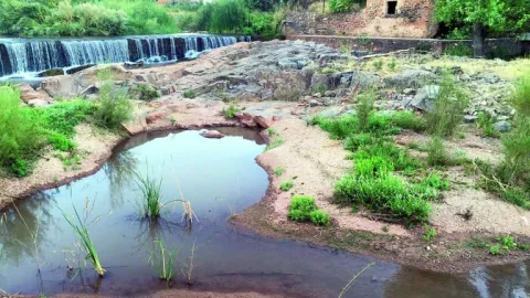
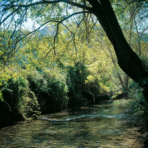
The Aguamulas is a small tributary of the Guadalquivir that runs one of the most beautiful valleys of the park, forming numerous rapids and pozas. It is enjoyed walking through a nice forest track between pine trees, in the shadow of which is developed a thick Mediterranean vegetation with oaks, madroños, lentils and cornicabra. At the bottom are the impressive walls of the Banderillas, whose summit is about 2,000 m high.

Ubicación
Nombre
Casa forestal Los Bonales
Latitud
38.044880
Longitud
-2.794950
Ubicación en el mapa
POINT (-2.79495 38.04488)
Tipos de punto de interés
Imágenes carrusel
imagen
Image
nacimiento-aguasmulas.jpg
Imagen principal
Desactivado
imagen
Image
aguasmulas.jpg
Imagen principal
Desactivado
Imágenes cabecera
imagen
Image
natu001%20%281%29.png
Imagen principal
Activado
Loading map
Preparing points of interest and routes...