Saltar al contenido principal
icon-intereses-viajar-solo

Mountain Range of Campillo

Submitted by brandcode_deweloper on
Id
4555300
Descripción
Descripción larga

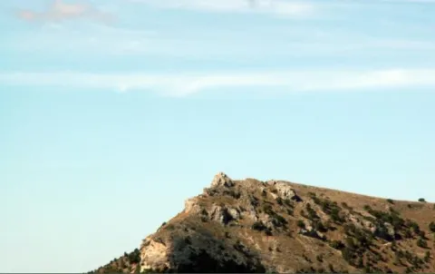
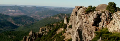
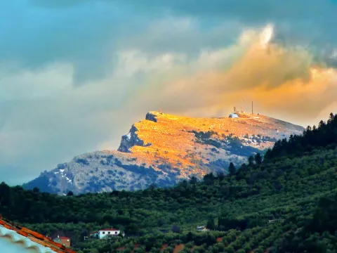
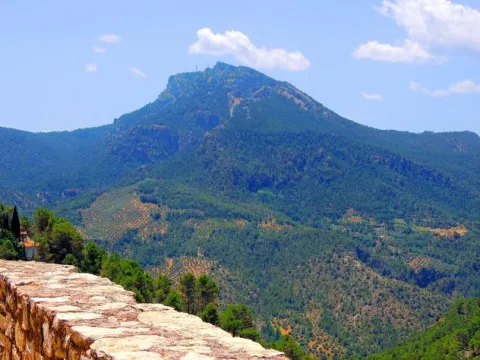
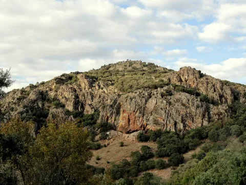
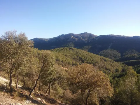
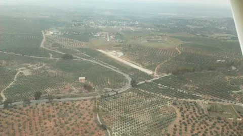
Mediterranean mountain area, also called Sierra de Alta Coloma, with high-value geological and vegetable formations such as oaks, complaints, junips and savannas. The following enclaves are highlighted: the Monastery ravine, the Quebrajano reservoir, the Valdecarazos river, the Palo Stone, the Netherlands Prados cortijo or the Alberquilla lookout.

Location: Sector west of the municipal term.

Distance: 3-7 km.

Medium: by all-terrain vehicle, by bike and on foot.

Access route: By the JV-2.228, which leaves directly from the urban centre, and through agricultural and forestry roads.

Ubicación
Latitud
37.555995
Longitud
-3.635602
Distrito
Municipio
Ubicación en el mapa
POINT (-3.635602 37.555995)
Tipos de punto de interés
Imágenes carrusel
imagen
Image
sierracampillo1.jpg
Imagen principal
Desactivado
Imágenes cabecera
imagen
Image
sierracampillo.jpg
Imagen principal
Activado
Microsite al que pertenece
Loading map
Preparing points of interest and routes...
Mountain Range of Ahillos

Submitted by brandcode_deweloper on
Id
1918729
Descripción
Breve descripción

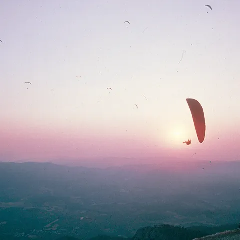
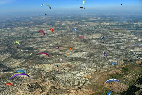
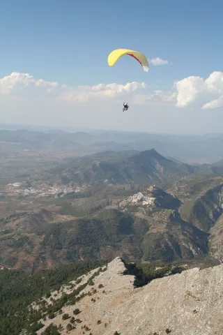
Innailed in the Sierra Sur region, the Achillos saw has take-off areas in all directions of the wind, so here the opportunities to fly multiply. In the second half of July a concentration of paragliding and paramotor is held.

Telecomunicaciones
Teléfono de contacto
650 621 081
Ubicación
Código Postal
23660
Latitud
37.599690
Longitud
-4.033650
Dirección
C/ Alta, 1
Distrito
Municipio
Ubicación en el mapa
POINT (-4.03365 37.59969)
Imágenes carrusel
imagen
Image
106571953_373426606961168_8043577217586885911_n.jpg
Imagen principal
Desactivado
imagen
Image
12341580_968660439848652_2638285071187591491_n.jpg
Imagen principal
Desactivado
Imágenes cabecera
imagen
Image
IMG_2667.jpeg
Imagen principal
Activado
Loading map
Preparing points of interest and routes...

Small Mountain Range of Pegalajar

Submitted by brandcode_deweloper on
Id
5848471
Descripción
Breve descripción

Landscape of high interest to be located in the vicinity of Pegalajar, where the cave house district is located, some of them for rent. On the northern side there are stunning views of the capital, Jaén, and the Guadalquivir River countryside. To the south the Serrezuela looks at the massif of Sierra Magina and the valley of the Guadalbullion River.

Ubicación
Latitud
37.742398
Longitud
-3.661094
Distrito
Municipio
Ubicación en el mapa
POINT (-3.661094 37.742398)
Tipos de punto de interés
Imágenes carrusel
imagen
Image
serrezuelapegalajar1.png
Imagen principal
Desactivado
Imágenes cabecera
imagen
Image
serrezuelapegalajar.png
Imagen principal
Activado
Microsite al que pertenece
Loading map
Preparing points of interest and routes...
Small Mountain Range of Bedmar

Submitted by brandcode_deweloper on
Id
5845460
Descripción
Breve descripción

A very steep limestone formation that is located east of the town of Bedmar and above it. On the other side of these scarves is the neighbouring town of Jódar. The climbing lovers will find here magnificent ways to practice their favorite sport. In the center of it you can see an obscene with an Arab wall known as the Air Cave.

Ubicación
Latitud
37.832416
Longitud
-3.423530
Distrito
Municipio
Ubicación en el mapa
POINT (-3.42353 37.832416)
Tipos de punto de interés
Imágenes carrusel
imagen
Image
serrezuelabedmar1.png
Imagen principal
Desactivado
Imágenes cabecera
imagen
Image
serrezuelabedmar.png
Imagen principal
Activado
Microsite al que pertenece
Loading map
Preparing points of interest and routes...

Jurassic-Lower Cretaceous Series of Navalperal

Submitted by brandcode_deweloper on
Id
877361
Descripción
Descripción larga

The total power of the section is over 150 m. On a few sucrose dolomies attributed to the lower and medium Jurassic we find materials from the upper Kimmeridgian; they are limeals with large gastropods and corals that end up on an erosive surface with a crusts of iron oxides.

The following are limestones, locally sandy and margas, with various levels of interspersed calcrets; these materials are being decrified and dolomitised, giving way to stoned dolomies with abundant carbonous remains; this whole set of materials is of the age Hauteriviense- Barremiense. The lower Aptiense is characterized by the presence of sands, calcareous sandstone and sandy limestone with laminations and cross stratifications as well as orbitolins at various levels. The materials of the upper Aptiense have abundant rudists and orbitolins. The Albibe is represented by dolomies with black songs and ghosts of rudists.

Source: Inventory of Georresources of Andalusia. Environmental Council. Junta de Andalusia.

Breve descripción

Navalperal

Ubicación
Latitud
38.298857
Longitud
-2.651877
Distrito
Ubicación en el mapa
POINT (-2.651877 38.298857)
Tipos de punto de interés
Imágenes carrusel
imagen
Image
1%20%285%29.jpg
Imagen principal
Desactivado
imagen
Image
561_img.png
Imagen principal
Desactivado
Imágenes cabecera
imagen
Image
561_img.png
Imagen principal
Activado
Loading map
Preparing points of interest and routes...

Jurassic-Cretaceous Series of El Yelmo

Submitted by brandcode_deweloper on
Id
877317
Descripción
Descripción larga

From the view of Segura de la Sierra you have a magnificent panoramic view of the relief of El Yelmo (its northern slope), one of the most emblematic of the Sierra de Segura. This relief has a synchronal structure, with a rich succession of marine and continental sedimentary rocks of Jurassic-Cretaceous age.

In addition to vertical succession, there are important side changes in the stratigraphic architecture, observable in the panorama, which consist of remarkable changes of powers, culminating in the coining of formations. These exceptional characteristics are due to the paleogeographical position on the margin of a marine basin (sudiberic paleomargen) during the Mesozoic. The observations on the northern side of the Yelmo are complemented, from the same viewpoint, by that of the "Segura de la Sierra Court," which shows a section covering the Jurassic and Cretaceous, and which is accessible by the asphalt forest track that leads inside the Segura Sierra from the Segura de la Sierra population.

Source: Inventory of Georresources of Andalusia. Environmental Council. Junta de Andalusia.

Breve descripción

Jurassic Series - El Yelmo Cretaceous

Ubicación
Latitud
38.298857
Longitud
-2.651877
Distrito
Ubicación en el mapa
POINT (-2.651877 38.298857)
Tipos de punto de interés
Imágenes carrusel
imagen
Image
1%20%285%29.jpg
Imagen principal
Desactivado
imagen
Image
2%20%284%29.jpg
Imagen principal
Desactivado
imagen
Image
Natu204.jpg
Imagen principal
Desactivado
Imágenes cabecera
imagen
Image
560_img%20%281%29.png
Imagen principal
Activado
Horario
Monday's closed. Tuesday to Friday: 10: 00 - 13: 00 and 18: 00 - 21: 00. Saturday: 10: 00 - 14: 00 and 18: 00 - 21: 00. Sunday and holidays: 10: 00 - 14: 00.
Loading map
Preparing points of interest and routes...

Cretaceous Series of the southern Yelmo

Submitted by brandcode_deweloper on
Id
877273
Descripción
Descripción larga

The stratigraphic section of the South Yelm is a magnificent example of the materials of the Aptiene-Ambient of the Prebetic. The Aptiense is essentially represented by limestone, of facies that vary between lacustre / palustres (carbonous) and of somere platform, both protected (lagoon), and open (coral reef).

The Albibe is made up of an alternation of carbonates (limestones and dolomies) and terrogenes (margas, clays and sands), from coastal to shallow marine environments. The faces represented are very rich and varied, at certain levels with a very well developed cyclicity. The content in fossils is extraordinarily rich, both in marine fauna and corals, lamelibranchios (rudists and ostreides), foraminiferous (e.g. orbitolinides), as well as fresh water (caraceous algae).

Source: Inventory of Georresources of Andalusia. Environmental Council. Junta de Andalusia.

Breve descripción

South Yelm Cretaceous Series

Ubicación
Latitud
38.298857
Longitud
-2.651877
Distrito
Ubicación en el mapa
POINT (-2.651877 38.298857)
Tipos de punto de interés
Imágenes carrusel
imagen
Image
2%20%284%29.jpg
Imagen principal
Desactivado
imagen
Image
1%20%285%29.jpg
Imagen principal
Desactivado
Imágenes cabecera
imagen
Image
sur-yelmo.png
Imagen principal
Activado
Loading map
Preparing points of interest and routes...

Segura de la Sierra

Submitted by brandcode_deweloper on
Id
919387
Descripción
Descripción larga

These lines correspond to the Treaty of the Mountain, studied by the Duke of Almazan, a document that some researchers attribute to Jorge Manrique. To talk about the 15th century in the Sierra de Segura is to talk about the Manrique family and the border period. A situation in which attacks and responses by Christians and Muslims were frequent. This danger and the border situation can only be seen by entering Segura de la Sierra: remains of walls, towers, entrance doors and on top of the hill, the watchful castle.

The Visits Books of the Order of Santiago described in the late 15th century the castle of Segura de la Sierra as a military compound with weapons to face a siege or, if necessary, to organize a village to attack the enemy. We cannot forget that in 1434 Rodrigo Manrique organized a village to conquer Huécar in the Altiplano granadino.

In Segura de la Sierra, taking advantage of this privileged position and under the security offered by its walls is where Jorge Manrique was raised under the care of his mother, Mrs. Mencía de Figueroa, in the house that still today is preserved five hundred years later.

Breve descripción

A candle on an oak table, a tintero with a pen and a half-write piece of paper. A figure draws attention to the rest of the room dedicated to the Manrique family on the second floor of the tower of tribute in the castle of Segura. Jorge Manrique is a character closely linked to Segura de la Sierra. If we were to imagine the poet in front of the paper, we might think that the text might start like this: "remind me to be very noble, Mr. Brother, having once said, in they are closer to mockery, you will see if you wanted me to write you something about the work of the Montaria."

Ubicación
Latitud
38.298857
Longitud
-2.651877
Distrito
Ubicación en el mapa
POINT (-2.651877 38.298857)
Tipos de punto de interés
Imágenes cabecera
imagen
Image
1517663098_978370_1517663226_noticia_normal.jpg
Imagen principal
Activado
Loading map
Preparing points of interest and routes...

Iberian Sanctuary el Pajarillo

Submitted by brandcode_deweloper on
Id
4652660
Descripción
Breve descripción

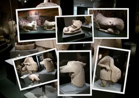
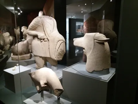
TheSanctuaryHeroic of ElDuck, inHuelma, is the place where the well-known sculptural ensemble in which a wolf and a hero are faced, surrounded by other animals such as lions and taps and placed on a stone tower, in sum in a monumental context of great importance.

Telecomunicaciones
Sitio web
www.redjaen.es
Ubicación
Código Postal
23560
Latitud
37.647300
Longitud
-3.455180
Distrito
Municipio
Ubicación en el mapa
POINT (-3.45518 37.6473)
Tipos de punto de interés
Imágenes carrusel
imagen
Image
el%20santuariodel%20pajarillo.jpg
Imagen principal
Desactivado
Imágenes cabecera
imagen
Image
santuario.jpg
Imagen principal
Activado
Microsite al que pertenece
Loading map
Preparing points of interest and routes...

Iberian Sanctuary of the Collado de los Jardines

Submitted by brandcode_deweloper on
Id
4554285
Descripción
Descripción larga

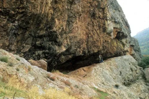
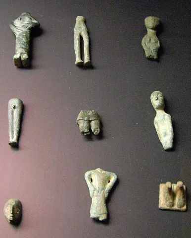
The original place of worship would be made up of a grotto in the rocky massif and a source; in front of that it is possible to emerge at different times, successive buildings of worship; for the oldest one it is kept news of its rectangular plant, and it is suspected a chronology of the centuries V- IV BC; for the most recent the dating managed would place it in the first century or perhaps before; the Shrine would already work from before the construction of the first building and would continue to do so, at least until the fourth century, after the destruction of the second building towards the third century AD. It seems that the exvotes, in the vast majority or in their entirety bronze figures, "Fury primitivement dépossées dans la caverne, et jetées de temps a autre sur la pente, mais jamais aucune fosse ne fut creusée pour les recevoir," which prevents the existence of a reliable strategy, which is aggravated by the precarious conditions of the excavation, at the beginning of the century, of the site. It is not unlikely, as one of the excavators suggested, that the religious whole should also be completed with a sacred forest, from whose branches the devotees would hang part of the offerings.

Breve descripción

Located in the area that could have been by way (although not surely of the most important before the 18th century) between Alta Andalucía and the Plateau, is this Sanctuary of which almost all that is known are its bronze exvotes (about 2,200 from the official excavations) that the Oretan peoples offered to the gods.

Telecomunicaciones
Sitio web
www.santaelena.es
Teléfono de contacto
953 664 010
Ubicación
Nombre
Cueva de los Muñecos
Código Postal
23213
Latitud
38.388204
Longitud
-3.498567
Distrito
Municipio
Ubicación en el mapa
POINT (-3.498567 38.388204)
Tipos de punto de interés
Imágenes carrusel
imagen
Image
Santuario%20Collado%20de%20los%20Jardines3.jpg
Imagen principal
Desactivado
imagen
Image
Santuario%20Collado%20de%20los%20Jardines2.jpg
Imagen principal
Desactivado
Imágenes cabecera
imagen
Image
dsc03816.jpg
Imagen principal
Activado
Loading map
Preparing points of interest and routes...