Saltar al contenido principal

Pozo Alcón

Submitted by brandcode_deweloper on
Id
749855
Perfil de redes sociales
Facebook
https://www.facebook.com/ayuntamiento.depozoalcon/
Twitter
https://twitter.com/PozoTurismo
Instagram
https://www.instagram.com/turismoenpozo/
Descripción
Breve descripción

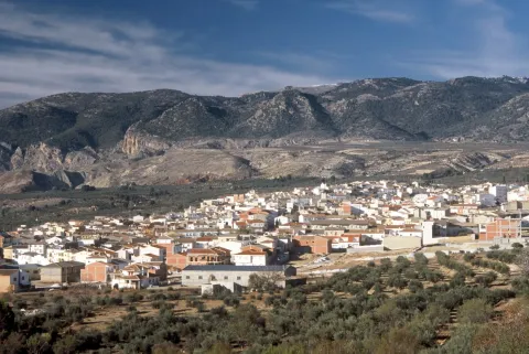
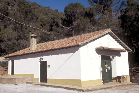
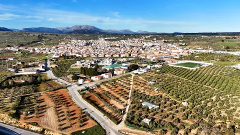
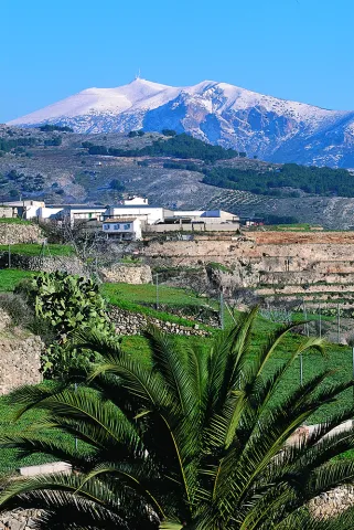
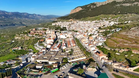
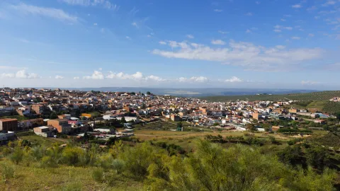
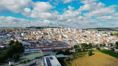
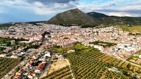
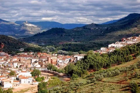
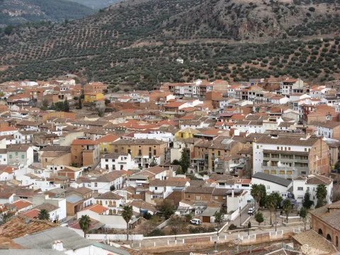
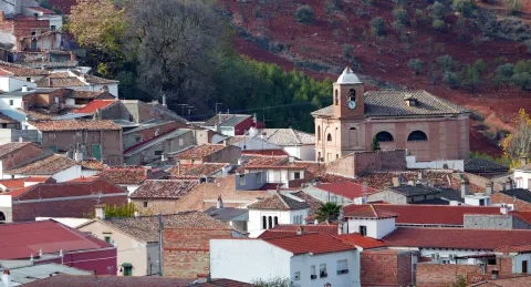
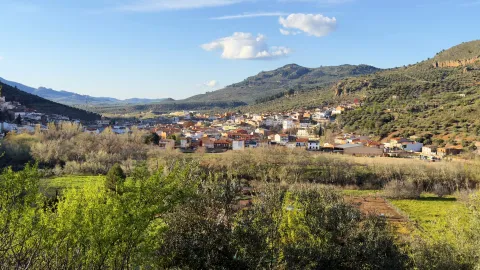
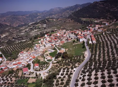
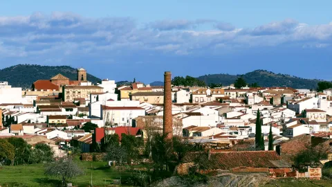
Well Alcón is found to the south of the Natural Park of the Sierras de Cazorla, Segura and Las Villas, between two landscapes that combine the verdor of the mountains with the dryness of the lowlands that border Granada.

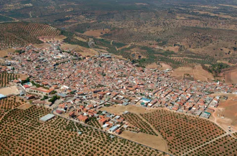
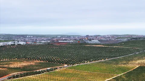
The agriculture is the main activity, highlighting the olive cultivation, herbaceous plants and almonds. The livestock It is also an important activity, dominated by sheep (Segureño lamb) and poultry. Bad communications with Jaén, makes this town is more linked to Baza (Granada)to other locations in the province.

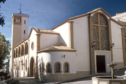
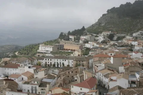
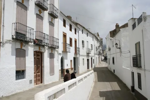
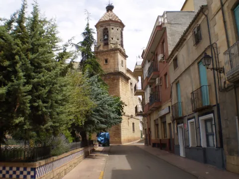
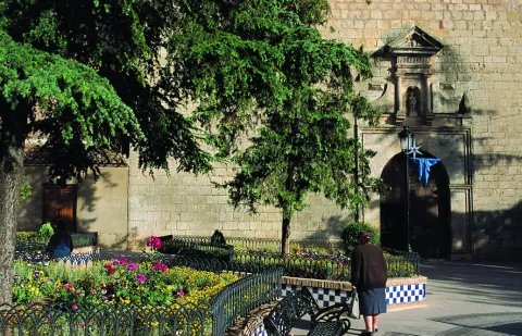
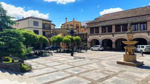
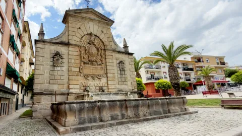
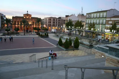
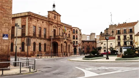
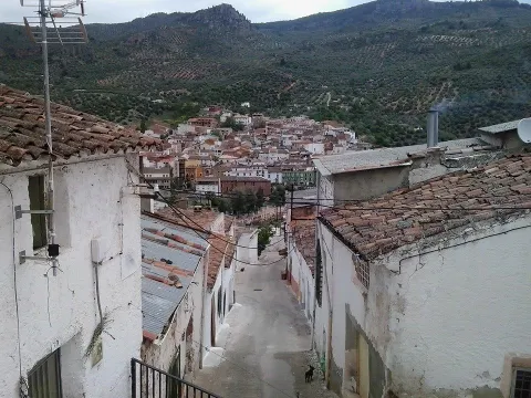
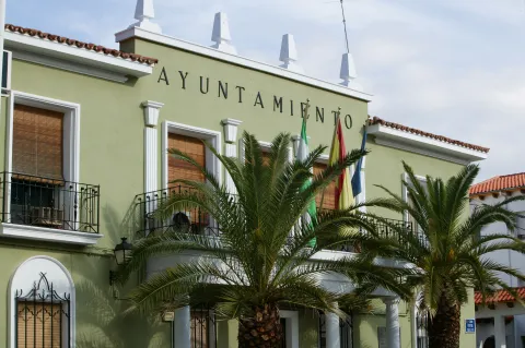
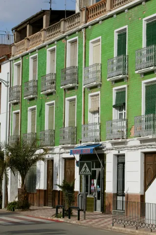
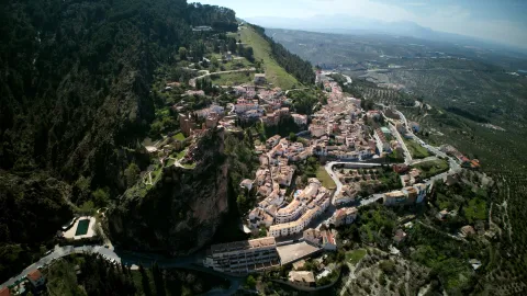
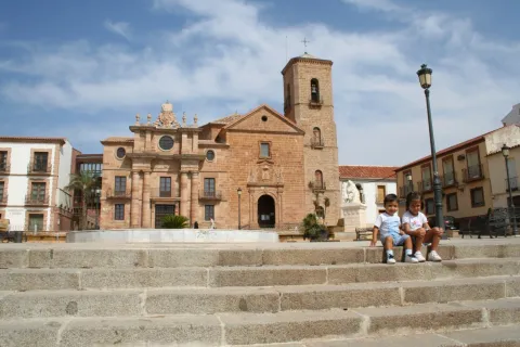
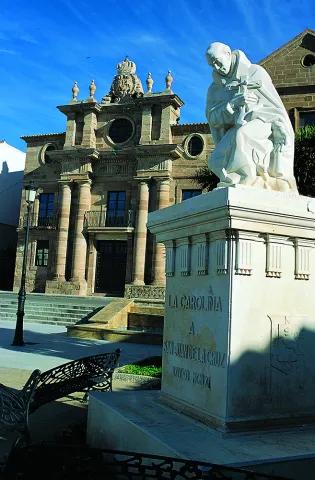
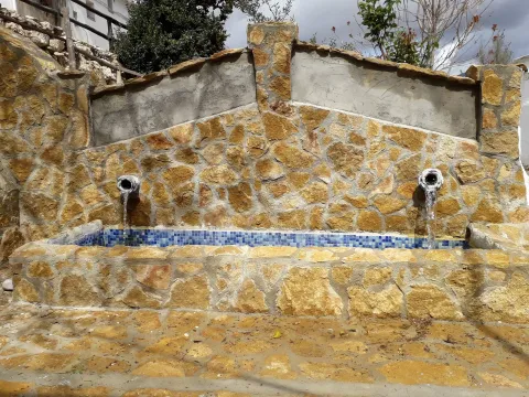
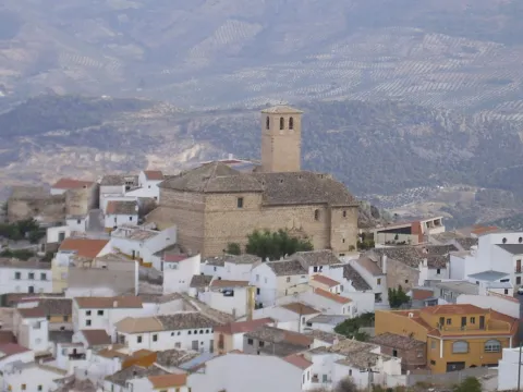
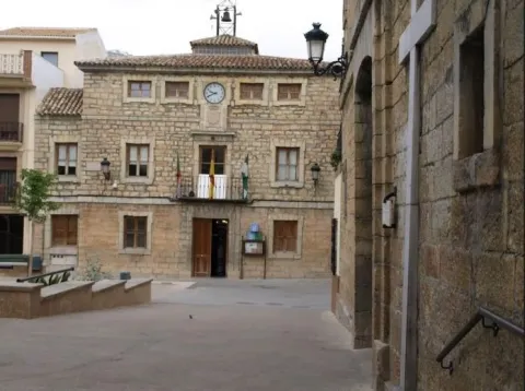
The villa, that up to the 18th century belonged to Quesada, owns a valuable and dedicated popular architecture. It's the only of the peoples of the Natural Park which has not lost population census since the creation of the Park. The municipality has been able to preserve old monuments such as the church of Our Lady of the Incarnation and the City Hall Square. His home shows deep respect for traditional architecture, especially in the high neighborhoods surrounding the church of Our Lady of the Incarnation.

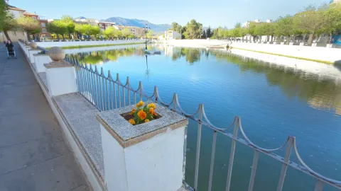
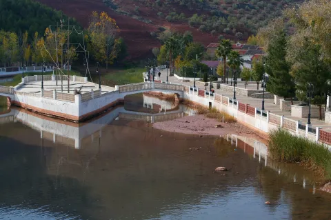
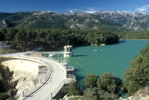
Tourism is consolidating as a future activity in the so-called environment "Sierra del Pozo," where there are numerous sites of great environmental value and exceptional landscapes. Near the village is the beautiful area of the Bread reservoir.

All this allows the enjoyment of numerous and varied activities ranging from extreme sports, hiking through sports fishing, observation of fauna and flora and astronomical observation.
Telecomunicaciones
Teléfono
953 738 041
Sitio web
www.pozoalcon.es
Fax
953 950 898
Correo electrónico
ayuntamiento@pozoalcon.es
Ubicación
Nombre
Pozo Alcón
Latitud
37.702010
Longitud
-2.932740
Municipio
Ubicación en el mapa
POINT (-2.93274 37.70201)
Imágenes
imagen
Image
4a1af24f-5e10-d7f4-b310-6d488956b6eb?t=1621355480052
Imagen principal
Desactivado
imagen
Image
1ca7f7e4-fdb2-99a3-6f26-6fd5015bda9d?t=1610988789849
Imagen principal
Desactivado
imagen
Image
df2400b1-a485-33ed-1b04-2bc6df5d6e8c?t=1621355480139
Imagen principal
Desactivado
imagen
Image
f975805d-814e-29f8-b061-57375da6c448?t=1621355480184
Imagen principal
Desactivado
imagen
Image
0d168a3f-fcab-3f86-8f23-6b1e514cb97e?t=1621355480242
Imagen principal
Desactivado
imagen
Image
dee179f4-893f-23e0-07fb-5433c3a50289?t=1621355480290
Imagen principal
Desactivado
imagen
Image
46d10711-3054-c7d7-c605-a95a68bac832?t=1621355480476
Imagen principal
Desactivado
Información adicional
Imágenes cabecera
imagen
Image
Pozo Alcón
Imagen principal
Desactivado
Datos de interés

Tourist area: Serras de Cazorla, Segura and the Villas

Distance to the capital (km): 134

Altitude over sea level (m): 854

Extension (Km2): 139

Number of inhabitants: 5,464

Cattle

Postal code: 23485

Videos
Video file
Cultura
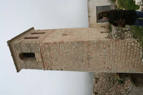
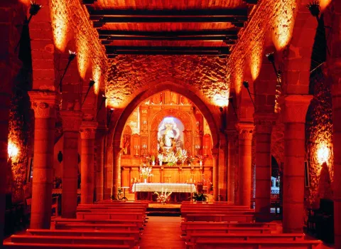
  • Church of Our Lady of the Incarnation. Up in the middle of the the 1960s of the 20th centuryon another previous temple with the same advocation, whose origin was back to the 13th century. Its cover presents a vain of intellized access, Latin cross and hastial. The tower stands out for its volume, it is square-based and decorated with geometric elements.
Naturaleza

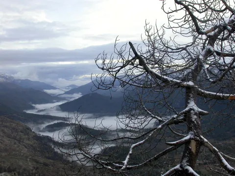
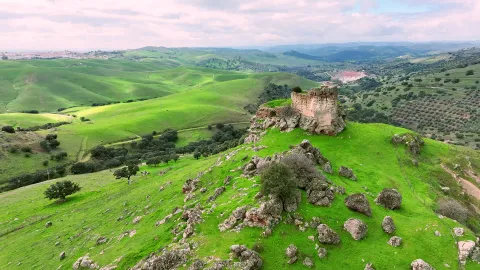
Pozo Alcón is a municipality del Alto Guadalquivir located on the border with the province of Granada. The North half of the term included in the Natural Park of the Sierras de Cazorla, Segura and Las Villas. Changing the natural environment to the south and south-east, on the hillside to the river Guadiana Menor and Guadalentín, changing the landscape abruptly with large half-life areas, very eroded, of splits and tumours.

Well Alcón is a natural paradise for sports lovers and activities in contact with nature. In a radius of a few kilometers we have three reservoirs near: El portillo swampat the end of Castril; The Negratin, in the region of the mountain plane; and La Bolera reservoir at the end of Well of Alcon. The water of these reservoirs, in addition to their use for irrigation and human consumption of the populations, can be practiced different sports.

The term municipal has many ecosystems in which infinity of species that make up rich and varied fauna:: from the rapacious birds, the carrionies, the cynetic species, both of major and minor hunting, the fish, amphibians, reptiles, as well as the characteristic fauna of the riverside vegetation that exists next to the stream and river.

No doubt, a true paradise where nature seems to be recreating. It is almost compulsory to make direct contact with one of the wonderful places that this territory hides, where in addition to observing "in situ" both vegetation and fauna, we can enjoy a fabulous panoramic view of the mountains and the jienese countryside.

Among the different sites, we mention:

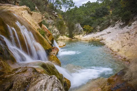
  • Cold rice. This tributary of the Guadalanimín River, with crystal clear waters, is a beautiful enclave that invites you to travel through any of its margins. We can see his lush coastal vegetation: chopos, alamos, willows, mimberas... It's 17 km away. of the city and belongs to the Natural Park of the Sierra de Cazorla.
  • The Hornic. Here is most of the vegetation of Natural Park and is the starting point for start routes for the Sierra del Pozo. 10 km. of the city centre and is in full Natural Park.
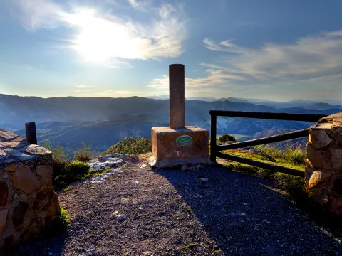
  • Peña de Quesada look. This impressive massif that reaches 1329 m of altitude is a natural lookout for the stunning panoramic views of the boulder and the Sierra del Pozo. It's 10 km from the town.
  • Mirador de Guazalamanco, You can reach by enjoying a pleasant hiking route and watching from there magnificent views of the swamp and Sierra del Pozo.
  • Pico Cabañas. It reaches a height of 2038 m and is the emblematic place to contemplate the beautiful formations of larix pine. The rise to the peak will show you beautiful pictures. It's 25 km from the population.
Fiestas y Eventos

The people are looking forward to the arrival of the following local parties:

  • Feria y Fiestas de Santa Ana Patrona de Pozo Alcón. Since 3013, these parties are held during the days 25-30 Julyafter having been approved by a vote of the neighbors to recelebrate the parties on these dates, which had previously been modified by the risk of fires that may be caused by the rockets of the parties when coinciding with the period of collection of the mieses.
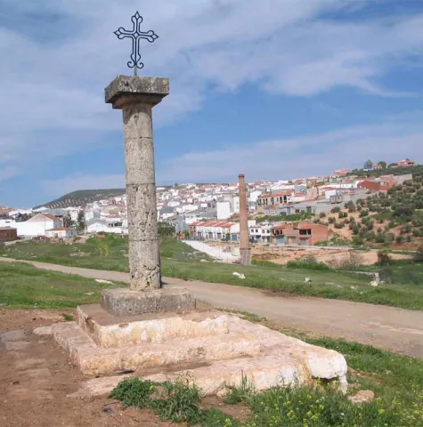
  • San Sebastiánon May 9. This day is celebrated a curious pilgrimage in honor of St. Gregory, which is taken in procession to an image of the Child Jesus which is popularly known among the poor as the "Boy of the Ball," and also with a cross to the place called "the Cross of St. Gregory," distant 1.5 km. on the road leading to the swamp of The Bolera.
  • Celebration of "El Paso" on Good Friday. At the dawn of this day an image of Our Father Jesus Nazarene, popularly known as "The Pass," comes out in procession. At a time of the journey the image of Nazarene, the Virgin of the Dolores and San Juan shall be composed "The Pass" to the full.
  • Festivity of the Immaculate Conception, on December 8. The day before the holiday the call was held "Viva's party", in memory of a friar who went through the streets of the village giving live and praises to the Immaculate Conception. Hence the popular name of the party, praises that were answered and chorted by the entourage of children who accompanied him during the tour, while filling a sack that he carried on his shoulder with sweets and nuts with which the neighbors gave him.
  • Living Bethlehem of Fontanar (nearest Saturday to December 25).
Gastronomía

The kitchen of Pozo de Alcón sinks its roots in the old fires that for generations have seen the preparation of daily sustenance. Among those dishes we remember:

  • "Hachapecho," also called a pharinera, with which the gluers were fed (workers who had as their trade the extraction of fish by combustion of pine wood). It consists of this dish in a "labrao garlic" made from olive oil and salt, to which some strips of cod were added.
  • "Rice with beans," Pintas beans that eat next to the caldy rice and that are usually accompanied by rabbit meat, symbol in the times behind the pocense Christmas.
  • "Bread crumbs." For the Romeria de San Gregorio, the Pocenses prepare the traditional "crumbs" accompanied by torreznos, chorizo, olives and some fruit.
  • "Arroches with meat," which are made in the Romeria of San Gregorio, next to the swamp of La Bolera.
  • "meat fries," also on the day of the rosemary in the fantastic surroundings of the La Bolera swamp. All this accompanied by the good wine of the earth.
  • Chickpeas with acelgas, is a dish that along with that of "fried cod ', are used preferably in Easter, it is a very deep-rooted custom in these southern lands.
  • "Spicy gazhas," made of fried or scabbering bakers, or the cakes with which the Carnival was celebrated and entered in time of abstinence.

In pastry shops:

  • Fruits of frying pan, typical of Easter, among which we can count the "fried rosses" and "Pens."
Historia

The first written reference of this locality dates from 1331, in which reference is made a "Pozuelo," between the limits of the term Cazorla, but without any population. After the completion of the Reconquest, a colonization of the area known as "El Pozo de Campo Cuenca."

In 1529, it was rotated by its inhabitants, who will begin to make their ground, which meant that the population was increasing, and in 1618 it already had the Hermitage of Santa Ana and the Church of the Incarnation.

The day 12 July 1648The king. Felipe IV separated the place of the well from the village of Quesada, passing to be a real and independent villaTo get it, several neighbors had to pay 5,000 ducats.

In achieving independence the municipality experienced a progressive increase in population, and already the mid-18th century had 2,227 inhabitants, a parish, two hermitage, a posite and a hospital.

In the town, wheat, barley, rye, oil, wine, cumin and anis are produced.

The main occupations of the neighbours included the "rivals," which consisted of going from village to village, with the goods on donkeys, to sell what they could.
Loading map
Preparing points of interest and routes...
Imagen principal
imagen
Image
Pozo Alcón
Imagen principal
Activado

Pegalajar

Submitted by brandcode_deweloper on
Id
749615
Perfil de redes sociales
Facebook
https://www.facebook.com/ayuntamientopegalajar/
Descripción
Breve descripción

Municipality of west of the Sierra Magina regionwhose municipal term is entered by the north-east end in the Natural Park of Sierra Magina, which is part of the Subbetica and which offers beautiful and spectacular landscapes. The town is located at the feet of the Serrezuela, at 798 m above sea level, where the spring of the Fuente de la Reja that supplies the Charca and the Huerta, elements exclusive the local landscape of Pegalajar.

The municipal term of Paste occupies a extension of 80 km2and is located in the valley of the Guadalbullion River, about 18.8 km. from the city of Jaén. Pedany The lock is part of the municipality.

The olive tree, become practically monoculture, occupies the descending slopes of the numerous peaks that coronate the geomorphology of Pegalajar, focusing on the south and east and occupying approximately half of the municipal term.The economy is based on olive trees and the oil industry.

In the municipality of Pegalajar there are 26 Property declared Heritage Real estate of Andalusia, six of them too Good for Cultural Interest. Let us quote: The Church of Santa Cruz, Tower of the Head, Arc of the Incarnation, Castle of the Peñuelas, Medieval Arrabal, Conistory House, hermitage of the Virgin of the Snow, The Fountain of the Reja, the Charca and the Huerta, the Molinos, the Plaza de Toros, the Caves of the Serrezuela...

Telecomunicaciones
Teléfono
953 360 003
Sitio web
www.ayto-pegalajar.org
Fax
953 360 002
Correo electrónico
ayuntamientopubli@pegalajar.es
Ubicación
Nombre
Pegalajar
Latitud
37.740060
Longitud
-3.645020
Distrito
Municipio
Ubicación en el mapa
POINT (-3.64502 37.74006)
Imágenes
imagen
Image
7700b9b4-1f86-8d03-5d6c-80f8cbf28cb8?t=1621353747106
Imagen principal
Desactivado
imagen
Image
d420b1bd-20f1-a85f-8d06-d75f7020b357?t=1621353747368
Imagen principal
Desactivado
imagen
Image
img_9478-jpg
Imagen principal
Desactivado
imagen
Image
d6dabf3f-5dc2-5b96-0a15-c982914310b1?t=1621353747420
Imagen principal
Desactivado
imagen
Image
img_9482-jpg
Imagen principal
Desactivado
imagen
Image
73500c6e-b45f-bcfd-99e9-48782dbadc55?t=1595962404361
Imagen principal
Desactivado
imagen
Image
22bf0ed0-e023-731f-78ea-3bead20486f4?t=1621353747486
Imagen principal
Desactivado
imagen
Image
cf7993c4-d47a-1c6f-3caf-fbf1d28d3828?t=1621353747535
Imagen principal
Desactivado
imagen
Image
484a263b-7ebf-80db-d5eb-c5a55dd2ccd2?t=1621353747639
Imagen principal
Desactivado
imagen
Image
1250ab62-0360-ce68-bfa8-dcbe37eadd53?t=1603128932399
Imagen principal
Desactivado
imagen
Image
526cc8e9-ccf1-f5ff-976b-8089825ae4d1?t=1621353747714
Imagen principal
Desactivado
imagen
Image
e8da0954-ae46-57a9-9ba7-b631ac7bf71f?t=1603725645301
Imagen principal
Desactivado
Imágenes cabecera
imagen
Image
Pegalajar
Imagen principal
Desactivado
Datos de interés

Tourist area: Sierra Magina

Distance to the capital (km): 21

Altitude over sea level (m): 818

Extension (Km2): 79

Number of inhabitants: 3145

Gentilicon: Pegalajeños

Postal code: 23110

Videos
Video file
Cultura
  • Pegalajar City Council: Its construction is linked to the repopulation of the southern part of Jaén in the time of Charles V. It preserves the 18th century facade. It is fully rebuilt and only maintains its original track, the two-story cover of the 17th century.
  • Church of the Holy Cross: Built in the castle's enclosure in the 16th century Renaissance style. Its two covers with a very sober decoration are of mannerist style and in its interior, stands out the baroque altarpiece, from which only the top is preserved. The bell tower is the ancient tower of homage. It's declared Good of Cultural Interest in 1985.
  • Castle of the Peñuelas: In Christian chronicles it is cited as a Muslim fortress. Two different fortifications can be observed in the remaining remains. A previous one with a walled interior, with two entrance doors. One of them was protected by two circular turreons and the second was defended by two square turreons. He had another turret higher than the previous ones that today is the bell tower of the Church. The second outer enclosure is later, more damaged and served as an extension to the primitive fortification. One of its doors that is in good state of conservation is known as Arc of the Incarnation. Declared Good of Cultural Interest.
  • Tower of the Head: It was built between 1462 and 1470, Although it is likely to rise on the ruins of a previous one. It is part of a set of towers that crossed the province, such as the atalaya de la Pedregosa located in Serrezuela de Pegalajar. Declared Good of Cultural Interest
  • Arc of the Incarnation: It is about the main access door to the enclosure and the old castle of Pegalajar. It forms a pointed arch on which there is a commemorative stone in Gothic letter and two shields. The arms shield on the left belongs to a family linked to the Order of Calatrava and the shield on the right is from the city of Jaén. On top of all the above is the shield of Fernando III the Holy. It's kept in good condition. In the 19th century the chapel of La Incarnación was built in the adarve. It was declared Historical Monument in 1985.
Naturaleza

The Sticking Garden along with the Charca, is a Good Cultural Interest, for being an emblematic model of man-nature interaction.

The Serrezuela de Pegalajar is a Mediterranean mountain, with a large mass of pino carrasco repopulation, natural regeneration cells and other shrubs (majelo, juniper, torvisco...). Very abundant are also the aromatic plants (rosemary, alhucema and thyme). Between her fauna There's big. Rape (perishable eagle, common fencing), Night rapes (royal owl, mocha and autillo) and mountain goats in the rocky areas.

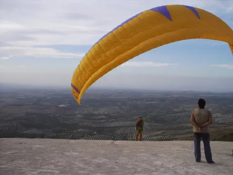
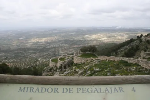
Currently takes advantage of this saw to do sport in nature: hiking, mountain bike, climbing, bulder, free flight... It has two views with splendid panoramic views of the mountain environment, and a recreational area known as "Seven Pillas."

Paste has numerous natural sites of high interest both environmental and cultural. Between them We stand out the following:

  • The Charca. It's a reservoir that collects the waters of the birth of the Fuente de la Reja since medieval times. In the beginning it was a simple dam with a containment stone wall and gates that regulated the water output through a network of kilometres of waterfalls, which allowed to water the orchard and olive lands located south of the urban core, distributed in banks. A spring that has never been enough to fertilize all the lands that extend at a decreasing level towards the Guadalbullion River. On the other hand, the years of drought the flow of the source is significantly reduced.
  • Source of the Reja. It is the natural spill of the underground aquifer and origin of the hydraulic system of the garden pegalajareña. A legend tells, that a lavender discovered the image of the Virgin of Grace in this place, building in his honor a hermitage over the source itself.
  • Recreative area "Seven Pills." This area is 2 km away. from Pegalajar, it is given this name due to the source in the vicinity and it is called in the same way. A space with merenderos and viewpoints from which an extraordinary panorama of the countryside, Sierra de Cazorla, Jaén capital and the municipal term of the municipality are obtained. Here is the flight center Seven Pills dedicated to the practice of the Paragliding.

Other areas of interest They deserve to be visited: Valle del Guadalbullón (The Lock) and Bercho Valley.

Fiestas y Eventos
  • Carnival: The arraigo among the pegalajareños is so important that after the Spanish Civil War, the festival of the masks continued to be celebrated.
  • Party in honor of the Virgin of Grace:Commemorated on the first Sunday of May. The participants go to the hermitage of the Virgin, located in the area where the spring of the Fuente de la Reja is located. A Mass is held in his honor and later the procession through the streets of the people.
  • San Gregorio Nacianceno: Devotion to this saint goes back to 1670, When the people decide to hold a feast and process the saint every year to rid the field of plagues.
  • Virgin of the Snow:: Between 4 and 8 AugustThe patron parties are held in honor of the Virgin of the Snow, with many activities dedicated to all the groups. The Flamenco Festival, to which there are notable figures at national level. Also the bulls and bullfights, which are held in the Plaza de Toros opened in 1919 and have many followers.
  • Flamenco Festival: A special mention is required of the Festival of Flamenco Art of Pegalajar, which has been held since 1969 and where each year it is honoured to different prominent figures of Flamenco Art.
Gastronomía

In Pegalajar we find a very varied gastronomy whose fundamental base are the products of the garden. Among the most traditional dishes we have:

  • Pipirrana: with tomato, garlic mallet, cooked egg, salt, olive oil.
  • Peanuts: soup garlic, chorizo red pepper.
  • Cazolilla: made from a traditional conserved called "tomato cake" consisting of dry tomato forming a large cake, which makes a sauce to which a saffrito of onion and cod is added.
  • Bercho rice: with potatoes and vegetables from the garden or with "peppers."

Warehouse:

  • Papajotes: fried mass of flour, milk, sugar and egg.
  • Fried skillet peas and nuts, sugar "tostah," roscs and almond stained...
  • Home licenses of endrin, purple or the mistel and wine of the country.
Historia

The first documented references date back to the Bronze Age. It has been found in the Cueva de los Majuelosdiscovered in the 1970s of the last century, a collective burial with human remains and instruments carved in bone and silex, polished stone, ceramic remains...

Another of the prehistoric references is the hill of Tower of the Head in which the remains of the Copper, Bronze, Iberian, Roman and medieval epoch are mixed.

From the Roman era, deposits have been located scattered by the municipal term, corresponding to small necropolis and villas that indicate the existence of a scattered habitat, with an agro-livestock economy. One of these. necropolis is the Port Altowhere there is also a pottery of the seedling land, pieces of Roman teagula and a stone-carved altar. There are other locations, such as the Canteruelathe Charcons, even in the vicinity of the Torre de la Cabeza has been located Roman ceramics made around.The four militaries found in 1975 in The lock They make known to us the existence of an important Roman road passing through this town. The insecurity of the area in the Middle Ages is reflected in the disappearance of the Roman houses scattered by the term and occupation of the natural strength of the Peña de los Vultreswhere it was built a pebble that is still preserved.

The origin of the villa is from the time of Al-Ándalus. Their existence revolves around the Source of the Tea, aquatic origin of La Charca. With peace and the rise of the caliphate between the X and XI centuries should have to expand the network of accesses and banks that form the Paste orchard.

The Christian conquest took place next to that of Jaén by Fernando IIIwhich also took over the castle of Pegalajar. The primitive Muslim compound was expanded after the conquest, with the construction of a second compound and strengthening of the first one with circular towers more resistant to the gunpowder attack.

From the conquest in 1246, was a village of Jaén, was part of its alfoz and its proximity to the Muslim kingdom of Granada made it a fundamental defense of this city, until the end of the Reconquest in 1492. On this date he loses the strategic value of his castle, but not its economic importancebecause at the feet of the fortress a fertile vega of orchards and olive trees, inherited from the Arabs.

The origin of the population of Pegalajar after the Reconquista was linked to the city of Jaén, on whom it depended administratively. This population was formed by men in the 13th century from several Spanish areas.

In 1559 King Philip II granted Pegalajar a real privilege for which he recognized him. Jaén's exemption and the title of the villa in exchange for a service to the Crown of a significant amount of maravedis. The municipality begins a period of economic and demographic improvement.

After XVII crisis, increased by the tabs and famine in the 18th century, there is a slow population growth leading to the expansion of the agricultural land and the various production, which was maintained until mid-term 20th century where, as in the rest of the province, a important emigration to cities in search of a better life.

Loading map
Preparing points of interest and routes...
Imagen principal
imagen
Image
Pegalajar
Imagen principal
Activado

Navas de San Juan

Submitted by brandcode_deweloper on
Id
749122
Perfil de redes sociales
Facebook
https://www.facebook.com/Ayuntamiento-Navas-de-San-Juan-448985438457871/
Descripción
Breve descripción

Population located in the north of the province, in the district of El Condado. The whole of its term is located in Sierra Morena on its southern side and in the Guadalquivir watershed. The rivers of Guadalimar, Guadalén and Guarrizas run through this municipality.

The landscape of Navas de San Juan, as the rest of the region has the olive tree as its protagonist, although there are also areas of cereal. The uncultivated land is pasture in which a mainly bovine livestock is fed. Pigs and stabulated birds are also important at the provincial level.

The economy is based first on olive cultivation, followed at a distance by livestock and hunting. The pistachio is recently being introduced as an alternative crop and economic source.
From its cultural heritage we highlight: the hermitage of the Virgin of the Star and the church of St. John the Baptist.

Telecomunicaciones
Teléfono
953 689 100
Sitio web
www.navasdesanjuan.es
Fax
953 688 012
Correo electrónico
navas@dipujaen.es
Ubicación
Nombre
Navas de San Juan
Latitud
38.183640
Longitud
-3.313750
Distrito
Municipio
Ubicación en el mapa
POINT (-3.31375 38.18364)
Imágenes
imagen
Image
056fe538-4d82-8621-2ced-07fcf5561cd9?t=1595352501222
Imagen principal
Desactivado
imagen
Image
7459d44a-841b-509b-4d76-d3490e4baaca?t=1595352516320
Imagen principal
Desactivado
imagen
Image
f98e1bf3-2beb-106a-2277-02c01fa10a2a?t=1595436293652
Imagen principal
Desactivado
imagen
Image
10f8a3e8-0495-4644-e363-79174b2f4513?t=1595436293770
Imagen principal
Desactivado
imagen
Image
4a17f527-2aef-e582-8906-7848b2ee6075?t=1595436333456
Imagen principal
Desactivado
imagen
Image
2ec55283-1a70-8d06-6f99-c37b6ec049d4?t=1621270123467
Imagen principal
Desactivado
imagen
Image
98701ad5-582b-2261-af27-a20fa0f8b448?t=1621270123633
Imagen principal
Desactivado
Información adicional
Imágenes cabecera
imagen
Image
Navas de San Juan
Imagen principal
Desactivado
Datos de interés

Tourist area: Sierra Morena
Distance to the capital (km): 86
Altitude over sea level (m): 732
Extension (Km2): 176
Number of inhabitants: 5285
Gentilicon: Naveros
Postal code: 23240

Videos
Video file
Cultura
  • Hermitage of the Virgin of the Star. Up on an Arab fortress of the 13th century, of which the tower of homage is preserved. In the 15th century he began his dedication to Christian worship and has since been reformed several times. Built in gilded masonry and silery, the set presents basic plant with arches of half point on quadrangular pillars with achaflanated corners. The shrimp of the Virgin is located in the tower of homage, covered by a half-orange vault on breast. From the outside it is observed that in order to adapt it, vain and saetera were blinded. In 1781 the bell tower and the last century the swordsman.
  • Church of St. John the Baptist. Built between the 16th and 18th centuries. It presents Renaissance, mannerist and baroque elements. Its plant is long and of a single ship, arranged in three unequal sections: the presbyterium, covered with a barrel vault with lunetes; the previous space, which is a little wider, covered with a vault of edges and with hornacino chapels on the sides and the third section is centralized and covered with a half-orange vault on the pechines.The cover style Mannerist It has a simple half-point arch with trapezoidal dovens, and in the upper body a hornaine with dogrous columns, dogric setting and triangular fronton. The bell tower It's been raised in the 18th century, with a first body of square floor and the second of polygonal floor topped by a conical volume covered with Arab tile. A very valuable and important piece is preserved in this church. a silver cross adorned with low-reliefs which represent the Old and New Testament.
  • The Vergao Fountain. We found the first references of its existence in the Marquis de la Ensenada Census in 1752. It is a sample of public-use civil architecture from which not many remain. It has supplied water to Navas until 1966, when the drinking water network was installed in the municipality.

Naturaleza

The town of Navas de San Juan located to the north of the province, on the southern slope of Sierra Morena, it extends between the Montizon River and the Guadalimar.

Its landscape, like the rest of the municipalities of this region, has protagonist to the olive tree, but also cereal lands and mountain areas.

In North third is found the most abrupt area, the areas of Torrealver, Villamalo, Cerro de San Pablo and the Ballestera.

We found several valleys throughout the term: The one from the Guadalimar River, by its southern limit; the Guadalén in the north half, and the valley of River Guarrizas delimiting the north of the municipal term.

The the whole of the municipal term is found in the river Guadalquivir watershed and from its main tributary the Guadalimar River.

The South Third of the term pour directly to the Guadalimar River, while the remaining two thirds pour to the Guadalén River, either directly to it, or to its tributary the Montizon River.

In the term of Navas de San Juan we distinguish four ecosystems well-differentiated: mountain and high mountain areas, of the olive tree, the cereal crops and banks of rivers and wetlands.

It will be this last ecosystem, with its gallery forests in the vicinity of the rivers, that they put a color note in the landscape with the passage of the stations, especially at the station fall.

The flora is made up of: oaks, corks, complaints, oaks, Mediterranean nobleman forest, and repopulation pines, gallery forests in the water courses.

The fauna The site is also very diverse: major and minor hunting species, presence of protected mammals such as the wolf, lince or meloncillo. Birds related to the aquatic environment and rapacious birds of special interest such as the imperial eagle, leonate vultures or the royal owl.

An ideal space from which we can contemplate extraordinary panoramic views of the countryside and jienese saws.

Fiestas y Eventos

The following festivities are held in the town of Navas de San Juan:

  • Virgin of the Star Romeria. During the first three days of May, Navas de San Juan celebrates the Romeria of Our Lady of the Star. The events begin on April 30 with the floral offering to the banner of the Virgin, mass and preaching. The day 1 May, rosemary in typical suits, carrots garnetted, horsemen and horses Start towards the hermitage of its employer, located in the Star Plane. In the sanctuary there is a solemn mass, performances in the auditorium and "mayos" in the hermitage at night. The day two, the authorities leave again from the City Council to accompany the Virgin of the Star from the sanctuary to the monolith that commemorates its appearance in the 12th century. The Third dayafter the Mass in the sanctuary, the Virgin return to his parish in the Navas de San Juan, being received with great joy by the naveros that cover the image with rose petals and where it will remain until the first Saturday of September. In addition to "Maya.", traditional songs in honor of the Virgin, also offer to her patron the, wide silk ribbons with embroidery beautiful that are placed to the image of the patron. It has been declared National Tourist Interest Party in 1985.
  • Festivals of San Juan. These parties have been held since 1808 in honor of San Juan Bautista, the master of the municipality. The day 24 June, in the afternoon, the Patron walks through the streets of the village to the bullring, to the double bar to turn the course and grant the blessing and approval of the acts prepared in his honor. Within all the programmed, the "bulls", a custom celebrated since time immemorial, in which Braves run through the streets of the village.
  • August parties. Also called migrant parties. They were born in order to pay tribute to all who one day for work reasons had to emigrate and are unable to attend the holidays of San Juan. They are a replica of the traditional ones held in June. It has been established for the first weekend of August.

Gastronomía

It has a certain influence of the manchega cuisine due to its proximity, but it has many typical recipes of the village. These are some of those with the greatest roots in the population:

  • Cauliflower knife. For its production it is necessary: cauliflower, onion, tomato, pepper, garlic, parsley, olive oil, it can also carry boquerones, but it is optional.
  • Gachamas, made with olive oil, flour, water and potatoes. You can eat with chorizos, torreznos...
  • Ajo- flour: potatoes, flour, cod, pepper, tomato, onion, garlic, cumin and pepper.
  • Cranberries: olive oil, rabbit or field hare, potatoes, onions, garlic, dry pepper, tomato, sweet pepper, mint and laurel. For cakes, flour, water and salt.
  • Galians. Galianeras (bread cakes without yeast), rabbit, tomato, green pepper, olive oil, water and salt are needed.

In pastry shops:

  • Drunk: eggs, roasted oil, white wine, flour, sugar and spirits.
  • Other: Holy Week flowers, sweet gazhas...
  • Risol: It is the typical Christmas liquor and its ingredients are: sweet anis, coffee in grain, cinnamon, orange shell and sugar.

Historia

A mid-second millennium BC the territory of Navas de San Juan already showed an important human occupation, as the settlements of Castellón and the Atalaya testify.

The people must have emerged, the Iberian period, of a colonization promoted by the great Iberian center of Cattulo.

Later, as the rest of the province of Jaén was under Carthaginese power, and already in Roman times it was an important point on the road between Catulus and Ilugo as shown by the appearance of two "militaries" within the municipal term. In the territory, there was an abundance of the farm-type villa, of which seven have been invented, including the Cortijada de El Steel or Roman Villa of Cerro Prior.

In the times of Al Andalus, Navas de San Juan It had to be a pitcher, where Muslims built a castle and other fortifications such as the castle of Ero and tower of tribute around which the Sanctuary of Santa Maria de la Estrella has been built.

Fernando III conquered these lands in the year 1226, when they were under the jurisdiction of Santisteban del Puerto, coming this link with Santisteban until 1802, when Charles IV grants him the privilege of villain.

The second half of the 19th century was characterized by population growth, people looking for work in the countryside.

From 60 years of the last century, as in other Jienian localities, Navas de San Juan suffers from strong emigration due to the massive rural exodus to the large cities, losing up to 25% of its population.

Loading map
Preparing points of interest and routes...
Imagen principal
imagen
Image
Navas de San Juan
Imagen principal
Activado

Mengíbar

Submitted by brandcode_deweloper on
Id
747223
Perfil de redes sociales
Facebook
https://www.facebook.com/aytomengibar
Twitter
https://twitter.com/aytomengibar
Descripción
Breve descripción

Mengibar is located to the north of the Jiennense capital, between the Guadalquivir, Guadalumillon and Guadalimar rivers, land covered with olive trees and cereal and fruit fields. Its location next to the E-902 or A-44 motorway (Bailén-Motril) has helped to maintain a balance between the dedication to agriculture, industry and services. When you reach Mengíbar el Guadalquivir, your flow rate is amused, and you start a quiet middle course, allowing for better use of the water. Mengibar was highlighted river port, on the banks of the Guadalquivir, for its good geographical location, especially for the transport of wood from the Sierra de Segura.

The city centre, which is located on a soft hill of fertile lands, both dry and irrigated, has in its interior buildings and monuments of interest, such as the Renaissance Church dedicated to Saint Peter the Apostle, a beautiful and slender Christian Tower, the Conistory House and the House of the Palace.

The Iberian oppidum of Iliturgi, located in Cerro La Muela, and the famous Roman city of Iliturgi, in Cerro Machiz, have been discovered nearby.

The centre of Mengibar, of irregular layout and Arab influences, has expanded in the east, west and north direction, crystallizing in a wide and rectilinean road, with apples of considerable size in the ensanches closest to the old town and with smaller apples on the periphery of the core.

Telecomunicaciones
Teléfono
953 370 025
Sitio web
www.aytomengibar.com
Fax
953 372 535
Correo electrónico
info@aytomengibar.es
Ubicación
Nombre
Mengíbar
Latitud
37.968410
Longitud
-3.809080
Distrito
Municipio
Ubicación en el mapa
POINT (-3.80908 37.96841)
Imágenes
imagen
Image
bd9dd7c4-7f1e-0dba-0fd2-8ac8158bc6af?t=1676572188698
Imagen principal
Desactivado
imagen
Image
edb57e81-d17d-24a3-406b-ca287562ea61?t=1676572793978
Imagen principal
Desactivado
imagen
Image
8040c949-bac6-38f8-6440-6aa202fca8a5?t=1676572794051
Imagen principal
Desactivado
imagen
Image
e78df582-3ef0-8b51-20e5-ca72c6a31f77?t=1585758946143
Imagen principal
Desactivado
imagen
Image
36f6f987-4a88-2b73-e598-6e017b5c9459?t=1676572794144
Imagen principal
Desactivado
imagen
Image
c584628f-6dbd-68b3-3ad6-64da50dbc967?t=1676572863592
Imagen principal
Desactivado
imagen
Image
3d0828e3-c321-a256-617e-56fbfc9c1992?t=1676899290872
Imagen principal
Desactivado
Información adicional
Curiosidades

Por teléfono: 677 222 285

Por correo electrónico:

turismo@aytomengibar.com

https://mengibarturismo.com/

Imágenes cabecera
imagen
Image
men
Imagen principal
Desactivado
Datos de interés

Tourist area: Campiña and Jaén
Distance to the capital (km): 25
Altitude over sea level (m): 315
Extension (km ²): 62,3
Number of inhabitants: 10,068
Gentillo: Mengibarians or Mengibarians
Postal code: 23620

Videos
Video file
Cultura
  • Mengibar Tower, is the tower of homage of the old castle of Mengibar raised in the 13th century, being the only thing that has been preserved from it. It was restored in 1982. Its height is higher than 25 meters and has vaulted rooms inside. In 1985 she was registered as BIC.
  • Arc de Jano Augusto (Ianus Augustus), a milestone in the landscape, which marked the border between the Roman provinces Betica and Tarraconense. Declared Good of Cultural Interest, the Arc de Jano Augusto (1st century BC and 1st century AD) had dimensions of 14.80 meters in length, almost 5 meters in width and a single central vain of 5.15 meters. The arc was the starting point of the Augusta Way in the Betica. It has been BIC since 2019.
  • House of Inquisition, property that is included in the General Catalogue of the Andalusian Historical Heritage. Located on Jaén Street, there is a very late classic cover dating back to the second half of the 17th century. The most important thing about the building is the main two-storey facade. It's interesting your forging grate.
  • Hydroelectric Central and dam on the Guadalquivir River, the work of the architect Antonio Palacios, represents a remarkable exhibition of industrial architecture. The plant and dam are part of the ambitious project for the development of the Guadalquivir River of the MENGEMOR company.
  • Parish Church of Saint Peter the Apostlenear the Tower, an architectural jewel of the Renaissance, despite the reform of 1970. Its main façade is south-facing and built in the first half of the 16th century. The other facade, facing the north, has different dependencies such as the sacristy, chapels and salons throughout the different reforms. It obeys the Vandelvirian model of three-ship temple separated by pillars and vaults. In front of its construction, Francisco del Castillo, the old man, and Alonso Barba, intervened.
  • The Hermitage of the Lord of the Rainof small dimensions, it is made up of three narrow ships. The centre is of canyon vault, while the sides are intellized. The ships are separated thanks to two large arches of half-point brick seen. The exterior, with a stone view, has a simple front front cover, as a templet, on which a circular window is located and overlooks a revered bell swordsman. It is the only one in the municipality that is preserved from the 18th century. It is now called "Lord of the Rain," for it is venerated by a crucified Christ whom the Mengibarians have traditionally entrusted in the years and periods of drought.
  • The Hermitage of Santa María Magdalena was opened and blessed on 14 July 1990 outside the municipality of Mengibar, very close to the Roman city of Iliturgi. It is located in the Cerro de Machiz, where the ancient 16th century hermitage was erected. It has a simple half-point arch cover with two small side voids, as saetas. At the top we find a hornadine with the image of Mary Magdalena and, on a side, a small body of swordsman. Since its opening, the Romeria de Santa María Magdalena is held annually.
  • Oppidum ibero de Iliturgi and archaeological site of the Roman Iliturgi. Since 2016, the University of Jaén and the City of Mengibar have been working together to rescue the past of the municipality. In Cerro de la Muela, the ibero oppidum of Iliturgi (6th and 3rd centuries BC) was located, with an area of more than 14 hectares. Here, many archaeological remains have been found, which have made it possible to document the siege and destruction of the oppidum in 206 BC by the Roman army. After this event Tiberio Sememonio Graco would founded the Roman city of Iliturgi in the area of Maquiz, about 700 metres from the city destroyed. Since the mid-19th century, a large number of remains of the Roman city have been removed, most of which now form the Iliturgi Collection, which is preserved in Casa Palacio.
  • Mengibar rolls, picotas and bakers. They are part of the history of their formation as a people with their own jurisdiction. The origin of the rolls was found in 1574, when the villa managed to emancipate itself from the city of Jaén. The title, granted by Philip II, allows him to have full jurisdiction, made symbolized by the presence of rolls and picotas. While the former reflect the new administrative and legal status, picotta is the place where the prisoners were punished. The hornaces, on the other hand, are similar to holes made in walls and crowned by a reduced arc. A votive image was placed in them, thus being a sample of the popular fervor of the municipality.
  • The House Palace is a building dating from the 15th century, located in the central area of the historical artistic complex, next to the Torre del Tribute. The property has not always been a single house. From the 13th century, houses are being built very close to the castle wall. It would be a small fortification around the large tower located inside. With the coming of the centuries Casa Palacio has had distinguished owners. It has also been the scene of important historical events. It has also had functions beyond domestic. The building has now become a hotel. One of the first to build their houses on the house occupied by the palace was Mr Pedro Méndez de Sotomayor, Lord of Mengibar and Rider of Jaén, in order to keep the cattle and the cereals of their crops. This has now become the Hotel Palacio de Mengibar, which has a unique spa built in an Arab aljibe and decorated in the style of the Roman era.
  • Interactive Museum of Olive Oil and Sustainability Terra Oleum. It offers a modern exhibition space made up of unique architectural spaces, including its Caja Aurea and a natural environment presided over by the olive forest. For the dissemination of knowledge related to olive cultivation, oil production technology and Mediterranean diet. It has been selected as a reference centre by the European Union for the dissemination of the olive oil culture. The Terra Oleum Museum extends over a total area of more than 11,000 square metres. It is the largest area of knowledge planned in the Mediterranean basin for a food product.
Naturaleza


The municipal term of Mengibar is also spread between the herbaceous crops and the olive tree, with virtually all its irrigated surface, highlighting the vegas of the Guadalquivir and those of the Guadalbullion.

The dominant crops are: the olive tree, sunflower, cotton and cereals (wheat, barley and maize). The beautiful landscape of the Mengibareña countryside is interrupted to the north with Sierra Morena, and to the south with Sierra Mágina and Jaén, passing the rest between soft and undulations without great heights. This beautiful landscape is complete by the gallery forests on the banks of the three rivers that cross its term: the Guadalquivir and two of its tributaries, the Guadalbullón and the Guadalimar. In the autumn the trees of a caduca leaf paint a color brush in the landscape.

The lands of Mengibar offer the traveller various enclaves of natural interest. Among them is the Cerro Albariza, natural lookout from which magnificent views are obtained from the Guadalquivir valley or the Guadalbullón delta located next to the Cañada Real de Torreblasphcopedro, about three kilometres from the urban centre. Its abundant coastal vegetation gives it botanical interest.

The Mengibar dam on the Guadalquivir River, opened in 1916 by King Alfonso XIII, puts a color note to the landscape. The olive tree predominates, but next to the river line we find white alms, mumberas, tarais, black alms, as well as other species of bushes. The fauna is the same as the Jienese countryside: hares, rabbits, perdices, deer, linches, boars, foxes, quails... Also, they are easy to see the storks and a wide variety of prey birds. Without forgetting the fauna that dwells next to the rivers and in the vicinity of the reservoir.

Fiestas y Eventos


In Mengibar, as in the villages of Andalusia, people look forward to popular parties because they know that they will become days of joy and fun, for both the neighbors and visitors. In addition to the Christmas, Carnival and Easter celebration, the following parties are held in Mengibar:

  • San Antónwhich is held on 17 January. The night before the streets are filled with "luminaires," where people around them sing, chorizos, chops and sardines.
  • Holy Week of Mengibarthe Holy Thursday, its preaches and the Sunday of Resurrection, stands out.
  • May Crossthe Holy Cross is celebrated on May 3. On this day Mengibar is dressed as a party, its streets and neighborhoods are covered with crosses, flowers, light and colorful. Every year more visitors come to witness them.
  • Romeria de "La Malena". In honor of Santa María Magdalena, patron of Mengibar, is celebrated on the second Sunday of May. The image is taken that day to his hermitage, accompanied by rosemary on foot, in carrots or on horseback.
  • Fair and Festival of the "Malena"from July 22 to 25, the heat of these days is faced with the joy of the parties in honor of the patron. There is no lack of religious acts but a comprehensive programming of activities for all the public.
  • The Rosaries of the aurora. Mengibar prays singing in the auroras on Sundays, from the last of August to the first of October. It's a custom dating back to the 17th century. The Brothers of each involved fellowship summon their people to rise up and go to the Rosary on their own Sunday. On the afternoon of that day the procession of the title image of the brotherhood takes place. On the first Sunday the Virgin of Fatima is processed, on the successive Sundays of September the Virgin of the Head, Jesus Nazarene, the Virgin of the Dolores and the Virgin of Carmen. It ends the feast, with the procession of the Virgin of the Rosary.
  • Historical recreation of the funeral court of Isabel I de Castilla, La Católica. On November 26, 1504, the queen died in Medina del Campo (Valladolid) and, following her wishes, took a way to the city of the Alhambra where she asked to be buried. On the banks of the Guadalquivir, on its way through Mengibar, a storm forced the funeral court to turn from its route to Granada to take refuge in the Church of St. Peter the Apostle. Since 2015, the third Saturday of November is commemorated with a theatrical historical recreation. More than 220 people participate in it (horse guards, royal guards, drummers, Franciscan monks, nobles, cars of beings and plain people, among others).
Gastronomía


In the culinary culture of Mengibar are present two aspects, one is olive oil, and the other is the use of the products of its gardens that become part of the ingredients of these dishes. From its varied gastronomy, we will highlight the following:

  • Pipirrana, which uses peppers, tomatoes, garlic, onions and olive oil. A refreshing dish that can't be missed in summer.
  • Migas of bread with chorizo, radishes, herring and cod.
  • Tomato fish and pepper (typical of fair days).
  • Cod meatballs, a typical Lent meal.
  • Panoil, on a slice of bread the oil that can be accompanied with tomato and cod is spread.
  • From their pastries are delights such as wine roses, honey flakes, pestins and bienmesabe.
Historia

The history of Mengibar begins to be written on the banks of the Guadalquivir River, approximately 6,000 years ago, in the Neolithic. The traces of this period correspond to the denominated settlement of the Vega Baja. The largest milestone of Iberian occupation of the municipal term of Mengibar corresponds to the oppidium of Iliturgi and the different necropolis associated with this important population core.

Until very recently it was considered that this town would have risen in the area known as Cerro Machiz or Las Torres, a place very close to the confluence of the Guadalbullion River with the Guadalquivir. Recent archaeological excavations demonstrate the exact location of the Iberian city in the site known as "Plaza de Armas del Cerro de la Muela."

This site would be besieged by Roman General Publio Cornelio Scipion, the African. Tito Livio narrated how the city was attacked, burned and massacred. In the 2nd century BC, Rome would founded a new Iliturgi in Cerró Maquiz, an enclave located on the opposite bank of the Guadalbullion River, 700 metres from the old ibero oppidum.

These remains are preserved in Mengibar from the Almohad period. In 1225, Fernando III, the Holy Conquest Mengibar, granted the land of Machiz to the Order of Santiago, leaving the Place under the jurisdiction of Jaén.

The word "MENXIBAR" first appears in the conquest of Jaén, which shows that there must have been a fortress that was occupied by Christian troops. Conquistada Jaén, the king anexiona to this city, on which it will depend until 1574, year in which Philip II, by paying 22,500 ducats, makes it Villa.

On July 16, 1808, a glorious event took place in Mengibar: the defeat of French troops, who fled to Bailén, where days later they would be defeated by General Castaños.

Loading map
Preparing points of interest and routes...
Imagen principal
imagen
Image
Mengibar
Imagen principal
Activado

Martos

Submitted by brandcode_deweloper on
Id
747103
Perfil de redes sociales
Facebook
https://es-es.facebook.com/AytoMartos/
Twitter
https://twitter.com/aytomartos?lang=es
Descripción
Breve descripción

Martos is located to the north of the Sierra Sur region, being the largest municipality and population of this region. There are other populations that are part of the municipality, such as Monte Lope Álvarez, Las Casillas, La Carrasca and Villarbajo.

Its municipal term is essentially olive tree, in its landscape of countryside the olive tree is the protagonist, extending to the horizon. Because of the great quantity and quality of olive oil produced in the city, it is called the "Olivar Cot." Around it has developed an important olive industry that together with the automotive-related factories and their auxiliary industries are the engine of employment and wealth for the municipality and its region.

It has an important historical heritage, among other monuments we quote: the Old Cárcel and Cabildo, Castles of the Peña and the Villa, Puente Romano, Urban Wall, Castle of the Endowment, Pilar of the New Source; with respect to the religious architecture: Royal Parish Church of Santa Marta, Sanctuary of Mary Most Holy of the Villa, Monastery of the Most Holy Trinity, Ermita of San Bartolomé, parish of San Amador and Santa Ana, etc.

This is the cultural wealth and beauty of its historical ensemble, which since 2003 has had the status of Good Cultural Interest.

Telecomunicaciones
Teléfono
953 210 000
Sitio web
https://turismo.martos.es/
Fax
953 553 309
Correo electrónico
turismoycomercio@martos.es
Ubicación
Nombre
Martos
Latitud
37.722260
Longitud
-3.970320
Distrito
Municipio
Ubicación en el mapa
POINT (-3.97032 37.72226)
Imágenes
imagen
Image
7470103a-fede-6cf5-54b2-edb356074e03?t=1603121821734
Imagen principal
Desactivado
Información adicional
Imágenes cabecera
imagen
Image
Martos
Imagen principal
Desactivado
Datos de interés

Tourist area: Sierra Sur and Jaén
Distance to the capital (km): 24
Altitude over sea level (m): 753
Extension (Km2): 259
Number of inhabitants: 24520
Gentillo: Marteños
Postal code: 23600

Videos
Video file
Cultura

Old Jail and Cabildo. Building built in the 16th century, considered a masterpiece of Spanish mannerism. It is currently the City Hall of the city.

In his spectacular main façade We can highlight the huge, dogrous columns with piled armchairs, the sculptures of Justice and Prudence, (both were beheaded), the great doors and their bronze aldabones and a great shield of the Austrians crowning the whole. It was declared a National Historical Monument in 1931. Below the City Hall, the Convent of the Trinitarian, work of the late 16th century, and on the same street, but in the opposite sense the Hospital of San Juan de Dios, of baroque bill of the 18th century. All this high part of the intramurous historical centre is of great quaint and from it you can enjoy beautiful panoramic.

  • Santa Marta Parish Church. It rose in the 13th century, in the years following the taking of the city by Fernando III the Holy, on an Arab mosque. It is consecrated to the patron of the city and has the title of Real since 1617. Gothic Mudejar style. The Baptisterium, the Major Chapel, was later built and embellished with the slate-cross vaults and a large cover of the isabelin Gothic. In the 16th century the interior is expanded and remodeled, raising large columns of Tuscan order and building the original Bell Tower with three bodies.
  • Pilar of the New Source. Ornamental source located in the Manuel Carrasco Municipal Park. It was built in the 16th century, reflecting the most new and outstanding aspects of the Manier architecture. The set stands out for its monumental beauty and austerity. It consists of an abrevadero pillar and a smaller one in which two lions make water pipes. In the center is the Austrian shield, and on the sides is the shield of Martos and that of Governor Aboz Enríquez.
  • The hermitage of San Bartolomé. Located in the skirts of the Peña de Martos, dates from the 14th century and houses the venerated image of Mary Most Holy of the Victory, Queen and Lady of the Peña.
  • Roman Bridge of Martos. Important engineering work, built in the Roman era on the Salado stream in the vicinity of Martos to facilitate the passage between the two shores.
  • Sanctuary of Mary Most Holy of the Villa. Temple in which Mary Most Holy of the Villa, known as "La Labradora," is sold. It was built on dates near the delivery of Martos to the Kingdom of Castilla. In the 16th century the temple was remodeled and a bell tower was built. This sanctuary was burned and destroyed during the Spanish Civil War. The current was rebuilt in the 1940s of the last century, in a Neobaroque style. The Torre-Campanario dates from the 16th century, is separated from the main building and is the only original element of the ancient Sanctuary. It has a square floor with half-point arches.
  • The ruins of Castillo de la Peña which we know today are not those built by Muslims but correspond to the strength that the Calatravos built from 1340. The floor of the castle is trapezoidal adapted to the surface of the plateau on which it sits and its entrance, for security reasons, marked a zigzag drawing. The compound was divided into alcázar and a courtyard of weapons protected by a walled enclosure. The alcázar, where the tower of tribute is raised, takes advantage of a natural podium that lifts it about three meters above the courtyard of weapons, separated by a wide, also natural.

  • Castle of the Villa. It was an alcazaba or citadel surrounded by canvases of almenada wall, as well as passageways and towers, leaving the central space for the construction of administrative and religious buildings: church of Santa Catalina, headquarters of the governorate, cavalries, tahonas, lagores, aljibes, etc. According to evidence from an inspection carried out by the Visitors of the Order of Calatrava in the 16th century in order to repair the deficiencies of the Lower Fortress.

Naturaleza

The orography of the municipal term of Martos is characterized by being quite accidental, with plenty of mountain grounds above all the southern part, instead the north-western part corresponds to soft reliefs and plain characteristic of the Guadalquivir depression, which extends in the west and north of Martos.

Among the greatest levels are the Sierra de la Caracola, with 1340 m., located in the south and to the north is located the Sierra de La Grana with 1254 m. and this is the extension of the Sierra de Jabalcuz, and we would like to mention the well-known Peña de Martos with its 1003 m. on whose slopes the city of Martos is located.
The hydrographic network is composed of a set of rivers and streams which are used for both human consumption and irrigation.
They are two rivers the main ones that pass through the municipality: Eliche Riverwhich is born by the saw of the Grana, and the river Víboras which is born in the term of Valdepeñas de Jaén. The channel of this river is used in the a reservoir of the same name, next to the pastry of Las Casillas.

The flora of the term is dominated by the olive, located in a large percentage of the land of the municipality. It also exists indigenous vegetation of the Mediterranean forest in the mountain areas, where we see species such as: the oak, coscoja, white jara, complaining and abundant number of aromatic plants such as lavender, rosemary or thyme.

In the banks of the river Víboras coexist riverside species as they can be: white, strawberry, elves, olms, zarzamoras and carrizos.

In the fauna exists a great diversity of species, from rapacious birds, both diurnal and nocturnal; aquatic birds, paseriforms, reptiles, amphibians and minor-game mammals.

For nature lovers, Martos offers an interesting natural offer to make different routes, climb to the top of the Peña, offers unparalleled views of the countryside landscape and the surrounding mountains.

Other very interesting routes are also the rise to the Sierra de la Grana, the Sierra de la Caracolera and the setting that forms the reservoir of the Víboras River and the Víboras Castle.

Fiestas y Eventos

Among the main festive celebrations of Martos are:

  • Romeria in honor of the Virgin of Victory. The last weekend of May is held. The festivities begin on Friday with the departure of the procession of the image from the hermitage of San Bartolomé to the Church of Santa Marta with the streets where it passes adorned with flags, reunions, retamas, altars and rosemary in typical suits. The next day the Virgin leaves the parish to go to the hermitage of the Virgin of Peña followed by carts, chariots and horsemen. On Sunday, the day of the rosemary, the virgin returns to her hermitage carried on a cart thrown by oxen and accompanied by gilded carrots with floral ornaments and various decorations. During the tour the atmosphere is fun and cheerful. They sing songs, they eat cheese, ham and rebujito. Once in the Peña, the solemn mass is celebrated and at the end of the rosemary they prepare to eat in the surroundings of the hermitage. This party is declared the Festival of Tourist Interest of Andalusia.
  • Fair and parties in honor of San Bartolomé. At the end of August, Martos is preparing for the largest celebration. Many and many different activities are organized during the days of pre-fair and fair, such as concerts, theatre, cultural and sports activities, horseback riding, pasacalles and taurinos (traditional the brandy torillo). The festivities begin with the official turn on of the cover and the fun is centralized in the fairgrounds, where various musical performances are offered.
  • Olive party. Typical celebration of Martos that symbolizes the official start of the olive collection campaign and pays tribute to the olives that work in the campaign. It takes place during several days of December with the celebration of many cultural activities related to the olive grove. The brooch of party end takes place on December 8, with the most outstanding events: reception of authorities at the City Hall, followed by a floral offering at the Monument to the Olives and the invitation to the attendees of a olive hole (bread, oil, cod and olives). And to put the final point to the party, the Martos' almazara teachers extract the first olive oil of the year.Declared holiday of Tourist Interest of Andalusia.
  • Holy Week. It is one of the most important popular and religious manifestations of Martos. The existence of co-fradies in the 16th century is recorded. Part of its Reciprocity in the narrow, tortuous and very considerate streets for which the hermandades run. All this linked to the incomparable frame offered by the millennial city of La Peña and the beauty of the images and thrones. It has been declared Tourist Interest Festival of Andalusia in 2002.
Gastronomía

In the gastronomy of Martos, extra virgin olive oil is a fundamental ingredient.

  • HoyoIt's bread and oil.

It retains two salads with origins of the Arabian-Andalusian cuisine: The orange chopper and the granate salad, where other vegetables are accompanied by orange or seasoned grenade grains.

  • Potage of beans and eggplants.

Meat dishes:

  • The rabbit with olives, which is prepared in the pastry of Las Casillas from which is found its replica in North Africa.

Dishes attached to the festive cycle:

  • Carnival filling, onions of Easter, the Sweet peas typical of the holiday of All Saints.

The of the Trinity mothers like the crotch or the buds, among many others.

Many traditional Martos dishes are shared with the rest of the Mexican cuisine Like, crumbs, gazpacho, pipirrana, white...

Historia

The origins of Martos they go back to Prehistory. Its strategic location, the existence of springs and the natural defense it offered were factors that caused the human settlement in the area.

There is evidence of different lytic materials belonging to the Paleolithic, however, the oldest documented statements are from the Neolithic. Remains of this period have been found in "El Molinillo," "Huertas Viejas" and "La Alberquilla." They are underground housing, funeral and defensive structures.

The city is known from very old, the Iberians named it Tucci and an important Iberian oppidum located in the upper part of the Peña is cited in the works of Ptolemy. There will be many settlements around Martos, such as Castlejo de Belda, La Atalaya, El Alamillo...

The Iberian city of Tucci, being occupied by the Romans, it became a colony that was named after Augusta Gemella Tuccitana. Many remains of this time are preserved such as mosaics, coins, ceramics, weapons, marble portraits..., the most important being the collection of Roman tombstones exposed on the façade of the Casa Consistorial de Martos.

From the visigode period, the paleocristian sarcophagus which is preserved in the Provincial Museum is the most important archaeological piece appeared in the town.

In the year 711 The Visigodic monarchy on the Iberian peninsula ends with the arrival of Muslims. Since the 9th century it was a very disputed border city. From this time are the castle of the Peña, the walls and torreons of the castle of the Villa. In 1225, Martos became part of the kingdom of Castilla, which King Fernando III will donate to the Order of Calatrava.

From the 13th century it acquired great splendor that will be increased with King Fernando the Catholic and the arrival of settlers from Castile and the Moorish of the Alpujarras.

The 16th century was a stage of economic, social expansion and of great transformation of the villa with the construction of new buildings, the remodeling of others and the expansion of the urban town.

During the 20th century, With the development of the olive grove, the arrival of the railway and the road there was a great population growth that decreased in the decades of the 50 and 60 of the last century caused by emigration.

The urban, social and demographic development of the city has now been increased by industrialization, being considered as one of the main industrial centres of Andalusia.

Loading map
Preparing points of interest and routes...
Imagen principal
imagen
Image
Martos
Imagen principal
Activado

Los Villares

Submitted by brandcode_deweloper on
Id
743218
Perfil de redes sociales
Facebook
https://www.facebook.com/aytolosvillares/
Twitter
https://twitter.com/losvillaresjaen
Instagram
https://www.instagram.com/losvillaresjaen/?hl=es
Descripción
Breve descripción

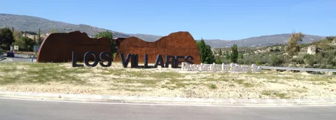
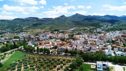
Municipality located north-east of Sierra Sur region, very close to Jaén capital. This circumstance, coupled with the abundance of water in this area and the soft weather of the summer, makes it an ideal place for the summer season to rest.

The town is located in a vaguada near the confluence of the Eliche and Frio rivers, that along with multiple streams go through its municipal term and supply the Quebrajano swamp, an interesting place from an environmental point of view. Its geographical location makes you enjoy great beauty.

The economy of the municipality is based mainly on the cultivation of the dry olive tree, Wicker craftsmanship is the second source of income. We should also mention the production of sausages, the craft of the spartum and other vegetables and, in recent years, the packaging of mineral water at the birth of the Cold River.

Among its historical-artistic heritage is the Church of St. John the Baptist of the 15th century, the Capital houses of the City Council, opened in 1775, and the Vizcount Palace.

Telecomunicaciones
Teléfono
953 320 005
Sitio web
www.losvillares.com/
Fax
953 321 160
Correo electrónico
ayuntamiento@losvillares.com
Ubicación
Nombre
Los Villares
Latitud
37.687710
Longitud
-3.818200
Distrito
Municipio
Ubicación en el mapa
POINT (-3.8182 37.68771)
Imágenes
imagen
Image
5ba651a8-a42f-cedd-f6cd-7cd6c637dbcd?t=1610977784486
Imagen principal
Desactivado
imagen
Image
cfe5e649-28c6-27b4-f3de-e8eba17b3476?t=1610977784617
Imagen principal
Desactivado
imagen
Image
8aabea48-819a-e5c7-65bf-7c59bc3301da?t=1610977784740
Imagen principal
Desactivado
imagen
Image
2b852f60-d67d-442b-9fc9-49ad0d68a9af?t=1610977784893
Imagen principal
Desactivado
Información adicional
Curiosidades

Ayuntamiento
Plaza de Fernando Feijoo, 1

https://turismolosvillares.es/

Imágenes cabecera
imagen
Image
Los Villares
Imagen principal
Desactivado
Datos de interés

Tourist area: Jaén and Sierra Sur
Distance to the capital (km): 13
Altitude over sea level (m): 521
Extension (km2): 89
Number of inhabitants: 4860
Gentillo: Villariegos
Postal code: 23160

Videos
Video file
Cultura

From its historical-artistic heritage, we highlight:

  • Parish Church of Saint John the Baptist. In the first half of the 16th century the original temple was built, very small, and in the 18th century it was necessary to expand and reform it, but again in the 19th century some remodeling was necessary. In the Spanish Civil War, the parish was seized and dismantled, losing the small but interesting movable heritage. In general terms it retains its primitive typical provision of mannerist architecture. It consists of a single ship with small furnaces on its walls, a short cruise covered with a half-orange dome, a side chapel and chorus at the foot of the temple. The main facade is very simple. Contains a reduced but select collection of goldsmiths.
  • Casa del Vizconde or Casa Grande, As the villariegos call it. It's the most remarkable building in town. A solarium house that follows the Spanish rural Renaissance models and the high Andalusia. The facades made in excellent shillery. On the main door the traditional signor balcony and crowning the façade the usual sun open in eight half-point arches, crowned by an elegant alley. The main courtyard organized by the building, the lordory staircase covered with a vault, and some wooden-carved meds and zapatas, are also preserved.
  • City Hall House. They are built in the 18th century. The architectural lines are very simple and severe, based on the guidelines given to it by the Royal Academy of Fine Arts of San Fernando. The building was opened in 1775 and has recently been rehabilitated by preserving its early 19th-century air.
Naturaleza

The whole term of Los Villares is framed in the context of what is known geographically as Subbetic Sierra.

Geomorphologically the territory is composed of a succession of crest and valleys of different magnitude, The urban core is located in a large depression, which is flanked by the Sierra de Jabalcuz to the north, the Sierra de la Pandera to the south, the Cerro del Wind to the west, and the Cimbras to the east.

The large number of rails and temporary streams that originate in the higher areas converge into two main rivers: Eliche River and the Cold River. Both are born in the term of Los Villares.

The two converge outside the municipal term, leaving Los Villares for the known area of Los Cañones, on the border with the municipal term of Jaén.

The vegetation has undergone a profound transformation throughout history: most of the territory is currently dedicated to the cultivation of the olive tree in a dry form. The original vegetation corresponded to oak trees, riverbank forests in the surroundings of rivers, bushes and mountain pastures in the highest and most rocky areas.

At present, although there are not many places where the original vegetation, some examples can be seen:

  • Encinars and costomals in the high areas of Jabalcuz.
  • Sea forest on the Eliche River and the Cold River.
  • Encinar and complain in the area of El Espinar and in the area of Puerto Viejo.

The fauna is mostly made up of animals of medium or small size. The large vertebrate fauna associated with forests and bushes is currently very little due to the agricultural transformation and persecution of many species. The great Iberian mammals: the bear, the wolf and the lince... disappeared. Other species of great natural value such as Royal eagle or the royal owl They still have some couples.

In addition to invertebrates, small fauna is particularly interesting. Instructive birds, for the ecological role they play. Birds like Look at him, the zorzal, the red-haired, the curled... They play a very important role in the control of insects that can become plagues of the olive tree.

  • Water birth in Riofro. It is a recreational area, fully equipped, where you can enjoy the typical coastal ecosystem, characterized by the abundance of water and the presence of numerous and varied species of plants and birds. It is reached by the road in the direction of Valdepeñas de Jaén, from which we turn left, after going about 5.5 Km., on a road that leads to this enclave.
  • Port of the Hoya.Where it is still possible to find a small grotto with stalactites and stalagmites just a few kilometers from the village. This part of the Sierra is a surprise for the lush vegetation on the other side of the Air Port.
  • The Cimbras and the lock.
  • The Jabalcuz summit (1,614 m.s.n.m.): From where the three morphological units that constitute the province of Jaén are seen. At the bottom in the North Sierra Morena; at our feet the Guadalquivir valley and the countryside; and the ground on which we step is the first formation of the Betic Sierras. The summit is easily accessible in the East (Carretera de Los Villares a Jaén) or in the West from Torredelcampo. These two accesses can be done by bike through a lane.
Fiestas y Eventos

In addition to the celebration of the Christmas parties, the Carnivals and the Holy Week in Los Villares, these parties are held:

  • Celebrations in honor of Our Lady of the Rosary, patron of Los Villares since 1781.They are held between 6 and 10 October. On the 6th there is a show of carrozas, prepared by the neighbors who parade through the main streets of the village. The most important day, "Fat Day," It's day 7. This day a procession with the patron walks the streets of the town centre. During these days, cultural activities, sports competitions, dance competitions and lively night greens take place.
  • Festivals of San Juan. The parties take place between June 23 and 26. Neighbors set the streets of the appropriate neighborhood that year. On the 23rd, the eve of San Juan, the traditional fire is organized around which the neighbors gather to drink, eat and have fun. The next day, on the 24th day of San Juan, the procession that runs through the streets of the verbena is held and in the end the image will be housed in one of the houses of the neighborhood.
  • The Sunday following the verbena is held traditional Romeria with the image of San Juan that will be taken to his hermitage in Cerro Viejo. The villariegos move to the hermitage of San Juan where they will spend a country day.
Gastronomía

Of the most typical dishes in the town, we will quote:

  • Atascaburra, is a saladilla of cooked potatoes, bacalus, tomato, onion, garlic, hard eggs and tuna.
  • Pipirrana villariega, crushed garlic, green peppers, mature and peeled tomato, half a glass of olive zome and salt.
  • Choto de Los Villares.

From the confectionery we quote: Sweet Goat Pates (made with cream and biscuit), Home Alfajor (sugar and almonds), Higo bread (mass of dried figs with almonds).

Historia

Before the foundation of Los Villares, as we know it today, there are signs that make us think that in this place the Iberian, Roman, Arab and other prehistoric civilizations passed through, given the remains found in the municipal term. Some of these remains, coins, jewels, pieces, utensils... are found in the Archaeological Museum of Jaén.

The Villars, as we now know it, was founded in the framework of the policy of repopulation of the border areas with the Kingdom of Granada by the Crown of Castile, in order to protect and defend the roads.

In 1508, Jaén Council, request to Queen Doña Juana, repopulation of several places in terms and saws within the jurisdiction.

By Real Cédula, the queen has everything necessary to establish these populations and at the same time refers to the need to protect these places and their properties so that they can be inhabited. As an area with water, they had gardens and bread mills.

The foundation was not immediate. The town began its journey in 1538, after the distribution of land and the route of the city. In Los Villares, as in the rest of repopulated cores, a hipodamic colonial urbanism inherited from the Roman baskets was introduced.

Your first inhabitants were farmers of the city of Jaen and also soldiers of the Emperor's guard.

By the mid-18th century, its population had increased and, in addition to the farms, it had achieved artisanal, livestock and commercial development. In the 19th century it has an important production of cereals, fruit, vine and olive, this being the most prominent, also livestock farming. Its industries are notable, it has several flour mills and oil plus two pottery.

Loading map
Preparing points of interest and routes...
Imagen principal
imagen
Image
Los Villares
Imagen principal
Activado

Linares

Submitted by brandcode_deweloper on
Id
741239
Perfil de redes sociales
Facebook
https://www.facebook.com/TurismodeLinares
Twitter
https://twitter.com/TurismoLinares
Youtube
https://www.youtube.com/user/turismolinaresofi
Descripción
Breve descripción

This popular and important city is located to the north of the province of Jaén, in the first foothills of Sierra Morena and close to the depression of the high Guadalquivir. It enjoys a privileged geographical location as a road crossing close to the main roads of the south peninsular.

Linares has amining heritageof the most important and best preserved in Spain. In their lands it is common to see remains of chimneys and other industrial vestiges, silent witnesses of a past of mining splendor that left in Linares an architecture linked to industry and to bourgeois and proletarian society.

The basilica of Santa María la Mayor, a mixture of Gothic and Renaissance style, or the Marquis hospital, of a neo-Gothic style, are two good samples of its artistic heritage.

Especially interesting is the archaeological legacy of the archaeological ensemble of the Iberian city of CatulusJust five miles from the city. It was in Roman times one of the ten most important cities of the Peninsula, thanks to its mines of lead and silver, of which today there remain vestiges as important as the mosaic of the Amores, the mosaic of the Octogones, a palleocrist of glass of the 4th century or the sculpture of the Lion, of the IIa centuries. C.

On the other hand, Linares owns a remarkable monumental ensemble, as well as the owner of an accused and musical character. The bullring square of Santa Margarita, located on the side of the emblematic promenade of Linarejos, has witnessed great afternoons and tragedies such as the death, in 1947, of the right hand Manolete. In addition, the city in which the famous guitarist Andrés Segovia was born has a long musical tradition linked to the taranta, a flamenco song born around mining.

The La Garza golf course is the only one in the province of Jaén. It is located a few kilometers from the city, in a privileged enclave with the mining landscape as a backdrop.

Telecomunicaciones
Teléfono
953 648 810
Sitio web
www.ciudaddelinares.es
Fax
953 648 813
Correo electrónico
ayuntamiento@aytolinares.es
Ubicación
Nombre
Linares
Latitud
38.092880
Longitud
-3.635550
Distrito
Municipio
Ubicación en el mapa
POINT (-3.63555 38.09288)
Imágenes
imagen
Image
717b4559-d8aa-43fd-4c6c-9c08a1541fd7?t=1620666050927
Imagen principal
Desactivado
imagen
Image
e4f5be42-25eb-8780-b90c-b1581819c8ba?t=1620666050609
Imagen principal
Desactivado
imagen
Image
39d78aac-4357-f5c4-91ae-a3d9d63960dd?t=1585838352419
Imagen principal
Desactivado
imagen
Image
703abb91-4bea-1ffb-3037-438af2c5bb18?t=1585838354473
Imagen principal
Desactivado
imagen
Image
42160d5d-b5b9-5fa8-da43-ff885202d248?t=1620666050784
Imagen principal
Desactivado
imagen
Image
5cb04542-9fff-58cb-7826-c022d4be2e83?t=1620666050980
Imagen principal
Desactivado
imagen
Image
278f0651-1ac2-64cb-c271-07d8e3a236e0?t=1585838353321
Imagen principal
Desactivado
imagen
Image
d28ffb7b-e8b5-2882-e0d7-b55f650ecb22?t=1620666050684
Imagen principal
Desactivado
imagen
Image
4a291902-03f8-1724-b60a-6cf3613c0eec?t=1620666050832
Imagen principal
Desactivado
imagen
Image
c7bc271c-c88c-b709-bb90-1ee3ea569ef8?t=1585777337631
Imagen principal
Desactivado
imagen
Image
de6c8ca4-32fa-3650-f257-539779c5466c?t=1603125039699
Imagen principal
Desactivado
imagen
Image
0e513dc5-1b59-8502-fbbe-4fb055c3a80f?t=1620666051035
Imagen principal
Desactivado
imagen
Image
663b4497-8d8e-f89e-2699-1b166c9c5197?t=1603138489292
Imagen principal
Desactivado
Información adicional
Curiosidades

ÁREA DE TURISMO
Iglesia, 5 – 23700 Linares, Jaén
Tel.: 953 10 01 83
http://www.turismolinares.es/
Email: turismo@aytolinares.es

Imágenes cabecera
imagen
Image
Linares
Imagen principal
Desactivado
Datos de interés

Touristic area: Sierra Morena / Jaén Toro Culture / Linares- La Carolina / Sierras de Andújar and Despeñacolos
Distance to the capital (km): 49
Altitude over sea level (m): 419
Extension (Km2): 196
Number of inhabitants: 57,414
Gentilicon: Linarians
Postal code: 23700

Videos
Video file
Cultura

Linares has a varied set of buildings (churches, palaces, solariegal houses) of different styles and times, from the simplicity of the Romanesque to the preciosism of the modernist buildings of the 19th and 20th centuries linked to their past of mining splendor.

The Basilica of Santa Maria la Mayorbuilt during the 13th to 15th centuries, with a mixture of Gothic and Renaissance styles, it has a beautiful silver altarpiece.

The city of Cástulo It has a historical trajectory of more than 4000 years, a history in which the presence and influences of Mediterranean cultures have been reflected, which have left their mark on the site and its territory. Cástulo offers us a heritage that we gradually recover from archaeological research, a legacy that we must know and protect.

The city has also not wanted to forget what its past was, good proof of it are the museums we found in it: Archaeological Museumin which the remains of previous civilizations that occupied these lands are preserved, and the Centre for the Interpretation of the Mining Landscapewhere we find samples of the mining works, pieces and videos on the location of the mining heritage in the region. And with the statue of the Miner, the inhabitants want to pay tribute to the generations who laid the foundations of the city that today is Linares.

The Casa - Museum of Andrés Segoviaor Raphael MuseumWe are reminded of illustrious people who took the name of Linares all over the world.

Naturaleza

As it is located in the first foothills of Sierra Morena, Linares has a beautiful natural location and enclaves.

The spaces of greatest landscape value are found to the north of its municipal term. The best example of this is the natural monument of "The Bat.". To the spectacular tour of the river Guarrizas during its high course, the beauty of the Roman bridge of Vadollane, which is part of the Via Augusta.

Linares enjoys an extensive network of trails of a small route duly marked that they travel part of their natural and mining heritage, and that they can be visited on foot, on horse or by bike, adding one more incentive to the visit of this area. Sendas that complement with "Green routes"whose tracks take advantage of the old railway tracks.

The set of plant species in the municipality of Linares is distributed in three well-defined spaces:

  • The countryside, on which much of the surface is intended for olive trees and dried cereals.
  • The dehesas, for livestock use and in which the tree species that stands out is the oak.
  • The pastures, little or no trees, which are used for cattle pasture or grasses or forage.

Next to the rivers Guadalimar, Guadiel and Guarrizas we find the vegetation called the riverside: strawberries, willows, white wings...

Fiestas y Eventos

Among the most rooted parties in the tradition of the Linarians, we have:

  • Holy Week, declared as the National Tourist Interest Party of Andalusia, a week with a mixture of party and veneration.
  • San Agustín Fairalong with Holy Week is Linares' most important holiday. They take place between August 27 and September 1. Among the most diverse activities, there are also bullfighting in the Santa Margarita.
  • Ibero-Roman Festivals of CatulusMay. A wide range of programming and activities immerse the city of Linares and the Archaeological Set of Catulus in its Ibero-Roman past. Historical recreations of a Roman circus, camps, workshops, parades, combat tactics, gastronomy, guided tours and gladiator struggles, among others, are the sign of identity of this tourist-cultural event.
  • Santa Barbaraon December 1. In these days Linares wants to remember his past mining with different demonstrations of trades in the mine and other activities for all ages that includes a multititling road through the mining district.

In addition to these most named, the May Crosses, Christmas, Carnival and the party of VoteIt's next to the hermitage of Linarejos.

Gastronomía

Linares has made the Tampoo a delicious sign of identity and one of the city's greatest attractions. Tabernas and bars fine-tune their ingenuity to make the exquisite tapas culinary miniatures that never fail to accompany the drink for free.

The Spanish gastronomy is very linked to the gastronomy of the province: olive oil as a common denominator of its peas and salads, not to mention sour olives, which are common as an appetizer. Among the most traditional are: gazhas, migas, gazpacho, andrajos, pipirrana and anis roses.

It also has others of clear mining descentsuch as potatoes with cod, potatoes with pimenton, mining and soaking based on orange salad, cod, olives, onions and olive oil.

In the letters of the Linarian restaurants, tradition, variety and innovation are given hand, and the most intense flavors are made of. It stands out among its local creations, the characteristic white sweet chachepol, a delicious biscuit soaked in syrup and spirit.

Historia

The history of Linares has always been very linked to the mining. The lead filons of their lands attracted different peoples and cultures to this enclave. It was a claim for the Tartessa, Greek, Phoenician, Carthaginian, Visigodic and Arab peoples. Of all of them, archaeological vestiges have been found in the area.

Within the municipal term was founded in the 6th century BC the Iberian city of Catuluswhich would later become the capital of Oretania (a large territory that also included areas of Ciudad Real and Albacete) with great mining, agricultural and flourishing trade wealth.

They would also exploit these mines for the extraction of lead and silver. To ensure control of the main mining sites, General Anibal took the Princess Ibera Homily (born in Catulus), but without success, as the Carthaginians were defeated.

The Romans will magnify this city through all kinds of privileges (such as the continued coining of their own currency), making Catulo a city with first-class infrastructure such as hot springs, aljibes and even a forum and an amphitheater. The wealth of Catulus was such that chronists of the size of Estrabón, Polibio, Plinio el Viejo or Tito Livio speak of it in their writings. With the wars, Cástulo disappeared, and the population took refuge in the atalaya of the mines, becoming dependent on Baeza. The current city owes its name to a place close to Cástulo, called Linarium.

Liners it does not appear in the historical archives until 1155, reign Alfonso VII, which at that time was a village that depended on Baeza. In the mid-16th century, thanks to agriculture and livestock, commercial activity and the population are increasing, giving Philip II the title of villa. During the 17th and 18th centuries, mining activity increases considerably and focuses on lead extraction.

As early as the 19th century, the city is considered one of the most important centers in the province of Jaén. With the arrival of the new machinery and mining techniques, as well as the development of the rail as a means of transport of the mineral, Linares reaches its further progress. The intense mining activity attracts migrants to the new jobs generated by mining and makes the population more than six-fold in a short time. In 1875, King Alfonso XII granted him the title of city.

The mining area Liners - The Carolina would become the first producer of lead of the world. The first labour movements are emerging as a result of wage inequalities between workers and employers.

But in the 20th century, mining activity is beginning to decline to the point where all mines are closed. In parallel, a powerful industry, of which Santana Motor It's the flagship.
With the arrival of the 21st century and the end of Santana Motor, the activity of the city is focused on the services as one of its main economic axes.

Otra información

There are many people born in the city of Linares who have had an outstanding career in their professional activity:

  • Andrés Segovia, guitarist and composer.
  • Raphael, singer.
  • Sebastian Palomo Linares, bulldozer.
  • Carmen Linares, flamenco singer
  • Francisco Baños, plastic artist.
  • Miguel Ángel Belinchón Bujes, Belin, plastic artist (grapher).
Loading map
Preparing points of interest and routes...
Imagen principal
imagen
Image
Linares
Imagen principal
Activado

La Puerta de Segura

Submitted by brandcode_deweloper on
Id
739673
Perfil de redes sociales
Facebook
https://www.facebook.com/Ayuntamiento-La-Puerta-de-Segura-1196731970534179/
Descripción
Breve descripción

La Puerta de Segura is a municipality located in the north-east of the province of Jaén, in the Sierra de Segura region. It owes its name to its privileged position, as a natural entrance to the Sierra de Segura and one of the main accesses to the Natural Park of the Sierras de Cazorla, Segura and the Villas, within which is found much of its municipal term. It offers a mountain landscape full of nuances and variety that goes from olive fields to saw areas.

The villages of Los Pascual, Las Graceas, Bonache, Los Llanos and Los Yegüerizos are also part of this City Hall.

Its main economic activity is agriculture, the olive tree being the predominant crop. Tourism and hotel activity have some importance in the income of the municipality. Minor hunting, major hunting and fishing are also practised.

The urban core of La Puerta de Segura is divided into two parts by the Guadalimar River.

From its historical heritage, we highlight: Church of San Mateo, the Theatre, the Bridge on the Guadalimar River, the Castle of Bujalamé, the Casa Tercia.

Telecomunicaciones
Teléfono
953 486 002
Sitio web
www.lapuertadesegura.es
Fax
953 486 659
Correo electrónico
alcadia@lapuertadesegura.es
Ubicación
Nombre
La Puerta de Segura
Latitud
38.349680
Longitud
-2.736610
Distrito
Ubicación en el mapa
POINT (-2.73661 38.34968)
Imágenes
imagen
Image
8bc3e428-c20a-30be-004b-7c6d65b0b2eb?t=1595347564411
Imagen principal
Desactivado
imagen
Image
dc8e41c2-7974-0553-fd55-693b2e8694d2?t=1595347579489
Imagen principal
Desactivado
imagen
Image
la-puerta-jpg
Imagen principal
Desactivado
imagen
Image
ayuntamiento-2-jpg
Imagen principal
Desactivado
imagen
Image
373f3443-24d1-3952-9160-ed22d9795d42?t=1595347702076
Imagen principal
Desactivado
imagen
Image
fuente-alegorica-jpg
Imagen principal
Desactivado
imagen
Image
arquitectura-colorista-jpg
Imagen principal
Desactivado
imagen
Image
teatro-1-jpg
Imagen principal
Desactivado
imagen
Image
iglesia-de-san-mateo-jpg
Imagen principal
Desactivado
imagen
Image
rio-guadalimar-2-jpg
Imagen principal
Desactivado
Información adicional
Curiosidades

Oficina de Información Turística 
Ctra. de Siles s/n
Tfno.: 953 48 70 06
http://www.lapuertadesegura.es/turismo.html

Imágenes cabecera
imagen
Image
la puerta del segura
Imagen principal
Desactivado
Datos de interés

Tourist area: Serras de Cazorla, Segura and the Villas
Distance to the capital (km): 145.5
Altitude over sea level (m): 585
Extension (km ²): 98
Number of inhabitants: 2,646
Gentillo: Porceños
Postal code: 23360

Videos
Video file
Cultura
  • San Mateo Parish Church: It was erected in 1821 in the same place as the old medieval temple, which was burned by French troops in 1811. Despite its valuable dimensions, it was organized from a single ship, divided into two sections, with canyon vault cover that unloads on fajon arches. The inner walls are totally flimsy. The header covered by semi-spherical vault defines the circular arrangement of the main altar. A neoclassical air is observed externally. The main cover, of a quarry, consists of an intellized door of remarkable proportions, on it a large circular window and two smaller ones on both sides. The rest of the facade is made of embossed brick. The tower, of low height and lacquered appearance was later added and has a body of bells and a watch. In the sacristy is a processed cross of silver from the 16th century, which reflects in a very clear way the characteristics of the Renaissance goldsmith.
  • The Castle of Bujalamé. The strategic location of La Puerta de Segura resulted in the lifting of defensive constructions since the Islamic era, there is a record of two strengths in the place where the urban core is located. One of them popularly known as "The Castle" it has been deteriorating, its stones were used for other constructions. At present from the medieval fortress, only the remains of an old turret of the outer defensive belt, belonging to the Almohad period of the late 11th and first half of the 12th century, are preserved. In 1985 declared Good for Cultural Interest.
  • Theatre: The La Puerta de Segura Theatre was built in 1928. It is representative of the current trends and the most characteristic is its circular plant. The façade is versed on two floors: at the bottom the arched half-point door with trapezoidal key resting on pilasters and windows on both sides. On the upper floor, the central balcony with the ancestor of balaustre and double columns stands out. Two pilasters frame the height of the building to which a ceramic panel is crowned with the date of its construction. It's been rehabilitated recently.
  • Bridge: Built in the Muslim era, at the foot of an old fortress, it was made with calicanto masonry and with one eye. Dam service in case of danger. At present, the calicanto and the large and irregular medieval bulkheads are kept semi-hidden. Another bridge has been built in the same place, which is wider
  • Casa Tercia: Building on whose door the cross of the Order of Santiago appears, under whose domain the Sierra de Segura was found.

Naturaleza

The name of The Safe Gate comes from being the natural entrance to the Sierra de Segura along the Guadalimar River. This river that divides the village into two, on its shores is a nice walk with recreational areas and children's park.

On the Guadalimar River there was a bridge built in the Muslim era, however, the small eye of its only eye caused numerous floods, which led to its flight at the beginning of the 20th century, with a larger one currently appearing.

Across the river is a new ship-shaped bridge, built to facilitate people's passage from one shore to another.

In recent years, the town, like many of the surrounding municipalities, is orienting its future towards tourism to make known the rich natural heritage they have. Other initiatives include:

The Natural Way of Segura. Through this "Natural Way" programme, the Ministry of Agriculture, Food and the Environment, since 1993, has been building roads and infrastructure with the aim of creating marked routes that contribute to the development of rural areas and to meeting the demand of the urban population for the use of non-motorized routes that allow them access to nature and rural areas.

The Natural Way of Segura, with 27 km. in the municipal terms of Arroyo de Ojanco, Segura de la Sierra, Puente de Géave, La Puerta de Segura, Géave and Villarrodrigo.

A tour from which we can see the wild fauna of these sites. In addition to the large herbivores (deer, muflons, gooseberries, boars...) and the rapacious birds of impressive bearing, the term is full of many other animals whose observation can be enjoyed; the case of the small birds (coal, horseradish, pinkles, oroping, myrtle, reyezuelos...

The flora is made up of: oaks, cornoques, moans, oaks, moorish, Mediterranean nobleman forest, mother-of-pearl, brezo, lentils, cornicabra, coscoja and repopulation pines, as well as the gallery forests in the water courses. This riverside vegetation brings a color brush over the landscape with the change of the seasons, especially in the autumn season.

There are numerous enclaves that exist in the term to get fantastic panoramic from the region:

  • The Vulture: Located to the south-west of the town, at 1,245 m of altitude, it is an ideal place to view beautiful landscape views. Just 5 km away. We can move on foot or by vehicle.
  • Sierra de Oruña: This massif to the north-east of the town, with a maximum height of 1,153 m, is on the edge of the Natural Park and 7 km. of the city centre. It is an excellent place to contemplate the typical mountain vegetation.
  • Monte Salfaraf. The elevation of Salfaraf is a residual relief of the tectonic unit of the tabular shed of the plateau which, as a witness hill, is independent from the surrounding area, causing a landscape milestone, with a large visual basin. The topographic contrast with the surrounding terrain and the altitude of more than 1,000m make it easily identifiable. From its peak there are interesting views of other milestones such as the Guadalmena reservoir, the Yelmo or Segura de la Sierra.
  • Río Guadalimar The Gate of Segura is surrounded by the river Guada- limar from west to east, giving away a landscape of riverside to its channel, with a still preserved vegetation that contrasts with the olive plants that develop in its surroundings. The natural entrance to the Sierra de Segura that forms its valley, where the river has caused a narrow passage between the Alto de La Buitrera and the Pico Oruña, is remarkable.

Fiestas y Eventos

All the villages of La Puerta de Segura celebrate their patron parties. The Llanos, Last weekend of July. The Yegüerizos, July 26, Santa Ana. The Pascals andMay 3rd, Cross Day. Bonache August 15, Virgin of the Assumption.

The Safe Gate:

  • San Blas: February 3rd. The habit of lighting luminaires on the eve remains. On that day, the traditional donuts of the saint are distributed, which according to the popular sense will free all those who ingest them from the evils of the throat during the year.
  • Virgen del Carmen: Between the 15th and the 18th of July, festivals in Honor de la Virgen del Carmen. On the 16th day of the Virgin, a solemn Mass is held in the morning and in the afternoon the procession that will go through the streets of the people. Various activities are planned, playful, sports, cultural and every night popular greens.
  • Feast of St. Matthew: A cattle fair is held in La Puerta de Segura between 20 and 23 September, in honor of Saint Matthewit has now become a festive and outstanding fair of that part of the serrana region.

In addition to the traditional Multisectoral Agricol- Livestock Fair, a wide range of activities are planned, including bulls, bullfighting, the release of braves in the bullfighting square, plays, children's games and every night popular verbenas.

Gastronomía

In La Puerta de Segura they make good serrano dishes such as:

  • Andrajos: Serrano stew in which a thin mass made of water and wheat flour is cooked, in the sauce of a tomato saffrito and pepper with hare meat flavoured with herb.
  • Gahamas: It is based on flour, potatoes and olive oil. It can be accompanied with chorizo, torrezos...
  • Galians: Stew made with a cake of unleavened bread (galianera) hare, tomato, green pepper, olive oil water and salt.
  • Beads: They are made with the corn panizo flour accompanied by cucumbers, chorizos and torreznos.
  • Ajopringue: Owner of the time of the massacres. It is made with the liver of the ground pig and a lot of olive oil, with which it is customary to give to all those who participate in the singular rite of making the marrano a soul of orza and garlands of chacinas, with which once hung the ceilings of the pantries are adorned.
  • Sweet peas: of the feast of all Saints. Made of roasted flour, milk, cinnamon, orange shell and picatostes.

In pastries: fried rosses, oil rosses, baking, pestidos, entangled in Easter, flowers.... And to accompany, the home-made mistel.

Historia

The Gate of Segura has been populated since prehistory, with settlements on the banks of the Guadalimar River.

The strategic nature of the town is shown in the Iberian period in Bujalamé, whose remains reveal an agricultural, livestock and commercial activity.

The strategic position of this population led to the lifting of defensive constructions since the Islamic era. There are two strongholds, the one that was in the place that today occupies the urban town and the one of Bujalamé from which a stylized tower is preserved.

In 1235 it was conquered by the Knights of Santiago and became part of the extensive command of the Order, based in Segura de la Sierra.

During the reign of Philip II he was included in the territorial demarcation of Toledo, within the Order of Santiago's Order, later passing to the Dependence of the Segura Government.

For its geographical location, it was with Segura de la Sierra mojón of the kingdoms of Toledo, Granada and Murcia. In 1833 he passed with the entire region to depend on the province of Jaén. That same year he received the title of the villa and in 1917 he was added "de Segura."

In 1933 he was segregated Génave Bridge and Peñolite This represents a significant demographic and economic decline for the municipality, which lasted until the 1960s.

La Puerta de Segura currently records one of the minor depopulations of the region for its natural condition as the gateway to the Sierra de Segura.

Loading map
Preparing points of interest and routes...
Imagen principal
imagen
Image
la puerta del segura
Imagen principal
Activado

La Iruela

Submitted by brandcode_deweloper on
Id
739553
Perfil de redes sociales
Facebook
https://www.facebook.com/profile.php?id=100067577744297
Twitter
https://twitter.com/lairuela
Instagram
https://www.instagram.com/ayuntamientolairuela/
Descripción
Breve descripción

La Iruela, a small and beautiful town located in the north-east of the Sierra de Cazorla region. In its western part there are the cultivated lands, the rest of the municipal term is a mountain area reforested with pine trees. It belongs to the Natural Park of the Sierras de Cazorla and Las Villas, being its main entrance door.

The municipality of La Iruela, as if it were a puzzle, is composed of numerous cores, 17 pedanias are the ones that make it up. Burunchel, El Palomar, El Burrueco, Arroyo Frio, Fontanares, La Estrella, Mortalejos, Tramaya, El Pocico, San Martín, Pasada Barrero, Los Tísanas, Arroyos de Plaza, Juntas de Muriel, Nubla, Cortijo Enroque and Cañamares.

The economic activity of the municipality rests on two basic pillars: olive cultivation and nature tourism, also highlighting forest activity.
Among its historical heritage we quote the medieval castle, the ruins of the church of Saint Domingo de Silos and the conistory house.

The Iruela has been declared Artistic Historical Set in 1985.

Telecomunicaciones
Teléfono
953 720712
Sitio web
www.lairuela.es
Correo electrónico
info@ayuntamientolairuela.es
Ubicación
Nombre
La Iruela
Latitud
37.920350
Longitud
-2.994140
Municipio
Ubicación en el mapa
POINT (-2.99414 37.92035)
Imágenes
imagen
Image
00aa1637-c873-62dd-9f08-19a8dc93b82a?t=1594840447803
Imagen principal
Desactivado
imagen
Image
cascada-calavera-jpg
Imagen principal
Desactivado
imagen
Image
142fcccc-1b78-b00f-12b9-9861653aa985?t=1594840446686
Imagen principal
Desactivado
imagen
Image
984dda33-81c5-6dfc-f4c8-879496a017f7?t=1594840444901
Imagen principal
Desactivado
imagen
Image
cf00562e-66a8-42de-cafc-977dfa1c9576?t=1619544364548
Imagen principal
Desactivado
imagen
Image
0427da0e-3bb3-5495-44e8-9e5136623cc5?t=1611000362766
Imagen principal
Desactivado
imagen
Image
arroyo-de-las-truchas-la-iruela-2-jpg
Imagen principal
Desactivado
Información adicional
Imágenes cabecera
imagen
Image
La Iruela
Imagen principal
Desactivado
Datos de interés

Tourist area: Serras de Cazorla, Segura and the Villas
Distance to the capital (km): 106
Altitude over sea level (m): 954
Extension (km ²): 123
Number of inhabitants: 1,899
Gentilicon: Iruelenses or Firuqueños
Postal code: 23476

Videos
Video file
Cultura
  • La Iruela Castle. The imposing castle rises on an abrupt rock and at its feet a medieval district of unquestionable architectural value is spread. It is of mothade origin and is built on pre-Berber foundations. In the eighth century, La Iruela was occupied by Muslims, who in order to cultivate the land created alqueras, then walls to defend themselves from the enemies and, already in the twelfth century, the first fortress of the three that it currently presents. The second, also the work of the Almohades, was a courtyard of weapons surrounded by a series of defensive torreons united with each other by thick wall canvas. Inside the courtyard of arms are the remains of a large aljibe. When Fernando III conquers this area, Christians reform the castle and build the tower of tribute in the highest part of the rock. An auditorium with artistic and cultural activities has been created between the castle and the rock. It was declared a Historical Monument in 1985.
  • Ruins of the church of Saint Sunday. 16th century Renaissance Church, raised inside the walled castle enclosure. The church was composed of three ships, the largest central and where the presbytery was to be found, the sides had chapels. A building attached to the church would be the old tower-door of Muslim origin that would give entrance to the interior of the Almohad fortress and that Christians reused as a bell tower. During the French invasion, La Iruela suffered attacks and fires, in one of them (1810) the building was severely damaged. Some of its noble areas are still standing today.
  • Consistory house. It is a Mudejar-style monument that in its day was posited and grain storage. It dates back to the late 15th century. He was looted and burned in the War of Independence. In the mid-19th century it was set up as the municipality of La Iruela. A remodeling made at the end of the last century gave him the present look.

Naturaleza

The Iruela is in the skirts of the saw of Cazorla, crowning the Guadalquivir valley. It is located 932 m above sea level, which means it is the highest municipality in the entire region, and the one that has the most portion of the Natural Park of the Sierras de Cazorla, Segura and Las Villas.

If something characterizes the area is the variety in the landscapes and ecosystems, with altitudes ranging from 2,100 m in the Cabilla saw to 360 m in the vicinity of the Cerrada bridge.

The region is characterized by landscapes where the high peaks are mixed with deep ravines, soft reliefs and large valleys, forests, olive groves and high mountain pastures, orchards, humid, dry and arid areas. The altitude rises from the west to the east, but not continuously, but forming saw teeth, whose rising and incoming with progressively more pronounced, alternating river courses and summit lines.

The traditional useof these lands has been of pastures for livestock, forestry, small areas of traditional crops (olive, cereal, orchard), hunting, fishing, collection of mushrooms, wild fruits of the forest and spartum and wicker for the varied popular crafts, mainly.

These traditional uses have given way to new economic activities, mainly service companies, especially tourism, in the area of the Natural Park. Today La Iruela has a large tourist infrastructure that, together with those of the cities of Ubeda and Baeza, are the most important in the province of Jaén.

At present the olive tree has been displacing the other crops, the loins are occupied by a sea of olive trees interrupted, sometimes, by orchards, all framed in the surrounding saws. In the drier and driest areas the almonds spatter in white spring.

A space with many ecosystems in which infinity of species that make up rich and varied fauna:: from the rapacious birds, the carrionies, the cynetic species, both of major and minor hunting, the fish, amphibians, reptiles, as well as the characteristic fauna of the riverside vegetation that exists next to the stream and river.

Without a doubt, a true natural paradise to recreate. It is almost compulsory to make direct contact with one of the wonderful places that this territory hides, where in addition to observing "in situ" both vegetation and fauna, we can enjoy a fabulous panoramic view of the mountains and the jienese countryside.
Most of the land in La Iruela belongs to Mount Público Guadahornillos, with just over 6,740 hectares.

In the municipality of La Iruela, the following public equipment is highlighted:

  • Nature Hall "El Cantalar."
  • Recreative area "Tejina"
  • "Air Pass" lookout
  • Path Rio Borosa (partial)
  • Path Cold Arroyo to Cerrada de Utrero (partial)
  • Mirador "Ribera del Guadalquivir", located on the path Arroyo Frio to Cerrada de Utrero.
  • Several sections of GR-247 Southern Forests. Stage 10 "Refugio CF La Zarza - La Iruela" and derivation stage "Port of the Doves - Cold Arroyo".
  • Most of the GR-7 "Coto Rios a Vadillo Castril" and some trips of the Vadillo Castril - Quesada section.

Fiestas y Eventos

We began the festive cycle of La Iruela in January:

  • Saint Anton, January 17. It is tradition to light fires and bless animals so that Saint Anthony Abad will protect them throughout the year.
  • San Blason February 3. The traditional doughnuts are distributed and a joint raffle is made with the products that the neighbors have donated. A few days before the celebration of the party, the image is brought from its Nubla hermitage. During the procession, the saint is the reason for many offerings in thanks to the favors received.
  • Celebrations in honor of the Virgin of the Unprotected and Holy Silos Sunday. They are held in the last days of August. There are many and varied activities that are carried out: fireworks, barter championships, serrano bolus, domino tournaments, local garden and gastronomy products competition, children's theatre, pasacalles, recitals and verbenas. The Virgin is brought from her hermitage to the parish, where she will remain until the fall, when she will return to her.
  • Saint Martin and the Virgin of the Rosary. Romeria that is celebrated the first weekend of October since time immemorial. In the pedania of San Martín
  • Party in honor of the Assumption of the Virgin Mary. It is celebrated between the 13th and the 15th of August and takes place in the pedanias of Arroyo Frio and El Palmar.
  • Celebrations in honor of the Immaculate Conception and Saint Julian. From 22 to 25 August, it is held in the pedanía of Burunchel. The saint is transferred from the hermitage of Saint Julian to Burunchel, where it is processed.
Gastronomía

It shares its gastronomy with the region where it is located. In general, peas are made from land products. Among the most characteristic are the following:

  • Gachamita, which is made from olive oil, flour, water and potatoes. You can eat with chorizos, torreznos...
  • Farmed flour, which are made with hard pasta.
  • Tallarines. It consists of a stew of meat, vegetables and mushrooms in which wafers of mass are cooked that are broken.
  • Rin-Ran. It has red pepper, onion, potatoes, cod, black olives and olive oil.
  • Serrano eggs. They are usually served in saucepan with pork products, such as chorizo, scratched bacon and meat from game animals.
  • Other: In Easter the dishes made with cod and Fried artichokes.

Warehouse:

  • Lis flowers. They are made of a very liquid mass of flour and passed through the frying pan in hot iron mold.
  • Fried milk and sugar roses.

Historia

The first signs of human presence in the Iruela environment date from the Copper Age, with great occupation until the Bronze Age. Then there was a depopulation of the area for which the researchers have no explanation, since after time we attended a proliferation of settlements. One of them is that of Nubla, with remains of fortification and that was active from the Iberians to the medieval era, the same happening in the times of the Romans, the bridge of the Mill that crosses the Cañamares River is attributed to this period.

It has been said that the Carthaginians founded the city, that it was popular in Roman times, and that the Arabs destroyed it and then populated and rebuilt it.

During the Islamic period it must have been one of the villages that populated the region. Around the 11th century this population was walled and the top of the promontory served as a refuge.

In the time of King Fernando III and thanks to the troops of the Archbishop of Toledo, conquer the castle and the rest of the municipality. In thanks the king gives him the jurisdiction of these lands within the advance of Cazorla. By the end of the 13th century, in order to strengthen the Alfoz of Cazorla, they donate to him La Iruela as a village, but La Iruela did not want to accept this privilege given to Cazorla.

He sometimes got the privilege of a villa, but for very short spaces of time.
Francisco de los Cobos, Secretary of Charles I, got the monarch to give him the villa to the detriment of the archbishop of Toledo, who pleaded until in 1606 he recovered it again. In this short period of time, the Cobos, large mecenas on the lands of their lordship, ordered to build the church of Saint Sunday of Silos in the interior of the castle.

The archbishops of Toledo always maintained the possession of this villa until 1811, when the Cortes of Cadiz abolished the territorial jurisdiction of the archbishop of Toledo. The spiritual jurisdiction over these lands reaches 1958, when it passed to Jaén.

Loading map
Preparing points of interest and routes...
Imagen principal
imagen
Image
Castillo La Iruela
Imagen principal
Activado

La Carolina

Submitted by brandcode_deweloper on
Id
739288
Perfil de redes sociales
Facebook
https://www.facebook.com/AyuntamientoLaCarolina
Twitter
https://twitter.com/aytolacarolina
Youtube
https://www.youtube.com/channel/UCBY6A3TaSP3JqhViYdshufw
Instagram
https://www.instagram.com/ayto_la_carolina/
Descripción
Breve descripción

La Carolina is a city at the foot of Sierra Morena and the Caraway, natural mountain port that links Castilla with Andalusia.

Its area is made up of extensive olive trees, but also the dehesas and the half-mountain areas populated by oak and pine trees. It is easy to find abandoned mine chimneys, clear signs of their past related to this activity.

It was the capital of the New People of Sierra Morena, a political project by the enlightened king, Charles III, in 1767. The main objective was to colonize and take advantage of the lands of Sierra Morena and to provide security to the mountain port, as it was a very unsafe place, where bandits and malefactors were camping. The population is made of settlers who came from central Europe, France and Germany mainly. A close collaborator of King Charles III, Pablo de Olavide, would be appointed responsible for the project, with the title of Superintendent of the New Populations of Sierra Morena.

The municipality of La Carolina is composed of five population centres: La Carolina, as main, Navas de Tolosa, La Fernandina, la Isabela and the Guindo. It is surrounded by natural areas such as the nearby Natural Park of Despeñacolos, the Fernandina reservoir or the small urban nucleus of the Guindo, which evokes its mining past.

In its artistic heritage are: The Palace of the Intendente Olavide, in Baroque style; the parish church of the Immaculate Conception, the seat of the ancient Carmelite foundation of San Juan de la Cruz, the Torrecillas del Molino de Viento and the Torres de la Aduana.

Telecomunicaciones
Teléfono
953 660 034
Sitio web
www.lacarolina.innovasur.es
Fax
953 681 626
Correo electrónico
info@lacarolina.es
Ubicación
Nombre
La Carolina
Latitud
38.274240
Longitud
-3.615270
Distrito
Municipio
Ubicación en el mapa
POINT (-3.61527 38.27424)
Imágenes
imagen
Image
f91faa0d-bd7e-a921-740d-33c048ef2e8f?t=1619532688353
Imagen principal
Desactivado
imagen
Image
1aacd6bf-6d2b-6336-9456-d95923815de8?t=1594142871900
Imagen principal
Desactivado
imagen
Image
9e49b509-9667-17c5-697b-fc861d03bf8c?t=1619532688419
Imagen principal
Desactivado
imagen
Image
e2b43921-6f14-e958-7cb1-de980f088f48?t=1594142869986
Imagen principal
Desactivado
imagen
Image
131f904e-ba6e-379c-daec-e19a7d0d88b4?t=1619532826514
Imagen principal
Desactivado
imagen
Image
4b85bd84-f1c0-34bb-d56a-a343c5bea6c1?t=1619532688547
Imagen principal
Desactivado
imagen
Image
07cad3d1-017c-774f-16d7-c166133050a9?t=1619532688596
Imagen principal
Desactivado
imagen
Image
fc7e8a03-c91f-3245-be11-c83899c22fe4?t=1603128351869
Imagen principal
Desactivado
Información adicional
Imágenes cabecera
imagen
Image
La Carolina
Imagen principal
Desactivado
Datos de interés

Tourist area: Sierra Morena / Sierras de Andújar and Despeñacolos
Distance to the capital (km): 66
Altitude over sea level (m): 595
Extension (km ²): 201
Number of inhabitants: 15,261
Gentilicon: Carolinenses
Postal code: 23200

Videos
Video file
Cultura
  • The municipal term of La Carolina is full of archaeological vestiges from Prehistory. Places like La Calera, El Minado or El Ochavo, so they testify. We met with Rupéstre art fields like Dona Lady, the Puntal or the Guindo. And also former mining holdings, mainly Roman, like Fountain Spis, or El Guindo.
  • The Church of the Immaculate Conception, built as a church of the convent of the barefoot Carmelites of the Peñuela, after the Colonization it is extended to serve as a parish to the nascent population. It has undergone several reforms over the years, and in 1899 the tower was built.
  • Palacio del Intendente Olavide, which was the residence of Mr Pedro Olavide, executive of the Sierra Morena Repopulation project. It was built in 1775, in neoclassical style and is located in the center of the village, right next to the parish church.
  • La Carolina Museum,The Centre for the Interpretation of the History of Mining in the New Populations of Jaén, integrated in the majestic building of the Palacio del Intendente Olavide, offers countless possibilities of knowledge, culture, history and research of the city, with the latest technologies, an unbeatable infrastructure and a human team that make it an inescapable cultural and tourist resource when visiting the city.
  • The Customs Towers, neoclassical style and airy architecture flank the main entrance to the city coming from Madrid.
  • Castillo de Navas de Tolosa: For more than two hundred years, it served as a defense and vigilance for the Muslim kingdom of what we know today as the passage of Despeñacolos, once Paso del Muradal. Today the silhouette of its tower stands out in a typical Sierra Morena dehesa in which you can also see braves.

Other monuments of interest are:

  • Hermitage of San Juan de la Cruz.
  • Monument to San Juan de la Cruz.
  • Old jail.
  • Monolitos de la Fundación.
  • Monument to the Battle of the Navas de Tolosa.
  • Mining heritage.
Naturaleza

Its enclave at the foot of Sierra Morena and at the limits of the Natural Park of Despeñacolos, makes La Carolina a municipality especially attractive to nature lovers. The visitor has the opportunity to enjoy a landscape full of contrasts, with steep mountains and wide dehesas, on which it is easy to see majestic birds.

The cultivated land represents only 10% of its extent, mostly dedicated to olive trees. The main agricultural activities are the cultivation of olive trees, livestock and hunting, greater and lesser. It also highlights its mining landscape, heritage of an industry that supported the life of the Carolinians: remains of abandoned mines, lavatories, remains of smelters...

The vegetation is very abundant and heterogeneous: olive, oak, cork, chestnut, eucalyptus, alms and oaks. The fauna, both in larger game animals (boar, goose, cords, reels...) and smaller (rabbits, hares, parrots, quail) is very abundant. There are also cattle of wild cattle, sheep and goats.

Part of the term La Carolina covers the mountains of Sierra Morena to the north, while towards the south the landscape becomes adhesitated, thus offering beautiful and contrasting landscapes. In the area of saw, the highest peak of the mountain range, La Estrella, with 1,300? m altitude. The nearby Natural Parks of Despeñacolos to the East and the Sierra de Andújar to the West.

To the South, the Embalse de La Fernandina allows sports fishing and presents beautiful images of the Mediterranean forest, being an ideal place for the development of a rich extensive livestock.

The villages abound in their term as well as the natural sites, making La Carolina a municipality of special human and natural appeal. It has three urban cores or pedanias, these being:

  • The village of Los Guindos, to the north of the term and in the surroundings of the saw, evokes its mining past.
  • Aldea La Fernandina: presents one of the simplest traces of the New Populations, of rectilinear and orthogonal design.
  • Aldea La Isabela: The route of this village, presents reminiscent of the European city of the Enlightenment.
Fiestas y Eventos

In addition to the Christmas and Carnival celebrations, the most rooted celebrations in the town are as follows:

  • Festivals of the Foundationthey are held from 3 to 5 July, in an attempt to link present and past from La Carolina, to value in a fun way its history, traditions and origin. The acts include the reading of the court and the tribute to the Colonoan act to claim the persons who still keep foreign surnames.
  • May Fair, has its origin in a cattle party that is very famous and that competed with the most important in Spain. A Selected livestock morphological competition (berrenda cow, seaweed sheep and serrana goat)
  • Festivals of San Juan de la Cruz, Patron from La Carolina. The last weekend of November is held. The tradition of Shake a live pig after the celebration of the Eucharist.
  • San Carlos Borromeo, which is celebrated on November 4 and is also co-patron of the city.
  • Romeria de San Isidroon the 15th of May, and is celebrated with a Romeria to the natural area of La Aliseda, a beautiful recreational area that is located in the village of Santa Elena, at the foot of Despeñacolos.
  • Carnivals, of the most renowned in the province of Jaén.
Gastronomía

Hunting is very present in the local gastronomy, so among the most traditional dishes we have:

  • Monkey meat, first adobada and then stew in sauce.
  • Pate of perdiz, typical Jaén dish that was born on these lands.
  • Scattered perdiz, a dish that can get cold.
  • Chickpeas, which is consumed preferably in Lent.
  • Migas and Pipirrana.
  • Jars with hare.
  • Trick asparagus.
  • Cod wet.

In the pastry shop, the following are typical:

  • Sweet gazes of the holiday of All Saints.
  • Summer gazhas: with fish and peppers, according to the recipe of the miners who came from Almería and Granada.
  • Oil nuts, Rice with milk, fried milk and drunks.
Historia

In the 18th century, the enlightened king Carlos III and its ministers (Aranda, Jovellanos and Campomans) decide to create the New Populations in Sierra Morena. At the head of the repopulation he put the Superintendent Pedro Olavidewho would be responsible for the settlement of settlers from France, Germany, the Netherlands and Switzerland.

In 1767, the The strength of the New Populationsestablishing the regulations and rules governing these new settlements, different from those of the rest of the country. This year, and near La Peñuela, a former Carmelite convent, La Carolina is founded, which would be the capital of all the new settlements in Sierra Morena.

The beautiful city of La Carolina is the best example of the city of Enlightenment. It is known as the City Jewel of the Holy Kingdom. This was designed as a Roman camp; that is, following two axes that are crossed, one from N to S, which is called cardo and another called decumano, from E to O that in the City Hall square is where they are, indicating this crossing the city center, according to the design of Simon Desnaux, supervised by Olavide. The avenues of Las Huertas and Juan Carlos I are the main lines for the division of the land. The result of its urbanization is an orthogonal mesh that divides it into squares, with streets and straight and wide avenues.

In the mid-19th century, La Carolina began the exploitation of its rich Argentine lead filons. Previous mining work already existed, but it will now be when a large-scale exploitation begins that will lead you, in the early and mid-20th century, to become the world's largest Argentine lead producer along with the nearby Linares, under the territorial delimitation of Linares- La Carolina mining district.

This led to a strong immigration of workers from nearby provinces that significantly changed their demography and sociology, even to the birth of populations around these farms such as El Centenillo or El Guindo.

But the mining crisis meant the closure of all the mines in the 1970s. Thus today, the buildings linked to this activity have become part of the landscape as witnesses to its industrial past, being inscribed in the catalogue of the Institute of Historical Heritage of Andalusia.

For a few decades, La Carolina has been in the industrialization sector and is now a city full of future.

Otra información

The village of The Guindsbecause of its geographical location it is a great place to make astronomical observations, especially in the autumn and winter months. In fact, it is included as a Mirador within the "Reserve Certification and Starlight Tourist Destination of Sierra Morena."

Loading map
Preparing points of interest and routes...
Imagen principal
imagen
Image
La Carolina
Imagen principal
Activado