Saltar al contenido principal

Villacarrillo

Submitted by brandcode_deweloper on
Id
4581827
Perfil de redes sociales
Facebook
https://www.facebook.com/VillacarrilloAyuntamiento/
Youtube
https://www.youtube.com/channel/UCSS-7wNamznXxiHQlHe-f-Q
Descripción
Breve descripción

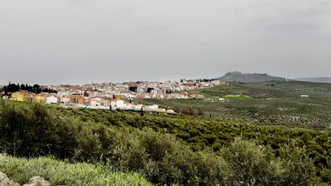
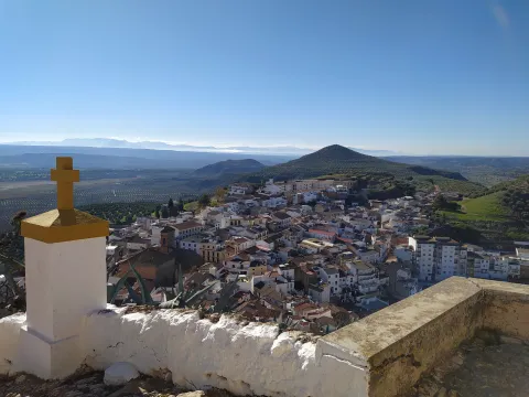
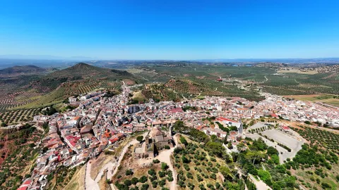
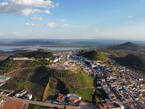
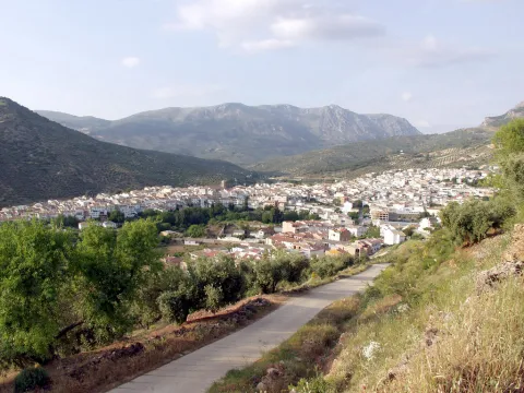
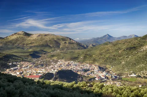
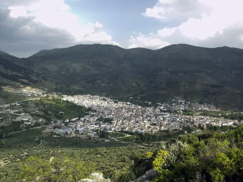
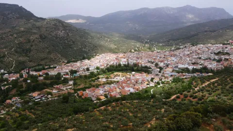
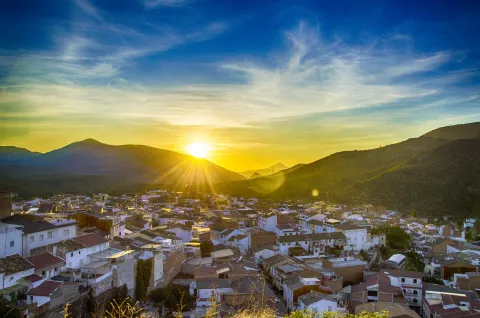
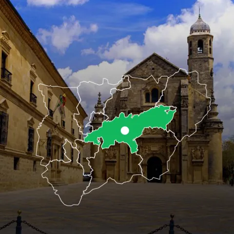
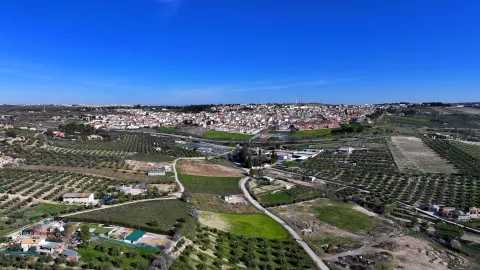
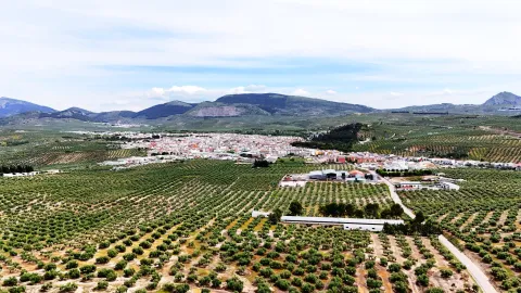
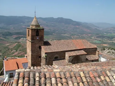
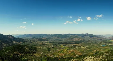
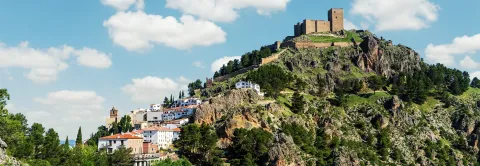
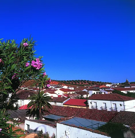
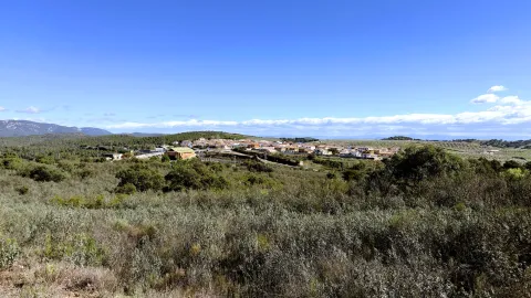
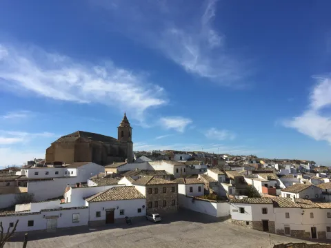
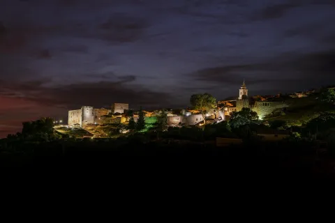
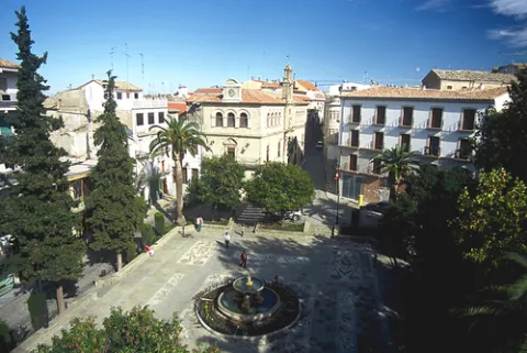
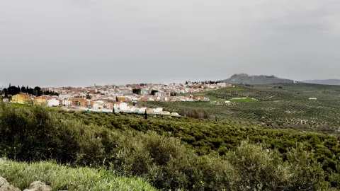
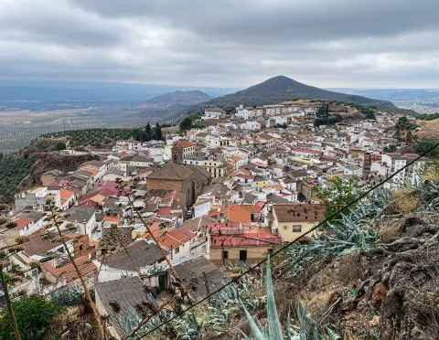
Municipality located in the eastern part of La Loma and the Four Villas, in the north-eastern part of the province and at 794 m altitude. It has two well-defined orographic sectors, on the one hand the area of the countryside, of land alominated and occupied by a true "sea of olive trees," and on the other, the area of the Sierra de las Villas, where the coniferous, the bushes and the low mountain define the landscape.

Several rivers irrigate their territory: Guadalimar, which serves as a natural border with the region of El Condado; Guadalquivir, which separates the countryside from the saw, with its two tributaries, the Huascebas Grande and Avocados Chico.

The municipality of Villacarillense includes the following population units: Villacarillo, Cabeza de Mogón, La Caleruela and Agupación de Mogón y Arroturas.

The economy is based almost exclusively on the cultivation of the olive tree, we cannot forget that Villacarillo is currently the world's largest olive oil producer.

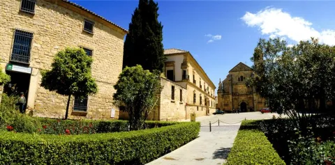
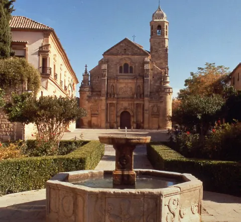
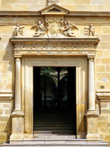
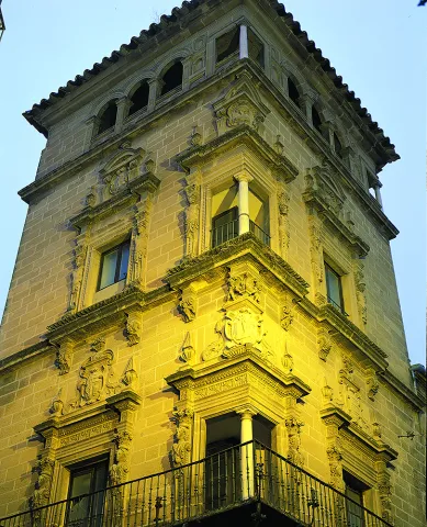
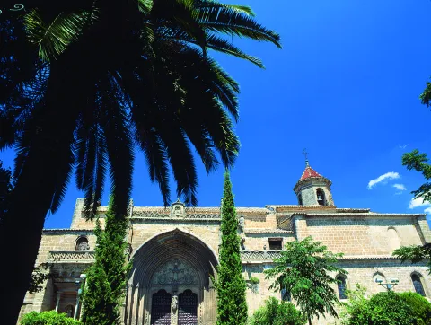
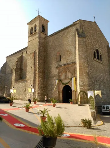
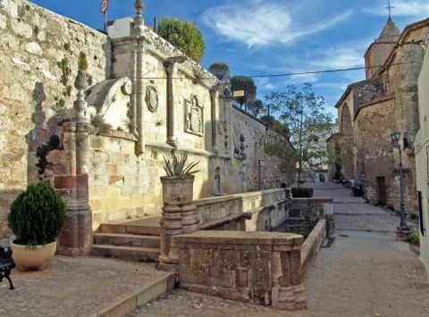
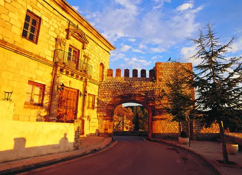
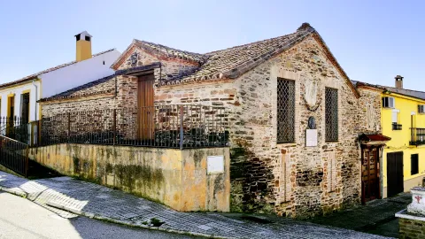
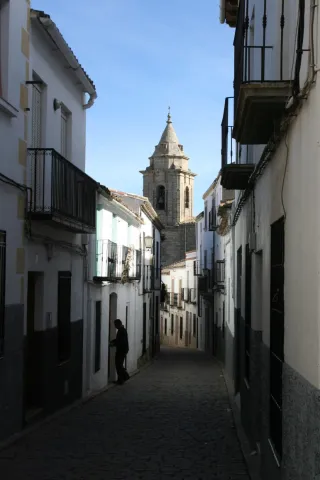
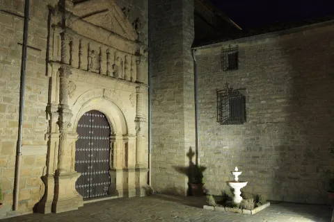
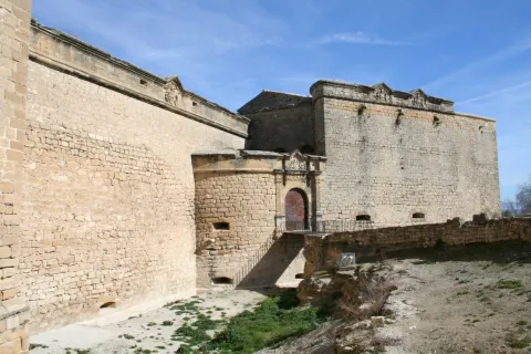
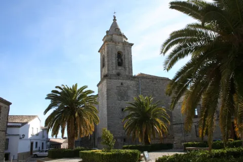
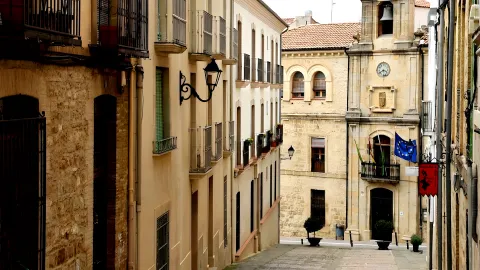
The historical-artistic heritage of the town is much and varied. Among others, the Church of the Assumption, the Church of Santa Isabel de los Angeles, the City Council, the House of Inquisition, anti-aircraft shelters, as well as numerous palaces and houses of different times and great artistic interest.
Telecomunicaciones
Teléfono
953 440 000
Sitio web
www.villacarrillo.es
Fax
953 440 000
Ubicación
Nombre
Villacarrillo
Latitud
38.117650
Longitud
-3.079750
Municipio
Ubicación en el mapa
POINT (-3.07975 38.11765)
Imágenes
imagen
Image
4988dd3b-5735-8c56-439d-1c1f61fd5155?t=1595533596392
Imagen principal
Desactivado
imagen
Image
Villacarrillo
Imagen principal
Desactivado
imagen
Image
c3c668b7-f134-fcb6-d9bb-395c42ced8d4?t=1595533644381
Imagen principal
Desactivado
imagen
Image
b5048a37-5162-490f-2a58-bd4b21064b02?t=1595533722236
Imagen principal
Desactivado
imagen
Image
40dab106-ae56-70ee-351e-83887ba49a0c?t=1595533692248
Imagen principal
Desactivado
imagen
Image
c064696c-14a6-9059-a4bb-73793690c862?t=1595533703628
Imagen principal
Desactivado
imagen
Image
3f3b062a-a83a-65b8-dc1b-0b2d71c7d7fd?t=1595533715604
Imagen principal
Desactivado
Información adicional
Curiosidades

Paseo Santo-Cristo

Imágenes cabecera
imagen
Image
Villacarrillo
Imagen principal
Desactivado
Datos de interés

Tourist area: Serras de Cazorla, Segura and the Villas

Distance to the capital (km): 84.3

Altitude over sea level (m): 785

Extension (km ²): 239.37

Number of inhabitants: 10,726

Gentilicon: Villacarillenses

Postal code: 23300

Videos
Video file
Cultura

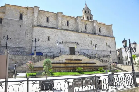
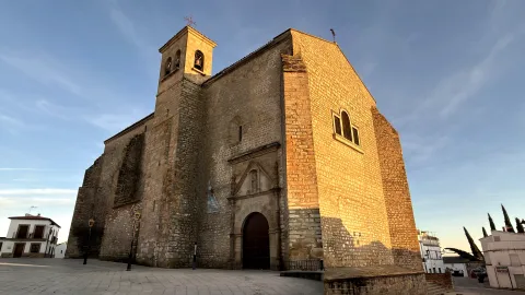
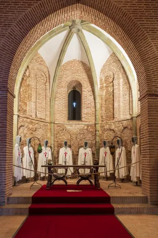
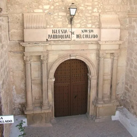
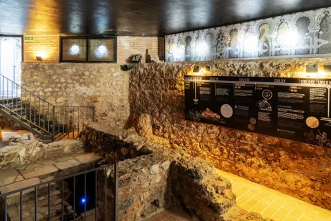
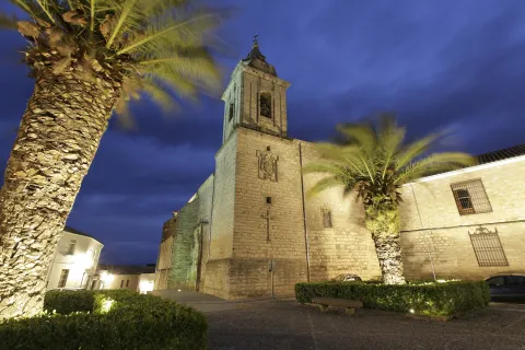
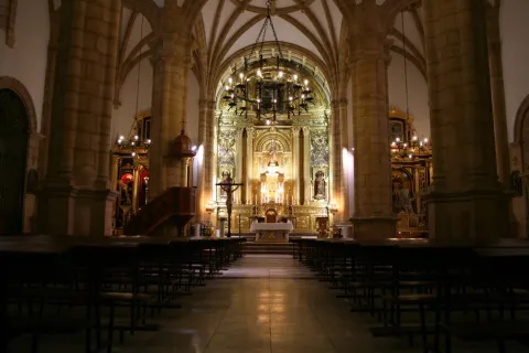
- Parish of the Assumption.It's the most important monument of Villacarillo, is a proud building built between the 16th and 17th centuries, in which the last forms of the Gothic and the first manifestations of the Renaissance coexist. It is one of the great works of Andrés de Vandelvira, who set up his first home here, married the neighbor of this city, Luisa de Luna, and had seven children. The construction works begin in the year 1540, setting up the Vandelvirian project on the primitive medieval castle of Mingo Priego, part of which is integrated into the upper dependencies of the temple, now converted into a museum.

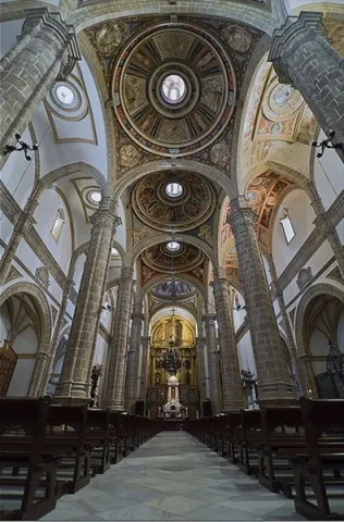
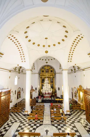
The Church of the Assumption is extraordinary for the uniqueness of its volumetric profile, the inner spatial grandiosity, the originality and beauty of its vaults, and the integration of medieval traditions into Renaissance classicism. It is one of the most significant churches of the Renaissance in the diocese of Jaén. National Monument since 1931. The interior is of basic and three ships with the same height separated by high and slender pillars that complete the feeling of a monumental set. Even with Gothic resabies, visible on the pillars and side ships, it shows what will be the idea of a Christian temple that Vandelvira has, dominated by vaults of a vanish type. On the side walls, hornadine chapels are opened, which are covered with nerve vaults.

The Central cover It is formed by a beautiful succession of half orange domes with lanterns on decorated breasts. We can imagine Vandelvira and his assistants during the first years of the construction of this church, large wooden scaffolding, the noise of the quarries, piles of stone to be turned into armchairs and the caleros selling lime for the argamase. Without a doubt, the most curious image should be the perplexity of the elderly, seeing such thin pillars on the sides of a great central ship, nothing to do with the churches of the area, or the recite Sanctuary of the Virgin of Fuensanta, in the nearby Villanueva of the Archbishop. Very important will be all the pictorial decoration of vaults, The work of Peter of Raxis, mainly dated from 1575, representing scenes of the Old Testament and the Passion of Christ.

The altarpiece, Baroque, by Juan Gómez Lobo, from Toledana, in 1670; Chapel of the Christ of the Veracruz, with his baroque shrimp of the 18th century and the Sacristywhich begins to be built after the temple is finished at the end of the 16th century, in which Alonso Barba must intervene, on what had until then been a parish of Santa María del Castillo of Gothic style. It has a rectangular floor, with a cover divided into three sections with vaulted vaults.

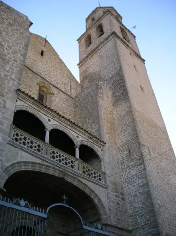
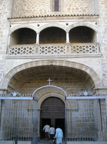
The Puerta de Sol and Door of the Umbria are the main accesses to the temple. The tower designed by Vandelvira is quadrangular, topped by a body of bells, crowned by a regular octagon and petreous cone and located on the right side of the main door, Puerta del Sol, its height is 56 meters. The climb of stairs is helical. In Parish Museum of La Asunción the collection of baroque goldsmiths of the 17th, 18th and 19th centuries, as well as misals, bibles, casullas, etc.

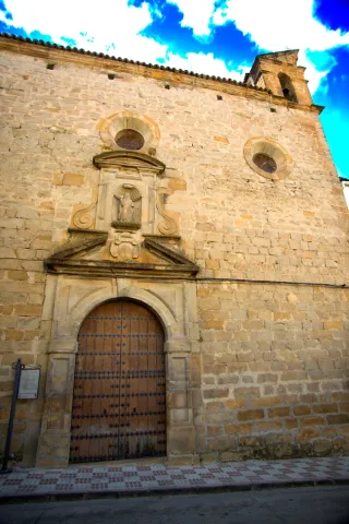
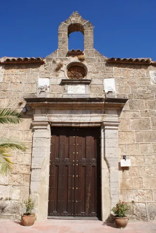
- Church of Santa Isabel de los Angeles is one of the most important monuments of Villacarillo, of Renaissance style. It is located on Ramón and Cajal Street, popularly known as "Cuesta de las Monjas." Old Franciscan convent, built in 1645 and made by the architect Juan de Aranda Salazar. The interior of a single ship with a barrel vault, with high chorus to the feet and remarkable frescoes that are attributed to the village of Escudero de la Torre. The baroque-style golden altarpiece has salomonic columns that are decorated with grapes, sardines and glass leaves. The facade is made of stone with irregular armchairs and a simple three-body swordsman.

The cover, elegant and classic, with a garden in which you will find the stone image of Santa Isabel of Hungary. In 1812, a solemn act of swearing of the Constitution of Cadiz, popularly known as "The Pepa". The building attached to the church was a closing convent until 1737, a public prison during the French occupation and, from 1884, a hospital to which the services of the former San Lorenzo Hospital were transferred. Between 2012 and 2013, a number of work has been done to recover the damaged church areas. Today it houses several municipal units.

- Municipal Public Library. It is a 19th century building considered of high value, with two floors of height and marked modernist and eclectic character in its architectural concept. Inside, the staircase and the entrance fireplace stand out. Also, the decoration of the ancestors of the low windows and balconies is remarkable.

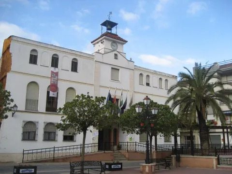
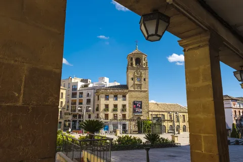
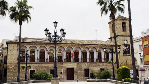
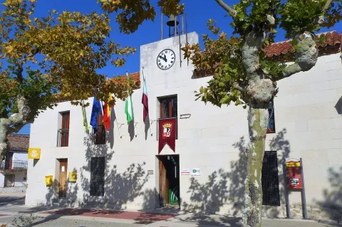
- City Hall. In a neoclassical style, it was built in the 19th century, with horizontal façade with three clearly differentiated floors and regularly distributed vain. It highlights his cover.

- The House of Inquisition. Located in the old town, on Repullete Street, it is a historic three-storey building built between the 16th and 17th centuries. The original facade, the grating and the rise of the gilded stairs with shields of the Holy Office of the Inquisition and a pontored cross are preserved.

- La Feria Streetthe main artery, in which the best examples of domestic housing are located, particularly bright in the casas- palaces like the House of the Rubials; Palace of Cardinal Benavides; Courts; current House of Youth and below we find that of the Regil, of the 17th century, which must have belonged to this family of quarters who also worked in the church.

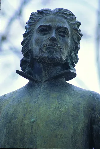
- Vandelvira's house and bust. On the side of the church and on Vandelvira Street there is a house, at number seven, which is held by the house of the master in Villacarillo and a bust tribute to Vandelvira.

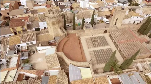
- Anti-aircraft shelters. They were built in the middle of the Civil War in 1937 to protect the population in the event of air bombardment. They never got used. They have subsequently served as a food store. In 2018 they were rehabilitated to be included in the city's heritage. The shelters and the Parish are within the program "Hidden Treasures" de la Loma and Las Villas.

- Archaeological settlements. Villacarillo is prodigy in archaeological discoveries that shed light on the successive peoples and civilizations who chose their territory to settle. Many of them are concentrated in the Turruñuelos fieldwhere the human presence has been documented, and almost uninterruptedly, from the Copper Age to the Roman era. The Castellones de Mogón, place located on the right bank of Guadalquivir, have documented the existence of a village appeared in the 6th century BC, From this place comes a relief known as the Domador de Caballos. The ceramic elements located west of the mouth of the Arroyo Del PocicoThey say it would be a necropolis.

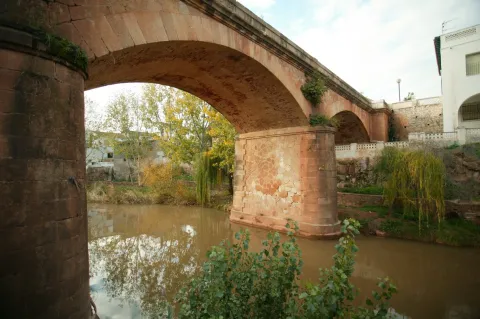
- Other interesting constructions are the bridges in Villacarillo and Mogón, as well as the hydroelectric power plant of the Duende or the Gardening Mill of the Pepper in La Caleruela.

- Almazara Tourist Agricultural Cooperative Ntra. Mrs. del Pilar, the largest of the province and surely of Spain, built on a plot of 160,000 m ² located on the outskirts of the municipality, includes a factory of 12 production lines and more than 11,000 m ², four industrial ships, several wineries and a social building of 2 floors, with 1,800 m built.

Naturaleza

Villacarillo with an extensive municipal term, has two well-defined orographic areas:

- The countryside, which extends through the eastern end of the region of La Loma, occupying most of the municipal term. The orography of this area is of lomas with soft slopes and almost entirely covered by olive trees. It is the fauna of the olive tree that corresponds to the small-game cynetic species: hare, rabbits, partridges, clumsy pigeons, badgers... Without forgetting the olive fauna, both the birds that the shelter has here and those who feed on it on their migration trips. To point out the importance of insecticide birds to prevent the spread of pests in the olive tree, an ecological insecticide.

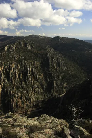
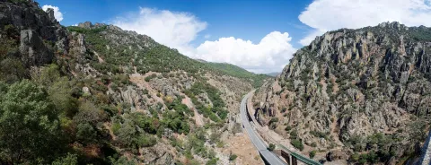
- The area of the Sierra de las four Villas, which is part of the Natural Park of the Sierras de Cazorla, Segura and Las Villas. One of the features that draws the attention of the landscape of this area, is the water abundance and lush vegetation. Four rivers go through its term: The Guadalimar, which is a natural limit to the region of El Condado; the Guadalquivirwhich serves as the border between La Campña and the Sierra and the rivers Huascebas Grande and Chico hives, whose waters will go to Guadalquivir. These waters make up an agribusiness relief, with large cliff slopes, enclosed valleys, canyons, flashlights... The water dissolves the limestone and while modeling the landscape will result in karmic formations such as caves, wells, bowling...

The vegetation In this area it is colonized by large-scale larix and black pines, strawberries, maples, boj, madroños, tejos, some of them millennia. It's an ideal place for it to develop cynetic species of major game like: the boar, deer, gamo... and it is very easy to see the royal eagle, the perdicular eagle or the black vulture or the leonated vulture lying in the rocks or flying over the skies of the area.

Walking the trails of the area is to have the opportunity to enjoy really wonderful panoramic, as you can see the Guadalquivir Valley, the Yelmo, the villages of La Loma or even Sierra Nevada.

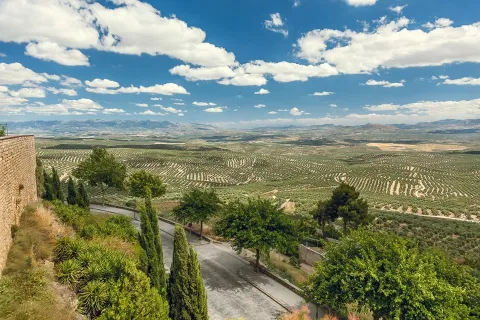
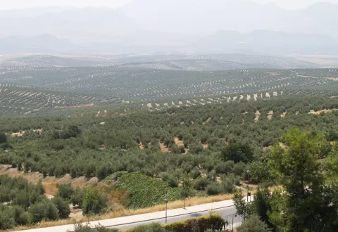
Mirador: Road A-316 in its Torreperogil- Villacarillo-Villanueva del Archbishop section. It is just an example of the great olive groves that can be seen when travelling through the province of Jaén. In particular this stretch of road runs almost air in the interflude of the valleys of the Guadalimar and the Guadalquivir. From this area you can see thousands of hectares of olive trees in a single look, framed by the horizons of Sierra Morena on one side, and Sierra de Segura and Sierra de Las Villas on the other.

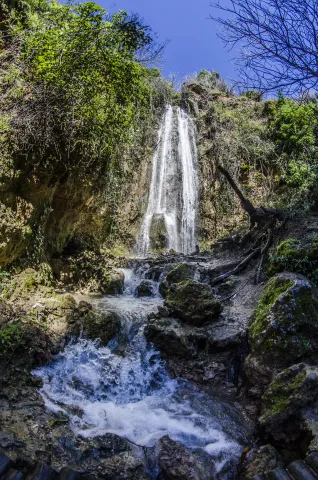
There are many places where we can enjoy an exuberant nature at the end of Villacarillo, but we will quote three of them: The Path of the Odera, the Cascade of Chorrogil and the reservoir of Aguascebas.

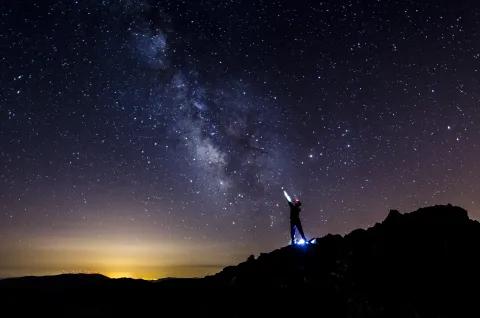
In Mogón, the StrawberryIt's a beautiful natural place surrounded by trees. There is the Astronomical Outreach Centre of La Fresnedilla, which aims to introduce the visitor into the various techniques and means of astronomical observation.

Fiestas y Eventos

- Holy Week. Festivity of great tradition in Villacarillo, dates back to the 16th century and stands out for the solemnity of its steps, for the Songs of Passion and Saetas, for the devotion of the cofrades and in general, of all the participants. They have processions every day, from Dolores Friday to Resurrection Sunday. The cornet and drum bands that spread along with the hermandades are originating in Villacarillo. The traditional "songs of passion" take place on Good Friday. This is all what makes this holiday really unique.

- San Isidro. On May 15, the image of San Isidro comes out in procession, accompanied by horsemen with typical costumes and beautifully decorated carrots, from the church of Our Lady of the Assumption, to the hermitage located in the Mastizal Road. There the Eucharist is celebrated in honor of the farmers' pattern and the fields are blessed. After the religious events, the attendees have in the surroundings of the hermitage a day of coexistence and a meal of brotherhood.

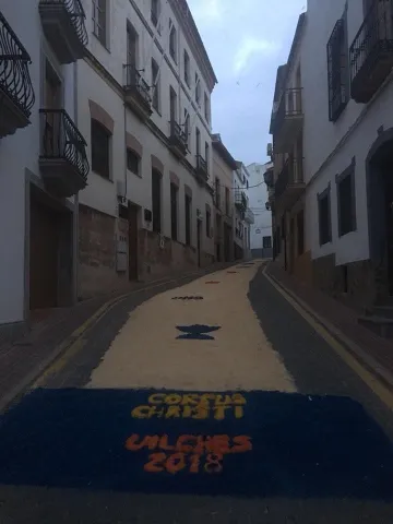
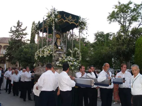
- Corpus Christi. It is the most important and traditional holiday of Villacarillo. It has been held for about 650 years and since the 19th century this celebration is held in the afternoon due to a papal bull (Lion XIII). The streets through which the custody will pass are covered with pots and pits, the floors are covered with carpets made with colored sawdust and flower petals, creating true works of art and covered with awnings and banners. To highlight the gothic silver custody in which the Body of Christ has been processed since the 17th century. The court leaves the Parish Church of Our Lady of the Assumption. The public influx during the celebration or following it from the balconies is a massive one. The National Poetry Prize "Corpus Christi" in Villacarillo has been held since 1975.

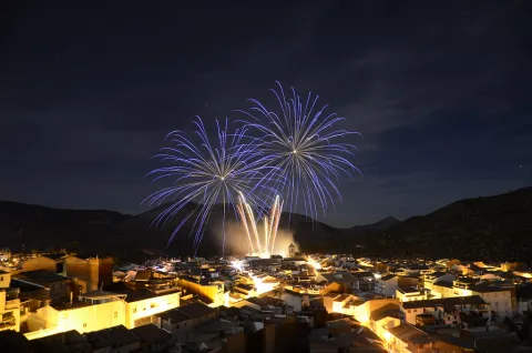
- Fairs and parties. The origin dates back to the trade fair and livestock which was held in the Middle Ages. Fernando VII gives him an official character. Parties between the 9-14 September in honor of the patterns, The Most Holy Christ of the Vera Cross and Our Lady of the Rosary. In the first days the traditional braggard coils, they go back to the 18th century and enjoy great popularity. The bullring that since 1955 has seen the first figures of the bullfighting, has gained a well-deserved prestige. Many cultural, sports, concerts, verbenas... organized by the City Council.

- Patterns. In honor of their patterns, in addition to the September parties are held individually, the 3 May, theLegacy of the Christ of the Vera Cross a Villacarillo; and 7 October the day of Our Lady of the Rosary.

- Serrano bowling. The serrano bowling is a way of expression, in the form of a traditional game or sport, which is shared and internalized by the inhabitants of the mountain massif that forms the current Natural Park of the Sierras de Cazorla, Segura and the Villas as part of their identity, with Villacarillo being the municipality that provides the largest number of practitioners and currently has seven active bowls.

Gastronomía

- The Calandrajos. They have as ingredients water, flour and salt for wafers. In the frying pan a saffrito of tomato, garlic, onion, green pepper, a little spicy and rabbit, hare or partridge. When cooked the meat is added the wafers and let be boiled. They're served in the same pan.

- The Migas. It was a dish used to take advantage of hard bread. They are fried in a frying pan of garlic teeth, to which the bread is added until it is touched. The crumbs are usually served with fried peppers, torreznos, sardines, grapes and melon.

- The Harina Garlic. A saffrito is made with tomato, onion, potato and eggplant. In the frying pan, dry red peppers are tasted, once toast is crushed in the mortar with cumins and salt. When everything is ready, water is added and at the end flour is to be weighed.

- The Popes' Hat. It is a mashed potatoes with garlic and is added a saffrito of tomato, onions, peppers, pepper and cumin. It rehogs all together and can be served hot or cold.

- The piirrana. and the damp, the latter with crushed chickpeas and cod strips. Others: La Gachamita, El Ajo de Morcilla, El Picadillo, la Morcilla Blanca and the Papajotes.

- Other: The Gachamita, the Ajo de Morcilla, El Picadillo, the White Morcilla and the Papajotes.

In the pastry shop:

- The Sweet Gachas. They are made from roasted flour, bread, milk, cinnamon, sugar, olive oil and matalahúva or anis. They're typical of All Saints Day.

- The Bitch. Made with a bread made of oil and egg cooked in the center. It's consumed on Easter.

- The Drinks. Oil, wine, flour, a little anise and sugar.

- The Sobaos. It's a big, baked, sugar-cooked rosy. Also typical of Easter.

- The fried thighs, Pestives, butter and butter cakes, made in a handmade way.

Historia

Although we have no archaeological research that can specify the antiquity of human occupation in the locality, the quality and quantity of the remains found in its surroundings allow us to go back to the Neolithic. Among these, we quote numerous legal instruments, such as neolithic axes, funeral tombstones of different historical times, the Treasure of Mogon, currently in the National Archaeological Museum, the Mercury God, in golden bronze, the Winged Sphinx of Phoenician origin or the Roman mosaic of Teatino. The Iberian and Roman settlements were very important.

Villacarillo originated in the Muslim era as a fortress defending Iznatoraf. After the conquest of this by Fernando III the Holy one in 1226, his evolution began. At first he was known as the village of Mingo Priego, which the king donated to the advance of Cazorla.

The growth and importance of the population were increasing until the archbishop of Toledo, Alfonso Carrillo, gave him the category of independent villa in 1449, giving him his name and shield. Category that was later confirmed by King John II of Castile and later, in 1498, by the Catholic Kings.

The richness of its cerealistic field will allow for a rapid growth maintained over the following centuries, the population has been consolidating and increasing, leading to the formation of the urban town of regular layout and large solariegal houses. In the 19th and 20th centuries it enjoyed an important boom that is reflected in the modernist buildings that splash their streets. By Royal Decree of 8 March 1877, Alfonso XII grants the City title.
Loading map
Preparing points of interest and routes...
Imagen principal
imagen
Image
Villacarrillo
Imagen principal
Activado

Vilches

Submitted by brandcode_deweloper on
Id
787264
Perfil de redes sociales
Facebook
https://www.facebook.com/profile.php?id=100068958337736
Descripción
Breve descripción

Vilches is a municipality located in the north of Jaén, in the district of El Condado, located in the foothills of Sierra Morena. The pedanias of Guadalén and Miraelrio are also part of it.

Its municipal term is crossed by the Guadalén, Guarrizas and Guadalimar rivers, which pour their waters in the reservoirs of Guadalén, La Fernandina and Giribola, respectively.

Its varied landscape has great tourist potential, highlighting its areas of environmental interest, reservoirs, oak dehesas, extensive olive trees, farmland, not forgetting its cynetic and fish resources.

The historical-artistic heritage is relevant. The church of San Miguel, the hermitage of the Virgin of the Castle, the remains of the castles of Vilches and Giribola, belonging to the Route of the Castles and the Battle of Jaén, and archaeological sites such as Giribola, of Iberian times, are highlighted.

Telecomunicaciones
Teléfono
953 63 00 75
Sitio web
www.turismovilches.com
Correo electrónico
turismo@vilches.com
Ubicación
Nombre
Vilches
Latitud
38.211660
Longitud
-3.512960
Distrito
Municipio
Ubicación en el mapa
POINT (-3.51296 38.21166)
Imágenes
imagen
Image
c4eb1866-6864-211d-8b8d-5d6240b72c0e?t=1687277240860
Imagen principal
Desactivado
imagen
Image
e203e5aa-0c7b-55bc-bb18-7f2ad2a50893?t=1687277240664
Imagen principal
Desactivado
imagen
Image
36f5d348-3269-39d2-d70f-6d5b005c43c2?t=1687277240761
Imagen principal
Desactivado
imagen
Image
61e83072-e72e-55d4-da7b-2cbab669b212?t=1585852470283
Imagen principal
Desactivado
imagen
Image
b8aaede2-095b-503f-349d-1f204fe0ddee?t=1687277240934
Imagen principal
Desactivado
imagen
Image
de02a0ed-f04e-7e2f-c703-d8c7d6baea37?t=1687277240590
Imagen principal
Desactivado
Imágenes cabecera
imagen
Image
Vilches
Imagen principal
Desactivado
Datos de interés

Tourist area: Sierra Morena / Sierras de Andújar and Despeñacolos
Distance to the capital (km): 80
Altitude over sea level (m): 543
Extension (Km2): 273
Number of inhabitants: 5086
Gentillo: Vilcheños
Postal code: 23220

Videos
Video file
Cultura

Its artistic heritage includes:

  • Church of San Miguel Archangel, This church dates back to the last third of the 16th century. The main cover is simple and with a half-point arch. It appears decorated with a stone shield made of quarry, typical of the Renaissance and Spanish mannerism. On a side it has a cover with a tile image of the Virgin of the Castle. The tower is of rectangular floor, which is unusual, and with relief decoration of the bell tower, similar to work in brick. The interior is one-ship and at the bottom is a half-barrel vault with the arms shields of Bishop Calderón. The majestic baroque altarpiece of the 18th century, the work of sculptor Diego de Briones, the chapel in which the so-called "trophies" of the battle of the Navas de Tolosa are kept (1212) and, in another chapel, a canvas of the Final Judgment are kept.
  • Ermita- shrine of the Virgin of the CastleHe rose in the 18th century on the ancient church of Santiago, at the top of the hill of the castle. It houses the image of the patron of Vilches, who every August 14, on the occasion of the holidays in his honor, is brought down in procession to the parish of San Miguel.
  • Vilches Castlelocated on a high hill to which it gives name and from where you can enjoy a wonderful view, is the castle of Vilches. A fortress castle that played a very important role as a point of defense of the high Guadalquivir, served as a refuge for the inhabitants of the environment in the face of the advance of Christian troops during the Reconquest and starred in famous war episodes, in the Middle Ages, between Arabs and Christians. Although we know that the hill has been populated since the time of the Iberians, the origins of the castle are uncertain. There are only a few remains of the fortress: a esquinero turret, known as "Cube de la Villa," part of another turret and a passage with a slightly pointed vault of armchair. With the passage of the years and the consolidation of Christian culture, much of the towers and parts of the walls of the castles were used to build small churches and hermitage. In the courtyard of arms the church of Santiago was built, on which the hermitage of the Virgin of the Castle was later built. It was declared Good of Cultural Interest in 1985.
  • Archaeological site of Giribola. It is an archaeological site of great importance located in the confluence of the Guadalimar and Guadalén rivers, from where you can enjoy excellent panoramic surroundings. From what has been known so far, it is known that it was home to an Iberian city, which some scholars associate with Orisia, which was destroyed in the Second Punio War, a prehistoric sanctuary, a Paleocrist or Visigode cenobium and a Almohad castle built after the battle of the Tolosa Navas.
Naturaleza

TheNorthfrom the term Vilches extends through Sierra Morena, with altitudes reaching 800 m. The vegetation in this higher part is very varied and is associated with the Mediterranean forest: encinars, alcornocals, complaints. There are also shrubs and areas of wood pine plantations.

More to Southin the foothills of Sierra Morena, with altitudes between 400 and 500 m., the adhesitated surfaces and pastures predominate. With a soft orography of constant undulations, where the olive grove predominates and we also find low mountain with acuchals and madroños.

Here live numerous animal species, such as birds, mammals and arthropods, easily observable in their natural habitat.

Thewet areass are around the reservoirs(Guadalén, Girirbola and Fernandina), in theriver banksGuadalén, Guadalimar and Guarrizas. The banks of the rivers and streams welcome mimberas, tarays, adelfas and other tree species such as the white chopo or the black Alamo.

The reptiles abound, highlighting the populations of theleprous galapagoin the rivers Guadalén and Guarrizas, as well as theViper de Latastein the Sierra. They will also be easily observable fishing and real eagles, common and black vultures, royal owls, lynches, gines, badges, etc.

Fiestas y Eventos

Vilches is a municipality of deep-rooted traditions, with popular celebrations, both religious and profane, that take place throughout the year and with activities for all ages.

  • San Antónwhich is held on 17 January. The streets are filled with bonfires of olive branches, which come from the pruning of these trees, to honor the pattern of the animals.
  • San Sebastián, Vilches pattern, which is held on January 20. That day the saint leaves his hermitage to process the streets.
  • Carnival parties, in which the neighbors participate, in which they dress up and sing mockery cokes (the City Council awards the best). They take place in the Caves del Zahaní district.
  • Holy Week. A week marked by religious acts and processions from Palm Sunday to Resurrection Sunday.
  • Festival of Corpus Christi. After Mass, in the church of St. Michael, the Lord will take a tour of the people accompanied by children of first communion. It is tradition to paint the streets using multi-color sawdust to reproduce allegorical drawings to the day of Corpus.
  • Saint GregoryOn May 9, in the neighborhood of the Mesones, a mass is held in the church of St. Gregory. At the end of the day, the rosses of blessed bread are distributed and the image of the saint is moved to the church of San Miguel.
  • Patrons in honor of the Virgin of the Castleon the 14th of August the transfer of the patron from her hermitage to the parish is carried out, remaining there until 8 September. The next day, on the 15th, the Holy Mass is celebrated in his honor and the floral offering. The festivities will last five days, in which there will be sports events, enclosures, capeas, gastronomic samples and popular verbenas.
  • The Vilches bell-bearers, they are a gang of Vilcheños who, when Christmas comes, go through the streets, singing their stanza. They sing ancient and villain senses. It is a tradition in which Arab reminiscent is observed, both in its melodies and in its stanza. The song is initiated by a soloist and the chorus chorus. The accompaniment is very unique: guitar, bandurry, laud, bell, triangle, Spartan alpargata, plow, wooden drawer, almirez and saucers.
Gastronomía

Vilches is a municipality very fond of its traditions and this is also reflected in its gastronomy. Meat obtained from hunting is often used to make its dishes.

We highlight among the best known:

  • The harls, a hare stew, flour, tomato, onion, olive oil and pepper.
  • The countrysideA stew with hare and potatoes.
  • The brain, on this dish is cod, with onion, tomato and olive oil, which takes the lead.
  • The crumbswhich consists of bread, garlic, olive oil, all accompanied by some products from the slaughter of the pig.

From the pastry shop we want to highlight:

  • PapajotesIt's traditional sweet. This dessert is consumed at breakfast or at snack, and is one of the most widespread sweets in the province.
  • Sweet peas for the Day of All Saints.
  • Tickles, drunks and flowersHoly Week.
  • Bake and bread with matalauva in San Gregorio.
Historia

In the municipal term of Vilches, about a hundred archaeological sites have been invented. From the Copper age the field of Santagon. The occupation of this settlement had to end at the beginning of the Bronze Age, when the consolidation of metallurgical activity and the fertility of the surrounding lands involved the emergence of small villages in the area, some of them fortified, such as the Cañada de Malaguo, Giribola or Cerro Santo. This settlement has the novelty of having a large defensive tower.

In the Iberian stage, GiridanceThe metallurgical centers were controlled from here. The town has an urban layout defined by streets, houses and public areas, delimited by a large wall. From this Iberian period, many settlements and small fortifications have been invented, including the first occupation of the castle hill.

In the Roman times Vilches is identified as BaesucciAccording to a stone located on the hill of the castle. The Emperor Vespasian granted him the title of municipality. In Santagon, remains of ancient villas with mosaics have been found in the noble areas.
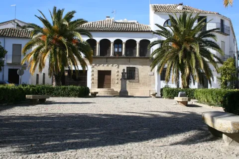
Also the people Visigode He settled in Vilches. A visigode architrabe has been found and is preserved in the Jaén Provincial Museum.

It's in the Islamic period when the current Vilches site is consolidated, being occupied from 711. It was part of al- Andalus for five centuries, from the first years of the 8th to the 13th century. This long period makes Vilches a typical Muslim cityfrom which we can guess vestiges today. As the 12th century progressed, the castle of Vilches became very vulnerable by the proximity to Despeñacolos, where the Spanish-Latvian troops practiced acts of harassment over the possessions of al- Andalus.

In 1212, the Christian kings of Castile, Aragon and Navarra, beat the Muslims in the the battle of the ships of Tolosa. Three days later, the castle is conquered and the population exterminated, which will force this area to be repopulated with inhabitants from beyond Sierra Morena. The Christians will stay in the Vilches castle And the Muslims will return to Giribola.

It will be King Fernando III who gives up the territory of Vilches to the Council of Baeza, until Felipe IVin 1627, release him and grant him the The title of Villa.

The number of Vilches with railway station, already in 1900.

Loading map
Preparing points of interest and routes...
Imagen principal
imagen
Image
e2fdf917-2e2c-2a08-49fc-21c32566e218?t=1687277240494
Imagen principal
Activado

Valdepeñas de Jaén

Submitted by brandcode_deweloper on
Id
785241
Perfil de redes sociales
Facebook
https://www.facebook.com/Aytovaldepjaen/
Twitter
https://twitter.com/aytovaldepjaen
Descripción
Breve descripción

Valdepeñas de Jaén is a municipality in the province of Jaén, located in the Sierra Sur region, south-west of the province.

The forest area of its municipal area is important, as it is located between the mountains of the Pandera, to the north, and from Alta Coloma to the southeast. Giant Simas, complaints and centenary oaks with peaks that reach 2000 m., define this territory. This particular environment makes this territory ideal for major hunting.

Thanks to its privileged geographical location, Valdepeñas de Jaén has natural areas of great beauty, with abundant water, many fountains and streams, such as the "Las Chorreras" and "El canyon de Pitillos."

Valdepeñas de Jaén is an agricultural municipality, dedicated mainly to the cultivation of the olive tree; livestock, with a significant number of dairy goats, and with the oil industry, as the only representation of the industrial sector.

From the point of view of the architectural and cultural heritage, they stand out: the church of Santiago Apostle, from the 16th century; the Mill and Museum of Santa Ana and the hermitage of the Holy Christ of Chircales.

Telecomunicaciones
Teléfono
953 310 111
Sitio web
www.sierrasurjaen.com
Fax
953 310 873
Correo electrónico
informacion@sierrasurjaen.com
Ubicación
Nombre
Valdepeñas de Jaén
Latitud
37.589990
Longitud
-3.815320
Distrito
Ubicación en el mapa
POINT (-3.81532 37.58999)
Imágenes
imagen
Image
026d37c8-f20e-4826-c560-fc4bd77cf68d?t=1689185839921
Imagen principal
Desactivado
imagen
Image
3915a8f7-9fa8-0fa7-ed74-33482ff4ea91?t=1689185840042
Imagen principal
Desactivado
imagen
Image
bf7bbb7c-a151-ac2a-8f75-8e8664552c21?t=1689185840462
Imagen principal
Desactivado
imagen
Image
98453ab0-439f-cba6-73c5-54b3a5b25a7c?t=1689185840881
Imagen principal
Desactivado
imagen
Image
0bccdf26-5a8b-ef52-9de2-440899afc7de?t=1595248348518
Imagen principal
Desactivado
imagen
Image
15f6355e-9e6c-3e9e-6918-eac63f4aa7f1?t=1609851228739
Imagen principal
Desactivado
imagen
Image
7cd536a0-35a3-14ef-e466-e2a09999c223?t=1609851228907
Imagen principal
Desactivado
imagen
Image
4b6a3aba-5a3a-9311-a524-6110d01145a2?t=1609851229068
Imagen principal
Desactivado
imagen
Image
afccba20-2c98-3860-39e8-8b8d90520758?t=1609851229232
Imagen principal
Desactivado
imagen
Image
883f69b0-3a2a-6539-e34e-36bb2a558298?t=1609851229437
Imagen principal
Desactivado
imagen
Image
140fa0cb-2c88-1a1e-4de2-d5edcf44c392?t=1609851229713
Imagen principal
Desactivado
imagen
Image
369762fb-6339-eab1-5f10-e099e16da4f4?t=1609851229863
Imagen principal
Desactivado
imagen
Image
e44f53d6-8cba-c851-c3c1-18b8a91385df?t=1609851230036
Imagen principal
Desactivado
imagen
Image
9bfa7b28-47f3-3615-5f27-1fa546ff704c?t=1609851230215
Imagen principal
Desactivado
Información adicional
Imágenes cabecera
imagen
Image
Valdepeñas
Imagen principal
Desactivado
Datos de interés

Tourist area: Sierra Sur and Campiña de Jaén
Distance to the capital (km): 34
Altitude over sea level (m): 923
Extension (km ²): 184
Number of inhabitants: 4,573
Gentilicon: Valdepeñeros
Postal code: 23150

Videos
Video file
Cultura

Valdepeñas de Jaén, founded by Carlos I, shares with Mancha Real and Los Villares, being one of the paradigms of the Renaissance urbanism, inspired by the theories of the trattadist Vitrubio.

Its urban morphology had to adapt a reticular route to the irregular orography of the hill on which this municipality is based. The city centre was located in the most flat part with a large trapezoidal square where the most emblematic buildings are located.

  • Parish Church of James the Apostle (s. XVI-XVII). Located on one of the corners of the square, it stands out both by height and volumetric, following the rules of Vitrubio that the most representative building must dominate the urban whole. Its cover, located not at the foot of the temple, but laterally to the square, opens with a simple half-point arch on which goes a second body with veneer intended to host the image of the saint holder. Built in the 16th century, in a Renaissance style, it is evident in the classicism and simplicity of its cover, in the proportionality of the tower and in the clarity and internal spatial amplitude.
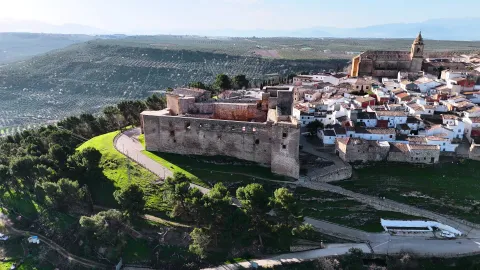
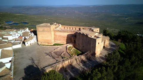
  • Sanctuary and Hermitage of the Christ of Chircales. The origin of this sanctuary goes back to the Middle Ages. Located in the Chircal area about 20 km. of the city centre. On the first Sunday of May there is a pilgrimage to this sanctuary.
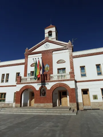
  • Mill Museum Alto de Santa Ana. It is a hydraulic flour mill of medieval origin. Restored in 2001, and in operation, it houses an ethnographic museum, of popular traditions and customs.
  • Santa Ana Bridge. Of possible medieval origin, also called the Dehesa or the Hundidero. Built in stone toba armchairs of the town, it has a single arch, under which they cross the waters of the river Ranera, tributary of the Víboras.

Other monuments of interest are: the episcopal residence, reformed in the 17th century under the inspection of Eufrassio López de Rojas and converted into episcopal headquarters when the Augustino bishop Fray Diego Melo of Portugal took refuge until his death in Valdepeñas; the Hermitage of Our Lady of the Angustias of the Parrizoso (on the banks of the Quebrajano reservoir) and the Hermitage of San SebastiánIn the old Egido, it has an attached cemetery.

Naturaleza

Valdepeñas de Jaén is a municipality with large forest mass when placed inside the subbetic saws. It is the highest point in the South Sierra to the north with the Pandera saw, with 1872 m., and to the south with the Alta Coloma saw.

The city centre is located 920 m. of altitude, located in a valley and surrounded by huge mountains. The natural environment with little exploitation by man must be highlighted. An environment full of walnuts, pastures, chaps and centenary complaints. His great saws, the Pandera and Sierra Vestinkers, mountains that are covered in snow during the winter.

Among the trees, the Coal Complaints, a millennial tree that has been declared a natural monument.

In this landscape of high mountains and abrupt areas lives a great diversity of wild animals who freely camp through the saws. An ideal place for the cynegetic species, especially for major hunting: deer, wowls, boars, muflons... among others.

A place where water is a true treasure of these lands that offer us countless fountains, waterfalls, reservoirs, rivers and streams which are contonated by these saws giving rise to places of a unique beauty such as: Paraje de las Chorras, Pitillos, declared Natural Monument and which conserves a forest of unique tiles in the region and of the few existing in Andalusia, Navalayegua's lookout, Salto del Hoyo, Chircales, el Castellón, el Vadillo or el Charco de Utrera, a large waterfall of 25 m, or the swamp of the Quebrajano and its imposing cannons.

The areas of the valley, populated by olive trees is the primary crop, next to the livestock and small game cynetic species, also has a goats' cabin Very important dairy.
We can say that the term of Valdepeñas we offers privileged places to contemplate nature in its greatest splendor and let him delight us and seduce us.

Fiestas y Eventos

Valdepeñas is a town of deep-rooted customs and traditions that make it unique. Where festivities are held that do not lose traditions like La Candelaria, In which the fire remains the protagonist, or the carnivals that fill the streets of the town with color and joy. There are also these parties:Holy Week, with dramatic representations of scenes of the Passion of Christ full of religiosity and that awaken the emotion among the attendees.

  • Romeria del Cristo de Chircales, which takes place on the first Sunday of May. The joyful and colorful Romeria in honor of the Most Holy Christ of Chircales, where the unique environment in which it is celebrated and the devotion he feels for his saint makes it a day expected by the Valdepeños and the visitors.
  • Realenga parties, are held in mid-August and attend them is like making a trip to the 16th century, enjoying the Renaissance gastronomy of those years, walking through a medieval market, listening to music, attending theatrical performances, animal samples, shooting with bow... Everything in the dress of the time creates a fantastic atmosphere.
  • September Big Fair. To fire the summer, the Great Fair takes place, where music and fun are guaranteed. Party that revolves around the Christ of Chircales, For these days it is carried from its hermitage to the church of the people.
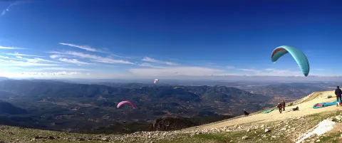
  • The agribusiness character of the massif of the South Sierra and Pandera in particular, it provides an exceptional framework for the development of activities related to nature and active tourism, such as free flight, hiking, cycling or mountain bike (It is not obvious that Pandera itself is the end of a remarkable mountain stage of the Ciclisto Tour to Spain) or astrotourism.
  • The old military base of The Pandera is the highest point of the Starlight Reserve No. Sierra Sur de Jaén and an emblematic place for the observation of the firmament. At its top there is a great explanade where in the past there have been important remains of astronomy fans that brought together hundreds of people. Another very interesting point is the Cortijo del Moralejo.
  • Jaén Valdepeñas Interpretation Center. It is located in San Isidro S.C.A. Jaén Road, km. 2. and dedicated to the history of olive and olive oil. It belongs to the Red de Almazaras oleoturísticas de la Sierra Sur.
Gastronomía

The gastronomy in the town is very linked to the livestock. The local receptarium gives hands to the surrounding mountains to incorporate into the table Triguero asparagus and cardo mushrooms and also aromatic herbs used as additives in many of the dishes.

Of the most typical dishes, we highlight:

  • "Chop to the chard.", it is cooked and well watered with a salsa of almonds, tomatoes, pepper... all very heavy with the bias.
  • "Carnerete."A chickenpox with lamb meat.
  • "Peanuts"
  • Migas with potatoes.

Between the typical sweets: "Ochíos" "nochebuenos as" "Sin salas," rosquetas, "roscos de vino" and "bollas de higo."

Typical drinks as the "resol" and "old milk", typical Christmas drink that mixes: milk, spirit, coffee, cinnamon and lemon crusts.

Historia

The oldest remains documented in the term Valdepeñas go back to the Bronze ageand are located in the area called "Castellón."

During Roman times a proliferation of small houses linked to the peasantry, as the remains in the Ventilla, Navalenga, El Torcal, La Solana, Pitillos and others testify.

In the Islamic period the castle of Susana, mentioned in the Arab and Christian chronicles, is raised with a rather busy existence, being conquered on several occasions by both sides.

What today is Valdepeñas de Jaén was founded on 1539 by the Emperor Carlos V, as a new population, within the project of colonization and repopulation of the saws of Jaén.

In the new towns is implanted a urbanism called colonial, in the form of a damer, in which the streets in reticle will give to the main square, the place in which are the most representative buildings: church, town hall, posite... A kind of urbanism that has been maintained to this day.

By 1550, the population was fully constituted, but as a place under the jurisdiction of Jaén. It will be in 1579 and thanks to the donation of 1,370,000 Maravedis who contributed their 170 neighbors, King Philip II gives Valdepeñas the title of the village, disconnecting from the city of Jaén.

Valdepeñas took an active part in the War of Independence, possibly encouraged by the Bishop of Jaén, who resided in the palace that the bishopric had in the city.

In 1917 obtained the title City, granted by S.M. King D. Alfonso XIII.

Loading map
Preparing points of interest and routes...
Imagen principal
imagen
Image
bd00fe5b-0aa1-5c0f-2b41-4bb61c4eb0cc?t=1689185839799
Imagen principal
Activado

Úbeda

Submitted by brandcode_deweloper on
Id
785118
Perfil de redes sociales
Facebook
https://www.facebook.com/pages/Turismo-de-%C3%9Abeda/173591095987915
Twitter
https://twitter.com/Turismodeubeda
Descripción
Breve descripción

This important city, settled on the hills of its own name, is located in the centre of the province of Jaénand is the capital of the region called La Loma.

Surrounded by a landscape of an extraordinary natural beautyin which the flat grounds for the cultivation of the cereal are alternated, with the smooth slopes of olive trees, seems to summarize the essence of the province of Jaén.

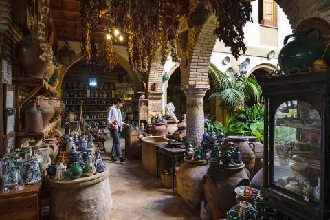
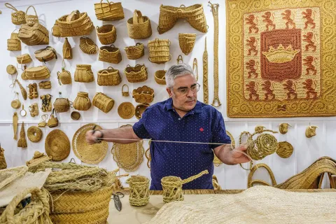
It is very important, within its varied economy, the crafts, with numerous workshops of pottery and ceramics, of forge, size, glass, tapestries, spartum, singing, etc.

As we walk through its lordship streets to admire the monuments, churches, palaces and lordship houses, we move virtually to the times of the historical splendor of this city.

Ubeda is known as "the city of the Andalusian Renaissance"for the quantity and quality of the monuments of this artistic age.

Together with Baeza, it has been declared World Cultural Heritage by Unesco on 3 July 2003.

Telecomunicaciones
Teléfono
953 779 204
Sitio web
www.turismodeubeda.com
Correo electrónico
promocion@ubeda.es
Ubicación
Nombre
Úbeda
Latitud
38.012640
Longitud
-3.371590
Municipio
Ubicación en el mapa
POINT (-3.37159 38.01264)
Imágenes
imagen
Image
4799c128-4243-ddbe-4c6c-d5f7ee6541a5?t=1603983703047
Imagen principal
Desactivado
imagen
Image
b990224c-93ea-e0df-74c2-b7e6183a3016?t=1603984517266
Imagen principal
Desactivado
imagen
Image
751f0349-5ec0-e737-56cf-235536e32ce7?t=1603983703075
Imagen principal
Desactivado
imagen
Image
6ddd0085-05f6-e8ef-366a-1963e112a78f?t=1603983703173
Imagen principal
Desactivado
imagen
Image
079eab40-54b9-462f-9652-50503cdb19b9?t=1585914434000
Imagen principal
Desactivado
imagen
Image
658dab1d-a8b7-6142-60d7-be18c41b4400?t=1620124630064
Imagen principal
Desactivado
imagen
Image
783f65fe-f295-0ac3-a5f1-c8a445f97f9d?t=1603987184323
Imagen principal
Desactivado
imagen
Image
a1c2cc59-155f-b35e-3797-8753b948883f?t=1603987072290
Imagen principal
Desactivado
imagen
Image
d514a2f2-df93-6914-23d0-4a2d3d8def54?t=1585914433864
Imagen principal
Desactivado
imagen
Image
96a361d6-abc7-8d8a-ac2d-39d7b956fb9a?t=1585914432211
Imagen principal
Desactivado
imagen
Image
34223fac-9819-3cc8-ab77-1ea66239de9c?t=1585914433058
Imagen principal
Desactivado
imagen
Image
897fc220-a1c5-8dc7-21a7-f794bb4b5ab1?t=1585914432869
Imagen principal
Desactivado
imagen
Image
fd162935-02a3-19d4-6d0a-e70d45e30088?t=1585914432724
Imagen principal
Desactivado
imagen
Image
c31acbfe-c818-2117-4875-2a38f23fdadd?t=1585777415890
Imagen principal
Desactivado
imagen
Image
a3df8019-f7c4-818f-49a7-812719c7627e?t=1585914432622
Imagen principal
Desactivado
imagen
Image
d66bcf17-80e3-b88c-1e2b-9e0c440410ed?t=1602853416998
Imagen principal
Desactivado
imagen
Image
ac732a47-55b6-b0eb-e42d-53cde4d8d4b5?t=1602853581698
Imagen principal
Desactivado
imagen
Image
5f1448d6-c40c-9c82-d042-dffbb558575d?t=1602853977830
Imagen principal
Desactivado
imagen
Image
8e10cba1-a64b-07b1-57ea-fa3bbbc174a1?t=1602854679588
Imagen principal
Desactivado
imagen
Image
a370e5d1-865a-9977-a663-e2feb66503c8?t=1602854760846
Imagen principal
Desactivado
imagen
Image
8f29648a-eadd-6fcc-1d1c-72ed12871101?t=1602858438953
Imagen principal
Desactivado
imagen
Image
d91d519d-ed0d-52aa-15a1-d61aeea22169?t=1602858557129
Imagen principal
Desactivado
imagen
Image
ec2bae3a-6a55-0359-e557-f51383218c1d?t=1602858895450
Imagen principal
Desactivado
Información adicional
Curiosidades

Oficina De Turismo De Úbeda
Plaza Andalucía, 5, 23400 Úbeda, Jaén
http://turismodeubeda.com/index.php/es/

Imágenes cabecera
imagen
Image
f6f7b606-a62a-fa14-8ad1-f8933a23bfde?t=1611066284336
Imagen principal
Desactivado
Datos de interés

Tourist area: Ubeda / Baeza
Distance to the capital (km): 56
Altitude over sea level (m): 757
Extension (km ²): 404
Number of inhabitants: 34345
Gentilicon: Ubetens
Postal code: 23400

Videos
Video file
Cultura

Ubeda has a beautiful monumental and cultural heritage that makes it a fundamental destination for those interested in the Renaissance architecture.

From its heritage we will highlight the excellent degree of conservation of many of its buildings, which still keep details of the time as can be the doors of claveted wood, the iron aldabas, the lanterns and the bars.

It covers such a number of monuments, churches, palaces and master houses, that it would be difficult for us to list them here to the full. Among its most notable monuments of Ubeda are the following:

Historical center:

  • Plaza Vázquez de Molina
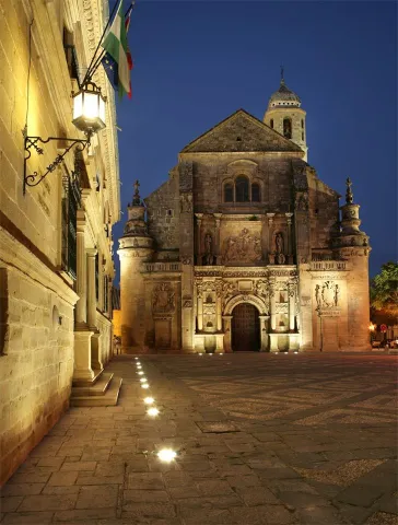
  • Sacra Capilla Funeraria de El Salvador del Mundo
  • Basilica of Santa Maria de los Reales Alcázares
  • Palace of Vázquez de Molina or Palace of the Chains. Current City Hall and houses the Andrés de Vandelvira Interpretation Center
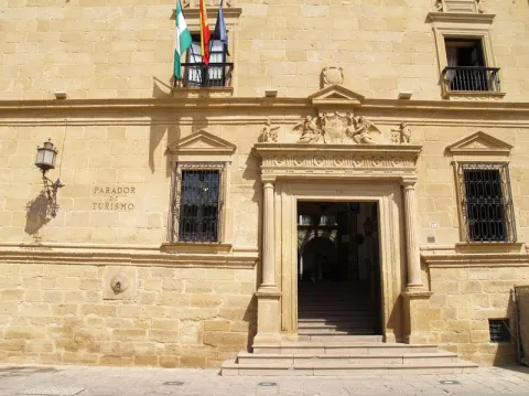
  • Deán Ortega Palace. Current National Tourism Parator
  • Hospital de los Honrados Viejos de El Salvador
  • Palace of the Marquis de Mancera
  • Vela de los Cobos Palace
  • Church of San Pedro
  • Church of St. Paul. Located at 1 May.

Barrio del Alcázar, San Lorenzo and Santo Domingo:

  • Casa de Las Torres
  • Palace of the Medinilla
  • Church of San Lorenzo
  • Church of Santo Domingo

San Isidoro district:

  • Santiago Hospital
  • Palacio del Marqués de la Rambla
  • Church of San Isidoro
  • Church and Convent of the Most Holy Trinity

Barrios de San Pablo y San Nicolás:

  • Church of San Nicolás de Bari
  • Convent of the Immaculate Conception. It houses a museum.
  • Casa de la Tercia - Olivar and Oil Interpretation Center

Barrios de San Millán y Santo Tomás:

  • Valencia Street. Numerous craft workshops to visit.
  • Church of San Millán
  • Palacio Francisco de los Cobos

Route of San Juan de la Cruz:

  • Convent of San Miguel and Oratorio of San Juan de la Cruz

In addition to these interesting attractions, we suggest a visit to the walls to contemplate the extraordinary panorama obtained from them.

Naturaleza

It is the main center of the region called La Loma. Ubeda is located on a hill at 750 m of altitude, and is surrounded by the valleys of the Guadalquivir and the Guadalimar.

Very close, around it, are the Natural Parks of Despeñacolos, Sierra Magina and Sierras de Cazorla, Segura and Las Villas.

The landscape is very characteristic because it is composed of a "sea of olive trees," as the poet Antonio Machado wrote.

Fiestas y Eventos

The city of Ubeda presents a mosaic of cultural activities, festivals, fairs, romanias... Events all very deeply rooted in the population and with a very consolidated organization, which makes visitors from all parts of Spain participate.

It is worth the celebration of the Holy Week, one of the most popular parties in Andalusia, being declared a National Tourist Interest Party.

On May 1, the Romeria de la Virgen de Guadalupe, patron of Ubeda and known as the "Great Romery." That day the Virgin moved from her sanctuary to the village of Santa Eulalia.

Typical are also the San Antón fires"the lumbres." On January 16, fires are made in the different neighborhoods, where sardines are roasted or the cobbled.

Special emphasis party of San Isidro Labradoron 15 May, farmers' employers and who enjoy much devotion among the olive workers.

Together with the neighbouring city of Baeza, the Festival of Ancient Music. And in the last months of the year, the puppet and tale festivals take place.

And we cannot stop quoting the San Miguel Fairon September 29, the city's patron party. And during the days of this fair the Autumn Theatre Show takes place, as well as high-quality musical activities and children's activities for all ages.

Other relevant events highlight theFlamenco and Mestizo Festival "City of Ubeda" or Exhibition of Autumn Theatre of Ubeda.

+ INFO

Gastronomía

The ubetense cuisine is basically Mediterranean, with influences both manchegas, alumina and Andalusian root.

The table includes legumes, game meat and products derived from the "slaughter of the pig," and, of course, virgin olive oil and table olives. Among the most outstanding dishes would be:

  • The crumbs (reminiscent of the shepherds in transhumanism).
  • The ointment, an olive oil cake.
  • The slick.
  • Potage of beans with eggplants.

The bars and canteens are the traditional meeting point of the ubetens. If you visit the city in September you can attend the Fiesta de la Tapa.

We cannot forget the "Gourmet days of the Renaissance". They take place from January to March in the most emblematic restaurants, where both lunch time and dinner are accompanied by shows.

Historia

The latest archaeological research shows that the first settlements of Ubeda date back to the Copper and Bronze Age (III and II millennium A.C), being the "oldest city in Europe" scientifically documented.

In search of product exchanges the Greeks will arrive and later the Carthaginians, who would be defeated by the Romans. It is under the Roman Empire, from the battle of Llipa in 206 BC, when the old city is romanized and will be known as the Betula.

The city takes on importance with the arrival of the Arabs, in particular with Abdeleran II, in the S. IX, who overlooks it with the name of Ubbada or Ubbadat Al-Arab (Ubeda "of the Arabs"). As a Muslim city it was surrounded by walls and became one of the most important cities of Al- Andalus, due mainly to its crafts and trade.

In the S. XI it will be conquered by the alparavids. And the definitive Christian conquest was carried out in 1234 by King Fernando III.

A number of factors, such as the geographical location, its extensive and rich jurisdiction, as well as the presence of an increasingly powerful nobility, would lay the foundation for the splendor that Ubeda reached in the 16th century.

The economic development of the city based on agriculture and on the feral livestock, the rotations of the forests that represented an increase in the land of cultivation, and having a mesta of its own, will base the greatest splendor of the city, which was a demographic increase to reach 18,000 inhabitants.

In addition to the ubetense nobility and the Orders of Cavalry, we found a group of neighbors who have prospered (doctors, tailor, scribes, bots...) that will lead to an incipient bourgeoisie.

To highlight the role of Francisco de los Cobos, secretary of Charles I, who, with his interest in art and under the advice of the architect Andrés de Vandelvira, fills the city with palaces. In Ubeda, take root the humanist currents of the Renaissance. It will be Juan Vázquez de Molina, Secretary of Charles I and Philip II, who will continue with the planning initiated by his predecessor.

Declive:
The 17th and 18th centuries are of decline for the city, as Spain is in a general crisis. The bad crops, the unfair pressure of taxation to cover the cost of wars, corruption, the power of the clergy, the expulsion of the Moorish, will be factors that contribute to the loss of that splendor that characterized this city.

Later, in 1820 and 1836, ecclesiastical disamortizations, Carlist wars, Civil War and post-war will come.

Recovery:
It will be in the 1960s and 70s of the last century, thanks to the development pull, when slowly it was the "Florence of Alta Andalucía" go to the present place and become a provincial reference point, head of the region of La Loma and a centre of industry and services of increasing importance.

Otra información

Known people born in Ubeda:

  • Antonio Muñoz Molina, writer and member of the Royal Academy of Language.
  • Joaquín Sabina, singer.

In Ubeda dies San Juan de la Cruzon 14 December 1591.

The popular saying of leaving or "walking on the hills of Ubeda," has its origin in the conquest of the Almohades of the Jienese city of Ubeda in 1234. It seems that one of the most important captains of King Fernando III "the Holy," disappeared moments before entering into combat, and that he appeared after the city was conquered. Asked where he had been, he replied that he had been lost by the hills of Ubeda.

Loading map
Preparing points of interest and routes...
Imagen principal
imagen
Image
9bbdff4c-5e18-d227-f40c-7c89c56fd0d7?t=1603979510184
Imagen principal
Activado
Literatura

These reasons are further enriched by the fact that San Juan de la Cruz died here, having been brought to the city to recover from a slight fever, and by the fact that it is the birthplace of Antonio Muñoz Molina, winner of the Premio Planeta and the Princess of Asturias Award for Literature.

You must come to Úbeda and venture into its streets and monuments, discovering them through the eyes of these authors. Without doubt, a different way to enjoy this monumental city.

Torreperogil

Submitted by brandcode_deweloper on
Id
4892283
Perfil de redes sociales
Facebook
https://www.facebook.com/AytoTorreperogil/
Twitter
https://twitter.com/torreperogil
Youtube
https://www.youtube.com/user/AyTorreperogil
Descripción
Breve descripción

Municipality located in the the heart of the region of La Loma, 8 km fromUbeda with which it maintains a close link. Surrounded by olive groves, with a picturesque urban core of white, crouched and well-known houses.

Part of its term is included in the Natural Area of Alto Guadalquivir. This natural area is made up of the reservoirsBridge of the Closed (Torreperogyl),Dona AldonzaandPedro Marínand the river and river sections between the swamps.

This river, which runs south of the municipality, borders the municipality of Cazorla.

Highlights the olive tree as a majority of its land, also the cultivation of chickpeas and vegetables in the vegas of the Guadalquivir Valley to the south of the municipality and a small area of its land, dedicated to the vine, which provides a quality wine. There is a protected geographical indication of "Wines of the land of Torreperogil."

As for its industry, it is important to point out the construction, as is the predominant sector. In the crafts, the size of olive wood stands out.

Of his Historical Heritage The Parish Church of Santa Maria Major, which is the most unique monument, the so-called Dark Towers (remains of the old fortress of But Gil) and hermitage of the Virgin of Mercy.

Torreperogil has a wide range of historical houses dated between the 19th and 20th century.

Telecomunicaciones
Teléfono
953 776 000
Sitio web
www.torreperogil.es
Fax
953 776 025
Correo electrónico
info@torreperogil.es
Ubicación
Nombre
Torreperogil
Latitud
38.034620
Longitud
-3.287700
Municipio
Ubicación en el mapa
POINT (-3.2877 38.03462)
Imágenes
imagen
Image
93d7675a-bc97-bc16-810e-bbfa259065f5?t=1605042473338
Imagen principal
Desactivado
imagen
Image
db133356-2c60-54a1-263f-1b54d869f3dc?t=1598963760580
Imagen principal
Desactivado
imagen
Image
bade3139-c0ac-0add-0f76-07e9f0cba84e?t=1598963783568
Imagen principal
Desactivado
Imágenes cabecera
imagen
Image
Torreperogil
Imagen principal
Desactivado
Datos de interés

Tourist area: Ubeda / Baeza

Distance to the capital (km): 63

Altitude over sea level (m): 749

Extension (Km2): 90 '87

Number of inhabitants: 7,276

Gentillo: Peroxileños or Torreños

Postal code: 23320

Videos
Video file
Cultura
  • Dark Towers: They are the most representative element of the urban complex of Torreperogil. They were part of the old castle - a fortress built in the 13th century, between 1230 and 1240 and which gave rise to the villa that was built after the battle of the Navas de Tolosa. At the end of the 19th century there were four towers, but at present only two are preserved. One of them is a square floor, it is accessed inside by an intellized door. It has a single floor covered by a pointed vault and it has aspillers in its paraments. The other, known as the ochavada tower, has an octagonal plant, is built of thick armchair and crowned with powerful shoes for the support of the matacans. To access its interior, it has a narrow warhead door and is given light by small saetera windows. They have been rehabilitated in recent years of the 20th century how Municipal Auditorium.The Ochavado Torreon and the Square Torreon eThey are declared a Historical Monument.
  • Church Santa Maria la Mayor, also known as the Assumption, dates from the first decades of the 16th century. It is a work of Gothic tracewith a single, slender polygonal headboard, divided into three sections with starry and very high Gothic vaults. It's proven that The main vault is work of Andrés de Vandelvira, which was decorated with Renaissance paintings of the seven virtues. On the outside four powerful counterforces. It has two covers, one of them works by Diego de Alcázar, disciple of Vandelvira, It shows on the bow and central space a hornant with the stone image of Our Lady of the Assumption with the Child in arms. The main cover is attractive and great. The access with a refined double arch and on it, stone images of Santa María la Mayor and San Juan Evangelista. Inside, a magnificent altarpiece, dated 1571, known as the "Stone Altar ", the work of Alonso de Vandelvira, with a high relief that represents the Descending Christ on the Cross and the city of Jerusalem at the bottom. The altar bank conserves the 16th century Sevillian tile and on it the figure of the lying Christ. It has been declared Good of Cultural Interest with the type of monument, in 2010.
  • Hermitage of the Vthe irgen of Mercy: Built between 1593 and 1634. Inside it is a rectangular-floor ship, which has been restored in 1960, covered with a half-barrel vault with lunetes and articulated with five hornant chapels on each side. The presbyterium is covered with half orange on pechines and communicates with the shrimp by means of a half-point arc on double mends. The Camarín, with baroque bills, with 18th-century gypsies, stands out. The main façade was built between 1960 and 1965, while the southern cover, of Renaissance style, was from the 16th century. The image of the Virgin of Mercy, patron of Torreperogil is an anonymous author and was sculpted in 1939, although it was restored in 1960.

Naturaleza

Torreperogyl has an extension of 90,87 km2 and at an average altitude of 749 m. on the sea level, it is on the top of the plateau of La Loma, framed by the Guadalimar River to the north, and by the Guadalquivir River to the south.

The cultivation of chickpeas and vegetables becomes important in the fruit and vegetable fields of the Guadalquivir valley.

There is also, a small part of the dedicated land to the cultivation of life. The result is one of the few Jiennense municipalities with wine production. It also has a geographical indication of "Wines of the land of Torreperogil," which also covers other nearby locations.

By the term of Torreperogil, among many other species are moved as emblematic as the grubb, cappuccino herrererillo, royal anade (azulon), ash aguilucho, common badger, fox, European otter, boar, gineta or musk cat, gamo, deer, montess goat, Guadiana boga, barbo andaluz, trout and crebra of stairs.

From the urban centre panoramic that are visible are spectacular: to the north the foothills of Sierra Morena, to the south Magina saw and the depression of Guadalquivir, and to the east the Serras of Cazorla, Segura and Las Villas.

At present the olive tree has been displacing the other cropsin the driest areas the almonds spatter in white in the spring.

But in addition to this great framework in which it is located, Torreperogil has places of special interest, among them we will mention:

  • El Paso Real Canyon. On a millennial road, Cañada Real de la Meseta, a recreational area has been built with parking, shadow areas and children's playground. A place to spend a nice family day.
  • Close Bridge. It is a basin regulatory reservoir, belonging to the Guadalquivir River, where you can enjoy the typical landscape of the wetland (especially carrizos), as well as the abundant aquatic fauna that forms the ecosystem: avetoro, large tick, squid, duck ral, duck spoon, common focha...

The confluence of such environments makes this place a space of great diversity, which has served your declaration asSpecial Protection Area for Birds.

Fiestas y Eventos
  • San Antón January 17. Around the bonfires, they taste roasted chickpeas accompanied by punch, drink made from Torreperogil wine, soda and sugar.
  • Carnival in February. It is commemorated in the municipality since time immemorial. It is a tradition that has never ceased to be celebrated and in which the "masked," which is a character who is disguised in old garments increases the concurrence becoming the most genuine of the carnival.
  • Romeria in honor of James the Apostle. In the hermitage of the Holy built on the estate El Pósito, every First of May is celebrated the rosemary and the bathroom in the river of the image of Santiago Apostle, mounted on a horse. The most unique of this party is found in the horse racing with flamenco-bound rider, which in the morning and in the afternoon mark the beginning and end of the party.
  • Celebrations in honor of Saint Gregory and the Virgin of Mercy. In Torreperogil they celebrate their patron parties in the second week of September. The most prominent are the braggard coils, the brandy bull in the morning, the fire bulls, a man who under a bull costume covered in flares admonishes the attendees, and the flamenco and rock festivals.

There is also the Corpus Christi, San Isidro, the Cruces de Mayo...

Gastronomía

The gastronomy of Torreperogil is based on the good products of the earth. We highlight the following dishes:

  • Aeggplant knife. Typical dish, made with eggplant of the earth, green onion bread, tomatoes, olive oil, garlic, parsley cumins and salt.
  • Caldy rice with rabbit. A dish that cannot be missed on the days of field food. We need: Rabbit, rice, green and red peppers, tomatoes, garlic, laurel, black pepper ground sweet pepper, saffron salt and parsley.
  • Cod scallops. The alrajos is a typical meal in the region of La Loma: flour, oil, tomato, onion, red and green pepper cod, mushrooms, cumin, pepper, peppermint, garlic, parsley, pepper and colouring.
  • Dizziness: Overcooked chickpeas, onions, olive oil, Pimenton and dry red pepper.
  • Pipirrana: Potatoes, olive oil, cod, onions, pepper.
  • Gachamita. With olive oil, garlic, potatoes, water flour and salt.

From your confectionery we quote: Drinks, Ochíos, Hornazos, Roscos de frying pan, Sweet panecetes....

Wine types: White, pink and dyes.

TheS.C.A. Our Lady of Mercywas born in 1956. During the visit you will know the modern facilities opened in 2005 and the most advanced techniques for the development of theOlive oilsandWines with protected geographical indication Wines from the land of Torreperogil.

The white varieties of grapes that they produce represent approximately 70% of the surface, the most representative being the Jaén Blanco variety. Pedro Ximénez, Airén and, to a lesser extent, Palomino Fino, Cirial, Jaén colorado and others are also grown. The remaining 30% of the surface is dedicated to the cultivation of red varieties, especially early ring and ink garnacha although Cabernet Sauvignon and Merlot are also grown.

Products Degusta Jaén: In addition to the wines mentioned, there are breads, sweets and beer, meat and sausages such as the white butyfarra with the label "Degusta Jaén Quality" which gives them recognition at national and European level.

Historia

It was founded by the Phoenicians. During the Roman era it became more important. In the period of Al-Andalus its fortifications were reconstructed.

The name Torreperogil has His origin in the master of the tower around which the people were built: But Xil of Zatia.

This man was a Spanish gentleman who distinguished himself in the Christian conquest of Ubeda in 1231 at the orders of Fernando III and one of those who settled in the villages of the Loma de Ubeda

Under the jurisdiction of the Gil remained up 1369, date on which his personal lord and friend of Peter I was killed next to him in Montiel. After his death, Henry II granted Torreperogil to Ubeda in lordship, for the support received. He achieved his independence in 1635, granted by Philip IV, something that Ubeda does not accept and this makes his declaration of villa is delayed until 1642.

For the centuries XVI and XVII consolidates its urban centre and its population. In the 19th century the villa had been distinguished for its struggle against the French in 1808, its cooperation in the Carlist wars with the maintenance of the national militia and for having been the first people to proclaim Alfonso XII kingand so this monarch granted him the title of Very Illustre Villa de Torreperogil.

Loading map
Preparing points of interest and routes...
Imagen principal
imagen
Image
Torreperogil
Imagen principal
Activado

Torredonjimeno

Submitted by brandcode_deweloper on
Id
751667
Perfil de redes sociales
Facebook
https://www.facebook.com/aytodetorredonjimeno/
Twitter
https://twitter.com/ATorredonjimeno
Youtube
https://www.youtube.com/@ayuntamientodetorredonjimeno
Instagram
https://www.instagram.com/aytotorredonjimeno
Descripción
Breve descripción

The municipality of Torredonjimeno is located to the southwest of the province of Jaén, 17 km. to the west of the provincial capital.

It is not administratively included in the Sierra Sur region, but is considered a bridge head towards the countryside and therefore initiator of another route. However his history and art are so linked to the rest, always by the common denominator of the Order of Calatrava.

Torredonjimeno is an olive town with a certain industrial development. It is characterized by the development of agricultural activity, where olive trees constitute 97% of the cultivated land.

The industry is on the rise in recent years. On the outskirts of Torredonjimeno is the industrial polygon "Mirabueno," where most industries are located: workshops, upholstery, textile fibres... There are companies dedicated to the construction, highlighting the crafts of metal, the forge and especially a factory of casting of bells, which has been in existence since 1881, being the only one in Andalusia following traditional artisanal techniques and performing works that in many cases go beyond the national level, to be exported to other continents.

It is quite linked to the capital by its closeness and excellent road communications.

This city offers us corners, monuments and places, culminating in a city centre full of attractions.

Telecomunicaciones
Teléfono
953 571 950
Sitio web
www.tosiria.com
Fax
953 341 326
Correo electrónico
secretaria@tosiria.com
Ubicación
Nombre
Torredonjimeno
Latitud
37.765769
Longitud
-3.958760
Distrito
Municipio
Ubicación en el mapa
POINT (-3.95876 37.765769)
Imágenes
imagen
Image
e001aa8c-ca72-9178-b82d-e3fa54956708?t=1621473670658
Imagen principal
Desactivado
Información adicional
Curiosidades

Casa Municipal de Cultura.

Telfs.  953 572 202 – 620 525 273

cultura@tosiria.com

culturatorredonjimeno@gmail.com

Horario de atención: 

Invierno:

De lunes a viernes: 9:00h. - 14:00h. / 16:00h. - 21:00h.

Verano: 

De lunes a viernes: 9:00h. - 14:00h. / 17:00h. - 21:00h

Imágenes cabecera
imagen
Image
Torredonjimeno
Imagen principal
Desactivado
Datos de interés

Tourist area: Sierra Sur and Campiña de Jaén

Distance to the capital (km): 17 '3

Altitude over sea level (m): 587

Extension (km ²): 157 '68

Number of inhabitants: 13,696

Gentilicon: Toxirians

Postal code: 23650

Videos
Video file
Cultura

The declaration of Historical set It is justified in 2005 by the presence of several monumental buildings in the old town, as well as by the medieval route.

We highlight the following monuments:

Civil architecture:

  • Castle (12th and 13th centuries). The castle of Torredonjimeno was built by the Arabs to protect the population from a small rural house. It was a rectangular fortress, of medium size, which after the reconquest was widely reformed by the Order of Calatrava. The Fortaleza, of a mannerist style, is one of the most important monuments of the historical and archaeological heritage of Torredonjimeno. As a matter of curiosity, the castle served as an accommodation for Fernando III in one of his perils and, according to tradition, in the room of which he was Torre del Tribute, the commando of the Order of Calatrava wrote the first book of which the art of the bullfighting is recorded. From this book, printed in the 16th century, only one preserved copy is known in the Salamanca Library. At the end of the Middle Ages the castle became a church residence. Inside the compound we can see part of that 16th century palace house in which several of its dependencies are highlighted with polychrome potters of Mudejar style. After its restoration, the castle has become a cultural center in which much of the activity of Torredonjimeno is developed and which also houses the Visigode Treasury Interpretation Centre which was found in the surroundings of the municipality fortuitous in the early 20th century. Considered the second most important visible legacy of the Peninsula after the one found in Guarrazar (Toledo), its original pieces are today distributed by several Spanish museums. Declared Good of Cultural Interest with the type of Monument in 1985 (BOE 29 / 06 / 1985).
  • San Sebastián Bridge. On one side of the missing Gate of Martos and on the other side with the pillar of the same name and it rises on the way of the Salado River.
  • City Council (17th century, mannerist). Of elegant and proportionate facets, typical of the classicism of the 17th century. The facha is divided into two floors, the one below has in the center a cover and on the double sides of the intellized windows. The superior presents a gallery with 11 arches of half points supported on double columns. The open character of the gallery contrasts with the solid and sober underfloor in the style of the Italian palaces. Declared B.I.C. in 1983.
  • Cube mill. It is a fortified flour mill that takes the name of the stream of the cube, is built by the Order of Calatrava in 1437. It is the largest and best preserved fortified mill built by the South Peninsular Military Orders. In this place, down to the river of the Cube, we find an area of high ecological and landscape value.
  • Torres- Fortress. In the municipal term of Torredonjimeno there are numerous towers such as: Castle of the Fucovert, Castle of Torre Venzala and Castle of Torre Alcázar.

Religious architecture:

  • Church of Santa Maria.Built in the early 16th century, in late Gothic style. It is a temple dedicated to the Mystery of the Immaculate Conception of Mary, of one ship, with two chapels on each side, flat tester and tower at the feet. The ship is divided into three sections, with star gothic vaults separated by pointed arches. The main facade, at the foot of the temple, stands out on the volume of the whole by the body of the torre-bell tower attached to the wall, has a small furnace flanked by two shields of the Order of Calatrava.

    The first extension of the temple is in 1671, consisting of a chapel next to the presbytery for the Most Holy. The second enlargement, in the first third of the 18th century, is dedicated to Our Lady of the Dolores. It is worth noting the Camarín, which is accessed from the sacristy. Declared B.I.C. with the type of Monument in 2010 (BOJA 9 / 11 / 2010. p. 50).

  • Church of St. Peter the Apostle (S. XVI), Renaissance style, designed by Francisco del Castillo "El Mozo" and built in 1592. It is divided into three ships by sober columns of Tuscan order that support a Mudejar artisan: that of the right dedicated to the Virgin of the Angustias, that of the left is occupied by the Christ of Love and at the bottom the Chapel of the Virgin of Carmen. On the presbyterium is the fourth-sphere vault, on pechines, covered with frescoes of the Celestial Glory. The altarpiece, from the first third of the 17th century, originates from a convent of Valladolid. It also highlights the large number of pictorial works of Easter.
  • Convent of Our Lady of the Piety (16th century), popularly known as "Las Dominicas." Founded by Don Jerónimo de Padilla and Pacheco around the year 1540, belonging to the Order of Santiago and with a triple function: to house a convent of Dominican nuns, to be a family pantheon for the founders and to serve as a school for homemade maidens. The church presents one ship divided into three sections, with side chapels embedded in the wall. It has double choruson the feet and on the side of the presbytery. The altarpiece is baroque from 1728. The ship is divided into three sections with star Gothic vaults and separated by half-point arches, columns and capitals. The profusion of santiaguine shells and the general composition of late and Renaissance Gothic elements are a decorative element. In the interior of the convent you can highlight the double floor cloister, you cannot visit it as a closing convent.
Naturaleza

The municipal term of Torredonjimeno has a surface area of 157, 68 km ²and is at an average altitude of 587 m. over sea level.

The municipal term is characterized by the abundance of hills and a shortage of very flat areas. The altitude of the term varies between 300 m from the lowest areas to the west to 800 m in the south-east, being a transition area between the Sierra Sur and the Campiña.

Although there are no notable geographical accidents, there are many natural spaces and attractions who will make the delights of lovers of nature. It is these places that make nature in this municipality a real sign of identity.

The indigenous vegetation corresponding to the term is made up of oats, a small forest with different species such as lentils, retama, zarzas, rosemary, madroño and thorn.

The fauna the species that have been able to adapt to these lands without almost forest area: sedentary birds, jellyfish, greens, partridges. Migratory birds coming from the African continent, such as the tortola, the cuckoo, the swallow and the victor, who come to these lands to feed and reproduce. They also abound in the Tusrian rabbit field, hares and all kinds of rodent animals.

We highlight the following areas:

  • Las Quebradas Park. Frondosa grove in the old town of Torredonjimeno where there is an area conditioned for leisure and free time consisting of a children's park and a picnic area.
  • Calvary. It's one of the local lungs. Located to the south-east of the city centre, it is a hill where there is pine mixed with oak and Mediterranean bushes. Through a wide and soft sidewalk, along which there are several stone crosses, you reach the top where you find the San Cristobal hermitage. On this path, at the evening of Holy Monday, the crucified Christ is processed. From here we'll have some Exceptional panoramic views of the helmet of Torredonjimeno.
  • The site of the Cube Mill. It is located 3 km away. from the town and near the Green Way of Oil. It is an area with a high ecological and landscape value. There is the Cube Mill, a fortified flour mill of the 15th century. Here we can observe various water jumps and the riverside vegetation.
  • Salinas de San José. Old saline exploited from the Roman era to well in the 1990s. They are now out of activity.
  • Paqua source. Small area 2.5 km from the town, crossed by the Arroyo del Barranco. We can discover the river vegetation and the Mediterranean forest. The best way to get to this place is through the Green Way.
  • Laguna de la Casilla and Laguna de las Navas. They are seasonal lagoons located in the western part of the municipality. Since 2007 they have been registered in the inventory of wetlands in Andalusia. These two lagoons are ideal for the observation of aquatic and amphibian birds at some times of the year.
  • Green Way of Oil.It is presented as a new and attractive offer of indoor tourism based on the use and recovery of the old Jaén- Campo Real railway (Córdoba) as green corridor, ideal for the practice of cycling, hiking and other sports in contact with nature. Built between 1882 and 1893, this railway belongs to the line Linar- Puente Genil, and was dedicated for much of the 20th century to the transport of different metals from the mines of Liares and especially from the abundant olive oil produced in the region. It was finally closed in 1985, to passengers and goods. It was possibly called "Oil train.". The tour begins in the sports "Las Fuentezuelas" of the jienese capital, continues by Torredelcampo, Torredonjimeno, Martos and concludes the jienese part of the Green Route, on the great iron bridge over the Guadaljoz River, right in the tail of the Vadomojón swamp, in the municipal term of Alcaudete. On his way through Torredonjimeno, right in the km. 15, the Green Way of Oil is in a 120 m tunnel. After passing by the site of the station (km 15.5), a gentle rise of about 5 km is started. La Vía directed her path to the imposing Peña de Martos, with a winding track, crossing through a lower step (km 20) and two new metal walkways, the A-316.

Gastronomía

The gastronomy of Torredonjimeno is very linked to the products obtained from the orchards, to the animals that were raised in the corrals and to the minor game animals. Simple and easy to prepare dishes, where virgin olive oil is never missing. Among the most prominent are:

  • Pipirrana: is a salad whose basic ingredients are onion, tomato, green pepper and cucumber. Sometimes it is added cooked egg, some kind of fish, meat priet or even sausages.
  • Gazpacho: It is a drink with several ingredients such as olive oil, vinegar, water, bread, raw vegetables, usually tomatoes, cucumbers, peppers, onions and garlic.
  • Migas and gachas. They argue that the crumbs are made with bread and the gaches are made with flour. It was the breakfast of the quadrillas on the long days of the olive collection. They were added, grapes, chorizo, morcilla, eggs, cod... As far as possible.
  • Cucumbers: Owner of Holy Week, where the main ingredient is cod.
  • Handmade French fries, product "Degusta Jaén" as a sign and distinctive of quality.

Warehouse: rosquettes, meringues, coffins, saintly bones and pestions.

Drinks:

  • Pitch: It is the general term for a wide variety of cocktails, alcoholics or not, that may contain fruit or juices, and other estival drinks such as crow, turf, lemonade and different types of bleeding.
  • Coffee solution

Historia

The the geographical location of Torredonjimeno, located in an area of fertile land and in a crossing of roads that links the lands of Jaén with the Cordobese countryside, has allowed the presence of human communities throughout history.

The oldest data retract us to the existence of an Iberian population called Cosiria (hence the Gentile applied to the inhabitants of Torredonjimeno, of "the Syrians").

After Roman conquest, joined to Martos gets the rating of a colony with the name Augusta Gemina.There is little news about the Spanish-Muslim stage. To highlight inclusion as part of Martos.

In 1224 he became part of the Spanish crown, and years later Fernando III would grant this entire territory of the countryside to the Military Order of Calatrava, so that it would repopulate and defend it as a border until well advanced in the 15th century.

This border condition will determine the lifting of a good number of watchmen to defend the territory: Tower of the Foncada, Tower of the Alcázar and the existing one in Venzala

From this time it is born its current name which refers to the existence of a military enclave (Tower) and the name of one of its first warlords, D. Ximene of the Raya.

Around 1369, in the middle of the border in the area, Torredonjimeno, already has a walled enclosure that defended the whole city.

By 1526, when the Emperor Charles I went to Seville to marry Isabel of Portugal, he stayed in the palace of Gonzalo de Villalta.

The Year 1558 will be decisive for the history of Torredonjimeno, as, this year, the Princess Joan of Austria, governor of the kingdoms of the Monarchy in the absence of Philip II, grants independence to the villa, definitely taking her away from the dependence of Martos.

The 15th century will be a stage of expansion and prosperity. However, the XVII will know the bad crops, epidemics, hunger, the fall of the population... Despite this, in 1637, the construction of one of the most beautiful buildings is started: the City Council.

In 18th century, it starts a recovery in the style of the new illustrated society promoted by Charles III. During these years, cultivated areas are growing, and olive trees will replace other arable crops in many places.

The years of drought and poor crops, as well as the periods of war and emigration to industrial cities, meant that people were lost in these localities.

In year 2005is declared by the Council of Culture of the Junta de Andalucía, Good of Cultural Interest in the category of Historical set, in recognition of the historical and urban values of the city.

Loading map
Preparing points of interest and routes...
Imagen principal
imagen
Image
Torredonjimeno
Imagen principal
Activado

Segura de la Sierra

Submitted by brandcode_deweloper on
Id
751057
Perfil de redes sociales
Facebook
https://www.facebook.com/ayuntamiento.segura/
Youtube
https://www.youtube.com/channel/UC0tAxfUQ5z6fv74Z3R6BrGg
Instagram
https://www.instagram.com/seguradelasierra_/
Descripción
Breve descripción

Segura de la Sierra is a beautiful villa located in the heart of the Sierra de Segura, located in the northeast of Andalusia. It is certainly one of the most beautiful peoples in Andalusia and, as such, is part of the most beautiful Peoples Network in Spain.

Segura gives name to a river, to a region and is synonymous with history. Visiting this town we can pack history and heritage in its urban centre or taste nature in its maximum expression in the many villages of its large municipal territory.

From its castle, of Muslim origin, you can see impressive panoramic views of the whole area, which is distinguished by its wide serrania, with an enormous natural and forest wealth. It is part of the Natural Park of the Sierras de Cazorla, Segura and Las Villas, the largest protected area in Spain.
This wonderful environment, its streets and historical corners make Segura de la Sierra has been declared a Historical-Artistic Set and Pintoresque Park.

Segura de la Sierra and its high peaks served to illuminate the best literature of the Renaissance, by the hand of Jorge Manrique, author of the "Cops to the death of my father."

Telecomunicaciones
Teléfono
953 480 280
Sitio web
www.seguradelasierra.es
Fax
953 481 012
Correo electrónico
administracion@seguradelasierra.es
Ubicación
Nombre
Segura de la Sierra
Latitud
38.298850
Longitud
-2.651870
Distrito
Ubicación en el mapa
POINT (-2.65187 38.29885)
Imágenes
imagen
Image
18670190-05e7-df1b-a17a-e92e0d671cef?t=1603979935869
Imagen principal
Desactivado
imagen
Image
despegue-el-yelmo-jpg
Imagen principal
Desactivado
imagen
Image
84676aeb-bfa8-a851-5550-3b4d15c74706?t=1621445408264
Imagen principal
Desactivado
imagen
Image
6fde7b00-3201-46c4-e6c3-528a9d11093d?t=1595353573804
Imagen principal
Desactivado
imagen
Image
a66e4f4c-435d-565a-2c1d-47799e04c4ce?t=1595353573833
Imagen principal
Desactivado
imagen
Image
4e21d820-8e51-89a4-0274-af8aeb2894f0?t=1621445408309
Imagen principal
Desactivado
imagen
Image
8668c55e-f4f0-0979-0f1b-fbd53f037c7e?t=1621445408354
Imagen principal
Desactivado
imagen
Image
78496ace-41be-4e6a-cd26-a6097356a63d?t=1621445408397
Imagen principal
Desactivado
imagen
Image
d1c73291-0577-d6d3-7c68-b4cea6f8ac35?t=1595353574079
Imagen principal
Desactivado
imagen
Image
5a350abd-951a-6543-e791-3a83e2a39938?t=1621445408446
Imagen principal
Desactivado
imagen
Image
307ca2fa-ccf4-8ce0-302a-896577682bb1?t=1595353574160
Imagen principal
Desactivado
imagen
Image
4d621b1f-d10e-8b22-6bc0-9c2c2c218615?t=1621445408494
Imagen principal
Desactivado
imagen
Image
b5bce32c-dbd5-c32b-b191-af98ea79ea34?t=1621445408543
Imagen principal
Desactivado
imagen
Image
aeb6f7e7-dfc2-de87-6f7f-daaaadba363b?t=1621445408593
Imagen principal
Desactivado
imagen
Image
49a44de3-3e7c-ef37-cfb0-56a999ea436d?t=1602789076574
Imagen principal
Desactivado
Información adicional
Imágenes cabecera
imagen
Image
segura-de-la-sierra1-jpg
Imagen principal
Desactivado
Datos de interés

Tourist area: Serras de Cazorla, Segura and the Villas
Distance to the capital (km): 160
Altitude over sea level (m): 1145
Extension (Km2): 224
Number of inhabitants: 1986
Gentillo: Segureños
Postal code: 23379

Videos
Video file
Cultura

The villa offers the physiognomy of past times, preserving its steep and silent streets. From its rich and varied heritage, we highlight:

  • Castle.Of Mudejar origin, eternal vigil located in the highest of the village and surrounded by an old wall that still retains some turreons. The tower of tribute, which reaches 18.50 m in height and from which you can see impressive panoramic views of the Segura saw. Inside the castle we find: chapel, adarves, covered with wood and roofed in two waters, aljibe and Arab baths.
  • Parish Church of Saint Mary of the Collado. It was built in the 16th century on the site of the old Romanesque temple. The Napoleonic troops set it on fire and would be restored between 1814 and 1817. Its only ship is rectangular and of vaulted roof. On the outside, his tower built with masonry. With a quadrangular plant, it has its first body with a flask and a second body covered with an octagonal pyramid on which a forged iron cross goes. He has accumulated a rich religious iconography during his history.
  • City Hall. Other Renaissance paradigm, old house of the Society of Jesus. It opens with an arched arch of highlighted keys, to which they flank crate pilastras and dotal column. The second body is embellished by a curved balcony, a triangular fronton decorated with tacos and noble oval shields with plucked helmets.
  • Imperial source. A monument that reflects the transition between the Gothic and the Renaissance. It is built in front of the church and dates from the year 1517. Presents a large fronton divided into three streets separated by Ionian columns. A large shield with the weapons of Carlos V. is displayed on the central street
  • Casa de Jorge Manrique. The façade has a half-point arch decorated with vegetable motifs, flanked by crate pilasters and complemented by small Ionian columns. The nobility shield of arms of the Figueroa, the mother family of Jorge Manrique, was carved in stone.
  • Church of the Jesuit. It is built in the last quarter of the 16th century. It has Renaissance decoration, with a half-point arch with reliefs of the apostles. This building has now been remodeled and turned into an event and exhibition room.
  • Bull's Square. It is located on the outskirts of the village in the old courtyard of weapons and chivalry. It's one of the oldest and most curious, being quadrangular.
  • Arab baths (hammam). Used not only for hygiene and toilet, but also as social assembly centres. They were used by both men and women, but at different times. They consist of three longitudinal ships, corresponding to thecold room, the most external,tempered and hot, the innermost. They were tied with double horseshoe arch and canyon vault with skylights. It is estimated to be built between the 11th and 12th centuries.
  • Wraith and defense. Many sections of the local walls can still be observed. One of the best preserved is the water tower, It is called that because its mission was to protect a water spring that supplied the plateau. Other still preserved are: The Era tower, the School tower and the Snow well. The latter space was used to store water and snow during the winter period and then to use them through drains that existed at the bottom.
  • Access doors. The way to access the Segura de la Sierra fortification was 4 doors: The New, the Gontar, the Catena and the Orcera.


Naturaleza

Segura de la Sierra is located in the center of the mountains to which it gives name, the entire municipal term is part of the PN Sierras de Cazorla, Segura and the Villas.

The flora, when there is such a great difference in height in the municipal term, it is different: high mountainLet's find the pino laricio, flexible and resin-rich wood, and lacquer; half mountain live the black pine, whose wood is very resistant to rot and can reach 45 m in height and tejoof slow growth, but of a longevity that can reach the age of 5,000; low mountainthe Pine carrasco, complaining, melojo oak, the oak, the oak, the coscoja, olive and other endemic and aromatic plants.

The fauna is also, like the flora, very diverse. So, we'll meet. Rapist birds and scavengers(eagles, lethand vultures, alimoche vultures...), animals of major game(deer, muflon, gamo, boar...) and minor hunting (perdiz, rabbit, hares, crow, crows, tortoises, doves and foxes).

They also live in various species of fish, like trout, barbo, boga, etc., andmammals,Like bat, mountain cat, chickenpox, badger, otter, fox and gin.

An area with enormous natural and forest wealth, place to feel that nature is alive.
 

Fiestas y Eventos

The Segureños celebrate the following parties:

  • Patrons of the Virgin of the Rosary. They have a place of 4-8 Octoberand are celebrated in honor of the patron. On the 8th the most emotional act takes place: the procession of the Virgin on the shoulders of the women of Segura. During these days there are taurine celebrations, which are held in the peculiar square of quadrangular bulls, and serrano bolus competitions.
  • Saint Vincent. It is the patron saint of the town and is celebrated the January 22. In his honor fire is on in the extramides of the villa. It is a custom that is very rooted in the saw that the winter festivities turn on "Luminaires"(bonfires). This is the day of" La Pura "(8 December), in Saint Lucia (13 December), Christmas Eve, New Year's Eve, San Antón (17 January), in San Vicente (22 January) and ending at the Candelaria (2 February).
  • Romeria de San Isidro. It is the pattern of the New cuts, the most important pedany of the many that Segura has. It is held in the area of the Lomilla, by the village The Ojuelo.
Gastronomía

The gastronomy of Segura de la Sierra is rich and full of tradition, has been able to combine the agricultural customs with those of the pastors or those dedicated to the works of the wood, carried out by the cut of pine trees in this saw.

The diversity of the dishes that we find in the town is characterized by the use of the products we find in the area: olive oil, mountain meat in hunting season (boar, perdiz, rabbit, soybean sheep) and, in concrete seasons, mushrooms and niscalos (guízcanos) or asparagus that are so well given in the saw.

  • Galians, bread cakes, rabbit and spices.
  • Andrajoswith flour, meat and spices.
  • The Migasof bread, to which is added chorizo, torrezos...
  • The Gachamita, flour and potato that is accompanied by all kinds of dressing, both sweet and salty.
  • Lamb to the young shepherd, pastoralist chard, lamb in cabañil garlicIn all these dishes, the base is the same: the following sheep's meat.
  • Pisto gandul, made of goat, lamb or rabbit and is to then consume in fairs or evenings. Hence the name of the gangul.
  • Cecinaof sheep's or goat's meat that has been cured.
  • Ajopringueis consumed in the massacres and is made with the pig liver It's a bit.

In pastry, the bake, a dessert of oil cake that carries a hard egg in the middle.

Historia

The history of the term Segura de la Sierra dates back to the 4th millennium BC, according to the many archaeological sites that testify to the human presence in those times.

Very close to the city centre is the settlement called The Old Onea few kilometres from the village of Moralejos and that it has always been attributed to peoples as Iberians and Phoenicians, being later the scene of wars between Romans and Carthaginians.

But it is, no doubt, with the Islamic people (781) when the population they call Saqura lived the golden era as a strong square in the area. In the 9th and 10th centuriesAfter the collapse of the Cordoba caliphate, Segura de la Sierra has several periods of independence that make it important.

It will be conquered by the Christian troops, becoming dependent on the Order of Santiago by the donation of Alfonso VIII. In 1243, with King Fernando III, he passed to the crown of Castile and within the kingdom of Murcia until 1833, the year in which the current province of Jaén was created.

In 1517, after the visit by Carlos I to the square, the fountain is built in his honor. A Renaissance source, though clearly of transition. In 16th century had a a time of great splendor, provided by the large amount of wood produced in its territory and which, transported by the Guadalquivir River, supplied all of Andalusia.

In 18th century, the State has converted the saw, under the name of saw of Segura, Maritime Province, No doubt you need wood for the construction of your ships. The Napoleonic invasion (1810) turned the population into a huge stake, destroying the files and taking part of its history.

illustrious characters:

  • Jorge Manrique (1440-1479), a Spanish poet and author of "Cops for my father's death," considered one of the capital works of Spanish literature. The origin of his birth is discussed with Paredes de Nava (Palencia)
Otra información

We want to place on record two traditions that are very deep-rooted in Segura de la Sierra:

  • The serrana jack. Of the popular dances of Segura de la Sierra, no doubt, the serrana jota is the one with the greatest personality. It is interpreted alone or with whole or half-ways, usually, in popular parties.
  • Via living crucis. It is interpreted by the neighbors of the village and is developed in different places of the town, with excellent views of the Segura saw.
     
Loading map
Preparing points of interest and routes...
Imagen principal
imagen
Image
53a920a5-6491-8831-30ac-3d989e48192e?t=1603979644641
Imagen principal
Activado
Literatura

This town may have been the birthplace of the warrior-poet, since his father was Commander of Segura de la Sierra, the most important commandery of the Order of Santiago. In fact, the Manrique family home is still preserved today.

Segura de la Sierra pays tribute to the poet not only by marking the Manrique family home, but also by building part of its tourism offer around Jorge Manrique, dedicating several rooms of the castle to interpretation spaces devoted both to the poet and to the Order of Santiago.Segura de la Sierra also pays tribute to the illustrious writer with a statue-monument and with a magnificent viewpoint offering sweeping views of the Natural Park from the village itself.

The tribute to Jorge Manrique culminates with the biennial Jornadas Manriqueñas, an event combining academic and leisure activities as a way of honouring this illustrious figure.

Santa Elena

Submitted by brandcode_deweloper on
Id
750455
Perfil de redes sociales
Facebook
https://www.facebook.com/AyuntSantaElena/
Twitter
https://twitter.com/santaelenajaen
Youtube
https://www.youtube.com/user/santaelenajaen
Descripción
Breve descripción

Nice town, located in the northernmost area of the Sierra Morena regionnext to the provincial border with Ciudad Real.

The northern part of its term is found within the Natural Park of Despeñapores and its geographical position makes it the greatest point of passage between Andalusia and the plateau so it receives the nickname "Puerta de Andalucía. "

It is one of the few municipalities with little agricultural interest, only 1% of its term is cultivated land.

Its economy is based mainly on the exploitation of the mountain, among which the forest, cynegetic, mushroom collection and livestock, usually cattle. The passage of the motorway of Andalusia has developed a relevant hotel offer.

It has two nests: Miranda del Rey and Venta Nueva.

From its historical heritage we highlight the St. Helena Parish Church, Iberian Shrine of the Collado de los Jardines, Urban Helmets and Rupestrian Paints in St. Helena.

Telecomunicaciones
Teléfono
953 664 010
Sitio web
www.santaelena.es
Fax
953 664 253
Correo electrónico
santaelenajaen@gmail.com
Ubicación
Nombre
Santa Elena
Latitud
38.340230
Longitud
-3.539800
Distrito
Municipio
Ubicación en el mapa
POINT (-3.5398 38.34023)
Imágenes
imagen
Image
56f3a98d-b73d-3f55-8527-4d32fc56ae8f?t=1621425534983
Imagen principal
Desactivado
imagen
Image
e0fb7c79-3e7f-346a-cc16-3c8006bb9462?t=1610986998582
Imagen principal
Desactivado
imagen
Image
3429e098-1c49-2cdf-4ef5-179be64fce14?t=1621425535119
Imagen principal
Desactivado
imagen
Image
4e91cd6e-bea0-d427-df82-939c7ce7f23c?t=1621425535162
Imagen principal
Desactivado
imagen
Image
10c50cba-ee4b-ebcf-0e3e-0d11e8e97728?t=1621425535219
Imagen principal
Desactivado
imagen
Image
0c44f832-9d15-336d-b8e7-72044fea6e76?t=1610986998629
Imagen principal
Desactivado
imagen
Image
b5682c3b-4bf3-f730-fe45-52d0391f170c?t=1621425535421
Imagen principal
Desactivado
imagen
Image
78ede978-44df-d8c2-c363-f10c79bea024?t=1621425535584
Imagen principal
Desactivado
Información adicional
Curiosidades

OFICINAS DE INFORMACIÓN Centro de Visitantes LLANO DE LAS AMÉRICAS

  • Autovía A4, salida 257. Ctra. Miranda del Rey, Km. 2   
  • (Abierto de jueves a domingo)
  • Tfno.: 610 282 531
  • Email: puertanatura@hotmail.com
Imágenes cabecera
imagen
Image
Santa Elena
Imagen principal
Desactivado
Datos de interés

Tourist area: Sierra Morena / Despeñacolos

Distance to the capital (km): 78

Altitude over sea level (m): 742

Extension (Km2): 144

Number of inhabitants: 1,003

Gentilicon: Santaeleneros

Postal code: 23213

Videos
Video file
Cultura
  • St. Helena Parish Church: It was erected in 1793 on an ancient medieval hermitage, which had been raised to commemorate the Christian victory in the battle of the Navas de Tolosa, which had these sites on stage and to guard the Cross to which the miracle was attributed. Built of redesigned and painted masonry, with a simple facade, of small dimensions. A staircase stands out the access door, composed of a half-point arch on imposts, flanked by Tuscan pillars that give way to an inlet finished with triangular fronton and two bones, one on each side. On the top of the first body, the pyramidal structure is raised to three levels, with pinacles at the ends and half-point holes for bells. Inside it is a single drawer ship, covered with a half-canyon vault and double lunetes on the sides. The presbyterium is opened with a spinal arch, covered with an arista vault and illuminated with two large bone-shaped windows. The header is presided over by the image of its patron saint, St. Helena, between dogrous columns that support an injunction and a curved fronton. It was remodeled in 2001.
  • Iberian Shrine of the Collado de los Jardines: It is located in the heart of Sierra Morena Oriental, on the most important traditional road of communication between Alta Andalucía and the Plateau. For the Iberian shrines they chose places, usually caves, located next to springs and forests, where it was thought that the divinity lived and where the faithful went to worship, pray and deliver offerings to their divinities. These offerings were what we know as "exvotes," small statues, between eight and twenty cm, made of bronze, stone or mud. In Iberian Shrine of the Collado de los Jardines There have been many exvotes, most of them bronze, representing men and women offering, priests, warriors and objects. It is part of the whole town that was excavated on the hill adjacent to the castle, where a wall, a sacred enclosure and a cast of metal exvotes have appeared. We meet before one of the three great Iberian shrines of the peninsula.
  • St. Helena's Urban Helmets:Given its geographical location, a forced passage between the plateau and Andalusia, has experienced many historical events. The Battle of the Navas de Tolosa in 1212 in which King Alfonso VIII of Castile defeated the Almohades. To commemorate this battle, a hermitage was erected in honor of the Empress St. Helena, who would later name this place and the new population, which King Charles III founded in 1767. In the colonizing urbanism of Sierra Morena, the most important element is the large rectangular square, from which they leave streets on each side and where are the important buildings, such as the Church, the City Hall and the posite of Diezmos and Labradores. The rest of the town is organized from the Plaza. The streets are dominated by axial perspectives, houses of the same height and proportions, reticular fabric and geometric structure. It only deviates from the neoclassical model on its perimeter, to adapt to the road. It has been declared Good for Cultural Interest.

  • Rupestrian Paints: The province of Jaén has more than forty points with rock paintings, declared World Heritage Sitewithin the whole Mediterranean arc. Some of them are found in St. Helena with exceptional testimonies of schematic and seminaturalist paintings, located in coats of the area, including those of the Cave of the Cows of the Retamoso in the area of the bodies, Cave of the Holy, the Cave of the Schools and some more.
  • Mining Heritage. The landscape of ancient mines and Mediterranean mountains of the former Minero District extends to eight municipalities: Linares, La Carolina, Bailén, Baños de la Encina, Vilches, Guarroman, Santa Elena and Carboneros. This mining activity has left in these municipalities an exceptional concentration of remains, unique vestiges in the world and representative of the industrial revolution in the 19th century.
Naturaleza

St. Helena is located in the northernmost sector of the northern region, next to the border with the province of Ciudad Real.

It is of the few municipalities of the province without agricultural vocation, only 1% of the total area. So its economy is based on development of the mountainincluding forest, cicnetic, mushroom collection and livestock (cattle).

The passage of the highway of Andalusia through the municipality has developed in the town a certain hotel offer of importance.

By its term the rivers run Caraway and Bell.The northern part of the municipality of St. Helena belongs to the Natural Park of Despeñacolos, of great landscape, faunistic and botanical interest.

The Park includes, among others:

  • Place of the bodies, declared a Natural Monument of Andalusia. A place where a set of huge rock columns that resemble the tubes of the organ of a cathedral. Increases the beauty of this place the chromatic contrast of the grey of the coas with the intense yellow and orange of the different species of lichens that survive in them. On these rocks, oaks, alcornoques and shrubs form a Mediterranean forest in which they inhabit ginets, chickpeas and numerous rapacious birds.
  • Embryo de los Organos: It is an affront place that was inhabited from very old, as shown by the rock paintings found. From here we can discover the pineapples of repopulation (carrascos, black, pineapples), sodas of alcornoques, complaints, oaks and madroños.
  • The Empedraillo: These are the interesting remains of a small section of the Roman road that unites Catulo (Linares) and the Galena mines of El Centenillo with Toledo.
  • Quejigal del Collado de los Jardines: Also located in the Natural Park of Despeñacolos, its biodiversity stands out. In the plant species we find complaints, alcornoques, maples and other species typical of the Mediterranean forest. With regard to the faunistic species that inhabit this place quote the wolf, lince, the otter, imperial eagle, royal eagle and azor.

If anything characterizes Despeñacolos are their unique geological formations. The Despeñapoerno de Despeñaperes, with 4 km of extension is the product of the erosion of the stream of the same name on a natural failure of the Iberian Macizo and the main means of communication between Castilla La Mancha and the lower lands of the Guadalquivir valley.

Fiestas y Eventos
  • Sunday of Resurrection: From the Central European settlers who came in the 18th century, only the tradition of painting cooked eggs, which are eaten in the area of La Aliseda, is left. Before you have to meet the rite of making them roll by a earring of grass so they don't break. This has meant that, in St. Helena, the feast of this very well-known day is known as Rolaeggs.
  • Romeria de San Isidro: On May 15, the neighbors of St. Helena accompanied San Isidro, in gilded carrots for that party until the site of The Aliseda. In this place, of incomparable beauty, a mass is held in honor of the Holy and a whole day of field is spent.
  • Patron parties: In honor of their patron saint St. Helena, parties are held between 17 and 21 August. During all these days there are many and varied leisure and sports activities. On the 17th, with the traditional repeat of bells, the beginning of the parties is announced and the three rocket warnings indicate the beginning of the cobblestones in the streets of the town. In the afternoon, taurino show. We arrived at 18 August, big day. In the morning Mass in honor of the Holy and invitation to all attendees in one of the houses. At night, the most important event of the whole fair that is the procession of the Patronthat accompanied by a music band runs through the streets of the village. On the 20th and 21st days, the morning and evening cobwebs and taurino festival return. The fair ends with a powerful haze on the 21st of the morning.
Gastronomía

St. Helena for its location in Sierra Morena is a very suitable place to take mountain meat, either from major game (deer, boar or gamo) or from small game (perdiz, rabbit or hare).

  • Andrajos: Made with a mass of flour (andrajo) that is cooked in a broth of hare meat with a saffrito of peppers and tomatoes flavoured with mint.
  • Pipirrana: Salad made from roasted peppers, olives, cooked eggs, tuna and olive oil.
  • Sage in salsa: It is made with deer meat, onion, tomato, flour, water, thyme, rosemary, peppers, olive oil and almonds.
  • Niselos al ajillo: Niscalos, olive oil, ham, garlic, parsley white wine and salt.
  • Tortilla Alfonso XIII: Made of eggs, ham, lamb kidneys, mushrooms, salt, fried tomato and olive oil.

Warehouse:

  • Sweet Gachas: With toast, hot milk or boiler honey, flour, sugar, cinnamon powder olive oil. They are preparing for the feast of All Saints.
  • Pestiños: They are made with olive oil, wine, dry spirits, sugar, cinnamon and flour.
  • Lis flower: Eggs, flour, milk, sugar and olive oil, salt and cinnamon or melted honey for irrigation.
  • Risol: A drink made with sweet anis, coffee, mejana and water.
Historia

The area has been occupied from prehistoric periodAs shown by the rock paintings located in the area's coats, with more than five thousand years old and declared a World Heritage Site in 1998.

In time of the Iberiansin the term of St. Helena was one of the most important centres of worship: Shrine of the Collado de los Jardineswhere many Iberian exvotes and the remains of what could have been a village have been located, not only in Iberian times but also in Roman and medieval times. The sanctuary also known as Cave of the Dolls has been used by the Romans for religious worship.

In the Age of Mediathe most important event is the Battle of the Navas de Tolosain 1212. The town is very close to it, in the vicinity is the Museum of the Battle de las Navas de Tolosa. The Almohade army was defeated and King Alfonso VIII of Castilla, ordered to build in the place a hermitage to guard the Cross to which they attributed the miracle of victory and a window-castle, to commemorate the triumph over the Almohades and that currently It is part of the Route of the Castles and the Battle.

In this same place in the 18th century, one of the New populations of Sierra Morena, project driven by the King Charles III. One of these populations is St. Helena. With the settlers, farmers from Centroeuropa (French, German and Flemish), efforts were made to establish a population and generate wealth in the depopulated areas of Sierra Morena while ensuring the passage of Despeñacolos.

In 1793, the population was in a ruinous state and it was King Charles IV who ordered it to demolish and build a new colonial type..

Otra información

It has recently been built in the municipal term, the Museum of the Battle of the Navas de Tolosa. The museum is one of the most interesting points on the route of the Castles and the Battle and is the starting point for the seventeen municipalities that make up this tourist product. Very close is the Iberian Sanctuary of La Cueva de los Muñecos and The "Llano de las Américas" Interpretation Center.

Loading map
Preparing points of interest and routes...
Imagen principal
imagen
Image
Santa Elena
Imagen principal
Activado

Sabiote

Submitted by brandcode_deweloper on
Id
750335
Perfil de redes sociales
Facebook
https://www.facebook.com/AyuntamientoSabiote/
Twitter
https://twitter.com/SabioteAyunt
Descripción
Breve descripción

Sabiote is a municipality in the centre of the province of Jaén, located in the region of La Loma and Las Villas, on the top of the inter-river plateau, bordered by the north by the Guadalimar River and the south by the Guadalquivir River.It is the third vertex of the call "La Loma Renaissance triangle," Chair of the best Renaissance along with Ubeda and Baeza.

It is also part of the widest "South Renaissance Route"along with Ubeda, Baeza, Canena and Villacarillo, a whole range of monuments, corners and places of the region with which it is intended to attract the interest of tourists.Walking through Sabiote is nice, as the entire villa has an excellent state of conservation. Their homes and their preserved and cobbled streets are splashed with blasphemed houses.

The economic base of the municipality agriculture of the olive tree, in the form of a monoculture as in the rest of the region. The crafts It also has implementation in the locality: articles made with sparto and palm, gardening made with leather and wool carpets.

The exploitation of its historical attractions is being enhanced to boost the attraction of tourism.

The best sample of the local architectural heritage is, no doubt, the Castle, which has its origin in an ancient Spanish-speaking alcazaba, which later, Mr Francisco de los Cobos, transformed into a Renaissance palace.

The parish church of San Pedro, a mixture of Gothic, plastic and Renaissance style; Hermitage of San Ginés de la Jaraof the 18th century and the Monastery of Carmelitas Descalzas of Renaissance ethyl.

Telecomunicaciones
Teléfono
953 773 002
Sitio web
www.sabiote.com
Fax
953 773 503
Ubicación
Nombre
Sabiote
Latitud
38.070120
Longitud
-3.309740
Municipio
Ubicación en el mapa
POINT (-3.30974 38.07012)
Imágenes
imagen
Image
75d4600b-20b5-6914-cb11-863b8e9bfb6c?t=1621358282523
Imagen principal
Desactivado
imagen
Image
898d58ff-f025-34e2-21e5-3806a8805773?t=1621358721532
Imagen principal
Desactivado
imagen
Image
071b9b26-8ccb-9642-ec42-2832066b9210?t=1621358721697
Imagen principal
Desactivado
imagen
Image
dacdacbe-d81f-539a-e826-17dea56944f3?t=1621358282578
Imagen principal
Desactivado
imagen
Image
ffa72b86-f7d5-9dd1-f0fa-034389cb7f22?t=1621358721746
Imagen principal
Desactivado
imagen
Image
6573dcf7-4b5e-9f6e-45a3-4919d96eaf83?t=1585842724448
Imagen principal
Desactivado
imagen
Image
3eeff34b-f2d1-a061-0424-a93bf0e083cc?t=1627996237182
Imagen principal
Desactivado
imagen
Image
ae0f9b59-9086-4bb0-7307-05de12e62bd4?t=1621358282756
Imagen principal
Desactivado
imagen
Image
d2a39c8f-945d-8fe9-3b46-a7786229e5d8?t=1621358282806
Imagen principal
Desactivado
imagen
Image
c9db30f7-6ee4-738d-b3e6-2193bea160df?t=1621358282866
Imagen principal
Desactivado
imagen
Image
73b43b3e-6187-c512-d2fe-7636bb7c4286?t=1621358282919
Imagen principal
Desactivado
Información adicional
Imágenes cabecera
imagen
Image
Sabiote
Imagen principal
Desactivado
Datos de interés

Tourist area: Ubeda / Baeza
Distance to the capital (km): 64
Altitude over sea level (m): 840
Extension (km ²): 112
Number of inhabitants: 4,302
Gentillo: Sabioteños
Postal code: 23410

Videos
Video file
Cultura

In general the villa has an excellent state of conservation, so when walking through its streets it easily transports us to preterito times.

The views from the walls or from the viewpoints are truly spectacular. Among the most prominent monuments are:

  • Sabiote Castle. It was built on 13th century, Although this hill must have been a fortified place in all previous civilizations. The ancient Muslim alcazar is placed on a small mound, where it rises its signage door preceded by a pits. The current appearance of strong walls and elegant and imposing bastion is due to the reconstruction in the 16th century, Mr Francisco de los Cobos, Secretary of Carlos V., The reform was carried out by Andrés de Vandelvira and is inspired by the Italian Renaissance fortifications. Unfortunately it was Flying by the Napoleonic troops, so internally there is only one outline of what was an outstanding work of art. It has an accused military character. Its great Renaissance facade of silery and quarry, as well as the large pentagonal towers, stands out. declared Good of Cultural Interest since 1931 and its walled enclosure Historical-Artistic Set in 1972..
  • Parish Church of San Pedro. The perspective it offers is oversized for a parish temple. Reconstructed in the 16th century, with a drawing of Alonso Barba, disciple of Vandelvira. The North cover It's style. isabelin Gothicbut in the south, or Puerta del Sol, the protoplatereco. A large corner arch holds all the weight of the monument in that southern part. Your magnificent tower is striking.
  • The wall. That until just over a century ago surrounded the villa in its entirety. They stand its two-thirds share, as well as two of the six doors, that of the Saints and that of Granada, plus the arch opened in the 19th century.
  • Convent of Barefoot Carmelites. This convent recalls the presence in La Loma de San Juan de la Cruz. It was founded on 1584 by Francisco de los Cobos and his wife, Maria de Mendoza. With a Renaissance style, it has a beautiful cloister with half-point arches and dórica columns. This cloister was designed by Alonso de Vandelvira and Luna, "Architect Mayor de Sabiote," in 1586. The church, under the title of St. Mary, was built on an earlier Romanesque. Inside it is preserved the high chorus grille, the large wooden beam that holds it and at its extremes it is viscated with angels and the shield of the Order of Carmelites. It is believed that the cover of the temple is due to the great Alonso of Vandelvira. The City Council has now rehabilitated it as a House of Culture.

  • Hermitage of San Ginés. Apart from the historical core, it is dedicated to the pattern of the villa. It was built in the 18th century. It has a half-point and triangular front cover.
  • Barrio del Albaicín. Of the different neighborhoods that make up the urban town, this is the one that best preserves the taste of the past, that of the old neighborhood where the streets are of pebbles worn out by hundreds of years of traffic, of gone and coming, where each house has its own history.
Naturaleza

Sabiote with an extension of 112 km2 and at an average altitude of 840 m. on the sea level, it is on the top of the plateau of La Loma, framed by the Guadalimar River to the north, and by the Guadalquivir River to the south.

The view that offers us its term is typical "olive seas " that in a soft way, both on the north and south slopes, they go down until they find the valleys of the Guadalimar and Guadalquivir rivers, to the north and to the south, respectively.

From the urban centre panoramic that are visible are spectacular: to the north the foothills of Sierra Morena, to the south Magina saw and the depression of Guadalquivir, and to the east the Serras of Cazorla, Segura and Las Villas.

But in addition to this great framework in which it is located, Sabiote has places of special interest, including:

  • Cañada Real del Paso, recreational area just 3 km. of the town of the town.
  • The Source of the Corridor. It is a natural mushroom of great beauty with a natural waterfall and a cave in the vicinity.
  • The Source of HealthIt's his stalactites and the birth of a stream.
  • Olvera's jump, a water jump over the Guadalimar River, where we can practice the fishing of the barb.

The Sabioteños the plant resources which offers them the ground to maintain some traditional activities. We can still find samples of the craft made with spartum and palmand the most traditional gardening made of leather and wool carpets.

Sabiote, in the shadow of Ubeda can go unnoticed, but we have already seen that it is a town with a historical-artistic heritage and a natural heritage that makes it a worthy representative of the most characteristic of the region of La Loma Fuck you.

Fiestas y Eventos
  • Holy Week. When Holy Week comes, Sabiote, he takes his works of religious art to the streets to commemorate the Passion of Christ. Its origins start in the 16th century when the first cofradies were created, Our Father Jesus Nazarene, Our Lady of Soledad and that of the Most Holy Christ of the Exhibition. An assistance that is increasing over the years, both for the quality and value of the sizes and for the bands of music, which are dressed in nazarene perform process marches.
  • San Ginés, whose celebration dates back to the times of Fernando III. They take place between 22 to 26 August. The day 25, day of the Patron, the image of the Saint Gines is processed from the church of St. Peter the Apostle to the hermitage that bears his name. At the end of the procession, the traditional auction of the threads takes place. As a farewell to the parties, a pyromuscular show is held.
  • Horse racing. On the occasion of the Festivals of the Virgin of the Star (May 1) The Middle Ages-style horse races are developed. The races take place on the football field and are held at 12 in the morning and 6 in the afternoon.
  • The bulls. The Taurin tradition of this town dates back to the 16th century, celebrated in portable squares until 1914, Sunday of Resurrection, the day on which the fixed bullring was opened. The day 24 August, local copattern party, is the Main Taurin Day. The first swords of the tauromaquia have passed through this square.
  • The fire of Saint Anton, January 17. The day begins with a religious feast attended by farmers, farmers, craftsmen and the Big Brother. At the end of the Mass the procession of the saint through the streets of the town. At the end of the procession, the Big Brother offers a refreshment to the attendees. In the afternoon the traditional fires where smoke cigarettes of matalahuga and eat chickpeas.
  • Virgin of the StarMay 1. She's the patron of Sabiote. In the early morning of this day she is processed on the streets. In the Rosary of the Aurora it is moved to the hermitage of San Ginés, where the Eucharist is celebrated, the Maya are sung and the traditional one is offered to the faithful charity of bread and oil, green beans and wine. In the afternoon, after the prayer of the Rosary, Our Patron is processed until the parish done will remain during the month of May for the offering of flowers, being returned to his sanctuary on the last Sunday of May.
  • The Virgin of the Head. The Sabiote Brotherhood is one of the oldest to attend the Romany.
  • La Candelariaon February 2.
  • San Isidro Labrador, patron of farmers who exhibit their machinery.
  • Santa Rita, on May 22, although the hermitage of this saint is in the jurisdiction of Villacarillo.
  • Corpus Christi.
  • Carnival.
Gastronomía

This town has a wide variety of traditional dishes and some with clear reminiscent of the civilizations that have been on these lands. Among the dishes with the most roots in the population, we highlight:

  • "Andrajos": cooked in the broth of boiling minor game pieces with peppermint and a saffrito of vegetables and strips of flour made of jirones that take the name of "talarines."
  • "Ajoharina": A saffrito is made with tomato, onion, potato and eggplant. In the frying pan, dry red peppers are tasted, once toast is crushed in the mortar with cumins and salt. When everything is ready, water is added and at the end flour is to be weighed.
  • "Bread migas." They are accompanied by chorizo, torreznos, rabanillos, olives, and fruits like grapes or melon.
  • "Hare hair soup." That's what the tomato soup is called.
  • "Sabioteña Salad." It has cucumber, melon, orange, tomato seasoned with olive oil, chopped garlic, oregano, salt and vinegar.
  • "gazpachos salad." The aquasal, oil and vinegar are added with chopped onion and toast.
  • "Stand up." It is a modest spicy dish of La Loma that is made with saffrito of vegetables, trimmed with flour, toast and colored with pimenton.

Among the daily dishes are:

  • "Muchero," The one who in Sabiote is called "widower" when he has no meat.
  • Cortiser riceIn addition to the dressing, it only has a few chopped potatoes.
  • Eggplant tortilla.
  • Panets: are meatballs made with bread miga and unscratched cod pieces.

From the sweetness stand out:

  • Roscos de San Ginés. They are deposited in the ways of the saint when he moves to his hermitage, auctioning himself at the end of the procession.
  • "Whites."Of Morisca tradition, it is a mass of oil, flour, egg, and covered with a fragile layer of sugar, egg clear and a lemon chorreon, then taking a solid consistency the white or white bath.
  • Other: drunks, buds, cinnamon and powder.
Historia

It is likely that first settlements daten of the Copper Age, and they would be located in the fertile lands by the Guadalimar River. These settlements are characterized by being watertight settlements, establishing platforms on which the houses would be located, with stone sockets. Remains of these settlements have been found in the area called "The Coward" and "Cerro de la Mula."

We will no longer have any information until the end of the Iberian stage, between the 2nd and 1st centuries. C., where we find a town on the flat on the site "Avenazar's Cortijo," on a terrace of the Guadalimar with 20 or 30 houses.

In the Roman era, the first century, the population is occupied by the small peasants, known as villas.

With the Muslim era, centuries VIII - X, the strategic situation of being on the hill would lead to a "hisn," a shelter, to which the occupants of the houses would come in case of danger. This core would be fortified in the ninth century.

This settlement would be conquered by Fernando IIIbetween 1227 and 1229, and that years later, his son, Alfonso X, to the Order of Calatravawhich would strengthen medieval fortification, to which it would belong until the early 16th century. The Military Order would sell the villa with its land to Francisco de los Cobos, Secretary of Charles V, and after his son Philip II. At this time the castle would be reformed to make it a palace.

The Napoleonic troops when Sabiote left, 1808They would fly the interior of the palace.

As of this date, stability is reflected in the population increase from Sabiote, which at the beginning of the 20th century already had with 7,000 inhabitants. A population that lives from agriculture, mainly from cereal and vineyard cultivation. It will be from the last century when we begin to replace the cultivation of the cereal with that of the olive tree.

The social convulsions of the first half of the 20th century, as well as the Civil War and the emigration to the provincial capitals or industrial areas, will be the causes of population loss to reach 4,302 inhabitants at present.

Loading map
Preparing points of interest and routes...
Imagen principal
imagen
Image
Sabiote
Imagen principal
Activado

Puente Génave

Submitted by brandcode_deweloper on
Id
749975
Perfil de redes sociales
Facebook
https://www.facebook.com/AyuntamientodePuentedeGenave/
Descripción
Breve descripción

The Jienese population of Génave Bridge is located at north-east of the provinceat the natural entrance through this area to the Sierra de Segura.

Located at the head of the Guadalimar Riverwhere the most eastern foothills of Sierra Morena and the Sierra de Segura are joined.

Its privileged location, at a road crossing and next to the N-322 road, Dancing, has made the population a knot of economic activity.

As his name indicates, because it was in the Roman era a route to Génave, the bridges on the Guadalimar River are a constant that appears in several enclaves of the municipality: the 19th century bridge and Roman bridge, partially preserved.

Like the neighbouring peoples, much of its economy is based in the agriculture, in particular in olive cultivation. There is a cooperative and a bottling machine "Olivar de Segura" with oil of origin.

Su landscape is made up of land of olive groves and mountain areas.

It has two pedanities: The Tamaral and Peñolite.

In its artistic heritage has monuments of interest, such as the church of San Isidro Labrador, The Old Bridge and the Castle of Peñolite.

Telecomunicaciones
Teléfono
953 435 002
Sitio web
www.puentedegenave.es
Fax
953 435 277
Correo electrónico
pgenave@puentedegenave.es
Ubicación
Nombre
Puente Génave
Latitud
38.352470
Longitud
-2.805630
Distrito
Municipio
Ubicación en el mapa
POINT (-2.80563 38.35247)
Imágenes
imagen
Image
20d8325a-434a-cfa0-bd80-8b903bb59230?t=1596630429947
Imagen principal
Desactivado
imagen
Image
932122cb-1ec5-57b0-126d-73401dfa9ebd?t=1621442071415
Imagen principal
Desactivado
imagen
Image
b0f14008-09e5-f1de-5b3c-20b1907af34c?t=1596630501562
Imagen principal
Desactivado
imagen
Image
4a79597d-9263-4547-925f-ca644697bf5e?t=1621442071473
Imagen principal
Desactivado
imagen
Image
e1561c44-96b2-c89e-c5e6-0e0a7bc5415d?t=1621442071666
Imagen principal
Desactivado
imagen
Image
65695e0b-df80-fdb8-58ce-86ff85fca0fd?t=1621442071909
Imagen principal
Desactivado
imagen
Image
43936d7c-73d4-a5be-e3e3-99e80fe0f433?t=1621442071974
Imagen principal
Desactivado
Imágenes cabecera
imagen
Image
Puente Génave
Imagen principal
Desactivado
Datos de interés

Tourist area: Serras de Cazorla, Segura and the Villas

Distance to the capital (km): 135

Altitude over sea level (m): 540

Extension (km ²): 38

Number of inhabitants: 2,298

Gentilicon: Bridges

Postal code: 23350

Videos
Video file
Cultura
  • Roman Bridge. The "Old Bridge" or Roman Bridge, on the Guadalimar River is of stone, of a reduced arch and of a single eye, in which the masonry is alternated with the silery. This bridge has been a forming element of the settlement of the village around the river.
  • Peñolite Towers. Located on a small fringe that dominates the valley of the Peñolite stream, the two are located Peñolite Towers. Actually, they are two torreons of an ancient Muslim fortress Almohad period. The dimensions are very similar to the Santa Catalina Towers located between Orcera and Segura de la Sierra.
  • Bottom or Vicar Mill. This flour mill is located on the right bank of the Guadalimar, upstream of the core of Puente de Génave. It consists of one wheel and two stones, one to grind the wheat, and the other to grind another type of grain.
  • Parish Church of San Isidro Labrador. It was raised towards the end of the 19th century, from a single ship with a cover to four waters. The simple cover presents a door with a half-point arch. Next to the door is a small tower with several bodies separated by cornels.
  • New Bridge. It is the bridge over the Guadalimar River that was built on the 19th century. The excellent lacquer of his syllable stands out. It has three eyes covered with scarlet arches, and of greater dimensions the central.
  • Outdoor Museum. In recent years the visitor can be surprised to contemplate small works of art in different places in the village:: Cats, children dipping in the Guadalimar River, a small paper boat stranded on the shore... It is certainly an original way of understanding access to culture.
  • Curious window of art 'kitsch', with examples such as the building of the headquarters of Unicaja, of the 1960s, with asymmetric voids, semicircular tower with outer helical staircase and garden with landscaped tapia

Naturaleza

This small municipality of 38 km2 surface, 540 m located in the region of Sierra de Segura, it is essentially agricultural, and its economy depends on the olive, to a lesser extent of cereals and other herbaceous.

Minor hunting is abundant and fishing can be done in the Guadalimar River.

The Guadalimar is the river that passes through the village, which is visited by tourists and fishermen to the fishing of the boat. In its passage through the term, it forms a fertile garden.

In the municipality of Puente de Génave we have three ecosystems well differentiated: the ecosystem of the mountains and high areas, olive and arable cropsand, lastly, orchards and wetlands by the banks of the rivers.

For this reason the vegetation is also abundant and very varied. Here we can observe from the river vegetation, next to the river and stream, with species such as: chopos, birches, alms, willows, mimberas, carrizos and swordsmen.

In the higher and larger areas We'll find Cucumbers, larix pines, junips, cornicabra, complaints, shrubs like tumours and splits. As we lose height, the pines and olive trees will appear.

The faunain line with vegetation, as well is varied and abundant. If we walk through the term, it'll be easy for us. discover rapaceslike eagles, close them, and plunder; Night rapesLike owls and mocha.

In the most steep and high areas we find the major hunting species: boar, muflon, mountain goat...

Small game animals proliferate in the olive and herbaceous crops area: rabbits, hares, partridges, foxes... Without forgetting the fauna that lives in the olive tree or that they use it as a place to feed and replenish forces on the long migration flights that they are forced to carry out in two moments of the year. Among them are the Insectivorous birds of great importance for the control of pests in a natural and ecological way: the grubb, carboneros, tordos... In addition fauna on the banks of rivers and streams: tents, salamander, barbos..., amphibians and reptiles.

Puente de Génave is a town that is in the right way orientating towards tourism, to make known the rich natural heritage it has. Of the many natural enclaves with interest to visit, we quote:

  • Peñolite Arroyo Basin: The basin that forms this stream that runs a good stretch of the municipality, is surrounded by a series of peaks that exceed the 1,000 m of altitude (Cordera de Lucas, Cerro de las Banderillas, Pico Catena or Cerro Estero), from what you can enjoy magnificent panoramic, both from the interior of the saw and the Guadalimar Valley, from Sierra Morena and from the foothills of the Jienese countryside. La Corda de Lucas is located to the east of the village of Peñolite and separates the municipalities of Puente de Génave and La Puerta de Segura.
  • Río Guadalimar: This river, which is also known as "Rio Rojo," due to its often crowded color, crosses the municipality of Puente de Génave in its lowest area, forming a rich Vega parallel to the road N-322. As it passes through the town it crosses the Roman bridge and the new bridge. In the course of its journey there are small jumps, among which is the one that exists in the town of Puente de Génave, and the jump of Maniche Bridge, old dam over the river that is located next to the Casa de la Vicaría.
Gastronomía

The gastronomy of Puente de Génave is typical of many mountain villages. Everything revolves around to a culinary jewel as it is extra virgin olive oil. Products derived from the slaughter of the pig and Hunting meat.

In the town we can taste the following culinary dishes:

  • Garlic of flour: A saffrito is made with tomato, onion, potato and eggplant. In the frying pan, dry red peppers are tasted, once toast is crushed in the mortar with cumins and salt. When everything is ready, water is added and at the end flour is to be weighed.
  • Galians: Galianeras (bread cakes without yeast), rabbit, tomato, green pepper, olive oil, water and salt are needed.
  • Andrajos: cooked in the broth of boiling minor game pieces with peppermint and a saffrito of vegetables and strips of flour made of jirones that take the name of "talarines."
  • Ajoatao: It's a grilled garlic sauce with olive oil. It is usually taken cold, or temperate, as an accompaniment of some meat and sausages.
  • Ajopringue: It's a dish that used to be prepared on the days of killing. It is made with pork liver, cut into pieces and crushed, pork butter and bread, so it is a dish with a lot of strength.
  • Pigs' derivatives and Segureño lamb high quality.

In pastry They have: Flowers, Easter panets, fried rosses, sigh, entangled, and to accompany these sweets a drink: The Mistress.

Historia

There are testimonies that the territory was occupied in the Paleolithicin the terraces of the Guadalimar and in Cerro Migallejo.

From the Bronze age several settlements have been found in easy-to-defend hills: Two Sisters, Guru.

Although the origin of the city goes back to century I BC, with the construction of Old Bridge, which was part of the Roman road linking the Guadalquivir River Valley with Cartagena. The existence of a mill near the bridge was important to the foundation of the village.

In the first third of the century, it grew rapidly because of the momentum of some abandoned mining farms.

In the Roman times the Old Bridgewhich is still preserved and which was part of the route it was joining Catulus (Linares) with Cartagena.

During Muslim period was built in the village of Peñolite a fortress today is known as The Towers. At present, only two of them are preserved, which are very much destroyed, but this castle built by the pillows would consist of four towers.

After the Christian conquest, these lands would remain within the term Segura de la Sierra.

The municipality of Puente de Génave dates 1933, the year in which it was segregated from La Puerta de Segura, and is now set up as an agricultural town dedicated to the cultivation of the olive tree.

In 19th century, the population in the urban centre of what is today the Génave Bridge, which until then was scattered in several nuclei: Pedro Henares, El Molino, Las Animas and La Mina.

In this century the construction of the parish church of San Isidro Labrador.

Among their villages and villages We have to highlight: Peñolite, New Cortijos, El Tamaral and Avileses.

Loading map
Preparing points of interest and routes...
Imagen principal
imagen
Image
Puente Génave
Imagen principal
Activado