Saltar al contenido principal

Villardompardo Castle

Submitted by brandcode_deweloper on
Id
4521326
Descripción
Descripción larga
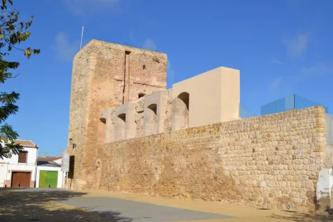
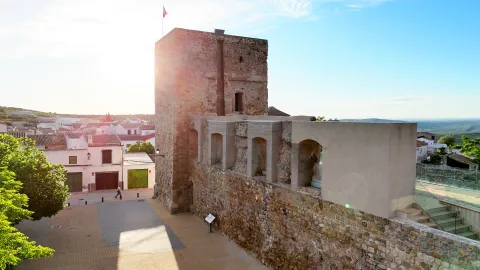
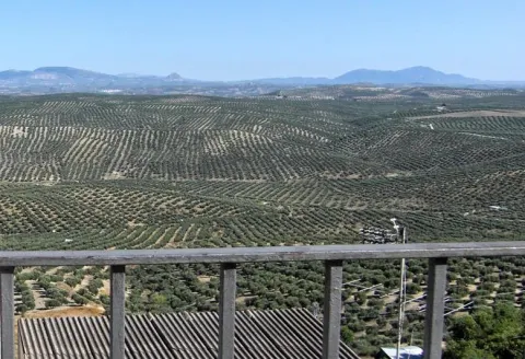
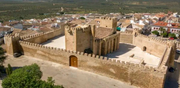
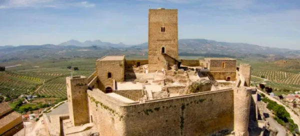
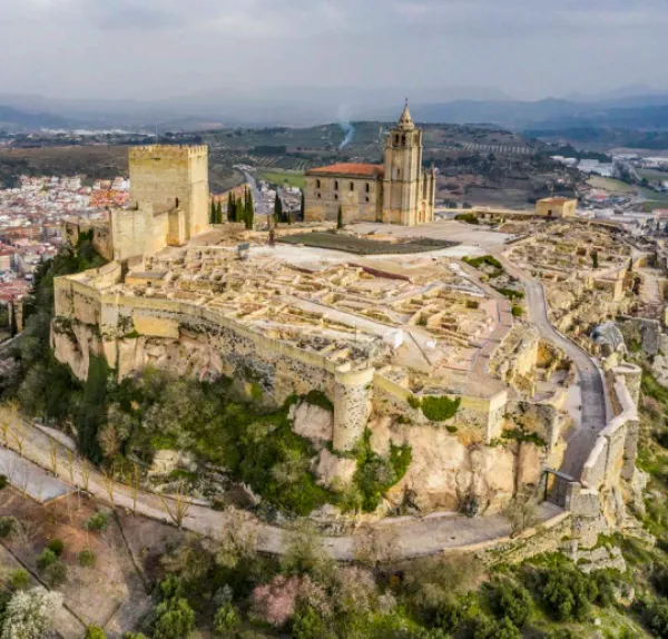
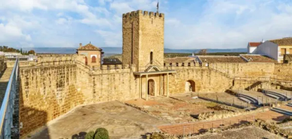
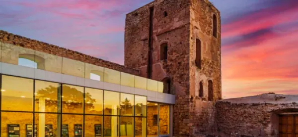
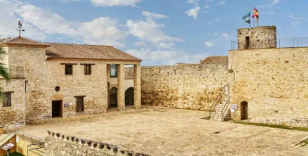
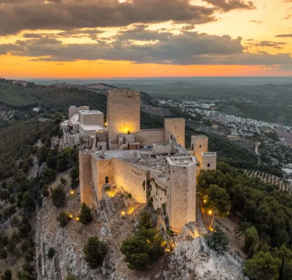
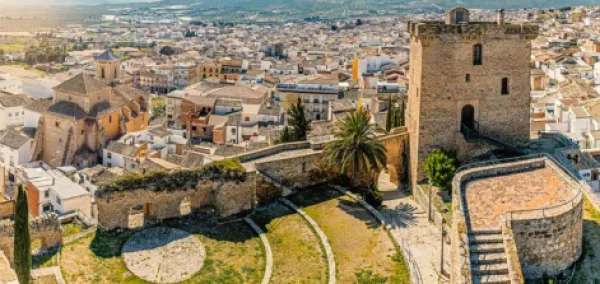
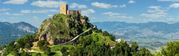
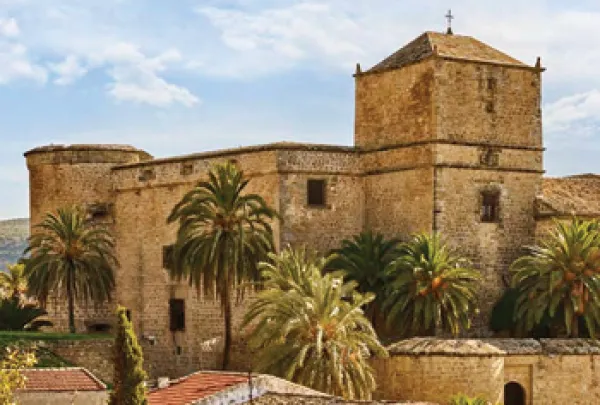
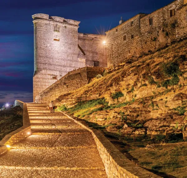
In the area where the castle stands, dwelling and storage structures (a hydraulic feature, silos and hut floors) belonging to a Copper Age settlement have been documented. Of the Roman settlement, a double walled enclosure can be identified, protected by a moat on the northern side that reinforced its defences. It was probably organised around a tower located to the south-west, to which the large-sized masonry blocks forming the foundations of the medieval tower would correspond. Inside, buildings would have stood, of which few traces remain, with storage structures for agricultural produce and water. The medieval fortress, built between the 13th and 14th centuries making use of Roman-period remains, consisted of a walled enclosure in the shape of an irregular trapezoid, with four towers, of which three survive today: a large rectangular tower occupying the south-western corner; a small, circular one to the north-west, of which only the base survives; and another rectangular, solid one to the north-east, which defended the castle gate. A fourth tower once stood at the south-eastern corner, lost in the 19th century. The complex is built of masonry, except for the southern wall, which is built in rammed earth. The south-western tower, or keep, is divided into three floors plus a ground floor, occupied by a cistern. In some parts of the keep, traces can still be seen of the original decoration that would have covered the walls of the fortification — a pattern of leaves or drops using sgraffito techniques, decoration that would also have covered the walls and the solid tower. The tower's original door was heavily defended, double-leaved, and would have had a machicolation-like opening for pouring liquids or stones onto attackers, as well as a portcullis. This access was sealed off when a cistern was built inside the tower, occupying almost the entire ground floor. The vaulted roof of the cistern has disappeared, but two related elements survive: a settling structure and a well for drawing water. The archaeological excavations that uncovered this water tank also recovered the original staircase embedded in the tower's north wall. Both can be seen during a visit, and it is possible to walk over the cistern. The climb up the tower ends at the terrace, which offers wide visual control of the surrounding territory, with views of sites such as El Berrueco, Andújar, Arjona and Martos — explaining why this location was chosen for the fortification. Its position on a steep slope acted as a natural defence, but the northern and western sides, being more accessible, were protected by a wide moat around 7 m across and up to 2.10 m deep, hidden until it was uncovered during recent archaeological work. The moat ran between two towers reinforced with scarps that are still visible. From the 16th century onwards, a new door was opened in the western wall, with a Renaissance doorway carved in ashlar stone that survives today. It consists of two sections: the lower one with a semicircular arch on pilasters, and the second with a large rectangular panel at its centre, bearing the coat of arms of Don Fernando de Torres and his first wife, Doña Francisca de Carvajal y Osorio. The greatest transformation was the construction of wings attached to the walls, forming a large residential space. The Keep and the southern wall retain openings that would have connected them. Today, the ground floors of these structures can still be identified, although they would originally have reached two or three storeys in height. These wings housed the palace's "privileged space" — that is, the rooms of the Count and Countess, the chapel, the crypt, the entrance hall and a gallery-corridor or atrium, in the western wing — while in the southern building, the ground floor was used for storage, with the first floor reserved for the palace's main representative space, a large hall with a fireplace carved into the tower's façade. The structures to the north and east would have been dedicated mainly to service functions, including stables, kitchens and a cellar. Archaeological work confirmed the existence of a prehistoric, Copper Age settlement on the hill where the castle now stands. The presence of sickle teeth, mills and storage silos points to an agricultural economy based on cereal farming. A hydraulic structure, underground dwelling features and post-hole structures have also been found. There does not appear to have been continuous occupation of the site, suggesting the settlement must have been temporarily abandoned. From the early 1st century BC to the 2nd century AD, there was an increase in agricultural settlements devoted to cereal farming across the countryside. During this period, the site was reoccupied as a fortified settlement, reaching its peak between the first quarter of the 1st century and the 2nd century AD, after which it was abandoned once again. In the late Middle Ages, the term "villar" identified a place with the remains of an abandoned ancient settlement. Following the conquest of the territory, the Castilians settled here while Roman structures were still visible, choosing to reuse some of them, along with building material, to construct the castle. The hamlet of El Villar de Don Pardo is already mentioned in sources in 1251, but the castle was not built until the late 13th or early 14th century, with the fortification first referred to in 1416, as a place still belonging to the Council of Jaén. Fernando Ruiz de Torres later obtained the cession of the hamlet. In the second half of the 15th century, with Teresa de Torres — married to the Constable of Castile, Miguel Lucas de Iranzo — as lady of the estate, Villardompardo became one of the defensive lines of the supporters of Henry IV against the rebellious nobility, led in the area by the Order of Calatrava. The death of her son without heirs passed the lordship to a side branch of the Torres family, which married into the family of Peter I of Portugal. Philip II made it the seat of a county when he named Don Fernando de Torres y Portugal Count of Villardompardo in 1576. Between the late 16th and early 17th centuries, the castle was converted into a palace, serving as the usual residence of the counts. Their successors, however, settled at Court in Madrid, which began a process of decline through lack of maintenance. The abolition of entailed estates under the reign of Ferdinand VII forced the inheritance to be divided, separating Villardompardo Castle from the main noble line. In the late 19th or early 20th century, the 16th-century buildings were demolished, leaving only the perimeter walls, levelling the surface and carving steps into the northern wall to temporarily turn the enclosure into a bullring. The castle has undergone various emergency consolidation works, archaeological excavations and restoration between 2012 and 2023.
Breve descripción
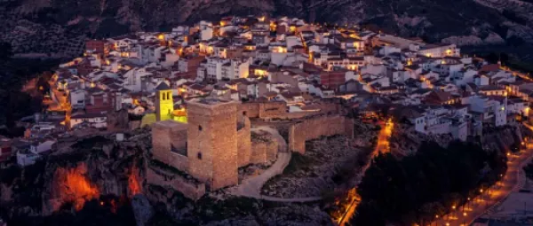
Villardompardo Castle, built between the 13th and 14th centuries, is a walled enclosure built mostly of masonry. It was marked by four towers, the most notable being the great keep, and was protected on its north-western side by a moat. From the 16th century onwards, the fortress underwent a profound transformation, eventually becoming a large rural building, the palace-residence of the Counts of Villardompardo, notable for its monumental doorway and the cistern occupying the ground floor of the tower. The site on which it stands was once home to a Copper Age settlement and a fortified Roman settlement dated between the early 1st and 2nd centuries AD, of which numerous structures survive. Following the Castilian conquest of this territory, the Castilians built a fortress that played an important role in the noble power struggles of the 15th century, becoming one of the defensive lines of the supporters of Henry IV. Philip II made it the seat of a county when he named Don Fernando de Torres y Portugal Count of Villardompardo in 1576.
Telecomunicaciones
Sitio web
www.villardompardo.es/el-municipio/patrimonio-historico.html
Correo electrónico
villardompardo@promojaen.es
Ubicación
Código Postal
23659
Latitud
37.83912
Longitud
-3.99972
Dirección
Villardompardo, Jaén
Distrito
Municipio
Ubicación en el mapa
POINT (-3.99972 37.83912)
Tipos de punto de interés
Imágenes carrusel
imagen
Image
Castillo%20de%20Villardompardo2.jpg
Imagen principal
Desactivado
imagen
Image
Castillo%20de%20Villardompardo5.jpg
Imagen principal
Desactivado
imagen
Image
Castillo%20de%20Villardompardo13.jpg
Imagen principal
Desactivado
imagen
Image
Castillo%20de%20Villardompardo9.jpg
Imagen principal
Desactivado
Imágenes cabecera
imagen
Image
Castillo%20de%20Villardompardo14.jpg
Imagen principal
Activado
Microsite al que pertenece
Loading map
Preparing points of interest and routes...

Villardompardo

Submitted by brandcode_deweloper on
Id
M-01
Descripción
Breve descripción

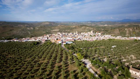
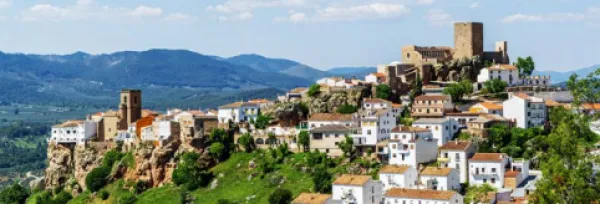
Villardompardo is a small municipality in terms of area, located in the Campiña region west of the provincial capital, on the banks of the Salado de los Villares stream, whose main landscape feature is the olive grove. The municipal area is almost entirely flat, with some sloped areas, and its town centre sits on top of a low hill. The municipality's economic activity is almost exclusively agricultural, specifically the single-crop rainfed olive grove, which occupies practically the entire area. In recent years, activity has diversified with the creation of small industries and construction firms. Worth highlighting are the town's gypsum quarries, a resource with potential for exploitation. In Villardompardo, made-to-order furniture is still crafted today. The finest examples of this cabinetmaking follow a classic Spanish, Renaissance-inspired style, close to the furniture that characterised Granada in the first half of the 20th century. Among the woods used, beech and chestnut stand out. In terms of historical heritage, the most notable features are its Castle, declared a Site of Cultural Interest in 1985, and the Church of Nuestra Señora de Gracia.

Telecomunicaciones
Teléfono
953 576 007
Sitio web
www.villardompardo.es/index.html
Ubicación
Nombre
Villardompardo
Latitud
-4.00174
Longitud
37.83810
Distrito
Google Maps Url
https://www.google.es/maps/place/+Villardompardo+jaen/@37.83810,-4.00174
Municipio
Ubicación en el mapa
POINT (-4.001467 37.839673)
Imágenes
imagen
Image
91ecf920-91ea-5663-0130-16861a76753e?t=1621522962369
Imagen principal
Desactivado
imagen
Image
f7b6ff10-f629-83f1-4a85-7d9eeebafa6f?t=1627995588146
Imagen principal
Desactivado
Imágenes cabecera
imagen
Image
Villardompardo
Imagen principal
Desactivado
Datos de interés

Tourist area: Sierra Sur and Campiña of Jaén 

Distance to the provincial capital (km): 30 

Altitude above sea level (m): 460 Area (km²): 17 

Population: 1,257 

Demonym: Villariegos or Villarengos 

Postcode: 23659

Videos
Video file
Cultura
  • Villardompardo Castle. Built in the second half of the 13th century, following the Christian conquest in 1245 by King Ferdinand III. It was erected on a sloping, elongated hill at the centre of the town, with the castle enclosure taking a trapezoidal shape. In the second half of the 14th century it became a noble residence, and was later renovated on two further occasions. The most valuable of its remains is the Keep, square in shape and around 20 metres tall, built on rocky ground. It is structured over four floors supported by sturdy wooden beams, with large windows covered by segmental arches. The staircase is located in the north corner. Major works were carried out in the 16th century to convert it into a castle-palace. From that period dates the harmoniously proportioned doorway, representative of its palatial use, featuring a moulded semicircular arch with large, finely cut voussoirs, a corbel at the keystone resting on large pilasters. Above the arch rises the carved noble coat of arms of the first Count of Villardompardo. It was declared a Site of Cultural Interest in 1985. 
  • Church of Nuestra Señora de Gracia. Located in the centre of the town, built in the 16th century in masonry and reinforced with side buttresses. It consists of a central nave and a chapel. The doorway features a simple semicircular arch, with a niche without sculpture above its axis, topped by a small triangular pediment. The tower, of extraordinary height, is square and consists of two sections separated by a moulding that projects out from the church nave, culminating in a bell tower with closed, lintelled openings, slightly segmental arches, and pinnacles topped with balls at the upper corners. 
  • Other places of interest include the hermitages of the Virgen de Atocha and San Roque, and the Town Hall.
Naturaleza

The landscape offered by Villardompardo is almost entirely flat, with very gently sloping hills, and rather monotonous, as it is almost entirely covered by olive groves. The Salado de Villares stream runs through the municipality; it has a low flow and dries up in summer, which is why it is not used for irrigation. Most of the crops are rainfed. 

As in most other towns of the Campiña, natural vegetation is practically non-existent, reduced to field boundaries, paths and the banks of the Salado stream. 

The olive tree plays an important ecological role: numerous birds, mammals and reptiles find shelter in its old trunks, and its fruit is also a highly energy-rich food source. 

Few species are found continuously in pure olive groves, as they are mostly used as feeding or transit areas by certain species. Here you can spot species such as the European serin and the greenfinch; and in winter, the blackcap, the robin and the song thrush. 

Biodiversity in the olive grove increases where streams appear alongside riparian woodland or Mediterranean scrub boundaries made up of reeds, oleanders and tamarisks. Here you can find house sparrows, chaffinches, goldfinches, nightingales, crested larks, quail and carrion crows. Amphibians: common toad, green frog, salamander; reptiles: Montpellier snake, ocellated lizard and wall lizards; mammals: hares, rabbits, foxes, badgers, genets… 

The Charca de Pajarejo, to the northeast of the town, is a natural pond that only forms after heavy rainfall, functioning as a temporary wetland ecosystem where various waterbirds nest.

Fiestas y Eventos

Villardompardo's traditional festivals are closely linked to agricultural work: 

  • San Antón, on 17 January. On the eve of this day, bonfires are lit year after year at the request of the brothers of the Brotherhood of San Antón. 
  • La Candelaria and San Blas, on 2 and 3 February. San Blas, protector against throat ailments, is honoured with the making and eating of the rosquillas (ring-shaped pastries) that bear his name on this day. 
  • San Isidro Labrador, on 15 May. This is a pilgrimage that has been held since 1968. In the morning, the townspeople, many on horseback or in carriages, set off in procession carrying the Saint to the spot known as "Las Piedras de Eulogio", where Mass is celebrated. Locals then enjoy a lively day together. 
  • Feast of Corpus Christi. A festival of special significance in Villardompardo. Residents prepare altars, and carpet and decorate the streets along which the Eucharistic procession will pass. Altars adorned with beautiful traditional motifs and streets covered in flowers. San Roque. 
  • San Roque, protector against plagues and epidemics, is celebrated and venerated on 16 August with both festive and religious events. On the 14th, the saint is carried from his hermitage to the Parish Church, and after asking for protection from all harm on behalf of the townspeople, the image is returned to its hermitage. 
  • St John's Eve. It is also customary to celebrate St John's Eve, on 24 June, when lamps are made from hollowed-out watermelons or pumpkins, with lit candles placed inside. 
  • Patron Saint Festivities of San Francisco de Asís and the Virgen del Rosario. Held from 4 to 7 September in honour of the town's patron saints.
Gastronomía
  • "Hoyo". The popular "hoyo" is bread soaked in olive oil, enjoyed together with salt cod, olives and wine. Served with sugar, it has for decades been one of the healthiest snacks for children. 
  • Migas (fried breadcrumbs) is the dish with the longest tradition among locals, always served with pork crackling, chorizo, fried peppers, sardines and herrings, and topped off with green olives, grapes or melon. 
  • Artichoke salad. Made using artichoke hearts, together with chopped tomato and a little lettuce or endive. 
  • "Oil and vinegar", made with the same ingredients as Cordoban salmorejo, but with the ingredients chopped rather than blended. 
  • Salt cod stew, or Lenten stews, which are a must during Holy Week. 

The town also boasts delicious pastries: 

  • "Roscos de sartén" (fried ring doughnuts) and "gusanillos", the local name for the "pestiños" so common in the province's cuisine. 
  • "Hornazos", a bread roll with a hard-boiled egg baked inside. Eaten on Maundy Thursday night. 
  • "Bizcocho de la princesa" (princess sponge cake), sweets similar to traditional madeleines, but smaller and much moister.
Historia

The discovery of archaeological remains predating the Middle Ages in Villardompardo, such as Neolithic axes, Roman troughs and brick pavements, indicates that the area was inhabited in earlier periods. 

In the surroundings of the town, traces of Iberian and Roman presence have been found, including the possible existence of rural villas devoted to agriculture in places such as Las Piedras de la Rata and Cerro Pelado. 

However, there is no mention of Villardompardo until its conquest by Ferdinand III the Saint in 1245. The municipality was a small hamlet devastated by the war between Christians and Muslims. It was granted by the king to a nobleman who accompanied him, Don Pedro Aznar Pardo, from whom it took its name (El Villar de Don Pardo), with the task of resettling it and organising an appropriate defensive system. It is very likely that the castle was built around that time, though smaller than the one we see today. The instability of the war meant it was repeatedly devastated and resettled until, in 1371, King Henry II turned it into a lordship entrusted to Don Pedro Ruiz de Torres, on condition that he resettle it once again. 

In the 15th century, the castle was used militarily in the fight against knights of the Order of Calatrava who had risen up against King Henry IV. The town gradually gained more privileges, and in 1558 Philip II elevated the lordship to a county, naming Don Fernando de Portugal y Torres the first Count of Villardompardo. He was responsible for the major works carried out on the castle in the 16th century to transform it into a residential palace. 

Under the feudal regime, the population went through very difficult times — famines, wars and epidemics — until the Constitution of 1812, which abolished lordships and entailed estates. The two 19th-century disentailments, that of Mendizábal and that of Madoz, which put the Count's lands, Church lands and communal lands up for sale, were decisive in significantly boosting the local economy and population. 

The population held steady until, in the 1960s and 1970s, its people emigrated to other, more industrialised areas of Spain or to European countries, in search of a better standard of living.

Loading map
Preparing points of interest and routes...
Imagen principal
imagen
Image
Villardompardo
Imagen principal
Activado

Route of the Castles and Battles

Submitted by brandcode_deweloper on
Id
1477084
Descripción larga

Arjona is included in the Route of the Castles and Battles, an itinerary running through the province of Jaén and part of the provinces of Ciudad Real and Granada. Arjona once had one of the most complex fortification systems in Al-Ándalus, with a triple line of defensive walls which, combined with Arjona's own strategic position, made it an impregnable stronghold. The origin of its wall system is set within the protohistory of the Iberian Peninsula, having been used by the successive cultures that passed through it, all of which left their mark on its structure. Today, part of this vast defensive system survives, along with an Almohad-period cistern located at the heart of the Alcazaba. The Archaeology Room of the Arjona Museum holds remains of weapons used in the Islamic medieval period, notably including arrowheads of a type matching those used at the Battle of Las Navas de Tolosa; also of note, inside the Sanctuary of the Sacred Relics, is a collection of drawings and plans based on the manuscripts of the 17th-century historian Martín Ximena Jurado, showing what Arjona's defensive system looked like at that time.

The visit ticket includes a guide and admission to all monuments, museums and churches, except the Sanctuary of the Sacred Relics; admission to the Sanctuary costs €1, payable at its entrance.

Latitud
37.936503
Longitud
-4.055315
Distrito
Municipio
Ubicación en el mapa
POINT (-4.055315 37.936503)
imagen
Image
vistas.JPG
Imagen principal
Activado

Nature

icon-intereses-naturaleza

Friends

icon-intereses-amigos

Adventure

icon-intereses-aventura

Culture

icon-intereses-cultura

Sport

icon-intereses-deporte

Eco-friendly

icon-intereses-eco-friendly

For couples

icon-intereses-en-pareja

Family

icon-intereses-familia

Gastronomy

icon-intereses-gastronomia

Municipality

icon-intereses-municipio

Low-cost tourism

icon-intereses-turismo-low-cost

Solo travel

icon-intereses-viajar-solo

Ruta de los castillos y batallas

All year round

Desactivado
Coordenadas / Huso 30S

30S x=407265 y=4199295

Tramo de asfalto o cemento
 
Tramo de pista o camino forestal
 
Tramo de vía pecuaria
 
Tramo de senda
 

The Frontier Path

Submitted by brandcode_deweloper on
Breve descripción

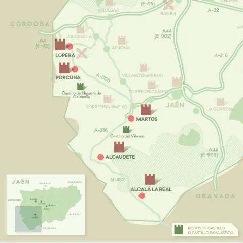
ROUTE FROM LOPERA TO ALCALÁ LA REAL

MILITARY LANDMARKS ON THE LAST FRONTIER

This itinerary, which includes some of the most striking examples of military architecture, follows the same north-to-south progression as the Castilian territorial advance: it starts in Lopera, passes through Porcuna, Martos and Alcaudete, and ends in Alcalá la Real. This final frontier features several castles belonging to the Order of Calatrava, including its main commandery in Martos, along with the fortress that, following the Castilian conquest of Jaén, became the most advanced outpost of the new kingdom: Alcalá la Real. 

Travellers thus gain insight into the organisation of the military orders and the process of military conquest that enabled the Kingdom of Castile to advance into the territory of the Nasrid Kingdom, culminating in 1492 with the capture of the city of Granada.

imagen
Image
mapa ruta 6
Imagen principal
Desactivado
Puntos del trazado
Latitud
37.94542
Longitud
-4.21463
Latitud
37.871
Longitud
-4.185
Latitud
37.723
Longitud
-3.965
Latitud
37.5881
Longitud
-4.0813
Latitud
37.4625
Longitud
-3.9228
Desactivado

Route card

Lopera Castle

Lopera

A KEY DEFENCE IN THE COUNTRYSIDE OF JAÉN

Its origins lie in a fortified church, which, after several interventions, was transformed into a castle-palace. Following the Castilian conquest, Lopera was granted, in 1240–1241, to the Military Order of Calatrava, giving rise to the Encomienda de Lopera. Its role as a frontier fortress in the advance of Castilian armies through the countryside of Jaén was crucial during the 13th and 14th centuries, regaining prominence in the second half of the 15th century — amid the noble power struggles that took place during the reign of Henry IV. 

The outer walled enclosure preserved today, with its irregular pentagonal layout and five solid corner towers, belongs to this later fortification. Between the late 15th century and the first half of the 16th, this fortified church was adapted into a castle-palace.

Imagen

Walls and Tower of Boabdil

Porcuna

THE PRISON THAT HELD BOABDIL

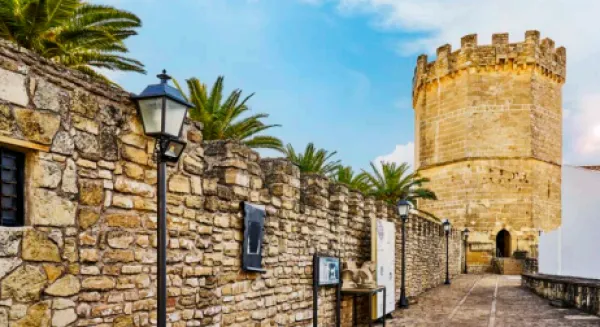
The town of Porcuna safeguards the remains of the walled enclosures that once defended the old city, the most representative surviving structure of this fortified complex being the Torre Nueva, with its octagonal floor plan, built in 1335 by the Order of Calatrava in Gothic-Mudéjar style, which now houses the Archaeological Museum of Porcuna. 

Popularly known as the Tower of Boabdil, as sources say he was held prisoner in Porcuna Castle after being captured at the Battle of Lucena, it is an octagonal tower in the Gothic-Mudéjar style, once attached to the castle's walls and structure, reaching a height of 28 metres.

Imagen

Castles of the Villa and of the Rock, Martos

Martos

POWERFUL FRONTIER STRONGHOLDS FOR CHRISTIAN EXPANSION

The legacy of Martos's powerful defensive past features two main structures: the Keep and the Almedina Tower of the Castillo de la Villa (13th century); and the remains of the Castillo de la Peña, belonging to the Order of Calatrava (an irregularly shaped citadel, difficult to access, surrounded by a walled enclosure that stands out above the present-day town). 

The fortresses of Martos played an important role as a frontier stronghold in the territorial expansion undertaken by Castilian armies during the 13th and 14th centuries. Later, in the second half of the 15th century, they once again gained prominence amid the noble power struggles during the reign of Henry IV. 

It was after its transfer to the Order of Calatrava by Ferdinand III, in 1228, that the defensive complex visible today was built.

Imagen

Alcaudete Castle

Alcaudete

A CALATRAVA STRONGHOLD AGAINST THE NASRID KINGDOM OF GRANADA

This castle was always a key stronghold, particularly during the second half of the 13th century, gaining major strategic importance along the frontier with the Nasrid Kingdom of Granada. This led the Castilian monarch Ferdinand III to hand it over, in 1246, to the Military Order of Calatrava, which would undertake extensive reinforcement of its defences.

The Almohad alcazar, with its polygonal layout and lined with towers and bastions built of rubble masonry and rammed earth, was restructured by the Order of Calatrava, which built a new fortress within it. During the Renaissance, having lost its military function, it was converted into a palatial residence, transforming the existing structures.

Imagen

La Mota Fort

Alcalá la Real

FROM ISLAMIC CITY TO ROYAL PATRONAGE ABBEY

The Monumental Complex of the Fortaleza de la Mota stands imposingly on the skyline of Alcalá la Real.

La Mota is structured into three fortified enclosures: the madina, the alcázar and the arrabal (outer district). The complex rises from a steep, plateau-like hill covering almost three hectares, at an altitude of over a thousand metres, from where it controlled the routes connecting Granada and Almería with Córdoba and the highlands of the Guadalquivir.

The triangular alcázar is made up of three towers: the Keep, the Bell Tower (or Torre de la Vela) and the Torre Mocha. Around it lies the madina, occupying the entire plateau summit of La Mota. Among the towers of the walled enclosure, the Torre de la Cárcel stands out, built between the 14th and 15th centuries. Access to the interior of the enclosure was through a complex fortified system requiring passage through five gates, three of which still stand today: the Puerta de las Lanzas, the Puerta de la Imagen and the Puerta del Peso de la Harina.

The Iglesia Mayor Abacial, standing to the south of the alcázar, was built between the 16th and 17th centuries, on the site of the original church commissioned by Alfonso XI, of which only the Gothic funerary chapel of Dean Chirinos (15th century) remains. Other notable elements of the madina include the Casas del Cabildo Municipal and the Carnicerías (butcher's houses), both built in the 16th century. Cisterns and an ice house have also been preserved.

With the conquest of Granada, La Mota's defensive role came to an end, though it remained a centre of civil and religious power.

Imagen

Castles Among the Olive Groves

Submitted by brandcode_deweloper on
Breve descripción

ROUTE FROM ANDÚJAR TO TORREDELCAMPO

EVERYDAY LIFE IN A UNIQUE FOREST

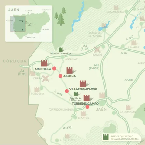
The almost endless, genuine landscape of the olive groves of Jaén is the world connecting this route, which starts in Andújar and continues down through Arjonilla, Arjona, Villardompardo and Torredonjimeno, ending in Torredelcampo.

The various fortifications that make up this itinerary are enriched by a much broader story that shapes the territory: aspects of everyday life on the frontier, the olive forest, and the cuisine closely tied to olives and olive oil. It's worth noting, as an added charm to the route, that a stretch passing through the towns of Torredonjimeno and Torredelcampo coincides with the path of the Vía Verde del Aceite. In Torredelcampo, the Castillo de El Berrueco played a key role — due to its strategic position atop a hill, it was one of the main strongholds controlling access to Jaén, forming part of a vast network of towers and watchtowers. 

Similarly, the historic centre of Andújar is dotted with remains of walls and towers from the old fortifications that once encircled the original city, evolving from the earliest Roman fortified structure. Following the conquest by Ferdinand III the Saint, it became a strategic stronghold of the new Christian territory, from which the assault and conquest of the Upper Guadalquivir were organised.

imagen
Image
mapa ruta 4
Imagen principal
Desactivado
Puntos del trazado
Latitud
37.974
Longitud
-4.107
Latitud
37.9361
Longitud
-4.0550
Latitud
37.8381
Longitud
-4.0017
Latitud
37.77021
Longitud
-3.89723
Desactivado

Route card

Cistern of Arjona Castle

Arjona

BIRTHPLACE OF MUHAMMAD IBN NASR

Arjona was the birthplace, in 1194, of Muhammad ibn Nasr, founder of the Nasrid Kingdom of Granada and driving force behind the construction of the Alhambra. The town was defended by a solid walled enclosure over two kilometres long, encircling the settlement and crowned at its highest point by an alcazaba, located on what is now the Plaza de Santa María.

Next to the church, built on the site of the old aljama mosque, an extraordinary cistern survives, possibly of Almohad origin, with columns from the Roman period, which can be visited alongside the church. Part of the wall and an adjoining tower have allowed for the creation of a small interpretation space dedicated to the walls of Arjona.

Imagen

Castle of the Troubadour Macías

Arjonilla

THE PRISON WHERE THE LOVER SANG HIS SORROW

A striking setting with a compelling story — that of the love affair of the Troubadour Macías, which inspired works by such renowned authors as Lope de Vega's "Porfiar hasta morir" and Mariano José Larra's "El doncel de Don Enrique el Doliente."

Although the castle's current structure and layout are Christian, it may have had Almohad origins, and it was likely expanded and reorganised between the late 13th and early 14th centuries, particularly once Arjonilla came under the domain of the Order of Calatrava. It takes the form of a walled enclosure, with a notable square-plan tower standing 17 metres tall. Today, cultural activities are held in its parade ground.

Imagen

Villardompardo Castle

Villardompardo

THE CASTLE OF PEDRO AZNAR PARDO

Built between the 13th and 14th centuries, the castle is notable for its large Keep. In 1461, the wedding of Miguel Lucas de Iranzo, Constable of Castile in Jaén, and Teresa de Torres, lady of the estate, was celebrated at this castle, an event that brought prestige to both the town and the castle.

The castle was granted privileges by Henry IV and the Catholic Monarchs, and in 1558 Philip II created the County of Villardompardo, after which the building was renovated to become the palace-residence of the Counts of Villardompardo. Notable features of the building include its monumental doorway and the cistern occupying the ground floor of the tower. Also worth mentioning is the Jewish presence, as its Jewish quarter is one of the few still preserved in the province of Jaén.

Imagen

Torredonjimeno Castle

Torredonjimeno

THE CASTLE AND THE VISIGOTHIC TREASURE

It originated as a small Islamic hamlet, which may have been fortified during the Almohad period, later evolving after the Christian conquest and its integration into the lordship of the Order of Calatrava, when a solid castle of irregular masonry was built. It eventually shifted from a military fortress to a residential castle in the second half of the 15th century. 

During a visit to the castle, you can see an 18th-century olive oil mill, the Torredonjimeno Visigothic Treasure Interpretation Centre, and the permanent fossil exhibition "Testigos de vida" ("Witnesses of Life"), as well as the remains of a 15th-century Casa Señorial or Casa Maestral (notable for its 15th-century Mudéjar-style coffered ceiling and its late-18th-century garden).

Imagen

The Heart of the Kingdom

Submitted by brandcode_deweloper on
Breve descripción

ROUTE FROM JÓDAR TO JAÉN

A BARRIER BETWEEN TWO RIVAL POWERS

This route runs through the central area of the province of Jaén and serves as a thread for understanding how the transition from Muslim to Christian rule took place, along with the resulting changes in structure and organisation.

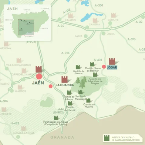
Following the conquest of Jaén, a Kingdom of Jaén began to take shape as a border territory with the Kingdom of Granada. The origins of Jaén as a provincial capital derive from its status as the capital of the Chora of Yayyān during the Muslim period, an era from which significant monuments have survived, such as the Arab Baths or Santa Catalina Castle. Castles such as those of Jódar, La Guardia or Huelma, although now displaying a Christian-era structure, have an important Muslim past as sites that protected the capital of the Cora of Ŷayyān, the Arabic name from which the place-name Jaén derives. Other castles the traveller can admire along the route include those of Jimena, Bedmar and Albanchez de Mágina.

imagen
Image
mapa ruta 4
Imagen principal
Desactivado
Puntos del trazado
Latitud
37.833
Longitud
-3.35
Latitud
37.74257
Longitud
-3.69371
Latitud
37.7836
Longitud
-3.7838
Desactivado

Route card

Santa Catalina Castle, Jaén

Jaén

HILL, CROSS AND PROVINCIAL CAPITAL

Across the summit and the northern and southern slopes of Cerro de Santa Catalina lie the defensive structures of the city of Jaén, which have undergone a complex historical and architectural evolution over the centuries.

The original fortress had two enclosures — the Abrehuí Castle and the Alcázar Viejo (Old Citadel) — but after the Christian conquest in 1246, the Castilians built a third, the Alcázar Nuevo (New Citadel), which still retains its original structure today. Its outer perimeter is defined by a walled enclosure incorporating six towers (square in plan, except for the easternmost, the Torre de Vela or de Guardia, which is pentagonal). East of the castle gate, on the northern side of the enclosure, stand two barbican towers in succession; the westernmost houses the Chapel of Santa Catalina, patron saint of the city.

Cerro de Santa Catalina witnessed various conflicts, as during the Christian conquest of the Guadalquivir valley, Jaén withstood several sieges until, in 1246, the King of Granada, Ibn al-Ahmar, surrendered the city to Ferdinand III "the Saint." Centuries later, during the War of Independence (19th century), Jaén and its defences once again played an important role in controlling the Upper Guadalquivir.

The surviving sections of the wall descend the hillside, encircling the old town below.

Imagen

La Guardia Castle

La Guardia

FROM MEDIEVAL BUILDING TO NOBLE RESIDENCE

In 1244, La Guardia was conquered by Ferdinand III as a preliminary step towards the conquest of the city of Jaén. From that moment on, La Guardia became a strategically vital castle for the Kingdom of Castile. Once in Christian hands, the original citadel was transformed into a rectangular fortress with towers at its corners, one of which was set up as the Keep. For two and a half centuries, it was a decisive stronghold in defending the Jaén flank, exposed to Nasrid incursions coming from the Guadalbullón river basin.

After the Castilian Civil War of the 14th century, La Guardia became part of the possessions of the Mexía lineage. The castle was turned into a noble residence, which led to a major renovation of the medieval building, incorporating palatial features and rooms, most notably its Gothic-style doorway and the Church of Santa María.

Imagen

Jódar Castle

Jódar

WATCHTOWER OVER THREE VAST VALLEYS

Of Muslim origin and later remodelled by the Christians, this castle is one of the oldest in Andalusia, mentioned in documents dating back to the year 860. It was set up as a double line of defence, consisting of an outer enclosure and an inner keep with two large towers of homage at either end, one of Arab origin and the other built by the Christians. Jódar was conquered by the Almoravids in 1090 and, in 1161, became part of the Almohad empire, a period to which the rammed-earth walls preserved in the castle may well belong.

After passing into Castilian hands between 1127 and 1229, it went on to become one of the most important strongholds on the border with Granada and the seat of a lordship, which led to constant clashes and changes of ownership. Later, the castle would be the scene of other conflicts, such as the Carlist Wars and the War of Independence.

Imagen

Sentinels of the Mountains

Submitted by brandcode_deweloper on
Breve descripción

ROUTE FROM SEGURA DE LA SIERRA TO CAZORLA

EXCEPTIONAL VIEWPOINTS 

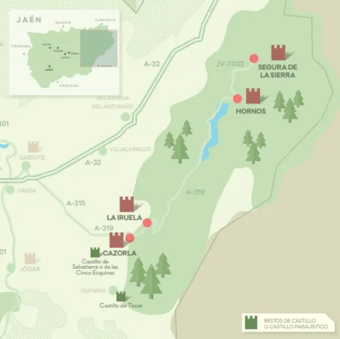
This very special itinerary includes some of the finest examples of military architecture in the province's catalogue of fortifications, together with an extraordinary array of viewpoints over the most striking landscapes of the former Kingdom of Jaén. 

The castles of Segura de la Sierra, Hornos, La Iruela and Cazorla lend interest to this route, which reveals how these medieval military fortifications adapted to the mountainous landscape of the eastern part of the province. A landscape unfolds before the traveller's eyes, viewed from different perspectives: the natural one, glimpsed from these watchtowers; the cultural one, linked to defensive architecture; the economic one, reflected in the different uses of the land between the Muslim era and the period following the Castilian resettlement. And finally, a symbolic landscape emerges, telling the story of the shared imaginaries between the two cultures and the emergence of a new system of territorial organisation.

imagen
Image
mapa ruta 3
Imagen principal
Desactivado
Puntos del trazado
Latitud
38.2982
Longitud
-2.6521
Latitud
38.21674
Longitud
-2.71918
Latitud
37.9108
Longitud
-2.9633
Latitud
37.911
Longitud
-3.002
Desactivado

Route card

Segura de la Sierra Castle

Segura de la Sierra

AN ESSENTIAL STRONGHOLD IN THE STRUGGLE AGAINST GRANADA

Following the Castilian conquest of the region, in 1242 Ferdinand III granted Segura to the Order of Santiago, which would turn it into the Encomienda Mayor of Castile. From here, numerous attacks were launched against the Nasrid Kingdom of Granada, and it would later serve as a stronghold during the noble power struggles of the 14th and 15th centuries, under the authority of the Manrique family. In 1810, it was the scene of confrontation with Napoleonic troops, who destroyed and burned both the town and the castle. 

Numerous defensive elements stretch along the slope of the hill on which it stands, while inside the castle a chapel built in the 13th century by the Order of Santiago, in Mudéjar style, along with a chapter house and other structures from various historical periods, have been preserved. 

The complex preserves a chapel built in the 13th century by the Order of Santiago, in Mudéjar style. The castle has been declared a Historic-Artistic Site and Picturesque Landscape, and the town, like the castle, is included in the network of "Most Beautiful Villages of Spain."

Imagen

Hornos de Segura Castle

Hornos de Segura

A WINDOW ONTO THE STARS

Following the conquest of Hornos in 1239 by Don Pedro Pérez Pelayo Correa, Master of the Order of Santiago, Ferdinand III "the Saint" granted this territory to the Order, which built a Christian castle consisting of a trapezoidal enclosure with a large keep. 

Hornos was one of the settings for the projection of the Manrique family's political power in the 15th century, in conflict with the monarchs John II and Henry IV. The Manriques came to control much of the Order of Santiago's resources, which enabled Rodrigo Manrique, Commander of Segura, to be proclaimed Grand Master of the Order. 

Originally, the castle's walls extended to form an enclosure surrounding the town centre; today, two towers still stand, along with the so-called Puerta de la Villa (Town Gate). 

Another added attraction of this fortification is that it houses the Cosmolarium, an astronomy interpretation centre.

Imagen

La Yedra Castle

Cazorla

THE BIRTHPLACE OF THE LEGEND OF LA TRAGANTÍA

The Castillo de la Yedra, also known as the Castle of the Four Corners, is an ancient site of defensive origin. It is located on the lower part of the Salvatierra hill, above the Cerezuelo river. It is a structure dating back to Berber times, although it was completed in the form we know today by the Castilians. From its position, at an altitude of 831 metres above sea level, the town of Cazorla and its surroundings can be seen. At the top of the hill, the Castillo de Salvatierra, or de las Cinco Esquinas, can also be seen. The origins of the Castillo de la Yedra may be Muslim, possibly dating from the Almohad period (12th century), although over the course of the 13th, 14th and 15th centuries, the Christians completed its final layout, which explains why the Gothic style predominates in many of its interior rooms. The castle houses the Museum of Popular Arts and Customs of the Upper Guadalquivir.

Imagen

La Iruela Castle

La Iruela

A MAJESTIC SILHOUETTE ATOP A CRAG

The Fortress of La Iruela stands out for its striking presence, perched on a steep rocky outcrop. It belonged to Don Rodrigo Ximénez de Rada, Archbishop of Toledo, who organised the crusade that led the Christian kingdoms to war against the Almohad Empire, culminating in the Battle of Las Navas de Tolosa.

It is a formidable structure of Almohad origin, built to reinforce the frontier of Al-Andalus, and is accessed through a 15th-century gate tower. It consists of three walled enclosures dotted with towers, arranged in a stepped layout running north to south, with its Keep standing out most prominently, positioned at the highest point of the crag and visible from a great distance.

Next to the castle, the ruins of the 16th-century Renaissance church of Santo Domingo can also be seen.

Imagen

Battlefields

Submitted by brandcode_deweloper on
Breve descripción

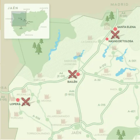
ROUTE FROM SANTA ELENA (LAS NAVAS DE TOLOSA) TO LOPERA

WAR MILESTONES THAT CHANGED THE COURSE OF HISTORY

This adventure takes travellers to the sites of the three most significant battles that took place on the lands of Jaén: Las Navas de Tolosa (1212), Bailén (1808) and Lopera (1936).

The first two were especially momentous, as they determined the fate of the rivals they pitted against each other: in the first case, the Kingdom of Castile against the Almohad Caliphate; and in the second, Spain against France. The third is remembered, among other things, for the tragic fate of the international brigade members who took part, including the English poet John Cornford (great-grandson of Charles Darwin) and the writer Ralph Winston Fox. "Battlefields" highlights the province's geographical position, which has historically made it a strategic stronghold from the time of the Roman conquest of Hispania — with the Battle of Baecula (currently under study) — right through to the Spanish War of Independence in the 19th century. All three battles have a museum or interpretation centre where visitors can learn first-hand about the historical and military background of each and their consequences.

imagen
Image
mapa ruta 2
Imagen principal
Desactivado
Puntos del trazado
Latitud
38.3402
Longitud
-3.5398
Latitud
38.2858
Longitud
-3.5867
Latitud
38.09679
Longitud
-3.77656
Latitud
37.94542
Longitud
-4.21463
Desactivado

Route card

Battle of Las Navas de Tolosa

Navas de Tolosa

THE GREAT CRUSADE ON THE PENINSULA

The Battle of Las Navas de Tolosa on 16 July 1212, in the province of Jaén, represents one of the great events of medieval history on the Iberian Peninsula, owing to its significance in the advance of the Christian kingdoms over Al-Andalus.

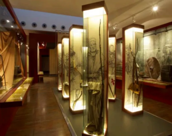
The conflict was conceived as a crusade — preached by Pope Innocent III — and pitted an army of men from the peninsular kingdoms and from beyond the Pyrenees, led by the Christian kings Alfonso VIII of Castile, Peter II of Aragon and Sancho VII of Navarre, against the forces of the Almohad Caliph Muhammad al-Nasir, whose army brought together fighters from the Maghreb, sub-Saharan territories and Turkish contingents. The confrontation proved vital for the territory's future, as the Almohad defeat at Las Navas de Tolosa marked the beginning of the definitive conquest of Al-Andalus by the Christian kingdoms of the peninsula. It is precisely in the Despeñaperros Natural Park, a short distance from where the battle took place, that the Museum of the Battle of Las Navas de Tolosa can be found, specifically in the town of Santa Elena. This space guides visitors through the history of the conflict, from its build-up to the decisive confrontation, using audiovisual displays and staged scenes, educational workshops, and visits to the battlefield and the Despeñaperros Natural Park. It is also a starting point and information hub for the Castles and Battles of the Kingdom of Jaén route.

Imagen

Battle of Bailén

Bailén

NAPOLEON'S FIRST MAJOR SETBACK

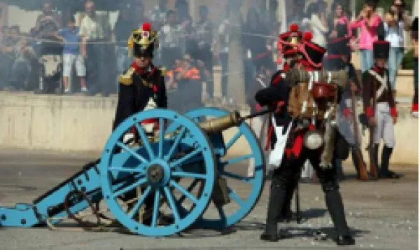
If there was one key moment in the later course of the War of Independence, it was the Battle of Bailén, on 19 July 1808, as it marked the first major defeat of the French imperial army against the Spanish side.

That day, Divisional General Pierre Dupont, after a long day of continuous, unsuccessful attacks — and with an army weakened by heat and lack of water — surrendered to the troops organised by the Captain General of Andalusia, Francisco Javier Castaños. The victory at Bailén had major consequences for the course of the war against the French, as it psychologically raised Spanish morale and, politically, supported the argument for the need to establish a single authority to lead the war. Militarily, it opened the way to Madrid, forcing Joseph I to withdraw to Vitoria. Thus began the first chapter of a war that would last until 1814. The Museum of the Battle of Bailén offers the chance to learn about this key episode in Spain's contemporary history and gain a historical overview of the War of Independence, through a journey through the six years of conflict and its consequences.

Imagen

Battle of Lopera

Lopera

THE BLOODY FRONTLINE BETWEEN TWO SIDES

During the early stages of the Spanish Civil War, the province of Jaén became a vital territory for controlling the route towards the north of the peninsula.

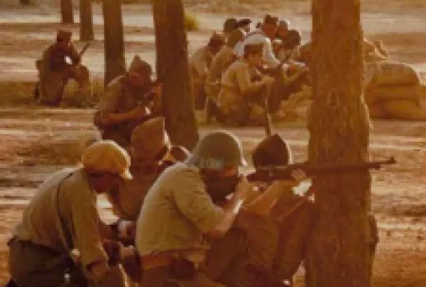
Lopera was one of the key towns in this reality, which kept Jaén on the front line for more than three years of conflict. In late 1936, the advance of the Francoist troops under Commander Redondo forced the Republican armies to block their path in the area around Porcuna and Lopera. In this latter town, the XIV International Brigade — led by General Walter, on the Republican side — clashed with the troops of Commander Redondo — on the side of the rebels. It was Christmas 1936. Because Lopera remained the dividing line between the two sides until the end of the war, visitors can find remains of trenches, machine-gun nests, bunkers, small forts, caves, shelters and more, scattered across the area. Lopera Castle houses a museum with an exhibition dedicated to the Civil War and to this battle.

Imagen

From Al-Andalus to the Renaissance

Submitted by brandcode_deweloper on
Breve descripción

ROUTE FROM SANTA ELENA TO SABIOTE

THE TRANSITION FROM AL-ANDALUS SOCIETY TO CASTILIAN SOCIETY

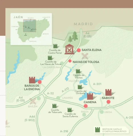
The journey enters the "Castles and Battles of the Kingdom of Jaén" route from the north, in an itinerary that begins at the Museum of the Battle of Las Navas de Tolosa (Santa Elena) and takes in some of the route's most spectacular castles, such as those of Baños de la Encina, Canena and Sabiote.

Visitors gain an overview of the historical process that led from Al-Andalus society to Castilian-Christian society; the story of a struggle for control of the territory between the peninsula's Christian kingdoms and Al-Andalus, with particular attention to the frontier between the Nasrid Kingdom of Granada and the Kingdom of Castile between the 12th and 16th centuries. Each stop offers a glimpse of a specific aspect. The Museum of the Battle of Las Navas provides a concise overview of the conflict, while Baños de la Encina offers the Muslim perspective and the organisation of Al-Andalus territory. Canena and Sabiote, meanwhile, represent the period following the conquest and the establishment of a new social, economic and cultural model that emerged under the feudal system prevailing in the conquered territories, thereby linking to the Renaissance.

imagen
Image
mapa ruta 1
Imagen principal
Desactivado
Puntos del trazado
Latitud
38.28561
Longitud
-3.58674
Latitud
38.1710
Longitud
-3.7744
Latitud
38.048
Longitud
-3.483
Latitud
38.06919
Longitud
-3.30681
Desactivado

Route card

Burgalimar Castle

Baños de la Encina

WITH THE SOUL OF AL-ANDALUS FORTRESSES

A defensive complex built in the 12th century and remodelled after the Christian conquest in 1225, it stood out for its enviable strategic position, controlling Sierra Morena to the north and the entire countryside of Jaén to the south.

This fortress is undoubtedly one of the main reasons Baños de la Encina has been included in the "Most Beautiful Villages of Spain" network. This defensive complex was built before the military events that culminated in the Battle of Las Navas de Tolosa (1212), serving as a defensive stronghold, alongside the castles of Castro Ferral, Las Navas de Tolosa and Vilches, against the advance of Christian troops led by their monarchs, most notably Alfonso VII and Alfonso VIII.

It is a walled Muslim fortress built in tabiyya (rammed earth) technique, with an elliptical shape, featuring an alcazar and an outer enclosure marked by 14 square towers and a Keep (Torre de Homenaje). Following its conquest by Ferdinand III of Castile in 1225, the castle and its defensive system underwent internal reorganisation. In the northern area, the Alcazarejo was built, featuring a circular tower and two ashlar walls attached to the castle's original Muslim ramparts.

The Lasting Legacy of Francisco de los Cobos

This transformation of life in these territories towards the Renaissance, reflected architecturally in castles such as those of Sabiote and Canena, is closely linked to Francisco de los Cobos, private secretary and Secretary of State to Charles I, whose high administrative standing led him to accompany the emperor on his expeditions to Germany, Italy and Berbería. In the case of the Canena fortification, De los Cobos commissioned Andrés de Vandelvira to build it after acquiring the entire town in 1539. In the case of Sabiote, following its acquisition in the late 15th and early 16th centuries, he hired the architect to transform the original fortress into a majestic Renaissance palace. 

Other Must-See Visits 

Other unmissable stops for the unhurried, patient traveller include the picturesque castles of Castro Ferral in Santa Elena, Las Navas de Tolosa in La Carolina, Vilches and Giribaile, or Tobaruela and Santa Eufemia in Linares.

Imagen

Canena Castle

Canena

A FASCINATING EXAMPLE OF MILITARY-PALATIAL ARCHITECTURE

An elegant and outstanding example of Renaissance architecture in its own right, bearing the mark of one of the great masters of this artistic movement in Andalusia: Andrés de Vandelvira.

The complex combines military elements — such as the circular towers, the moat and the loopholes defending its main entrance — with purely decorative ones, such as the Plateresque doorway, the gallery opening onto the south side, or the Renaissance-style courtyard. During the Islamic period, Canena was a small fortified settlement (hisn), but around 1226 this territory fell into Castilian hands, giving rise to an extraordinary situation: it was divided between the military orders of Santiago and Calatrava, splitting the village into two "quarters" under different jurisdictions that coexisted for more than a century and a half. In the 16th century, Francisco de los Cobos, secretary to Charles I, acquired the town and commissioned the renowned Andrés de Vandelvira to build a fortified palace. It is a rectangular, compact and austere building. The southeastern side, where the entrance is located, is protected by two cylindrical towers positioned at its corners, as well as by a moat.

Sabiote Castle

Sabiote

FROM FORTRESS TO MAJESTIC RENAISSANCE PALACE

In the heart of the charming Albaicín district — the town's oldest quarter, which still preserves its medieval network of narrow streets, small squares and dead-end alleys — stands the dazzling fortress of Sabiote.

It is considered one of the most important military structures in Andalusia. This castle originated as a small fortified Emirate/Caliphate settlement, which was demolished to make way for a solid castle built by the Order of Calatrava. Its later acquisition by Francisco de los Cobos, in the late 15th and early 16th centuries, brought about its final transformation, as he commissioned Andrés de Vandelvira to renovate the castle and turn it into a majestic Renaissance palace arranged around a colonnaded courtyard. Seven solid towers make up the structure of Sabiote Castle, the most notable being the great Keep (Torre del Homenaje). Vandelvira worked on both the interior spaces and the defensive systems, enhancing the residential function with new palace wings reaching four storeys and altering the access points into the fortress. Inside, new rooms were created around a large colonnaded courtyard, with arches resting on columns.

Imagen

Routes teatralizadas

Submitted by brandcode_deweloper on
Perfil de redes sociales
Descripción
Breve descripción

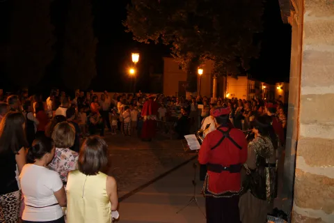
The Theatralized Routes are usually carried out in the summer period, coinciding with the Nazi evenings that the Arjona City Council organizes every year, including the activities of the Castles and Battles Route. Because of the strong success of the last edition, which was attended by more than 700 people in the two days already taken in the face of the demand of Arjoneros and visitors who so request, these types of routes will continue to be interpreted on specific dates. If you want to attend them, do not lose sight of our website, as these visits will be announced in advance, so that anyone who wishes to participate in them can do so.

Contextualization and Characters:

The Teatralized Guided Tours or Routes differ in content from the other visits offered. In this case the protagonists of the history of Arjona take life, to tell you in the first person the episodes or events by which they are recognized, all of them characterized from time and with contextualized environments or scenarios and live music by the members of the Musical Association "Lira Urgavonense." The narrator interacts with the characters, contextualizing the scenes and leading the audience to the different enclaves where they are interpreted. illustrious characters such as Helvia Paulina, King Alhamar, Fernando III "El Santo," Baron de Velasco, Martin Ximena Jurado, Cardinal Baltasar Moscoso-Sandoval, Juan de Aranda Salazar, Isidoro Pérez de Herrastri and a long etc. participate in these theatrical visits, characters that will make you understand episodes of the history of our locality.

The ticket of the visit includes the guide and entrance to all monuments, Museums and Churches, except the Sanctuary of the Sagradas Reliquias, the cost of the entrance to the Sanctuary is 1 €, to be paid at the entrance of it.

Telecomunicaciones
Ubicación
Código Postal
23760
Latitud
37.936476
Longitud
-4.055304
Distrito
Municipio
Ubicación en el mapa
POINT (-4.055304 37.936476)
Imágenes
imagen
Image
ruta-teatro.jpg
Imagen principal
Activado
imagen
Image
Las%20Rutas%20Teatralizadas_Arjona.png
Imagen principal
Desactivado
Loading map
Preparing points of interest and routes...
Tipo de experiencia