Saltar al contenido principal

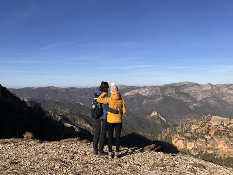
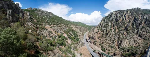
CIRCUIT 11. EXPLORING THE SIERRA DE SEGURA-DISCONNECT AND NATURE

Submitted by brandcode_deweloper on
Id
13496417
Descripción larga

Day 1.

Arrived at the accommodation.

Option A.

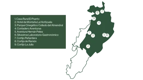
Farm House El Puerto, a refuge in the middle of the serrana nature.
Duration of experience: minimum stay of 1 night.
Price: from 150 €.

Option B.

Hotel de Montaña La Hortizuela with the experience Disconnect in nature with products from the territory.
Duration of experience: Minimum stay of 2 nights.
Price: From 200 €.

Day 2.

Option A.

Learn about the importance of the Iberian wolf in the ecosystem in the Collado de Almond Cinegetic Park.
Duration of experience: 3 hours.
Price: 15 €/ adults and 11 €/ children. For retirees and children with disabilities entry is free.

Option B.

Safe birds: a first flight over the saw with Contadero Adventures.
Duration of experience: 4 hours
Price: 25 €/ person

Day 3.

Discover the fields of Hernán Pelea with Adventure Hernán Pelea.
Duration of experience: between 4 and 5 hours.
Price: 50 €/ person.

Day 4.

Experience a unique gastronomic experience in the Serra de Segura with Silvestres Gastronomical laboratories.
Duration of experience: 4 hours.
Price: 75 €/ person.

Day 5.

Change of accommodation.

Immersion in the culture of oil in Siles in the Cortijo Peñardera.
Duration of experience: 2 days.
Price: 270 €/ person.

Day 6.

Change of accommodation.

Enjoy a stay in the Cortijo de Ramón between Roots and Candles.
Duration of experience: Minimum stay of 2 nights.
Price: from 72 €/ person.

(*) Prices may be subject to change.

GEOLOCALIZATION

Breve descripción

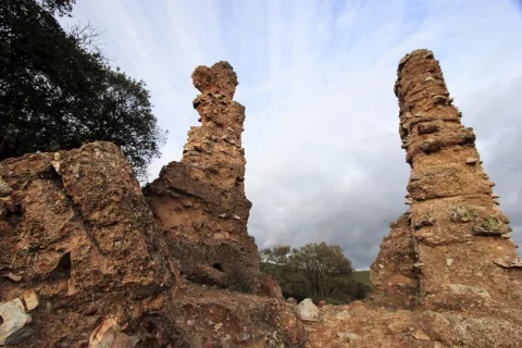
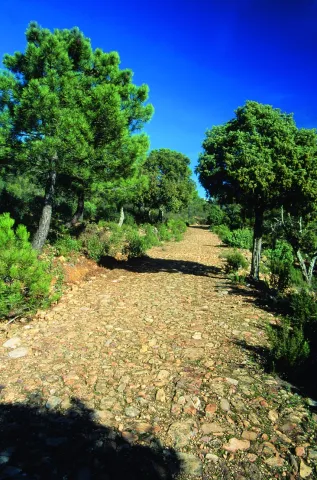
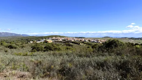
A circuit designed for lovers of nature, culture and indigenous flavors. In this tour, travelers can enjoy watching birds in their natural habitat or learning about the importance of the fauna of the territory. In addition, guided routes are offered to learn about the impressive landscapes of the Sierra de Segura. The circuit also invites you to discover the historical legacy of the area, exploring its monuments and traditions.

This circuit combines nature, history, gastronomy and a sustainable approach, which provides a complete experience in the Sierra de Segura.
Latitud
38.2803
Longitud
-2.6502
Distrito
Municipio
Ubicación en el mapa
POINT (-2.6502 38.2803)
imagen
Image
mapas-segura-5-png
Imagen principal
Activado
imagen
Image
_mg_6638-jpg
Imagen principal
Desactivado
imagen
Image
img_8027-1-jpg
Imagen principal
Desactivado
imagen
Image
_mg_6408-1-jpg
Imagen principal
Desactivado

Seniors

icon-intereses-senior

Friends

icon-intereses-amigos

Nature

icon-intereses-naturaleza

Groups

icon-intereses-grupos

Gastronomy

icon-intereses-gastronomia

For couples

icon-intereses-en-pareja

Family

icon-intereses-familia

Adventure

icon-intereses-aventura

Culture

icon-intereses-cultura

Municipality

icon-intereses-municipio

Eco-friendly

icon-intereses-eco-friendly
CIRCUITO 11. EXPLORANDO LA SIERRA DE SEGURA-DESCONEXIÓN Y NATURALEZA
Desactivado
Tramo de asfalto o cemento
 
Tramo de pista o camino forestal
 
Tramo de vía pecuaria
 
Tramo de senda
 

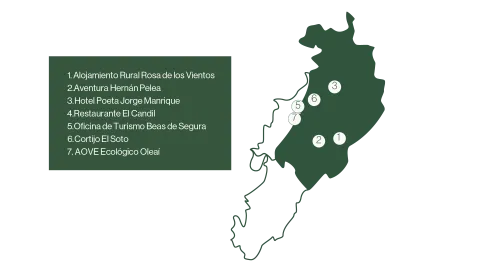
CIRCUIT 4. ENJOY WITH ALL 5 SENSES IN THE SIERRA DE SEGURA

Submitted by brandcode_deweloper on
Id
13492529
Descripción larga

Day 1.

Arrived at the accommodation.

Experience 1.

Rural accommodation Rosa de los Vientos- The autoreiki workshop in Rosa de los Vientos.
Duration of experience: minimum stay of 1 night.
Price: From 70 €/ person.

Experience 2.

A perfect combination: the virtual with the real with Adventure Hernán Pelea.
Duration of experience: 3 hours.
Price: adult: 30 €/ person and children up to 14 years: 15 €/ person.

Day 2.

Change of accommodation. Hotel Poeta Jorge Manrique- Poetry in every sip, history in every dish.
Duration of experience: Minimum stay of 1 night
Price: From 170 €

Day 3.

Option A.
Enjoy the tasting menu "Taste of the stars" on the Mesón El Candil Restaurant.
Duration of experience: 2 hours.
Price: 50 €/ person.

Option B.
Taste and melodies on the heights with the Beas de Segura Tourist Office.
Duration of experience: 3 hours.
Price: 15 €/ person.

Day 4.

Change of accommodation.

Cortijo El Soto offers Energy and balance: personal growth workshop with Qi Gong-Chi Kung.
Duration of experience: minimum stay of 1 night.
Price: From 40 €/ person.

Day 5.

Enjoy a sunrise between olive groves and birds of Segura with AOVE Ecological Oleai.
Duration of experience: 4 hours.
Price: 55 €/ person.

(*) Prices may be subject to change.

GEOLOCALIZATION

Breve descripción

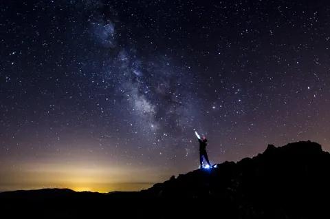
This circuit offers us a complete sensory experience, designed to connect body, mind and nature. Through a series of activities, you can view the night sky in one of the cleanest places in the country, with a variety of experiences that combine from virtual reality to music, to make you discover the stars. In addition, you can immerse yourself in your gastronomy with bets that combine it with poetry or with flavors that want to transport you to the cosmos.

This circuit fuses outdoor activities, culture and well-being, offering an integral way to enjoy nature and local life, all in harmony with the environment.

Latitud
38.2804
Longitud
-2.6501
Distrito
Municipio
Ubicación en el mapa
POINT (-2.6501 38.2804)
imagen
Image
mapas-segura-2-png
Imagen principal
Activado

Seniors

icon-intereses-senior

Friends

icon-intereses-amigos

Nature

icon-intereses-naturaleza

Solo travel

icon-intereses-viajar-solo

Gastronomy

icon-intereses-gastronomia

For couples

icon-intereses-en-pareja

Family

icon-intereses-familia

Culture

icon-intereses-cultura

Municipality

icon-intereses-municipio

Eco-friendly

icon-intereses-eco-friendly
CIRCUITO 4. DISFRUTA CON LOS 5 SENTIDOS EN LA SIERRA DE SEGURA
All year round
Desactivado

A perfect combination: the virtual meets the real with Aventura Hernán Pelea

Submitted by brandcode_deweloper on
Id
13470103
Descripción
Descripción larga
Aventura Hernán Pelea offers an experience to know the stars that will not leave you indifferent, combining virtual reality with one of the heavens with less light pollution of the area. This innovative experience begins at the site of Aventura Hernán Pelea where you will learn various curiosities of the sky, and through a spectacle of virtual reality you can be a star and first know the life of this astro, from what is necessary for its creation as the journey it makes through the universe. In addition, different constellations can be seen in the sky of Santiago Pontones at the time of your visit, so that you can better identify them abroad. Then after a small walk they will move to the outskirts of Pontones, where the light of the village is barely detected and the night sky will wrap them in their darkness. With the help of the activity specialist, participants will be able to identify the constellations that are seen at that time, and at all times will be shown the combinations of stars that cannot recognize Persons with disabilities have prior consultation with the company. This activity is petfriendly.
Telecomunicaciones
Teléfono
690 386 271
Ubicación
Latitud
38.119002
Longitud
-2.671696
Dirección
Av. Sierra de Segura, 17. Pontones
Ubicación en el mapa
POINT (-2.671696 38.119002)
Imágenes
imagen
Image
_mg_8434-jpg
Imagen principal
Activado
Horario de apertura
All year round
Precio
30.00€
Loading map
Preparing points of interest and routes...
Duración
3 h
Que incluye
Telescope.
A tener en cuenta
Clothes and comfortable footwear.
Enlace reserva
https://www.aventurahernanpelea.com/actividades

Flavors of the universe and night sky observation

Submitted by brandcode_deweloper on
Id
13404385
Descripción
Descripción larga
The Hospedería de Montaña Morciguillinas invites participants to enjoy a unique experience where tradition and cosmos merge into an unforgettable experience. "Sabores del Cosmos" is a proposal that combines the gastronomic wealth of the Segura Region with the magic of the observation of the night sky. * The minimum age for this activity is 10 years. The night will begin with a special menu, in which each dish is inspired by the universe, evoking constellations, planets and celestial phenomena. Using traditional ingredients and recipes from the region, dinner becomes a sensory journey that connects history and local culture with the immensity of the firmament. After dinner, participants will be able to move outside the hostel to enjoy a guided session of astrotourism. Under one of the cleanest skies of the saw, you will discover the constellations, learn about the mythology of the stars and watch with telescope the planets and other celestial bodies. An experience where the tradition of the saw and the universe are hand-held, perfect for those who seek a unique connection to gastronomy and the starry sky.
Telecomunicaciones
Teléfono
648 183 026
Ubicación
Latitud
38.256151
Longitud
-2.744331
Dirección
Carretera de Beas, Km. 23,5. Cortijos Nuevos
Distrito
Ubicación en el mapa
POINT (-2.744331 38.256151)
Imágenes
imagen
Image
_mg_6643-mejorado-nr-editar-jpg
Imagen principal
Activado
Horario de apertura
All year round
Precio
65.00€
Idiomas
Loading map
Preparing points of interest and routes...
Duración
Minimum stay: 1 night
Que incluye
Night sky observation.
A tener en cuenta
Self-vehicle.
Enlace reserva
https://www.morciguillinas.com/
Aforo
A minimum of 4 persons and a maximum of 15 persons are established to carry out the activity.

Savor the 'Eat the Moon' gastronomic menu at Lusco Restaurant

Submitted by brandcode_deweloper on
Id
13481168
Descripción
Descripción larga
The Lusco Restaurant, located in Cazorla, in an emblematic place known as the Balcony of Zabaleta, from which you can see the stars of the sky on clear days, offers a gastronomic experience to travel to the flavors of the moon. This menu has been designed to transport the diners to a lunar landscape full of mystery and depth, where the smoked and terrous flavors evoke the texture and the arid and desolate environment of the lunar surface. Getting surprised with a mixture of shadows and lights, roughness and softness, the known and the mysterious. Each dish is designed to capture the essence of the moon through ingredients that represent its raw beauty and its imposing atmosphere, mixing culinary creativity with the symbolism of outer space, and offering a gastronomic experience that not only feeds the body, but also imagination. All of this is accompanied by the observation of the moon in its various stages, thanks to the telescope that the Lusco Restaurant has at the disposal of its customers. Reservations are made on the phone 682842256.
Telecomunicaciones
Teléfono
682 842 256
Ubicación
Latitud
37.910109
Longitud
-3.001740
Dirección
C/ de La Nubla, 33
Municipio
Ubicación en el mapa
POINT (-3.00174 37.910109)
Imágenes
imagen
Image
_mg_5033-jpg
Imagen principal
Activado
Precio
52.00€
Idiomas
Loading map
Preparing points of interest and routes...
Duración
All year round
Que incluye
Cocktail.
A tener en cuenta
Food allergies and intolerances should be reported at the time of booking.
Enlace reserva
www.facebook.com/luscotaberna
Aforo
A minimum of 2 persons and a maximum of 10 persons are established to develop the activity. For groups over 10 see availability.

Stay among the stars at Hotel Al-Ándalus

Submitted by brandcode_deweloper on
Id
13477059
Descripción
Descripción larga
The Al-Ándalus Hotel is located in Peal de Becerro, a family and welcoming accommodation, a place to watch the sky and its stars. Discover the magic of the night sky in a unique environment. An unforgettable experience under the stars of the Sierra de Cazorla. This accommodation wants you to feel surrounded by stars, and therefore offers a stay in its tematised plant with the universe, where you will feel surrounded by constellations. The decoration of all the rooms is designed so that you can identify stars and planets. The stay is complemented by an astroturistic experience of approximately two hours. You can enjoy a quiet evening on your terrace accompanied by an aperitif of products from the area, while your expert will show you the combinations of stars that are seen in the time of the year in which you travel. They will also have at their disposal different information on constellations and stars. (*) Breakfast is not included. For groups of more than 6 people, see if the hotel offers breakfast. The meeting point for astroturistic activity is the lounge of the Al-Ándalus Hotel.
Telecomunicaciones
Teléfono
953 716 480 / 647 459 623
Ubicación
Latitud
37.914365
Longitud
-3.121854
Dirección
Av. Juan Carlos I, 15
Municipio
Ubicación en el mapa
POINT (-3.121854 37.914365)
Imágenes
imagen
Image
_mg_8017-jpg
Imagen principal
Activado
Horario de apertura
All year round
Precio
160.00€
Idiomas
Loading map
Preparing points of interest and routes...
Duración
Minimum stay: 2 nights. 2 h (astroturistic activity)
Tipo de experiencia
Que incluye
Hot drinks during activity.
A tener en cuenta
Comfortable and warm clothes. It is recommended to light with red light to avoid dazzling.
Enlace reserva
www.hotelsierracazorla.com; www.hotelal-andalus.com

Valdepeñas de Jaén

Submitted by brandcode_deweloper on
Id
785241
Perfil de redes sociales
Facebook
https://www.facebook.com/Aytovaldepjaen/
Twitter
https://twitter.com/aytovaldepjaen
Descripción
Breve descripción

Valdepeñas de Jaén is a municipality in the province of Jaén, located in the Sierra Sur region, south-west of the province.

The forest area of its municipal area is important, as it is located between the mountains of the Pandera, to the north, and from Alta Coloma to the southeast. Giant Simas, complaints and centenary oaks with peaks that reach 2000 m., define this territory. This particular environment makes this territory ideal for major hunting.

Thanks to its privileged geographical location, Valdepeñas de Jaén has natural areas of great beauty, with abundant water, many fountains and streams, such as the "Las Chorreras" and "El canyon de Pitillos."

Valdepeñas de Jaén is an agricultural municipality, dedicated mainly to the cultivation of the olive tree; livestock, with a significant number of dairy goats, and with the oil industry, as the only representation of the industrial sector.

From the point of view of the architectural and cultural heritage, they stand out: the church of Santiago Apostle, from the 16th century; the Mill and Museum of Santa Ana and the hermitage of the Holy Christ of Chircales.

Telecomunicaciones
Teléfono
953 310 111
Sitio web
www.sierrasurjaen.com
Fax
953 310 873
Correo electrónico
informacion@sierrasurjaen.com
Ubicación
Nombre
Valdepeñas de Jaén
Latitud
37.589990
Longitud
-3.815320
Distrito
Ubicación en el mapa
POINT (-3.81532 37.58999)
Imágenes
imagen
Image
026d37c8-f20e-4826-c560-fc4bd77cf68d?t=1689185839921
Imagen principal
Desactivado
imagen
Image
3915a8f7-9fa8-0fa7-ed74-33482ff4ea91?t=1689185840042
Imagen principal
Desactivado
imagen
Image
bf7bbb7c-a151-ac2a-8f75-8e8664552c21?t=1689185840462
Imagen principal
Desactivado
imagen
Image
98453ab0-439f-cba6-73c5-54b3a5b25a7c?t=1689185840881
Imagen principal
Desactivado
imagen
Image
0bccdf26-5a8b-ef52-9de2-440899afc7de?t=1595248348518
Imagen principal
Desactivado
imagen
Image
15f6355e-9e6c-3e9e-6918-eac63f4aa7f1?t=1609851228739
Imagen principal
Desactivado
imagen
Image
7cd536a0-35a3-14ef-e466-e2a09999c223?t=1609851228907
Imagen principal
Desactivado
imagen
Image
4b6a3aba-5a3a-9311-a524-6110d01145a2?t=1609851229068
Imagen principal
Desactivado
imagen
Image
afccba20-2c98-3860-39e8-8b8d90520758?t=1609851229232
Imagen principal
Desactivado
imagen
Image
883f69b0-3a2a-6539-e34e-36bb2a558298?t=1609851229437
Imagen principal
Desactivado
imagen
Image
140fa0cb-2c88-1a1e-4de2-d5edcf44c392?t=1609851229713
Imagen principal
Desactivado
imagen
Image
369762fb-6339-eab1-5f10-e099e16da4f4?t=1609851229863
Imagen principal
Desactivado
imagen
Image
e44f53d6-8cba-c851-c3c1-18b8a91385df?t=1609851230036
Imagen principal
Desactivado
imagen
Image
9bfa7b28-47f3-3615-5f27-1fa546ff704c?t=1609851230215
Imagen principal
Desactivado
Información adicional
Imágenes cabecera
imagen
Image
Valdepeñas
Imagen principal
Desactivado
Datos de interés

Tourist area: Sierra Sur and Campiña de Jaén
Distance to the capital (km): 34
Altitude over sea level (m): 923
Extension (km ²): 184
Number of inhabitants: 4,573
Gentilicon: Valdepeñeros
Postal code: 23150

Videos
Video file
Cultura

Valdepeñas de Jaén, founded by Carlos I, shares with Mancha Real and Los Villares, being one of the paradigms of the Renaissance urbanism, inspired by the theories of the trattadist Vitrubio.

Its urban morphology had to adapt a reticular route to the irregular orography of the hill on which this municipality is based. The city centre was located in the most flat part with a large trapezoidal square where the most emblematic buildings are located.

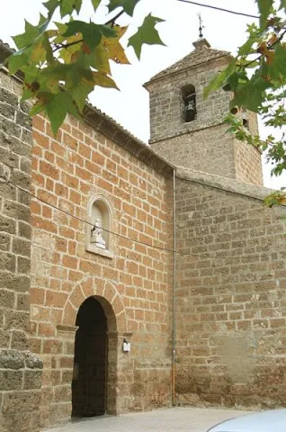
  • Parish Church of James the Apostle (s. XVI-XVII). Located on one of the corners of the square, it stands out both by height and volumetric, following the rules of Vitrubio that the most representative building must dominate the urban whole. Its cover, located not at the foot of the temple, but laterally to the square, opens with a simple half-point arch on which goes a second body with veneer intended to host the image of the saint holder. Built in the 16th century, in a Renaissance style, it is evident in the classicism and simplicity of its cover, in the proportionality of the tower and in the clarity and internal spatial amplitude.
  • Sanctuary and Hermitage of the Christ of Chircales. The origin of this sanctuary goes back to the Middle Ages. Located in the Chircal area about 20 km. of the city centre. On the first Sunday of May there is a pilgrimage to this sanctuary.
  • Mill Museum Alto de Santa Ana. It is a hydraulic flour mill of medieval origin. Restored in 2001, and in operation, it houses an ethnographic museum, of popular traditions and customs.
  • Santa Ana Bridge. Of possible medieval origin, also called the Dehesa or the Hundidero. Built in stone toba armchairs of the town, it has a single arch, under which they cross the waters of the river Ranera, tributary of the Víboras.

Other monuments of interest are: the episcopal residence, reformed in the 17th century under the inspection of Eufrassio López de Rojas and converted into episcopal headquarters when the Augustino bishop Fray Diego Melo of Portugal took refuge until his death in Valdepeñas; the Hermitage of Our Lady of the Angustias of the Parrizoso (on the banks of the Quebrajano reservoir) and the Hermitage of San SebastiánIn the old Egido, it has an attached cemetery.

Naturaleza

Valdepeñas de Jaén is a municipality with large forest mass when placed inside the subbetic saws. It is the highest point in the South Sierra to the north with the Pandera saw, with 1872 m., and to the south with the Alta Coloma saw.

The city centre is located 920 m. of altitude, located in a valley and surrounded by huge mountains. The natural environment with little exploitation by man must be highlighted. An environment full of walnuts, pastures, chaps and centenary complaints. His great saws, the Pandera and Sierra Vestinkers, mountains that are covered in snow during the winter.

Among the trees, the Coal Complaints, a millennial tree that has been declared a natural monument.

In this landscape of high mountains and abrupt areas lives a great diversity of wild animals who freely camp through the saws. An ideal place for the cynegetic species, especially for major hunting: deer, wowls, boars, muflons... among others.

A place where water is a true treasure of these lands that offer us countless fountains, waterfalls, reservoirs, rivers and streams which are contonated by these saws giving rise to places of a unique beauty such as: Paraje de las Chorras, Pitillos, declared Natural Monument and which conserves a forest of unique tiles in the region and of the few existing in Andalusia, Navalayegua's lookout, Salto del Hoyo, Chircales, el Castellón, el Vadillo or el Charco de Utrera, a large waterfall of 25 m, or the swamp of the Quebrajano and its imposing cannons.

The areas of the valley, populated by olive trees is the primary crop, next to the livestock and small game cynetic species, also has a goats' cabin Very important dairy.
We can say that the term of Valdepeñas we offers privileged places to contemplate nature in its greatest splendor and let him delight us and seduce us.

Fiestas y Eventos

Valdepeñas is a town of deep-rooted customs and traditions that make it unique. Where festivities are held that do not lose traditions like La Candelaria, In which the fire remains the protagonist, or the carnivals that fill the streets of the town with color and joy. There are also these parties:Holy Week, with dramatic representations of scenes of the Passion of Christ full of religiosity and that awaken the emotion among the attendees.

  • Romeria del Cristo de Chircales, which takes place on the first Sunday of May. The joyful and colorful Romeria in honor of the Most Holy Christ of Chircales, where the unique environment in which it is celebrated and the devotion he feels for his saint makes it a day expected by the Valdepeños and the visitors.
  • Realenga parties, are held in mid-August and attend them is like making a trip to the 16th century, enjoying the Renaissance gastronomy of those years, walking through a medieval market, listening to music, attending theatrical performances, animal samples, shooting with bow... Everything in the dress of the time creates a fantastic atmosphere.
  • September Big Fair. To fire the summer, the Great Fair takes place, where music and fun are guaranteed. Party that revolves around the Christ of Chircales, For these days it is carried from its hermitage to the church of the people.
  • The agribusiness character of the massif of the South Sierra and Pandera in particular, it provides an exceptional framework for the development of activities related to nature and active tourism, such as free flight, hiking, cycling or mountain bike (It is not obvious that Pandera itself is the end of a remarkable mountain stage of the Ciclisto Tour to Spain) or astrotourism.
  • The old military base of The Pandera is the highest point of the Starlight Reserve No. Sierra Sur de Jaén and an emblematic place for the observation of the firmament. At its top there is a great explanade where in the past there have been important remains of astronomy fans that brought together hundreds of people. Another very interesting point is the Cortijo del Moralejo.
  • Jaén Valdepeñas Interpretation Center. It is located in San Isidro S.C.A. Jaén Road, km. 2. and dedicated to the history of olive and olive oil. It belongs to the Red de Almazaras oleoturísticas de la Sierra Sur.
Gastronomía

The gastronomy in the town is very linked to the livestock. The local receptarium gives hands to the surrounding mountains to incorporate into the table Triguero asparagus and cardo mushrooms and also aromatic herbs used as additives in many of the dishes.

Of the most typical dishes, we highlight:

  • "Chop to the chard.", it is cooked and well watered with a salsa of almonds, tomatoes, pepper... all very heavy with the bias.
  • "Carnerete."A chickenpox with lamb meat.
  • "Peanuts"
  • Migas with potatoes.

Between the typical sweets: "Ochíos" "nochebuenos as" "Sin salas," rosquetas, "roscos de vino" and "bollas de higo."

Typical drinks as the "resol" and "old milk", typical Christmas drink that mixes: milk, spirit, coffee, cinnamon and lemon crusts.

Historia

The oldest remains documented in the term Valdepeñas go back to the Bronze ageand are located in the area called "Castellón."

During Roman times a proliferation of small houses linked to the peasantry, as the remains in the Ventilla, Navalenga, El Torcal, La Solana, Pitillos and others testify.

In the Islamic period the castle of Susana, mentioned in the Arab and Christian chronicles, is raised with a rather busy existence, being conquered on several occasions by both sides.

What today is Valdepeñas de Jaén was founded on 1539 by the Emperor Carlos V, as a new population, within the project of colonization and repopulation of the saws of Jaén.

In the new towns is implanted a urbanism called colonial, in the form of a damer, in which the streets in reticle will give to the main square, the place in which are the most representative buildings: church, town hall, posite... A kind of urbanism that has been maintained to this day.

By 1550, the population was fully constituted, but as a place under the jurisdiction of Jaén. It will be in 1579 and thanks to the donation of 1,370,000 Maravedis who contributed their 170 neighbors, King Philip II gives Valdepeñas the title of the village, disconnecting from the city of Jaén.

Valdepeñas took an active part in the War of Independence, possibly encouraged by the Bishop of Jaén, who resided in the palace that the bishopric had in the city.

In 1917 obtained the title City, granted by S.M. King D. Alfonso XIII.

Loading map
Preparing points of interest and routes...
Imagen principal
imagen
Image
bd00fe5b-0aa1-5c0f-2b41-4bb61c4eb0cc?t=1689185839799
Imagen principal
Activado

Santa Elena

Submitted by brandcode_deweloper on
Id
750455
Perfil de redes sociales
Facebook
https://www.facebook.com/AyuntSantaElena/
Twitter
https://twitter.com/santaelenajaen
Youtube
https://www.youtube.com/user/santaelenajaen
Descripción
Breve descripción

Nice town, located in the northernmost area of the Sierra Morena regionnext to the provincial border with Ciudad Real.

The northern part of its term is found within the Natural Park of Despeñapores and its geographical position makes it the greatest point of passage between Andalusia and the plateau so it receives the nickname "Puerta de Andalucía. "

It is one of the few municipalities with little agricultural interest, only 1% of its term is cultivated land.

Its economy is based mainly on the exploitation of the mountain, among which the forest, cynegetic, mushroom collection and livestock, usually cattle. The passage of the motorway of Andalusia has developed a relevant hotel offer.

It has two nests: Miranda del Rey and Venta Nueva.

From its historical heritage we highlight the St. Helena Parish Church, Iberian Shrine of the Collado de los Jardines, Urban Helmets and Rupestrian Paints in St. Helena.

Telecomunicaciones
Teléfono
953 664 010
Sitio web
www.santaelena.es
Fax
953 664 253
Correo electrónico
santaelenajaen@gmail.com
Ubicación
Nombre
Santa Elena
Latitud
38.340230
Longitud
-3.539800
Distrito
Municipio
Ubicación en el mapa
POINT (-3.5398 38.34023)
Imágenes
imagen
Image
56f3a98d-b73d-3f55-8527-4d32fc56ae8f?t=1621425534983
Imagen principal
Desactivado
imagen
Image
e0fb7c79-3e7f-346a-cc16-3c8006bb9462?t=1610986998582
Imagen principal
Desactivado
imagen
Image
3429e098-1c49-2cdf-4ef5-179be64fce14?t=1621425535119
Imagen principal
Desactivado
imagen
Image
4e91cd6e-bea0-d427-df82-939c7ce7f23c?t=1621425535162
Imagen principal
Desactivado
imagen
Image
10c50cba-ee4b-ebcf-0e3e-0d11e8e97728?t=1621425535219
Imagen principal
Desactivado
imagen
Image
0c44f832-9d15-336d-b8e7-72044fea6e76?t=1610986998629
Imagen principal
Desactivado
imagen
Image
b5682c3b-4bf3-f730-fe45-52d0391f170c?t=1621425535421
Imagen principal
Desactivado
imagen
Image
78ede978-44df-d8c2-c363-f10c79bea024?t=1621425535584
Imagen principal
Desactivado
Información adicional
Curiosidades

OFICINAS DE INFORMACIÓN Centro de Visitantes LLANO DE LAS AMÉRICAS

  • Autovía A4, salida 257. Ctra. Miranda del Rey, Km. 2   
  • (Abierto de jueves a domingo)
  • Tfno.: 610 282 531
  • Email: puertanatura@hotmail.com
Imágenes cabecera
imagen
Image
Santa Elena
Imagen principal
Desactivado
Datos de interés

Tourist area: Sierra Morena / Despeñacolos

Distance to the capital (km): 78

Altitude over sea level (m): 742

Extension (Km2): 144

Number of inhabitants: 1,003

Gentilicon: Santaeleneros

Postal code: 23213

Videos
Video file
Cultura
  • St. Helena Parish Church: It was erected in 1793 on an ancient medieval hermitage, which had been raised to commemorate the Christian victory in the battle of the Navas de Tolosa, which had these sites on stage and to guard the Cross to which the miracle was attributed. Built of redesigned and painted masonry, with a simple facade, of small dimensions. A staircase stands out the access door, composed of a half-point arch on imposts, flanked by Tuscan pillars that give way to an inlet finished with triangular fronton and two bones, one on each side. On the top of the first body, the pyramidal structure is raised to three levels, with pinacles at the ends and half-point holes for bells. Inside it is a single drawer ship, covered with a half-canyon vault and double lunetes on the sides. The presbyterium is opened with a spinal arch, covered with an arista vault and illuminated with two large bone-shaped windows. The header is presided over by the image of its patron saint, St. Helena, between dogrous columns that support an injunction and a curved fronton. It was remodeled in 2001.
  • Iberian Shrine of the Collado de los Jardines: It is located in the heart of Sierra Morena Oriental, on the most important traditional road of communication between Alta Andalucía and the Plateau. For the Iberian shrines they chose places, usually caves, located next to springs and forests, where it was thought that the divinity lived and where the faithful went to worship, pray and deliver offerings to their divinities. These offerings were what we know as "exvotes," small statues, between eight and twenty cm, made of bronze, stone or mud. In Iberian Shrine of the Collado de los Jardines There have been many exvotes, most of them bronze, representing men and women offering, priests, warriors and objects. It is part of the whole town that was excavated on the hill adjacent to the castle, where a wall, a sacred enclosure and a cast of metal exvotes have appeared. We meet before one of the three great Iberian shrines of the peninsula.
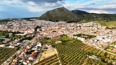
  • St. Helena's Urban Helmets:Given its geographical location, a forced passage between the plateau and Andalusia, has experienced many historical events. The Battle of the Navas de Tolosa in 1212 in which King Alfonso VIII of Castile defeated the Almohades. To commemorate this battle, a hermitage was erected in honor of the Empress St. Helena, who would later name this place and the new population, which King Charles III founded in 1767. In the colonizing urbanism of Sierra Morena, the most important element is the large rectangular square, from which they leave streets on each side and where are the important buildings, such as the Church, the City Hall and the posite of Diezmos and Labradores. The rest of the town is organized from the Plaza. The streets are dominated by axial perspectives, houses of the same height and proportions, reticular fabric and geometric structure. It only deviates from the neoclassical model on its perimeter, to adapt to the road. It has been declared Good for Cultural Interest.
  • Rupestrian Paints: The province of Jaén has more than forty points with rock paintings, declared World Heritage Sitewithin the whole Mediterranean arc. Some of them are found in St. Helena with exceptional testimonies of schematic and seminaturalist paintings, located in coats of the area, including those of the Cave of the Cows of the Retamoso in the area of the bodies, Cave of the Holy, the Cave of the Schools and some more.
  • Mining Heritage. The landscape of ancient mines and Mediterranean mountains of the former Minero District extends to eight municipalities: Linares, La Carolina, Bailén, Baños de la Encina, Vilches, Guarroman, Santa Elena and Carboneros. This mining activity has left in these municipalities an exceptional concentration of remains, unique vestiges in the world and representative of the industrial revolution in the 19th century.
Naturaleza

St. Helena is located in the northernmost sector of the northern region, next to the border with the province of Ciudad Real.

It is of the few municipalities of the province without agricultural vocation, only 1% of the total area. So its economy is based on development of the mountainincluding forest, cicnetic, mushroom collection and livestock (cattle).

The passage of the highway of Andalusia through the municipality has developed in the town a certain hotel offer of importance.

By its term the rivers run Caraway and Bell.The northern part of the municipality of St. Helena belongs to the Natural Park of Despeñacolos, of great landscape, faunistic and botanical interest.

The Park includes, among others:

  • Place of the bodies, declared a Natural Monument of Andalusia. A place where a set of huge rock columns that resemble the tubes of the organ of a cathedral. Increases the beauty of this place the chromatic contrast of the grey of the coas with the intense yellow and orange of the different species of lichens that survive in them. On these rocks, oaks, alcornoques and shrubs form a Mediterranean forest in which they inhabit ginets, chickpeas and numerous rapacious birds.
  • Embryo de los Organos: It is an affront place that was inhabited from very old, as shown by the rock paintings found. From here we can discover the pineapples of repopulation (carrascos, black, pineapples), sodas of alcornoques, complaints, oaks and madroños.
  • The Empedraillo: These are the interesting remains of a small section of the Roman road that unites Catulo (Linares) and the Galena mines of El Centenillo with Toledo.
  • Quejigal del Collado de los Jardines: Also located in the Natural Park of Despeñacolos, its biodiversity stands out. In the plant species we find complaints, alcornoques, maples and other species typical of the Mediterranean forest. With regard to the faunistic species that inhabit this place quote the wolf, lince, the otter, imperial eagle, royal eagle and azor.

If anything characterizes Despeñacolos are their unique geological formations. The Despeñapoerno de Despeñaperes, with 4 km of extension is the product of the erosion of the stream of the same name on a natural failure of the Iberian Macizo and the main means of communication between Castilla La Mancha and the lower lands of the Guadalquivir valley.

Fiestas y Eventos
  • Sunday of Resurrection: From the Central European settlers who came in the 18th century, only the tradition of painting cooked eggs, which are eaten in the area of La Aliseda, is left. Before you have to meet the rite of making them roll by a earring of grass so they don't break. This has meant that, in St. Helena, the feast of this very well-known day is known as Rolaeggs.
  • Romeria de San Isidro: On May 15, the neighbors of St. Helena accompanied San Isidro, in gilded carrots for that party until the site of The Aliseda. In this place, of incomparable beauty, a mass is held in honor of the Holy and a whole day of field is spent.
  • Patron parties: In honor of their patron saint St. Helena, parties are held between 17 and 21 August. During all these days there are many and varied leisure and sports activities. On the 17th, with the traditional repeat of bells, the beginning of the parties is announced and the three rocket warnings indicate the beginning of the cobblestones in the streets of the town. In the afternoon, taurino show. We arrived at 18 August, big day. In the morning Mass in honor of the Holy and invitation to all attendees in one of the houses. At night, the most important event of the whole fair that is the procession of the Patronthat accompanied by a music band runs through the streets of the village. On the 20th and 21st days, the morning and evening cobwebs and taurino festival return. The fair ends with a powerful haze on the 21st of the morning.
Gastronomía

St. Helena for its location in Sierra Morena is a very suitable place to take mountain meat, either from major game (deer, boar or gamo) or from small game (perdiz, rabbit or hare).

  • Andrajos: Made with a mass of flour (andrajo) that is cooked in a broth of hare meat with a saffrito of peppers and tomatoes flavoured with mint.
  • Pipirrana: Salad made from roasted peppers, olives, cooked eggs, tuna and olive oil.
  • Sage in salsa: It is made with deer meat, onion, tomato, flour, water, thyme, rosemary, peppers, olive oil and almonds.
  • Niselos al ajillo: Niscalos, olive oil, ham, garlic, parsley white wine and salt.
  • Tortilla Alfonso XIII: Made of eggs, ham, lamb kidneys, mushrooms, salt, fried tomato and olive oil.

Warehouse:

  • Sweet Gachas: With toast, hot milk or boiler honey, flour, sugar, cinnamon powder olive oil. They are preparing for the feast of All Saints.
  • Pestiños: They are made with olive oil, wine, dry spirits, sugar, cinnamon and flour.
  • Lis flower: Eggs, flour, milk, sugar and olive oil, salt and cinnamon or melted honey for irrigation.
  • Risol: A drink made with sweet anis, coffee, mejana and water.
Historia

The area has been occupied from prehistoric periodAs shown by the rock paintings located in the area's coats, with more than five thousand years old and declared a World Heritage Site in 1998.

In time of the Iberiansin the term of St. Helena was one of the most important centres of worship: Shrine of the Collado de los Jardineswhere many Iberian exvotes and the remains of what could have been a village have been located, not only in Iberian times but also in Roman and medieval times. The sanctuary also known as Cave of the Dolls has been used by the Romans for religious worship.

In the Age of Mediathe most important event is the Battle of the Navas de Tolosain 1212. The town is very close to it, in the vicinity is the Museum of the Battle de las Navas de Tolosa. The Almohade army was defeated and King Alfonso VIII of Castilla, ordered to build in the place a hermitage to guard the Cross to which they attributed the miracle of victory and a window-castle, to commemorate the triumph over the Almohades and that currently It is part of the Route of the Castles and the Battle.

In this same place in the 18th century, one of the New populations of Sierra Morena, project driven by the King Charles III. One of these populations is St. Helena. With the settlers, farmers from Centroeuropa (French, German and Flemish), efforts were made to establish a population and generate wealth in the depopulated areas of Sierra Morena while ensuring the passage of Despeñacolos.

In 1793, the population was in a ruinous state and it was King Charles IV who ordered it to demolish and build a new colonial type..

Otra información

It has recently been built in the municipal term, the Museum of the Battle of the Navas de Tolosa. The museum is one of the most interesting points on the route of the Castles and the Battle and is the starting point for the seventeen municipalities that make up this tourist product. Very close is the Iberian Sanctuary of La Cueva de los Muñecos and The "Llano de las Américas" Interpretation Center.

Loading map
Preparing points of interest and routes...
Imagen principal
imagen
Image
Santa Elena
Imagen principal
Activado

Martos

Submitted by brandcode_deweloper on
Id
747103
Perfil de redes sociales
Facebook
https://es-es.facebook.com/AytoMartos/
Twitter
https://twitter.com/aytomartos?lang=es
Descripción
Breve descripción

Martos is located to the north of the Sierra Sur region, being the largest municipality and population of this region. There are other populations that are part of the municipality, such as Monte Lope Álvarez, Las Casillas, La Carrasca and Villarbajo.

Its municipal term is essentially olive tree, in its landscape of countryside the olive tree is the protagonist, extending to the horizon. Because of the great quantity and quality of olive oil produced in the city, it is called the "Olivar Cot." Around it has developed an important olive industry that together with the automotive-related factories and their auxiliary industries are the engine of employment and wealth for the municipality and its region.

It has an important historical heritage, among other monuments we quote: the Old Cárcel and Cabildo, Castles of the Peña and the Villa, Puente Romano, Urban Wall, Castle of the Endowment, Pilar of the New Source; with respect to the religious architecture: Royal Parish Church of Santa Marta, Sanctuary of Mary Most Holy of the Villa, Monastery of the Most Holy Trinity, Ermita of San Bartolomé, parish of San Amador and Santa Ana, etc.

This is the cultural wealth and beauty of its historical ensemble, which since 2003 has had the status of Good Cultural Interest.

Telecomunicaciones
Teléfono
953 210 000
Sitio web
https://turismo.martos.es/
Fax
953 553 309
Correo electrónico
turismoycomercio@martos.es
Ubicación
Nombre
Martos
Latitud
37.722260
Longitud
-3.970320
Distrito
Municipio
Ubicación en el mapa
POINT (-3.97032 37.72226)
Imágenes
imagen
Image
7470103a-fede-6cf5-54b2-edb356074e03?t=1603121821734
Imagen principal
Desactivado
Información adicional
Imágenes cabecera
imagen
Image
Martos
Imagen principal
Desactivado
Datos de interés

Tourist area: Sierra Sur and Jaén
Distance to the capital (km): 24
Altitude over sea level (m): 753
Extension (Km2): 259
Number of inhabitants: 24520
Gentillo: Marteños
Postal code: 23600

Videos
Video file
Cultura

Old Jail and Cabildo. Building built in the 16th century, considered a masterpiece of Spanish mannerism. It is currently the City Hall of the city.

In his spectacular main façade We can highlight the huge, dogrous columns with piled armchairs, the sculptures of Justice and Prudence, (both were beheaded), the great doors and their bronze aldabones and a great shield of the Austrians crowning the whole. It was declared a National Historical Monument in 1931. Below the City Hall, the Convent of the Trinitarian, work of the late 16th century, and on the same street, but in the opposite sense the Hospital of San Juan de Dios, of baroque bill of the 18th century. All this high part of the intramurous historical centre is of great quaint and from it you can enjoy beautiful panoramic.

  • Santa Marta Parish Church. It rose in the 13th century, in the years following the taking of the city by Fernando III the Holy, on an Arab mosque. It is consecrated to the patron of the city and has the title of Real since 1617. Gothic Mudejar style. The Baptisterium, the Major Chapel, was later built and embellished with the slate-cross vaults and a large cover of the isabelin Gothic. In the 16th century the interior is expanded and remodeled, raising large columns of Tuscan order and building the original Bell Tower with three bodies.
  • Pilar of the New Source. Ornamental source located in the Manuel Carrasco Municipal Park. It was built in the 16th century, reflecting the most new and outstanding aspects of the Manier architecture. The set stands out for its monumental beauty and austerity. It consists of an abrevadero pillar and a smaller one in which two lions make water pipes. In the center is the Austrian shield, and on the sides is the shield of Martos and that of Governor Aboz Enríquez.
  • The hermitage of San Bartolomé. Located in the skirts of the Peña de Martos, dates from the 14th century and houses the venerated image of Mary Most Holy of the Victory, Queen and Lady of the Peña.
  • Roman Bridge of Martos. Important engineering work, built in the Roman era on the Salado stream in the vicinity of Martos to facilitate the passage between the two shores.
  • Sanctuary of Mary Most Holy of the Villa. Temple in which Mary Most Holy of the Villa, known as "La Labradora," is sold. It was built on dates near the delivery of Martos to the Kingdom of Castilla. In the 16th century the temple was remodeled and a bell tower was built. This sanctuary was burned and destroyed during the Spanish Civil War. The current was rebuilt in the 1940s of the last century, in a Neobaroque style. The Torre-Campanario dates from the 16th century, is separated from the main building and is the only original element of the ancient Sanctuary. It has a square floor with half-point arches.
  • The ruins of Castillo de la Peña which we know today are not those built by Muslims but correspond to the strength that the Calatravos built from 1340. The floor of the castle is trapezoidal adapted to the surface of the plateau on which it sits and its entrance, for security reasons, marked a zigzag drawing. The compound was divided into alcázar and a courtyard of weapons protected by a walled enclosure. The alcázar, where the tower of tribute is raised, takes advantage of a natural podium that lifts it about three meters above the courtyard of weapons, separated by a wide, also natural.

  • Castle of the Villa. It was an alcazaba or citadel surrounded by canvases of almenada wall, as well as passageways and towers, leaving the central space for the construction of administrative and religious buildings: church of Santa Catalina, headquarters of the governorate, cavalries, tahonas, lagores, aljibes, etc. According to evidence from an inspection carried out by the Visitors of the Order of Calatrava in the 16th century in order to repair the deficiencies of the Lower Fortress.

Naturaleza

The orography of the municipal term of Martos is characterized by being quite accidental, with plenty of mountain grounds above all the southern part, instead the north-western part corresponds to soft reliefs and plain characteristic of the Guadalquivir depression, which extends in the west and north of Martos.

Among the greatest levels are the Sierra de la Caracola, with 1340 m., located in the south and to the north is located the Sierra de La Grana with 1254 m. and this is the extension of the Sierra de Jabalcuz, and we would like to mention the well-known Peña de Martos with its 1003 m. on whose slopes the city of Martos is located.

The hydrographic network is composed of a set of rivers and streams which are used for both human consumption and irrigation.

They are two rivers the main ones that pass through the municipality: Eliche Riverwhich is born by the saw of the Grana, and the river Víboras which is born in the term of Valdepeñas de Jaén. The channel of this river is used in the a reservoir of the same name, next to the pastry of Las Casillas.

The flora of the term is dominated by the olive, located in a large percentage of the land of the municipality. It also exists indigenous vegetation of the Mediterranean forest in the mountain areas, where we see species such as: the oak, coscoja, white jara, complaining and abundant number of aromatic plants such as lavender, rosemary or thyme.

In the banks of the river Víboras coexist riverside species as they can be: white, strawberry, elves, olms, zarzamoras and carrizos.

In the fauna exists a great diversity of species, from rapacious birds, both diurnal and nocturnal; aquatic birds, paseriforms, reptiles, amphibians and minor-game mammals.

For nature lovers, Martos offers an interesting natural offer to make different routes, climb to the top of the Peña, offers unparalleled views of the countryside landscape and the surrounding mountains.

Other very interesting routes are also the rise to the Sierra de la Grana, the Sierra de la Caracolera and the setting that forms the reservoir of the Víboras River and the Víboras Castle.

Fiestas y Eventos

Among the main festive celebrations of Martos are:

  • Romeria in honor of the Virgin of Victory. The last weekend of May is held. The festivities begin on Friday with the departure of the procession of the image from the hermitage of San Bartolomé to the Church of Santa Marta with the streets where it passes adorned with flags, reunions, retamas, altars and rosemary in typical suits. The next day the Virgin leaves the parish to go to the hermitage of the Virgin of Peña followed by carts, chariots and horsemen. On Sunday, the day of the rosemary, the virgin returns to her hermitage carried on a cart thrown by oxen and accompanied by gilded carrots with floral ornaments and various decorations. During the tour the atmosphere is fun and cheerful. They sing songs, they eat cheese, ham and rebujito. Once in the Peña, the solemn mass is celebrated and at the end of the rosemary they prepare to eat in the surroundings of the hermitage. This party is declared the Festival of Tourist Interest of Andalusia.
  • Fair and parties in honor of San Bartolomé. At the end of August, Martos is preparing for the largest celebration. Many and many different activities are organized during the days of pre-fair and fair, such as concerts, theatre, cultural and sports activities, horseback riding, pasacalles and taurinos (traditional the brandy torillo). The festivities begin with the official turn on of the cover and the fun is centralized in the fairgrounds, where various musical performances are offered.
  • Olive party. Typical celebration of Martos that symbolizes the official start of the olive collection campaign and pays tribute to the olives that work in the campaign. It takes place during several days of December with the celebration of many cultural activities related to the olive grove. The brooch of party end takes place on December 8, with the most outstanding events: reception of authorities at the City Hall, followed by a floral offering at the Monument to the Olives and the invitation to the attendees of a olive hole (bread, oil, cod and olives). And to put the final point to the party, the Martos' almazara teachers extract the first olive oil of the year.Declared holiday of Tourist Interest of Andalusia.
  • Holy Week. It is one of the most important popular and religious manifestations of Martos. The existence of co-fradies in the 16th century is recorded. Part of its Reciprocity in the narrow, tortuous and very considerate streets for which the hermandades run. All this linked to the incomparable frame offered by the millennial city of La Peña and the beauty of the images and thrones. It has been declared Tourist Interest Festival of Andalusia in 2002.
Gastronomía

In the gastronomy of Martos, extra virgin olive oil is a fundamental ingredient.

  • HoyoIt's bread and oil.

It retains two salads with origins of the Arabian-Andalusian cuisine: The orange chopper and the granate salad, where other vegetables are accompanied by orange or seasoned grenade grains.

  • Potage of beans and eggplants.

Meat dishes:

  • The rabbit with olives, which is prepared in the pastry of Las Casillas from which is found its replica in North Africa.

Dishes attached to the festive cycle:

  • Carnival filling, onions of Easter, the Sweet peas typical of the holiday of All Saints.

The of the Trinity mothers like the crotch or the buds, among many others.

Many traditional Martos dishes are shared with the rest of the Mexican cuisine Like, crumbs, gazpacho, pipirrana, white...

Historia

The origins of Martos they go back to Prehistory. Its strategic location, the existence of springs and the natural defense it offered were factors that caused the human settlement in the area.

There is evidence of different lytic materials belonging to the Paleolithic, however, the oldest documented statements are from the Neolithic. Remains of this period have been found in "El Molinillo," "Huertas Viejas" and "La Alberquilla." They are underground housing, funeral and defensive structures.

The city is known from very old, the Iberians named it Tucci and an important Iberian oppidum located in the upper part of the Peña is cited in the works of Ptolemy. There will be many settlements around Martos, such as Castlejo de Belda, La Atalaya, El Alamillo...

The Iberian city of Tucci, being occupied by the Romans, it became a colony that was named after Augusta Gemella Tuccitana. Many remains of this time are preserved such as mosaics, coins, ceramics, weapons, marble portraits..., the most important being the collection of Roman tombstones exposed on the façade of the Casa Consistorial de Martos.

From the visigode period, the paleocristian sarcophagus which is preserved in the Provincial Museum is the most important archaeological piece appeared in the town.

In the year 711 The Visigodic monarchy on the Iberian peninsula ends with the arrival of Muslims. Since the 9th century it was a very disputed border city. From this time are the castle of the Peña, the walls and torreons of the castle of the Villa. In 1225, Martos became part of the kingdom of Castilla, which King Fernando III will donate to the Order of Calatrava.

From the 13th century it acquired great splendor that will be increased with King Fernando the Catholic and the arrival of settlers from Castile and the Moorish of the Alpujarras.

The 16th century was a stage of economic, social expansion and of great transformation of the villa with the construction of new buildings, the remodeling of others and the expansion of the urban town.

During the 20th century, With the development of the olive grove, the arrival of the railway and the road there was a great population growth that decreased in the decades of the 50 and 60 of the last century caused by emigration.

The urban, social and demographic development of the city has now been increased by industrialization, being considered as one of the main industrial centres of Andalusia.

Loading map
Preparing points of interest and routes...
Imagen principal
imagen
Image
Martos
Imagen principal
Activado

Los Villares

Submitted by brandcode_deweloper on
Id
743218
Perfil de redes sociales
Facebook
https://www.facebook.com/aytolosvillares/
Twitter
https://twitter.com/losvillaresjaen
Instagram
https://www.instagram.com/losvillaresjaen/?hl=es
Descripción
Breve descripción

Municipality located north-east of Sierra Sur region, very close to Jaén capital. This circumstance, coupled with the abundance of water in this area and the soft weather of the summer, makes it an ideal place for the summer season to rest.

The town is located in a vaguada near the confluence of the Eliche and Frio rivers, that along with multiple streams go through its municipal term and supply the Quebrajano swamp, an interesting place from an environmental point of view. Its geographical location makes you enjoy great beauty.

The economy of the municipality is based mainly on the cultivation of the dry olive tree, Wicker craftsmanship is the second source of income. We should also mention the production of sausages, the craft of the spartum and other vegetables and, in recent years, the packaging of mineral water at the birth of the Cold River.

Among its historical-artistic heritage is the Church of St. John the Baptist of the 15th century, the Capital houses of the City Council, opened in 1775, and the Vizcount Palace.

Telecomunicaciones
Teléfono
953 320 005
Sitio web
www.losvillares.com/
Fax
953 321 160
Correo electrónico
ayuntamiento@losvillares.com
Ubicación
Nombre
Los Villares
Latitud
37.687710
Longitud
-3.818200
Distrito
Municipio
Ubicación en el mapa
POINT (-3.8182 37.68771)
Imágenes
imagen
Image
5ba651a8-a42f-cedd-f6cd-7cd6c637dbcd?t=1610977784486
Imagen principal
Desactivado
imagen
Image
cfe5e649-28c6-27b4-f3de-e8eba17b3476?t=1610977784617
Imagen principal
Desactivado
imagen
Image
8aabea48-819a-e5c7-65bf-7c59bc3301da?t=1610977784740
Imagen principal
Desactivado
imagen
Image
2b852f60-d67d-442b-9fc9-49ad0d68a9af?t=1610977784893
Imagen principal
Desactivado
Información adicional
Curiosidades

Ayuntamiento
Plaza de Fernando Feijoo, 1

https://turismolosvillares.es/

Imágenes cabecera
imagen
Image
Los Villares
Imagen principal
Desactivado
Datos de interés

Tourist area: Jaén and Sierra Sur
Distance to the capital (km): 13
Altitude over sea level (m): 521
Extension (km2): 89
Number of inhabitants: 4860
Gentillo: Villariegos
Postal code: 23160

Videos
Video file
Cultura

From its historical-artistic heritage, we highlight:

  • Parish Church of Saint John the Baptist. In the first half of the 16th century the original temple was built, very small, and in the 18th century it was necessary to expand and reform it, but again in the 19th century some remodeling was necessary. In the Spanish Civil War, the parish was seized and dismantled, losing the small but interesting movable heritage. In general terms it retains its primitive typical provision of mannerist architecture. It consists of a single ship with small furnaces on its walls, a short cruise covered with a half-orange dome, a side chapel and chorus at the foot of the temple. The main facade is very simple. Contains a reduced but select collection of goldsmiths.
  • Casa del Vizconde or Casa Grande, As the villariegos call it. It's the most remarkable building in town. A solarium house that follows the Spanish rural Renaissance models and the high Andalusia. The facades made in excellent shillery. On the main door the traditional signor balcony and crowning the façade the usual sun open in eight half-point arches, crowned by an elegant alley. The main courtyard organized by the building, the lordory staircase covered with a vault, and some wooden-carved meds and zapatas, are also preserved.
  • City Hall House. They are built in the 18th century. The architectural lines are very simple and severe, based on the guidelines given to it by the Royal Academy of Fine Arts of San Fernando. The building was opened in 1775 and has recently been rehabilitated by preserving its early 19th-century air.
Naturaleza

The whole term of Los Villares is framed in the context of what is known geographically as Subbetic Sierra.

Geomorphologically the territory is composed of a succession of crest and valleys of different magnitude, The urban core is located in a large depression, which is flanked by the Sierra de Jabalcuz to the north, the Sierra de la Pandera to the south, the Cerro del Wind to the west, and the Cimbras to the east.

The large number of rails and temporary streams that originate in the higher areas converge into two main rivers: Eliche River and the Cold River. Both are born in the term of Los Villares.

The two converge outside the municipal term, leaving Los Villares for the known area of Los Cañones, on the border with the municipal term of Jaén.

The vegetation has undergone a profound transformation throughout history: most of the territory is currently dedicated to the cultivation of the olive tree in a dry form. The original vegetation corresponded to oak trees, riverbank forests in the surroundings of rivers, bushes and mountain pastures in the highest and most rocky areas.

At present, although there are not many places where the original vegetation, some examples can be seen:

  • Encinars and costomals in the high areas of Jabalcuz.
  • Sea forest on the Eliche River and the Cold River.
  • Encinar and complain in the area of El Espinar and in the area of Puerto Viejo.

The fauna is mostly made up of animals of medium or small size. The large vertebrate fauna associated with forests and bushes is currently very little due to the agricultural transformation and persecution of many species. The great Iberian mammals: the bear, the wolf and the lince... disappeared. Other species of great natural value such as Royal eagle or the royal owl They still have some couples.

In addition to invertebrates, small fauna is particularly interesting. Instructive birds, for the ecological role they play. Birds like Look at him, the zorzal, the red-haired, the curled... They play a very important role in the control of insects that can become plagues of the olive tree.

  • Water birth in Riofro. It is a recreational area, fully equipped, where you can enjoy the typical coastal ecosystem, characterized by the abundance of water and the presence of numerous and varied species of plants and birds. It is reached by the road in the direction of Valdepeñas de Jaén, from which we turn left, after going about 5.5 Km., on a road that leads to this enclave.
  • Port of the Hoya.Where it is still possible to find a small grotto with stalactites and stalagmites just a few kilometers from the village. This part of the Sierra is a surprise for the lush vegetation on the other side of the Air Port.
  • The Cimbras and the lock.
  • The Jabalcuz summit (1,614 m.s.n.m.): From where the three morphological units that constitute the province of Jaén are seen. At the bottom in the North Sierra Morena; at our feet the Guadalquivir valley and the countryside; and the ground on which we step is the first formation of the Betic Sierras. The summit is easily accessible in the East (Carretera de Los Villares a Jaén) or in the West from Torredelcampo. These two accesses can be done by bike through a lane.
Fiestas y Eventos

In addition to the celebration of the Christmas parties, the Carnivals and the Holy Week in Los Villares, these parties are held:

  • Celebrations in honor of Our Lady of the Rosary, patron of Los Villares since 1781.They are held between 6 and 10 October. On the 6th there is a show of carrozas, prepared by the neighbors who parade through the main streets of the village. The most important day, "Fat Day," It's day 7. This day a procession with the patron walks the streets of the town centre. During these days, cultural activities, sports competitions, dance competitions and lively night greens take place.
  • Festivals of San Juan. The parties take place between June 23 and 26. Neighbors set the streets of the appropriate neighborhood that year. On the 23rd, the eve of San Juan, the traditional fire is organized around which the neighbors gather to drink, eat and have fun. The next day, on the 24th day of San Juan, the procession that runs through the streets of the verbena is held and in the end the image will be housed in one of the houses of the neighborhood.
  • The Sunday following the verbena is held traditional Romeria with the image of San Juan that will be taken to his hermitage in Cerro Viejo. The villariegos move to the hermitage of San Juan where they will spend a country day.
Gastronomía

Of the most typical dishes in the town, we will quote:

  • Atascaburra, is a saladilla of cooked potatoes, bacalus, tomato, onion, garlic, hard eggs and tuna.
  • Pipirrana villariega, crushed garlic, green peppers, mature and peeled tomato, half a glass of olive zome and salt.
  • Choto de Los Villares.

From the confectionery we quote: Sweet Goat Pates (made with cream and biscuit), Home Alfajor (sugar and almonds), Higo bread (mass of dried figs with almonds).

Historia

Before the foundation of Los Villares, as we know it today, there are signs that make us think that in this place the Iberian, Roman, Arab and other prehistoric civilizations passed through, given the remains found in the municipal term. Some of these remains, coins, jewels, pieces, utensils... are found in the Archaeological Museum of Jaén.

The Villars, as we now know it, was founded in the framework of the policy of repopulation of the border areas with the Kingdom of Granada by the Crown of Castile, in order to protect and defend the roads.

In 1508, Jaén Council, request to Queen Doña Juana, repopulation of several places in terms and saws within the jurisdiction.

By Real Cédula, the queen has everything necessary to establish these populations and at the same time refers to the need to protect these places and their properties so that they can be inhabited. As an area with water, they had gardens and bread mills.

The foundation was not immediate. The town began its journey in 1538, after the distribution of land and the route of the city. In Los Villares, as in the rest of repopulated cores, a hipodamic colonial urbanism inherited from the Roman baskets was introduced.

Your first inhabitants were farmers of the city of Jaen and also soldiers of the Emperor's guard.

By the mid-18th century, its population had increased and, in addition to the farms, it had achieved artisanal, livestock and commercial development. In the 19th century it has an important production of cereals, fruit, vine and olive, this being the most prominent, also livestock farming. Its industries are notable, it has several flour mills and oil plus two pottery.

Loading map
Preparing points of interest and routes...
Imagen principal
imagen
Image
Los Villares
Imagen principal
Activado