Saltar al contenido principal

Muralla Ciclópea de Ibros

Submitted by brandcode_deweloper on
Id
308824
Descripción
Descripción larga
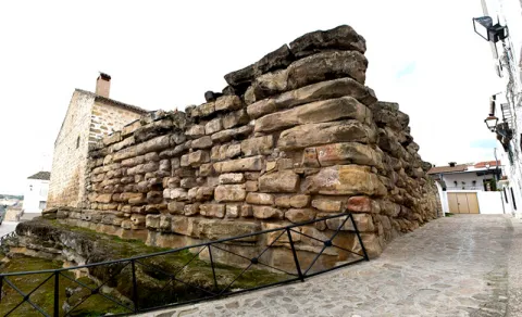
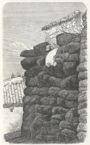
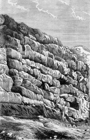
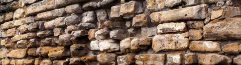
It was Manuel de Góngora, during his journey through the province of Jaén around 1860, who discovered this magnificent wall, stating for the first time that it was of Iberian construction. This Professor of Universal History and Inspector of Antiquities made a spectacular discovery: he was the first to identify the Iberian peoples of the Upper Guadalquivir. More recent studies have identified this type of cyclopean structure with towers and fortified enclosures dating from between the 2nd and 1st centuries BC. In these later stages of Iberian culture, the Romans had already reached the lands of the Guadalquivir, imposing new models of land occupation in which these great defensive structures appear to correspond to strategic sites that delimit and control territories, roads, water sources and even farmland. The cyclopean wall of Ibros, today integrated into the townscape, has survived to the present day as an important architectural element of Iberian culture. Its huge stones, originally joined without mortar, teach us much about those people: their fears, technological advances, struggles and wars, conquests, social transformations… It is located in the northern part of the historic centre, in the district known as "el señorío". Its location makes strategic sense, as it defended the most vulnerable area, closest to the riverbed. It is one of the most celebrated prehistoric monuments in the province of Jaén. A large structure, originally formed by a quadrangular enclosure surrounding the perimeter of the settlement, of which today only a corner measuring 12 to 13 metres long survives. Its enormous ashlar blocks are fitted together without mortar and measure 3.60 metres in length by 1.70 metres in width. We hear nothing more of the town until Christian times, when it was taken in 1157. It later fell once again into Arab hands, until it was definitively conquered by Ferdinand III the Saint. During the reign of Philip IV, the town's defence consisted of a small castle and a wall in which the Ibero-Roman cyclopean wall was reused. The old castle of Ibros must have gradually fallen into disuse, like the rest of the region's fortresses, since after the fall of Granada in 1492 there was no immediate external threat, and advances in artillery made such fortifications unnecessary.
Breve descripción
The Cyclopes were mythological beings with only one eye, members of a race of giants — strong, hot-tempered and prone to sudden emotions. Mythology tells us they were great builders and craftsmen, and this is why, during the Middle Ages, walls made of large worked blocks — like this one in Ibros — began to be discovered and came to be called "cyclopean structures", leading to the conclusion that only the Cyclopes possessed the skill and strength needed to build them.
Telecomunicaciones
Teléfono
Visita exterior, no precisa reservar para su visita.

*Consejos para la visita

Se aconseja comenzar la visita desde la Plaza del Ayuntamiento, dirigiéndonos hacia la calle Gradas llegaremos a la calle del Pilar donde se localiza la muralla.
Sitio web
www.ayunibros.es
Ubicación
Código Postal
23450
Latitud
38.02357
Longitud
-3.50342
Dirección
C/ Pilar, 1
Municipio
Ubicación en el mapa
POINT (-3.50342 38.02357)
Tipos de punto de interés
Imágenes carrusel
imagen
Image
murralla.png
Imagen principal
Desactivado
imagen
Image
muralla_ciclopeda_5.jpg
Imagen principal
Desactivado
imagen
Image
muralla_ciclopeda_4.jpg
Imagen principal
Desactivado
Imágenes cabecera
imagen
Image
Ibros_cab%20%281%29.jpg
Imagen principal
Activado
Horario
Abierto 24 horas
Microsite al que pertenece
Loading map
Preparing points of interest and routes...
Archaeological Site of Peñalosa

Submitted by brandcode_deweloper on
Id
10887417
Descripción
Descripción larga

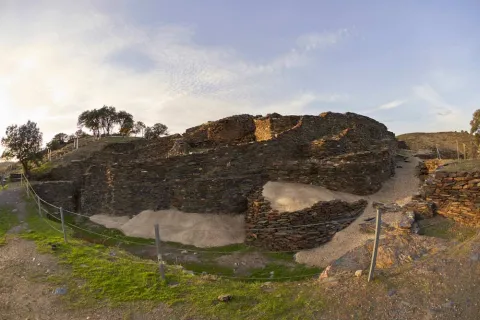
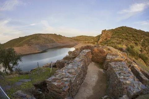
Located in the municipality of Baños de la Encina, the argaric village of Peñalosa has been a reference in the research of the Bronze of Alto Guadalquivir. It sits on a slate slate in the form of a tongue, with two large slopes of strong slopes limiting to the north with the Rumblar River and to the south with the Salsipuas stream. The waters of the Rumbar reservoir now bathe the structures of this argaric village.

The town belongs to the Argar Culture, which was developed during the Bronze Age by the provinces of Almería, Murcia, Granada and part of those of Jaén and Alicante, and was inhabited about 400 years, from the mid-19th century a. C. until the mid-15th century a. C.

The site is a fortified village with houses built with slate on the hill and along its slopes on terraces, as steps, connected with each other by narrow streets and corridors, no significant architectural differences between the different terraces are seen. Within the village there are several different areas: on the top of the hill a fortified area with three houses connected to each other by the aforementioned corridors; generating a structured and organized area. On the north side, three natural and artificial terraces are alternated, interconnected with corridors, and in which houses are distributed. The village also has a large tank in the lower part that would collect the water from the rain and powerful defensive bastions that delimited the village. A characteristic feature of this culture was the interiors within the houses themselves, accompanying the deceased with joules corresponding to the social range they had within the village.

The main economic activity of the population was copper mining, especially the Azurite and Malakita, exploiting the mining wealth of the valley. The entire mining process has been documented: mining, reduction, casting and manufacturing of tools and ingots. Other economic activities such as looms and cereal processing, especially barley, have also been documented.

Socially, there are differences between the burials between those on the middle and upper terraces and those on the bottom; in addition, most burials on the upper terrace are located in exclusively funerary spaces, which has led to the hypothesis that it was a very hierarchical community, with a militarized elite (upper terrace) to which the mass of peasants - free warriors (middle terrace) would be subordinate and on whose base there would be a population layer in a servile state attached to the elite (lower terrace).

Breve descripción

In Peñalosa we can find the best-studied town of the Bronze Age of the Peninsular South, belonging to the Argar Culture and example of the socio-economic reality of this society.

Telecomunicaciones
Sitio web
www.bdelaencinaturismo.com/banos-de-la-encina/
Teléfono de contacto
953 613 338 / 626 818 446
Correo electrónico
info@laencinaturismo.com
Ubicación
Código Postal
23711
Latitud
38.170813
Longitud
-3.796032
Distrito
Ubicación en el mapa
POINT (-3.796032 38.170813)
Tipos de punto de interés
Imágenes carrusel
imagen
Image
Pe%C3%B1alosa%202.jpg
Imagen principal
Desactivado
imagen
Image
Pe%C3%B1alosa%203.jpg
Imagen principal
Desactivado
imagen
Image
Pe%C3%B1alosa%204.jpg
Imagen principal
Desactivado
imagen
Image
Pe%C3%B1alosa%205.jpg
Imagen principal
Desactivado
Imágenes cabecera
imagen
Image
Pe%C3%B1alosa1.jpg
Imagen principal
Activado
Microsite al que pertenece
Loading map
Preparing points of interest and routes...

Archaeological Site Terrazas del Guadalimar

Submitted by brandcode_deweloper on
Id
7971552
Descripción
Descripción larga

The human occupation of the environment of what is today Beas de Segura is very old. The first human testimonies of the Sierra de Segura appear in this site, in the area of Puente Moccho, a name that is designated to an extensive outdoor habitat next to the terraces of the Guadalimar River. There are materials from the Lower and Middle Paleolithic of the dawn of the last glaciation (between 100,000-10,000 BC).

This place was the passage of important mammals, it had abundant fishing resources and abundant raw material for the manufacture of carved stone tools, highlighting rolling edges and pebbles worked in quartdate.

The remains of the Lachelian political industry of this place were discovered in 1913 by Cabré and the Abad Breuil and part of them are found in the Provincial Museum of Jaén, in the Archaeology Section, room 1: Prehistory.

Breve descripción

It is the oldest archaeological site in the province of Jaén, so the oldest pieces that are preserved in the provincial archaeological museum are those from this site.

Telecomunicaciones
Sitio web
www.beasdesegura.es
Correo electrónico
aytobeas@yahoo.es
Ubicación
Código Postal
23280
Latitud
38.253863
Longitud
-2.889467
Dirección
Paseo de la Constitución, 1
Distrito
Municipio
Ubicación en el mapa
POINT (-2.889467 38.253863)
Tipos de punto de interés
Imágenes carrusel
imagen
Image
Yacimiento%20Arqueol%C3%B3gico%20Terrazas%20del%20Guadalimar2.jpg
Imagen principal
Desactivado
Imágenes cabecera
imagen
Image
YACIMIENTO%20ARQUEOL%C3%93GICO%20TERRAZAS%20DEL%20GUADALIMAR%20PUENTE%20MOCHO.jpg
Imagen principal
Activado
Loading map
Preparing points of interest and routes...
Archaeological Site of the Vega Baja

Submitted by brandcode_deweloper on
Id
13575393
Descripción
Breve descripción

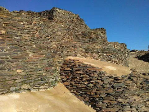
This site, located north of Mengibar, is an exceptional testimony of historical continuity, ranging from the Final Neolithic to the altomedieval period. Although not currently visible, their vestiges show intense human and economic activity over the centuries.

Telecomunicaciones
Sitio web
https://mengibarturismo.com/
Teléfono de contacto
677 222 285
Correo electrónico
turismo@aytomengibar.com
Ubicación
Latitud
37.968050
Longitud
-3.808780
Distrito
Municipio
Ubicación en el mapa
POINT (-3.80878 37.96805)
Tipos de punto de interés
Loading map
Preparing points of interest and routes...
Interés

Archaeological Site of the Iliturgi romana (Cerro Maquiz)

Submitted by brandcode_deweloper on
Id
13576957
Descripción
Descripción larga

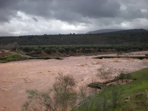
In this city, surrounded by a powerful wall, large public buildings were created, of which large remains of bases and capitals are preserved, and public inscriptions that were part of great sculptures.

In addition, it was equipped with an aqueduct that supplied large aljibes that are still visible today on the plateau of Maquiz. In the southern part of the city was built a large enlisted square of more than 1000 square meters (40x30m), possibly the forum of the city, from which we know in detail a small temple located on one of the corners of this square.

The beneficial acts of its most prominent citizens are reflected in several epigraphic documents, and reveal the existence of large playful buildings as a possible circus.

The identification of Cerro Machiz with the old Iliturgi is argued, among a large set of archaeological data, with the presence of several headings located in Cerro Machiz that refer to this name. Among them the most famous comes from an honorary heading dedicated by the "popvlus ilitvurgitanus" to Tiberio Sememonio Graccho.

Breve descripción

Around the change of era, the city of Iliturgi experienced a process of monumentalization, becoming one of the largest cities of Alto Guadalquivir. Qualified by Plinio at this time as Forum Iulium, one of the region's main markets thanks to its strategic position for land and river trade.

Telecomunicaciones
Sitio web
https://aytomengibar.com/municipio/descubre-mengibar/
Teléfono de contacto
677 222 285
Correo electrónico
turismo@aytomengibar.com
Ubicación
Código Postal
23620
Latitud
37.971404
Longitud
-3.774360
Dirección
Carretera A-600. Camino de los Chorrillos
Distrito
Municipio
Ubicación en el mapa
POINT (-3.77436 37.971404)
Tipos de punto de interés
Imágenes carrusel
imagen
Image
yacimiento-arqueologico-de-la-iliturgi-romana-1-jpg
Imagen principal
Desactivado
Imágenes cabecera
imagen
Image
yacimiento-arqueologico-de-la-iliturgi-romana-jpg
Imagen principal
Activado
Loading map
Preparing points of interest and routes...
Interés

Roman Villa of Bruñel

Submitted by brandcode_deweloper on
Id
10884676
Descripción
Descripción larga

The name Bruñel comes from the Latin word Balneum (bathroom), with the evolution of the mozarina degenerated in the word Bruñel (spa).

Despite the obvious Roman present, there is a record of an Iberian necropolis dating from the 4th century BC and the presence of material and constructive remains.

The villa of Bruñel would be framed in the Roman road that connected Catulo with the current Guadix and, according to the Roman constituency, was attached to the Roman province of the Carthaginense, with capital in Cartago Nova, present Cartagena. The Roman occupation of the village of Bruñel is referred to three phases throughout the II and IV centuries d. C. and according to its evolution, it can be distinguished the socio-economic changes that the Spanish population suffered.

A first phase corresponding to the 2nd century d. C. and is formed by an irregular cruciform building to which contrasts are associated, a tank and an arc of circular structure. The material used is the rich opus camenticium or Roman cement; in addition to stucco with large bermellon mirrors, dark blue or green, separated by dark bands and columns.

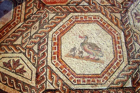
The second phase of the villa corresponds to the 3rd century d. C., being a well preserved villa with pretensions. It highlights the presence of an imposing Atrium with impluvium and a peristil around which most rooms and rooms are articulated. It highlights the decoration with the presence of mosaics with generally geometrical compositions, with swastika bands or braids of different ends or combinations of the previous ones with medallions with human figures; as well as the presence of stucco decorated in most rooms. It highlights the mosaic with the figure of Tetis that is currently located in the Museum of Jaén.

The third phase of the villa adheres to the 4th century d. C., a century of socio-economic changes that are reflected in the villa, demolishing part of the previous phase and replacing it with another building without pretensions, more focused on agricultural activity. These are two buildings, one of them rectangular with apses marked on its minor sides and another building with a large courtyard around which different rooms and rooms are connected with the peristil through two corridors. This latter building would be a courthouse, being the different rooms without paving warehouses or blocks. While the rectangular building, remains of the village of the 3rd century d. C., would be preserved as an urban villa, that is, the area reserved as the home of the owners.

The end of the villa occurred as a result of a great fire, evidenced by the carbonized remains found, although it is discussed whether it happened in the V century d. C. or VIII d. C.

Breve descripción

The Roman villa of Bruñel is a clear exponent of the passage of the Romans through Jaén, being an example of the typical Roman villa under imperial and being formed the archaeological site by an Iberian necropolis from the 4th century a. C. and a Roman occupation that extends from the 2nd century d. C. to the 4th century d.

Telecomunicaciones
Sitio web
www.ayuntamientoquesada.es/
Teléfono de contacto
953 714 011 / 638 395 912
Correo electrónico
oficinadeturismodequesada@gmail.com
Ubicación
Código Postal
23488
Latitud
37.843510
Longitud
-3.067440
Dirección
Carretera de Cazorla a Quesada, km. 6
Municipio
Ubicación en el mapa
POINT (-3.06744 37.84351)
Tipos de punto de interés
Imágenes carrusel
imagen
Image
Bru%C3%B1el%20defi2.jpg
Imagen principal
Desactivado
imagen
Image
bru%C3%B1el%20defi%203.jpg
Imagen principal
Desactivado
Imágenes cabecera
imagen
Image
Bru%C3%B1el%20defi1.jpg
Imagen principal
Activado
Horario
Quesada Tourist Office: Wednesday to Saturday 10: 00 - 14: 00 and 17: 00 - 20: 00. Interpretation Center: Wednesday to Saturday 10: 00 - 14: 00 and 16: 00 - 19: 00, Sundays or holidays 10: 00 - 14: 30 (afternoon closed). Free entry.
Loading map
Preparing points of interest and routes...

Toya and Hornos Princely Tombs

Submitted by brandcode_deweloper on
Id
308552
Descripción
Descripción larga

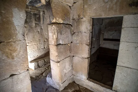
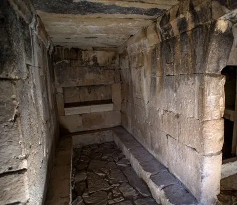
The camera has rectangular floor with three ships. The greater than the sides, and these to the right and left, have an antecedent that is accessed by false arches with simulated capitel in their jambas. In the interior of the receptacles we can observe banks and poyetes to deposit the cineries and the joules. The side and central ships have niches on the walls to receive offerings. The construction of about four meters in length by almost three meters wide is made with large armchairs adjusted to the time of its assembly and covered by a structure of large slabs. The whole construction is of a monumental character, cyclopean by the size of some armchairs and dintels. In terms of its content, we must refer to the recovered, and among all this we highlight the Greek ceramics of red figures, especially the crateras and the metal elements among which the remains of a car stand out. His chronology includes it within the Iberian culture of the end of the S. V and the beginning of the IV before Christ. The aim of this stop is to show how a main funeral chamber is and its meaning in the context of the Iberian aristocratic society. The Centre of the Principesque Tombs of Peal allows you to know the theme of the life of the ultratumba and the funeral rites.

Breve descripción

In the well-known Cerro de la Horca, very close to the village of Toya and the famous castle-archaeological site of its same name, is the great tomb known as the funeral chamber of Toya.

Telecomunicaciones
Sitio web
www.viajealtiempodelosiberos.com
Teléfono de contacto
953 730 075
Correo electrónico
info@viajealtiempodelosiberos.com
Ubicación
Código Postal
23460
Latitud
37.911830
Longitud
-3.127110
Dirección
Carretera Peal de Becerro a Toya
Municipio
Ubicación en el mapa
POINT (-3.12711 37.91183)
Tipos de punto de interés
Imágenes carrusel
imagen
Image
peal-becerro-tumbas%20%283%29.jpg
Imagen principal
Desactivado
imagen
Image
img-porcuna.jpg
Imagen principal
Desactivado
Imágenes cabecera
imagen
Image
peal-becerro-tumbas-ok.jpg
Imagen principal
Activado
Horario
Make visits.
Loading map
Preparing points of interest and routes...
Iberian Sanctuary of the Lobera Cave

Submitted by brandcode_deweloper on
Id
309676
Descripción
Descripción larga

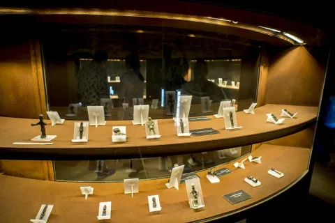
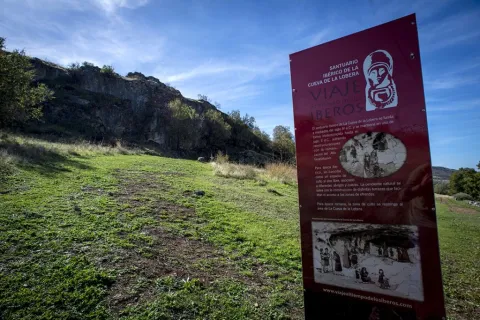
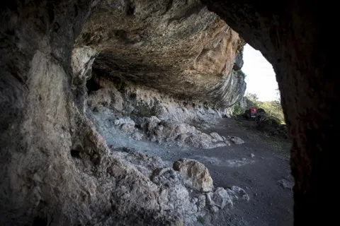
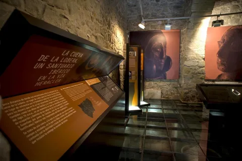
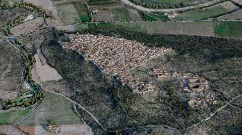
Through their rooms you can discover how the exvotes were made, what they meant to the Iberians, how their vision of the beyond and their relationship with the gods was. A magnificent collection of these figures that still keep in their faces the mystery of the people they represented. Just less than 1 km from this museum is located the Cave de la Lobera, where you can walkon a small path with information about the place and whereYou will discover the abode of the gods.

The Iberian Sanctuary of the Cave of the Lobera is founded in the mid-fourth century BC and is kept in use continuously until the second century AD, suffering restructuring with the romanization of the Alto Guadalquivir.

For Iberian times, it is conceived as an outdoor cult space, associated with different coats and caves. The natural slope is saved with the construction of different terraces that facilitate access to the offering areas.

For Roman times, the area of worship is restricted to the area of La Cueva de la Lobera.

This sanctuary was discovered by the Iberian bronze exvotes, which, since the 19th century, circulated and were treasured in private collections. Interest in the so-called "mingos" caused it to be illegally exploited throughout much of the 20th century. Since 1912, the Cave de la Lobera was the subject of interventions aimed at its conservation, and in these first performances the Cave de la Lobera was frequented by scholars moved by such rich archaeological heritage.

Breve descripción

The Museum of Castellar is dedicated to the exvotes of Iberian times that were recovered in the shrine of the Cave of the Lobera.

Telecomunicaciones
Sitio web
www.viajealtiempodelosiberos.com
Teléfono de contacto
953 460 497
Correo electrónico
info@viajealtiempodelosiberos.com
Ubicación
Código Postal
23260
Latitud
38.262190
Longitud
-3.110560
Dirección
Carretera A-312 Linares-Orcera
Distrito
Municipio
Ubicación en el mapa
POINT (-3.11056 38.26219)
Tipos de punto de interés
Imágenes carrusel
imagen
Image
santuario_castellar_6.jpg
Imagen principal
Desactivado
imagen
Image
Cueva de la Lobera
Imagen principal
Desactivado
imagen
Image
Cueva de la Lobera
Imagen principal
Desactivado
imagen
Image
Cueva de la Lobera
Imagen principal
Desactivado
imagen
Image
Cueva de la Lobera
Imagen principal
Desactivado
Imágenes cabecera
imagen
Image
santuario_castellar_3.jpg
Imagen principal
Activado
Horario
Free visit. Concert guided tours.
Loading map
Preparing points of interest and routes...
Marroquíes Bajos Archaeological Park

Submitted by brandcode_deweloper on
Id
10889839
Descripción
Descripción larga

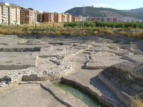
La Zona Arqueológica de Marroquíes Bajos ha sido para la ciudad de Jaén un todo, un antes y un después. Los más de 25 años de intervenciones arqueológicas han permitido una importante revisión de la historia del municipio.

Marroquíes Bajos es uno de los asentamientos más importantes del sur peninsular, no sólo por la extensión de más de 130 ha., sino porque contiene una de las secuencias culturales más completas y complejas de nuestro país, pues alberga cuatro ocupaciones  que han definido la manera de vivir de los pueblos que ocuparon esta tierra desde el neolítico, calcolítico, ibérica, romana y visigoda. Es decir, desde la segunda mitad del IV milenio a. C. hasta la actualidad, pasando por 19 fases distintas, otorgando al yacimiento de una complejidad espacial y diacrónica mayúscula.

Su forma de ocupación se orienta a la explotación de los recursos agrícolas y al desarrollo de las técnicas hidrológicas necesarias para su aprovechamiento intensivo. Los sistemas de canalización se suceden en el tiempo y bajo las acequias, aún en funcionamiento, se han localizado drenajes del siglo XVII; atarjeas, canales y molinos de noria islámicos; molinos, albercas y canales romanos; y soportándolo todo, el gran sistema hidráulico prehistórico que continúa aún hoy decidiendo sobre las trayectorias de las aguas subterráneas en la zona. La presencia de poblamiento continuado en este lugar tiene mucho que ver con su valor estratégico, ya que el norte de Jaén, donde se encuentra el yacimiento, está dominando la cuenca fluvial del arroyo La Magdalena y donde confluyen otros arroyos menores creando una pequeña cuenca hidrográfica que ha tenido un enorme valor estratégico y económico a lo largo de la historia. Los aportes aluviales de estos cursos de agua, han acabado formando una cubeta sedimentaria agrícolamente muy fértil, haciendo de la zona un lugar idóneo donde asentarse.

Las primeras evidencias de poblamiento son del Neolítico (segunda mitad del IV milenio a. C.), como un pequeño campamento estacionario con estructuras  semisubterráneas.

Fue durante el Calcolítico (III milenio a II milenio a. C.) cuando el poblamiento adquirió realmente importancia, conformándose una macro-aldea de 35 ha confirmadas y hasta más de 100 ha estimadas, con funciones definidas y donde el reaprovechamiento de las diferentes estructuras y remodelaciones serían constantes. El espacio habitado se confería mediante una serie de anillos concéntricos delimitados por un sistema de fosos (multifuncionales) de agua excavados. Flanqueados en el interior por empalizadas de maderas y muros de adobe o piedra; presentando accesos e incluso bastiones. El sistema de fosos permitía además recoger agua de los manantiales del cerro de Santa Catalina facilitando la irrigación de las tierras aledañas. La magnitud de los fosos sería manifiesta, existiendo entre 5 y 6 fosos de unos 650 m. a 1.900 m. de diámetro. Tal importancia tuvo el sistema de fosos que aún hoy en día altera la topografía de la ciudad, adecuándose esta a su disposición.

Las diferentes estructuras se articularían en los anillos definidos entre los fosos y las empalizadas, con planta circular y sección acampanada, tamaños variables y excavadas, al igual que los fosos, en la roca. Un segundo tipo de estructuras serían la cilindro-cónicas, realizadas con un entramado de ramas y barro, sustentadas por un poste y cuyo perímetro estaría definido por una zanja excavada en la roca. Por último, un tercer tipo serían cabañas de planta oval o circular con un zócalo de piedra. También destacan estructuras destinadas a almacenaje: con silos excavados en la roca, de planta circular y sección acampanada. Respecto a las estructuras funerarias, destacan la existencia de fosas con enterramientos múltiples similares a las destinadas al hábitat.

El asentamiento ibérico es de menores dimensiones, teniendo la mayoría de las estructuras semiexcavadas en la roca y realizadas con materiales potencialmente perecederos.

En la fase romana se pueden identificar varias áreas; con restos republicanos y una importante ocupación alto imperial (siglos I y II d. C.), destacando diversas estructuras destinadas al regadío como canales, balsas y, en especial, una imponente cisterna realizada en cemento romano (opus caementicium). Además, se han encontrados restos de una villa y una necrópolis de inhumación de época tardorromana o altomedieval cristiana.

Tras una breve etapa visigoda entramos en la fase islámica, con una gran densidad de dispersión de estructuras emirales, la rápida destrucción de las viviendas califales y la compleja configuración de construcciones almohades. Además, destaca la constate reutilización de estructuras romanas durante época almohade.

La magnitud y la importancia del yacimiento dieron lugar a su inscripción con carácter específico en el Catálogo General del Patrimonio Histórico Andaluz con la categoría de Zona Arqueológica según la Orden del 22 de octubre de 2003.

Breve descripción

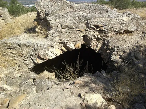
In the Archaeological Park of the Netherlands you will be able to know first hand the millennial origin of the city of Jaén, making a journey along the different civilizations that populated the place until you know the famous town of Calcolítico, a settlement that has been a unique model of habitat of Western Europe.

Telecomunicaciones
Sitio web
www.aytojaen.es/portal/p_20_contenedor1.jsp?seccion=s_fact_d4_v1.jsp&contenido=52789&tipo=2&nivel=1400&layout=p_20_contenedor1.jsp&codResi=1&language=es&codMenu=301&codMenuPN=4&codMenuSN=103
Ubicación
Código Postal
23009
Latitud
37.781393
Longitud
-3.786841
Dirección
C/ Miguel Castillejo, 8
Distrito
Municipio
Ubicación en el mapa
POINT (-3.786841 37.781393)
Tipos de punto de interés
Imágenes carrusel
imagen
Image
a2.jpg
Imagen principal
Desactivado
imagen
Image
a5.jpg
Imagen principal
Desactivado
Imágenes cabecera
imagen
Image
a1211.jpeg
Imagen principal
Activado
Horario
From 8 to 22 abr 2022 and from 6 to 22 may 2022 (days 8, 10, 22, 24 abr / 6, 8, 20, 22 may). Limited places. Registration in Tourist Office: 953 190 455. Guided tours for groups: Monday to Thursday abr - may 2022. Info: 673 668 369.
Loading map
Preparing points of interest and routes...

Cerrillo Blanco Archaeological Park

Submitted by brandcode_deweloper on
Id
4485896
Descripción
Descripción larga

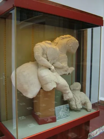
The sculptural ensemble located in this settlement is by far the most important and monumental that has provided Iberian archaeology and key to understanding this culture at the time of its full consolidation, during the fifth century before Christ. This sculptural ensemble is located in the Provincial Museum of Jaén. Other Iberian pieces are exhibited in the Municipal Archaeological Museum of Porcilla, located in the Tower of Boabdil.

Breve descripción

The settlement of Cerrillo Blanco is an extraordinary piece to understand not only the importance of the Iberian "oppidum" of Porcra, but also the very history of Alta Andalucía and the entire Iberian world in general.

Telecomunicaciones
Teléfono de contacto
666 445 513
Correo electrónico
info@museodeporcuna.com
Ubicación
Latitud
37.887160
Longitud
-4.179060
Distrito
Municipio
Ubicación en el mapa
POINT (-4.17906 37.88716)
Tipos de punto de interés
Imágenes carrusel
imagen
Image
museo%20arqueologico%20Cerrillo%20Blanco.jpeg
Imagen principal
Desactivado
imagen
Image
museo%20arqueologico%20Cerrillo%20Blanco%202.jpeg
Imagen principal
Desactivado
Imágenes cabecera
imagen
Image
Parque%20Arquel%C3%B3gico%20de%20Cerrillo%20Blanco.jpg
Imagen principal
Activado
Microsite al que pertenece
Loading map
Preparing points of interest and routes...