Saltar al contenido principal

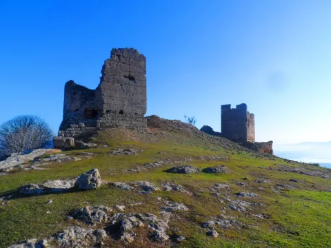
Iberian Oppidum of Iliturgi

Submitted by brandcode_deweloper on
Id
13577134
Descripción
Descripción larga

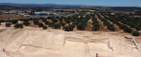
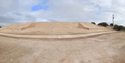
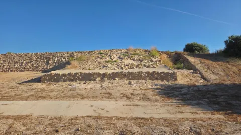
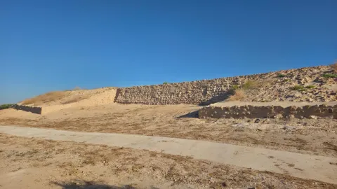
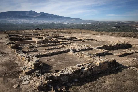
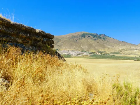
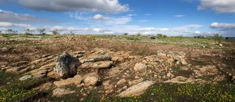
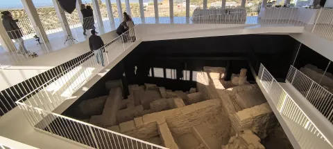
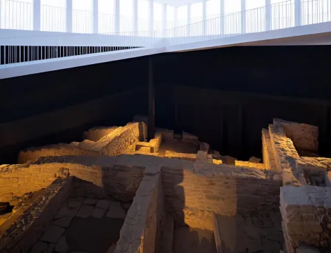
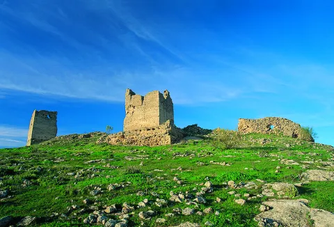
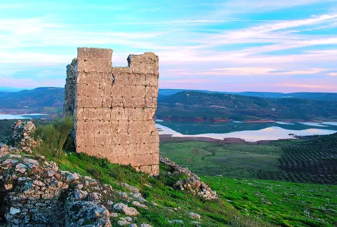
The oppidum (6th and 3rd centuries BC) occupies an area of approximately 14 hectares. The excavations have identified a fortification, domestic units, ceramics and weapons.

The Cerro de la Muela was the site of the ancient Iberian city of Iliturgi, destroyed in 206 BC during the Roman conquest, in the context of the Second Punic War.

Breve descripción

Research is currently being carried out at the Cerro de la Muela, together with the University of Jaén, with the aim of putting its wall to value, although the site is not accessible at this time.

Telecomunicaciones
Sitio web
https://mengibarturismo.com/
Teléfono de contacto
677 222 285
Correo electrónico
turismo@aytomengibar.com
Ubicación
Código Postal
23620
Latitud
37.971061
Longitud
-3.788947
Dirección
Carretera Bailén-Motril. Cerro de la Muela
Distrito
Municipio
Ubicación en el mapa
POINT (-3.788947 37.971061)
Tipos de punto de interés
Imágenes carrusel
imagen
Image
fotografias_oppidum-ibero-de-iliturgi-cerro-de-la-muela-jpg
Imagen principal
Desactivado
imagen
Image
fotografias_oppidum-ibero-de-iliturgi-cerro-de-la-muela-1-jpg
Imagen principal
Desactivado
imagen
Image
fotografias_oppidum-ibero-de-iliturgi-cerro-de-la-muela-1-jpeg
Imagen principal
Desactivado
Imágenes cabecera
imagen
Image
fotografias_oppidum-ibero-de-iliturgi-cerro-de-la-muela-jpeg
Imagen principal
Activado
Loading map
Preparing points of interest and routes...
Interés

Oppidum by Puente Tablas

Submitted by brandcode_deweloper on
Id
309632
Descripción
Descripción larga
A fortified city that invites you to travel 2,300 years ago and feel the pulse of a civilization
Breve descripción
A fortified city that invites you to travel 2,300 years ago and feel the pulse of a civilization
Telecomunicaciones
Sitio web
www.viajealtiempodelosiberos.com
Teléfono de contacto
670 948 946
Ubicación
Código Postal
23009
Latitud
37.811740
Longitud
-3.745720
Dirección
JV-3012, 15
Distrito
Municipio
Ubicación en el mapa
POINT (-3.74572 37.81174)
Tipos de punto de interés
Imágenes carrusel
imagen
Image
oppidum5.jpg
Imagen principal
Desactivado
Imágenes cabecera
imagen
Image
oppidum2.jpg
Imagen principal
Activado
Horario
From Tuesday to Sunday and holidays: from 9:00 a.m. at 3:00 p.m. | Monday: closed
Loading map
Preparing points of interest and routes...

Cerrillo Blanco Dynastic Necropolis

Submitted by brandcode_deweloper on
Id
308590
Descripción
Descripción larga

In this necropolis was buried in the 5th century BC the most important impressive sculptural ensemble of all Iberian culture and that can now be seen in the Museum of Jaén.

In the archaeological site and in its Visitors Center you will find the keys to understanding this sculptural group and the meaning of death in the Iberian world. Cerrillo Blanco is a funerary tumulum of the Tartesic era (7th century BC) with 24 individual graves in pits and 1 megalytic in which two individuals were buried. Towards the 5th century BC, it was buried in ditches covered with large slabs, an Iberian sculptural set intentionally destroyed. Both by the amount of pieces (approximately 1400 fragments) and by their artistic quality is the most important of Iberian sculpture. This set tells us and tells us the story of how a group of aristocrats became powerful and came to rule the important city of Obulco in Porcra.

The visit to the site is complete with the Porcra Museum which is located in the 15th century Boabdil Tower, in the historic center of the town. This museum has an important collection of Ibero-Roman sculptures. The museum offers guided tours with prior appointment and activity programming throughout the year that you can find on your website:www.museoatocuna.com

Breve descripción

Cerrillo Blanco is one of the most emblematic places of Iberian culture. Walking through this site, you will know an inhumation necropolis dating back to the 7th century BC.

Telecomunicaciones
Teléfono
<p>Oficina de Turismo: de martes a domingo, de 10:00 h. a 13:00 h.<br />
Plaza de Andalucía, 2.&nbsp;</p>
Sitio web
www.viajealtiempodelosiberos.com
Teléfono de contacto
953 545 130
Correo electrónico
oficinaturismo@porcuna.es
Ubicación
Código Postal
23790
Latitud
37.886633
Longitud
-4.179094
Dirección
Carretera Porcuna-Arjonilla, s/n
Distrito
Municipio
Ubicación en el mapa
POINT (-4.179094 37.886633)
Tipos de punto de interés
Imágenes carrusel
imagen
Image
porcuna%20%287%29.jpg
Imagen principal
Desactivado
Imágenes cabecera
imagen
Image
porcuna.jpeg
Imagen principal
Activado
Horario
Site: Tuesday to Sunday 10: 00 - 13: 00 (upon reservation). Porcilla Museum: Tuesday to Sunday 10: 00 - 13: 00.
Loading map
Preparing points of interest and routes...

Cerrillo Salido Necropolis

Submitted by brandcode_deweloper on
Id
4281438
Descripción
Descripción larga

According to the research, it is a necropolis whose extension would surround the entire town, making it one of the most important at the national level.

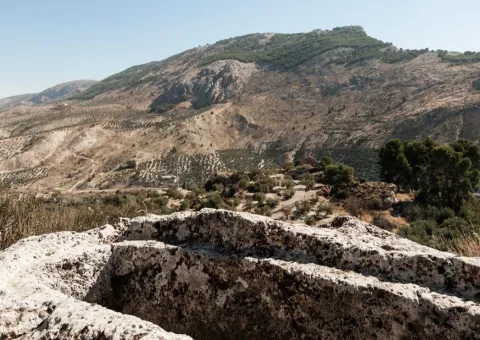
In 1954, the first archaeological excavation was carried out, 22 tombs of which only 7 remained intact. The inspected tombs had an ovoid and excessively elongated form, not keeping a certain orientation.

Next to this visigoda necropolis - just 30 metres - is another Muslim era.

Breve descripción

Located in the municipality of La Guardia, just 500 metres from the urban core, is this Visigoda period site whose tombs are excavated in the rock.

Ubicación
Latitud
37.742568
Longitud
-3.693708
Distrito
Ubicación en el mapa
POINT (-3.693708 37.742568)
Tipos de punto de interés
Imágenes carrusel
imagen
Image
Mon06510%20%281%29.jpg
Imagen principal
Desactivado
imagen
Image
Mon0610%20%281%29.jpg
Imagen principal
Desactivado
imagen
Image
Mon065120%20%281%29.jpg
Imagen principal
Desactivado
Imágenes cabecera
imagen
Image
40.jpg
Imagen principal
Activado
Microsite al que pertenece
Loading map
Preparing points of interest and routes...

El Cerro de Castellón

Submitted by brandcode_deweloper on
Id
8088833
Descripción
Descripción larga

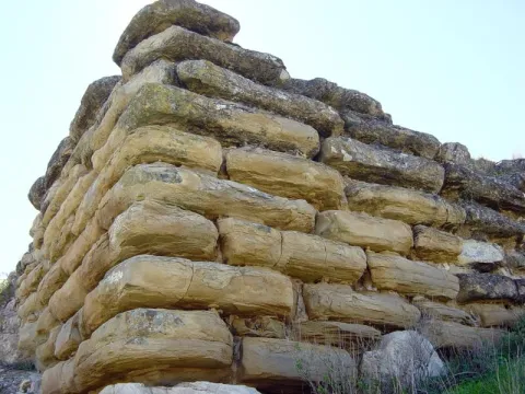
It has a rectangular plant facing from northeast to southeast and a walled enclosure. The best preserved wall is the northeast, 18.70 meters long and 4 meters high in its highest corner. It consists of several rows of large-scale stones, on which a wall of tapial, now missing, would be raised. In its interior it retains a seam of regular armchairs, smaller than those of the outer wall, of 6.30 meters in length and 2 meters in width.

Although it dates from Iberian chronology, both ceramic decorated with Iberian ceramic bands andterra sigillataRoman, so you can deduce a continued occupation of the land; as well as medieval ceramics.

Its mission was to monitor and control the communication routes, as it is closely linked to the corridor of the Guadiana Minor River, which communicates the upper valley of Guadalquivir with the highlands of Guadix and Baza.

In 1985 it was declared Good of Cultural Interest.

Breve descripción

On the hill of Castellón are preserved the remains of an Iberian cyclopian fortress between the II and I BC centuries It is a walled enclosure, with a quadrangular structure and an aljibe inside it, built with limestone armchairs that reach a meter and a half in length.

Telecomunicaciones
Sitio web
www.larva.es/el-municipio/patrimonio-historico.html
Correo electrónico
ayuntamiento@larva.es
Ubicación
Código Postal
23591
Latitud
37.770410
Longitud
-3.192560
Distrito
Municipio
Ubicación en el mapa
POINT (-3.19256 37.77041)
Tipos de punto de interés
Imágenes carrusel
imagen
Image
El%20Cerro%20de%20Castell%C3%B3n2.JPG
Imagen principal
Desactivado
imagen
Image
El%20Cerro%20de%20Castellon3%20%282%29.jpg
Imagen principal
Desactivado
Imágenes cabecera
imagen
Image
El%20Cerro%20de%20Castell%C3%B3n.jpg
Imagen principal
Activado
Microsite al que pertenece
Loading map
Preparing points of interest and routes...

Domus Herculana

Submitted by brandcode_deweloper on
Id
10888623
Descripción
Descripción larga

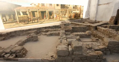
Because of the size, this Roman site is possibly a vicus or village, a settlement with a double rural and urban character; which, even of unknown size, had to be greater than a Roman village and was related to other defensive settlements of the same time that are known in the area.

The appeal of "Domus Herculana" is due to the great building (domus) in which the main findings of the site related to the Roman Hercules god were found, as a domus was a type of Roman house corresponding to families with a certain economic level.

With regard to the Roman field, its remains correspond to different levels of occupation, being the main ones corresponding to a first stage, which would range from the 1st to the 3rd century BC, and a second century, during the 4th century BC and V century BC. The levels of this second stage are based on remnants of fire episodes. It is recorded that the domus, suffered at least two important moments of destruction, the first at the end of the second half of the 3rd century d. C. (260-269), caused by a major fire, and the other in the 4th century d. C, after the time of Emperor Constantine I. After this second incident there is no indication of new populations.

Among the main findings, a small marble Hercules is part of the Roman art collection of the National Archaeological Museum in Madrid. The head of a fauno and a high relief of a Hercules with dog found in the Abacial Palace Museum have also been found.

Breve descripción

The Domus Herculana is an interesting Roman site inserted in the heart of the municipality with a marked mythological theme focused on the figure of the god Hercules.

Telecomunicaciones
Sitio web
www.turismo.alcalalareal.es/
Teléfono de contacto
953 102 868 / 953 580 000
Correo electrónico
turismo@alcalalareal.es
Ubicación
Código Postal
23680
Latitud
37.465429
Longitud
-3.924912
Dirección
C/ la Tejuela
Distrito
Municipio
Ubicación en el mapa
POINT (-3.924912 37.465429)
Tipos de punto de interés
Imágenes carrusel
imagen
Image
domus%20h-min.jpg
Imagen principal
Desactivado
imagen
Image
Domus-min-min.jpeg
Imagen principal
Desactivado
Imágenes cabecera
imagen
Image
1111.jpeg
Imagen principal
Activado
Horario
Monday to Friday: 09: 00 - 15: 00 and 16: 00 - 20: 00. Office of Tourist Information: Monday to Friday 10: 00 - 18: 00.
Loading map
Preparing points of interest and routes...

Archaeological ensemble of the Ibero-Roman city of Cástulo

Submitted by brandcode_deweloper on
Id
5868069
Descripción
Descripción larga

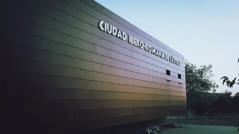
The Archaeological Set of Catulo and its monographic museum in Linares are the ideal sites to know the cultural diversity of Andalusia. The Ibero-Roman city is located on the right bank of the Guadalimar River, it is one of the capital centers of the peninsular noon during the antiquity, both for the extension of its walled enclosure (70 hectares), and for its strategic position in the Alto Guadalquivir and its mining holdings of silver, lead and copper. The "oppidum"- or fortified city - of Cattulo, first, was the most important nucleus of the population of the Iberian Oretania and, later, was formed as a Roman municipality, becoming episcopal headquarters in the lower-imperial era.

Catulus, Ibero-Roman city

The archaeological area of Catulo comprises a vast surface where multiple evidence is overlapping which are expression of other forms of occupation. There are necropolis, factories, public infrastructure and other suburban facilities related to the Ibero-Roman city, but also other settlements from Prehistory to the low Middle Ages, which complete the historical value of this archaeological area. This complex stratigraphic and temporal sequence, which has reached our time in exceptional conditions of conservation and integrity, is a significant segment of the entire history of Andalusia.

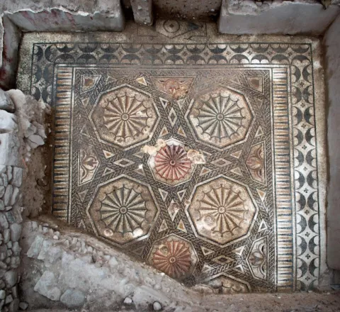
The tour begins with the reception center, where the visitor will find all the keys to understand the historical development of the site. In the walls you can make a stop in the highest part of the city and visit the Gate of the Lions of the Republican period, where the famous León de Catulo, the best preserved of the entire Iberian peninsula, was discovered. In the central area of the plateau do not forget to make a tour of the different archaeological areas and to contemplate the spectacular "Mosaic of the Amores," considered one of the ten greatest discoveries of 2012 by the magazine National Geographic. Also in the same area you can see an important religious building within which the "Patena de Cristo" was discovered, a fourth-century glass dish with one of the best preserved images of Christ which is currently exposed in the Museum of Linares. At the most eastern end of the settlement, you can see the Castle of Santa Eufemia, a fortification that dates from the Arab period and is also part of the cultural itinerary Route of the Castles and the Battle.

Archaeological Museum

This museum cannot be understood in its integrity without reference to the Archaeological Set of Cattulo, as they are intimately related. In fact, an important impetus in the development of the Museum occurs when the expropriation of the lands of the former Cattulo is carried out, a process that began in 1968 and concluded in 1972, thus facilitating the research work that has been carried out in these areas since 1958 and from where the most important and numerous part of the collection comes from.

The tour is arranged on several floors, a covered courtyard and the basement. Its rooms treasure the most important findings of Catulus, including the Ibero-Roman Lion dating back to the 1st century BC and the Patena of Christ dating back to the 4th century AD.

Breve descripción

The archaeological set of Catulo and its monographic museum in Linares are the ideal sites to know the cultural diversity of Andalusia. The Ibero-Roman city is located on the right bank of the Guadalimar River, it is one of the capital centers of the peninsular noon during the antiquity, both for the extension of its walled enclosure (70 hectares), and for its strategic position in the Alto Guadalquivir and its mining holdings of silver, lead and copper. The "oppidum"- or fortified city - of Cattulo, first, was the most important nucleus of the population of the Iberian Oretania and, later, was formed as a Roman municipality, becoming episcopal headquarters in the lower-imperial era.

Telecomunicaciones
Sitio web
www.castulolinares.com
Teléfono de contacto
953 106 074
Correo electrónico
museoarqueologicolinares.ccul@juntadeandalucia.es
Ubicación
Código Postal
23700
Latitud
38.087695
Longitud
-3.640179
Distrito
Municipio
Ubicación en el mapa
POINT (-3.640179 38.087695)
Tipos de punto de interés
Imágenes carrusel
imagen
Image
mosss-346-jpg
Imagen principal
Desactivado
Imágenes cabecera
imagen
Image
139234900--62l4x468.jpg
Imagen principal
Activado
Horario
Archaeological Set of Catulus: Tuesday to Saturday 09: 00 - 18: 00, Sundays and holidays 09: 00 - 15: 00, Monday closed. Archaeological Museum of Linares - 1 abr - 15 Jun: Tuesday to Saturday 09: 00 - 21: 00, Sundays and holidays 09: 00 - 15: 00, Monday closed. 1 Jul - 31 Aug: Tuesday to Sunday 09: 00 - 15: 00, Monday closed. 1 sept - 31 sea: Tuesday to Saturday 09: 00 - 21: 00, Sundays and holidays 09: 00 - 15: 00, Monday closed. Closed: 1 and 6 ene, 1 may, 24, 25 and 31 Dec.
Microsite al que pertenece
Loading map
Preparing points of interest and routes...

Giribaile Fortified City.

Submitted by brandcode_deweloper on
Id
308631
Descripción
Descripción larga

You can visit the Interpretation Centre in Vilches (currently closed by reforms) and learn about the historical evolution of this important site, but there is a fence that closes the passage to the fortified city, so it is necessary to telephone the City Hall in advance, on working hours from 8: 00 to 14: 00, to make an appointment.

In the archaeological enclave you can visit a prehistoric sanctuary, an Iberian village, a cenobium or eemite paleocristian or visigode and a Almohad castle, all surrounded by beautiful landscapes between olive and saw. Landscape, culture, heritage, history, nature, hiking... are intermingled in Giribola, where it is possible to appreciate the footprint left by different peoples and cultures over the centuries.

Thus, along with the vestiges of the castle, the traveller will also be able to see the remains that are still preserved from the great wall surrounding the Iberian oppidum, an important city that occupied a strategic place on the road of connection between Catulo and the Levant and that was abandoned after being swept away by the Romans. Similarly, the numerous caves that are distributed on the slopes of the hill, the so-called Cuevas de Espeluca, are also interesting.

Breve descripción

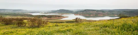
Giribola is located in the confluence of the Guadalimar and Guadalén rivers, in the municipal term of Vilches. The archaeological area occupies a prominent position at the end of a plateau interrupted by a barrier-type fortification that serves as a limit and, at the same time, a main access to the Iberian city. It can be considered, with its 18 hectares, one of the largest Iberian villages in the province of Jaén.

Telecomunicaciones
Teléfono
<p>Visitas concertadas por teléfono.</p>

<p>&nbsp;</p>
Teléfono de contacto
953 630 075 / 637 784 927
Correo electrónico
turismo@vilches.com
Ubicación
Código Postal
23220
Latitud
38.203092
Longitud
-3.508578
Dirección
Cerrillo, s/n
Distrito
Municipio
Ubicación en el mapa
POINT (-3.508578 38.203092)
Tipos de punto de interés
Imágenes carrusel
imagen
Image
vilches_giribaile_8.jpg
Imagen principal
Desactivado
imagen
Image
Cabecera-Ciudad%20fortificada%20de%20Giribaile.jpg
Imagen principal
Desactivado
imagen
Image
vilches_giribaile_3.jpg
Imagen principal
Desactivado
imagen
Image
vilches_giribaile_1.jpg
Imagen principal
Desactivado
Imágenes cabecera
imagen
Image
IMG_2037%20giribaile.JPG
Imagen principal
Activado
Horario
Interpretation centre closed for reforms.
Microsite al que pertenece
Loading map
Preparing points of interest and routes...

Roman Cistern La Calderona

Submitted by brandcode_deweloper on
Id
13375131
Descripción
Descripción larga

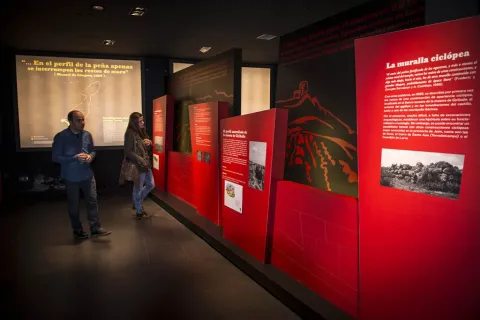
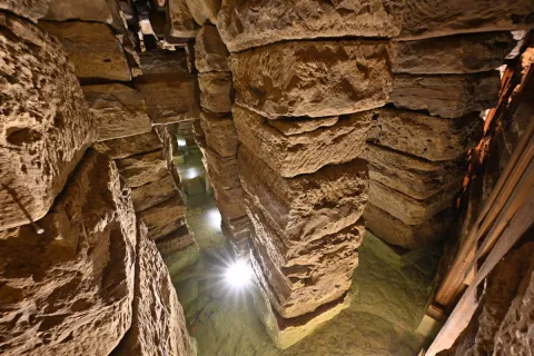
Declared Good of Cultural Interest in 2014, the La Calderona tank in Porcra (Jaén) is a water tank in the Roman city of Obulco, which is presumed to be linked to a water infrastructure of themunicipum,Maybe public hot springs. In the time of the Roman Empire, the growth of the large walled city led to the area being covered with large stone pillars on which new constructions were settled, thus starting what became its final burial.

In the Spanish civil war the tank served as an anti-aircraft shelter. In a fortuitous way, there was a finding that put the experts on the track of the original infrastructure: as they went down to the ground to protect themselves from the bombing, the neighbors observed that the wells they had in their homes were part of a more complex structure.

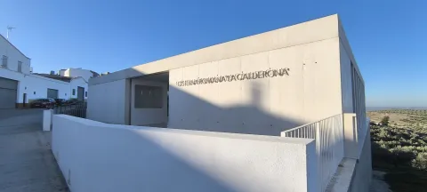
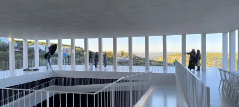
After a long and complex restoration, the tank currently in operation has been opened to the public. In order to access the level of the deposit, the intervention required, first, to build a new building, to serve as a reception centre for visitors and to integrate in turn the helicoidal ramp of down with 100 meters suspended, that do not touch the archaeological remains. In order to locate the new construction, an empty area was taken advantage of, located on one of the margins of the nearest road, so that the houses located on the Roman complex were not affected. In this way, the search for access to the tank ended up generating as added in addition to the new construction, a bridge that crosses San Marcos street and a tunnel that passes below the houses.

The project, led by the architect Pablo Millán, is based on the interrelationship of opposite realities and that, in the face of complexity, proposes a discourse based on the simplicity of a clean, geometrically precise architecture that does not conflict with the heritage architecture, present both in the Roman tank and in all the domestic buildings that appear during the archaeological intervention. In front of the space under the railing, hidden, in which the light does not enter, there is a new clear and deafan space through which the visitor travels, establishing a dialogue between the archaeological heritage and contemporary architecture.

Breve descripción

It is an underground hydraulic complex more than two millennia old, located in the municipality of Porcra. Accidentally rediscovered by one of the inhabitants of the contemporary houses above him and used during the civil war as an anti-air shelter, it was originally a large public water tank with several years of rainwater collection and three catchment wells. Its construction, by means of walls and built-in pillars of cyclopean armchairs that support the architrabada deck with huge slabs of local calcarenita, makes it unique and unique at all levels.

Telecomunicaciones
Teléfono
<p>Oficina de Turismo</p>

<p>Plaza de Andalucía, 3&nbsp;</p>
Teléfono de contacto
953 545 130
Correo electrónico
oficinaturismo@porcuna.es
Ubicación
Código Postal
23790
Latitud
37.872025
Longitud
-4.189043
Dirección
Camino de San Marcos, s/n
Distrito
Municipio
Ubicación en el mapa
POINT (-4.189043 37.872025)
Tipos de punto de interés
Imágenes carrusel
imagen
Image
cisterna-porcuna-jpg
Imagen principal
Desactivado
imagen
Image
473630070_1066239135548190_4988771702868297360_n-jpg
Imagen principal
Desactivado
imagen
Image
473611344_1066239522214818_5207770888572245213_n-jpg
Imagen principal
Desactivado
imagen
Image
473660714_1066240128881424_4094374543181858277_n-jpg
Imagen principal
Desactivado
Imágenes cabecera
imagen
Image
la-calderona-2-jpeg
Imagen principal
Activado
Horario
Guided tours after booking in Porcra Tourist Office. Tuesday to Sunday: 10: 00 - 13: 00.
Microsite al que pertenece
Loading map
Preparing points of interest and routes...

Castle of Giribaile

Submitted by brandcode_deweloper on
Id
573373
Descripción
Descripción larga

La fortaleza medieval de Giribaile se sitúa en el extremo noreste de un alargado cerro amesetado, ocupando un amplio saliente rocoso protegido por acantilados de roca que le sirven de defensas naturales, y por una vaguada en el sur que le separa del resto de la meseta.

Actualmente se extienden por la mayor parte de la planicie los restos de un oppidum ibérico, cuyas estructuras pudieron ser reutilizadas por los habitantes de este asentamiento a lo largo de la Edad Media. 

La fortificación emiral-califal fue construida en mampostería irregular trabada con mortero de cal y arena. Su planta irregular tiene tendencia triangular, adaptándose a la orografía del terreno y aprovechando algunos restos de la antigua fortificación ibérica. Torres y lienzos de muralla se levantan sobre la base rocosa, a modo de muros en cremallera que reproducen los sucesivos entrantes y salientes del espolón.

La puerta principal de acceso al interior de la fortaleza, se emplazó en el lienzo suroeste, estaba protegida por dos torres, mientras que en el lienzo noroeste se abría otra puerta o poterna, a la que se accedía tras ascender por una suave senda que discurría por la ladera del cerro. Se trataba de un complejo acceso en codo formado por tres torres, la primera edificada sobre un pequeño espolón rocoso de la ladera, desde la que partía un lienzo que enlazaba con la más oriental de las otras dos torres, que flanqueaban la puerta.

Entre los siglos XII y XIII, los almohades llevaron a cabo una reestructuración de la fortificación, que afectó principalmente al sector sur, donde se va a levantar una nueva torre de tapial de argamasa, sobre un sólido basamento de grandes sillares de piedra caliza, dividida interiormente en tres estancias.

Estaba rodeada, en tres de sus frentes, por un antemuro, a modo de barrera de corta altura y edificado con la misma técnica constructiva, que dejaba un espacio o liza de 2 m de anchura entre ambos. Este antemuro se extendería de forma paralela a la muralla meridional, reforzando el flanco sur de la fortaleza. En el lienzo suroeste, una de las torres que protegían la puerta principal del castillo fue forrada por tres de sus frentes con un grueso revestimiento de tapial de argamasa levantado sobre un basamento de mampostería regular, a la vez que se rellenó, convirtiéndola en un cubo macizo. 

En la actualidad, aunque se puede distinguir el trazado de la fortificación, solo se conserva el alzado de dos torres cuadradas de tapial y de algunos lienzos de muralla. En el interior del castillo permanecen los restos de un pequeño aljibe rectangular cubierto con bóveda de cañón y de dos dependencias anexas, posiblemente utilizadas como almacenes.

El asentamiento de Giribaile ha sido ocupado a lo largo de la historia, en diferentes periodos de tiempo más o menos duraderos, correspondiendo la ocupación más temprana a un poblado de la Edad del Bronce.

En época ibérica el cerro estuvo ocupado por un oppidum fortificado de 14,56 hectáreas, que formó parte del pago de Cástulo, territorio político que en el siglo IV a.C. alcanzaba las fronteras naturales de las cabeceras de los ríos Guarrizas y Montizón, donde se localizan los santuarios de Collado de los Jardines y Castellar de Santisteban. La desaparición de este asentamiento está vinculada a un episodio de destrucción violenta, con el incendio de la ciudad, que pudo tener lugar en el marco de una acción de castigo desarrollada durante la Segunda Guerra Púnica. 

La posición estratégica de la meseta de Giribaile, junto a la existencia de abundantes manantiales naturales, fueron determinantes para la ocupación prácticamente ininterrumpida desde la Tardoantigüedad hasta la Baja Edad Media. 

Los primeros momentos de esa ocupación podrían remontarse a los siglos VI y VII d.C., momento en que los habitantes del valle lo abandonan, trasladándose al cerro. En la pared rocosa del lado este habilitan una serie de cuevas naturales, que amplían y transforman para constituir un complejo hábitat troglodítico de altura, mientras que por la meseta se expandiría un poblamiento más o menos disperso, protegido aún por los elementos de fortificación edificados en época ibérica.

Este hábitat se mantuvo tras la invasión islámica hasta que, a lo largo de los siglos IX y X, la inestabilidad creada por las sublevaciones de finales de época emiral, empuje a la población a concentrarse en la plataforma norte, convirtiéndose en un hisn (castillo-refugio) que aglutinaría a gran parte de los habitantes de la zona. Es posible que las reparaciones de las antiguas defensas ibéricas y la construcción de una nueva fortaleza en el extremo noreste del cerro, se debiese a ibn al-Sāliya, rebelde muladí que se enfrentó a los emires omeyas.

Una vez consolidada la islamización de al-Ándalus, bajo Abd al-Rahmān III, se abandonan buena parte de los asentamientos defensivos de altura, y los que permanecen se transforman en puntos estratégicos para controlar el territorio. En el entorno de Giribaile la población debió ser obligada a trasladarse a centros en desarrollo como Vilches, Baeza o Santisteban.

Finalmente, los acontecimientos políticos y militares acaecidos en al-Ándalus entre los siglos XII y XIII, que llegaron a convertir el Alto Guadalquivir en un territorio prácticamente independiente durante periodos muy concretos, así como la expansión hacia el sur de los ejércitos cristianos, promovieron un proceso de fortificación, intensificado por los almohades, para controlar la cabecera del Guadalquivir. Las últimas remodelaciones del castillo de Giribaile corresponden a este momento histórico, en el que se refuerza principalmente su flanco sur, más accesible. 

Tras su conquista por los castellanos, en 1227, Giribaile se integró en el territorio de la Comunidad de Villa y Tierra (Concejo de Realengo) de Baeza, perdiendo su importancia militar.

LEYENDAS

Leyenda de la muerte de Gil Baile. Un noble de Baeza, don Gil Baile, señor de las tierras donde se asienta el castillo al que da nombre, mandó grabar en la puerta de su casa, bajo el escudo de su linaje: “Entre río y río todo lo que hay es mío. Esta es la tierra de Gil Baile que no morirá de sed ni de hambre”.
Una mañana salió de caza con otros distinguidos nobles. Descubrió un hermoso venado que el noble siguió al galope por el monte, hasta que se precipitó al abismo de una oscura sima de la que no pudo salir. Era un camino poco transitado y nadie escuchó sus gritos de auxilio, hasta que finalmente falleció, muriendo de frío, de sed y de hambre. 

Breve descripción

Giribola is an archaeological set whose historical-architectural evolution can be read today in the superposition of fortification structures. The plateau of the hill is bound by a line of walls that defended an Iberian oppidum. At the foot of the hill skirting we find an interesting rock habitat with rooms carved in the living rock between the late and the early Middle Ages. Finally, at the north-east end of the plateau, the remains of a medieval fortress, made up of two square towers of tapial, a small aljibe and some masonry wall canvases, a bulwark that played an important role in the political and military conflicts that took place in several periods of al-Ándalus.
The castle of Giribola has a strategic position on a riverbed hill, between the Guadalimar and Guadalén rivers, surrounded by aquifers and springs. It is a fortification that evolved from a simple shelter for rural communities, which takes advantage of the elements of the ancient Iberian fortress and the steep orography of the land, to become a solid fortress of irregular masonry with towers and wall canvases, which would defend a group of Muladic rebels, and then become the first border line in front of the Christian armies. It is one of the Giennese fortresses that maintain, without any modification, its ancient Islamic structure.

Telecomunicaciones
Sitio web
www.ayuntamientovilches.es/es/
Teléfono de contacto
953 630 075 / 637 784 927
Correo electrónico
turismo@vilches.com
Ubicación
Código Postal
23220
Latitud
38.120797
Longitud
-3.483696
Dirección
Carretera comarcal A-312
Distrito
Municipio
Ubicación en el mapa
POINT (-3.483696 38.120797)
Tipos de punto de interés
Imágenes carrusel
imagen
Image
castillo_giribaile1.jpg
Imagen principal
Desactivado
imagen
Image
Mon058.jpg
Imagen principal
Desactivado
imagen
Image
Mon051.jpg
Imagen principal
Desactivado
Imágenes cabecera
imagen
Image
10073663Master.jpg
Imagen principal
Activado
Microsite al que pertenece
Loading map
Preparing points of interest and routes...