Saltar al contenido principal
Image
Club de Producto de la Ruta de los Castillos y Batallas

Arjonilla

Submitted by brandcode_deweloper on
Id
723638
Perfil de redes sociales
Facebook
https://es-es.facebook.com/ayuntamiento.dearjonilla
Twitter
https://twitter.com/aytoarjonilla?ref_src=twsrc%5Egoogle%7Ctwcamp%5Eserp%7Ctwgr%5Eauthor
Instagram
https://instragram.comcom/ayuntamiento.dearjonilla
Descripción
Breve descripción

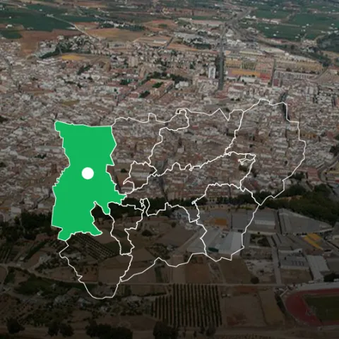
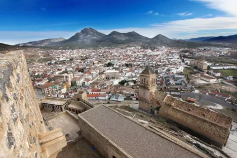
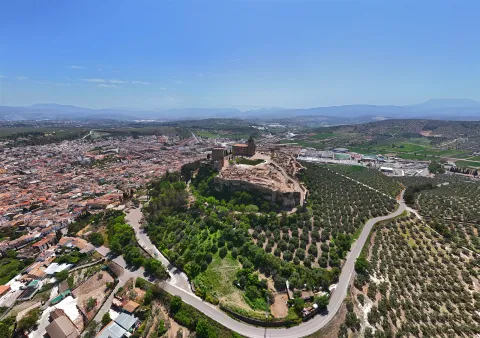
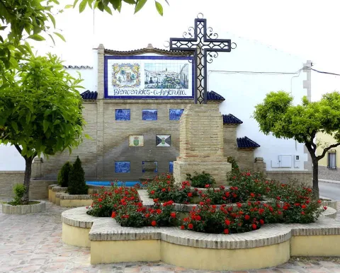
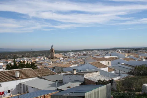
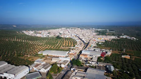
Municipality located to the northwest of the province and belonging to the region of La Campiña.

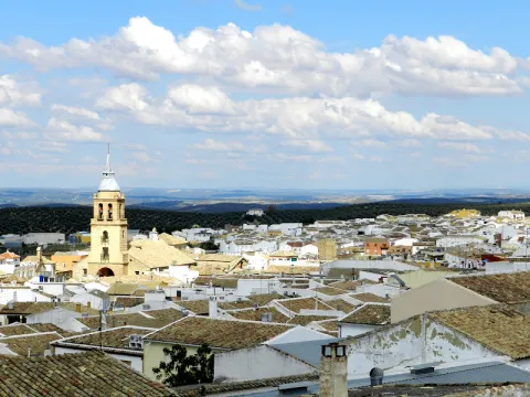
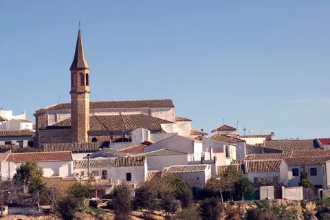
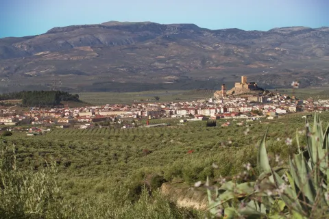
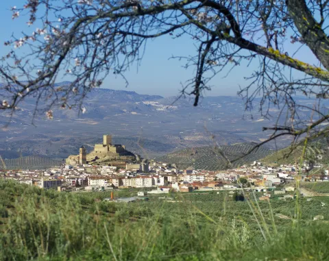
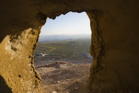
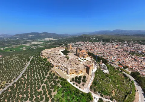
Eminently agricultural, since almost all of its surface is cultivated land, dominated by the olive tree. We found Arjonilla between a sea of olive trees and a wavy territory, without any relief accidents.

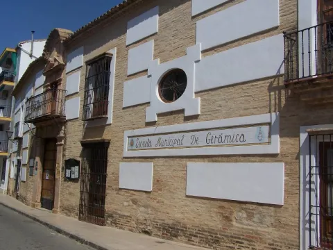
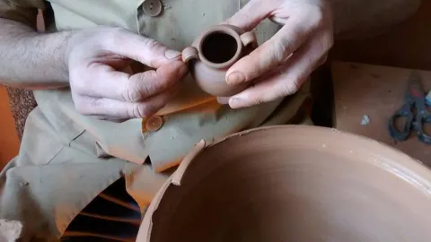
Its main source of income is the collection of olive oil, the production of olive oil, which has developed an important oil industry and the artisan decorative ceramic of high quality, variety and style. It's famous for its clay.

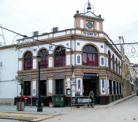
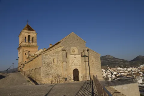
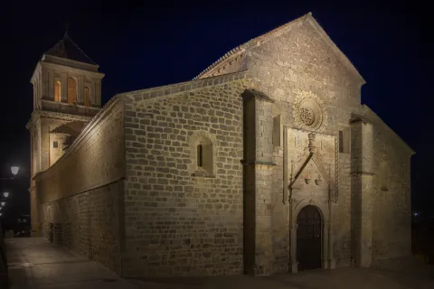
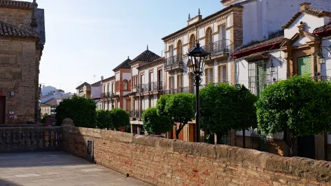
From its historical heritage, we highlight the Castle of Macias, Church of the IncarnationThe House of the Court, Hermitage of Jesus, Palace of the Marquis de la Merced, among others.
Telecomunicaciones
Teléfono
953 52 01 11
Sitio web
www.arjonilla.es
Correo electrónico
ayuntamiento@ayuntamientodearjonilla.es
Ubicación
Nombre
Arjonilla
Latitud
37.974090
Longitud
-4.106840
Distrito
Municipio
Ubicación en el mapa
POINT (-4.10684 37.97409)
Imágenes
imagen
Image
e8eed32d-840f-f332-cb5c-6fc74a0201aa?t=1605646381917
Imagen principal
Desactivado
imagen
Image
49c1498e-61c7-73c8-3bac-72a45d6b52cd?t=1595438174696
Imagen principal
Desactivado
imagen
Image
01593e43-628a-b506-38c5-0f1f9fdc6dc4?t=1605644224878
Imagen principal
Desactivado
imagen
Image
8f8483d7-6f81-ee19-11b4-57408d3895d6?t=1585924069327
Imagen principal
Desactivado
imagen
Image
09bb18a0-0306-df60-70ac-20d52d809ac3?t=1585924069139
Imagen principal
Desactivado
imagen
Image
3ffcbe1d-0e51-bbcf-2fda-eb7aea5c9e45?t=1605644113147
Imagen principal
Desactivado
imagen
Image
2a50b8e5-468f-c1bf-9032-f7ce80029d65?t=1605644113197
Imagen principal
Desactivado
imagen
Image
3f2668c2-2a93-7b32-224b-5e5ec02635fa?t=1605646382003
Imagen principal
Desactivado
imagen
Image
b27cfd04-b6fc-14d1-f4fe-0a55346a1da6?t=1605646382115
Imagen principal
Desactivado
imagen
Image
a3145961-fddb-3eba-8107-462f755a12fd?t=1605646382598
Imagen principal
Desactivado
imagen
Image
00e7340a-1935-8161-38a4-e0b7e32b9cf2?t=1605646382726
Imagen principal
Desactivado
Información adicional
Curiosidades

Oficina de Turismo
Avd. Andalucía, 13. 
oficinaturismo@ayuntamientodearjonilla.es
953520410 
Imágenes cabecera
imagen
Image
arjonillla
Imagen principal
Desactivado
Datos de interés

Tourist area: Sierra Morena / Sierras de Andújar and Despeñacolos
Distance to the capital (km): 53
Altitude over sea level (m): 348
Extension (Km2): 42
Number of inhabitants: 3876
Gentilice: Arjonilleros
Postal code: 23750

Videos
Video file
Cultura
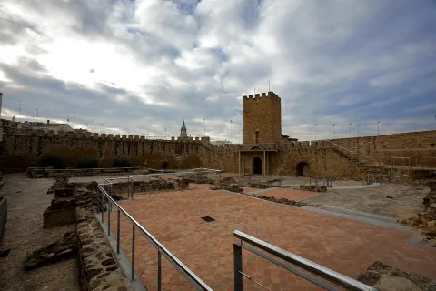
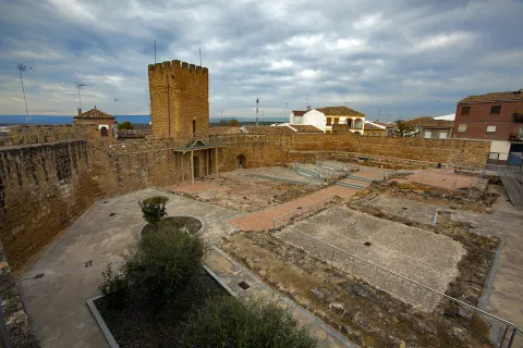
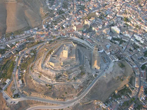
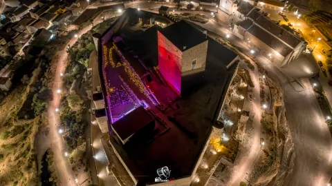
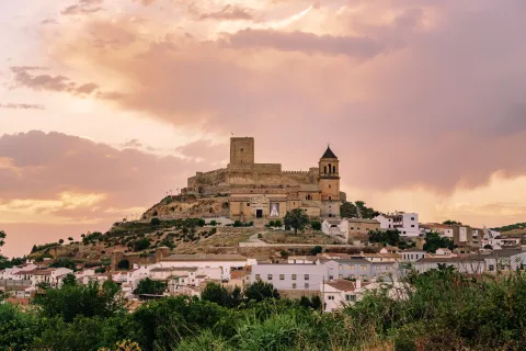
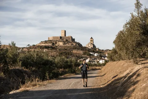
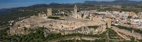
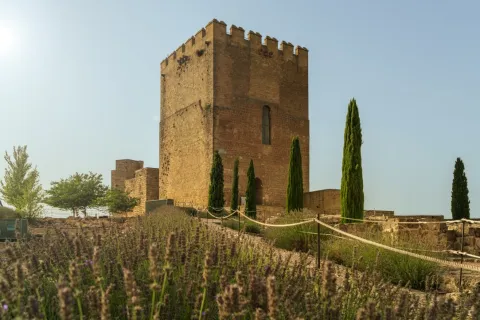
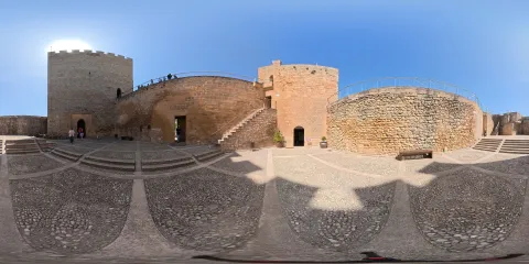
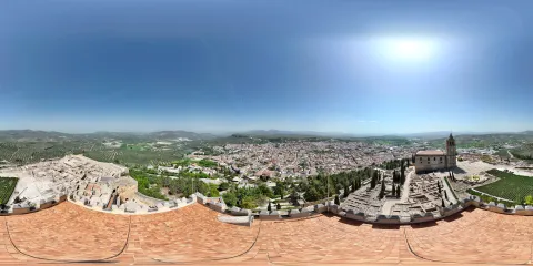
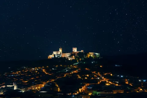
  • The Castle of Macías: It's the most representative medieval building Arjonilla. This medieval fortification was built on an Arab fortress of 8th century. Its most outstanding and ancient element is the Tower of Tribute dating from the 13th century, from a chair with regular chains, it is based on a square-based rock socket. It has three plants that reach 17 meters high. The rest of the compound was erected in the 15th century by the Order of Calatrava. In the form of an irregular polygon of seven sides, three in relative good condition are preserved. This castle is not famous for the war that took place in it, but because in its tower of tribute he lived in prison and died. Macias el Enamorado, whose loves inspired the works of Lope de Vega, "Porfiar to die" and Mariano José de Larra. "Don Enrique the Dollient's maiden." Since 2005 included in the Route of Castles and Battles dand the Diputación de Jaén.It was declared Good of Cultural Interest in 1985.
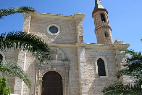
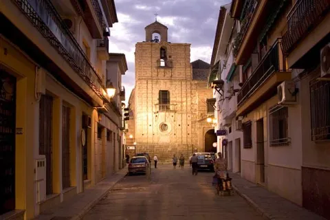
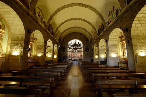
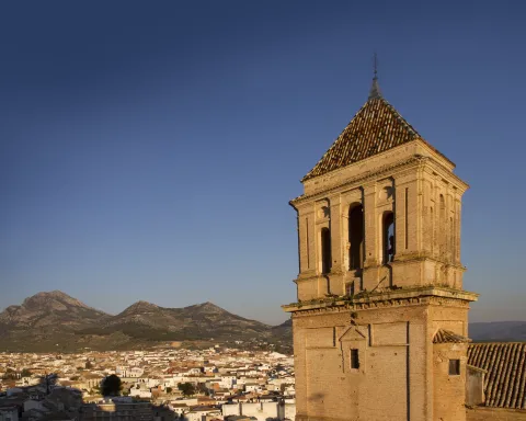
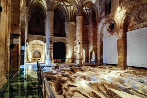
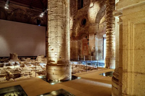
  • Church of the Incarnation: It was built following the Gothic style from the early 16th century. Its plant consists of three ships separated by cruciform pillars and covered with a mudejar roof that in the 18th century was camouflaged with false cross vaults. The chorus and the mannerist altarpiece were destroyed in the 1936 Civil War and later restored. The sacristy is accessed by a plateresque cover. It has a pantheon and side chapels, built between the 17th and 18th centuries. Highlights the size of the tower of octagonal structure and traces mannerist, raised at the foot of the church in the early 17th century. The cover of the church is discovered behind a large half-point arch of silery at the start of the tower. It was declared an Artistic Historical Monument in 1983.
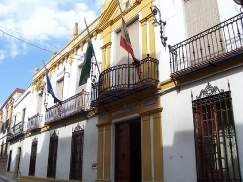
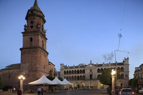
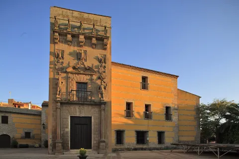
  • House of the Court: Known as Old Town Hall is the more interesting civilian building Arjonilla. Of this building built in the early years of the 17th century, only the facade made of stone is preserved. It has three bodies. In the bass, the door with lintel and wide Tuscan pilasters. In the second one a large balcony flanked by two great mannerist figures, popularly known as "the sticks of sticks" and in the third the shield of the Austrians in the center, the shield of the villa and another place on both sides.
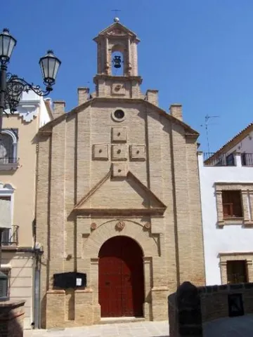
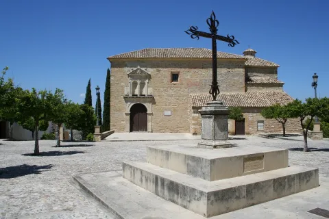
  • The Hermitage of Jesus: Built in the 17th century, retains the cover of its only floor with canyon vault with lunetes. The 18th century facade stands out for its monocrous simplicity of the brick, the ascending verticality of lines and the articulation of spaces. From its interior to highlight the Jesus' shrimp with paintings of this century in the vault.
  • Palacio del Marqués de la Merced: Building of the late 17th century, whose facade has two intellized bodies: on the top it has a forging balcony crowned by a party fronton. It is the seat of the Arjonilla Museum Collections, opened in 2018. It has a room dedicated to the archeology of the municipality, another is the Hall of Historical Ceramic Reproductions of the pottery potter Manuel Bejarano and will shortly have other rooms dedicated to the traditions of Arjonilla to illustrious characters....

Naturaleza

The average altitude of the municipality is 315 m and is located in the surroundings of the Guadalquivir River and the Jandula River. The Arjona Salado stream represents the limit of the municipal term with the city of Andújar in the northeast. Arjonilla is a agricultural municipality, since almost the whole of its surface is a land of cultivation dominated by the olive tree, along with the one that develops a powerful oil industry.

The vegetation in the locality is influenced by agricultural use, which has led to the gradual replacement of the original shrubs and shrubs by olive trees, or by other crops such as wheat or barley. The vegetation of natural origin has therefore been relegated to road cunetas and roads. In the streams we can find remains of river vegetation like canes, tarais and alamos.

In the term of Arjonilla we can distinguish three ecosystems: the olive tree, the banks of the streams with its riverside vegetation and the godparents or liners.

  • The olive tree: The olive tree has an important ecological function. To be the main ecosystemIt's the one that determines most of its fauna. In the old logs of the centenary olive trees find numerous refuge birds, mammals and reptiles. Its fruits are a food of great energy value that takes advantage of the species that live in the olive grove as well as those migratory birds that replenish forces for their long traverses. Among the species that live in a continuous way are: the green and the green in the months of spring and summer, and in winter the curled curled, the red petrored and the common zorzal.
  • Patrons and banks of the streams: The biodiversity of the olive tree increases when, along with it, streams and godparents or lines of Mediterraneanwhere the thick vegetation can develop: carrizos, telfas and tarajes. In this case the number of species increases, both of nesting species and greenhouses: sparrow, common pinzón, jilguero, nightingale, defeat, golondrin, lettuce, corneja... To the list of birds join others amphibians looking for moisture: common toad, green frog, salamander...Reptiles Like the ripple, stair, common lizard...Mammals Like the rabbit, hare, hedgehog, fox, badger...

In the town of Arjonilla we find places of natural interest such as:

  • La Albarrada: This is an old mud quarry next to the city centre. It has an artificial water lagoon very interesting for its ecological function.
  • The Pino and the Marmolejo well: It is the symbolic tree of the town declared a protected landscape element. In its vicinity is the well of Marmolejo, whose construction dates from 1730, as it prays in a tile of the brocal of the well. He brought water to the people of Arjona and Arjonilla.
  • Source of the scribe: It has traditionally been a watershed for animals and pour its water into the stream of the Fountain of the scribe.

Fiestas y Eventos
  • The Candelas of San Antón: on the night of January 16, the eve of Saint Anton, fires are lit so that the Holy One can protect domestic animals.
  • Holy Week: The steps of the Holy Week of Arjonilla are very viscous. Some events such as Palm Sunday with the display of the palms, carried out by people of the village and on Good Friday the act of "unnailing" Christ, procession of the Holy burial and preaching.
  • Corpus Christi: The neighbors decorate some of their streets with vegetable motifs and pastries (heraldic tapestries) and raise beautifully decorated altars for this day. The night before, it's tradition to walk those streets...
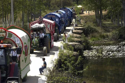
  • Romeria de la Virgen de la Cabeza: they feel the arjonilleros special devotion for the Virgin of the Head to whose Romeria they come with their own fellowship.
  • Festival of San Roque, August 16: It is celebrated in honor of San Roque, patron of Arjonilla since the 17th century. During these days, playful activities take place, highlighting the popular verbenas in which you can taste the typical "punch." In the early morning of the 15th, the Virgin of the Rosary's Brotherhood awakens its neighbors with songs of aurora. It is a tradition that dates back to the 16th century. It's tradition to eat this day "bean potage with eggplant." Tradition dating from 1602, when the people of Arjonilla, to win the favors of the Holy One, promised to refrain from eating meat on the day of their holiday.
  • Festivals of the Virgin of the Battle the second Sunday of October: It is organized by three families of the town. The most important act is the drawing of the "Los Cargos," flag, scepter and cane, of the Virgin of the Battles, who is the patron of Arjonilla, received worship in the hermitage of San Roque.
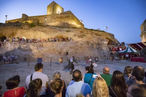
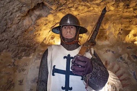
  • Medieval Macy Festivals, Last weekend of September. Medieval market that takes place around the Castle, with many sales posts and many activities, such as exhibition of fighting, cetries, archery, street animation, creative workshops

Gastronomía

The traditional cuisine of Arjonilla is identified with the customs of the region to which it belongs, with some gastronomic particularities, as it can be "the potage of beans with eggplants"that the arjonilleros take the day of their patron's feast, San Roque.

I sing arjonillero: a piece of bread in which a hole is made, to pour olive oil accompanied by crushed tomato, ham, cheese, sausages, olives....

In addition to the traditional gazpachos, the "Salmorejo Old, of clear influence and that is a heavy gazpacho with yolks of eggs cooked and adorned with the clear of them. They are also typical of Arjonilla's kitchen, "skimmed or spun bobbins," "crumbs with stumps" or "chestnut stew"which is prepared for the feast of the Saints on November 1. We can't forget "the Torrijas","The Tickles of San Blas "" the Hole " or "Bread of the Saints.".

Historia

Arjonilla is located in an important archaeological area, the cradle of the Iberian civilization, as the Iberian settlements and funeral cores of the nearby Cerro Venate show. This town must have disappeared around 600 to C. And when centuries later a new nucleus is established it does so in the place that today occupies this town. The existence of clay in the area facilitated the establishment of Roman settlements, proof of this are the material remains found. Also highlight the abundance of Roman coins in the area of San Antón. At this time belongs the stone found in the 19th century and is exposed at the entrance of the bishopric of Jaén. A visionary settlement was also located

For most of his history, It belonged to Arjona, which was conquered by Fernando III around 1244. In the early 14th century, the administrative control of much of the countryside was assumed by the Order of Calatrava and among the fortresses he administered was the castle of Arjonilla. King John II forced the Order to dwell and rebuild the castle in the first half of the 15th century.

The first reference documentary by Arjonilla data of 1282 when the town is given to the archdiacon of Ubeda, forming a lordship, which lasted a few years, as the same archedian, sells it to the village of Arjona. It will be in the 16th century when Arjona gets jurisdictional independenceby Carlos I. From the 17th and 18th centuries the olive tree began to have great relevance In its agricultural landscape, an incipient industry settled in oil mills began. During the War of Independence in 1808, occurred in the term Arjonilla a great battle against the French, prelude to the later battle of Bailen. The industrial activity was encouraged by the arrival of the railway, the improvement of the roads and the installation of the electricity in 1901.
Loading map
Preparing points of interest and routes...
Imagen principal
imagen
Image
Arjonilla
Imagen principal
Activado

Arjona

Submitted by brandcode_deweloper on
Id
723497
Perfil de redes sociales
Facebook
https://www.facebook.com/AytoArjona/?ref=hl
Twitter
https://twitter.com/AytoArjona
Descripción
Breve descripción

Arjona is a municipality located in the north-west of the province, 44 km. of the capital and belongs to the region of the countryside of Jaén. It has a population of 6,000 and its municipality has an area of 158, 45 km ².

It is an eminently agricultural town with a predominance of olive cultivation. Its economy is based on agricultural activity and the olive industry, although the furniture and pastry industry has a recognized prestige and tradition.

Minor hunting is another of its attractions and the banks of the Salado stream make up areas of natural interest.

In its historical-artistic heritage is the Sanctuary of the Reliquias, designed by Juan de Aranda Salazar in the 17th century; the church of Santa María, from the 15th century and of an isabelin style, built on the remains of a medieval castle of which a aljibe is preserved, included in the Route of the Castles and the Batallas.

Other buildings are: the church of Carmen, from which stands out its Mudejar tower and the church of San Martín and San Juan with a plateresque cover.

Telecomunicaciones
Teléfono
953 523 325
Sitio web
www.arjona.es
Fax
953 523 641
Correo electrónico
consistorio@ayto-arjona.com
Ubicación
Nombre
Arjona
Latitud
37.935590
Longitud
-4.054460
Distrito
Municipio
Ubicación en el mapa
POINT (-4.05446 37.93559)
Imágenes
imagen
Image
14c228fb-4685-0007-ab13-56b94d334c04?t=1585584681223
Imagen principal
Desactivado
imagen
Image
5bfca9c9-f954-26af-ee99-4eaafdaff3da?t=1616519266775
Imagen principal
Desactivado
imagen
Image
ebbdbbbb-4195-e5cf-7332-98a1d7deea28?t=1585584680906
Imagen principal
Desactivado
imagen
Image
a991b45b-b46e-144c-a1a0-6f8db1f98f41?t=1585584680776
Imagen principal
Desactivado
imagen
Image
85d5220c-799b-d2ce-fce5-36f886b68605?t=1616519266819
Imagen principal
Desactivado
imagen
Image
506fd5fd-463b-1599-e49f-303e3c4dbadb?t=1602871305320
Imagen principal
Desactivado
Información adicional
Imágenes cabecera
imagen
Image
a575386f-120b-ebd2-537c-d68fb2875bba?t=1606405208504
Imagen principal
Desactivado
Datos de interés

Tourist area: Sierra Morena / Sierras de Andújar and Despeñacolos

Distance to the capital (km): 44

Altitude over sea level (m): 458

Extension (Km2): 158

Number of inhabitants: 5826

Gentillo: Arjoneros or Urgavonenses

Postal code: 23760

Videos
Video file
Cultura

From its abundant and rich monumental heritage, we highlight:


  • Aljibe Almohade. It is built on the 13th century, work of the pillows and is the oldest building that is preserved in Arjona. It is in the noble area of the ancient alcaza of Aryuna, under what could be the Major Mosque. It is rectangular with 3 canyon vaults, supported on half-point arches that rise on Roman alabaster baseswhich supported Roman sculptures.
  • Church of Santa Maria del Alcázar. It is an isabelin-style temple (16th century) with a single ship and short-arms cruise. Located on a sacred place since ancient times (Roman remains, Visigoths and Muslims), it was built on the remains of the primitive Arab mosque. The church custody since 1843 the images of the patrons of the town: San Bonoso and San Maximiano, next to that of Santa Maria del Alcázar, who was also a patron of the city.
  • Sanctuary of the Saints and the Sagrada Reliquias. The sanctuary was erected during the bishopric of Moscoso and Sandoval to guard the alleged remains of the martyred saints Bonoso and Maximilian, found in this villa in the early 17th century, as well as the remains of more than 3,000 martyrs of the first Christians during the Roman era. He rose between 1617 and 1619 with stone from Santiago de Calatrava and, as John of Aranda and Salazar planned, who also worked in the cathedral of Jaén, two churches were overtaken. At the bottom a camera was billed to be seen from the outside, as a crypt, with access to the cemetery of the Saints. It has a polychrome plaster altarpiece, baroque decoration, which was not finished until the mid-19th century, tombstones with the stories of the martyrs and a silver cover. The upper part has its entrance from the Plaza de Santa María, by a cover of 1659, and its plant is of a single ship covered with canyon vault with lunetes and architrabed pilasters that hold half-point arches. The upper floor was intended to house the stone images of San Bonoso and San Maximiano, which were never placed. In the year 1843, with the Decriminalization of Mendizábal, the images are moved to the church of Santa Maria, and the relics of the martyrs to the upper floor. The lower floor is not functional. This space currently houses the Religious Museum of the parishes of Arjona, where much of the heritage of the fellowship, as well as ancient drawings and photographs are displayed.
  • Church of St. John the Baptist. Building that began to be built in the 16th century, although it was destroyed in the Civil War. His reconstruction was in the hands of Devastated regions which quite changed the plant, adding a more framed crunch over two towers. The inside is of a neo-Gothic style with a three-ship plant separated by pointed arches. Of its primitive construction only remains a cover, of silver style, which gives access to the interior of the temple that was carved by Juan Marquina in 1531. Next to imagining should be noted the sacred made thanks to the donations of gold and silver delivered by the parishioners in donations around 1950. Under the temple of St. John is the Rhipta del Baron de Velasco, covered by a dome made up of thousands of neoByzantine-style tesels.
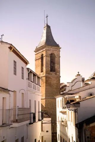
  • Church of Our Lady of Carmen. It began to be built in 1898. A historical style, with a tarootic plant on its only central ship. Neobarroca on its stone cover, with tile for the image of its headline in curved front. The presbytery welcomes in its central altarpiece a magnificent image of the Virgin of Carmen. The Neomudéjar tower, slender and elegant, with brick and tile masonry.
  • Church of San Martín. It was built on the pillars of an old Roman temple. Its foundations are gothic, but the remodeling of the last centuries changed its physionomy. The tower was erected in the 16th century.
  • City hall and old town hall. The building takes a seat over the old San Miguel hospital. The most important is the room of the former mayor's office, a neo-Arab stay that evokes the palatine dependencies of the Alhambra of Granada and whose decorative elements were brought from the house-palace of the Baron of Velasco. Today it is used as a reception place for official visits and one of the main tourist claims.
  • Stone of desires. This enigmatic sphere, which in Arjona is popularly known as "La Piedra de los Deseos" or "Las Casualidades," was incorporated into the city of Arjona in 1995. Despite these "titles" with which the stone currently counts or is known, it is a bethyl or sacred stone. This type of "Sacred Stone," comes from an excavation that took place in the ancient Gothic Cathedral of Jaén, which reaches Arjona by the well-known writer Juan Eslava Galán.


Naturaleza

The lands of Arjona are soft lomas with moderate slopes that are mostly dedicated to agriculture, the cultivation of the olive tree being the most occupied area, followed by cereals. The forest area is non-existent and it is only possible to observe small spots of Mediterranean bushes in the rocky areas of difficult access, in the margins of the streams and in the godparents or liners.

In the term of Arjona we can distinguish three ecosystems: the olive tree, the banks of the streams with its riverside vegetation and the godparents or liners.

The olive tree: The olive tree has an important ecological function. To be the main ecosystemIt's the one that determines most of its fauna. In the old logs of the centenary olive trees find numerous refuge birds, mammals and reptiles. Its fruits are a food of great energy value that takes advantage of the species that live in the olive grove as well as those migratory birds that replenish forces for their long traverses. Among the species that live in a continuous way are: the green and the green in the months of spring and summer, and in winter the curled curled, the red petrored and the common zorzal.

Patrons and banks of the streams: The biodiversity of the olive tree increases when, along with it, streams and godparents or lines of Mediterraneanwhere the thick vegetation can develop: carrizos, telfas and tarajes. In this case the number of species increases, both of nesting species and greenhouses: sparrow, common pinzón, jilguero, nightingale, defeat, golondrin, lettuce, corneja... To the list of birds join others amphibians looking for moisture: common toad, green frog, salamander...Reptiles Like the ripple, stair, common lizard...Mammals Like the rabbit, hare, hedgehog, fox, badger...Fish have disappeared because of the pollution of the streams, especially the Salado stream, the most cuddly.

Arjona presents to the visitor as Balcony of the Jiennense countryside. As you walk through the historical ensemble it offers the visitor four viewpoints well-cared with panoramic views to the north and south of the Jiennense countryside.


Fiestas y Eventos

Among the local parties, we highlight:

  • Fiestas de los Santos Patronos: San Bonoso and San Maximiano. These are Arjona's most important parties. They are celebrated in honor of the patron saints San Bonoso and San Maximiano, which were given by the neighbouring city of Andújar in 1629. They are known by the name of "Festivals." They take place between 11 and 24 August, when day 21 the most important dayin which the procession of the images and relics of the saints takes place. These days take place different traditions who are kept alive from their origins: the repeat of the Campanica del turrón, the transfer of the Sagradas Reliquias to the church of Santa María (August 11), the Pesos to collect donations weighing people in a Roman, to then deliver the equivalent of its weight in wheat, the procession of the luminaire, the Burn of Daciano and, to finish, the transfer of the Sagradas Reliquias to its place of origin (August 22)
  • Real Fair. The old livestock fair that has been held since the 18th century has become the only party "Arjonera" which does not develop around a religious figure. It takes place around to 15 September, celebrating the closest weekend to the date, from Thursday to Sunday. Among other activities is an exhibition and sale of livestock, especially equine. But, above all, they are four days in which the neighbors enjoy four days where singing, dancing and gastronomy are the center of the celebration.
  • Feast of San Isidro. On the 15th of May, in honor of the farmers' pattern, a parade of carrots with tallying tools and cavalers is organized to accompany the saint during the procession. It ends with the blessing of the field on the New Paseo. In this day's vergena, the City invites the typical "singing": bread with olive oil, beans and cod.


Gastronomía

Among the most characteristic dishes of Arjona's gastronomy are the following:

  • Migas: The crumbs, Roulera crumbs or shepherd crumbs, they are a culinary preparation that has been common for people who are engaged in Spanish transhumanism, are made from pieces of the roasted bread miga accompanied by minced meat and vegetables.
  • Pipirrana: Also called pimpirrana or pirirach, is a salad whose basic ingredients are onion, tomato, green pepper and cucumber. Sometimes it is added cooked egg, some kind of fish, meat priet or even sausages.
  • Bake: They receive this name a number of food preparations that have in common that are made in the oven with fat bread mass. They are usually eaten from Carnivals until shortly after Easter.

It's often a kind of Empanada filled with butcher products: loin, ham, chorizo, etc., which are cooked together with the oven mass.

  • Gachas: It is a dish that is made by cooking oats or other cereals or vegetables in water, milk or a mixture of both. They usually serve hot in a bowl or dish.

In the pastry The following are highlighted: Biscoco de los Santos (is the traditional biscuit covered with ballast sugar), Chocolate millets, Sweet sephardi of nuts, orange and spices, Oil cake and Filled peppers. We must highlight the Christmas products produced by the firm Campos.


Historia

In Archaeological Museum of Arjona, opened in 2012, we can observe more than 3,000 pieces found at the end of the town and ranging from the fossil remains to pieces related to modern archaeology. Visiting this museum will be a extraordinary lesson of the History of Arjona and the different peoples and cultures that have passed through this town.

Of the three rooms that make up the museum the first of them is dedicated to the Prehistory, where we can find material remains of the Paleolithic, Neolithic, Calcolytic and the Age of Metals. Among these remains are: Protro-Bifaces to argaric arrows of the type "Palmeta," made at the time of the Metals.

We also find the reconstruction of a Paleolithic cave and a Neolithic cabin, they become the didactic bet of this first room.

In the second room, dedicated to history, shows us some epigraphic remains Iberians, Romans and Muslims. Another type of ceramic utensils are added, in glass and marble that make this room the most complete of the Museum.

Arjona corresponds to the old Urgavo or Urgao Alba, from Roman times. After Caesar's victory in Monda (year 45 BC), Urgabo received a privileged legal status for his support to the cesarian side, as well as Lliturgi, Isturgi and Obulco.

Important epigraphic remains have been found that demonstrate the importance of the city in the imperial high time, together with the existence of temples dedicated to Augustus and Plotina, wife of Trajano.

After the conquest Muslim becomes called Oal'at Aryuna, controlled by the family Bann Bayila. After the fall of the Califate of Córdoba, the city participated in the inner struggles of the period of taifles, a time when the walls are reinforced.

Here he was born in 1149, Mohamed ibn Yusuf ibn Nâzar, known by the name of Alhamar (the Red), first futureKing Nazarí of Granada. He was born in the alcázar where today the San Miguel hospital rises. It preserves the ruins of a medieval castle. With the Christian conquest carried out by Fernando III, In 1244, the city was besieged and destroyed.

In 1430, King John II gave it to D. Fabrique de Castro with the title of ducacy. Four years later it would be sold to the constable Mr Alvaro de Luna. In Year 1891Get it. the city title. The third of the rooms is dedicated to the illustrious characters of the History of Arjona: King Alhamar and Helvia Paulina. The room is covered with a collection of audiovisual services that aim to make known the history of the city of Arjona to the visitor. An excellent way to make the history of the city of Arjona known in a friendly and well-founded way.

Loading map
Preparing points of interest and routes...
Imagen principal
imagen
Image
b8afc11d-6ba5-ac68-85db-33e46223f3c5?t=1603889351626
Imagen principal
Activado

Andújar

Submitted by brandcode_deweloper on
Id
1304223
Perfil de redes sociales
Facebook
https://www.facebook.com/AyuntamientodeAndujar
Twitter
https://twitter.com/aytoandujar
Instagram
https://www.instagram.com/turismo_de_andujar/?hl=es
Descripción
Breve descripción

The city of Andújar is located at the foot of Sierra Morena, to the northwest of the province. Its municipal term is included in the Natural Park of the Sierra de Andújar, with half-mountain formations that contain a Mediterranean ecosystem, composed of masses of encinars, alcornoques, complaints, pineapples, oaks and bushes.

It is the most extensive and populated municipality of the region of La Campiña, on the banks of the Guadalquivir River, which divides the municipal term into two well-differentiated parts: one of Vega and countryside, to the south, and one of dehesas and Mediterranean forest in Sierra Morena, to the north.

Agriculture is very varied, with olive groves, although there are other crops such as cereals, legumes and cotton. It also has livestock and larger hunting that represent a significant economic income.

The city also stands out for a strong manufacturing presence: textile industries, concierges, ceramics... The construction activity, as well as small trade, occupy a significant number of people, although the latter, currently and due to the crisis, is resisting. In addition, the modernization and machining of the field makes it unable to absorb the group of unemployed.

Telecomunicaciones
Teléfono
953 504 959
Sitio web
www.andujar.es
Fax
953 508 207
Correo electrónico
turismodeandujar@andujar.es
Ubicación
Nombre
Andújar
Latitud
38.039610
Longitud
-4.054940
Distrito
Municipio
Ubicación en el mapa
POINT (-4.05494 38.03961)
Imágenes
imagen
Image
b0f7238b-8f63-ac27-4966-827e8a4fa6b8?t=1585581420642
Imagen principal
Desactivado
imagen
Image
b1bc38ae-53ae-5bc9-cebd-c7d32d33ba59?t=1585581420473
Imagen principal
Desactivado
imagen
Image
ca2cce8f-c738-3a80-a2c0-14697fd628ab?t=1616518390356
Imagen principal
Desactivado
imagen
Image
21589599-2dfb-bfd6-fe3d-ac2d69bc36c4?t=1616518390441
Imagen principal
Desactivado
imagen
Image
faa23b01-6f15-e7fa-755e-046cf270ce8f?t=1616518390491
Imagen principal
Desactivado
imagen
Image
b090f7c9-9aa9-8e0a-b5b0-de0cb34203b5?t=1616518390541
Imagen principal
Desactivado
imagen
Image
7cb8d394-b36c-6184-ea34-923bfdbbd7a1?t=1616518390652
Imagen principal
Desactivado
imagen
Image
0dcb1e5b-5c56-4471-e932-14f8fed5f461?t=1616518390711
Imagen principal
Desactivado
Información adicional
Imágenes cabecera
imagen
Image
bb48aa8d-9afc-13a3-7ec4-a1203be45aa8?t=1608747255282
Imagen principal
Desactivado
Datos de interés

Tourist area: Sierra Morena / Sierras de Andújar and Despeñacolos
Distance to the capital (km): 42
Altitude over sea level (m): 212
Extension (km ²): 964.9
Number of inhabitants: 36,793
Gentillo: Andujareños
Postal code: 23740

Videos
Video file
Cultura

The city of Andújar continues to maintain a heritage set of great interest, for the quality of its monuments and for the diversity of artistic styles that can be appreciated.

We highlight some of them:

  • Church of Santa Maria la Mayor. The construction of the church Santa María la Mayor, of a basic plant, began in the 15th century and ended in the first quarter of the 17th century. Its pillars and vaults of the first stretch are Gothic and the rest of the sets of the second half of the 16th century. The plant is articulated in 3 ships of 4 sections each. Among his works of great value is the 16th century paving and two pictorial works, the Prayer in the Garden of the Greco Olives and the Immaculate of Giuseppe Cessari. It has 3 covers: Northern front, in the square of Santa Maria. Designed in the early 16th century, in purist style. South front, dedicated to San Pedro. It is from the second half of the 16th century, in the strictest purism. Foot cover. It belongs to the Herriian style, is characterized by its absence of ornate and the sobriety of its elements.
  • The chapel of the Christ of Agonyis connected to the church of Santa Maria. It is a Neogotic style, built between 1923 and 1925, by Rafael and Mª Elvira Pérez de Vargas (condes de la Quinteria). It is a private chapel conceived as a crypt of the counts. It has a single ship, organized in two sections, with nerve vaults, the header is decorated with five windows pointed with glass windows.
  • Church of San Miguel. It dates from the second half of the 15th century and is a Gothic temple, with a basic plant of three ships. The plant, wider than the sides, ends in polygonal header, while the sides are flat. The interior lacks its own luminosity by not having windows, one of the most characteristic elements. Of its covers, the one of the feet is of a plateresque style; the northern cover is in the transit between the Gothic and the Renaissance; the southern cover has a double conopial bow flanked by pinacles. The 16th century tower has undergone numerous reforms as it is damaged by the Lisbon earthquake.
  • Church of San Bartolomé.It is the first parish built to extramurus and later founded. In the initial project it is conceived as a three-ship gothic, articulated in five sections. From the different remodeling, there are signs: at the door of the sacristy the late Gothic (16th century) is observed, the primitive cross vaults are replaced by others of mannerist sensitivity. The tower, which is inconclusive, is from the 17th century and recalls that of San Miguel, is attributed to Francisco del Castillo, the Young. Of the three doors, the one that gives the runner of San Bartolomé is the most interesting. Its vanity integrates a bent bow pointed by another conopial with cardinals and flanked by pinacles.
  • Church of Santa Marina.Mosque in Muslim times and Christian temple since the village was taken by Fernando III, the Holy (1225). It is a temple of three ships articulated in four sections. Its main chapel was remodeled in the 17th century, with a square section covered with a half-orange vault on the breast, in which the arms shields of Pedro and Luis Pérez de Vargas Palomino, their patrons, are located. Its two covers are of great simplicity, being that of the feet, of baroque style, which presents a greater monumental. He ceased to be a parish in 1843 although he remained open to worship until the 1970s. It is currently used as a cultural space.
  • The Clock Tower.Mudéjar influence tower made in the time of Emperor Charles I (concluded on 20 August 1534). It was part of the royal prison and was conceived as a lookout to observe the village and the surrounding areas of the city. Head the square of Santa María, the heart of the medieval city. Its building is sober, based on alternating brick with stone armchairs. The almenas that kill the whole give it a strong tower air. Two elements stand out in this unique building: the Emperor's bicephalic shield and the beautiful silver-style watch that gives name to the tower. The towers of the church of Santa Maria, both the primitive and the modern, do not exceed the Clock tower in height, as a sign of the primacy of municipal civil power over religious power.
  • House of the Children of Don Gome.This single house of the Cárdenas and Valdivia is popularly known as "the Children of Don Gome," reference to the ten children who had the marriage and was built in the late 16th century. The Renaissance palace is built behind the Almohad wall and in the vicinity of the Sun gate. Torreada fachada built in late XVI and early XVII. Two elements of very different use make up the house of the Children of Don Gome, the house of the inhabitants and the cavalry. On the façade of the solariega house, built in a plane more advanced than that of the cavalry, stands out its portada- tower, built unlike the other elements of the whole in sandstone, in the second third of the 17th century, by Don Gome de Valdivia, Cárdenas and Guzmán and Dona Mayor Nicuesa, and that is in the Baroque style. The pillow cover is almost unnoticed by the exuberant decoration, two Indian-accent, repetitive heraldic, and a highlighted cornice, as more prominent elements. The Children's Palace of Don Gome is the venue of the courses of the University of Autumn. Inside is the Archaeological Museum Professor Sotomayor. The stables are preserved with part of the fish, a porticated courtyard and the winery. In the latter is the Casa del Alfarero, which includes the extensive and rich tradition of ceramics that has characterized this land.
  • Comedian house - town hall.The current town hall is located in the building that was built between 1620- 1631 for comedia house, which it maintained until 1680. In 1787, the Cabildo decided to move to it, as it had lost its old function. The fruit of this remodeling is its central body of neoclassical style and the beautiful staircase of "empire style." Three floors make up their beautiful façade: In the first one a portico and in the second one, a gallery as a lookout for the taurine celebrations of the time. The building is topped with an airy balustrada, articulated in pillars topped with pinacles. This facade has an Italian orientation and can be located within the most classical mannerism.
  • Roman bridge.Its construction dates back to the end of the second century and saves the Guadalquivir River. Built with sandstone armchairs of a seine or brown colour, it has fourteen eyes, of which the twelve on the right bank are of half-point arch and the other two scarves. Like the Merida bridge, it offers lightens or drains on pillars to facilitate the passage of water in the large rivals.
  • Basilica and Royal Sanctuary of Our Lady of the Head. Located in the heart of the Natural Park of the Sierra de Andújar, in the area known as the hill of the Cabezo, 32 km. north of the city of Andújar. The sanctuary is built between 1287 and 1304 and was reformed in the late 16th century. Since 1930 the trinitarians have served the cult in the sanctuary. The façade is made up of the door's vain, arco-sino balcony and two-body swordsman. The interior is a single ship covered with a barrel vault. The trinitarians community makes the enlargements of the two side buildings, leaving a harmonic set. In the very dependencies of the basilica is the Mariano Museum, where an important artistic, documentary and anthropological exhibition of the historical legacy has been developed through the centuries by devotion to the Virgin of the Head.
  • González Orea Museum of Plastic Arts.Located in the old convent of the Capuchino Mothers.
Naturaleza


Andújar, head of the region of the countryside of Jaén, with almost 965 km ² of area is the municipality with the largest extension of the province. The city is the third most populated in the province, with approximately 37,000 inhabitants.

Its municipal term is divided by the Guadalquivir River, with the Sierra de Andújar Natural Park in Sierra Morena in the north and the Vega and countryside in the south.

  • The Vega del Guadalquivir.The territory of the Vega del Guadalquivir is characterized by its very flat landscapes of irrigation, with intensive crops (oranges, lemoneros and orchards). The olive industry, textiles, wood furniture, crafts and ceramics are other sources of economic dynamism, along with the hotel, which takes advantage of natural tourism and its strategic location, right on the motorway of Andalusia.
  • Natural Park of the Sierra de Andújar.It focuses important landscape and wildlife attractions. It extends through the neighbouring municipalities of Villanueva de la Reina, Baños de la Encina and Marmolejo, occupying an area of 74,774 hectares. Agriculture is very varied and dominated by the olive tree, with livestock and major hunting as the predominant agricultural activities. The natural park, in the form of an almost perfect equilateral triangle, is a sample of the typical landscape of Sierra Morena. A large number of emblematic species find here their refuge between the Mediterranean mountain and the dehesas of the heart of the park, the steep northern saws and the dense southern pine trees. The most characteristic species are the oak and the cork in adherent form, while in the higher altitudes, where the humidity is higher, we find the complaint. From the hydrography of the park we highlight the river Jandula, tributary of the Guadalquivir, with numerous streams that will lead to it and that form numerous pools and lagoons. In the end of Andújar we will find numerous sites, trails and routes that will discover the beauty of this term, like the Juncillo path.
  • Junctile Path.Suggestive and easy 5.7 km road that travels a very representative space of Sierra Morena and this natural park. On the road A-6178, about nine kilometres from the Sanctuary of the Virgin of the Head, you reach a crossing with signs to Valdelagrana and Las Tapas, which is where the path begins. In it there are the dehesas on almost flat grounds and Mediterranean mountain stains, both populated by numerous animal species, including various birds, easily visible, or mammals, such as deer, boars, foxes or garduñas, difficult to see but whose traces we will find with some ease. The Madrona and Quintana saws, on the horizon behind these plains, evoke the many legends that these depopulated lands have inspired throughout history.
  • Visit center Viñas de Peñallana. The visitor center is located on the 13th kilometer of the road A-6177 that links the shrine of the Virgin of the Head with the town of Andújar, at the entrance of the natural park, where the visitor can find a first approach to the different environments of the environment, walk through a recreated Mediterranean forest where to identify plant species and their aromas or discover numerous emblematic endangered species that find refuge in these saws; it is the case of the Iberian wolf, the imperial eagle or the Iberian lince, the most threatened feline on the planet.
  • Environmental Park Cercado del Ciprés.It is located in the town of Andújar (past the Hospital Alto Guadalquivir). The Cercado del Ciprés Environmental Park has an area of 11 hectares on which there is an artificial lake and a stream. This complex represents the ecosystems of the Mediterranean forest and the typical river vegetation. It also has different recreational areas such as a bike lane, an aviary, rustic huts, wooden kiosks, lookout, pedestrian trails. In the main building, there is an information point that offers guidance for the visit to the Sierra de Andújar Natural Park. Next to the Cercado del Ciprés Environmental Park is the only Interpretation Centre of the Honey of all of Andalusia.

Recreational areas El Encinarejo, La Recta, El Jabali. These are traditional areas of leisure and recreation on the road that reaches the shrine of the Virgin of the Head. They have banks, barbecues, tables and containers, so they represent an excellent option to spend an outdoor day in the family.

  • In El Encinarejo, the characteristic vegetation is that of the forests of riverside, strawberries, allies, sardines, thelves and tarayes, which serve as a refuge to the representative fauna of this humid area, such as royal herons, zampullines, water cocks and, if we are lucky, some otter can be observed. Following the river bank you can reach the foot of the small, lake-like Encinarejo swamp dam. From El Encinarejo you can make several hiking routes, for example, being the starting point of the so-called Encinarejo path.
  • The Recreative Area The Straight, 2.7 km, is located on the left side of the road, on the banks of the Jandula River. From there a path is left for which you have to ask for authorization 15 days before.
  • In the El Jabali Recreative AreaOn some rocks there's a granite boar. Through it passes GR-48, which comes from the Encinarejo and reaches the Sanctuary. In addition, the El Jabali trail, of 3.2 km, is started.
Fiestas y Eventos


There are numerous parties and events held in the city of Andújar throughout the year, including the following:

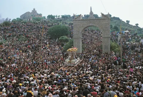
  • Romeria de la Virgen de la Cabeza. It is the most outstanding party and has its origin in the first half of the 13th century. It is celebrated in the week of the last Sunday of April:

On Thursday a flower offering is made to the Virgin of the Head in the City Hall square.
Friday is the entrance to the cofradies of all of Spain on the Roman bridge.
On Saturday, people ride up on carts and horses to the sanctuary of the Virgin.
On Sunday, with the sanctuary full of Liturgypsies, they all want to see the mother of Sierra Morena, to process through the reels.
After four hours walking through the streets, the Virgin returns to her shrimp, when the rosemary return to their places of origin to wait for the rosemary of next year. It is declared a National Tourist Interest and Cultural Interest Fair.

  • Holy Week. It is considered the big week of the town, celebrated with great recollection and religiosity since ancient times. It highlights the artistic-cultural value of the dominating images of the different cofradies and hermandades that carry out their processions on the streets. The Old Holy Week begins on Palm Sunday with the Brotherhood of the Borriquilla, with the highest splendor being reached on Holy Thursday with Our Father Jesus of Great Power.
  • Patron party in honor of San Euphrassio. It is held on May 15. This saint, a disciple of the Apostle James, has become relevant to the city since 1597, when a relic of the saint was brought to Andújar. Since then, he has been his patron and is dedicated to worship and parties in his honor every year.

In addition, these other parties are held: Festival of the Candelaria (2 February), carnival, Cruces de Mayo, Feast of the Divine Pastor (16 July) and Santiago Apostle (25 July).

The following events also take place:

  • Anducab. Since 2004 the Morfológico-Functional Anducab competition has been held, which has been consolidated as one of the five most important competitions in Spain, scoring for the competition in the International Horse Hall (SICAB) that is held annually in Seville. The main objective of this fair is to offer the exhibition and sale of everything related to the world of the horse.
  • Iron and forge competition. This is a meeting of horseshoes from all over Spain in which they come together to show their skills in this modality, making "on-site" plastic horseshoes.
  • Agricultural Fair of Andalusia. Organized by the Jaén Farmers' Association, it is held for three days in October. It includes machinery and utility companies, institutional government stands and different products, such as honey, real jelly, sweets, etc.
  • On the horse from the rock rocks. These are days of coexistence in which a pilgrimage is made on horseback to the sanctuary of the Virgin of the Head. It brings together hundreds of horsemen who with their horses and mules run along the "old road" through the Natural Park to the sanctuary of the Virgin. These days are true "girl romaneries" that they carry out during the year different rosemary collectives.
  • Flamenco. It is a flamenco fashion walkway that takes place outdoors in the market square, unique heritage environment. It is attended by more than 10,000 people for four days (Friday afternoon, Saturday morning and afternoon and Sunday morning).
  • International Fair of Iberian Lince (FILYNX). The International Fair of Iberian Lince is a three-day tourism event for nature observation, with a special focus on Iberian lince, conservation tourism and ecotourism. Its first edition was in 2019.
Gastronomía


The gastronomy of Andújar is typical of the serrano villages. Everything revolves around a culinary jewel such as extra virgin olive oil, as well as the high variety of typical products of the earth. The hunting meat that provides us the natural environment of Andújar, attached to the vegetables of the rich land that irrigates the Guadalquivir River.

We can taste the following dishes:

  • Pipirrana: is a salad whose basic ingredients are onion, tomato, green pepper and cucumber. Sometimes it is added cooked egg, some kind of fish, meat priet or even sausages.
  • Andrajos: cooked in the broth of boiling minor game pieces with peppermint and a saffrito of vegetables and strips of flour made of jirones that take the name.
  • Ajoharina: A saffrito is made with tomato, onion, potato and eggplant. In the frying pan, dry red peppers are tasted, once toast is crushed in the mortar with cumins and salt. When everything is ready, water is added and at the end flour is to be weighed.
  • Mountain meat, preferably deer, which is cooked with potatoes and vegetables.
  • Flamenquin: which originated in Andújar. There is also a variant called flarosquin, or what is the same, flamenco with circular form.

In pastries we highlight: Holy Week panets, fried rosches, sigh and entangled.

Historia

Andújar is in a privileged situation because it is a crossroads of commercial routes and roads for the displacement of populations, that would explain the penetration of artistic and cultural influences from different backgrounds. The proximity of the Guadalquivir River will be an incentive to the settlements of the populations. The oldest remains found date from the Paleolithic, but it is in the Neolithic and first part of the Bronze Age that the population of the area is intensified, for its fertile land for the development of agriculture and mining in Sierra Morena. The first people to settle would be the Oretans, the Iberians who founded the ancient Isturgi in the place that today occupies the pedany of Los Villares de Andújar.

Everything indicates that it was a flourishing city during the Roman domain, linked to the production and marketing of the high-imperial ceramic (I-II centuries). At the end of Roman rule, the population moved to a nearby place, the current Andújar, losing the name of Isturgi with the arrival of the island.In the year 711, after the battle of Guadalete, the entire southern area of the peninsula would become al-Ándalus. Moving the population from Los Villares to the current Andújar.

In 1225, the city is conquered by Fernando III, the Holythe Christian troops of the orders of Santiago and Calatrava to settle in the city. The Muslim population leaves the cities of Andújar, Martos and Baeza, the first Christian inhabitants being settled.King Henry IV, in 1467, gives him the title of city. This would begin with a period of population growth and an increase in agricultural land, reaching 13,000 by the end of the 16th century. The population is mainly made up of farmers and farmers.

In 1808 he will be occupied by French troops, where General Dupont established his headquarters. From here he would send his troops to Bailén, a battle in which he would be defeated. During the Spanish civil war, Andújar was left on the Republican side, which meant that he was bombed by the Franco troops, causing death and resentment on both sides.

Today, the city of Andújar continues to have a part of its population occupied in the agricultural sector, it also has modern industries, and the tourism sector is making way to make known its rich artistic and natural heritage, which makes it able to face its future with optimism.

Loading map
Preparing points of interest and routes...
Imagen principal
imagen
Image
e6de5d04-2828-525b-0221-966572b7fb26?t=1603888972531
Imagen principal
Activado
Literatura

Discover San Juan de la Cruz and Miguel Hernández in Andújar.

A fascinating itinerary not to be missed.

Alcaudete

Submitted by brandcode_deweloper on
Id
722589
Perfil de redes sociales
Facebook
https://www.facebook.com/AyuntamientoAlcaudete/
Twitter
https://twitter.com/aytoalcaudete
Descripción
Breve descripción

Alcaudete is located at the foot of the Sierra Achillos, on the south-west end of the province of Jaén, in the region of the Sierra Sur. Its geographical location allows it to be half an hour from Jaén, less than an hour from Granada and Córdoba and two short hours from Malaga and Seville.

In Alcaute the story is breathed in all its corners. Its home is poured in the form of a ring on the hill side, embracing its two most important buildings: the Church of Santa Maria la Mayor and the Calatravo Castle, from which its rich olive lands and orchards are seen. It has three villages: La Bobadilla, Los Noguerones and El Sabariego, where the target of their houses stands out among the green olive tree.

The urban centre of medieval origin has an important architectural heritage since the villa has had a great expansion between the 16th and 18th centuries, building a large number of civil and religious buildings of many different styles, which embellish and embellish the streets of its historic town.

Its landscape is determined by strong slopes and areas of Vega around river courses, between the Guadalquivir countryside and the Subbetic Serras, which conditions the predominant type of crops: orchards and a "sea" of olive trees. In its term are the natural reserves of the Laguna Honda and La Laguna del Chinche, endemic complex of great ecological interest for the avifauna that inhabits it (evil, flamenco, anade real, squid...).

For its municipal term it runs the Green Way of Oil and is integrated into the route of "Castles and Battles," as well as the route of the Caliphate, belonging to the Andalusian Legate Routes.

Telecomunicaciones
Teléfono
953 560 000
Sitio web
www.alcaudete.es/index.php/es/
Correo electrónico
ayuntamiento@alcaudete.es
Ubicación
Nombre
Alcaudete
Latitud
37.590980
Longitud
-4.086670
Distrito
Municipio
Ubicación en el mapa
POINT (-4.08667 37.59098)
Imágenes
imagen
Image
80e747f2-e97c-94df-583a-42e6306567b4?t=1583262294673
Imagen principal
Desactivado
imagen
Image
castillo-desde-sierra-ahillos-jpg
Imagen principal
Desactivado
imagen
Image
img_0645a-jpg
Imagen principal
Desactivado
imagen
Image
img_0910a-2-jpg
Imagen principal
Desactivado
imagen
Image
img_0913a-2-jpg
Imagen principal
Desactivado
imagen
Image
img_1469-2-jpg
Imagen principal
Desactivado
imagen
Image
img_1594-2-jpg
Imagen principal
Desactivado
imagen
Image
img_1655-jpg
Imagen principal
Desactivado
imagen
Image
panorama_sin_titulo1-2-jpg
Imagen principal
Desactivado
imagen
Image
00716363-1d29-daf1-c47e-14878f00a61c?t=1585328067736
Imagen principal
Desactivado
imagen
Image
dji_0002-1-jpg
Imagen principal
Desactivado
imagen
Image
1w9a5696-1-jpg
Imagen principal
Desactivado
imagen
Image
1w9a1663-jpg
Imagen principal
Desactivado
Información adicional
Curiosidades

Plaza de Santa María, s/n (Junto Iglesia de Santa María la Mayor)
Tlf: 953 560 304 
E-mail: turismo@alcaudete.es

Imágenes cabecera
imagen
Image
alcaudete
Imagen principal
Desactivado
Datos de interés

Tourist area: Sierra Sur and Campiña de Jaén
Distance to the capital (km): 48
Altitude over sea level (m): 676
Extension (Km2): 238
Number of inhabitants: 11015
Gentillo: Alcaudetés
Postal code: 23660

Videos
Video file
Cultura

The urban centre of medieval origin has an important architectural heritage since the villa has had a great expansion between the 16th and 18th centuries, building a large number of civil and religious buildings of many different styles, which embellish and embellish the streets of its historic town.

  • Church of Santa Maria la Mayor. The temple of Santa María de Alcaudete is a faithful exponent of the plurality of aesthetic offers that characterize the Spanish art of the 16th century, which explains the coexistence in its plant of two spaces or defiant structures: a Gothic body of three ships and a major Renaissance chapel. In the preserved factory book, the intervention of Vandelvira around 1558 is mentioned, when a rostrum is commissioned by Bishop Diego Tavera. It is declared BIC (Good of Cultural Interest), published in the Gazette of June 4, 1931.
  • Church of the Incarnation or of Carmen.At present, the early convent of the Incarnation only remains the church known as the Church of Carmen. In its interior it houses images of great artistic importance, such as Our Father Jesus Nazarene, the Holy Inlay, a lying, articulated Christ possibly attributed to Joseph of Mora or St. Elijah, attributed to the famous sculptor Peter of Mena and currently the most important work of imagination of Alcaudete.
  • Church of St. Peter.The Parish Church of San Pedro was created on an ancient hermitage, in the new arrabals, as a result of the spectacular increase of the population that Alcaudete experienced from the 16th century. The author is the architect Francisco del Castillo, although he was finished by his collaborator Juan de la Monja in the second half of the 16th century. A simple exterior gives way to an interior of great beauty and harmony, which also reflects an atmosphere of austerity, accentuated by the outer counterstrengths of the walls of the silery.
  • Convent and Church of Santa Clara.The convent of Santa Clara belongs to the order of the clarisas, within the order of San Francisco. The convent is made up of a set of buildings that rise in the neighborhood of its own name, highlighting among all that of its church. In the province of Jaén is the only example of full cover in stone that exists, appearing overlaid on two floors The building is rectangular, drawer type. It can be placed on the border between the 16th and 17th centuries.
  • Cemetery and Chapel of Santa Catalina: Although the oldest reference is that of its chapel, dated 1511, as regards the municipal Cemetery, in 1807 it was built to extramuras of the villa, next to the hermitage of Santa Catalina, is considered one of the oldest in Spain, and surely in the province of Jaén. The Cemetery of Alcaudete, on the occasion of the third prize in the category "Best Cemetery of Spain as a whole" of the 3rd Cemetery Contest 2016 of the Cultural magazine Adios, is included in the Spanish Cemetery Route.
  • Castle-Palacio de Alcaudete. El Castillo- Palacio, declared a historic monument in 1985, defended the population and controlled the communication route that links Córdoba with Granada. It is one of the highest examples of the power that, in the Middle Ages, reached the Order of Calatrava, to which King Fernando III the Holy entrusted the protection of the western border of the kingdom of Jaen in front of the Nazari kingdom of Granada. The castle has a centre of interpretation dedicated to its historical evolution and, in particular, to the stage occupied by the nuns-warriors.

    The enclosure has three aljibes, on one of them, the one located next to the main door, is located the guard body, in charge of controlling access to the castle and connected directly with the adarve of the walls. In the southern area of the walled perimeter are the cavalry and above them, the capitular room. But, among all these buildings, in the center of the fortress and at the highest point of the hill, the spectacular Tower of Tribute, a symbol of the power of the Order, is prominent for its dimensions (22 meters high and walls up to three meters thick) and is practically inexorable for the difficulty of its access. In it, in addition to the aljibe and the warehouse to store the food, on the last floor, the residence of the planner was located.
Naturaleza

To the perfect comfort of a rich historical-cultural heritage and an extraordinary natural heritage. The visitor who approaches our city can enjoy beautiful walks in the heart of nature a few minutes away.

Surrounded by a mountain belt, Alcaudete is the ideal place to practice sports such as hiking or paragliding.

Within the municipal term of Alcaudete, there are two protected natural spaces: the natural reserve of the Lagoon del Chinche and Honda lagoon (natural, endorreic lagoons).

The highest heights located in the municipality are: the Sierra Ahillo with 1,455 m, Morron Redondo with 1,020 m, Morron Largo with 957 m, Cerro de los Santos with 831 m, Sierra de la Caracolera (de Codes) with 1,285 m, Sierra de San Pedro with 1,043 m, Caniles with 839 m, Torre Maestra with 812 m, Sierra Orbes with 787 m, Calvary with 688 m, Villodres with 615 m, Sierra Chircales with 1,205 m and Utrera with 979 m

In Alcaudete the aromatic plants are of great importance for their family use: (food condiments, sausages, etc.) These include: thyme, rosemary, fangs, etc. There are also another series of plants that are in a way profitable such as the oak (pig feeding); zarzals (white or red purple producers, which are very much appreciated fruits in Alcaudete); arbulagas (characterized by its large number of thorns, which makes it almost impossible to pass between them); the olive tree (species of olive whose fruit is olive, but in small size, and which is used as bait for the hunting of certain birds).

The most characteristic wild animals of Alcaudete are: the common badger, who live in almost all of the municipal term (Sierra Orbes, Ahillos, Chaparral, etc.), the hedgehog which is also common in all areas of Alcaudete and which is especially abundant in Los Noguerones, the montés cat, of which are increasingly less and less exemplary in Alcaudete, with an estimated 3 to 7 couples, most of them in the Sierra Achilos and some in the Sierra Orbes, being in extinction in the municipality. The hare that is found throughout the term Alcaudete. In addition to all the animals named in this section, it deserves special attention due to their low frequency, not only here but throughout Spain, the real eagles that are located in Alcaudete at certain times of the year, establishing themselves in the Sierra Achillos and the Sierra Orbes. There are also very small hawks in Alcaudete, but in greater numbers than eagles, because they are more extensive: Sierra Achillos, Sierra Orbes, Los Morrones, Sierra de Chircales, etc.

Víboras River. It is born in the urban centre of Fuensanta de Martos, having at the beginning the name of Arroyo de Fuensanta, to which other streams are joined, which, by thickening its waters, give it true character as a river.

San Juan River. It is born in the municipal term of the Castle of Locubin, although its birth is not very clear, it seems that it is born in the Gracia and Cerro Marroquí mountains, near Valdepeñas. It enters the Alcaudete border on the Alcalá bridge, continues on Saltobazos leaving the Ajos Tower and other places to its left.

Source Amuña. Its flow rate is very irregular, it has a very high flow rate with the rains and it decreases considerably in times of drought. The municipality for the public supply of Alcaudete, which had a private character, is part of this water source. Hence the importance of this source, which was a decisive factor in the establishment of Alcaudete in this area.

Fiestas y Eventos
  • Fruit fair: The hortellans of the region, present their best, melons, watermelons, pumpkins, apples, pears, tomatoes... and as not their excellent and odorous peaches, in all its varieties, to meet with some prizes, where the most important thing is to be winners. The participating fruits are exposed in a peculiar Fruit Exhibition. At night, on the 18th, the fruit is popularly auctioned.
  • Festivals through:will be held on Friday, Saturday and Sunday of the second week of July. The parties will take place mainly around the Calatravo Castle of Alcaudete. The parties begin with a pasacalles with gentlemen, comics, phonies, juclars, jugarists, acrobats, balancers... The Calvia Fiestas also have a prepondero, a market, tournaments, concerts and medieval dinners, theatrical and didactic visits for schoolchildren to the castle, and as they could not miss, musical performances. The weekend before the Mediaval party is the Medieval Viandas Fair where you can taste the most exquisite Medieval tapas irrigated with good wine and beer.
  • Real Fair:originally from cattle, which is held from 15 to 19 September in the incomparable framework of the Park of Our Lady De la Fuensanta, highlighting its day fair, as well as its horticultural region competition. Another local party is the celebration of Santiago and Santa Ana on July 25 and 26.
  • Romeria Virgen de la Fuensana.The night of the 14th to the 15th of August is celebrated "La Velada," a night rosary in honor of the Virgin, and at dawn is celebrated the "Mass of the dawn." The hortellans heard this mass earlier after having processed the Virgin for her gardens accompanied by torches, then beginning the rosemary.
  • Holy Week:where about thirty steps process associated with thirteen cofradies and with images like that of St. Elijah of the 17th century. It highlights the staging of liturgical steps, such as the passage of Abraham, the Sale of the Lord, Repentance of Judas, Good and Bad Thief, Veronica, Apostles, with texts dating back to the 13th century. A characteristic element is the Roman band parade.

Gastronomía
  • Typical dishes. Typical Alcaudete dishes are the bathrobe (potato salad, beans, eggplant and spices), the overbony (green beans with artichokes and spices) and the Easter potage (chickpeas with spinach and cod).
  • The orchard will cause:Products of its gardens are the artichokes, light green, tight, soft and juicy, which are prepared in the Alcaudete style, filled with a mass of bread, egg, parsley, minced meat and wine, and boiled with a sauce made with garlic, parsley and flour. They also highlight the very used green beans in the overbone and types of salad
  • Delicious desserts.The sweet tradition of the city, of long conventional tradition and decisive Arab influence, is manifested in two large companies Doña Jimena with its excellent line in chocolates and Mata with its famous Hojaldrinas, both also with the manufacture of Christmas sweets. Not in vain, Dean Mazas, at the end of the 18th century, glossed, in his "Portrait to the Natural," something as diverse as the sugar capers who used to eat on this land. These exquisite desserts, such as peaches that are usually accompanied by resol or risoli, herbal liquor that in its origin was prepared with the grass "ros solis," that is, dew of the sun, and that in its various varieties accompanied the desks of our Golden Century. It is usually prepared with spirits in which coffee, lemon, sugar and some herbs, such as chamomile, peppermint or mejana are made
Historia

In Alcaudete, the oldest population remains date from the Paleolithic and Neolithic, identifying themselves with camps in the nearby mountains. Its occupation dates back to the third century BC, as a result of the colonization carried out by the Iberians.
The romanization of the area is sufficiently demonstrated by the presence of dozens of rural settlements. At this time belongs the Paleocristic sarcophagus of the time of Constantine, of the 4th century, found in the gardens around the street Torres Ortega at the end of the 19th century and preserved today in the National Archaeological Museum.
The Muslims will call it hoss al-Qabdaq or al-Qibdaq, attached to the Cora de Ilbira (Granada), forming part of its defensive structure along with other castles and athalayas distributed throughout the territory. After the triumph of 'Abd al-Rahman III and the implementation of its policy of Islamization, Alcaudete became the head of an administrative district (Iqlim), under the supervision of officials representing the Omeya State, whose main task was the control of the territory and the tax collection of the region.
It was conquered in 1246 by Fernando III and given to the military order of Calatrava, becoming the most advanced point of the Christian border with the Nazari Kingdom of Granada. The Calatravos carried out profound reforms in the Almohade alcázar, not only to adapt it to the conventional life of the freires, but to enhance its unbeatable or unbeatable character.
In 1312, both the fortress and the villa become part of the realingo lands and since then very close to the family Fernández de Córdoba and Montemayor. Alcaudete became a Lordship in 1385 and later, in the 16th century, Charles V transformed him into a county.
The villa had a large expansion between the 16th and 18th centuries, building a large number of civil and religious buildings of many different styles, which embellish and embellish the streets of its historic town.

Loading map
Preparing points of interest and routes...
Imagen principal
imagen
Image
alcaudete-baena-3-jpg
Imagen principal
Activado

Tower of the Homenaje

Submitted by brandcode_deweloper on
Id
1908944
Descripción
Descripción larga

The Tower of Tribute is built with irregular stone armchairs except for corners, which are embellished and reinforced by regular armchairs. The basement, which was used as an aljibe, is only accessible through a trap on the ground floor. To collect the rainwater from the roof it had a conduction of ceramic tubes, and so they were stored in the aljibe.

Access to the ground floor is made from the outside. This plant is covered by an ojival vault. The first floor is accessed from the inside by a narrow staircase led on the ground floor; this floor is the main stay of the Tower and is covered by a dome made from a brick row approach, supported by pechines, also brick. Finally, when you reach the roof you get a great visibility and control of the city. This Tower was restored and is currently a visitor reception centre.

Breve descripción

The Tribute Tower is an important place in the Marteña architecture and in the panoramic image of Martos. To this day he has lost the raison d'être of defending the city but helps us to understand what it was one day: the capital of the Calatrava Endowment. It is the most significant element of the defensive architecture of the lower fortress of Martos. It is a milestone in its location as it is visible from the different accesses to Martos: roads of Alcaudete, Jaén, Monte Lope Alvarez and Santiago de Calatrava.

The Tower was built by the demand of the Order of Calatrava in the 14th century, serving at the same time as a watchtower and a headquarters of government. It has a square floor, 10 x 10 m. and consists of a basement, ground floor, first floor and roof. It is 25 m high from the basement and 22 m above the street level.

Ubicación
Latitud
37.723755
Longitud
-3.966906
Dirección
C/ Primero de Mayo, s/n
Distrito
Municipio
Ubicación en el mapa
POINT (-3.966906 37.723755)
Tipos de punto de interés
Imágenes carrusel
imagen
Image
castillo_de_la_villa2-jpg
Imagen principal
Desactivado
imagen
Image
_mg_5748-jpg
Imagen principal
Desactivado
imagen
Image
_mg_5753-jpg
Imagen principal
Desactivado
Imágenes cabecera
imagen
Image
martos-170-jpg
Imagen principal
Activado
Microsite al que pertenece
Loading map
Preparing points of interest and routes...

Fortress of the Mota

Submitted by brandcode_deweloper on
Id
327249
Descripción
Descripción larga

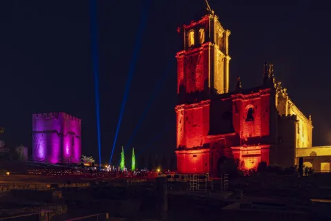
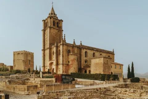
La fortaleza de la Mota, se asienta sobre un escarpado cerro amesetado, de casi tres hectáreas de superficie, a más de mil metros de altura. Enclave estratégico, desde el que se controlaban los pasos que comunicaban Granada y Almería con Córdoba y las tierras altas del Guadalquivir.

El alcázar, se ubicaba en la zona más elevada de La Mota, ocupando el extremo Noreste. Es un recinto de forma triangular, formado por tres torres: la del Homenaje, la de la Campana o de la Vela y la Torre Mocha. Un conjunto edificado en mampostería, a cuyo interior se accedía a través de una puerta en recodo bajo la Torre del Homenaje que, a pesar de las sucesivas restauraciones, aún muestra su origen islámico en los dobles arcos de herradura, los superiores apuntados, que forman el vano. Esta estructura constructiva es muy similar a las de la Puerta de las Pesas o la de Monaita en Granada, datadas a finales del siglo XI.

En torno al alcázar se dispone la madina, ocupando la totalidad de la cumbre amesetada de la Mota. El recinto amurallado que circunda la meseta, jalonado por torres, se construyó originalmente de tapial de tierra, pero tras la conquista cristiana sus lienzos se revistieron de mampostería o directamente se sustituyeron. Entre las torres destaca la de la Cárcel, una gran albarrana estructurada en tres salas abovedadas, construida entre los siglos XIV y XV, posiblemente sobre los restos de una antigua torre islámica, que defendería el acceso a la madina.

El camino de acceso al interior del recinto se hacía a través de un complejo sistema fortificado compuesto por una rampa encajada entre murallas, en el que había que franquear cinco puertas, de las cuales todavía se encuentran en pie tres: la de las Lanzas, la de la Imagen y la del Peso de la Harina. La subida se iniciaba a través de una primera puerta, de la que apenas quedan restos, defendida y controlada por las torres del Homenaje y Mocha del Alcázar. Una vez en el camino, se asciende hasta una torre albarrana, la llamada puerta de las Lanzas, muy modificada en el siglo XVI. Tras atravesar esta puerta, el visitante encuentra una segunda torre albarrana, de grandes proporciones, que cobija una de las puertas más monumentales, la Puerta de la Imagen, de mampostería, con doble arcada, la primera de ellas con arco de medio punto apuntado, mientras que el segundo, es de herradura, y está enmarcado por una bóveda apuntada de gran altura. Esta puerta es muy similar a la Puerta de la Justicia de la Alhambra de Granada. Siguiendo el ascenso hacia la cumbre de la Mota, se alcanzaba la Puerta de la Aguilera, de las que apenas quedan restos y a continuación la del Peso de la Harina, al final de la rampa, en la que se abren dos arcos apuntados y tras la que se accede directamente a la Plaza Alta. 

Este recinto contaba con otras puertas, como la Puerta de Santiago en el extremo Noroeste y la de San Bartolomé, en el lienzo Suroeste, accesos secundarios que comunicaban la Mota con el exterior de la ciudad.

La puerta del Zaide, en el lienzo sur, comunicaba los arrabales con la madina a través de una calle que ascendía hasta llegar a la Torre de la Cárcel, a partir de la cual se cubría con una bóveda de cañón formando un pasaje que llegaba hasta la Torre del Adarve y a la Plaza Alta, a este tramo abovedado se le denominaba el Cañuto.

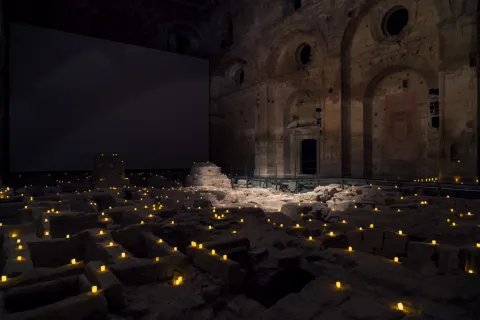
En el interior de la madina las investigaciones arqueológicas han documentado parte del entramado urbano, con numerosas viviendas que ocupan la zona occidental de la meseta, que formarían un barrio popular, conocido como el Bahondillo, que también se extendía hacia el alcázar, donde se encontraron viviendas más señoriales.  

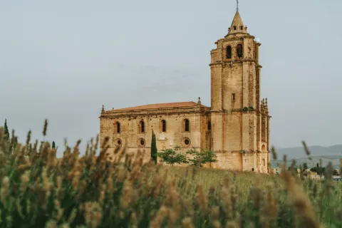
La Iglesia Mayor Abacial, que se yergue al sur del alcázar, fue construida entre los siglos XVI y XVII, sobre la primitiva iglesia mandada edificar por Alfonso XI, de la que solo queda la capilla funeraria del Deán Chirinos, construida en el siglo XV en estilo gótico. El templo compila varios estilos artísticos, desde las bóvedas góticas de los pies hasta el manierismo del cuerpo de la iglesia y la portada. En su interior se han hallado numerosas inhumaciones de diferente cronología. En el flanco Sur de la iglesia se encuentra la sacristía, obra del siglo XVII. 

Otros elementos destacados de la madina son las Casas del Cabildo Municipal o las Carnicerías, ambas edificadas en el siglo XVI. Se conservan también aljibes y un nevero.

A partir del siglo XV la ciudad se desborda, surgiendo el arrabal Viejo o de Santo Domingo, que se extiende por la ladera sureste circundado por un tercer recinto. Las investigaciones arqueológicas han sacado a la luz el trazado de las murallas, la trama viaria, las estructuras edilicias, así como numerosos pozos y muladares. En este barrio se encuentran las ruinas de la iglesia de Santo Domingo de Silos, de estilo gótico-mudéjar.

La ocupación del cerro de la Mota se remonta a la primera mitad del tercer milenio a.n.e., con la existencia de un importante asentamiento de la Edad del Cobre en la meseta y sus laderas, donde se han documentado cabañas y silos de almacenaje, que posiblemente se prolongase durante la Edad del Bronce. 

De época romana también se han detectado indicios en la Iglesia Mayor Abacial, que fechan el inicio de la ocupación romana antes del siglo I d.n.e. Se trata de dos aljibes excavados en la roca, estucados y pintados en rojo, y un muro de grandes sillares con un suelo de mortero. La meseta continuaría habitada en los siglos posteriores, como demuestran los enterramientos visigodos de carácter antropomorfo aparecidos en el subsuelo de la Iglesia.
Los musulmanes se instalaron en este asentamiento, que pasó a ser conocido como Qal'at Astalir, debido a la cercanía de una importante fuente de agua, y Qal'at Yahsub, nombre del jefe del grupo familiar que se asentó en su territorio.

La crisis del Califato y el posterior avance de los ejércitos cristianos convirtieron las tierras del Alto Guadalquivir en un incesante campo de batalla con incursiones de desgaste de ambos bandos, lo que provocó la exhaustiva fortificación de las líneas fronterizas. En este contexto se construyeron probablemente los principales edificios de Alcalá. 

En el siglo XI perteneció a la dinastía zirí de Granada, pero fue con los Banu Said, en el XII, cuando recibió el nombre con el que se la conocería hasta la conquista cristiana: Qal' at Banu Said. Bajo el gobierno de los Said mantuvo cierta independencia ante los nuevos poderes norteafricanos de almorávides y almohades, alcanzando un gran auge reflejado en la ciudad, que experimenta su mayor desarrollo urbanístico y arquitectónico. En el área, que actualmente está ocupada por la iglesia Mayor Abacial, se encontraba la medina de la ciudad islámica, con los principales edificios públicos, comerciales, religiosos y administrativos.

A principios del siglo XIII, tras la victoria cristiana en las Navas de Tolosa, los Banu Said abandonaron Al-Andalus, pasando Alcalá a formar parte del reino nazarí de Granada. Su emplazamiento estratégico y su posición como último emplazamiento defensivo en la frontera de los dominios musulmanes, la convirtieron en un enclave codiciado por ambos bandos. Un espacio donde se sucedieron las luchas entre granadinos y castellanos, principalmente por la posesión de esta estratégica plaza, con períodos en los que cambió de manos temporalmente, como ocurrió en 1213, año en que fue conquistada por Alfonso VIII, para volver a dominio granadino poco después. Finalmente, en 1341 Alfonso XI conquistó definitivamente Qal' at Banu Said o Alcalá de Ben Zaide, como la llamaban los cristianos, convirtiéndose en la puerta de Castilla hacia Granada y pasando a ser conocida como Alcalá la Real. 

El rey fundó una abadía de patronato real con jurisdicción propia, lo que se tradujo en un importante desarrollo socioeconómico que hizo que la ciudad sobrepasara el recinto amurallado y se extendiese por las laderas de La Mota. Según las fuentes, Alfonso XI edificó una primera iglesia gótica, sobre la mezquita mayor de la ciudad musulmana, que mantuvo su función religiosa hasta que en el siglo XVI fue sustituida por la Iglesia Mayor Abacial. 

Con la conquista de Granada, la función defensiva de la Mota desapareció, aunque se mantuvo como centro del poder civil y religioso.  

Entre los siglos XVI - XVIII la población se fue trasladando hacia zonas más bajas, al este del cerro, despoblando la antigua ciudad. La iglesia fue el único edificio que siguió en funcionamiento hasta que en 1810 las tropas francesas la incendiaron en su retirada. A partir de ese momento el proceso de abandono y deterioro se aceleró, siendo utilizada como cementerio y sufriendo demoliciones parciales. Desde mediados del siglo XX se han sucedido numerosas excavaciones y restauraciones en todo el conjunto.

En 1931 la Mota, fue declarada Monumento Nacional y en 1967 Conjunto Histórico Artístico. 

Breve descripción

In the heart of the subbetic saws, the imposing fortress of the Mota in Alcalá la Real reproduces the general scheme of the Islamic city, structured in three fortified enclosures: the madina, the alcazar and the arrabal. The madina, occupies the large plateau that crowns the Cerro de la Mota with the alcazar, last defensive bastion, rising on a rocky skirting, from which it controls the beginning of a heavily fortified climb to the medieval city, while the Old Arrabal unfolds along the southeast slope, around the ruins of the church of Santo Domingo de Silos. Under them, the underground is paved by a set of siege galleries, which communicate the arrabal with the madina, going over 120 m of tunnel, with a 40% gap. The monumental complex also houses a centre of interpretation that immerses the visitor in the daily life of the border territories.

Telecomunicaciones
Sitio web
https://fortalezadelamota.com/
Teléfono de contacto
953 102 717 / 953 102 717
Correo electrónico
fortalezadelamota@alcalalareal.es
Ubicación
Nombre
Castillo-Fortaleza de la Mota
Código Postal
23680
Latitud
37.460590
Longitud
-3.929620
Distrito
Municipio
Ubicación en el mapa
POINT (-3.92962 37.46059)
Tipos de punto de interés
Imágenes carrusel
imagen
Image
_DSC6603-1.jpg
Imagen principal
Desactivado
imagen
Image
Castillos_Cacbecera_alcalalareal.jpg
Imagen principal
Desactivado
imagen
Image
Fortaleza de la Mota
Imagen principal
Desactivado
imagen
Image
Fortaleza de la Mota
Imagen principal
Desactivado
imagen
Image
Fortaleza de la Mota
Imagen principal
Desactivado
imagen
Image
Fortaleza de la Mota
Imagen principal
Desactivado
imagen
Image
Fortaleza de la Mota
Imagen principal
Desactivado
imagen
Image
Fortaleza de la Mota
Imagen principal
Desactivado
imagen
Image
Fortaleza de la Mota
Imagen principal
Desactivado
Imágenes cabecera
imagen
Image
CyB_Alcala_01
Imagen principal
Desactivado
imagen
Image
CyB_Alcala_02
Imagen principal
Desactivado
Horario
Fortress of the Mota - 1 may - 15 sept: Monday to Sunday 10: 00 - 19: 00. 16 sept - 30 abr: Monday to Sunday 10: 00 - 18: 00. Abacial Palace - all year round: Monday to Sunday 10: 00 - 18: 00. Closed 25 Dec, 1 and 6 ene. Special hours 10: 00 - 14: 00 on 24 and 31 Dec and 5 ene.
Microsite al que pertenece
Otros servicios
  • Parking.
  • Access and parking for buses.
  • Free audio guide in Spanish (adult and child version), English (adult and child version), German, French and Italian.
Experiencia 360
Image
CyB_Alcala_03_360
Image
CyB_Alcala_04_360
Loading map
Preparing points of interest and routes...

Calabrus Travel Agency

Submitted by brandcode_deweloper on
4575165
Facebook
https://www.facebook.com/VCalabrus
Twitter
https://twitter.com/viajescalabrus?lang=es
Descripción larga

Calabrous Travel is a travel agency with availability of magnificent snow offers, only hotel, cruises, flight more hotel, travel to the Caribbean and circuits.

Teléfono
953 274 444
Sitio web
https://www.mundigeaonline.com/calabrus/home.php
Correo electrónico
agencia@calabrusviajes.com
Latitud
37.769880
Longitud
-3.787290
Dirección
C/ Navas de Tolosa, 10
Distrito
Municipio
Ubicación en el mapa
POINT (-3.78729 37.76988)
imagen
Image
265833407_4177846642321006_2986257280706533774_n-jpg
Imagen principal
Activado
imagen
Image
275019966_4448343251938009_1363783009615584560_n-jpg
Imagen principal
Desactivado
Monday to Friday: 09: 30 - 14: 00 and 17: 00 - 20: 30. Saturday: 10: 00 - 13: 00.
Loading map
Preparing points of interest and routes...

Maivan Travel Agency

Submitted by brandcode_deweloper on
4579394
Facebook
https://www.facebook.com/groups/147752378258683
Twitter
https://twitter.com/viajesmaivan?lang=es
Instagram
https://www.instagram.com/viajesmaivan/
Descripción larga

Travel Maivan Arjonilla is a travel agency specialized in all types of travel, especially group travel, cruises, circuits, honey moons, coasts, etc.

Teléfono
953 520 723 / 678 218 363
Sitio web
https://www.viajesmaivan.es/
Correo electrónico
ivantobar1968@gmail.com
Latitud
37.974430
Longitud
-4.106850
Dirección
C/ Juan XXIII, 4
Distrito
Municipio
Ubicación en el mapa
POINT (-4.10685 37.97443)
imagen
Image
img_20210503_122236-jpg
Imagen principal
Activado
imagen
Image
img_20220226_174002-jpg
Imagen principal
Desactivado
Loading map
Preparing points of interest and routes...

SEMER, Turismo y Cultura

Submitted by brandcode_deweloper on
367023
Facebook
https://www.facebook.com/pages/Semer-Turismo/127541290645258?fref=ts
Twitter
https://twitter.com/SEMERTurismo
Instagram
https://instagram.com/semer_turismo_cultura?igshid=1dkam2uggl9d
Descripción larga

SEMER Tourism and Culture offers services of daily guided toursin the cities "World Heritage," Ubeda and Baeza, in addition to services arranged and adapted for groups and private and exclusive visits with guides specialized in the interpretation of the heritage, in different parts of the province of Jaén apart from those mentioned above (Jaén, Cástulo, Sabiote, Linares,...). It also manages some heritage and museum enclaves, such as the Vela de los Cobos Palace (Ubeda) and Museum of the Battle of the Navas de Tolosa (St. Helena).

We have a professional guide equipment and specialists in history and heritage. Our guides combine your proven university qualification with the experience, training and rigour and animation capacity of groups, as well as the mastery of various languages.

Teléfono
630 117 597
Sitio web
http://www.visitasguiadasubedaybaeza.com
Correo electrónico
info@semerturismo.com
Latitud
38.009080
Longitud
-2.86719
Dirección
C/ Juan Montilla, 3
Municipio
Ubicación en el mapa
POINT (-2.86719 38.00908)
Curiosidades

We can also help you define, program and organize your visits, adapted to your needs, manage your space or monument for the visit or organize the cultural event your people demand or need, since in addition, in its most creative, cultural and animation facet, we design, drive and launch cultural events such as the International Historic Novel Competition "City of Ubeda," the European Comic Festival of Ubeda, CINAFAN Festival with a proven and consolidated trajectory in the provincial cultural programming and great public success.

SEMER Tourism and Culture was born by SEMER S.L. (Society for the Rural Strategy), a company created in 1995 with extensive experience in the management of rural and cultural development strategies and in European cooperation.

imagen
Image
semer-1.jpg
Imagen principal
Activado
imagen
Image
visita-ubeda-baeza-grupos.jpg
Imagen principal
Desactivado
imagen
Image
Gu%C3%ADas%20SEMER%20Turismo%20en%20%C3%9Abeda%20y%20Baeza.jpg
Imagen principal
Desactivado
imagen
Image
visita%20guiada%20ubeda%20SEMER%20Turismo.jpg
Imagen principal
Desactivado
imagen
Image
Visita%20%C3%9Abeda%20grupo%201107%202.jpg
Imagen principal
Desactivado
imagen
Image
ruta%20guiada%20diaria%20en%20%C3%9Abeda%20con%20SEMER%20Turismo.jpg
Imagen principal
Desactivado
imagen
Image
Local%20visitas%20guiadas%20SEMER%20Turismo%20ubeda.jpg
Imagen principal
Desactivado
imagen
Image
RUTA%20GUIADA%20Giribaile%20SEMER%20Turismo.jpg
Imagen principal
Desactivado
imagen
Image
gu%C3%ADas%20de%20turismo%20baeza%20jaen%20SEMER%20Turismo.jpg
Imagen principal
Desactivado
imagen
Image
Visita%20%C3%9Abeda%20Lobos%20Boom%20con%20SEMER%20Turismo.jpg
Imagen principal
Desactivado
imagen
Image
gu%C3%ADas%20de%20turismo%20jaen%20SEMER%20Turismo%20%281%29.jpg
Imagen principal
Desactivado
imagen
Image
Visita%20teatralizada%20con%20escolares%20Castulo%20SEMER%20Turismo.jpg
Imagen principal
Desactivado
imagen
Image
visita%20guiada%20ubeda%20museo%20arqueologico%20SEMER%20Turismo.jpg
Imagen principal
Desactivado
imagen
Image
Ruta%20guiada%20en%20%C3%9Abeda%20con%20SEMER%20Turismo.jpg
Imagen principal
Desactivado
imagen
Image
Visita%20guiada%20Semer%20Turismo%20Catedral%20Ja%C3%A9n.jpg
Imagen principal
Desactivado
imagen
Image
RUTA%20GUIADA%20Ubeda%20SEMER%20Turismo%20%281%29.jpg
Imagen principal
Desactivado
Desactivado
Loading map
Preparing points of interest and routes...

Seturja

Submitted by brandcode_deweloper on
2754576
Facebook
https://www.facebook.com/mireservaonline
Twitter
https://twitter.com/mireservaonline
Descripción larga

Visits to Ubeda, Baeza, Jaén and the Navas de Tolosa Battle Museum.

Teléfono
953 108 310 / 663 870 761
Sitio web
https://www.mireservaonline.es/es/empresas/seturja.aspx
Correo electrónico
info@bonoturistico.com
Latitud
38.007820
Longitud
-2.86678
Dirección
C/ Baja del Salvador, 2
Municipio
Ubicación en el mapa
POINT (-2.86678 38.00782)
imagen
Image
Seturja.jpg
Imagen principal
Activado
imagen
Image
7.jpg
Imagen principal
Desactivado
Desactivado
Loading map
Preparing points of interest and routes...