Saltar al contenido principal

Chiclana de Segura

Submitted by brandcode_deweloper on
Id
727634
Perfil de redes sociales
Facebook
https://www.facebook.com/ayuntamiento.chiclanadesegura
Twitter
https://twitter.com/chiclanasegura
Descripción
Breve descripción

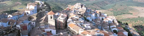
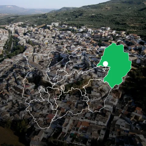
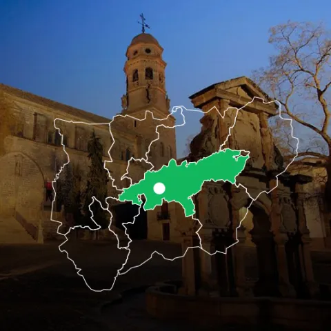
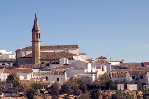
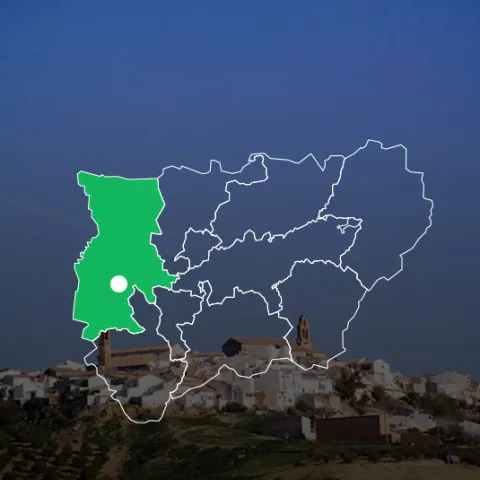
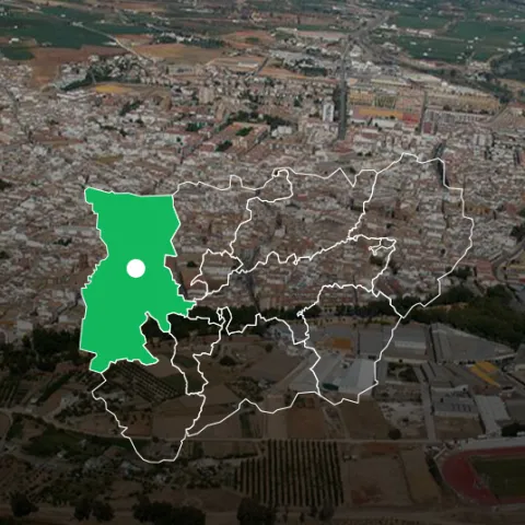
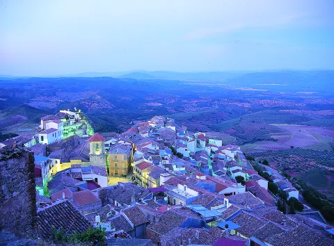
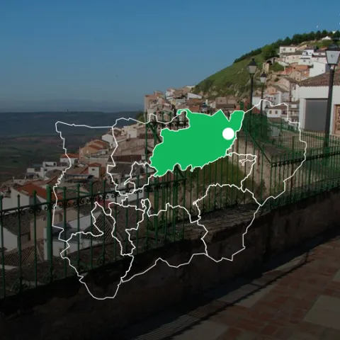
Chiclana de Segura is a municipality located to the east of the district of El Condado and to the north-east of the province of Jaén, limiting to the region of Segura and the province of Ciudad Real.

Two thirds of its territory is forestry, occupying the north. This forest area is repopulated with coniferous areas, which alternate with shrubs, ideal for the cynetic species, both in the larger and smaller hunting mode.

The southern third of the term is mainly olive tree, with parts dedicated to cereal and orchard.

The environment River Guadalimar and Guadalmena reservoir are recreational spaces of great interest, ideal for direct contact with nature.

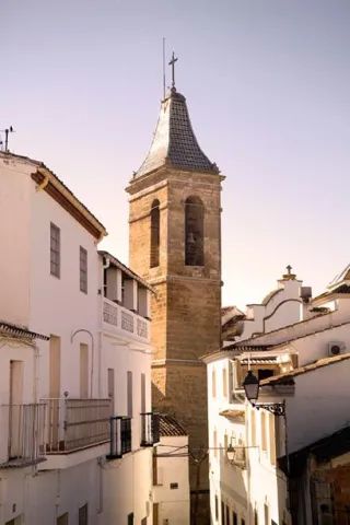
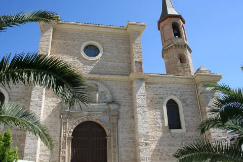
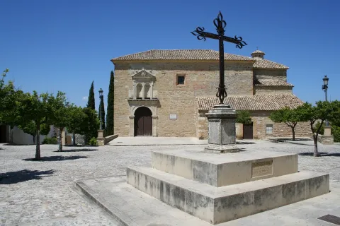
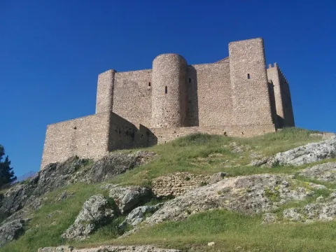
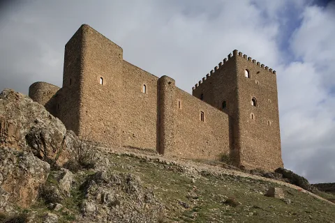
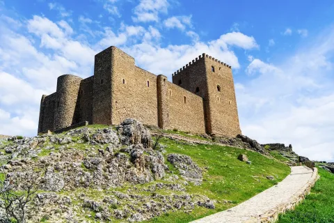
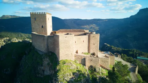
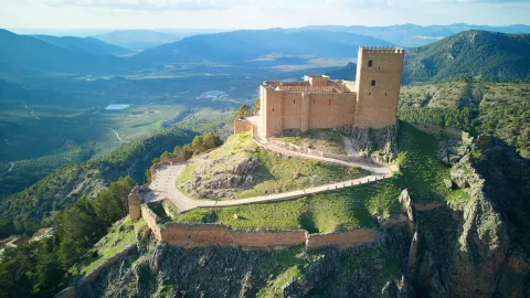
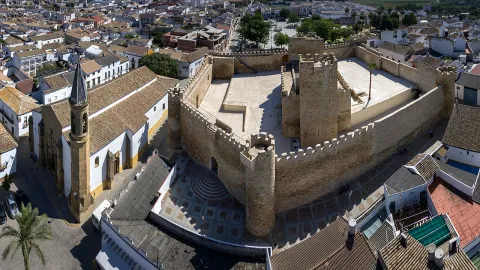
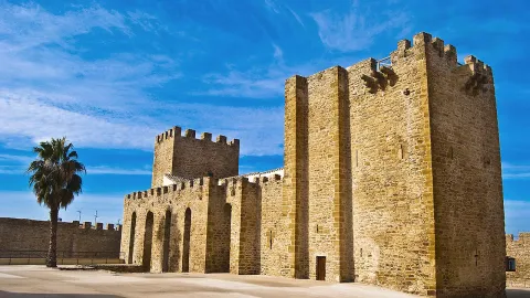
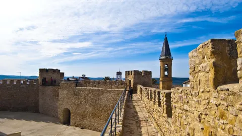
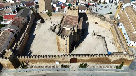
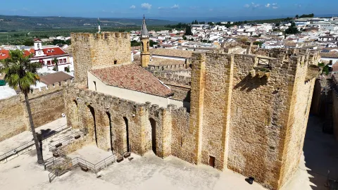
Of its artistic heritage stands out the castle of Arab origin, parish church of San Pedro, built in the late 16th century and the first third of the 17th and house of the Condation, which served as a dwelling place for the poet Jorge Manrique.
Telecomunicaciones
Teléfono
953 466 300
Sitio web
www.chiclanadesegura.es/
Fax
953 466 024
Correo electrónico
ayunchiclana@hotmail.com / info@aytochiclanadesegura.es
Ubicación
Nombre
Chiclana de Segura
Latitud
38.311560
Longitud
-3.042820
Distrito
Municipio
Ubicación en el mapa
POINT (-3.04282 38.31156)
Imágenes
imagen
Image
7c7bfeb7-9d43-e263-5ba9-e2ec093b6103?t=1602771840746
Imagen principal
Desactivado
imagen
Image
f717e020-63f8-d790-ee30-75c70e4ee043?t=1611606644120
Imagen principal
Desactivado
imagen
Image
501ca05f-ebe1-f604-9dbf-cd494c548b3d?t=1611227015211
Imagen principal
Desactivado
imagen
Image
7e83f382-d3c4-e908-7a70-143af2b50821?t=1611606644179
Imagen principal
Desactivado
imagen
Image
ba7ab87e-8a81-68aa-dee2-acea65b04169?t=1611607634576
Imagen principal
Desactivado
imagen
Image
ffecd637-4bfe-4066-604c-558062acd7e8?t=1611606644224
Imagen principal
Desactivado
Imágenes cabecera
imagen
Image
db2d8202-78b5-05e6-675c-c2f74c933cbb?t=1606405211915
Imagen principal
Desactivado
Datos de interés

Tourist area: Sierra Morena / Sierras de Andújar and Despeñacolos
Distance to the capital (km): 130
Altitude over sea level (m): 900
Extension (km ²): 236
Number of inhabitants: 1488
Gentilicon: Chiclaneros
Postal code: 23264

Videos
Video file
Cultura

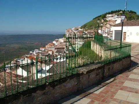
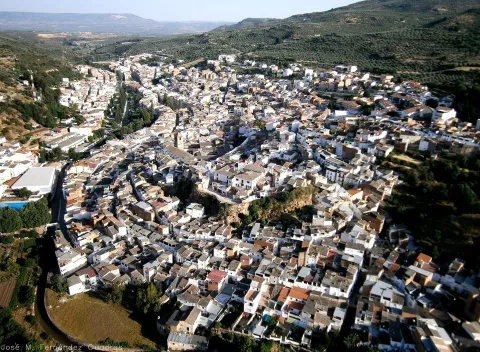
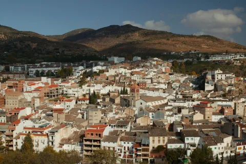
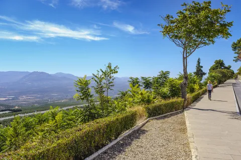
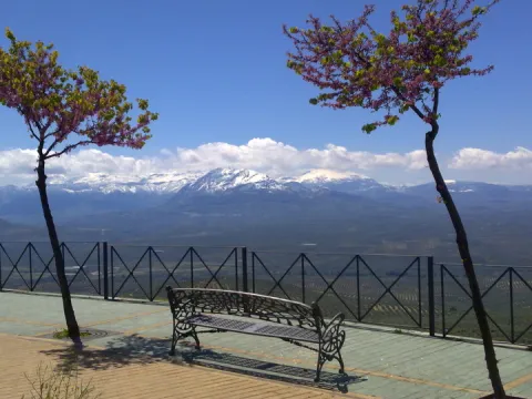
Virtually from any point in the historic town of Chiclana de Segura, due to the height at which it is located, we will get fantastic images of the sea of olive trees that flood the area. Next to the river line are the lands dedicated to gardens, almost hidden by the lush vegetation of the river: willows, alms and mimberas. We can also observe the most steep, repopulated slopes of coniferous and shrouded mountains surrounding this town: the Sierra de Segura and Sierra Morena.

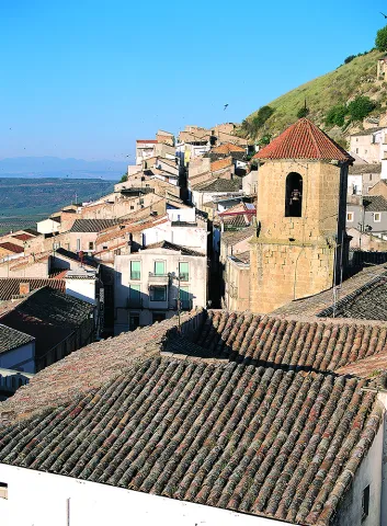
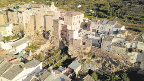
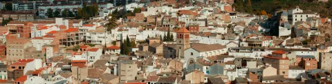
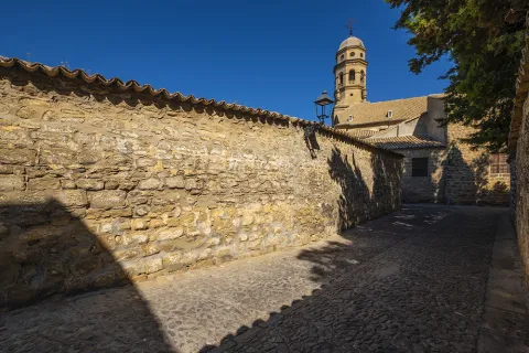
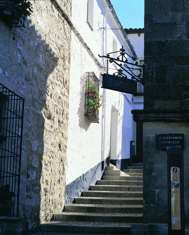
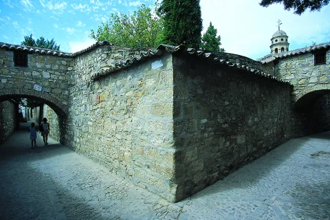
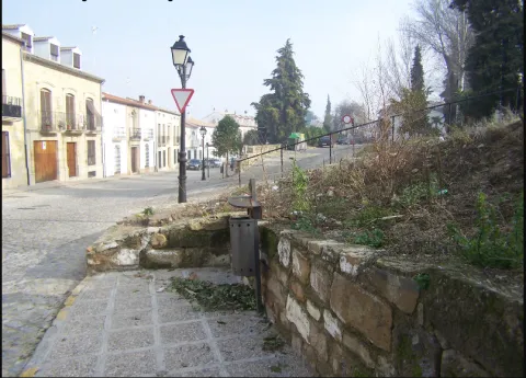
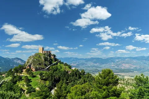
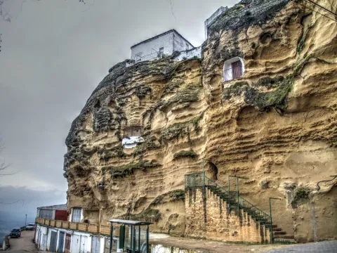
The city centre of Chiclana de Segura is at a high height and seems to be embedded in the same rock. Its serpentating streets, with the windows and balconies adorned with geraniums, seem to spread along the slope of the slope.

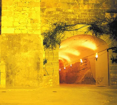
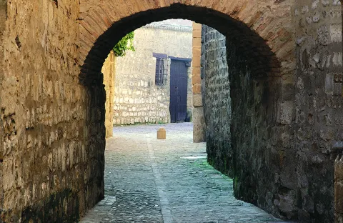
We access him through a tunnel that suddenly introduces us into a village with a medieval aura. In addition to surprising us with whimsical corners, we have a pleasant surprise: the buildings excavated on the stone, a troglodito wisdom that makes it possible to have houses that keep the same temperature all year round.

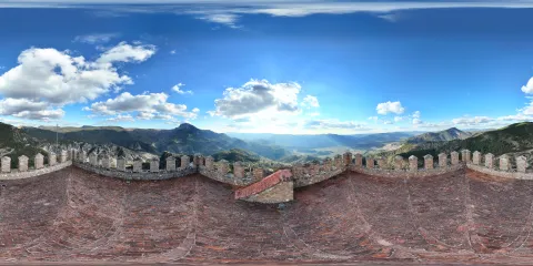
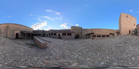
  • Castlelocated at the top of the environment, it was a privileged place of surveillance for centuries. It was built by the Arabs, and its strength gives us good proof of the remains of the canvases of their destroyed walls. Its ruins were declared in 1985, Good of Cultural Interest. From its viewpoint, very close to the ruins of the castle, on top of one of the highest hills of the entire contour, we will get impressive views of four different provinces: Ciudad Real, Granada, Albacete and Jaén's own.
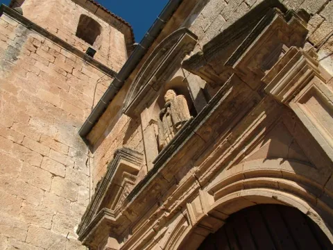
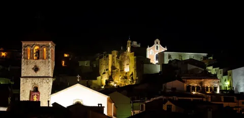
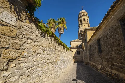
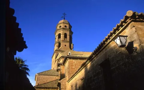
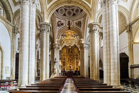
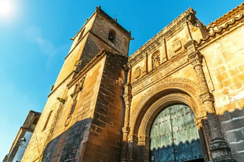
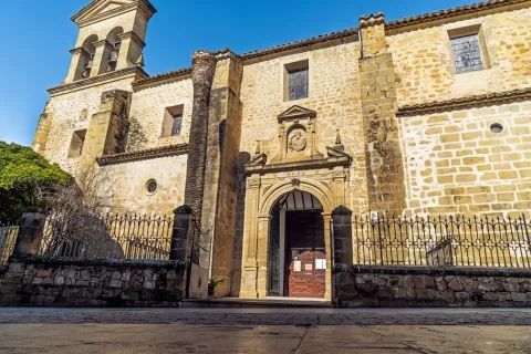
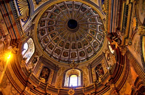
  • The parish church of San Pedro. It rises in an explanade located in a peñasco, on the site of an ancient medieval temple. The construction takes place between the end of the 16th century and the first third of the 17th century. It impresses its outer appearance: magnificent shillery, counter-strong and step to access the southern cover, which has a half-point arch flanked by cramped pilasters. The most important element is the tower, square floor and two bodies, the bass with two windows, and separated by a ledge; the second body with canyon vault and snail staircase. By removing the set a cornice with three gargools with anthropomorphic figures.
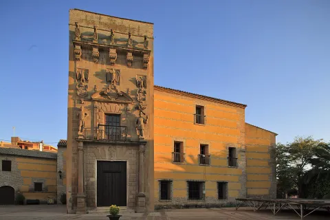
  • Palace of the Endowment. It is a baroque building, popularly known with the "House of Inquisition". The good syllable and the rectangular-floor courtyard are noted for its zapatas, wooden beams and dogrous columns.
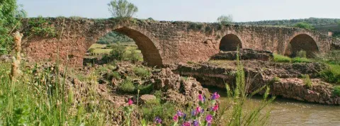
  • Miloco Bridge. It is a Roman bridge over the Guadalimar River that divides the terms of Chiclana de Segura and Beas de Segura. And according to document 1575, the passage between the two municipalities "tax-free." It is built in an alternated quarry with masonry and supports a stretch of the Roman road that corresponds to the Via Andalinesa. With a length of almost 100 meters and supported on six eyes formed by half-barrel vaults. The name of "mocho"is due to the lack of the top railing that acts as a railing.


Naturaleza

Miloco Bridge. This old Roman bridge, located on the avenue of the Guadalimar River and in which we will find various archeological in its surroundings, offers a beautiful panorama of the contour. To move to the place we will have to use a vehicle as it is 16 km away. of the city centre.

Virtually from any point in the historical centre, due to the height at which it is located, we will get fantastic images of the sea of olive trees that flood the area. Next to the river line are the lands dedicated to gardens, almost hidden by the lush vegetation of the river: willows, alms and mimberas. We can also observe the most steep, repopulated slopes of coniferous and shrouded mountains surrounding this town: the Sierra de Segura and Sierra Morena.

The cynetic fauna, both of major and of minor hunting, is abundant. Here we will find wild boars, mountain goats, go and deer; and others like: hares, rabbits, quails and parrots.
It will also be easy to see in the air the majestic flight of the rapes that nestle in these hills.


Fiestas y Eventos

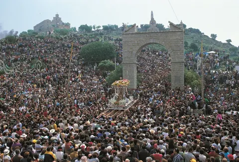
The parties of Chiclana have as their main motive the devotion they feel for their patron, the Virgin of Nazareth. The second Sunday of May takes place the "Romeria de la Carrasca" in honor of the patron. A Romeria to which the neighbors of the Sale of Saints join, a pedany that currently belongs to Montizon. A holiday that has a curious legend (We tell it at the end)

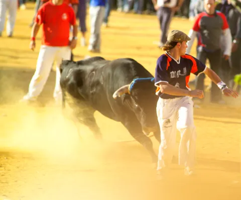
The day 8 September The celebrations are held again in honor of the patron, within which the traditional bulls of braves take place.

Also since time immemorial is celebrated the San Marcos holiday, arising from the vote made by the chiclaneros to the saint, patron of the farmers and of the countryside, when they were threatened by a plague of locusts that fed on the breads of the term Chiclana and adjacent. To this fact is the tradition of eating that day, 25 April, the bannazos of San Marcos.

From the folklore point of view, a local dance consisting of an airous jota stands out.


Gastronomía

They understand the chickpeas on the good table. And its kitchen is based on two main ideas: to use virgin olive oil for its peas and to use as ingredients those products that get from its gardens, mountains or rivers. Among its most traditional dishes are:

  • "Ajoharina" which is the oldest dish in the region, made of fresh potatoes and vegetables to be processed with flour and pepper.
  • "Hare Andrajos"where the broth of the meat is added a saffrito of onion, tomato, pepper and flour dough. (Hence his name, because they look like jirons of broken fabric.)
  • "Galians"an ancient vianda that the shepherds took at the foot of the cabin. The galianera, is a cake of unleavened bread that the shepherd cooked in a sheep's leather.
  • "Migas" accompanied by olives, radishes, torreznos and a fruit like melon.
  • "Gachamita.", is a cake that is prepared with flour, slices and olive oil, which are usually accompanied by chorizo.


Historia

In the term of Chiclana one of the most significant elements of Iberian culture was found: a solid silver fhibula which, on one side, represents a hunting scene and, on the other, a female deity kneeled by two horses. This piece, together with a set of coins found, constitute what was called "the treasure of Chiclana", dated around the 1st and 2nd centuries BC

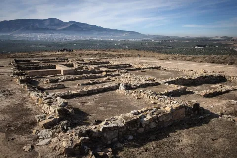
In the Roman era there is a proliferation of agricultural settlements in the term, villas, including the Calar de la Mucha.

Chiclana will be conquered by Fernando III around 1235. The king gave it to the Order of Santiago, becoming the head of the Santiaguista commission of Montizón-Chiclana. And for many years I would be his co-ordinator the warrior-poet Jorge Manriquewho was one of the 13 knights leading the Order of Santiago.

From the beginning of the contemporary era to point out two facts: the destruction caused by the Napoleonic troops in 1811 and the frequent running that the supporters carried out in the framework of the First Carlist War, they raided these lands in 1838.

The population belonged to the Kingdom of Toledo and the Order of Santiago until the disappearance of the Military Orders in the 19th century. He would then become dependent on the Beas de Segura Abbey, the Segura de la Sierra party, so he added the "Segura" to his traditional name.

Legend of the Virgin of Nazareth and the Christ of Expiration.Here we reflect a legend that is rooted in the population:

It tells the popular voice that when the sale of the saints belonged to Chiclana, both the chiclaneros and the veners, they celebrated the Romeria together in honor of the Virgin of Nazareth and the Christ of the Expiration in a place called the "Cortijillo de la Virgen". When King Charles III promulgated the Fuero de las Nuevos Poblaciones de Sierra Morena in 1767, the new population of Montizon, to which it was to belong Venta de los Santos, there was a conflict between the parishioners to determine who would be left with the beautiful Gothic image of the Virgin of Nazareth.

In the dispute the bishop will intervene, who decides to draw both images, wanting the chance that the image of the Virgin would correspond to the Sale of Saints, while that of the Christ to Chiclana.

The legend tells us that when the children of both populations went to raise the images that had been in their luck, they could not raise them from their weight. They decided to change the carrier's bands and the venters were able to lift the image of Christ and the chiclaners that of the Virgin of Nazareth, which was interpreted as a divine plan that the Virgin of Nazareth should be from Chiclana.
Loading map
Preparing points of interest and routes...
Imagen principal
imagen
Image
cbd29be4-78e1-eede-972d-487244082503?t=1603897261620
Imagen principal
Activado
Literatura

In this town you will get to know Jorge Manrique in a very direct way, as he served here as Commander and lived here for long periods.

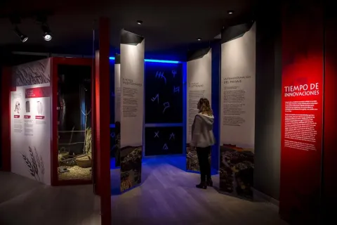
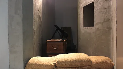
In Chiclana you will also discover one of the few Interpretation Centres in Spain dedicated exclusively to the poet.
Chiclana de Segura's connection with Jorge Manrique comes from the fact that the town became the head of the Encomienda de Montizón, administered by the Order of Santiago.

Chiclana de Segura pays tribute to the poet, in this case with the opening, in 2013, of an Interpretation Centre dedicated to Jorge Manrique; with the identification of the Palacio de la Encomienda, where he may have resided; with the castle viewpoint, where he lived for the longest and administered the Encomienda; and with the annual celebration of the Festival de la Encomienda, as well as with the recent creation, in 2016, of the Jorge Manrique National Poetry Prize.
Beas de Segura

Submitted by brandcode_deweloper on
Id
725377
Perfil de redes sociales
Facebook
https://es-la.facebook.com/pages/AYUNTAMIENTO-DE-BEAS-DE- SEGURA/125298257498380
Twitter
https://twitter.com/aytobeassegura
Descripción
Breve descripción

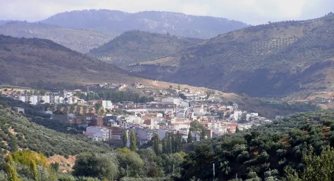
A town located to the north-east of the province, between Sierra Morena and the Sierra de Segura, with a landscape of large olive groves and mountain areas. Part of its term is included in the Natural Park of the Sierras de Cazorla, Segura and Las Villas, the largest protected space in Spain: the orographic labyrinth of valleys, calares, tachos, mountains and altiplanos of great hydrological importance (because of the large amount of rivers and streams that they handle); botany (lario pine, carrasco pine, black pine and many endemic species); faunistico-cynetic and landscape.
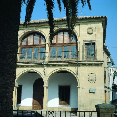
From all of which it follows that it is one of the most visited and frequented natural spaces in the country. In its term is the Embalse del Tranco de Beas, one of the most beautiful places in the entire Park. The urban core has a quiet, white and harmonious aspect, in which elements such as the Convent of the Carmelites, the Mocchio Bridge, the Parish of Our Lady of the Assumption and the Palace of the Sandovales stand out.
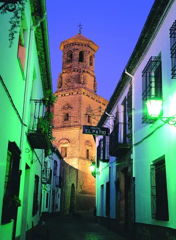
Telecomunicaciones
Teléfono
953 424 000
Sitio web
www.beasdesegura.es
Correo electrónico
turismo@beasdesegura.es
Ubicación
Nombre
Beas de Segura
Latitud
38.252530
Longitud
-2.889850
Distrito
Municipio
Ubicación en el mapa
POINT (-2.88985 38.25253)
Imágenes
imagen
Image
79945e94-3092-d99e-1404-1cf7692a4381?t=1585574461382
Imagen principal
Desactivado
imagen
Image
b8a94a81-da6c-d0c4-8cab-5f4f5136a71c?t=1616675872913
Imagen principal
Desactivado
imagen
Image
cff0ec28-2934-b2e1-ce19-53f1746163fd?t=1585574461798
Imagen principal
Desactivado
imagen
Image
31d69475-fd88-41ac-3e7b-bcaece457149?t=1616675873252
Imagen principal
Desactivado
imagen
Image
88bcf4cd-a186-1f8f-8170-cac04aa6998f?t=1585574456638
Imagen principal
Desactivado
imagen
Image
f05e0b2a-2d48-4d1f-ead4-d31316d00b49?t=1585574456825
Imagen principal
Desactivado
imagen
Image
0c9bc10a-ced0-46be-a896-2fa43b1c0cf6?t=1585574457518
Imagen principal
Desactivado
imagen
Image
a35ec1fb-ac27-b460-6d48-f560c3021388?t=1585574461578
Imagen principal
Desactivado
imagen
Image
151ff99d-bb15-0c69-fc80-350b68f240f9?t=1585087029731
Imagen principal
Desactivado
Información adicional
Curiosidades
  • http://www.turismobeasdesegura.es/
  • turismobeas@gmail.com
Imágenes cabecera
imagen
Image
4366d0ec-d1b6-4363-8869-a2a89e5b76f4?t=1611067513835
Imagen principal
Desactivado
Datos de interés

Tourist area: Serras de Cazorla, Segura and the Villas
Distance to the capital (km): 121
Altitude over sea level (m): 600
Extension (Km2): 155
Number of inhabitants: 5591
Gentilicon: Beassians
Postal code: 23280

Videos
Video file
Cultura

Few villas may presume to have been a source of poetic inspiration from some of the most universal literates. St. Teresa of Jesus, St. John of the Cross or Francis of Quevedo were captivated by the places they found in Beas de Segura, the main population core of the Sierra de Segura, with a strategic location and a legacy full of history.

The municipality also belongs to the pedanias of Cañada Catena, Cuevas de Ambrosio, Cazona, Los Santiagos, Cortijo de las Piedras and Prados de Armijo among others. Arroyo del Ojanco also belonged to Beas de Segura, until its segregation in 2001.

It is the most inhabited municipality of the Sierra de Segura region, also one of the entrance doors to the Natural Park on the road A-314 (Segura-Cortijos Nuevos), once the National 322 (Crta. Cordoba-Valencia) has been abandoned.

Beas is a bridge that links the Campo de Montiel with the Alto Guadalquivir and forced passage from Baja Andalucía to Levante. Its name comes from the Latin term Veha which means way or way, because it is located at the crossing of three Roman tracks that are headed for the Sierra, the Levante and the County. It's across the Beas River.
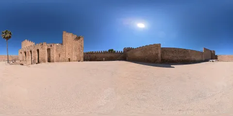
It has 35 archaeological sites in its term that give proof of its history. In the urban centre we will find medieval architecture, historical of the late 19th, etc. Beas de Segura also has villages that are a delight for the visitor.

We highlight the following points of interest:

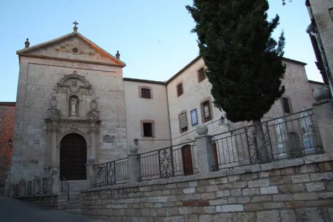
  • The Carmelite Convent.Here was the first foundation of St. Teresa of Jesus in Andalusia in 1575. Three years later, San Juan de la Cruz arrived. A Renaissance style in his church stands out as a major altarpiece.
  • Mocchio Bridge.Located on the Guadalimar River, this bridge that belonged to the new Via Augusta, is made of limestone masonry. Paleolithic materials have been found nearby. Divide Beas from the neighbor Chiclana de Segura.
  • Church of the Assumption.It is of medieval origin, but was rebuilt in 1825 after the burning it suffered years earlier. In the 14th century the chapel was built where the gentlemen who made the incursion into the Nazarite territory of Granada were buried.
  • Uceda Street.The historical architecture representative of the 19th century is altered in this way with neo-Arab elements with classical and Renaissance lexicographs. To highlight another house with califal references with horseshoe arches and scones.


Naturaleza

In its municipal term the traveller is surprised with a landscape of valleys and mountains surrounded by a true sea of olive trees. The orography of the term is very rugged by the countless valleys and mountains that settle. Mountains such as Pico Corencia, Eagle Stone, Cerro de la Hoyera or Las Zanjas, with heights above 1,000 meters, and places such as the Water Cave (very close to the village and divided into two orchards communicated by a small but deep lake).

The areas of the Soto, Palananas, Buenamar, Aceres, Buzo de la Nieve or Fuente Pinilla are also important and deserve the attention of nature lovers and hiking. No less suggestive is the Mirador de las Maravillas, in the direction of the village of Cañada Catena, a limestone escarpe over the valley of the Beas River that gives name to the cortijo, used as rural accommodation.

Another of the attractions of the municipality is the aerodrome of El Cornicabral, located in the N-322, about five kilometres from the city centre of Beas. It has two cross-tracks of 1,500 and 700 metres long, two hangars for 800 and 600 square metres aircraft and free camping area with service building.


Fiestas y Eventos

On January 23, the eve of the day of Our Lady of Peace where the lumbres burn in all the corners of the town while tasting typical products. After Holy Week The big local party is taking place. From 22 to 25 April the parties of San Marcos that bring together thousands of people from the most diverse backgrounds around the running of bravas, soaked in the streets of the town.

Although the first skirmishes, for the younger ones, begin on the afternoon of the 23rd, the adrenaline is fired when, one after another, the reses are jumping into the sand. Bulls and cows, between clouds of dust and screams of the spectators to see almost the hundred that, during the afternoon of the 24 and all the day 25, will walk the streets led by squadrons to care for and guide them with a rope of between 10 and 25 meters. After the summer period with the festivities of its different villages already held, ends the festive cycle with the fair and parties from 17 to 20 September in honor of the Our Lady of Peace.
 

Gastronomía

Beas was always a land of passage for the transhuman pastors who crossed the manchegan lands looking for the pastures of the south for their cattle.

The fruit of this pastoral heritage, in Beas, the pastoralist cakes, made of flour, water and salt and amassed in a curted sheep or goat skin that the pastor carried on his journey, have been preserved. These cakes are the basis of other masses that are incorporated into the peas, such as the andrajos or galians, where the mass is cooked next to the hunting meat and sometimes with pieces of cod.

To highlight also the Easter bannazos, with several eggs cooked.
 

Historia

Beas de Segura is a villa full of history. Their occupation is documented from the Lower Paleolithic. It was in Roman times that Beas was consolidated as an urban core. From that time there are many tracks, such as villas, streets or the emblematic Mocho Bridge.

During the Islamic period, the stage of the highest splendor of Beas was reached in the time of Abdeleran III where it was part of the great district of the Alpujarra and Elvira. From that time it was its fortified enclosure, now already missing. Fernando III conquered Beas between 1224 and 1227 by joining her in the Crown of Castile, giving as an award to his Chancellor Don Juan, Bishop of Osma, the castle and the Villa of Beas, and this in turn the exchange with the Master of Santiago in exchange for inheritance. The title of Villa and other privileges received it in 1239, and in the 16th century, according to the Topographic Relations of Philip II, Beas appears as a flourishing economic center in the area of Segura, with a strong agricultural activity.

After the Reconquista was first included in the territorial demarcation of Toledo and within the Order of Santiago's Order, then passed to the Dependence of the Governor of Segura. Thus he was part of the Segura Common and all his territory was governed by the Ordinances. It was a crossroads of roads, hence its primitive name of Veha (way or way). Here are the three Roman tracks that were heading for the mountains, the Levante and El Condado.

At present, Beas is one of the main economic centres of the Sierra de Segura, whose region presupposes pride despite the fact that in the past it did not belong to the Segura Encomandación. Through the Beas River, the town is on horseback between the Sierra de Segura and the lands of El Condado and Sierra Morena. Beas de Segura offers the traveller a legacy impregnated in history, as demonstrated by the 35 archaeological sites located in its term.

The oldest pieces, including those of the Mocchio Bridge, are preserved in the archaeological section of the Provincial Museum. Beas is one of the doors of the Natural Park of the Sierras de Cazorla, Segura and Las Villas and an excellent starting point for entering the interior of these majestic lands.

Before, the traveller can walk his urban town, between narrow and tortuous streets that bear witness to a rich medieval and historical architecture of the late 19th century, such as Ángel Uceda Street and the building of the Old Carniceria. However, his main monumental claim is the Convent of the Descalzas Carmelites, which Saint Teresa of Jesus founded in houses owned by Catherine Maria de Sandoval and Godínez.

In a Renaissance style, the convent has a baroque cover and is structured with the classic half-point arch on imposts, with mensula in the key and rosettes. On the friso with triglyphs there is a split fronton and shields that frame the pilasters and bake with San José and El Niño. On the niche, the shield of the Order. A large triangular front and pinnacles kill the facade.

Loading map
Preparing points of interest and routes...
Imagen principal
imagen
Image
d383e669-73f6-0a29-76df-3aa2da3d3377?t=1603979643246
Imagen principal
Activado
Literatura

An appeal that captivated the greatest mystic poets: Santa Teresa, for whom this land was "most delightful and of a fine climate," and San Juan de la Cruz, who was constantly travelling to and from Beas from the various places his duties took him. 

The presence in the town of illustrious figures such as Santa Teresa de Jesús, San Juan de la Cruz and Ana de Jesús reinforces Beas's importance in the reform of the Carmelite Order.

Baeza

Submitted by brandcode_deweloper on
Id
725103
Perfil de redes sociales
Facebook
https://www.facebook.com/aytobaeza/
Twitter
https://twitter.com/AytoBaeza
Instagram
https://www.instagram.com/aytobaeza/
Descripción
Breve descripción

Baeza is located in the same geographical centre of the province of Jaén, located in the region of the Loma of which its western capital is considered.

Located near the Guadalquivir River, in a landscape of fertile land of orchards, olive groves and cereal. The absence of non-agricultural land reduces the areas of natural interest to the Guadalquivir River and the wetlands of the Lagoon Grande, of great ecological wealth and the largest in the province.

Baeza is a city where the Renaissance is shown in all its splendor, in both civil and religious monuments: palaces and churches that alternate with white houses, portades, porticos, towers, squares and fountains.

Its period of splendor dates back to the 16th and 17th centuries, although the city has been outstanding since remote times.

Telecomunicaciones
Teléfono
953 740 150
Sitio web
www.baeza.net
Correo electrónico
sac@baeza.net
Ubicación
Nombre
Baeza
Latitud
37.995930
Longitud
-3.474130
Municipio
Ubicación en el mapa
POINT (-3.47413 37.99593)
Imágenes
imagen
Image
6b113f25-c234-0491-af2f-c149a865afa8?t=1603923180029
Imagen principal
Desactivado
imagen
Image
a65f89b4-654e-e046-fdbd-d44fa6641988?t=1603922557103
Imagen principal
Desactivado
imagen
Image
6310a5e2-e849-e7b1-582a-468d48f758f0?t=1586171131274
Imagen principal
Desactivado
imagen
Image
1f236e61-7713-a025-2f0d-35391af76a7d?t=1603922557227
Imagen principal
Desactivado
imagen
Image
8a202e8f-385a-5f9e-3afe-569acec987a4?t=1616522299103
Imagen principal
Desactivado
imagen
Image
795a0c33-4ee3-408e-1c13-b816123adc64?t=1586171132490
Imagen principal
Desactivado
imagen
Image
b6010740-bf62-6b8e-ab23-6d9f76897f5b?t=1586171132143
Imagen principal
Desactivado
imagen
Image
750eeda9-773d-709d-2383-372d10701650?t=1586171130098
Imagen principal
Desactivado
imagen
Image
a78c862d-3c74-cde9-6ff9-b69630560ce4?t=1586171131756
Imagen principal
Desactivado
imagen
Image
beac10cd-9668-0c22-7db3-9966e5eda5b3?t=1586171132006
Imagen principal
Desactivado
imagen
Image
479bc6c3-babf-eaef-7fb3-b4ad8b635e5b?t=1616522299289
Imagen principal
Desactivado
imagen
Image
f361a4e0-b515-6e7c-a7dc-ff14c67688ec?t=1616522299347
Imagen principal
Desactivado
imagen
Image
81e8d636-ef0d-91e5-2750-3f56d6d04808?t=1616522299408
Imagen principal
Desactivado
imagen
Image
b1ddae0a-a5ee-4323-53d3-54bc68526d9a?t=1616522299473
Imagen principal
Desactivado
imagen
Image
0dee5670-1fe0-cbf4-5867-9147345e2afe?t=1616521131504
Imagen principal
Desactivado
imagen
Image
81d1e198-9d29-279e-149f-081024b27891?t=1586171130396
Imagen principal
Desactivado
imagen
Image
39a7fbfd-9aa2-1cac-c7d3-238c006f5a28?t=1616522299547
Imagen principal
Desactivado
imagen
Image
e016a9da-4297-fc04-4d3c-dfa579da9552?t=1586171130697
Imagen principal
Desactivado
imagen
Image
2b452c6d-15df-a819-aa50-e54921bbd0de?t=1616522299619
Imagen principal
Desactivado
imagen
Image
805356f8-60e7-d8f0-2e25-1edd5ebffa4d?t=1602694728132
Imagen principal
Desactivado
imagen
Image
7172efae-cdfc-d5aa-a347-037b6d6b16aa?t=1616522299688
Imagen principal
Desactivado
imagen
Image
36d285cc-5d64-d9a0-6e84-7ad58f539a76?t=1616522299749
Imagen principal
Desactivado
imagen
Image
bc9f53d4-3a83-f0a9-e1da-c486d747724b?t=1616522299815
Imagen principal
Desactivado
imagen
Image
0da7acd2-1162-bbf8-8c3d-d3a3d8140eaa?t=1603105398568
Imagen principal
Desactivado
imagen
Image
f1c392af-765a-3f53-d9a0-c0b6b9acfb77?t=1603105767022
Imagen principal
Desactivado
imagen
Image
2c724b20-61d7-99b1-e423-f4292a646491?t=1603106229722
Imagen principal
Desactivado
imagen
Image
eaa9f592-f374-8747-0f22-1cadb4e98585?t=1603106434496
Imagen principal
Desactivado
imagen
Image
02cdf257-dfc8-6b82-5816-a0ba6ba51dc1?t=1603106654931
Imagen principal
Desactivado
imagen
Image
8791fed9-36c1-40e4-b1a6-95e267986d8d?t=1603106857711
Imagen principal
Desactivado
imagen
Image
62bf1f22-afbd-c0da-1f93-ce52788b8636?t=1603107417445
Imagen principal
Desactivado
imagen
Image
79f98f41-2429-b937-f94c-827a88cb386c?t=1603107482920
Imagen principal
Desactivado
imagen
Image
086c140f-fab0-c0f1-595b-9eeda08b0616?t=1616522299958
Imagen principal
Desactivado
imagen
Image
59d90e88-c35f-3adb-7dbd-d51422bb9b63?t=1644243699085
Imagen principal
Desactivado
Información adicional
Curiosidades

Oficina de Turismo
Plaza del Pópulo, s/n, 23440
953 779 982
otbaeza@andalucia.org

Imágenes cabecera
imagen
Image
catedral-de-baeza176-2-jpg
Imagen principal
Desactivado
Datos de interés

Tourist area: Ubeda / Baeza
Distance to the capital (km): 48
Altitude over sea level (m): 769
Extension (Km2): 194
Number of inhabitants: 16012
Gentilicon: Baezanos
Postal code: 23440

Videos
Video file
Cultura

To understand today's Baeza, we have to go back to the first inhabitants who settled in the place known as the Alcázar hill, in the Bronze Age, evolving to the Iberian city Viatia or Vivatia, passing to the Roman era, when Biatia was one of the most important cities.

It would be the Muslims who made up the city's murary limits, some of which were remade in the 16th century. After the Christian conquest the epoch of splendor of Baeza begins. The new Christian Baeza begins to grow out of the world, where religious buildings are the most representative.

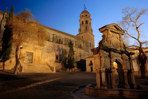
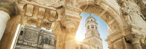
  • The Cathedral. It is the most representative building in the square. In this enclave there could have been a Roman temple, over which Muslims raise a mosque and, in 1227, under the Marian advocation of the "Nativity", the cathedralicia headquarters is erected. In the 16th century, a reform is carried out, which will be the one that prints the Vandelvirian Renaissance seal to the building. The cover was drawn in 1587 by Juan Bautista Villalpando with "relief of the Nativity of the Virgin." The base of the tower is believed to be the mosque's miner, adding in time of Vandelvira the body of the bells and the deck.
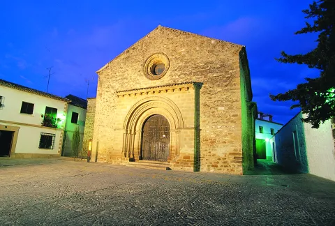
  • Church of Santa Cruz. This work dates from 13th century, of late Romanesque style and preserved after the Christian conquest. The exterior is austere, highlighting its two covers with half-point arquivolts. The interior consists of three ships.
  • Ruins of the convent of San Francisco(extracamides). This work could have been one of the most important of the Andalusian Renaissance, but a number of misfortunes have prevented it, among these, the Lisbon earthquake of 1775 that brought down the vault of the major chapel. In this funeral and conventual complex, Vandelvira developed all its genius. The Latin cross church, which is accessed by a half-point arch that frames the entire cover, still remains with the relief of San Francisco and a tondo with the Virgin, which now give way to a large auditorium.
  • Old House of Correction and Prison, current City Hall(extracamides). It was built in 1520 as a prison at the request of Charles I. Since 1867 it has been home to the City Council. It is composed of the prison, with a more sober cover on which Justice and Charity are represented, and the house of the corridor with rich silver decoration. On the upper floor we find tripartite balconies with the shields of Philip II, the corridor and the city. It is topped with cornice decorated with membranes highlighted with figures. The Salon de Plenos has a Renaissance potter (horizontal and intertwined wooden ceiling) from the convent of San Antonio.
  • Church of St. Andrew. Building from the early 16th century, which held the title of a schoolgirl from 1764 to 1852. The silver-style cover, next to the square tower, stands out. The interior is a large main ship made up of arches pointed with side chapels.
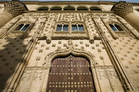
  • Jabalfifth Palace.In front of the church of Santa Cruz, the Jabalfifth palace, one of the highest exponents of the isabelin Gothic style, was built in the late 15th century. The isabelin Gothic We find it on the outside, with decoration based on diamond tips, pineapple nails, fronts, florons, ties, pinacles, mocaronas and heraldic shields. The facade it is overcome with five arches of half-point Renaissance period, as well as the courtyard of the late 16th century. Today it is the seat of the Antonio Machado International University.
  • The St. Mary's Square, Baezan monumental heart, concentrates the largest number of monuments: the cathedral, the conistorial houses, the fountain of Saint Mary; the seminary of St. Philip Neri, with its picturesque facade plagued with cheers, current headquarters of the International University of Andalusia or the house-palace of Rubin de Ceballos, behind the cathedral.
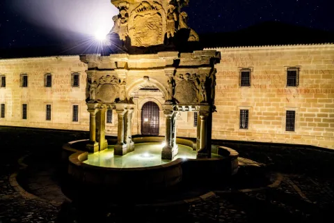
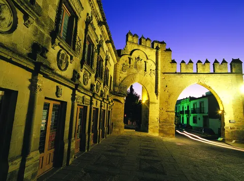
  • The Populo Square, framed by the door of Jaén and the arch of Villalar, is one of the most emblematic squares of the city, where we find the plateresque cover building of the old Escribanías, today the headquarters of the tourist office of the Junta de Andalucía, the old Carnicerías and the source of the Lions in the center.
     
Naturaleza

Baeza is located in a dominant place in the region of the Loma and on the right bank of the Guadalquivir River. The city is located on three hills and the small valley that remain in the middle, in a rather high position over the Guadalquivir valley, a situation conducive to being a very important square in ancient times. It is surrounded by the Guadalquivir rivers to the south and Guadalimar to the north.

A site that as we walk through the walls allows us to contemplate the immense sea of olive trees that is presented to us all around us. From the sights of this walk, you can see the beautiful picture of the Guadalquivir valley, the extensive olive trees, the Cazorla saw, the Segura and Sierra Mágina saw, with the villages of Jimena, Mancha Real, Bedmar and Garciez in the distance.

The predominant vegetation is the olive tree, but next to the river and the lagoon Grande we find what we call the gallery forest: white, mimberas, tarais, black, and other species of bushes. A vegetation that with the change of the seasons draw a color brush in the landscape, especially in the autumn season.

The fauna of the town is the one of the Jienese countryside: hares, rabbits, deer, foxes, parrots, quail... They are also easy to see the storks and a wide variety of prey birds. Without forgetting the fauna that lives next to the river line and in the vicinity of the lagoon Grande.

The absence of non-agricultural land reduces areas of natural interest to the river margins and to the wetlands of the Great Lagoon with a special ecological interest.

  • Laguna Grande: This permanent lagoon that suffers significant level fluctuations, is fed from the Torres River through irrigation channels. Precisely for maintaining water during summers, this wetland is particularly important for waterbirds, it is an ideal place for food and shelter. Around the water, in addition to the vegetation of carrizos, spadañas and juncos stands out the presence of tarajes, alamos, fresnos and zarzas, where there is plenty of the visitor and I shelter the fauna of the place, among which we can mention: common fence, real anade or common porron, highlighting the fly bird, where we can see the nests of this small bird, hanging from the trees of this natural place. The locals of both the Bishop's Bridge and Baeza are willing to visit this beautiful natural site.


Fiestas y Eventos

Among the parties with the most roots among the neighbors of Baeza, we highlight:

  • La Candelariaon February 2. On the eve of the feast of the Holy One celebrates the Candelaria, typical of the blessing of the donuts of Saint Blas, protector of the throat, in the parish of El Salvador.
  • Holy Week. Between Andalusian and Spanish, the Holy Week of Baeza, declared of National Tourist Interest, stands out for the artistic richness of its steps. About 20 cofradies process through its streets and squares, in this jewel of the Andalusian Renaissance. Its creation dates back to the 16th century, when the co-fradia of the Vera Cruz, one of the oldest in Andalusia and Spain, emerged. One of the most beautiful moments of Baezan Holy Week, occurs on the morning of Good Friday, with the departure of the fellowship of Our Father Jesus Nazarene and the Cross of St. Helena, better known by the name "El Paso"; when the Nazarene Christ gives the blessing to his mother, through an articulated mechanism, when the images are crossed.
  • May CrossesMay 1. In different plazoletas and neighborhoods of the old town, altars are covered with the only theme of the exaltation of the Holy Cross.
  • Annual city fair. It is celebrated on August 15, the feast of its patron saint, Santa María del Alcázar.
  • Romeria de la Yedra. It is celebrated around the feast of the Nativity of the Virgin (8 September).
  • The Yedra, a pastry of Baeza, located 7 km. to the north of this, and where there is the Marian sanctuary of Our Lady of the Rosel and the Holy Christ of the Yedra. The Romeria itself is celebrated on Saturday day 7, the day when the Virgin travels through the city of Baeza and goes back to her shrine of La Yedra, accompanied by horses, carriages, reels and carrots, all covered with flowers.
  • Corpus Christi. With reminiscent of the 15th and 16th centuries. Procedural custody is certainly the goldsmiths of the city.

The annual calendar of celebrations is completed with the festivities of San Isidro Labrador, the pattern of farmers, Saint Christopher, pattern of the driving industry,Our Lady of Carmen and Council parties of Baeza in honor of San Andrés.


Gastronomía

The gastronomic culture is based on its history and geography. In many of its dishes you can find cultivated influences of Roman, Jewish, Islamic, Moorish and Mudejar cuisine.

The traditional cuisine is merged with the seasons and with the festivities, as well as the basic raw materials of the earth and all irrigated with the liquid gold of the olive fields of Baeza.

Among the indigenous dishes are:

  • The orza loin. It is a typical dish of the slaughter, which is used as a preservative, frying the fresh back on a slow heat in its own butter to which different spices, nails, cinnamon, pepper... are added... and then introduced into the orza. It is also done with the chorizos of the slaughter and thus are preserved all winter.
  • Cod to the baezan. In a saffrito of onion, tomato, peas and roasted peppers made from strips, you will add the already fried cod.
  • Pipirrana. In which peppers, tomatoes, garlic, onions and olive oil are used. A refreshing dish that can't be missed in summer.
  • Andrajos. Red pepper, green pepper, onion, garlic, laurel, olive oil, pepper, white wine, vegetables and hare or rabbit. All flavoured with peppermint. For the dough, flour and water.
  • "Sick-cooked"or" dizzy chickpeas, "a dish that tries to take advantage of the remains of another meal. In a pan with oil we chopped onion and added the chickpeas, which when mixed with the spoon are broken. It is added fried tomato and eggs that are mixed and cut.
  • "Eyes." or "Masoil". It consists of a bread of extra virgin oil, pepper and anise. The name comes from being the eighth part of the mass of a bread.

Warehouse:

  • Virolos, typical pebbles.
  • Butter cakes with nuts.
  • Torrijas, a way to take advantage of the bread left over.
  • Fried milk: It's about bounced and fried milk.
  • Papajotes, It's a frying pan. A mass of fried flour and bounced with sugar and cinnamon.
  • Oil ice cream, with milk, sugar, egg yolks and oil ingredients.


Historia

Atalaya over the Guadalquivir valley, its alcázar assured the Spanish rear in the constant threat of the Islamic kingdoms located to the west and south of Guadalquivir.

Baeza is now known for its olive production, its abundant monumental legacy (declared World Heritage by Unesco in 2003) and for hosting the International University of Andalusia.

Its main economic activity is agriculture, linked to the olive and the olive industry, although monumental tourism has developed the activity of the hotel.

Its churches, palaces and towers are a monumental set in which the different architectural styles take place, although the Renaissance and the Gothic isabelin are of particular importance. From its rich architectural heritage, it stands out the cathedral (16th century), the church of Santa Cruz (13th century), the convent of San Francisco, the City Hall and the church of San Andrés, all of the 16th century.

In short, the historic centre of Baeza is one of the most important monumental ensembles of the world renaissance.


Culture

To understand today's Baeza, we have to go back to the first inhabitants who settled in the place known as the Alcázar hill, in the Bronze Age, evolving to the Iberian city Viatia or Vivatia, passing to the Roman era, when Biatia was one of the most important cities.

It would be the Muslims who made up the city's murary limits, some of which were remade in the 16th century. After the Christian conquest the epoch of splendor of Baeza begins. The new Christian Baeza begins to grow out of the world, where religious buildings are the most representative.

  • The Cathedral. It is the most representative building in the square. In this enclave there could have been a Roman temple, over which Muslims raise a mosque and, in 1227, under the Marian advocation of the "Nativity", the cathedralicia headquarters is erected. In the 16th century, a reform is carried out, which will be the one that prints the Vandelvirian Renaissance seal to the building. The cover was drawn in 1587 by Juan Bautista Villalpando with "relief of the Nativity of the Virgin." The base of the tower is believed to be the mosque's miner, adding in time of Vandelvira the body of the bells and the deck.
  • Church of Santa Cruz. This work dates from 13th century, of late Romanesque style and preserved after the Christian conquest. The exterior is austere, highlighting its two covers with half-point arquivolts. The interior consists of three ships.
  • Ruins of the convent of San Francisco(extracamides). This work could have been one of the most important of the Andalusian Renaissance, but a number of misfortunes have prevented it, among these, the Lisbon earthquake of 1775 that brought down the vault of the major chapel. In this funeral and conventual complex, Vandelvira developed all its genius. The Latin cross church, which is accessed by a half-point arch that frames the entire cover, still remains with the relief of San Francisco and a tondo with the Virgin, which now give way to a large auditorium.
  • Old House of Correction and Prison, current City Hall(extracamides). It was built in 1520 as a prison at the request of Charles I. Since 1867 it has been home to the City Council. It is composed of the prison, with a more sober cover on which Justice and Charity are represented, and the house of the corridor with rich silver decoration. On the upper floor we find tripartite balconies with the shields of Philip II, the corridor and the city. It is topped with cornice decorated with membranes highlighted with figures. The Salon de Plenos has a Renaissance potter (horizontal and intertwined wooden ceiling) from the convent of San Antonio.
  • Church of St. Andrew. Building from the early 16th century, which held the title of a schoolgirl from 1764 to 1852. The silver-style cover, next to the square tower, stands out. The interior is a large main ship made up of arches pointed with side chapels.
  • Jabalfifth Palace.In front of the church of Santa Cruz, the Jabalfifth palace, one of the highest exponents of the isabelin Gothic style, was built in the late 15th century. The isabelin Gothic We find it on the outside, with decoration based on diamond tips, pineapple nails, fronts, florons, ties, pinacles, mocaronas and heraldic shields. The facade it is overcome with five arches of half-point Renaissance period, as well as the courtyard of the late 16th century. Today it is the seat of the Antonio Machado International University.
  • The St. Mary's Square, Baezan monumental heart, concentrates the largest number of monuments: the cathedral, the conistorial houses, the fountain of Saint Mary; the seminary of St. Philip Neri, with its picturesque facade plagued with cheers, current headquarters of the International University of Andalusia or the house-palace of Rubin de Ceballos, behind the cathedral.
  • The Populo Square, framed by the door of Jaén and the arch of Villalar, is one of the most emblematic squares of the city, where we find the plateresque cover building of the old Escribanías, today the headquarters of the tourist office of the Junta de Andalucía, the old Carnicerías and the source of the Lions in the center.
     

Nature

Baeza is located in a dominant place in the region of the Loma and on the right bank of the Guadalquivir River. The city is located on three hills and the small valley that remain in the middle, in a rather high position over the Guadalquivir valley, a situation conducive to being a very important square in ancient times. It is surrounded by the Guadalquivir rivers to the south and Guadalimar to the north.

A site that as we walk through the walls allows us to contemplate the immense sea of olive trees that is presented to us all around us. From the sights of this walk, you can see the beautiful picture of the Guadalquivir valley, the extensive olive trees, the Cazorla saw, the Segura and Sierra Mágina saw, with the villages of Jimena, Mancha Real, Bedmar and Garciez in the distance.

The predominant vegetation is the olive tree, but next to the river and the lagoon Grande we find what we call the gallery forest: white, mimberas, tarais, black, and other species of bushes. A vegetation that with the change of the seasons draw a color brush in the landscape, especially in the autumn season.

The fauna of the town is the one of the Jienese countryside: hares, rabbits, deer, foxes, parrots, quail... They are also easy to see the storks and a wide variety of prey birds. Without forgetting the fauna that lives next to the river line and in the vicinity of the lagoon Grande.

The absence of non-agricultural land reduces areas of natural interest to the river margins and to the wetlands of the Great Lagoon with a special ecological interest.

  • Laguna Grande: This permanent lagoon that suffers significant level fluctuations, is fed from the Torres River through irrigation channels. Precisely for maintaining water during summers, this wetland is particularly important for waterbirds, it is an ideal place for food and shelter. Around the water, in addition to the vegetation of carrizos, spadañas and juncos stands out the presence of tarajes, alamos, fresnos and zarzas, where there is plenty of the visitor and I shelter the fauna of the place, among which we can mention: common fence, real anade or common porron, highlighting the fly bird, where we can see the nests of this small bird, hanging from the trees of this natural place. The locals of both the Bishop's Bridge and Baeza are willing to visit this beautiful natural site.


Celebrations and Events

Among the parties with the most roots among the neighbors of Baeza, we highlight:

  • La Candelariaon February 2. On the eve of the feast of the Holy One celebrates the Candelaria, typical of the blessing of the donuts of Saint Blas, protector of the throat, in the parish of El Salvador.
  • Holy Week. Between Andalusian and Spanish, the Holy Week of Baeza, declared of National Tourist Interest, stands out for the artistic richness of its steps. About 20 cofradies process through its streets and squares, in this jewel of the Andalusian Renaissance. Its creation dates back to the 16th century, when the co-fradia of the Vera Cruz, one of the oldest in Andalusia and Spain, emerged. One of the most beautiful moments of Baezan Holy Week, occurs on the morning of Good Friday, with the departure of the fellowship of Our Father Jesus Nazarene and the Cross of St. Helena, better known by the name "El Paso"; when the Nazarene Christ gives the blessing to his mother, through an articulated mechanism, when the images are crossed.
  • May CrossesMay 1. In different plazoletas and neighborhoods of the old town, altars are covered with the only theme of the exaltation of the Holy Cross.
  • Annual city fair. It is celebrated on August 15, the feast of its patron saint, Santa María del Alcázar.
  • Romeria de la Yedra. It is celebrated around the feast of the Nativity of the Virgin (8 September).
  • The Yedra, a pastry of Baeza, located 7 km. to the north of this, and where there is the Marian sanctuary of Our Lady of the Rosel and the Holy Christ of the Yedra. The Romeria itself is celebrated on Saturday day 7, the day when the Virgin travels through the city of Baeza and goes back to her shrine of La Yedra, accompanied by horses, carriages, reels and carrots, all covered with flowers.
  • Corpus Christi. With reminiscent of the 15th and 16th centuries. Procedural custody is certainly the goldsmiths of the city.

The annual calendar of celebrations is completed with the festivities of San Isidro Labrador, the pattern of farmers, Saint Christopher, pattern of the driving industry,Our Lady of Carmen and Council parties of Baeza in honor of San Andrés.


Gastronomy

The gastronomic culture is based on its history and geography. In many of its dishes you can find cultivated influences of Roman, Jewish, Islamic, Moorish and Mudejar cuisine.

The traditional cuisine is merged with the seasons and with the festivities, as well as the basic raw materials of the earth and all irrigated with the liquid gold of the olive fields of Baeza.

Among the indigenous dishes are:

  • The orza loin. It is a typical dish of the slaughter, which is used as a preservative, frying the fresh back on a slow heat in its own butter to which different spices, nails, cinnamon, pepper... are added... and then introduced into the orza. It is also done with the chorizos of the slaughter and thus are preserved all winter.
  • Cod to the baezan. In a saffrito of onion, tomato, peas and roasted peppers made from strips, you will add the already fried cod.
  • Pipirrana. In which peppers, tomatoes, garlic, onions and olive oil are used. A refreshing dish that can't be missed in summer.
  • Andrajos. Red pepper, green pepper, onion, garlic, laurel, olive oil, pepper, white wine, vegetables and hare or rabbit. All flavoured with peppermint. For the dough, flour and water.
  • "Sick-cooked"or" dizzy chickpeas, "a dish that tries to take advantage of the remains of another meal. In a pan with oil we chopped onion and added the chickpeas, which when mixed with the spoon are broken. It is added fried tomato and eggs that are mixed and cut.
  • "Eyes." or "Masoil". It consists of a bread of extra virgin oil, pepper and anise. The name comes from being the eighth part of the mass of a bread.

Warehouse:

  • Virolos, typical pebbles.
  • Butter cakes with nuts.
  • Torrijas, a way to take advantage of the bread left over.
  • Fried milk: It's about bounced and fried milk.
  • Papajotes, It's a frying pan. A mass of fried flour and bounced with sugar and cinnamon.
  • Oil ice cream, with milk, sugar, egg yolks and oil ingredients.


History

It's in the Copper age, 3rd millennium BC, when they appear the first villages. Most of them were walled and their economy was based on agriculture and livestock.

In the Iberian period, 7th century BC, the hill of the Alcázar is considered a consolidated town.

During the 2nd and 1st centuries BC, in full Roman Empire, appears in several sources as Vivatia or Biatia. It acquires great importance due to its location, as it is a mandatory step on the commercial route Catulo - Málaga.

The territory of Biatia would be occupied in the second decade of the eighth century by Muslim troops. This time the city is known as Bayyasa.

Christian kings will take the city and lose it again on several occasions. But it will be Fernando III "the Holy One" who finally conquered it in 1227, and considered it as a bridge head in the reconquest of Al-Andalus, for this reason it is given to the city of privileges and a court, the "Fuero de Cuenca."

The presence of the Catholic Church is restored, establishing in Baeza the episcopal seat in the 13th century. From this date on, the most important religious and conventual orders were present in the city.

It will be in the 16th century when Baeza reaches its maximum architectural splendor with the foundation of the University, among other public buildings of interest. The apogee will continue in the 17th century, is the century of the greatest conventional apogee.

The 18th century will be of decline. With the war of Baeza Independence, he suffers considerable human and economic losses. Excessive demands and contributions would also help. The deamortization of Mendizábal, which brought the disappearance of the convents, was very remarkable.

The mainly agricultural economy, increases production and increases the area dedicated to olive trees to the detriment of other arable crops.

In 1966Baeza was declared "Historical-Artistic Set", which was a take-off in tourism services, increased by the Declaration in 2003 by UNESCO, in Baeza as World Heritage.

University tradition is recovering with headquarters Antonio Machado of the International University of Andalusia.
 

Otra información

Other monuments that form part of their heritage are:

  • Old college.
  • Old Seminary of San Felipe Neri.
  • Casa Estudio de Manuel Garrido.
  • Museum of Baeza.
  • Casa-studio Diego Lozano, Father Sifon.
  • Antonio Moreno Museum.
  • Museum of the Olivo Culture.
  • Old Carniceries.
  • Civil Audience and Public Writings 16th Century.
  • Gaspar Becerra Exhibition Room.
  • Church of El Salvador
  • Church of St. Paul
  • Forgiveness door and streets adjacent to the Cathedral.
     
Loading map
Preparing points of interest and routes...
Imagen principal
imagen
Image
c1150e7f-a3ee-92c6-f4dd-7d7b9b44728d?t=1603979507918
Imagen principal
Activado
Literatura

The city has had a great influence on distinguished authors such as Antonio Machado and Federico García Lorca, who had a momentous meeting here.

Not forgetting the important presence of San Juan de la Cruz in Baeza and the family ties linking Jorge Manrique to this town.

Arjona

Submitted by brandcode_deweloper on
Id
723497
Perfil de redes sociales
Facebook
https://www.facebook.com/AytoArjona/?ref=hl
Twitter
https://twitter.com/AytoArjona
Descripción
Breve descripción

Arjona is a municipality located in the north-west of the province, 44 km. of the capital and belongs to the region of the countryside of Jaén. It has a population of 6,000 and its municipality has an area of 158, 45 km ².

It is an eminently agricultural town with a predominance of olive cultivation. Its economy is based on agricultural activity and the olive industry, although the furniture and pastry industry has a recognized prestige and tradition.

Minor hunting is another of its attractions and the banks of the Salado stream make up areas of natural interest.

In its historical-artistic heritage is the Sanctuary of the Reliquias, designed by Juan de Aranda Salazar in the 17th century; the church of Santa María, from the 15th century and of an isabelin style, built on the remains of a medieval castle of which a aljibe is preserved, included in the Route of the Castles and the Batallas.

Other buildings are: the church of Carmen, from which stands out its Mudejar tower and the church of San Martín and San Juan with a plateresque cover.

Telecomunicaciones
Teléfono
953 523 325
Sitio web
www.arjona.es
Fax
953 523 641
Correo electrónico
consistorio@ayto-arjona.com
Ubicación
Nombre
Arjona
Latitud
37.935590
Longitud
-4.054460
Distrito
Municipio
Ubicación en el mapa
POINT (-4.05446 37.93559)
Imágenes
imagen
Image
14c228fb-4685-0007-ab13-56b94d334c04?t=1585584681223
Imagen principal
Desactivado
imagen
Image
5bfca9c9-f954-26af-ee99-4eaafdaff3da?t=1616519266775
Imagen principal
Desactivado
imagen
Image
ebbdbbbb-4195-e5cf-7332-98a1d7deea28?t=1585584680906
Imagen principal
Desactivado
imagen
Image
a991b45b-b46e-144c-a1a0-6f8db1f98f41?t=1585584680776
Imagen principal
Desactivado
imagen
Image
85d5220c-799b-d2ce-fce5-36f886b68605?t=1616519266819
Imagen principal
Desactivado
imagen
Image
506fd5fd-463b-1599-e49f-303e3c4dbadb?t=1602871305320
Imagen principal
Desactivado
Información adicional
Imágenes cabecera
imagen
Image
a575386f-120b-ebd2-537c-d68fb2875bba?t=1606405208504
Imagen principal
Desactivado
Datos de interés

Tourist area: Sierra Morena / Sierras de Andújar and Despeñacolos

Distance to the capital (km): 44

Altitude over sea level (m): 458

Extension (Km2): 158

Number of inhabitants: 5826

Gentillo: Arjoneros or Urgavonenses

Postal code: 23760

Videos
Video file
Cultura

From its abundant and rich monumental heritage, we highlight:


  • Aljibe Almohade. It is built on the 13th century, work of the pillows and is the oldest building that is preserved in Arjona. It is in the noble area of the ancient alcaza of Aryuna, under what could be the Major Mosque. It is rectangular with 3 canyon vaults, supported on half-point arches that rise on Roman alabaster baseswhich supported Roman sculptures.
  • Church of Santa Maria del Alcázar. It is an isabelin-style temple (16th century) with a single ship and short-arms cruise. Located on a sacred place since ancient times (Roman remains, Visigoths and Muslims), it was built on the remains of the primitive Arab mosque. The church custody since 1843 the images of the patrons of the town: San Bonoso and San Maximiano, next to that of Santa Maria del Alcázar, who was also a patron of the city.
  • Sanctuary of the Saints and the Sagrada Reliquias. The sanctuary was erected during the bishopric of Moscoso and Sandoval to guard the alleged remains of the martyred saints Bonoso and Maximilian, found in this villa in the early 17th century, as well as the remains of more than 3,000 martyrs of the first Christians during the Roman era. He rose between 1617 and 1619 with stone from Santiago de Calatrava and, as John of Aranda and Salazar planned, who also worked in the cathedral of Jaén, two churches were overtaken. At the bottom a camera was billed to be seen from the outside, as a crypt, with access to the cemetery of the Saints. It has a polychrome plaster altarpiece, baroque decoration, which was not finished until the mid-19th century, tombstones with the stories of the martyrs and a silver cover. The upper part has its entrance from the Plaza de Santa María, by a cover of 1659, and its plant is of a single ship covered with canyon vault with lunetes and architrabed pilasters that hold half-point arches. The upper floor was intended to house the stone images of San Bonoso and San Maximiano, which were never placed. In the year 1843, with the Decriminalization of Mendizábal, the images are moved to the church of Santa Maria, and the relics of the martyrs to the upper floor. The lower floor is not functional. This space currently houses the Religious Museum of the parishes of Arjona, where much of the heritage of the fellowship, as well as ancient drawings and photographs are displayed.
  • Church of St. John the Baptist. Building that began to be built in the 16th century, although it was destroyed in the Civil War. His reconstruction was in the hands of Devastated regions which quite changed the plant, adding a more framed crunch over two towers. The inside is of a neo-Gothic style with a three-ship plant separated by pointed arches. Of its primitive construction only remains a cover, of silver style, which gives access to the interior of the temple that was carved by Juan Marquina in 1531. Next to imagining should be noted the sacred made thanks to the donations of gold and silver delivered by the parishioners in donations around 1950. Under the temple of St. John is the Rhipta del Baron de Velasco, covered by a dome made up of thousands of neoByzantine-style tesels.
  • Church of Our Lady of Carmen. It began to be built in 1898. A historical style, with a tarootic plant on its only central ship. Neobarroca on its stone cover, with tile for the image of its headline in curved front. The presbytery welcomes in its central altarpiece a magnificent image of the Virgin of Carmen. The Neomudéjar tower, slender and elegant, with brick and tile masonry.
  • Church of San Martín. It was built on the pillars of an old Roman temple. Its foundations are gothic, but the remodeling of the last centuries changed its physionomy. The tower was erected in the 16th century.
  • City hall and old town hall. The building takes a seat over the old San Miguel hospital. The most important is the room of the former mayor's office, a neo-Arab stay that evokes the palatine dependencies of the Alhambra of Granada and whose decorative elements were brought from the house-palace of the Baron of Velasco. Today it is used as a reception place for official visits and one of the main tourist claims.
  • Stone of desires. This enigmatic sphere, which in Arjona is popularly known as "La Piedra de los Deseos" or "Las Casualidades," was incorporated into the city of Arjona in 1995. Despite these "titles" with which the stone currently counts or is known, it is a bethyl or sacred stone. This type of "Sacred Stone," comes from an excavation that took place in the ancient Gothic Cathedral of Jaén, which reaches Arjona by the well-known writer Juan Eslava Galán.


Naturaleza

The lands of Arjona are soft lomas with moderate slopes that are mostly dedicated to agriculture, the cultivation of the olive tree being the most occupied area, followed by cereals. The forest area is non-existent and it is only possible to observe small spots of Mediterranean bushes in the rocky areas of difficult access, in the margins of the streams and in the godparents or liners.

In the term of Arjona we can distinguish three ecosystems: the olive tree, the banks of the streams with its riverside vegetation and the godparents or liners.

The olive tree: The olive tree has an important ecological function. To be the main ecosystemIt's the one that determines most of its fauna. In the old logs of the centenary olive trees find numerous refuge birds, mammals and reptiles. Its fruits are a food of great energy value that takes advantage of the species that live in the olive grove as well as those migratory birds that replenish forces for their long traverses. Among the species that live in a continuous way are: the green and the green in the months of spring and summer, and in winter the curled curled, the red petrored and the common zorzal.

Patrons and banks of the streams: The biodiversity of the olive tree increases when, along with it, streams and godparents or lines of Mediterraneanwhere the thick vegetation can develop: carrizos, telfas and tarajes. In this case the number of species increases, both of nesting species and greenhouses: sparrow, common pinzón, jilguero, nightingale, defeat, golondrin, lettuce, corneja... To the list of birds join others amphibians looking for moisture: common toad, green frog, salamander...Reptiles Like the ripple, stair, common lizard...Mammals Like the rabbit, hare, hedgehog, fox, badger...Fish have disappeared because of the pollution of the streams, especially the Salado stream, the most cuddly.

Arjona presents to the visitor as Balcony of the Jiennense countryside. As you walk through the historical ensemble it offers the visitor four viewpoints well-cared with panoramic views to the north and south of the Jiennense countryside.


Fiestas y Eventos

Among the local parties, we highlight:

  • Fiestas de los Santos Patronos: San Bonoso and San Maximiano. These are Arjona's most important parties. They are celebrated in honor of the patron saints San Bonoso and San Maximiano, which were given by the neighbouring city of Andújar in 1629. They are known by the name of "Festivals." They take place between 11 and 24 August, when day 21 the most important dayin which the procession of the images and relics of the saints takes place. These days take place different traditions who are kept alive from their origins: the repeat of the Campanica del turrón, the transfer of the Sagradas Reliquias to the church of Santa María (August 11), the Pesos to collect donations weighing people in a Roman, to then deliver the equivalent of its weight in wheat, the procession of the luminaire, the Burn of Daciano and, to finish, the transfer of the Sagradas Reliquias to its place of origin (August 22)
  • Real Fair. The old livestock fair that has been held since the 18th century has become the only party "Arjonera" which does not develop around a religious figure. It takes place around to 15 September, celebrating the closest weekend to the date, from Thursday to Sunday. Among other activities is an exhibition and sale of livestock, especially equine. But, above all, they are four days in which the neighbors enjoy four days where singing, dancing and gastronomy are the center of the celebration.
  • Feast of San Isidro. On the 15th of May, in honor of the farmers' pattern, a parade of carrots with tallying tools and cavalers is organized to accompany the saint during the procession. It ends with the blessing of the field on the New Paseo. In this day's vergena, the City invites the typical "singing": bread with olive oil, beans and cod.


Gastronomía

Among the most characteristic dishes of Arjona's gastronomy are the following:

  • Migas: The crumbs, Roulera crumbs or shepherd crumbs, they are a culinary preparation that has been common for people who are engaged in Spanish transhumanism, are made from pieces of the roasted bread miga accompanied by minced meat and vegetables.
  • Pipirrana: Also called pimpirrana or pirirach, is a salad whose basic ingredients are onion, tomato, green pepper and cucumber. Sometimes it is added cooked egg, some kind of fish, meat priet or even sausages.
  • Bake: They receive this name a number of food preparations that have in common that are made in the oven with fat bread mass. They are usually eaten from Carnivals until shortly after Easter.

It's often a kind of Empanada filled with butcher products: loin, ham, chorizo, etc., which are cooked together with the oven mass.

  • Gachas: It is a dish that is made by cooking oats or other cereals or vegetables in water, milk or a mixture of both. They usually serve hot in a bowl or dish.

In the pastry The following are highlighted: Biscoco de los Santos (is the traditional biscuit covered with ballast sugar), Chocolate millets, Sweet sephardi of nuts, orange and spices, Oil cake and Filled peppers. We must highlight the Christmas products produced by the firm Campos.


Historia

In Archaeological Museum of Arjona, opened in 2012, we can observe more than 3,000 pieces found at the end of the town and ranging from the fossil remains to pieces related to modern archaeology. Visiting this museum will be a extraordinary lesson of the History of Arjona and the different peoples and cultures that have passed through this town.

Of the three rooms that make up the museum the first of them is dedicated to the Prehistory, where we can find material remains of the Paleolithic, Neolithic, Calcolytic and the Age of Metals. Among these remains are: Protro-Bifaces to argaric arrows of the type "Palmeta," made at the time of the Metals.

We also find the reconstruction of a Paleolithic cave and a Neolithic cabin, they become the didactic bet of this first room.

In the second room, dedicated to history, shows us some epigraphic remains Iberians, Romans and Muslims. Another type of ceramic utensils are added, in glass and marble that make this room the most complete of the Museum.

Arjona corresponds to the old Urgavo or Urgao Alba, from Roman times. After Caesar's victory in Monda (year 45 BC), Urgabo received a privileged legal status for his support to the cesarian side, as well as Lliturgi, Isturgi and Obulco.

Important epigraphic remains have been found that demonstrate the importance of the city in the imperial high time, together with the existence of temples dedicated to Augustus and Plotina, wife of Trajano.

After the conquest Muslim becomes called Oal'at Aryuna, controlled by the family Bann Bayila. After the fall of the Califate of Córdoba, the city participated in the inner struggles of the period of taifles, a time when the walls are reinforced.

Here he was born in 1149, Mohamed ibn Yusuf ibn Nâzar, known by the name of Alhamar (the Red), first futureKing Nazarí of Granada. He was born in the alcázar where today the San Miguel hospital rises. It preserves the ruins of a medieval castle. With the Christian conquest carried out by Fernando III, In 1244, the city was besieged and destroyed.

In 1430, King John II gave it to D. Fabrique de Castro with the title of ducacy. Four years later it would be sold to the constable Mr Alvaro de Luna. In Year 1891Get it. the city title. The third of the rooms is dedicated to the illustrious characters of the History of Arjona: King Alhamar and Helvia Paulina. The room is covered with a collection of audiovisual services that aim to make known the history of the city of Arjona to the visitor. An excellent way to make the history of the city of Arjona known in a friendly and well-founded way.

Loading map
Preparing points of interest and routes...
Imagen principal
imagen
Image
b8afc11d-6ba5-ac68-85db-33e46223f3c5?t=1603889351626
Imagen principal
Activado

Andújar

Submitted by brandcode_deweloper on
Id
1304223
Perfil de redes sociales
Facebook
https://www.facebook.com/AyuntamientodeAndujar
Twitter
https://twitter.com/aytoandujar
Instagram
https://www.instagram.com/turismo_de_andujar/?hl=es
Descripción
Breve descripción

The city of Andújar is located at the foot of Sierra Morena, to the northwest of the province. Its municipal term is included in the Natural Park of the Sierra de Andújar, with half-mountain formations that contain a Mediterranean ecosystem, composed of masses of encinars, alcornoques, complaints, pineapples, oaks and bushes.

It is the most extensive and populated municipality of the region of La Campiña, on the banks of the Guadalquivir River, which divides the municipal term into two well-differentiated parts: one of Vega and countryside, to the south, and one of dehesas and Mediterranean forest in Sierra Morena, to the north.

Agriculture is very varied, with olive groves, although there are other crops such as cereals, legumes and cotton. It also has livestock and larger hunting that represent a significant economic income.

The city also stands out for a strong manufacturing presence: textile industries, concierges, ceramics... The construction activity, as well as small trade, occupy a significant number of people, although the latter, currently and due to the crisis, is resisting. In addition, the modernization and machining of the field makes it unable to absorb the group of unemployed.

Telecomunicaciones
Teléfono
953 504 959
Sitio web
www.andujar.es
Fax
953 508 207
Correo electrónico
turismodeandujar@andujar.es
Ubicación
Nombre
Andújar
Latitud
38.039610
Longitud
-4.054940
Distrito
Municipio
Ubicación en el mapa
POINT (-4.05494 38.03961)
Imágenes
imagen
Image
b0f7238b-8f63-ac27-4966-827e8a4fa6b8?t=1585581420642
Imagen principal
Desactivado
imagen
Image
b1bc38ae-53ae-5bc9-cebd-c7d32d33ba59?t=1585581420473
Imagen principal
Desactivado
imagen
Image
ca2cce8f-c738-3a80-a2c0-14697fd628ab?t=1616518390356
Imagen principal
Desactivado
imagen
Image
21589599-2dfb-bfd6-fe3d-ac2d69bc36c4?t=1616518390441
Imagen principal
Desactivado
imagen
Image
faa23b01-6f15-e7fa-755e-046cf270ce8f?t=1616518390491
Imagen principal
Desactivado
imagen
Image
b090f7c9-9aa9-8e0a-b5b0-de0cb34203b5?t=1616518390541
Imagen principal
Desactivado
imagen
Image
7cb8d394-b36c-6184-ea34-923bfdbbd7a1?t=1616518390652
Imagen principal
Desactivado
imagen
Image
0dcb1e5b-5c56-4471-e932-14f8fed5f461?t=1616518390711
Imagen principal
Desactivado
Información adicional
Imágenes cabecera
imagen
Image
bb48aa8d-9afc-13a3-7ec4-a1203be45aa8?t=1608747255282
Imagen principal
Desactivado
Datos de interés

Tourist area: Sierra Morena / Sierras de Andújar and Despeñacolos
Distance to the capital (km): 42
Altitude over sea level (m): 212
Extension (km ²): 964.9
Number of inhabitants: 36,793
Gentillo: Andujareños
Postal code: 23740

Videos
Video file
Cultura

The city of Andújar continues to maintain a heritage set of great interest, for the quality of its monuments and for the diversity of artistic styles that can be appreciated.

We highlight some of them:

  • Church of Santa Maria la Mayor. The construction of the church Santa María la Mayor, of a basic plant, began in the 15th century and ended in the first quarter of the 17th century. Its pillars and vaults of the first stretch are Gothic and the rest of the sets of the second half of the 16th century. The plant is articulated in 3 ships of 4 sections each. Among his works of great value is the 16th century paving and two pictorial works, the Prayer in the Garden of the Greco Olives and the Immaculate of Giuseppe Cessari. It has 3 covers: Northern front, in the square of Santa Maria. Designed in the early 16th century, in purist style. South front, dedicated to San Pedro. It is from the second half of the 16th century, in the strictest purism. Foot cover. It belongs to the Herriian style, is characterized by its absence of ornate and the sobriety of its elements.
  • The chapel of the Christ of Agonyis connected to the church of Santa Maria. It is a Neogotic style, built between 1923 and 1925, by Rafael and Mª Elvira Pérez de Vargas (condes de la Quinteria). It is a private chapel conceived as a crypt of the counts. It has a single ship, organized in two sections, with nerve vaults, the header is decorated with five windows pointed with glass windows.
  • Church of San Miguel. It dates from the second half of the 15th century and is a Gothic temple, with a basic plant of three ships. The plant, wider than the sides, ends in polygonal header, while the sides are flat. The interior lacks its own luminosity by not having windows, one of the most characteristic elements. Of its covers, the one of the feet is of a plateresque style; the northern cover is in the transit between the Gothic and the Renaissance; the southern cover has a double conopial bow flanked by pinacles. The 16th century tower has undergone numerous reforms as it is damaged by the Lisbon earthquake.
  • Church of San Bartolomé.It is the first parish built to extramurus and later founded. In the initial project it is conceived as a three-ship gothic, articulated in five sections. From the different remodeling, there are signs: at the door of the sacristy the late Gothic (16th century) is observed, the primitive cross vaults are replaced by others of mannerist sensitivity. The tower, which is inconclusive, is from the 17th century and recalls that of San Miguel, is attributed to Francisco del Castillo, the Young. Of the three doors, the one that gives the runner of San Bartolomé is the most interesting. Its vanity integrates a bent bow pointed by another conopial with cardinals and flanked by pinacles.
  • Church of Santa Marina.Mosque in Muslim times and Christian temple since the village was taken by Fernando III, the Holy (1225). It is a temple of three ships articulated in four sections. Its main chapel was remodeled in the 17th century, with a square section covered with a half-orange vault on the breast, in which the arms shields of Pedro and Luis Pérez de Vargas Palomino, their patrons, are located. Its two covers are of great simplicity, being that of the feet, of baroque style, which presents a greater monumental. He ceased to be a parish in 1843 although he remained open to worship until the 1970s. It is currently used as a cultural space.
  • The Clock Tower.Mudéjar influence tower made in the time of Emperor Charles I (concluded on 20 August 1534). It was part of the royal prison and was conceived as a lookout to observe the village and the surrounding areas of the city. Head the square of Santa María, the heart of the medieval city. Its building is sober, based on alternating brick with stone armchairs. The almenas that kill the whole give it a strong tower air. Two elements stand out in this unique building: the Emperor's bicephalic shield and the beautiful silver-style watch that gives name to the tower. The towers of the church of Santa Maria, both the primitive and the modern, do not exceed the Clock tower in height, as a sign of the primacy of municipal civil power over religious power.
  • House of the Children of Don Gome.This single house of the Cárdenas and Valdivia is popularly known as "the Children of Don Gome," reference to the ten children who had the marriage and was built in the late 16th century. The Renaissance palace is built behind the Almohad wall and in the vicinity of the Sun gate. Torreada fachada built in late XVI and early XVII. Two elements of very different use make up the house of the Children of Don Gome, the house of the inhabitants and the cavalry. On the façade of the solariega house, built in a plane more advanced than that of the cavalry, stands out its portada- tower, built unlike the other elements of the whole in sandstone, in the second third of the 17th century, by Don Gome de Valdivia, Cárdenas and Guzmán and Dona Mayor Nicuesa, and that is in the Baroque style. The pillow cover is almost unnoticed by the exuberant decoration, two Indian-accent, repetitive heraldic, and a highlighted cornice, as more prominent elements. The Children's Palace of Don Gome is the venue of the courses of the University of Autumn. Inside is the Archaeological Museum Professor Sotomayor. The stables are preserved with part of the fish, a porticated courtyard and the winery. In the latter is the Casa del Alfarero, which includes the extensive and rich tradition of ceramics that has characterized this land.
  • Comedian house - town hall.The current town hall is located in the building that was built between 1620- 1631 for comedia house, which it maintained until 1680. In 1787, the Cabildo decided to move to it, as it had lost its old function. The fruit of this remodeling is its central body of neoclassical style and the beautiful staircase of "empire style." Three floors make up their beautiful façade: In the first one a portico and in the second one, a gallery as a lookout for the taurine celebrations of the time. The building is topped with an airy balustrada, articulated in pillars topped with pinacles. This facade has an Italian orientation and can be located within the most classical mannerism.
  • Roman bridge.Its construction dates back to the end of the second century and saves the Guadalquivir River. Built with sandstone armchairs of a seine or brown colour, it has fourteen eyes, of which the twelve on the right bank are of half-point arch and the other two scarves. Like the Merida bridge, it offers lightens or drains on pillars to facilitate the passage of water in the large rivals.
  • Basilica and Royal Sanctuary of Our Lady of the Head. Located in the heart of the Natural Park of the Sierra de Andújar, in the area known as the hill of the Cabezo, 32 km. north of the city of Andújar. The sanctuary is built between 1287 and 1304 and was reformed in the late 16th century. Since 1930 the trinitarians have served the cult in the sanctuary. The façade is made up of the door's vain, arco-sino balcony and two-body swordsman. The interior is a single ship covered with a barrel vault. The trinitarians community makes the enlargements of the two side buildings, leaving a harmonic set. In the very dependencies of the basilica is the Mariano Museum, where an important artistic, documentary and anthropological exhibition of the historical legacy has been developed through the centuries by devotion to the Virgin of the Head.
  • González Orea Museum of Plastic Arts.Located in the old convent of the Capuchino Mothers.
Naturaleza


Andújar, head of the region of the countryside of Jaén, with almost 965 km ² of area is the municipality with the largest extension of the province. The city is the third most populated in the province, with approximately 37,000 inhabitants.

Its municipal term is divided by the Guadalquivir River, with the Sierra de Andújar Natural Park in Sierra Morena in the north and the Vega and countryside in the south.

  • The Vega del Guadalquivir.The territory of the Vega del Guadalquivir is characterized by its very flat landscapes of irrigation, with intensive crops (oranges, lemoneros and orchards). The olive industry, textiles, wood furniture, crafts and ceramics are other sources of economic dynamism, along with the hotel, which takes advantage of natural tourism and its strategic location, right on the motorway of Andalusia.
  • Natural Park of the Sierra de Andújar.It focuses important landscape and wildlife attractions. It extends through the neighbouring municipalities of Villanueva de la Reina, Baños de la Encina and Marmolejo, occupying an area of 74,774 hectares. Agriculture is very varied and dominated by the olive tree, with livestock and major hunting as the predominant agricultural activities. The natural park, in the form of an almost perfect equilateral triangle, is a sample of the typical landscape of Sierra Morena. A large number of emblematic species find here their refuge between the Mediterranean mountain and the dehesas of the heart of the park, the steep northern saws and the dense southern pine trees. The most characteristic species are the oak and the cork in adherent form, while in the higher altitudes, where the humidity is higher, we find the complaint. From the hydrography of the park we highlight the river Jandula, tributary of the Guadalquivir, with numerous streams that will lead to it and that form numerous pools and lagoons. In the end of Andújar we will find numerous sites, trails and routes that will discover the beauty of this term, like the Juncillo path.
  • Junctile Path.Suggestive and easy 5.7 km road that travels a very representative space of Sierra Morena and this natural park. On the road A-6178, about nine kilometres from the Sanctuary of the Virgin of the Head, you reach a crossing with signs to Valdelagrana and Las Tapas, which is where the path begins. In it there are the dehesas on almost flat grounds and Mediterranean mountain stains, both populated by numerous animal species, including various birds, easily visible, or mammals, such as deer, boars, foxes or garduñas, difficult to see but whose traces we will find with some ease. The Madrona and Quintana saws, on the horizon behind these plains, evoke the many legends that these depopulated lands have inspired throughout history.
  • Visit center Viñas de Peñallana. The visitor center is located on the 13th kilometer of the road A-6177 that links the shrine of the Virgin of the Head with the town of Andújar, at the entrance of the natural park, where the visitor can find a first approach to the different environments of the environment, walk through a recreated Mediterranean forest where to identify plant species and their aromas or discover numerous emblematic endangered species that find refuge in these saws; it is the case of the Iberian wolf, the imperial eagle or the Iberian lince, the most threatened feline on the planet.
  • Environmental Park Cercado del Ciprés.It is located in the town of Andújar (past the Hospital Alto Guadalquivir). The Cercado del Ciprés Environmental Park has an area of 11 hectares on which there is an artificial lake and a stream. This complex represents the ecosystems of the Mediterranean forest and the typical river vegetation. It also has different recreational areas such as a bike lane, an aviary, rustic huts, wooden kiosks, lookout, pedestrian trails. In the main building, there is an information point that offers guidance for the visit to the Sierra de Andújar Natural Park. Next to the Cercado del Ciprés Environmental Park is the only Interpretation Centre of the Honey of all of Andalusia.

Recreational areas El Encinarejo, La Recta, El Jabali. These are traditional areas of leisure and recreation on the road that reaches the shrine of the Virgin of the Head. They have banks, barbecues, tables and containers, so they represent an excellent option to spend an outdoor day in the family.

  • In El Encinarejo, the characteristic vegetation is that of the forests of riverside, strawberries, allies, sardines, thelves and tarayes, which serve as a refuge to the representative fauna of this humid area, such as royal herons, zampullines, water cocks and, if we are lucky, some otter can be observed. Following the river bank you can reach the foot of the small, lake-like Encinarejo swamp dam. From El Encinarejo you can make several hiking routes, for example, being the starting point of the so-called Encinarejo path.
  • The Recreative Area The Straight, 2.7 km, is located on the left side of the road, on the banks of the Jandula River. From there a path is left for which you have to ask for authorization 15 days before.
  • In the El Jabali Recreative AreaOn some rocks there's a granite boar. Through it passes GR-48, which comes from the Encinarejo and reaches the Sanctuary. In addition, the El Jabali trail, of 3.2 km, is started.
Fiestas y Eventos


There are numerous parties and events held in the city of Andújar throughout the year, including the following:

  • Romeria de la Virgen de la Cabeza. It is the most outstanding party and has its origin in the first half of the 13th century. It is celebrated in the week of the last Sunday of April:

On Thursday a flower offering is made to the Virgin of the Head in the City Hall square.
Friday is the entrance to the cofradies of all of Spain on the Roman bridge.
On Saturday, people ride up on carts and horses to the sanctuary of the Virgin.
On Sunday, with the sanctuary full of Liturgypsies, they all want to see the mother of Sierra Morena, to process through the reels.
After four hours walking through the streets, the Virgin returns to her shrimp, when the rosemary return to their places of origin to wait for the rosemary of next year. It is declared a National Tourist Interest and Cultural Interest Fair.

  • Holy Week. It is considered the big week of the town, celebrated with great recollection and religiosity since ancient times. It highlights the artistic-cultural value of the dominating images of the different cofradies and hermandades that carry out their processions on the streets. The Old Holy Week begins on Palm Sunday with the Brotherhood of the Borriquilla, with the highest splendor being reached on Holy Thursday with Our Father Jesus of Great Power.
  • Patron party in honor of San Euphrassio. It is held on May 15. This saint, a disciple of the Apostle James, has become relevant to the city since 1597, when a relic of the saint was brought to Andújar. Since then, he has been his patron and is dedicated to worship and parties in his honor every year.

In addition, these other parties are held: Festival of the Candelaria (2 February), carnival, Cruces de Mayo, Feast of the Divine Pastor (16 July) and Santiago Apostle (25 July).

The following events also take place:

  • Anducab. Since 2004 the Morfológico-Functional Anducab competition has been held, which has been consolidated as one of the five most important competitions in Spain, scoring for the competition in the International Horse Hall (SICAB) that is held annually in Seville. The main objective of this fair is to offer the exhibition and sale of everything related to the world of the horse.
  • Iron and forge competition. This is a meeting of horseshoes from all over Spain in which they come together to show their skills in this modality, making "on-site" plastic horseshoes.
  • Agricultural Fair of Andalusia. Organized by the Jaén Farmers' Association, it is held for three days in October. It includes machinery and utility companies, institutional government stands and different products, such as honey, real jelly, sweets, etc.
  • On the horse from the rock rocks. These are days of coexistence in which a pilgrimage is made on horseback to the sanctuary of the Virgin of the Head. It brings together hundreds of horsemen who with their horses and mules run along the "old road" through the Natural Park to the sanctuary of the Virgin. These days are true "girl romaneries" that they carry out during the year different rosemary collectives.
  • Flamenco. It is a flamenco fashion walkway that takes place outdoors in the market square, unique heritage environment. It is attended by more than 10,000 people for four days (Friday afternoon, Saturday morning and afternoon and Sunday morning).
  • International Fair of Iberian Lince (FILYNX). The International Fair of Iberian Lince is a three-day tourism event for nature observation, with a special focus on Iberian lince, conservation tourism and ecotourism. Its first edition was in 2019.
Gastronomía


The gastronomy of Andújar is typical of the serrano villages. Everything revolves around a culinary jewel such as extra virgin olive oil, as well as the high variety of typical products of the earth. The hunting meat that provides us the natural environment of Andújar, attached to the vegetables of the rich land that irrigates the Guadalquivir River.

We can taste the following dishes:

  • Pipirrana: is a salad whose basic ingredients are onion, tomato, green pepper and cucumber. Sometimes it is added cooked egg, some kind of fish, meat priet or even sausages.
  • Andrajos: cooked in the broth of boiling minor game pieces with peppermint and a saffrito of vegetables and strips of flour made of jirones that take the name.
  • Ajoharina: A saffrito is made with tomato, onion, potato and eggplant. In the frying pan, dry red peppers are tasted, once toast is crushed in the mortar with cumins and salt. When everything is ready, water is added and at the end flour is to be weighed.
  • Mountain meat, preferably deer, which is cooked with potatoes and vegetables.
  • Flamenquin: which originated in Andújar. There is also a variant called flarosquin, or what is the same, flamenco with circular form.

In pastries we highlight: Holy Week panets, fried rosches, sigh and entangled.

Historia

Andújar is in a privileged situation because it is a crossroads of commercial routes and roads for the displacement of populations, that would explain the penetration of artistic and cultural influences from different backgrounds. The proximity of the Guadalquivir River will be an incentive to the settlements of the populations. The oldest remains found date from the Paleolithic, but it is in the Neolithic and first part of the Bronze Age that the population of the area is intensified, for its fertile land for the development of agriculture and mining in Sierra Morena. The first people to settle would be the Oretans, the Iberians who founded the ancient Isturgi in the place that today occupies the pedany of Los Villares de Andújar.

Everything indicates that it was a flourishing city during the Roman domain, linked to the production and marketing of the high-imperial ceramic (I-II centuries). At the end of Roman rule, the population moved to a nearby place, the current Andújar, losing the name of Isturgi with the arrival of the island.In the year 711, after the battle of Guadalete, the entire southern area of the peninsula would become al-Ándalus. Moving the population from Los Villares to the current Andújar.

In 1225, the city is conquered by Fernando III, the Holythe Christian troops of the orders of Santiago and Calatrava to settle in the city. The Muslim population leaves the cities of Andújar, Martos and Baeza, the first Christian inhabitants being settled.King Henry IV, in 1467, gives him the title of city. This would begin with a period of population growth and an increase in agricultural land, reaching 13,000 by the end of the 16th century. The population is mainly made up of farmers and farmers.

In 1808 he will be occupied by French troops, where General Dupont established his headquarters. From here he would send his troops to Bailén, a battle in which he would be defeated. During the Spanish civil war, Andújar was left on the Republican side, which meant that he was bombed by the Franco troops, causing death and resentment on both sides.

Today, the city of Andújar continues to have a part of its population occupied in the agricultural sector, it also has modern industries, and the tourism sector is making way to make known its rich artistic and natural heritage, which makes it able to face its future with optimism.

Loading map
Preparing points of interest and routes...
Imagen principal
imagen
Image
e6de5d04-2828-525b-0221-966572b7fb26?t=1603888972531
Imagen principal
Activado
Literatura

Discover San Juan de la Cruz and Miguel Hernández in Andújar.

A fascinating itinerary not to be missed.

Sacred Capilla de El Salvador del Mundo

Submitted by brandcode_deweloper on
Id
915681
Descripción
Descripción larga
In the case of El Salvador de Úbeda, and previously in the Royal Chapel of Granada, the approach from the foundations is essentially funerary. Don Francisco de los Cobos and his wife, Doña María de Mendoza, in an absolutely novel way, conceived a free-standing building for their burial and that of their descendants, which in itself guarantees the importance and high social and economic rank achieved by Cobos, a second-rate Ubetense nobleman who came to hold, after a meteoric career, the most trusted administrative positions in the Court of Emperor Charles V. To carry out such an important project in his hometown, Cobos obtained from Pope Paul III, on February 2, 1535, a bull to erect a temple-pantheon to which the chaplaincies and privileges granted in 1525 were transferred to build a funerary chapel in the parish of Santo Tomás, located very close to the family palace-house. As in other building projects, the person in charge of carrying out the plan was Dean Ortega. The chosen place was a large plot of land near the Hospital de los Honrados Viejos del Salvador and the aforementioned family palace, sumptuously renovated and expanded. After acquiring various plots of land from individuals and the aforementioned Hospital, Cobos agreed with the famous Burgos architect, Diego de Siloé, working in Granada on the construction of the Cathedral, for his ambitious project. Siloé undertook, among other things, to provide the conditions and drawing of the plant. In 1536 the works were finished by Andrés de Vandelvira and Alonso Ruiz, who had to follow at all times the instructions drawn up by Siloé, published by Don Manuel Gómez Moreno. In 1539 Cobos ordered the suspension of the works, being advised by his relative, also royal secretary Juan Vázquez de Molina, on the convenience of transferring the construction of the sacred chapel to his manor of Sabiote. In 1540 they resumed, with Andrés de Vandelvira and Alonso Ruiz once again leading them. In this second contract, other works are required, such as the main façade, which must follow the model drawn by Siloé in the Forgiveness of the Cathedral of Granada, and the lateral ones, and Vandelvira is also in charge of the design of a new sacristy, an essential piece within the whole of the sacred chapel. The floor plan is made up of a nave with late Gothic vaults with coffered chapels and a main chapel in the shape of a rotunda with coffered ceilings flanked by two beautiful vaults, one under the tower, the other giving access to the sacristy. This articulation had already been experimented by León Battista Alberti for the funerary temple of Sigismundo Malatesta in the Italian city of Rimini. Ultimately, the circle refers us to the Pantheon of Rome and the Santo Sepulcro de Jerusalén, the nave, for its part, responds to the demands of the cult. In the sacristy, which is accessed through a beautiful angled door, Vandelvira shows his extraordinary knowledge, as in the rest of his works, of the technique of stone cutting; Its rectangular floor plan is divided into three modules covered with hollow vaults (very Vandelvirian), with large arches placed on the walls, like niches, to house the drawers, framed by Sibyls and Prophets of excellent carving, due to the French sculptor Esteban Jamete. The great façade, which presides over the east side of the monumental Plaza de Santa María, is structured like a great triumphal arch; The upper one shows us the Transfiguration of Jesus on Mount Tabor, a motif also repeated in the main altarpiece, the lower one - due to the hand of Esteban Jamete - is more complete and deeper and in it are inserted, among many other motifs, scenes from both the Old Testament (Fall of the Manna and the Veneration of the Bronze Serpent) and the pagan world (Planets, from the intrados of the large central arch), but there is also abundant Plateresque carving. Flanking this large doorway are two buttresses of Gothic tradition, featuring two of the seven labors of Hercules. (The fight against the centaurs and the bulls of Geryon). To the sides of them are two stands and below them on bases the shields of Don Francisco de los Cobos and Doña María de Mendoza supported by warriors and matrons, respectively. At the ends rise two graceful circular turrets decorated with plateresque elements. The emblems of the founders are inserted repetitively, both inside and outside The side covers are due to Andrés de Vandelvira; the southern one, like an altarpiece, with scenes from the Old and New Testament; The south, with delicate Plateresque work and the typical Vandelvirian composition of a triumphal arch, is dedicated to Santiago, patron saint of Spain. A monumental bell tower, located on the Epistle side, completes this superb complex with a high symbolic value, present both architecturally and decoratively. Ultimately everything was designed to eternalize its founders. Andrés de Vandelvira, somewhat subject at first to the instructions of Diego de Siloé, appears much more personal to us as a result of the second contract of 1540, his great creative capacity emerging in the wonderful sacristy with its entrance door, but also in many other architectural elements. In El Salvador, the desires for immortality sought by his mentor, Don Francisco de los Cobos, have been united with the architectural and sculptural quality fostered by great artists of the Renaissance: Diego de Siloé, Andrés de Vandelvira and Esteban Jamete. The church was consecrated in 1559. An inscription on one of the pillars of the nave remembers it: "This Holy Church was consecrated by the Most Reverend Don Diego Tavera, of good memory, bishop of Jaén. Sunday, October 8, 1539. Presiding in the chair of San Pedro, Pius the fourth and Philip II of this name reigning in Spain." But what really links this temple to the figure of Muñoz Molina is its façade, where the representation of the “juancaballos” is carved, mythical creatures from the Sierra de Mágina that the author rescues to echo the phenomena and legends typical of rural spaces. The author, although the real image chiseled on the façade is from Greek mythology, Hercules fighting a Centaur, to give greater emphasis to the local history, deploys a story that enhances the real possibility of its existence in the characters of the novel. “The proof that the juancaballos existed […] was, carved in stone, on the façade of the Church of the Savior, […], so that, if they had been sculpted in such a sacred place, next to the statues of the saints and under the relief of the Transfiguration of the Lord, my grandfather smilingly argued, one would have to be quite a heretic not to believe in them…” Antonio Muñoz Molina. The Polish Horseman. OTHER NON-ARCHITECTURAL ARTISTIC MANIFESTATIONS Don Francisco de los Cobos and his wife, Mrs. María de Mendoza, endowed the Sacred Chapel with a rich movable heritage, increased by her descendants the Marquises of Camarasa. Little of that valuable treasure has come from the last heirs of the Camarasa. Of the abundant goldwork still kept in the sacristy, we highlight a late-Gothic gilt silver chalice from the end of the 15th century that, according to tradition, was given by Emperor Charles V to Cobos, a Venetian-style reliquary chest (15th century) and the cluster and barrel of a processional cross (disappeared), the work of the Toledo silversmith Francisco Martínez, carved in 1542; Also there is the reliquary bust of Santa Aurelia (16th century), carved in polychrome wood, and an ivory Christ (17th century). Of the excellent pictorial collection treasured by Cobos, nothing remains in the Chapel, since even the pieces not destroyed in 1936 such as the Pieta (16th century), by Sebastián del Piombo, a Calvary (16th century) and a penitent Magdalene are currently deposited in the Casa de Pilatos. To alleviate these important losses, the Medinaceli Foundation has hung a replica of the aforementioned Pieta in one of the chapels of the nave. Only certain remains could be saved from the famous San Juanito, a sculpture sculpted in Carrara marble, which according to traditional and recent historiography is attributed to the great Michelangelo. In 1563, the image was deposited in the Sabiote castle, Cobos manor. The large altarpiece of the High Altar, partially destroyed in 1936, represents - under an 18th century duster - the Transfiguration of Jesus on Mount Tabor, traditionally attributed to Alonso de Berruguete; The complex was restored by the sculptor José Luis Vassallo. In the four niches that flank the altarpiece, the Evangelists are preserved, carved around 1634 by the Ubetense sculptor Pedro de Zayas, which are completed above with those by San Pedro y San Pablo, works from the 18th century. Part of the old upper ashlar masonry (16th century), carved by Blas Briñón according to the conditions of Andrés de Vandelvira, and the lower one (18th century) are preserved. Interesting are the collateral baroque altarpieces of the main chapel. The large grille, which separates the central space or rotunda from the rest of the nave, sits on the marble capitals of the patio of the nearby palace of Cobos and is one of the most relevant examples of Spanish ironwork, its execution being attributed to Francisco Martínez and Francisco de Villalpando; It is dated 1555, the year of consecration of this splendid funerary temple.
Breve descripción
Declared an Asset of Cultural Interest on June 3, 1931. In the Renaissance, together with the castle and the palace, the building destined for eternal rest was cared for with great attention by the monarchy, the nobility and the high ecclesiastical dignities. The funerary space could occupy an already built chapel or be manufactured in a cathedral, church or any other religious building not built expressly for this purpose.
Ubicación
Código Postal
23400
Latitud
38.007990
Longitud
-3.366760
Dirección
Plaza Vázquez de Molina
Municipio
Ubicación en el mapa
POINT (-3.36676 38.00799)
Tipos de punto de interés
Imágenes carrusel
imagen
Image
32003233217_cef2263647_b.jpg
Imagen principal
Desactivado
imagen
Image
Ubeda capilla
Imagen principal
Desactivado
imagen
Image
Ubeda capilla del salvador
Imagen principal
Desactivado
imagen
Image
Ubeda capilla del salvador
Imagen principal
Desactivado
imagen
Image
Capilla el Salvador
Imagen principal
Desactivado
imagen
Image
Capilla el Salvador
Imagen principal
Desactivado
imagen
Image
Capilla el Salvador
Imagen principal
Desactivado
imagen
Image
Capilla el Salvador
Imagen principal
Desactivado
imagen
Image
Capilla el Salvador
Imagen principal
Desactivado
imagen
Image
Capilla el Salvador
Imagen principal
Desactivado
imagen
Image
Capilla el Salvador
Imagen principal
Desactivado
imagen
Image
Capilla el Salvador
Imagen principal
Desactivado
Imágenes cabecera
imagen
Image
fachada-de-la-capilla-del-salvador-de-ubeda-jaen.jpg
Imagen principal
Activado
Horario
Monday to Saturday: 10:00 - 14:00 and 16:00 - 18:30. Sundays: 11:15 - 14:00 and 16:00 - 18:30. Worship: Monday to Saturday 6:30 p.m., Sundays 10:30 a.m.
Loading map
Preparing points of interest and routes...

Walk of the Walls

Submitted by brandcode_deweloper on
Id
3984471
Descripción
Descripción larga
Little by little, Antonio Machado is adapting to the rural environment of Baeza and its dazzling landscape outside the walls. Enjoy peri-urban walks that take you to the Alcázar hill and over the remains of the old wall. One of the spaces most frequented by Antonio Machado, who visits it again and again in his meditation exercises. At one point on said walk, a plaque and a monument to Antonio Machado with a bust of Pablo Serrano commemorate the poet today. This sculpture was made to honor the poet in 1966, although it did not arrive in Baeza until 1983. From the viewpoints along the promenade it dominates the middle valley of the Guadalquivir with its beautiful horizon carpeted with olive trees and outlined by the Cazorla, Mágina mountain ranges and the Aznaitín and Jabalcuz mountains. This image serves as an escape and an impulse for his creative capacity, creating here sublime verses that describe this landscape. PATHS (…) From the Moorish city behind the old walls, I contemplate the silent afternoon, alone with my shadow and my sorrow. The river runs, among gloomy orchards and gray olive groves, through the cheerful fields of Baeza The vines have golden branches on the red vines. Guadalquivir, like a broken cutlass and scattered, shines and mirrors. (…)
Breve descripción
Baeza Paseo de las Murallas and Antonio Machado. It begins in the Plaza de los Leones. Continue along the path of the walls and continue along the Antonio Machado walk. Good views of the Bishop Academy and Jaén olive oil bridge. We continue along the route and see a tribute to D. Antonio Machado. And from here at the end Impressive views of the Guadalquivir valley and at the end views of Úbeda.
Ubicación
Código Postal
23440
Latitud
37.987620
Longitud
-3.471160
Municipio
Ubicación en el mapa
POINT (-3.47116 37.98762)
Tipos de punto de interés
Imágenes carrusel
imagen
Image
muralla_baeza.png
Imagen principal
Desactivado
Imágenes cabecera
imagen
Image
57fd22895f44626a108a9ccbc88957b7_720x560.jpg
Imagen principal
Activado
Microsite al que pertenece
Loading map
Preparing points of interest and routes...

Oppidum by Puente Tablas

Submitted by brandcode_deweloper on
Id
309632
Descripción
Descripción larga
A fortified city that invites you to travel 2,300 years ago and feel the pulse of a civilization
Breve descripción
A fortified city that invites you to travel 2,300 years ago and feel the pulse of a civilization
Telecomunicaciones
Sitio web
www.viajealtiempodelosiberos.com
Teléfono de contacto
670 948 946
Ubicación
Código Postal
23009
Latitud
37.811740
Longitud
-3.745720
Dirección
JV-3012, 15
Distrito
Municipio
Ubicación en el mapa
POINT (-3.74572 37.81174)
Tipos de punto de interés
Imágenes carrusel
imagen
Image
oppidum5.jpg
Imagen principal
Desactivado
Imágenes cabecera
imagen
Image
oppidum2.jpg
Imagen principal
Activado
Horario
From Tuesday to Sunday and holidays: from 9:00 a.m. at 3:00 p.m. | Monday: closed
Loading map
Preparing points of interest and routes...

Castle of Segura de la Sierra

Submitted by brandcode_deweloper on
Id
6250036
Descripción
Descripción larga

El recinto exterior abarca una gran superficie, en la que se distinguen muros que pertenecerían a construcciones características de un castillo y dos grande aljibes excavados en la roca, destinados a recoger y almacenar agua.

La barbacana, muy restaurada, está formada por un antemuro que protegía el lado oeste, más accesible, y una puerta con dos tramos de escalera en codo, lo que dificultaba la entrada a los posibles atacantes y que sería el acceso original.

El alcázar, de forma trapezoidal, tiene cuatro torres esquineras y dos más pequeñas en los lienzos sur y sureste, esta última semicircular. La entrada, también en codo, pero con una subida en rampa, se sitúa en la torre noroeste, mientras que la torre del Homenaje, situada en el sector este, con 18,43 m de altura, se estructuraba en tres plantas y terraza comunicadas por una escalera empotrada en el grueso de los muros. Las torres están comunicadas por un adarve que recorre todo el recinto.

En el interior del recinto se conserva una capilla erigida en el siglo XIII por la Orden de Santiago, de estilo mudéjar, con una nave rectangular y ábside semicircular. Frente a ella hay una gran sala o refectorio con arcos apuntados, en la que, probablemente, el techo original fuese más alto que el actual, pudiendo haber sido reutilizada como polvorín durante la Guerra de la Independencia (1808-1814). El aljibe existente en el centro del patio de armas se construyó para el aprovisionamiento de los defensores del castillo en caso de que los atacantes hubiesen conquistado el recinto exterior. Durante las excavaciones arqueológicas realizadas en 2001 salieron a la luz restos de otras construcciones de diversas cronologías: una vivienda del siglo X, lienzos de la muralla de tapial del siglo XII y de una torre almohade o un baño. El baño debió estar decorado con cierta suntuosidad, como muestran los restos de elementos decorativos recuperados, lo que correspondería a residencia de un importante señor.

Un segundo recinto de mampostería trabada con argamasa se extiende por la ladera oeste, de sur a nordeste. En él se distinguen restos de hasta siete torreones, mientras que en su interior son visibles restos de otras estructuras. 

Al nordeste, a la misma altitud de la villa, se conservan restos de un pequeño recinto con una gran torre de tapial, conocida como la “Torre de las Eras” de, al menos, cuatro niveles, horadada por numerosas saeteras de la que tan sólo quedan en pie dos de sus lados. Unos metros al este se observan los restos de una torre esquinera de menor tamaño, y de unas caballerizas y un silo excavados en la roca, situados entre ambas.

En la ladera sur del cerro sobre el que se asienta el castillo se encuentra la Torre del Agua, construcción almohade de planta rectangular y realizada en un tapial muy duro (tabiyya). Formada por tres muros, tiene como cierre trasero la roca natural. Originalmente carecía de entrada u otros vanos, pues su función parece haber sido la protección de un manantial al que se accedería desde la parte superior. 

La ocupación del cerro en el que se asienta Segura de la Sierra es anterior a la construcción de la fortaleza y de los grandes recintos de murallas hoy visibles en la población, erigidos probablemente como resultado de las transformaciones sociopolíticas que sufrió al-Andalus a partir del siglo XI. Los restos más antiguos documentados durante las investigaciones arqueológicas corresponden a una vivienda del siglo IX bajo el castillo.

La desmembración del Califato de Córdoba, a principios del siglo XI, causó un continuo cambio de manos de Segura, que, tras pertenecer a la taifa de Murcia, llegó a ser reino independiente entre 1043 y 1044, antes de caer bajo el control de la Taifa de Denia. La conquista de esta última por el rey de Zaragoza propició un nuevo período de independencia entre 1076 y 1079, pasando finalmente a formar parte del reino de Sevilla, hasta la ocupación de Segura por los almorávides en 1091.

Durante la crisis del movimiento almorávide Ibrahim ibn Hamusk se sublevó en Sócovos de Yeste, apoderándose de Segura en 1147, aliándose con el reino creado en Levante y Murcia por ibn Sai ibn Mardanis. Esta alianza propició que ibn Hamusk se apoderase de un gran territorio, tomando Jaén, Baeza y Úbeda. Estos territorios que formaron parte de un reino independiente pasaron a manos almohades en 1169, quedando ibn Hamusk como gobernador de sus territorios en Jaén. 

En ese momento Saqura se describe ya como una fortaleza (hisn) comparable a una ciudad (medina) por la importancia de su población. Entre los siglos XI y XIII se produjo una amplia fortificación en la Sierra de Segura.

Tras la conquista castellana de la comarca, entre 1226 y 1239, Fernando III reparte paulatinamente los territorios a la Orden de Santiago, concediéndole Segura el 21 de agosto de 1242, localidad a la que la Orden trasladará la Encomienda Mayor de Castilla desde Uclés. En 1243 tenía Concejo y recibió el fuero de Cuenca. 

El castillo de Segura sirvió como bastión durante las luchas nobiliarias de los siglos XIV y XV, bajo la autoridad de la familia Manrique, y como lugar desde el que partieron numerosos ataques al reino nazarí de Granada, teniendo como uno de sus principales protagonistas a Rodrigo Manrique, Maestre de la Orden de Santiago y padre del poeta Jorge Manrique.

Permaneció como sede de la Encomienda y cabeza del señorío santiaguista durante toda la Edad Moderna. 

En 1748 se constituye la Provincia Marítima de Segura de la Sierra, por el aprovisionamiento de madera para la política naval del reinado de Fernando VI, lo que produjo la degradación forestal de la comarca.

En 1810 fue nuevamente escenario de un conflicto bélico, con el enfrentamiento con las tropas napoleónicas, que arrasaron y quemaron tanto la villa como el castillo, que permaneció en ruinas hasta una serie de restauraciones llevadas a cabo en el castillo y las murallas de la localidad durante los años 60 y 70 del siglo XX. En 2001 la Universidad de Jaén acometió la primera intervención arqueológica en el castillo y en 2021 en parte de la muralla de la villa, en la zona de la puerta de Góntar.

La villa de Segura de la Sierra y su castillo están declarados Conjunto Histórico Artístico y Paisaje Pintoresco.

LEYENDAS
Leyenda del ajedrez del rey de Segura. Mudarra, sobrino del rey de Córdoba, ganó una partida de ajedrez al rey de Segura siendo huésped de su castillo. El monarca indignado le llamó “hijo de nadie”, ante lo que Mudarra le asesinó golpeándole iracundo con el tablero en la cabeza. Huyó a Córdoba donde su madre le relató la historia de su padre, Gonzalo Gustioz, a cuyos hijos, los 7 infantes de Salas, decapitaron por orden de su tío Ruy Velázquez, como venganza por una grave afrenta a la familia de su esposa durante las celebraciones de su boda. 

Mudarra partió a Castilla en busca de Ruy Velázquez, al que dio muerte cerca de Burgos, completando su venganza quemando viva a doña Lambra, esposa de su tío e instigadora del asesinato de los infantes.
 

Breve descripción

The castle of Segura de la Sierra is made up of an outer enclosure of tapial and an alcázar protected by a barbacana, made in masonry, a Christian work built between the 13th and 14th centuries, although taking advantage of the remains of the previous Muslim fortification. Many defensive elements extend along the hill side on which it sits, while inside the castle a chapel, a capitular room, a bathroom and other structures are preserved from different chronological moments. The walls embrace the villa, in which samples of typical serrana architecture and monumental buildings are alternated.
The dismemberment of the Califate of Cordoba, in the early 11th century, caused a continuous change of hands of Segura, becoming the center of the independent kingdom of ibn Hamusk in the 12th century. After the Spanish conquest of the region, in 1242 Fernando III granted Segura to the Order of Santiago, which would make it the major envoys of Castile. From it, numerous attacks took place on the Nazari kingdom of Granada and served as a bastion during the nobility struggles of the 14th and 15th centuries, under the authority of the Manrique family. In 1810 it was the scene of the confrontation with the Napoleonic troops, which destroyed and burned both the village and the castle.
After several restorations, the village of Segura de la Sierra and its castle are declared an Artistic Historical Set and Pintoresque Landscape.

Telecomunicaciones
Sitio web
www.claritasturismo.com/experiencias-segura-de-la-sierra/
Teléfono de contacto
682 834 293
Correo electrónico
info@castilloseguradelasierra.com
Ubicación
Código Postal
23379
Latitud
38.299210
Longitud
-2.649790
Dirección
C/ Castillo
Distrito
Ubicación en el mapa
POINT (-2.64979 38.29921)
Tipos de punto de interés
Imágenes carrusel
imagen
Image
img-20160526-184330-largejpg.jpg
Imagen principal
Desactivado
imagen
Image
_MG_0250%20%281%29.jpg
Imagen principal
Desactivado
imagen
Image
Segura de la Sierra
Imagen principal
Desactivado
imagen
Image
Segura de la Sierra
Imagen principal
Desactivado
Imágenes cabecera
imagen
Image
CYB_Segura_Sierra_01
Imagen principal
Desactivado
imagen
Image
CYB_Segura_Sierra_02
Imagen principal
Desactivado
Horario
1 may - 31 oct: tuesday to sunday 10: 30 - 14: 00 and 17: 00 - 20: 30. 1 nov - 30 abr: tuesday to sunday 10: 00 - 14: 00 and 16: 00 - 18: 30.
Experiencia 360
Image
cyb_segura_sierra_360_02
Image
cyb_segura_sierra_360_02
Loading map
Preparing points of interest and routes...
Marcas de calidad

Lopera Castle

Submitted by brandcode_deweloper on
Id
2292974
Descripción
Descripción larga
The original construction was a fortified rural church, built in masonry repointed with lime mortar, with an irregular basilica plan and a quadrangular head offset to the left, a characteristic that defines those known as “Crooked” head Churches. It was divided into three naves, the central one being the widest, by arches on pillars and columns, lacking a transept, whose capitals have late Romanesque decoration. On the outside, on its northern side, during the archaeological excavations, part of a “U”-shaped trench excavated in the geological base was located, with an approximate depth of 2 m, and a dry-joined masonry wall that rests directly on the pit, possibly an antemural that delimited a narrow list. The excavations also revealed the existence of numerous burials both inside and outside the temple, most of them in the head and in its surroundings. The bodies rested in trapezoidal or anthropomorphic graves excavated in the rock, some with marked heads, and covered by earthen mounds or, in some cases, stone slabs. A burial covered by part of a large ceramic container stood out. This first building was destroyed and burned by the Nasrid armies of Muhammad V, allies of King Pedro I, around 1368, during the conflicts between the Castilian king and his half-brother Enrique II of Trastámara. After its destruction, a new church was built that maintains its layout, although it incorporates modifications. Two towers are erected, that of San Miguel, at the foot of the church and that of Santa María, which will encompass the head, now with a semicircular shape inside. This new fortification corresponds to the external walled enclosure that is preserved today, with an irregular pentagonal layout and five solid corner towers, built in masonry. It was defended by a rampart or a barbican and a moat. In the parade ground, the new fortified church was rebuilt as a fortress: two large towers joined by two sections of walls that form a wide walkway with loopholes, supported by semicircular arches on buttresses. This building was functionally divided into two environments: the lower one for religious use and the upper one for military use. The worship space was divided into three naves, the central one being the widest. A large terrace was formed above the cult area, which would serve as a parade ground and give access to the defensive elements of the walls and tower of Santa María. At this time the burials will be concentrated in the exterior area, relegated to the head and surrounding areas, with the exception of two tombs that are located inside next to the large arch that gives access to the apse area, the most sacred space of this new church. Between the end of the 15th century and the first half of the 16th century, this fortified church was adapted into a castle-palace. The works consisted of the construction of two large bodies and a small porticoed patio with three carpanel arches with Renaissance capitals, which would serve as the articulating axis of the noble residence, around which various rooms are distributed. The apse area of ​​the church was transformed into an oratory by the Commander of Lopera D. Juan Pacheco in 1535, covered by a barrel vault decorated with Renaissance plasterwork and painted inscriptions, which was also accessed from the exterior patio through a new door made on the north façade, equipped with a portico on columns. On the outside of the building, archaeological excavations brought to light a garden space, with a large patio, with a fountain that was supplied with water extracted by a water wheel and an orchard area, which confirm its use as a residential home. In the 20th century the castle functioned as a residence and winery, a phase from which numerous buried wine cellars are preserved to the west of the San Miguel tower, which caused the destruction of the archaeological levels. In the area around Lopera, sites from the Bronze and Iron Age have been found; settlements of the Lower Roman Empire with continued occupation until the Visigothic period; as well as rural settlements from the Emiral period, which used the Cerro de San Cristóbal as a common place of refuge, including the Lopera farm itself, which we could identify with the population of Bayyara cited in Islamic sources. The archaeological investigations carried out to date in its historic center confirm the existence of this farm that exploited the agricultural resources of the area in the 12th and 13th centuries. After the conquest, Lopera was handed over, in 1240–1241, to the Military Order of Calatrava, creating the Commandery of Lopera, which would reinforce its primitive defenses between the 14th and 15th centuries. The Order managed to form an extensive lordship in the extreme southwest of the current province of Jaén, which included large areas of the Campiña and a good part of the foothills of the Sierras Sur, bordering the Kingdom of Granada, which led it to promote extensive fortification work in its possessions. This network of fortifications played an important border role in the territorial expansion undertaken by the Castilian armies during the 13th and 14th centuries, regaining prominence in the second half of the 15th century, within the framework of the noble struggles during the reign of Henry IV. In the confrontation between the supporters of the Castilian monarch against the followers of a noble coalition headed by D. Pedro Pacheco, Marquis of Villena and D. Pedro Girón, Master of Calatrava, the members of the Order actively participating in the contest. During the conflict, the Lopera fortress was attacked and looted in 1466 by the allies of the Constable of Castile, led by the Mayor of Andújar, Pedro de Escavias. It was declared an independent town by Philip II in 1595. In the 19th century, with the confiscation, the assets of the church were acquired for the most part by bourgeoisie, the ownership of the castle passing into the hands of Alonso de Valenzuela, deputy and mayor of Lopera, in 1856. During the Spanish Civil War, Lopera once again became a prominent scene of a war, since the dividing line between both national and republican sides, popularly known as the Andújar front, was located around the town. Numerous vestiges have remained of this conflict in the area around Lopera: machine gun nests, Republican trenches, an anti-tank fort, basements and caves used as anti-aircraft shelters in the same town. The most notable episode was the Battle of Lopera, fought between December 27 and 29, 1936, in which the rebellious armies conquered Lopera. Finally, in the 20th century the Calatrava fortress was used as a wine cellar, a new use that profoundly transformed the original structure of the defensive complex, conditioned as a temporary residence and wine cellar and introducing irreversible changes to the castle.
Breve descripción
The castillo de Lopera, which is currently made up of two enclosures, offers a configuration resulting from its complex historical evolution, starting from an original fortified church to becoming a castle-palace formed by two large towers joined by two sections of wall, located in the center of a walled enclosure with towers in the corners.  After the Castilian conquest, Lopera was handed over, in 1240–1241, to the Military Order of Calatrava, creating the Commandery of Lopera, which would reinforce its primitive defenses between the 14th and 15th centuries. It played an important role as a border fortress in the advance of the Castilian armies through the Giennese countryside during the 13th and 14th centuries, regaining prominence in the second half of the 15th century, within the framework of the noble struggles that were settled during the reign of Henry IV. It was attacked and looted in 1466 by the allies of the Constable of Castile, led by the Mayor of Andújar, Pedro de Escavias. Finally, in 1595 it was declared an independent town by the monarch Felipe II.
Ubicación
Código Postal
23780
Latitud
37.943710
Longitud
-4.213650
Dirección
C/ Castillo, s/n
Distrito
Municipio
Ubicación en el mapa
POINT (-4.21365 37.94371)
Tipos de punto de interés
Imágenes carrusel
imagen
Image
VISTA%20A%C3%89REA.jpg
Imagen principal
Desactivado
imagen
Image
patio%20de%20armas.JPG
Imagen principal
Desactivado
imagen
Image
castillo de lopera
Imagen principal
Desactivado
imagen
Image
castillo lopera
Imagen principal
Desactivado
imagen
Image
castillo lopera
Imagen principal
Desactivado
Imagen principal
Desactivado
Imágenes cabecera
imagen
Image
CyB_Lopera_01
Imagen principal
Activado
imagen
Image
CyB_Lopera_02
Imagen principal
Desactivado
Horario
Tuesday to Friday: showings at 10:00 and 12:00. Saturdays and Sundays: passes at 10:00, 12:00 and 17:00 (winter) or 9:00, 11:00 and 13:00 (summer).
Experiencia 360
Image
CyB_Lopera
Image
CyB_Lopera
Loading map
Preparing points of interest and routes...
Marcas de calidad