Saltar al contenido principal
icon-intereses-cultura

Small Mountain Range of Bedmar

Submitted by brandcode_deweloper on
Id
5845460
Descripción
Breve descripción

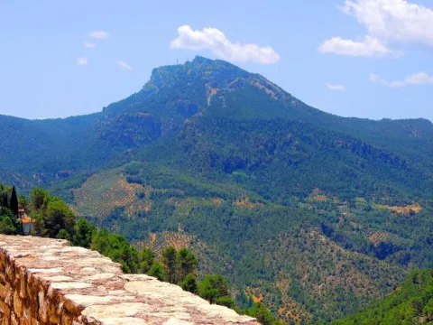
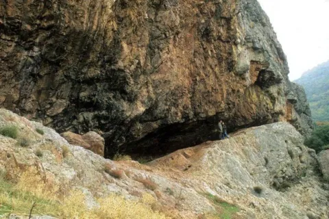
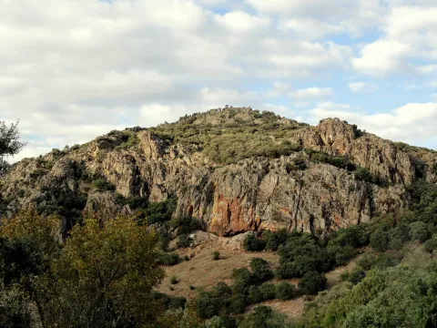
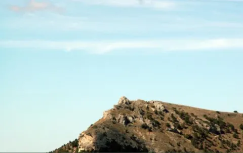
A very steep limestone formation that is located east of the town of Bedmar and above it. On the other side of these scarves is the neighbouring town of Jódar. The climbing lovers will find here magnificent ways to practice their favorite sport. In the center of it you can see an obscene with an Arab wall known as the Air Cave.

Ubicación
Latitud
37.832416
Longitud
-3.423530
Distrito
Municipio
Ubicación en el mapa
POINT (-3.42353 37.832416)
Tipos de punto de interés
Imágenes carrusel
imagen
Image
serrezuelabedmar1.png
Imagen principal
Desactivado
Imágenes cabecera
imagen
Image
serrezuelabedmar.png
Imagen principal
Activado
Microsite al que pertenece
Loading map
Preparing points of interest and routes...
Jurassic-Lower Cretaceous Series of Navalperal

Submitted by brandcode_deweloper on
Id
877361
Descripción
Descripción larga

The total power of the section is over 150 m. On a few sucrose dolomies attributed to the lower and medium Jurassic we find materials from the upper Kimmeridgian; they are limeals with large gastropods and corals that end up on an erosive surface with a crusts of iron oxides.

The following are limestones, locally sandy and margas, with various levels of interspersed calcrets; these materials are being decrified and dolomitised, giving way to stoned dolomies with abundant carbonous remains; this whole set of materials is of the age Hauteriviense- Barremiense. The lower Aptiense is characterized by the presence of sands, calcareous sandstone and sandy limestone with laminations and cross stratifications as well as orbitolins at various levels. The materials of the upper Aptiense have abundant rudists and orbitolins. The Albibe is represented by dolomies with black songs and ghosts of rudists.

Source: Inventory of Georresources of Andalusia. Environmental Council. Junta de Andalusia.

Breve descripción

Navalperal

Ubicación
Latitud
38.298857
Longitud
-2.651877
Distrito
Ubicación en el mapa
POINT (-2.651877 38.298857)
Tipos de punto de interés
Imágenes carrusel
imagen
Image
1%20%285%29.jpg
Imagen principal
Desactivado
imagen
Image
561_img.png
Imagen principal
Desactivado
Imágenes cabecera
imagen
Image
561_img.png
Imagen principal
Activado
Loading map
Preparing points of interest and routes...

Jurassic-Cretaceous Series of El Yelmo

Submitted by brandcode_deweloper on
Id
877317
Descripción
Descripción larga

From the view of Segura de la Sierra you have a magnificent panoramic view of the relief of El Yelmo (its northern slope), one of the most emblematic of the Sierra de Segura. This relief has a synchronal structure, with a rich succession of marine and continental sedimentary rocks of Jurassic-Cretaceous age.

In addition to vertical succession, there are important side changes in the stratigraphic architecture, observable in the panorama, which consist of remarkable changes of powers, culminating in the coining of formations. These exceptional characteristics are due to the paleogeographical position on the margin of a marine basin (sudiberic paleomargen) during the Mesozoic. The observations on the northern side of the Yelmo are complemented, from the same viewpoint, by that of the "Segura de la Sierra Court," which shows a section covering the Jurassic and Cretaceous, and which is accessible by the asphalt forest track that leads inside the Segura Sierra from the Segura de la Sierra population.

Source: Inventory of Georresources of Andalusia. Environmental Council. Junta de Andalusia.

Breve descripción

Jurassic Series - El Yelmo Cretaceous

Ubicación
Latitud
38.298857
Longitud
-2.651877
Distrito
Ubicación en el mapa
POINT (-2.651877 38.298857)
Tipos de punto de interés
Imágenes carrusel
imagen
Image
1%20%285%29.jpg
Imagen principal
Desactivado
imagen
Image
2%20%284%29.jpg
Imagen principal
Desactivado
imagen
Image
Natu204.jpg
Imagen principal
Desactivado
Imágenes cabecera
imagen
Image
560_img%20%281%29.png
Imagen principal
Activado
Horario
Monday's closed. Tuesday to Friday: 10: 00 - 13: 00 and 18: 00 - 21: 00. Saturday: 10: 00 - 14: 00 and 18: 00 - 21: 00. Sunday and holidays: 10: 00 - 14: 00.
Loading map
Preparing points of interest and routes...

Cretaceous Series of the southern Yelmo

Submitted by brandcode_deweloper on
Id
877273
Descripción
Descripción larga

The stratigraphic section of the South Yelm is a magnificent example of the materials of the Aptiene-Ambient of the Prebetic. The Aptiense is essentially represented by limestone, of facies that vary between lacustre / palustres (carbonous) and of somere platform, both protected (lagoon), and open (coral reef).

The Albibe is made up of an alternation of carbonates (limestones and dolomies) and terrogenes (margas, clays and sands), from coastal to shallow marine environments. The faces represented are very rich and varied, at certain levels with a very well developed cyclicity. The content in fossils is extraordinarily rich, both in marine fauna and corals, lamelibranchios (rudists and ostreides), foraminiferous (e.g. orbitolinides), as well as fresh water (caraceous algae).

Source: Inventory of Georresources of Andalusia. Environmental Council. Junta de Andalusia.

Breve descripción

South Yelm Cretaceous Series

Ubicación
Latitud
38.298857
Longitud
-2.651877
Distrito
Ubicación en el mapa
POINT (-2.651877 38.298857)
Tipos de punto de interés
Imágenes carrusel
imagen
Image
2%20%284%29.jpg
Imagen principal
Desactivado
imagen
Image
1%20%285%29.jpg
Imagen principal
Desactivado
Imágenes cabecera
imagen
Image
sur-yelmo.png
Imagen principal
Activado
Loading map
Preparing points of interest and routes...

Segura de la Sierra

Submitted by brandcode_deweloper on
Id
919387
Descripción
Descripción larga

These lines correspond to the Treaty of the Mountain, studied by the Duke of Almazan, a document that some researchers attribute to Jorge Manrique. To talk about the 15th century in the Sierra de Segura is to talk about the Manrique family and the border period. A situation in which attacks and responses by Christians and Muslims were frequent. This danger and the border situation can only be seen by entering Segura de la Sierra: remains of walls, towers, entrance doors and on top of the hill, the watchful castle.

The Visits Books of the Order of Santiago described in the late 15th century the castle of Segura de la Sierra as a military compound with weapons to face a siege or, if necessary, to organize a village to attack the enemy. We cannot forget that in 1434 Rodrigo Manrique organized a village to conquer Huécar in the Altiplano granadino.

In Segura de la Sierra, taking advantage of this privileged position and under the security offered by its walls is where Jorge Manrique was raised under the care of his mother, Mrs. Mencía de Figueroa, in the house that still today is preserved five hundred years later.

Breve descripción

A candle on an oak table, a tintero with a pen and a half-write piece of paper. A figure draws attention to the rest of the room dedicated to the Manrique family on the second floor of the tower of tribute in the castle of Segura. Jorge Manrique is a character closely linked to Segura de la Sierra. If we were to imagine the poet in front of the paper, we might think that the text might start like this: "remind me to be very noble, Mr. Brother, having once said, in they are closer to mockery, you will see if you wanted me to write you something about the work of the Montaria."

Ubicación
Latitud
38.298857
Longitud
-2.651877
Distrito
Ubicación en el mapa
POINT (-2.651877 38.298857)
Tipos de punto de interés
Imágenes cabecera
imagen
Image
1517663098_978370_1517663226_noticia_normal.jpg
Imagen principal
Activado
Loading map
Preparing points of interest and routes...

Iberian Sanctuary el Pajarillo

Submitted by brandcode_deweloper on
Id
4652660
Descripción
Breve descripción

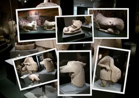
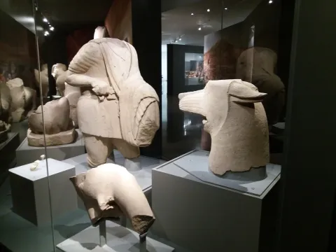
TheSanctuaryHeroic of ElDuck, inHuelma, is the place where the well-known sculptural ensemble in which a wolf and a hero are faced, surrounded by other animals such as lions and taps and placed on a stone tower, in sum in a monumental context of great importance.

Telecomunicaciones
Sitio web
www.redjaen.es
Ubicación
Código Postal
23560
Latitud
37.647300
Longitud
-3.455180
Distrito
Municipio
Ubicación en el mapa
POINT (-3.45518 37.6473)
Tipos de punto de interés
Imágenes carrusel
imagen
Image
el%20santuariodel%20pajarillo.jpg
Imagen principal
Desactivado
Imágenes cabecera
imagen
Image
santuario.jpg
Imagen principal
Activado
Microsite al que pertenece
Loading map
Preparing points of interest and routes...
Iberian Sanctuary of the Collado de los Jardines

Submitted by brandcode_deweloper on
Id
4554285
Descripción
Descripción larga

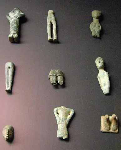
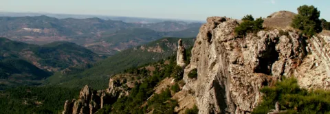
The original place of worship would be made up of a grotto in the rocky massif and a source; in front of that it is possible to emerge at different times, successive buildings of worship; for the oldest one it is kept news of its rectangular plant, and it is suspected a chronology of the centuries V- IV BC; for the most recent the dating managed would place it in the first century or perhaps before; the Shrine would already work from before the construction of the first building and would continue to do so, at least until the fourth century, after the destruction of the second building towards the third century AD. It seems that the exvotes, in the vast majority or in their entirety bronze figures, "Fury primitivement dépossées dans la caverne, et jetées de temps a autre sur la pente, mais jamais aucune fosse ne fut creusée pour les recevoir," which prevents the existence of a reliable strategy, which is aggravated by the precarious conditions of the excavation, at the beginning of the century, of the site. It is not unlikely, as one of the excavators suggested, that the religious whole should also be completed with a sacred forest, from whose branches the devotees would hang part of the offerings.

Breve descripción

Located in the area that could have been by way (although not surely of the most important before the 18th century) between Alta Andalucía and the Plateau, is this Sanctuary of which almost all that is known are its bronze exvotes (about 2,200 from the official excavations) that the Oretan peoples offered to the gods.

Telecomunicaciones
Sitio web
www.santaelena.es
Teléfono de contacto
953 664 010
Ubicación
Nombre
Cueva de los Muñecos
Código Postal
23213
Latitud
38.388204
Longitud
-3.498567
Distrito
Municipio
Ubicación en el mapa
POINT (-3.498567 38.388204)
Tipos de punto de interés
Imágenes carrusel
imagen
Image
Santuario%20Collado%20de%20los%20Jardines3.jpg
Imagen principal
Desactivado
imagen
Image
Santuario%20Collado%20de%20los%20Jardines2.jpg
Imagen principal
Desactivado
Imágenes cabecera
imagen
Image
dsc03816.jpg
Imagen principal
Activado
Loading map
Preparing points of interest and routes...

Iberian Sanctuary of the Lobera Cave

Submitted by brandcode_deweloper on
Id
309676
Descripción
Descripción larga

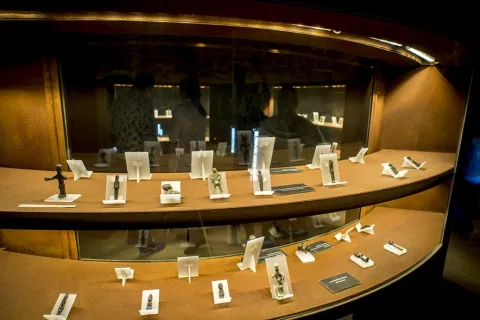
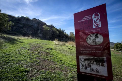
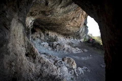
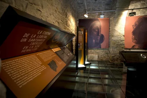
Through their rooms you can discover how the exvotes were made, what they meant to the Iberians, how their vision of the beyond and their relationship with the gods was. A magnificent collection of these figures that still keep in their faces the mystery of the people they represented. Just less than 1 km from this museum is located the Cave de la Lobera, where you can walkon a small path with information about the place and whereYou will discover the abode of the gods.

The Iberian Sanctuary of the Cave of the Lobera is founded in the mid-fourth century BC and is kept in use continuously until the second century AD, suffering restructuring with the romanization of the Alto Guadalquivir.

For Iberian times, it is conceived as an outdoor cult space, associated with different coats and caves. The natural slope is saved with the construction of different terraces that facilitate access to the offering areas.

For Roman times, the area of worship is restricted to the area of La Cueva de la Lobera.

This sanctuary was discovered by the Iberian bronze exvotes, which, since the 19th century, circulated and were treasured in private collections. Interest in the so-called "mingos" caused it to be illegally exploited throughout much of the 20th century. Since 1912, the Cave de la Lobera was the subject of interventions aimed at its conservation, and in these first performances the Cave de la Lobera was frequented by scholars moved by such rich archaeological heritage.

Breve descripción

The Museum of Castellar is dedicated to the exvotes of Iberian times that were recovered in the shrine of the Cave of the Lobera.

Telecomunicaciones
Sitio web
www.viajealtiempodelosiberos.com
Teléfono de contacto
953 460 497
Correo electrónico
info@viajealtiempodelosiberos.com
Ubicación
Código Postal
23260
Latitud
38.262190
Longitud
-3.110560
Dirección
Carretera A-312 Linares-Orcera
Distrito
Municipio
Ubicación en el mapa
POINT (-3.11056 38.26219)
Tipos de punto de interés
Imágenes carrusel
imagen
Image
santuario_castellar_6.jpg
Imagen principal
Desactivado
imagen
Image
Cueva de la Lobera
Imagen principal
Desactivado
imagen
Image
Cueva de la Lobera
Imagen principal
Desactivado
imagen
Image
Cueva de la Lobera
Imagen principal
Desactivado
imagen
Image
Cueva de la Lobera
Imagen principal
Desactivado
Imágenes cabecera
imagen
Image
santuario_castellar_3.jpg
Imagen principal
Activado
Horario
Free visit. Concert guided tours.
Loading map
Preparing points of interest and routes...

Sanctuary of the Saints and Sacred Relics

Submitted by brandcode_deweloper on
Id
5620622
Descripción
Descripción larga
Eslava Galán presented her work The Conquest of America told for skeptics here. The Saints are characters of great importance in The Templar Tomb in the search for the enigma that Solomon's Table treasures, appearing as a clear Templar symbol as they are dual saints, in the image of the Order's shield, a couple that rides on the same horse: (…) I also bring here some news from Arjona: at the top of the hill on which the town is located, a scholar and archaeologist from the 17th century, Martín de Jimena Jurado, carried out some excavations from which the bones of many martyrs allegedly came to light, among them those of the patrons Bonoso and Maximiano. Two employers? – Isabel was surprised. As in all Calatrava towns, two patrons - Íñiguez corroborated - (...)
Breve descripción
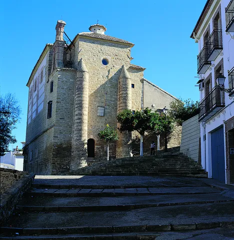
The sanctuary was erected during the bishopric of Moscoso and Sandoval to guard the supposed remains of the martyred saints Bonoso and Maximiano, found in this town at the beginning of the 17th century, as well as the remains of more than 3,000 martyrs of the first Christians during Roman times. It was built between 1617 and 1619 with stone from Santiago de Calatrava and, as planned by Juan de Aranda y Salazar, who also worked on the Jaén cathedral, two churches were superimposed. A chamber was drilled in the lower part to be seen from the outside, like a crypt, with access through the Saints cemetery. It presents a polychrome plaster altarpiece, baroque decoration, which was not completed until the mid-19th century, tombstones with the stories of the martyrs and a plateresque doorway. The upper part has its entrance from Plaza de Santa María, through a doorway from 1659, and its floor plan is a single nave covered with a barrel vault with lunettes and architraved pilasters that support semicircular arches. The upper floor was intended to house the stone images of San Bonoso y San Maximiano, which were never placed. In the year 1843, with the Confiscation of Mendizábal, the images were moved to the Santa María church, and the relics of the martyrs were moved to the upper floor. Leaving the lower floor without functionality. Currently this space houses the Museo Religioso of the Arjona parishes where a good part of the brotherhood's heritage is exhibited, as well as old drawings and photographs.
Ubicación
Código Postal
23760
Latitud
37.935860
Longitud
-4.054210
Dirección
Plaza Sta. María
Distrito
Municipio
Ubicación en el mapa
POINT (-4.05421 37.93586)
Tipos de punto de interés
Imágenes carrusel
imagen
Image
Mon295.jpg
Imagen principal
Desactivado
imagen
Image
santuario-de-las-sagradas.jpg
Imagen principal
Desactivado
imagen
Image
vista%20gral%20santuario%20%28I%29.jpg
Imagen principal
Desactivado
Imágenes cabecera
imagen
Image
img-20190429-125144-largejpg.jpg
Imagen principal
Activado
Microsite al que pertenece
Loading map
Preparing points of interest and routes...
Sanctuary of the Virgen de la Fuensanta

Submitted by brandcode_deweloper on
Id
12131034
Descripción
Descripción larga

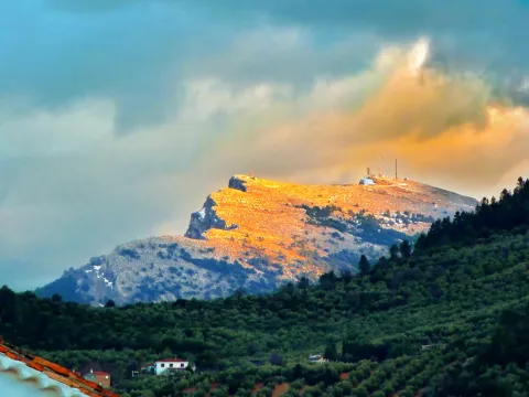
Today we see olive trees around the sanctuary but we must think of forest areas with some clear for cultivation, highlighting on the high Iznatoraf as the most important villa of the advance to the north of the Guadalquivir.

Little by little this situation of danger is disappearing, new inhabitants arrive and places are beginning to live outside the walls of the villa until it is necessary to disconnect them from the municipality. The inhabitants of the Moraleja in 1396 knew the autonomy with respect to Iznatoraf, going on to be called since then Villanueva del Archbishop.

It tells an ancient legend that in Muslim times there was a group of MozArabs in Iznatoraf with a great devotion to the virgin Mary. The king's wife showed some interest in the Christian religion by helping them in all that she could. When her husband, known as Alimenon, found out, he ordered that they take his wife into the forest and cut off her hands and take her eyes out to die in the most absolute solitude. The woman called on the virgin Mary, who presented herself and made a fountain sprout to wash her wounds. Miraculously he healed and the virgin ordered him to go up to her husband so that, being aware of the miracle, they would be baptized in the fountain and set up a temple in his honor.

The Sanctuary and the virgin of the Fuensana is one of the oldest in Spain and it is known that it existed in 1291 already as an important pilgrimage center on the border lands. The building is of three Gothic-style ships, although there are still some Romanesque reminiscent, such as a beautiful medieval mudejar tile. The virgin of the Fuensana is sold in a baroque shrimp of the 17th century.

Breve descripción

Contemplating the sanctuary building comes to mind memories of border life. The almenada tower and the robustness of the walls refer to other times when the danger of war was present in the daily lives of the people who lived in the village of the Moraleja. Without ever losing sight of Iznatoraf as a villa from which the different places that have ended up giving rise to the Sierra de las Cuatro Villas were torn.

Telecomunicaciones
Sitio web
https://villanuevadelarzobispo.es/turismo/
Teléfono de contacto
607 184 628
Correo electrónico
turismovillanuevadelarzobispo@gmail.com
Ubicación
Código Postal
23330
Latitud
38.163020
Longitud
-2.994220
Ubicación en el mapa
POINT (-2.99422 38.16302)
Tipos de punto de interés
Imágenes cabecera
imagen
Image
1604769448440107388872821794175587.jpg
Imagen principal
Activado
Horario
May - ago: Wednesday to Saturday 09: 00 - 14: 00 and 18: 00 - 21: 00, Sunday 10: 00 - 13: 00. Sept - abr: Wednesday to Saturday 10: 00 - 14: 00 and 16: 00 - 20: 00, Sunday 10: 00 - 13: 00.
Otros servicios
Guided tours under reservation in Tourist Office
Loading map
Preparing points of interest and routes...