Saltar al contenido principal

ALTERNATIVE GR 247.1 STAGE 1: Prado Maguillo and Forestrand House Refuge El Bodegón - Río Madera

Submitted by brandcode_deweloper on
Id
8165149
Breve descripción

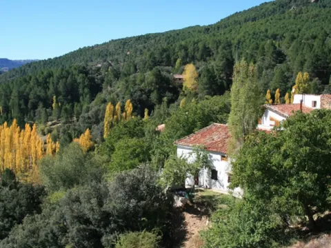
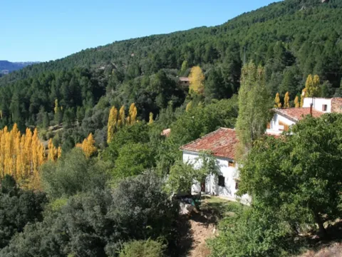
This first stage of the GR 247.1 Variant unites two of the most emblematic small inhabited nuclei of the deep interior of the Natural Park, in the Sierra de Segura. The first is the village of Los Anchos and Prado Maguillo, and the second is the village of Arroyo Canales and Rio Madera.

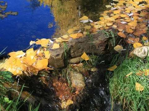
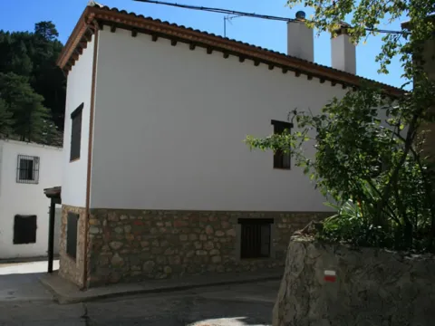
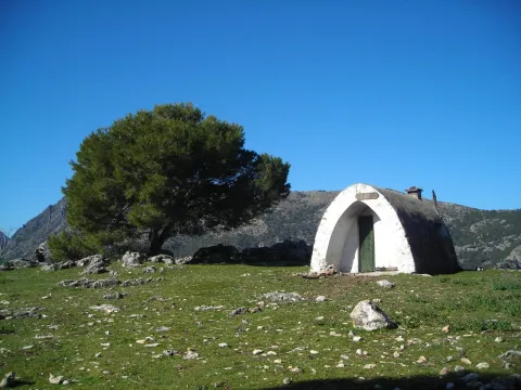
They are isolated, lonely and surrounded by a very beautiful environment. The first, at the highest altitude, draw attention to the good conservation of popular architecture, of great simplicity and with an aesthetics fully integrated into the landscape. The Recreative Area of La Morringa, which is a very pleasant and shaded space with fountain and tables next to the River Madera, whose waters run manly between the riverside vegetation, stands out.

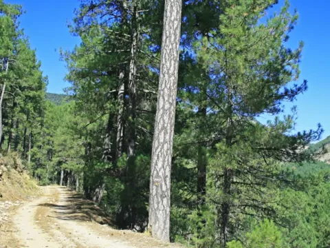
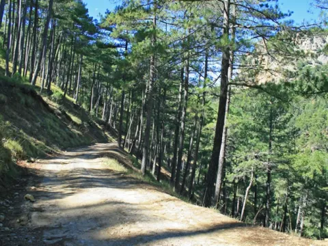
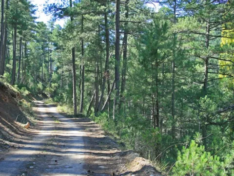
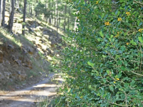
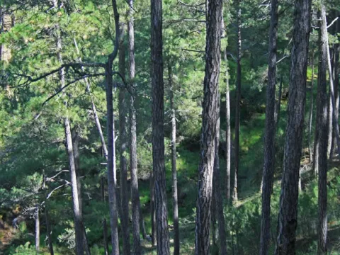
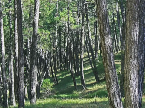
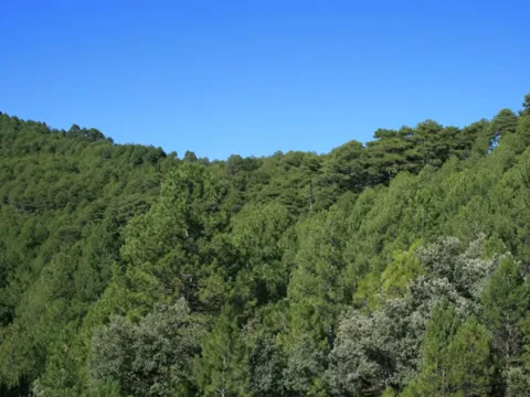
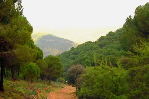
Most of the route runs through the forest track that runs through the Valley of Arroyo de las Tres Aguas, linking the valleys of Los Anchos and Río Madera through thick forests of pine laricio or salgareño. The Stage is short, and it is possible to chain it in the same day with one of the other steps of the Southern Forest Path with which it links, or with a stretch of them, but we recommend to do so without haste and to remain at any of the two ends of it, because they have left-over attractions for it.
Latitud
37.8351
Longitud
-3.1403
Distrito
Municipio
Ubicación en el mapa
POINT (-3.1403 37.8351)
imagen
Image
1.jpg
Imagen principal
Activado
imagen
Image
1.jpg
Imagen principal
Desactivado
imagen
Image
2.jpg
Imagen principal
Desactivado
imagen
Image
4.jpg
Imagen principal
Desactivado
imagen
Image
5.jpg
Imagen principal
Desactivado
imagen
Image
6.jpg
Imagen principal
Desactivado
imagen
Image
7.jpg
Imagen principal
Desactivado
imagen
Image
8.jpg
Imagen principal
Desactivado
imagen
Image
9.jpg
Imagen principal
Desactivado
imagen
Image
10.jpg
Imagen principal
Desactivado
imagen
Image
11.jpg
Imagen principal
Desactivado
imagen
Image
12.jpg
Imagen principal
Desactivado
imagen
Image
13.jpg
Imagen principal
Desactivado
imagen
Image
14.jpg
Imagen principal
Desactivado
imagen
Image
15.jpg
Imagen principal
Desactivado
imagen
Image
16.jpg
Imagen principal
Desactivado
imagen
Image
17.jpg
Imagen principal
Desactivado
imagen
Image
18.jpg
Imagen principal
Desactivado
imagen
Image
19.jpg
Imagen principal
Desactivado
2 h 12 min

Nature

icon-intereses-naturaleza

Friends

icon-intereses-amigos

Adventure

icon-intereses-aventura

Culture

icon-intereses-cultura

Sport

icon-intereses-deporte

Eco-friendly

icon-intereses-eco-friendly

For couples

icon-intereses-en-pareja

Family

icon-intereses-familia

Gastronomy

icon-intereses-gastronomia

Municipality

icon-intereses-municipio

Low-cost tourism

icon-intereses-turismo-low-cost

Solo travel

icon-intereses-viajar-solo
Medium
Prado Maguillo y Refugio Casa Forestal El Bodegón - Río Madera
7,78 km
248m
241m
416m
1
1
1
2
On foot
All year round
Activado
Some strong reels shortly before the end of the Stage in Rio Madera
Prado Maguillo, La Morringa Recreative Area, Arroyo Canales, Río Madera

On the path: No
Near the path: Segura de la Sierra

In the beginning: Refugio Casa Forestal El Bodegón (1.4 km from the beginning of Etapa).
In the end: there is no.

The serrano cortijo, a combination between the practical and the simple

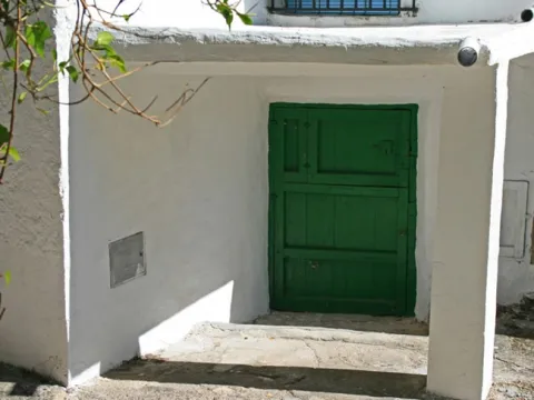
The Valley of Los Anchos, from which this route is part, is perhaps the area where what is left of the popular architecture of these mountains is best preserved. Joaquín Gómez Mena, an excellent connoisseur of the Natural Park, sums up its main features.
The serrana house, as a general rule, is rectangular and has thick walls ranging from 50 to 70 centimeters, made of stones and toves attached with argamase, which serves as protection against summer heat and the cold of winter. The surface of this rectangle ranges from 25-35 meters wide by 30-40 meters long.

On the lower floor there are usually three rooms that are aligned. The first is a kitchen-dining room, where there is the access door to the house and it has one or two windows not very large. In this kitchen-dining room is the home or fireplace, which has the double function of heating the room in winter and serving to cook the food and heat the water.

In most of the houses, on both sides of the fireplace are two fitted cupboards on the wall, where the cooking tools are kept. Sometimes in one of these holes the quarries were placed with the water that was brought from the source.

The other two rooms are single bedrooms, one for marriage and one for children. They have small ventilation windows and are very austere, for in them there is only one bed and a harpoon to keep the clothes. From one of the bedrooms leaves the staircase that gives access to the upper floor, where the camera is located.

The roof of this plant is of descending height, or as we say today, overstretched, because the roof becomes inclined, usually to a water, to run the rainwater. This camera has one or two small windows to air the stay, where the products of the killing are cured and stored. The roof of the camera is unglued, with the wooden rolls that make of beams and the wooden boards placed above them. Finally, a clay layer and tiles are available on the boards.

Next to the human stays, but separated by a wall and with independent entrances, the blocks for the cattle are located, which have freckles for mules and donkeys. In some corijos these blocks are separated from the house, in front of it or on one side of it. Other buildings of the cortijo separated from the family house are the corrals and aprines for the goats and sheep, the cochineas and the hens.

There are also other common-use infrastructure for different families in a corijada. Among them are the ages to pull the grain, which are usually on high and well ventilated grounds to take advantage of the effect of the air, are almost always circular and its soil is made with rolling edges, perfectly placed as if of a mosaic. Many of these ages are currently abandoned and it is regrettable that they end up being lost in the near future, because they are part of the cultural heritage of the natural park.

Another element of common use is the bread oven, built of stone and mud and in a vaulted form. It can be found standing out of the walls of the house to which it is located or, more often, as an independent construction among other buildings of the cortijo. The plant of these furnaces is usually circular or square, and is covered with Arab tile.

Also the fountains and lavatories, which were essential elements in the daily life of the village, are another heritage that in many places is being lost and that, even if the installation of running water in the houses makes them barely used, should be kept perfectly preserved.

Prado Maguillo and Refugio Casa Forestal El Bodegón

Wood River

Coordenadas / Huso 30S
According to Projection UTM Datum ETRS89
Tramo de asfalto o cemento
2.19%
Tramo de pista o camino forestal
87.79%
Tramo de vía pecuaria
0
Tramo de senda
10.02%

Route card

Km 0

Prado Maguillo

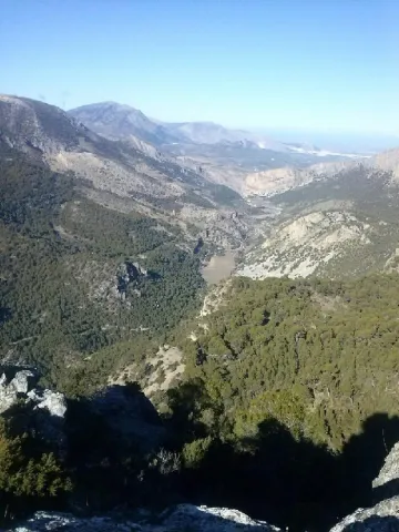
Nuestra ruta comienza en Prado Maguillo, una pequeña aldea de montaña muy cerca de Los Anchos. Ambas están en un entorno de extraordinaria belleza y conservan bastante bien la arquitectura popular. Salimos entre huertas, la mayoría ya abandonadas, y a los 500 metros, a la izquierda hay un pequeño cerro al que es imprescindible subir (son muy pocos metros) para recrearse en las maravillosas vistas que se contemplan desde él: el valle de Los Anchos en primer plano y, al fondo, las crestas de El Calarico, Poyo Gavilán y Poyo Alto.

Km 0,75

A la izquierda sale un camino que, al cabo 650 metros, nos lleva a la Casa Forestal El Bodegón, una de cuyas construcciones auxiliares ha sido rehabilitada como refugio. La Casa y el almacén –al que se llamaba barraca- ya están en ruinas, pero el paraje, que es un amplio claro en pleno bosque, es encantador.

Volviendo a nuestra ruta, continuamos bajando por la solitaria pista forestal en medio de un gran bosque de pino laricio o salgareño con sotobosque de encina, un paisaje cautivador que nos acompañará hasta el final de la Etapa. Vamos entre la Loma del Mirandante y el Calar de Peña Rubia, por el encajado valle del Arroyo del Prado de los Fresnos.

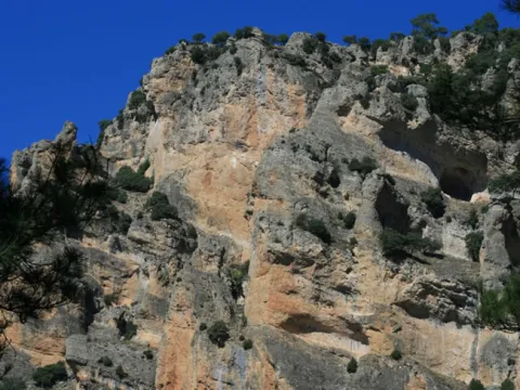
Pronto oiremos el rumor de sus aguas, mezclado con el canto de la abundante avifauna forestal. A la derecha, al otro lado del valle, aparece la inconfundible silueta de Peña Rubia, con sus paredones verticales que, haciendo honor a su nombre, tienen un llamativo color dorado y sepia que se acentúa con las últimas luces de la tarde.

A la altura del kilómetro 3, aproximadamente, en el fondo del valle confluyen las aguas del Arroyo del Prado de los Fresnos con las de los Arroyos de La Cerecera y La Cuesta del Majano. Por eso, a partir de ese punto, el cauce que resulta tiene el bello nombre de Arroyo de las Tres Aguas.

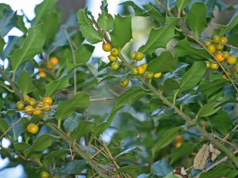
El ambiente fresco y umbrío del valle propicia la existencia de acebos aislados, pudiendo admirar un pequeño grupo de ellos en el kilómterom 3,8. Un poco más adelante vemos abajo las ruinas del Molino de Peña Rubia y su antigua conducción de agua, que nos hablan de un pasado en el que se trabajaba para sobrevivir, pero donde el agua era mucho más abundante, porque la que circula en la actualidad apenas podría mover la rueda de un molino con la necesaria continuidad.

En el kilómetro 4,4 hay un manantial de agua que sale a través de una conducción por el lado derecho de la pista forestal.

Km 5,9

Puente sobre el Arroyo de Las Tres Aguas

La ruta llega al fondo del valle y cruzamos sobre este río, que poco después afluye al Río Madera. Es un lugar refrescante con abundancia de mimbreras y juncos, al igual que el cruce sobre el Río Madera por un vado unos 400 metros más adelante. La lámina de agua que tenemos que atravesar suele ser muy delgada, pero si ha llovido mucho puede tener alguna dificultad. También hay que tener prudencia en invierno, época en la que puede tener una capa de hielo. A partir del vado, y ya por el Valle del Río Madera, caminamos otros 400 metros con el río a nuestra derecha. En este tramo apreciamos que la vegetación es abundante, pero además hay que saber que las condiciones de frescor y humedad convierten a la zona en un enclave con una relevante importancia botánica. Hay, por ejemplo, una población de un equiseto (similar a la cola de caballo) denominado Equisetum palustre, planta propia del norte cuyas escasas poblaciones andaluzas sólo están en este Parque Natural. También se puede ver la centaurea (Centaurea nevadensis), exclusiva de las sierras calizas del este y sureste de España, y la ajonjera de Cazorla (Carlina baetica), una planta de distribución restringida al Parque Natural y sierras cercanas.

Km 6,7

Área Recreativa de La Morringa

Este Área es un buen lugar para descansar e incluso para echarse una siesta, tal vez por eso los serranos le pusieron este nombre, que en el habla local es sinónimo de soñarrera. Es un espacio muy agradable y sombreado que dispone de fuente y mesas junto al Río Madera, cuyas aguas discurren mansamente entre la vegetación de ribera. Después salimos a la carretera del valle de Río Madera y caminamos por ella apenas 200 metros para tomar un camino que sale a nuestra izquierda. Se trata de un jorro (vía de saca de madera) con algunos repechos que al poco se convierte en senda. En el kilómetro 7, 4 llegamos a un collado donde se abren vistas hacia el pequeño Valle de Arroyo Canales, donde vemos la aldea del mismo nombre en la que finalizará nuestra Etapa. En este mismo collado cruzamos una pista forestal que, hacia la izquierda, nos llevaría a los cortijos de Los Jarales y Los Asperones.

Km 7,7

Arroyo Canales y Río Madera

La Etapa termina en la pequeña aldea de Arroyo Canales, unos metros después de atravesar el arroyo del mismo nombre y las huertas que riega. Por la carreterita que pasa por la aldea, a la derecha, llegaríamos en unos minutos a la aldea de Río Madera, que tiene menos casas, pero que con su ermita, su venta, su plazuela y su antigua casa forestal ha sido siempre y sigue siendo el lugar de referencia del frondoso y seductor valle de Río Madera. Si en vez de bajar a la aldea de Río Madera queremos continuar por la Etapa 2 de la Variante GR 247.1, solo hay que cruzar Arroyo Canales, y al llegar a la carretera seguir por el camino que arranca enfrente.
Trail Cerrillo del Plomo

Submitted by brandcode_deweloper on
Id
7437810
Breve descripción

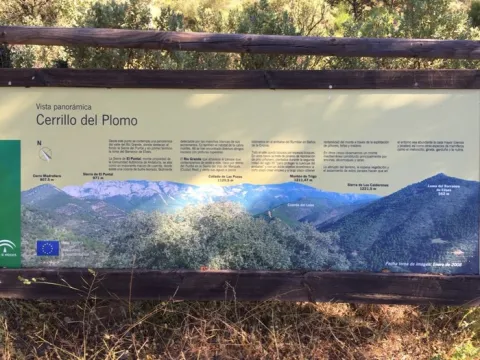
The Cerrillo del Plomo was one of the most productive mines during the Roman period, being one of the most important deposits in Spain for the extraction of galena, both for its production and for the quality of the mineral extracted. The galena is a mineral of the group of sulphides from which lead and silver are extracted.

Under the rule of the Roman Empire, this silver was sent to Rome, while lead was used to make coins, vessels and cover pipes and roofs. In the mid-20th century, the miners called sacageneros removed the bowels of this hill in search of the remains of lead that the Romans did not extract.

Latitud
37.8302
Longitud
-3.4404
Distrito
Ubicación en el mapa
POINT (-3.4404 37.8302)
imagen
Image
Sendero%20Cerrillo%20del%20Plomo%202.jpg
Imagen principal
Activado
imagen
Image
Sendero%20Cerrillo%20del%20Plomo.jpg
Imagen principal
Desactivado
45 min

Nature

icon-intereses-naturaleza

Friends

icon-intereses-amigos

For couples

icon-intereses-en-pareja

Family

icon-intereses-familia

Low-cost tourism

icon-intereses-turismo-low-cost

Solo travel

icon-intereses-viajar-solo
Medium
Sendero Cerrillo del Plomo
1,1 km
On foot
All year round
Desactivado
  • In front of COVID19, keep the safety distance and carry a mask, avoid agglomerations and contact with surfaces, wash your hands frequently, use hydroalcoholic gel and consult the available digital materials. Take care of your health and others.
  • It works to prevent fires. Do not throw cigarettes or any other object that produces combustion.
  • By consuming local products and having companies in the area you will contribute to rural development.
  • He lives with the local people and other users. It respects private property and property.
  • Unwind in a sustainable way: public transport, bike, walk, shared vehicle...
  • Noise is another form of pollution. In silence you will enjoy your experience more.
  • It facilitates the use of people with special needs.
  • The trash doesn't come back alone. Take her with you to the nearest container. Reduce, reuse, recycle.
  • Don't leave a mark on your way through nature.
  • It practices a responsible and committed tourism with the environment. Be a real ecotourist!
  • Respect the facilities at your disposal. We all pay for your maintenance.
  • Check the weather forecast before starting your activity.
  • Avoid going out alone. If you do, it communicates tour and time of return to other people.
  • Extreme caution under adverse conditions and with the occasional presence of animals or motor vehicles.
  • Please provide prior information on the possible existence of cynegetic activity.
  • It has water, sun protection, proper clothes and shoes.
  • It carries a mobile with enough battery in case of emergency (112), but remember that there is not always coverage.
  • Don't even bother animals. You would negatively alter his behavior.
  • For your safety and the safety of the environment, don't get out of the signposted road or take shortcuts.
  • Remember that the capture of animals, light fire, fish and collect plants or minerals is prohibited.
  • If you bring a dog, take him with his strap and make sure he doesn't bother other animals or people.
  • Your safety is our concern, but it's your responsibility.

Thank you for your cooperation!

On the A-4 E-5 Highway, at the height of La Carolina we will take Exit 270, to follow the JA-6100 road, which will lead us to El Centenillo. At the entrance of the village there is a track on the right that descends to the beginning of the path.

Tramo de asfalto o cemento
 
Tramo de pista o camino forestal
 
Tramo de vía pecuaria
 
Tramo de senda
 

Trail Balcón de Despeñaperros

Submitted by brandcode_deweloper on
Id
7396151
Descripción larga

If taken in the sense of the clockwise from the point of start, the path enters
quickly in a pine pine pineapple pineapple pineapple with some
Pines resineros, cypresses and oaks. The first 350 meters of path run through an area
trees with abundant shadows and free of shrubs, as it constitutes the safety zone against
camping fires. This makes this section an ideal site for mushroom search in the autumn.
The path continues another 170 meters through a more intricate area of Mediterranean vegetation in the
that abounds the rosemary and the jars under the tree, which leads us to a spectacular lookout
Panoramic suspended on the old road N-IV. From the viewpoint you have an unparalleled vision
of the Natural Park, as the path is located on the South end. The panoramic view of 180
degrees allows to see the whole mountain of Despeñacos from the Collado de la Estrella, the Port of the King, he
Salto del Fraile, Navavacas, the Castle of Castro Ferral and following the line of the Collado de la
Star to the East, you can see the Paso de Despeñacolos and to its right the Collado de los
Gardens from where the park looks at Aldeaquemada.

Leaving the lookout behind, the path runs 900 meters through an old wooden draw track
completely flat through a lush mixed forest of pine, cypress, oak and cork,
where again the noble bush of the Mediterranean mountain gives a touch of naturality to the visitor
which loses the notion of distance to the people, but which, let us not forget, is just over 1 km from
distance.


Arrived at the end of the track, the path turns abruptly to the right to return to St. Helena
using a wider forest path, which also runs under a canopy of pineapple pine
Great. It is from that point where the only difficulty of the path is found, for during
400 meters is raised by a light cost with a slope about 5% to reach the
limit of the park where again it becomes completely flat. The final section runs through an area of
transition between forest and agricultural space, bordering just the southern perimeter of the campsite
Cracking dogs, passing through their access door and ending right where it started.

The path shows as main attractions its closeness to the people of St. Helena, its affability,
the abundance of shadows for hot days, the great botanical biodiversity and, above
all, the privileged views from the viewpoint that invites to let the imagination fly contemplating
this unparalleled landscape and, why not, to reflect on the countless travelers of so many cultures
who have used this natural passage between the plateau and Andalusia.

Breve descripción

This new path has a length of almost 4 km. and being circular can be performed in both
senses. It starts in the corner that gives access to the Camping Despeñacolos, next to the old section of
the N-IV, on the outskirts of the town of St. Helena.

Latitud
38.4003
Longitud
-3.5201
Distrito
Municipio
Ubicación en el mapa
POINT (-3.5201 38.4003)
imagen
Image
Sendero%20Balc%C3%B3n%20de%20Despe%C3%B1aperros.jpg
Imagen principal
Activado
imagen
Image
Sendero%20Balc%C3%B3n%20de%20Despe%C3%B1aperros1.jpg
Imagen principal
Desactivado
1 h

Nature

icon-intereses-naturaleza

Friends

icon-intereses-amigos

Adventure

icon-intereses-aventura

Culture

icon-intereses-cultura

Sport

icon-intereses-deporte

Eco-friendly

icon-intereses-eco-friendly

For couples

icon-intereses-en-pareja

Family

icon-intereses-familia

Gastronomy

icon-intereses-gastronomia

Municipality

icon-intereses-municipio

Low-cost tourism

icon-intereses-turismo-low-cost

Solo travel

icon-intereses-viajar-solo
Baja
Sendero Balcón de Despeñaperros
3,8 km
On foot
All year round
Desactivado
  • In front of COVID19, keep the safety distance and carry a mask, avoid agglomerations and contact with surfaces, wash your hands frequently, use hydroalcoholic gel and consult the available digital materials. Take care of your health and others.
  • It works to prevent fires. Do not throw cigarettes or any other object that produces combustion.
  • By consuming local products and having companies in the area you will contribute to rural development.
  • He lives with the local people and other users. It respects private property and property.
  • Unwind in a sustainable way: public transport, bike, walk, shared vehicle...
  • Noise is another form of pollution. In silence you will enjoy your experience more.
  • It facilitates the use of people with special needs.
  • The trash doesn't come back alone. Take her with you to the nearest container. Reduce, reuse, recycle.
  • Don't leave a mark on your way through nature.
  • It practices a responsible and committed tourism with the environment. Be a real ecotourist!
  • Respect the facilities at your disposal. We all pay for your maintenance.
  • Check the weather forecast before starting your activity.
  • Avoid going out alone. If you do, it communicates tour and time of return to other people.
  • Extreme caution under adverse conditions and with the occasional presence of animals or motor vehicles.
  • Please provide prior information on the possible existence of cynegetic activity.
  • It has water, sun protection, proper clothes and shoes.
  • It carries a mobile with enough battery in case of emergency (112), but remember that there is not always coverage.
  • Don't even bother animals. You would negatively alter his behavior.
  • For your safety and the safety of the environment, don't get out of the signposted road or take shortcuts.
  • Remember that the capture of animals, light fire, fish and collect plants or minerals is prohibited.
  • If you bring a dog, take him with his strap and make sure he doesn't bother other animals or people.
  • Your safety is our concern, but it's your responsibility.

Thank you for your cooperation!

It starts in the urban centre of Santa Elena, next to the campsite Despeñacolos (C / Infanta Elena
s / n).

Tramo de asfalto o cemento
 
Tramo de pista o camino forestal
 
Tramo de vía pecuaria
 
Tramo de senda
 

Route Santuario-Jabalí

Submitted by brandcode_deweloper on
Id
7394904
Descripción larga

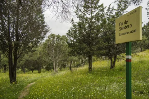
At the beginning of this path is a view of the Sanctuary of the Virgin of the Head, continuing to the East on a forest track. We immediately take a right turn, entering between jars, rosemary and lentils.

The path passes through an ancient herd of cattle, to then cross the forest track of the Membrellejo, used for the access of reels from Andújar and Marmolejo to the Sanctuary during the celebration of the annual Romeria.

It continues between the vegetation of the Mediterranean Mount, it can be seen the Pantano del Encinarejo, and the road that unites the populations of Andújar and Puertollano, beginning a slight down to reach the recreational area of El Jabali, where this path ends

Breve descripción

It is a small walk that will lead us from the surroundings of the Cerro del Cabezo to the Jabali Recreative Area.

Latitud
37.9201
Longitud
-3.0102
Distrito
Municipio
Ubicación en el mapa
POINT (-3.0102 37.9201)
imagen
Image
Ruta%20Santuario-Jabal%C3%AD1.jpg
Imagen principal
Activado
imagen
Image
Ruta%20Santuario-Jabal%C3%AD.jpg
Imagen principal
Desactivado
30 min (solo ida)

Nature

icon-intereses-naturaleza

Friends

icon-intereses-amigos

Adventure

icon-intereses-aventura

Culture

icon-intereses-cultura

Sport

icon-intereses-deporte

Eco-friendly

icon-intereses-eco-friendly

For couples

icon-intereses-en-pareja

Family

icon-intereses-familia

Gastronomy

icon-intereses-gastronomia

Municipality

icon-intereses-municipio

Low-cost tourism

icon-intereses-turismo-low-cost

Solo travel

icon-intereses-viajar-solo
Baja
Ruta Santuario-Jabalí
2 km (solo ida)
All year round
Desactivado
  • In front of COVID19, keep the safety distance and carry a mask, avoid agglomerations and contact with surfaces, wash your hands frequently, use hydroalcoholic gel and consult the available digital materials. Take care of your health and others.
  • It works to prevent fires. Do not throw cigarettes or any other object that produces combustion.
  • By consuming local products and having companies in the area you will contribute to rural development.
  • He lives with the local people and other users. It respects private property and property.
  • Unwind in a sustainable way: public transport, bike, walk, shared vehicle...
  • Noise is another form of pollution. In silence you will enjoy your experience more.
  • It facilitates the use of people with special needs.
  • The trash doesn't come back alone. Take her with you to the nearest container. Reduce, reuse, recycle.
  • Don't leave a mark on your way through nature.
  • It practices a responsible and committed tourism with the environment. Be a real ecotourist!
  • Respect the facilities at your disposal. We all pay for your maintenance.
  • Check the weather forecast before starting your activity.
  • Avoid going out alone. If you do, it communicates tour and time of return to other people.
  • Extreme caution under adverse conditions and with the occasional presence of animals or motor vehicles.
  • Please provide prior information on the possible existence of cynegetic activity.
  • It has water, sun protection, proper clothes and shoes.
  • It carries a mobile with enough battery in case of emergency (112), but remember that there is not always coverage.
  • Don't even bother animals. You would negatively alter his behavior.
  • For your safety and the safety of the environment, don't get out of the signposted road or take shortcuts.
  • Remember that the capture of animals, light fire, fish and collect plants or minerals is prohibited.
  • If you bring a dog, take him with his strap and make sure he doesn't bother other animals or people.
  • Your safety is our concern, but it's your responsibility.

Thank you for your cooperation!

Tramo de asfalto o cemento
 
Tramo de pista o camino forestal
 
Tramo de vía pecuaria
 
Tramo de senda
 

Greenwaand (Vía Verde) de Linares

Submitted by brandcode_deweloper on
Id
7370812
Descripción larga

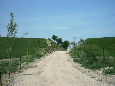
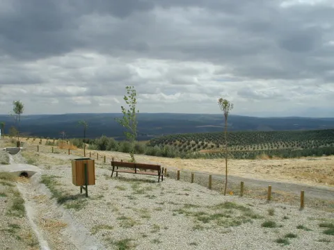
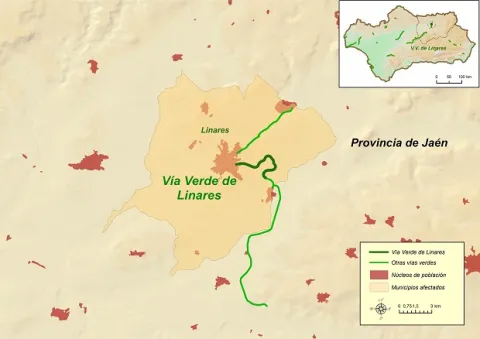
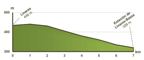
The Via Verde de Linares runs along 6 Km., from the old station of Linares- San José, better known in the municipality as the"Almería Station"untilLinares- Baeza station, corresponding to the old railway route between Linares and Almería.

The need and interest of this late railway were justified with the aim of bringing the new means of transport to the unprotected Eastern Andalusia, which until then, 50 years after the first Spanish railway, had been left out of the state's railway plans.

The objective of the new railway company created around the railway from Linares to Almería, the Southern Spain Iron Walk Company, was to make the transport of lead more attractive to the Almerian port due to the lower mileage between the mining city and the port of Almería. The kilometres of road linking the Linares- Baeza Station with that of Linares- San José, were not completed until 1904. The mining crisis in this region caused this section to lose traffic, leaving trains through its tracks in 1961.

Breve descripción

The sinuous descent of Linares al Guadalimar

Latitud
37.7796
Longitud
-3.7849
Distrito
Municipio
Ubicación en el mapa
POINT (-3.7849 37.7796)
imagen
Image
V%C3%Ada%20Verde%20de%20Linares%20%281%29.jpg
Imagen principal
Activado
imagen
Image
V%C3%ADa%20Verde%20de%20Linares1.jpg
Imagen principal
Desactivado
imagen
Image
Via%20verde%20de%20linares2.jpg
Imagen principal
Desactivado

Nature

icon-intereses-naturaleza
Easy
Image
ba908e6c-ae79-d178-d89c-ae4d72e73fa9?t=1607173181918
Vía Verde de Linares
6,6 km
It can be taken by foot, by mountain bike and by wheelchair.
All year round
Desactivado
Image
cd6c6d51-9ff7-9eff-bb85-0086e7462243?t=1607173185905

4 rest areas, equipped with tables, banks, parking bikes, stationery and fountains.

This Via Verde has a protected natural space located within a radius of less than 5 Km.: The ZIC of the Guadalimar River (Red Natura 2000).

Mirador del Valle, from where you can have a wide and beautiful view of the Guadalimar valley and various nearby villages.

By car: We recommend that you access the Green Way for the following access:

Access No 1:From Linares (Barriada San Gonzalo), on Ubeda Street.

GPS coordinates (decimal format): 38.095651 °, -3.622015 °.

Access No 2:In Linares, cross from the Via Verde with Mar Menor Street.

GPS coordinates (decimal format): 38.096232 °, -3.618323 °.

Access No 3:From the Articular Road (N-322, Linares-Baeza Station).

GPS coordinates (decimal format): 38.084612 °, -3.591498 °

By train:

Liners: Medium Distance, Madrid-Jaén Line and Long Distance from RENFE

Connections:
Jaén: 30 Km.

Tramo de asfalto o cemento
 
Tramo de pista o camino forestal
 
Tramo de vía pecuaria
 
Tramo de senda
 

Greenwaand (Vía Verde) de Segura

Submitted by brandcode_deweloper on
Id
6591286
Descripción larga

Km 114.5

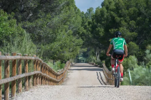
The Segura Natural Trail–Greenway, promoted by the Provincial Council of Jaén and developed by the Ministry of Agriculture, Fisheries and Food in 2015, is a truly unspoilt route surrounded by nature and landscapes. Visitors should be aware that the nearby towns, and therefore opportunities to obtain supplies, are located some distance from the route. It begins beside the kilometre 217 marker on the Bailén–Albacete national road (N-322), two kilometres from Arroyo del Ojanco and one kilometre from its abandoned railway station. There is no designated car park on the left-hand side of the road when travelling towards Albacete, although there is sufficient space to park several vehicles. Information panels and signs indicate the starting point.

The first kilometre descends towards the Guadalimar River viaduct, a monumental concrete structure with a 175-metre-long deck supported by five wide arches. The viaduct also provides an exceptional viewpoint overlooking the river’s gallery forest. The Guadalimar River is the lowest point on the route.
After crossing the Guadalimar River, the route of the former railway has been occupied for 1.5 km by the access road to a biogas plant. The alternative is a parallel path which, in order to negotiate the overpasses, includes several ascending and descending slopes.
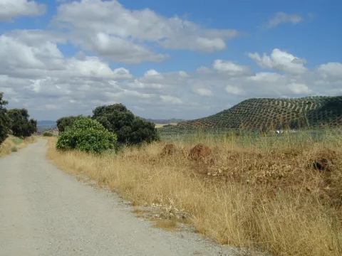
When the asphalt road branches away at km 118, the route once again takes over the former railway platform. The Segura Greenway regains the advantages of the original railway route and begins a long journey through a landscape of rolling hills, dominated by orderly rows of olive trees and alternating areas of uncultivated land covered with Spanish broom, dotted with isolated trees and small patches of pine forest. In the distance, high mountains rise on both sides, their olive groves extending upwards until they meet the dense pine forests crowning the summits.

Across such difficult terrain, the railway was able to maintain long straight sections thanks to its most characteristic engineering structures. High embankments built over stream valleys alternate with cuttings through raised terrain and cut-and-cover tunnels in places where the earthy walls of the cuttings were too unstable.

From km 122 onwards, it becomes easier to see a deep gorge opening in the mountain range that closes off the southern horizon on the right. The Guadalimar River has carved a passage through the Sierra de Segura, where the town of La Puerta de Segura occupies a strategic location. In the distance, beyond the gorge and perched on a hill, the castle and village of Segura de la Sierra can be seen overlooking the boundaries of the Sierras de Cazorla, Segura y Las Villas Natural Park.

Within sight of the hamlet of La Agracea, at km 124.5, there is another important point on the route. A shooting range stands to one side, and its bar is the only place near the greenway where visitors can obtain supplies. 

Km 125

At km 125, the original route of the Baeza–Utiel railway has been severed by the N-322 road. The gravel path ends at the intersecting JV-7001 road. As the former railway alignment has disappeared, the alternative is to share the lightly trafficked road with other vehicles. Turning right, the road rises over an overpass and crosses above the N-322 in the direction of La Puerta de Segura, located 6 km from the greenway. This interruption, which is clearly signposted, is marked by an old steamroller raised on an unusual pedestal: a former railway track overpass.
Around 200 metres further on, a gravel track on the left descends to rejoin the original railway alignment and allows vehicles to reach the car park provided beside the first station on the route.
 
The former Puente de Génave station, at km 125.3, follows the same architectural design as the other stations. It consists of a main passenger building and a goods warehouse, each with its respective platform. Here, however, there is also a livestock loading platform, which is not present at the other stations, alongside which a rest area has been provided.
 
It is worth mentioning that there is a new 5 km cycle lane between the town of Puente de Génave and La Puerta de Segura. This provides an excellent opportunity to reach this beautiful town and the heart of the Natural Park safely.
 
Beyond the station, the railway route winds around the courses of the Gavilán and Moral streams. The alignment curves around deep valleys with steep slopes. In this unspoilt environment, pine forest begins to spread towards the route, first reaching it through the intermittent ravines crossed by high embankments and eventually becoming the dominant feature. The pine trees enhance the route between the hamlet of Bonache, at km 126.7, shortly before crossing into the Natural Park, and the cutting at km 129. This section includes a rest area at km 128.2, an idyllic place to stop, where the greenery and shade of the pine trees create an oasis.

As the route crosses the Sierras de Cazorla, Segura y Las Villas Natural Park, the dominant landscape of olive groves and uncultivated land returns. The vegetation changes, but the surrounding stream valleys continue to shape the route. The Segura Greenway then enters a large cutting with high rocky walls that curves to the left, rises over two high embankments providing views across the deep valley and finally passes underground. The Génave Tunnel, at km 132, is the longest on the route and consists of a straight, 277-metre gallery in excellent condition. However, it has no lighting, so visitors are advised to bring a torch or bicycle lights.

Km 133.5

A long straight section through uncultivated land leads to Génave station, at km 133.5, where there is a rest area, a car park and access from the Génave road, the JV-7053.

Beyond Génave station, the rolling landscape returns. The former railway platform once again follows long straight sections between olive groves and uncultivated fields. The surroundings are similar, although the panoramic views are different. On the left-hand side, towards the north, Sierra Morena gradually descends and the landscape opens up. The view extends across the boundaries of the province of Jaén and may even reach the Campos de Montiel region in Ciudad Real. 

Km 137

The section through the Natural Park comes to an end beside an overpass near the Santa María farmhouse. The ruined buildings and rugged surroundings create a strong sense of isolation. From this farmhouse onwards, the landscape changes radically. Olive groves are no longer ever-present. They continue to dominate the distant mountains, but along the edges of the route they alternate with fields of herbaceous crops and uncultivated land covered with Spanish broom and holm oaks. The latter even form a small woodland extending for around one hundred metres.
 
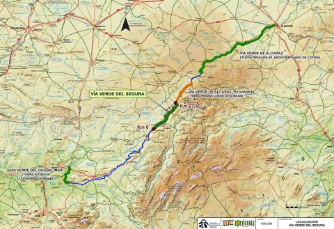
Villarrodrigo station, at km 140, has a rest area and an access point. Beyond the station lies the final section of the route: a gentle 1.5 km descent through flat cereal fields. The Segura Greenway ends at the provincial boundary with Albacete, at km 141.5. However, the journey can continue for another 19.5 km along the Sierra de Alcaraz Greenway, or even as far as the city of Albacete, although a further 16 km section beyond Reolid station and towards the town of Alcaraz has not yet been restored. 

Facilities
Information and evacuation panels, direction signs, railings, bollards and replanted vegetation along the edges of the route. Rest areas with tables, benches, litter bins and bicycle parking facilities. Access points at the stations.
 
The beginning of the Segura Greenway is marked as km 114.5 with a view to its future integration with other already signposted sections in both Jaén and Albacete. At km 131.5, there is an original series of railway markers bearing the initials B-U, standing for Baeza–Utiel. These belonged to the former Baeza–Utiel railway, whose starting point, km 0, was located in Linares. 

Breve descripción

The route of the old Baeza railway - Use its steps in the province of Jaén in the region of the Sierra de Segura. On the way to the province of Albacete, it unfolds between a landscape of lomas and hills dominated by the olive grove. And one of its sections goes through the Natural Park Sierras de Cazorla, Segura and Las Villas.

This Natural Road - Via Verde has been implemented under the Natural Walking Programme of the Ministry of Agriculture, Food and the Environment.

Latitud
37.7796
Longitud
-3.7849
Distrito
Municipio
Ubicación en el mapa
POINT (-3.7849 37.7796)
imagen
Image
PA200236%20-%20copia.jpg
Imagen principal
Activado
imagen
Image
PA200223%20-%20copia.jpg
Imagen principal
Desactivado
imagen
Image
Foto%201_RAF1305.jpg
Imagen principal
Desactivado
imagen
Image
Foto%202_RAF1230.jpg
Imagen principal
Desactivado
imagen
Image
Foto%203_RAF1232.jpg
Imagen principal
Desactivado
imagen
Image
Foto%204-203237.png
Imagen principal
Desactivado
imagen
Image
Foto%205_RAF1295.jpg
Imagen principal
Desactivado
imagen
Image
Foto%207_RAF1315.jpg
Imagen principal
Desactivado
imagen
Image
PA200215%20-%20copia.jpg
Imagen principal
Desactivado
imagen
Image
PA200280%20-%20copia.jpg
Imagen principal
Desactivado
imagen
Image
DGJK5601.jpg
Imagen principal
Desactivado
imagen
Image
thumb.png
Imagen principal
Desactivado
imagen
Image
PA200265%20-%20copia.jpg
Imagen principal
Desactivado

Friends

icon-intereses-amigos

Nature

icon-intereses-naturaleza

Solo travel

icon-intereses-viajar-solo

Gastronomy

icon-intereses-gastronomia

For couples

icon-intereses-en-pareja

Family

icon-intereses-familia

Adventure

icon-intereses-aventura

Culture

icon-intereses-cultura

Sport

icon-intereses-deporte

Municipality

icon-intereses-municipio

Low-cost tourism

icon-intereses-turismo-low-cost

Eco-friendly

icon-intereses-eco-friendly
Medium
Image
d3c1c77a-e613-630f-1a91-091aa05883f1?t=1604419293738
Vía Verde de Segura
27 km
Suitable though difficult between the km. 116.2 and 117.7.
All year round
Desactivado
Image
1bce61fa-87f2-0deb-4b00-f9ee11d10e13?t=1607013708900

Between the km 217 of the N-322 road (municipal term of Arroyo del Ojanco) and the provincial limit Jaén-Albacete (T.M. de Villarrodrigo).

Tramo de asfalto o cemento
 
Tramo de pista o camino forestal
 
Tramo de vía pecuaria
 
Tramo de senda
 

Greenwaand (Vía Verde) de Vadollano

Submitted by brandcode_deweloper on
Id
6585625
Descripción larga

This Green Way has 2 protected natural spaces located within a radius of less than 5 km: ZIC of the Guadalimar River (Red Natura 2000) and the El Pibat Natural Monument. In addition, it is possible to learn more about these natural spaces protected by the Laguna Grande Information Point.

ZIC of the Guadalimar River:In this natural space, red clays and sands are common. This area is part of the medium mountain serranies of the Sierras de Cazorla and Segura, predominating the landscape of mountain-standing countryside (Cuenca del Guadalimar). The final section is characterized by the landscape of the Vega del Guadalquivir. The river is important for species such as calandino, the Boga del Tajo and the Boga del Guadiana.

The Pat Natural Monument:This Natural Monument, located in the area of contact between the countryside and the foothills of Sierra Morena, houses a stretch of the river Guarrizas of extraordinary landscape and natural value. In the higher areas the landscape is rough and the river is attached to the huge granite blocks. The channel has to save a number of levels by producing two small waterfalls. Below, the arms of the river are reunited in a deep remnant. The riverside vegetation is in good condition of conservation, highlight species like the strawberry, with examples of a remarkable size. Among the fauna are the birds, among which is the black millano.

Breve descripción

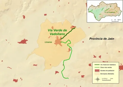
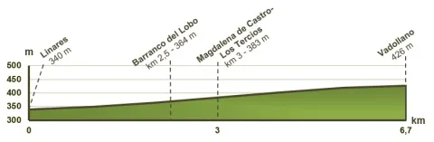
The Vadollano Green Way runs through the old route of the Linares- Vadollano railway road, from the old Santana factory to the access doors of the Army Station Headquarters in Vadollano, from which rail and naughty remains can be observed, which over the years have been covered with vegetation and are virtually unpassable.

Latitud
37.7796
Longitud
-3.7849
Distrito
Municipio
Ubicación en el mapa
POINT (-3.7849 37.7796)
imagen
Image
Vadollano00.jpg
Imagen principal
Activado
imagen
Image
Vadollano04.jpg
Imagen principal
Desactivado
imagen
Image
Vadollano01.jpg
Imagen principal
Desactivado
imagen
Image
Vadollano03.jpg
Imagen principal
Desactivado
imagen
Image
Vadollano05.jpg
Imagen principal
Desactivado
imagen
Image
Vadollano02.jpg
Imagen principal
Desactivado

Nature

icon-intereses-naturaleza

Friends

icon-intereses-amigos

Adventure

icon-intereses-aventura

Culture

icon-intereses-cultura

Sport

icon-intereses-deporte

Eco-friendly

icon-intereses-eco-friendly

For couples

icon-intereses-en-pareja

Family

icon-intereses-familia

Gastronomy

icon-intereses-gastronomia

Municipality

icon-intereses-municipio

Low-cost tourism

icon-intereses-turismo-low-cost

Solo travel

icon-intereses-viajar-solo
Medium
Image
cf9c3d89-f6e2-4cbc-ef01-e6d4338688df?t=1604420899217
Vía Verde de Vadollano
6,7 km
Can be taken by foot, mountain bike and horse
All year round
Desactivado
Image
76052e72-0bfc-a949-04c2-bb067efc28ba?t=1607013534423
1

1 rest area

Regardless of the way you decide to travel this route, it is recommended to use comfortable clothes and footwear and adapted to the time of the year. Although it is not convenient to do so in the middle of summer due to the heat. You must not forget to wear enough water and, if you go on a bike, it is always recommended to wear a helmet.

For more information visit:http: / / www.viasverdes.com

Monumental set of Linares, mining and industrial heritage, ruins of the Ibero-Roman city of Catulo and centres of interpretation of the Landscape Minero and Metallurgy.

By car we recommend you access the Via Verde for the following access:

  • Access No 1: Linares, in the vicinity of the Factory of Santa Ana. GPS coordinates (decimal format): 38.105551 °, -3.620675 °.
  • Access No 2: Vadollano area, access from road A-312. GPS coordinates (decimal format): 38.139634 °, -3.570731 °.

By train:

  • Liners: Medium Distance, Madrid-Jaén Line and Long Distance of Renfe

Connections:

  • Jaén: 30 km to Linares.

Trail de la Muralla PR-A126

Submitted by brandcode_deweloper on
Id
6489019
Descripción larga

Without leaving the path, at the front and below we find the path of the Fuente la Zarza, the forest opens and leaves room for the olive tree. Without going down to the lane, to the left, on the hillside, a narrow path diagonally ascends towards the right flank of the pine near the olive grove. Here begins a progressive, and pleasant promotion. This path connects with an access lane to an olive grove. At this point and without separating from the pine tree we go up to the left, for a short and steep stretch that softens and leads us first on a path and then on a track to the Neveral Hospital.

Due to the constant works in the vicinity of the Hospital and the lack of continuity of the original route of the path that previously surrounded the center through the back area, it is easier to continue straight by the asphalt, so we enter the hospital compound Dr. Sagaz, El Neveral and we cross it to its exit. At the entrance already on the road and to avoid moving on it, to the right, we take advantage of the trails of the recreational area of the Neveral that will take us away from the road traffic. We take a narrow road to the left, on a basketball field and cross the forest track, (common section with the PR-A127: Pinares del Neveral) the road marked, continues close to the vaguada, and the cross later to connect with the road again, about 50 meters from the Caño Quebrado Center. Caño Quebrado is the only source we find throughout the course. (End of common section with the PR-A127 Neveral Pines).

In Caño Quebrado they connect the road to Jaén, the road of the Castle of Santa Catalina and Parador Nacional, with the road to the Neveral Hospital, where we have passed before. In front of the Caño Quebrado Fountain. Just to the left of the road that goes up to the Castle of Santa Catalina and the Parador. Take a lane that descends next to some old chalet, below and to the right continue on a very good road that opens way between the pines and that will return us back to the crossing that is next to the Wall, which we cross again, this time in the opposite direction, to return to the beginning of the Path.

Breve descripción

This circular path, has its beginning in the city centre of Jaén, specifically begins on the bypass road, opposite No. 126. In front of this point a road in good condition, next to an electric transformer ascends on the north side of the hill of the Castle of Santa Catalina. The track with a strong slope, then turns right and softens, rushing through the castle wall. Once we cross the wall, we find an olive tree and the road forks. At this point we will return to the descent, as from here it begins circular section of the path. We take the right road, right through the olive line. From this flat section, you can see the San Vicente de Paul (below), the Magdalena Quarter, and the San Juan Quarter on the right. As we reach the pine tree, we continue on a path descending a few meters and then slightly ascending, opening the way between the pine trees. At about 150 m there is a crossing that we must continue on the right. Later on it passes through a (open) gate of one fenced, the path crosses this fencing, and it leaves it coming out later by a similar gate. Both cancels are generally open.

Latitud
37.768825
Longitud
-3.795409
Ubicación en el mapa
POINT (-3.795409 37.768825)
imagen
Image
sendero%20de%20la%20muralla1.jpg
Imagen principal
Activado
imagen
Image
sendero%20de%20la%20muralla.jpg
Imagen principal
Desactivado
2 h 30 min

Nature

icon-intereses-naturaleza

Friends

icon-intereses-amigos

Adventure

icon-intereses-aventura

Culture

icon-intereses-cultura

Sport

icon-intereses-deporte

Eco-friendly

icon-intereses-eco-friendly

For couples

icon-intereses-en-pareja

Family

icon-intereses-familia

Gastronomy

icon-intereses-gastronomia

Municipality

icon-intereses-municipio

Low-cost tourism

icon-intereses-turismo-low-cost

Solo travel

icon-intereses-viajar-solo
Medium
645 m
Muralla PR-A126
5,95 km
195m
195m
On foot
All year round
Desactivado

Good conservation status, but signs have disappeared in some areas.

Coordenadas / Huso 30S
UTM coordinates: x = 429946 and = 4180464
Tramo de asfalto o cemento
8.4%
Tramo de pista o camino forestal
47.9%
Tramo de vía pecuaria
0
Tramo de senda
43.7%

Trail Cruz de la Chimba

Submitted by brandcode_deweloper on
Id
6488877
Descripción larga

The path begins at the same source of the Cañada de las Azadillas, before a small round where the asphalt road ends. To the right of the fountain and to the empty, we go up perpendicularly from the road about 80 m. We make a turn of something more than 90 ° to the left where a horseshoe path is born that passes on the hillside of the fountain. Once on the road there is no loss as it is very marked, only some fallen trees cross the road, but these do not have difficulty avoiding them.

This first stretch is a constant rise and the good route of the path facilitates progression. As you gain height, the cups of the bushes adjacent to the path partially occupy some areas of the path, but in no case makes the footprint difficult or hidden. Already at the top the slope is softer and soon in a clear area we find the remains of a low-marked lane that lead to an explanade where forest cars turn, and start of the track. This point is the place of access and to which we must return, if we want to visit the forest shed Cruz de la Chimba at about 200 meters, hidden by the thickness of the pines. There is no path marked as such, so it is easy to get confused even though the distance is short. The best option is to walk on the track about 20 m from where the vehicle pass begins and is marked, perpendicularly to the lane and to the right of the track (west direction, direction 247th) we enter the pine in an area of path little defined, but with traces of the passage of the people, and that goes slightly up to reach a meadow where the shed is.

The Chimba Cross. It's the star point of the excursion. It has one of the best panoramic views of the Sierra de Jaén. Behind the shed is La Pandera, below the valley of the Quiebrajano River, and towards the north, the Castle of Otiñar and to the bottom of Jaén. It is in a semi-exclusive state thanks to the respectful care of its visitors. Caution should be exercised if we are accompanied by children or have vertigo, as the shed is in the vicinity of a steep area without any protection.

For return to the track the same route is used in the one way. Again on the forest track you have to continue to the right, the land is flat. This area is known as the Llanos de Navalopos. The track has no confusion. At its step and on the left it passes close to a plain and later borders a second plain up to a hill. At this point, the track goes down continuously until it returns to the Azadillas Canyon. But first we will find a chain that cuts the way to the cars and just beyond there is a crossing with the track that links the Azadillas Canyon with the Llanos de Palomares and the Pueblo de Carchelejo. We continue on the left descending, direction to the Cañada de las Azadillas. At the entrance to the Hall of Nature we will have finished the tour.

Breve descripción

It is located in the area of the Cañada de las Azadillas, inside the Jaén Periurban Park, at 18.5 Km. Its forest and abrupt orography are of a great beauty and landscape wealth that deserves to visit it. Their isolation because it is not a place of passage, has helped to remain practically intact. There is a recreational area, known and visited by the Jiennenses and people of neighbouring villages on weekends to make picnic hiking, etc. There is also a Nature Hall dedicated to environmental education. The previous approach is made from Jaén, from the Alcantarilla district, by regional road JA-3210 to the Sierra Bridge. From there, follow to the right, the road towards the Quebrajano Pantano, Otinar and Cañada de las Azadillas. In the Km 14 of the road, under the Castle of Otiñar, we take the left road across the bridge and about 3 km away we will reach the Cañada.

Latitud
37.654095
Longitud
-3.728805
Ubicación en el mapa
POINT (-3.728805 37.654095)
imagen
Image
1226012Master.jpg
Imagen principal
Activado
imagen
Image
Sendero%20Cruz%20de%20la%20Chimba%20%282%29.jpg
Imagen principal
Desactivado
2 h

Nature

icon-intereses-naturaleza

Friends

icon-intereses-amigos

Adventure

icon-intereses-aventura

Culture

icon-intereses-cultura

Sport

icon-intereses-deporte

Eco-friendly

icon-intereses-eco-friendly

For couples

icon-intereses-en-pareja

Family

icon-intereses-familia

Gastronomy

icon-intereses-gastronomia

Municipality

icon-intereses-municipio

Low-cost tourism

icon-intereses-turismo-low-cost

Solo travel

icon-intereses-viajar-solo
Medium
1114 m
Sendero Cruz de la Chimba
6,9 km
283m
283m
On foot
All year round
Desactivado

Recreational area of the Cañada de las Azadillas
Source of the Cañada de las Azadillas (non-drinking water) at the beginning of the path

It is located at 18.5 km. of the city of Jaén, in the area of the Cañada de las Azadillas well known for the recreational area of the same name. A vehicle is currently needed to access the start of the path quickly. Take the JA-3210 communal road leading to the Sierra Bridge. From there, we take to the right the road towards the Quebrajano Pantano, Otinar and Cañada de las Azadillas.

In the Km. 14 of the road, under the castle of Otiñar, we take the left road crossing the bridge over the river until we reach the canyon. The path begins at the source of the Cañada de las Azadillas, before a small round don ends the asphalt road.

Coordenadas / Huso 30S
UTM coordinates: x = 435713 and = 4167687

GR-7

Submitted by brandcode_deweloper on
Id
6485714
Descripción larga

The explanations offered here are very brief, and do not go from being a presentation of this great itinerary, with the aim of locating its different stages as it passes through our province. The most important localities and reference steps are mentioned, but the explanation does not stop to inform about each and every detail of the road, actually formed by different types of roads, landscapes and conditions.
The entire route in the province of Jaén will take a week to ten days of long walks, with the most recommended support of one or two vehicles for the transport of material. Its passage through villages makes its division possible and allows it to make stages of less journey, depending on the interest of the group of hiking people. The GR-7 was marked and beheaded by the Andalusian Mountain Federation and the Tourism, Trade and Sport Council. Years later, some of the milestones have been lost, but by using traditional roads, their realization remains possible.
The path crosses the provincial border Cordoba-Jaén in Pilas de Fuente Soto, reaches Alcalá la Real and continues, in the direction of the village of Santa Ana, coinciding with a Royal Canyon adorned with stone crosses that crosses a moor with the Castle of La Mota on the horizon. It passes through Santa Ana, takes us to Fries and then to Los Rosales, from where it follows a paved road and then to rural roads.
It traverses several ports among which is that of Los Alamillos, goes down to the river Valdearazo and comes up again by seeping the Stone of the Palo, between Camillo de Arenas and Carchelejo, giving view to the Embalse of Quiebrajano. The road continues to ascend to a few plains before the town of Carchelejo, which is accessed by a steep road, by the upper part of the town, by the deposits.
The road leaves the Sierra Sur and leaves Carchelejo following a path that descends in search of the old road N-323, passing through a rock needle to which they refer by "The Old Tooth." In the N-323 it continues to the highway, the cross below and goes back the river line between orchards and choperas to access Cambil next to the debugger of the population. From here we go in the direction of the Corrijada of Matabejid, in the direction of Huelma, to enter the Natural Park of Sierra Magina, with the highest summits of the province of Jaén. We pass through Matabejid and follow a track towards the Port of La Mata, passing through the area of the Castillejo, a magnificent landscape characterized by the ruins of a castle of the ancient medieval border. This mountain of oaks and complaints is kept by one of the most emblematic mountains of the province, La Peña de Jaén. This landscape has the particularity of being the dehesa of complaints on a limestone mountain, higher in Spain. Crossing the Port the road runs between pine trees in the direction of Torres, where we can refresh with the water of the Fuenmayor, and already in the village in the Pila Pellenda, at the entrance to the village, before continuing to Albánchez de Magina by means of pecuaria roads, used as pedestrian roads between populations, accompanied by almonds and cherry trees characteristic of this area, which offers an image of whitened valley during its flowering.
Once again, we pass through Fuente de la Fresneda and through the recreational area of Cuadros until we reach Bedmar, from where we will suddenly go up to El Portillo by one of the most pronounced ramps of the GR to go down to Jódar through the Serrezuela. We left Jódar for the Jódara-Quesada railway station, we crossed the Minor Guadiana looking for Peal Furnaces, then Toya, and continued on the Vega to Quesada.
We are already in the Natural Park of the Serras de Cazorla, Segura and the Villas. As we leave Quesada we will pass under the site known as El Chorro, in search of the Monastery of Monte Zion, and from here to the hermitage of San Isicio, near Cazorla. We will leave Cazorla on one of the most beautiful roads of the whole route, we will see the hermitage of the Virgin of the Cabeza, on a road between pine trees we will pass by the Fountain of the Bear in search of the village of Vadillo Castril, then the village of Loma de Mª Ángeles, later on, through the Natural Park of the Sierra de Cazorla, Segura and Las Villas, Catorrios, and through the avenue of the Guadalquivir, passing near the Aguamulas River, we will go to the Fountain to Segura to reach Pontones. From Pontones we continue to Poyotello, we go down next to the channel of the young Rio Zumeta to the village of the Ruices, Santiago de la Espada, and finally we cross the provincial limit towards the Puebla de D. Fadrique, in Granada.

Breve descripción

The path GR-7 is just over 300 km. of the province of Jaéngoing throughthree of the most important Sierras in the province:Sierra Sur, Sierra Magina and Sierras de Cazorla, Segura and Las Villas. This is a stretch of this great road that runs through the European continent. It begins in Tarifa (Cadiz, Spain) and through Brussels (Belgium), it ends in Athens (Greece). As you pass through the province of Jaén, you will find a network of local, no less interesting, small tour trails.

Latitud
37.4614
Longitud
-3.9222
Distrito
Municipio
Ubicación en el mapa
POINT (-3.9222 37.4614)
imagen
Image
gr7malaga1.jpeg
Imagen principal
Activado
imagen
Image
gr7malaga1-1-jpeg
Imagen principal
Desactivado
Unas 100 h de andadura a una media de 3 km/h

Friends

icon-intereses-amigos

Nature

icon-intereses-naturaleza

Solo travel

icon-intereses-viajar-solo

Gastronomy

icon-intereses-gastronomia

For couples

icon-intereses-en-pareja

Family

icon-intereses-familia

Adventure

icon-intereses-aventura

Culture

icon-intereses-cultura

Sport

icon-intereses-deporte

Municipality

icon-intereses-municipio

Low-cost tourism

icon-intereses-turismo-low-cost

Eco-friendly

icon-intereses-eco-friendly
GR-7
150 km
11000m
11000m
Desactivado
Tramo de asfalto o cemento
 
Tramo de pista o camino forestal
 
Tramo de vía pecuaria
 
Tramo de senda