Saltar al contenido principal
icon-intereses-cultura-del-toro

Palace of the marqueses de Camarasa

Submitted by brandcode_deweloper on
Id
5858362
Descripción
Descripción larga

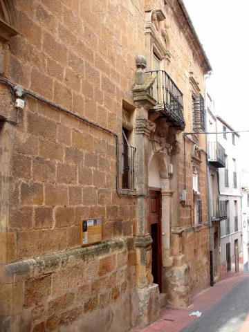
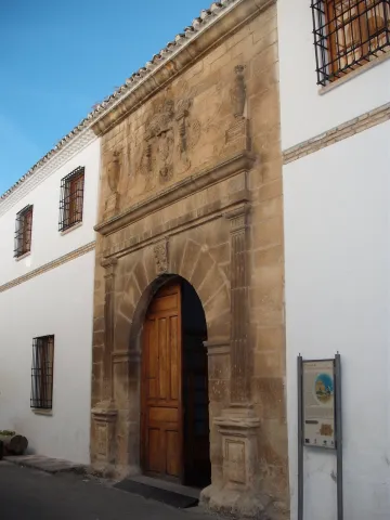
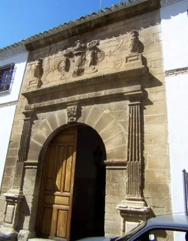
This house is the most outstanding civilian building as an architecture of the people and must be judged, at the same time, as a sign of their power through this special ornamental treatment of classical cover and the symmetrical composition of the facade that confers on it that seal of the palace as a dwelling, centre of dominion and administrative control of a territory.

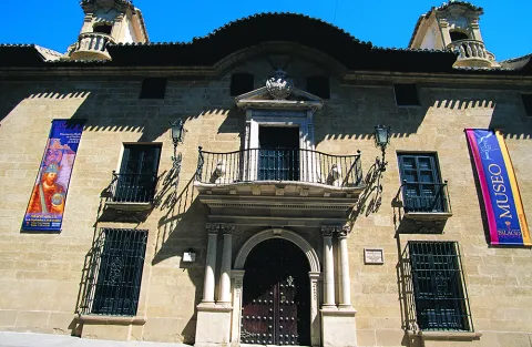
The cover It is divided into two bodies by an injunction.At the bottom is a half-point arc with acanto highlighted key and framed by acanto pilasters. The upper body is crowned laterally by two vases on pedestal and in the center a shield with a dome and cross of Santiago between columns decorated with reliefs.

On the other hand, distribution of the inner space It does not correspond strictly to that of rooms and housing, but to that of the depositary of the goods in kind that, as income due to the lord, had to be collected there. This aspect is above that of housing in the general consideration of the property. This deposit primacy is well justified by the agreement of the Marquis, whose residence since the end of the 16th century was not even in the land of Jaén, but in Valladolid. This primary function is demonstrated by the two large ships that run on the second floor along the entire body of the house and on whose access bank there is still an allusion to the date of construction of the barn.

In 1997 it was included in the catalogueGeneral of the Historical Heritage of Andalusia.

Breve descripción

As it appears in the inscription of the friso of the cover, in 1565 the house was finished - the palace of the Marquis of Camarasa, also known as house-palace of the Cobos. Renaissance style,remember the splendor that the people livedfrom the moment Carlos I sells it to his secretary D. Francisco de los Cobos.
Ubicación
Latitud
37.783665
Longitud
-3.508898
Dirección
C/ Prior Higueras, 2
Distrito
Municipio
Ubicación en el mapa
POINT (-3.508898 37.783665)
Tipos de punto de interés
Imágenes carrusel
imagen
Image
DSCF5542.JPG
Imagen principal
Desactivado
Imágenes cabecera
imagen
Image
Palacio_Marqueses_de_Camarasa.jpg
Imagen principal
Activado
Microsite al que pertenece
Loading map
Preparing points of interest and routes...

Palace of the Encomienda

Submitted by brandcode_deweloper on
Id
4437518
Descripción
Descripción larga
After contemplating the graffiti, enter the Historic Center of Chiclana through the audacious tunnel excavated in the imposing rock and approach the nearby Palacio de la Encomienda, where the Manrique family was housed as Commander of the Order of Santiago. It is located a few meters from the Belin mural, entering the Historic Center of Chiclana through the tunnel excavated in the rock and which leads to the Plaza de la Constitución, the nerve center of the town and where one of the most notable monumental buildings in Chiclana is located, the Iglesia de San Pedro, from the 17th century. Continuing along the square towards Calle Real, we find the Palacio de la Encomienda, so named since it was intended for administration functions of the Encomienda, in addition to being used as housing. It is thought that the Manrique family was housed here for some time. This palace is also known as Casa de la Inquisición, since it was also the seat of this religious court. Architecturally speaking, the palace presents in the lower body a doorway with a semicircular arch with a highlighted key, smooth jambs and, on bases, fluted pilasters and capitals; on the second floor, a lintel balcony, recessed pilasters, a split pediment, pinaculillos with balls and, finishing the upper floor, a cornice. Also striking is the good ashlar masonry and the rectangular patio due to its footings, wooden beams and Doric columns.
Ubicación
Código Postal
23264
Latitud
38.310780
Longitud
-3.044460
Distrito
Municipio
Ubicación en el mapa
POINT (-3.04446 38.31078)
Tipos de punto de interés
Imágenes carrusel
imagen
Image
palacio%20de%20la%20encomienda.JPG
Imagen principal
Desactivado
Imágenes cabecera
imagen
Image
Palacio%20de%20la%20Encomienda.jpg
Imagen principal
Activado
Microsite al que pertenece
Loading map
Preparing points of interest and routes...

Palace of the Ducal House of Medinaceli

Submitted by brandcode_deweloper on
Id
4485470
Descripción
Descripción larga

The first reliable constancy of documentary sources dates from 1,371, year of creation of the lord of Santisteban by Henry II in favor of Men Rodríguez Biedma, later last name Benavides. The lordship included the Villa de Santisteban del Puerto, along with the places of Castellar and the Navas. Later in 1,473, Henry IV made the title of Count by Sánchez de Benavides and Dávila with the same name. It is at this time that the construction of the walled enclosure that is still preserved begins.

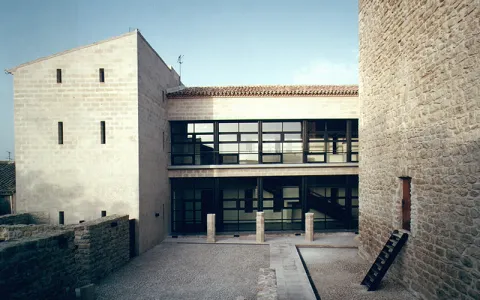
After the Christian Reconquest, the Castle loses its military function. The Dukes of Medinaceli, the last feudal lords of the place, kept within them the tower of the fourteenth century tribute, called Pallarés, and the courtyard of arms of the old fortress, raised a palace of good silery. In line with the Spanish stylistic fashion, the cover presents a robust half-point arc and blasphemous shields in the outgoing key and in the shrouds, framed by stylized columns and flaminers.

His name as the Palace of Medinaceli is due to the second half of the 18th century, when Louis Mary, Duke of Medinaceli, son of Pedro Alcántara and Maria Javiera of Gonzaga, obtained the title of Duke of Santisteban for his marriage to Joaquina de Benavides, daughter of Antonio Benavides and Ana Maria, sister of Pedro Alcántara.

At the end of the last century the Palace became a Liberal Casino, after the civil war it was the seat of the Labradores Circle and is currently the Casa Consistorial de Castellar, restored following the original guidelines.

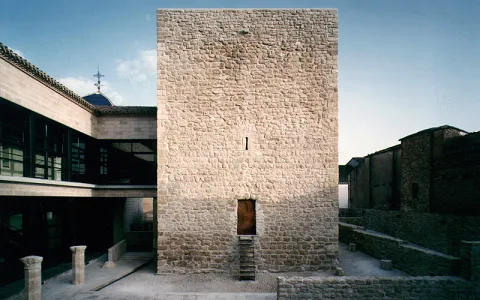
As for the tower, called Pallarés, of a square floor, it consists of two floors with ten meters of width and fifteen meters of height. From its first floor it is worth noting its beautiful pointed bow, and from its second floor, it is worth admiring its dome on the breast as well as its unrelenting steaks or saetries. In 1996 it was registered in the General Catalogue of the Andalusian Historical Heritage and since 1998 it has been hosting the Iberian Museum of Castellar, where you can see some of the important archaeological pieces found in the town, mostly bronze exvotes, as well as arrow tips, axes or ceramic containers.

The double personality of the whole, Castle and Palace, Palace and Castle is visible, with the refined and crude, civil and military, rustic and urban, naive and sophisticated concepts appearing in one and the other, both of which are the protagonists of this unique conglomerate.

Breve descripción

The Palace of the Ducal House of Medinaceli and the Castle of Don Men Rodríguez, known by Castillo de Pallarés, overlap in a single monumental set.

Telecomunicaciones
Sitio web
www.castellar.es/palacio-los-duques-medinaceli-castillo-pallares
Teléfono de contacto
953 460 005
Ubicación
Código Postal
23260
Latitud
38.256660
Longitud
-3.130090
Distrito
Municipio
Ubicación en el mapa
POINT (-3.13009 38.25666)
Tipos de punto de interés
Imágenes carrusel
imagen
Image
casa%20ducal%20medinaceli.jpg
Imagen principal
Desactivado
Imágenes cabecera
imagen
Image
0711.jpg
Imagen principal
Activado
Microsite al que pertenece
Loading map
Preparing points of interest and routes...

Jabalquinto Palace

Submitted by brandcode_deweloper on
Id
2275703
Descripción
Descripción larga
The Palace belongs to the Elizabethan Gothic style (15th century). It was ordered to be built by Juan Alfonso de Benavides, a relative of King Ferdinand the Catholic. His eldest son married Doña Luisa, daughter of the poet Jorge Manrique. This family bond is the fact that links Jorge Manrique with this Baeza space. When the author visited the city he was a guest at the Palace on more than one occasion. A family relationship that “forced” him to participate in the fight against Diego Fernández de Córdoba, Baeza being defeated and imprisoned for a time.
Breve descripción
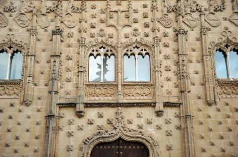
The palacio de Jabalquinto is a civil architecture building located within the walls of the Spanish city of Baeza, in the province of Jaén. It is one of the most prominent heritage symbols of the town and of the Lordship and later Marquisate of Jabalquinto. It is currently occupied by a headquarters of the International University of Andalusia. It is part of the Renaissance monumental complex of Baeza, which, together with that of Úbeda, was declared a World Heritage Site by UNESCO in 2003. Its façade, decorated with diamond points, nails, pinnacles and shields, is crowned by a Renaissance gallery and its interior features a sober Renaissance patio with two floors of galleries and a monumental Baroque staircase. Until 1720 it was a stately residence.
Ubicación
Código Postal
23440
Latitud
37.991430
Longitud
-3.468810
Dirección
C/ Conde Romanones, 1
Municipio
Ubicación en el mapa
POINT (-3.46881 37.99143)
Tipos de punto de interés
Imágenes carrusel
imagen
Image
shutterstock_1215612649.jpg
Imagen principal
Desactivado
imagen
Image
shutterstock_1214620720.jpg
Imagen principal
Desactivado
imagen
Image
Mon145.jpg
Imagen principal
Desactivado
imagen
Image
Mon110.jpg
Imagen principal
Desactivado
imagen
Image
Mon086.jpg
Imagen principal
Desactivado
imagen
Image
Mon040.jpg
Imagen principal
Desactivado
Imágenes cabecera
imagen
Image
172085.jpg
Imagen principal
Activado
Microsite al que pertenece
Loading map
Preparing points of interest and routes...

Abacial Palace - Municipal Museum of Alcalá la Real and Territory Interpretation Centre

Submitted by brandcode_deweloper on
Id
4653782
Descripción
Descripción larga

The new building was the result of the aggregation of several houses, in which the body of the façade was transformed and unified. This mansion remained in use until 1851, when the Abbey of Alcalá la Real is abolished. After years of uncertain destination, he became an abacial archive and residence of Mr. Arcitara of the Ecclesiastical Territory.

In 1927 the building became municipal property; school classrooms and other services were installed. The Civil War caused major damage to the building that was restored by the Directorate General of Devastated Regions to give it new uses. In 1959 it was the seat of the Official Center for the Patronate of Secondary Education, which would then be the Institute of Baccalaureate "Alfonso XI." In 1995 the City Council and the Public Works Council of the Junta de Andalucía began their rehabilitation for uses more in line with the cultural demand of the city.

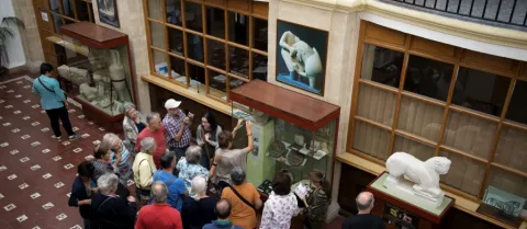
At present, after four years of rehabilitation, the Abacial Palace is the seat of the Municipal Museum. This new museum has been created with the intention of hosting for its exhibition, conservation and dissemination, funds of archaeological, ethnic, anthropological, paleontological and scientific type. All this heritage is organized in different exhibition spaces using new technologies. The visit to the museum makes it possible to know in an innovative way the heritage and vestiges of the past and the history of Alcalá la Real and offers the visitor a global vision to know the unique and attractive features of the city and its surroundings.

Breve descripción

The Municipal Museum of Alcalá la Real is located in the old Abacial Palace. This was reconstructed in 1781 by the abbot Esteban Lorenzo de Mendoza and Gatica, due to the ruinous state in which the primitive palace was located within the Mota.

Telecomunicaciones
Sitio web
www.museoalcalalareal.com
Teléfono de contacto
953 587 445
Correo electrónico
turismo@alcalalareal.es
Ubicación
Código Postal
23680
Latitud
37.462840
Longitud
-3.922800
Dirección
Carrera de las Mercedes, s/n
Distrito
Municipio
Ubicación en el mapa
POINT (-3.9228 37.46284)
Tipos de punto de interés
Imágenes carrusel
imagen
Image
image_105979.jpeg
Imagen principal
Desactivado
imagen
Image
redimensionador%20%282%29.jpg
Imagen principal
Desactivado
imagen
Image
image_105982.jpeg
Imagen principal
Desactivado
imagen
Image
Mon652.jpg
Imagen principal
Desactivado
Imágenes cabecera
imagen
Image
Mon158.jpg
Imagen principal
Activado
Horario
16 jun - 30 sept: monday to friday 17: 30 - 20: 30, saturdays, sundays and holidays 10: 30 - 13: 30. 1 oct - 15 jun: monday to friday 16: 30 - 19: 30, saturdays, sundays and holidays 10: 30 - 13: 30.
Microsite al que pertenece
Loading map
Preparing points of interest and routes...

Landscapes

Submitted by brandcode_deweloper on
Id
1913945
Descripción
Descripción larga

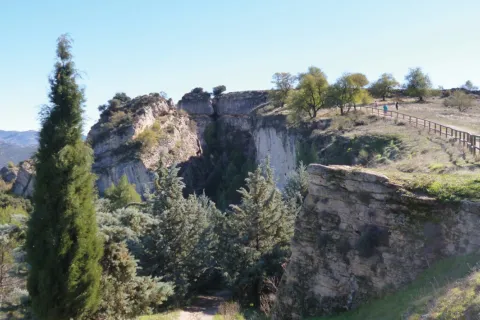
This diversity is conditioned by its irregular topography from the 400 m of Fuente Álamo to the 1.553 m of the peak of La Martina, as well as by the pronounced dominant climatology, with temos peratures that ascend to the 35 ° C du rante the months of vera no and descend to the -6 ° C in winter.

It is important to highlight forms such as Los Tajos, impressive cut and rocky, under which the natural vegetation is served, as a sign of what at one time were the Mediterranean bays of the southern Iberian Peninsula, species such as the oak (Quercus rotundifolia) and the whim (Quercus faginea) dominate the arboreum stratum and others like the peonies (Poeoni broteroi), madreselvas (Lonicera implexa), majuelos (Crataegus monogytoo, or the forest, etc.).

In these enclaves, and developing on the limestone walls, we can find an ende- same plant from the south of the Iberian Peninsula from which only 22 populations of Andalusia have been found and is listed as in danger of extinction, the Saetica Sarcopacnos subsp. Baetica.

As for the fauna that we can find in this ecosystem, from birds such as the vulgar cernicalo (Falco tinnunculus), gratilla (Corvus mone-du / o), piquirroja (Pymhocorax pyrrohocorax), crows (Corvus corax), red roquero (Monticola saxatilis), etc. We can also observe the occasional passage of some perdicular eagle couple (Hieraaetus fasciatus), the migration of the leonate vultures (Gyps fulvus) and other birds found in the forest area such as the boy owl (As / o otus), the real red colirar (Phien / curus phoen / curus), the oropen (On'o / us or / us), etc.

There is also a great diversity of wild mammals in this area that seek refuge in this enclave, although they are species that are difficult to observe, we can detect their presence based on prints and other records, species such as the Garduña (Tuesday foina), Gin (Genettagenetta), badger (Meles meles) and a large number of microfuels that act as the basis of the trophic chain.

It is also interesting to discover the area of Los Llanos, a large plateau where the tree vegetation is absent and where the number of stone or majano accumulations that give the territory a lunar look stand out.

Despite their yerma appearance, the Llanos have high biodiversity and possibilities for observing wildlife. The flora is characterized by the abundance of aromatic species such as lavandas (Lavandula), rosemary (Rosamrinus officinalis), tomi llos (Thymus) etc and fauna, we find a large number of birds linked to this type of large and unequipped ecosystems of arboreal vegetation such as the common cogujada (Calerida cristata), the montesina cogujada (Calenda íeck / oe), the chitovia (Lullulina arbórea), the calandria (Melanocorypha cala), the common (Saxacarus), the (Saguluus párama), the (La páribana (Párárágina), the (La párágina), the (Página), the common (La página), the

Breve descripción

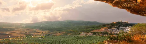
Alcalá la Real is located within the betico territories of the Andes, characterized by a great diversity of landscapes and ecosystems.

Ubicación
Código Postal
23680
Latitud
37.461290
Longitud
-3.922290
Distrito
Municipio
Ubicación en el mapa
POINT (-3.92229 37.46129)
Tipos de punto de interés
Imágenes carrusel
imagen
Image
paisajes.jpg
Imagen principal
Desactivado
Imágenes cabecera
imagen
Image
alcala-naturaleza.jpg
Imagen principal
Activado
Microsite al que pertenece
Loading map
Preparing points of interest and routes...

Oppidum by Puente Tablas

Submitted by brandcode_deweloper on
Id
309632
Descripción
Descripción larga
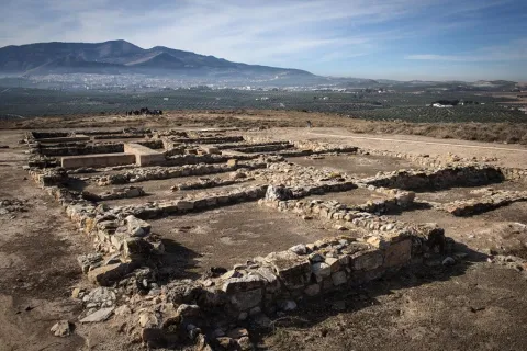
A fortified city that invites you to travel 2,300 years ago and feel the pulse of a civilization
Breve descripción
A fortified city that invites you to travel 2,300 years ago and feel the pulse of a civilization
Telecomunicaciones
Sitio web
www.viajealtiempodelosiberos.com
Teléfono de contacto
670 948 946
Ubicación
Código Postal
23009
Latitud
37.811740
Longitud
-3.745720
Dirección
JV-3012, 15
Distrito
Municipio
Ubicación en el mapa
POINT (-3.74572 37.81174)
Tipos de punto de interés
Imágenes carrusel
imagen
Image
oppidum5.jpg
Imagen principal
Desactivado
Imágenes cabecera
imagen
Image
oppidum2.jpg
Imagen principal
Activado
Horario
From Tuesday to Sunday and holidays: from 9:00 a.m. at 3:00 p.m. | Monday: closed
Loading map
Preparing points of interest and routes...

Andalusian Astronomical Observatory

Submitted by brandcode_deweloper on
Id
2897118
Descripción
Descripción larga

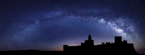
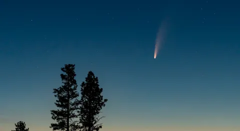
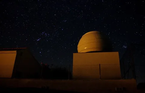
The South Sierra de Jaén, which obtained the Starligth Reserve certificate in 2014, retains the natural lighting and nocturnal conditions of the night sky intact. It is also a space where a commitment has been made to the defence of the quality of the night sky, access to the light of the stars and the different associated values.

The main building, about 70 square meters, houses the multi-purpose room and library, observatory control room, small kitchen, toilet and archive.

To the north of the main building and completely independent, is the observatory itself. The lower floor serves as a storage room for the various instrumentation and accessories of the telescopes and has a small workshop for the repairs.

The 4-meter-in-diameter Scope Dome dome, installed on the top, has a Meade S / C LX200-ACF GPS telescope of 0.30 meters of opening at f / 10, in an equatorial fork mount, supported by an independent rigid column.

The whole of the Andalusian Observatory of Astronomy: Dome, telescope as well as its battery of accessories and instrumentation can be operated remotely from anywhere.

On the terrace of the control room there is a weather station specially designed for use in an astronomical observatory and an AllSky automatic camera for meteor detection.

Breve descripción

In the village of La Pedriza, 8 km from Alcalá la Real with an impressive dark sky, the Einstein Society of Astronomy, with the collaboration of the Alcalá la Real City Council, has first-class facilities for astronomical observation and dissemination: the Andaluz Observatory of Astronomy.

Telecomunicaciones
Sitio web
www.astroalcala.es
Teléfono de contacto
661 090 957
Correo electrónico
espartero@astroalcala.es
Ubicación
Código Postal
23688
Latitud
37.414820
Longitud
-3.953560
Distrito
Municipio
Ubicación en el mapa
POINT (-3.95356 37.41482)
Tipos de punto de interés
Imágenes carrusel
imagen
Image
starlight-mota-1536x584.jpg
Imagen principal
Desactivado
imagen
Image
C-2020-F3-Neowise-blog.png
Imagen principal
Desactivado
Imágenes cabecera
imagen
Image
observatorioandaluzastronomia_jaen2.jpg
Imagen principal
Activado
Microsite al que pertenece
Loading map
Preparing points of interest and routes...
Marcas de calidad

Cerrillo Blanco Dynastic Necropolis

Submitted by brandcode_deweloper on
Id
308590
Descripción
Descripción larga

In this necropolis was buried in the 5th century BC the most important impressive sculptural ensemble of all Iberian culture and that can now be seen in the Museum of Jaén.

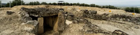
In the archaeological site and in its Visitors Center you will find the keys to understanding this sculptural group and the meaning of death in the Iberian world. Cerrillo Blanco is a funerary tumulum of the Tartesic era (7th century BC) with 24 individual graves in pits and 1 megalytic in which two individuals were buried. Towards the 5th century BC, it was buried in ditches covered with large slabs, an Iberian sculptural set intentionally destroyed. Both by the amount of pieces (approximately 1400 fragments) and by their artistic quality is the most important of Iberian sculpture. This set tells us and tells us the story of how a group of aristocrats became powerful and came to rule the important city of Obulco in Porcra.

The visit to the site is complete with the Porcra Museum which is located in the 15th century Boabdil Tower, in the historic center of the town. This museum has an important collection of Ibero-Roman sculptures. The museum offers guided tours with prior appointment and activity programming throughout the year that you can find on your website:www.museoatocuna.com

Breve descripción

Cerrillo Blanco is one of the most emblematic places of Iberian culture. Walking through this site, you will know an inhumation necropolis dating back to the 7th century BC.

Telecomunicaciones
Teléfono
<p>Oficina de Turismo: de martes a domingo, de 10:00 h. a 13:00 h.<br />
Plaza de Andalucía, 2.&nbsp;</p>
Sitio web
www.viajealtiempodelosiberos.com
Teléfono de contacto
953 545 130
Correo electrónico
oficinaturismo@porcuna.es
Ubicación
Código Postal
23790
Latitud
37.886633
Longitud
-4.179094
Dirección
Carretera Porcuna-Arjonilla, s/n
Distrito
Municipio
Ubicación en el mapa
POINT (-4.179094 37.886633)
Tipos de punto de interés
Imágenes carrusel
imagen
Image
porcuna%20%287%29.jpg
Imagen principal
Desactivado
Imágenes cabecera
imagen
Image
porcuna.jpeg
Imagen principal
Activado
Horario
Site: Tuesday to Sunday 10: 00 - 13: 00 (upon reservation). Porcilla Museum: Tuesday to Sunday 10: 00 - 13: 00.
Loading map
Preparing points of interest and routes...

Cerrillo Salido Necropolis

Submitted by brandcode_deweloper on
Id
4281438
Descripción
Descripción larga

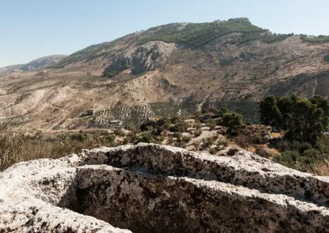
According to the research, it is a necropolis whose extension would surround the entire town, making it one of the most important at the national level.

In 1954, the first archaeological excavation was carried out, 22 tombs of which only 7 remained intact. The inspected tombs had an ovoid and excessively elongated form, not keeping a certain orientation.

Next to this visigoda necropolis - just 30 metres - is another Muslim era.

Breve descripción

Located in the municipality of La Guardia, just 500 metres from the urban core, is this Visigoda period site whose tombs are excavated in the rock.

Ubicación
Latitud
37.742568
Longitud
-3.693708
Distrito
Ubicación en el mapa
POINT (-3.693708 37.742568)
Tipos de punto de interés
Imágenes carrusel
imagen
Image
Mon06510%20%281%29.jpg
Imagen principal
Desactivado
imagen
Image
Mon0610%20%281%29.jpg
Imagen principal
Desactivado
imagen
Image
Mon065120%20%281%29.jpg
Imagen principal
Desactivado
Imágenes cabecera
imagen
Image
40.jpg
Imagen principal
Activado
Microsite al que pertenece
Loading map
Preparing points of interest and routes...