

Jaén – Puente de la Sierra – Otíñar – Carchelejo – La Guardia (C2)
Id
RUT-0019
Descripción larga
Circular route of medium-long distance that connects Jaén with the valleys of the Quiebrajano and the Guadalbullón, linking water, heritage and mountain landscape. The tour combines a progressive rise to the interior of Sierra Magina with a comfortable return through the countryside, passing through enclaves as unique as Otiñar, the Hazadilla Canyon and the natural views of La Guardia. A balanced proposal for cyclists looking for territory, history and variety of environments.
The route leaves Jaén, leaving the urban environment behind to roll south on secondary roads across traditional gardens and olive groves. From the first kilometers, the Castle of Santa Catalina is left behind as a visual reference, as the route enters the natural corridor of the Quiebrajano River, a clear transition between the Jiennense countryside and the first mountain foothills.
The passage through Puente de la Sierra, a historic recreation place linked to the water and the valley, marks the beginning of the most serrano stretch. From here on, the road accompanies the river between gardens, houses and limestone slopes, with a constant but grateful rise. In this area, the ruins of the Otiñar Castle, embellished on a rocky promontory, and the nearby Abrigo del Toril, one of the most unique sets of rock art in the surrounding area, are highlighted.
The rise continues towards the Hazadillas Canyon, a former livestock enclave and access door to the interior saws. The landscape becomes more mountainous: ravines, cascades and repopulation pines alternate with oaks and complaints, providing shade and a feeling of height. This section links with sectors shared with other cycloturist routes and finally leads to Carchelejo, a white core located on the edge of Sierra Magina and excellent balcony over the Guadalbullion valley.
From Carchelejo, the itinerary changes its tone. The profile softens and begins a comfortable descent on more open roads, following the historical corridor of the N-323a, an old axis of communication between the saw and the countryside. The pedal is made fluid between endless olive groves, sharing for a few kilometers drawn with other cycloturist routes.
The arrival at La Guardia de Jaén, located on the top of a hill, adds a marked heritage component. Its medieval castle and the Renaissance church dominate a wide transition landscape, with open views towards the valley and the mountains. From here, the return to Puente Jontoya and Jaén is made by a favorable route, between gardens, cortijos and river vegetation, closing a circuit that combines nearby mountain, history and water culture.
General recommendations
Suitable route for cyclists with minimal experience on long routes. The meteorology should be reviewed, especially in the serrano section between Puente de la Sierra and Carchelejo. Attention in long-term and shared sections with time traffic. Take sufficient water and respect natural and heritage enclaves, especially in sensitive areas such as Otinar.
Breve descripción
Circular route of about 62 km leaving Jaén on the Road of Valdecañas towards Puente de la Sierra, it goes back to the Quebrajano valley to the ruins of Otiñar and ascends to Carchelejo and La Guardia on mountain roads, to return later to Jaén on the old N-323a, the service area El Oasis, La Cerradura and the Jontoya valley.
imagen
Image

Imagen principal
Desactivado
imagen
Image
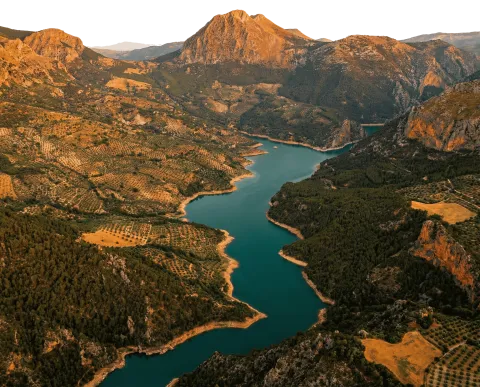
Imagen principal
Desactivado
imagen
Image

Imagen principal
Desactivado
imagen
Image

Imagen principal
Desactivado
imagen
Image

Imagen principal
Desactivado
imagen
Image

Imagen principal
Desactivado
Baja - Media
Jaén – Puente de la Sierra – Otíñar – Carchelejo – La Guardia (C2)
62,5 km
1575m
Desactivado
Tramo de asfalto o cemento
Tramo de pista o camino forestal
Tramo de vía pecuaria
Tramo de senda
Fuenmaandor, Navaparis, altos de Mágina (C3)
Id
RUT-0018
Descripción larga
Panoramic tour of the north of Sierra Magina with start and end in Fuenmayor. A complete and very scenic layout, which combines asphalt and track sections with long ascends to high balconies such as Mojón Blanco and Peña del Águila, and a more friendly return linking cores with services such as Mancha Real and Pegalajar. Ideal for mixed audience looking for viewpoints, water and rural landscape by pedal.
The route starts in the fresh environment of the Recreative Area of Fuenmayor, with the rumor of the spring marking the beginning. From here, it is on a progressive rise towards Navaparís, a stretch that leaves behind olive groves and banks - with the presence of cherry trees in the area - and is gaining a serrano atmosphere. As the route goes up, the landscape moves to oak and whine spots, and traditional water points such as the Navaparís Fountain and the Fountain of Uncle Mouse appear, historically linked to the passage of pastors and walkers.
The stretch of height leads to Mojón Blanco, geodetic vertex and clear reference on the route, and continues to the Peña del Águila, one of those viewpoints that justify the effort: to the north the countryside and the villages of the mountain edge are opened; to the south the mountain alignment of Magina is cut. From there, the tour goes comfortably to Mancha Real, a good point for a pause and services, before continuing to Pegalajar. -
In the sector of Pegalajar, the route adds up to a very territorial component: the Charca de Pegalajar as an icon of the water in the landscape, and the transition to rural roads and livestock roads leading to the Abradero de Villanueva, an enclave of strong livestock tradition. From here on, the itinerary again gains height in the direction of Mata Bejid, linking with shared sections with other routes of the intermodal system and passing through heritage references such as the Castle of Mata Bejid and its dehesas and pastures environment.
The return is resolved by tracks and half-mountain roads that lead back to the Fuenmayor area, with the option to approach (according to signs) the surroundings of the Cascade del Zurreón, before closing the circuit in the recreational area. The result is a round route: glances, dehesa, water and villages, on a varied and very representative pedal day in northern Magina.
General recommendations
Recommended route for cyclists with a certain custom to long climbs. Check the weather: in the heights there may be wind and sudden changes. Attention to sections of zahorra / track with loose or firm irregular gravel and to sectors marked with the presence of cattle (respect fences and local rules). It has sufficient water and plans stops in cores with services (Real, Pegalajar).
Breve descripción
A circular route of almost 64 km that begins in the Recreative Area of Fuenmayor and ascends between orchards and cherry trees to Navaparís and the Fountain of the Uncle Mouse. From Mojón Blanco, the route continues along the road to the repetitive communications station and follows to the Peña del Eagle, a classic lookout known for the practice of paragliding flights, before going down to Mancha Real.
The second half of the route links the Fountain / Mirador of the Seven Piles with the Vereda del Llano de Peñuelas, the Villanueva abrevadero, and the hermitage and the castle of Mata Bejid, before reaching the high areas of the Sierra Magina and returning to Fuenmayor by a forest track that crosses the pine trees.
Latitud
37.8103
Longitud
-3.4501
Distrito
Municipio
Ubicación en el mapa
POINT (-3.4501 37.8103)
imagen
Image

Imagen principal
Activado
imagen
Image

Imagen principal
Desactivado
imagen
Image

Imagen principal
Desactivado
imagen
Image

Imagen principal
Desactivado
imagen
Image

Imagen principal
Desactivado
imagen
Image
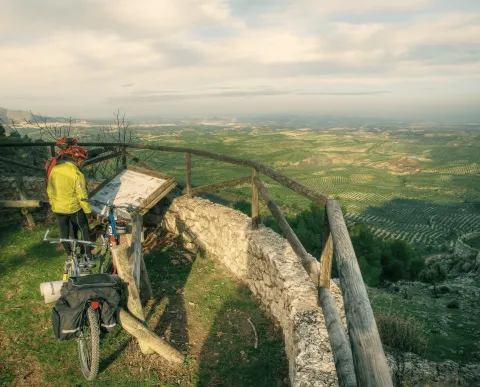
Imagen principal
Desactivado
imagen
Image

Imagen principal
Desactivado
Media - Alta
Fuenmayor, Navaparis, altos de Mágina (C3)
63,9 km
2320m
Activado
Despegue del Almadén
Id
RUT-0017
Descripción larga
At 2,036 meters above sea level, the Almadén peak rises as one of the great natural balconies of Sierra Mágina. From its crest, the look dominates a sea of olive groves, the loins that descend to the Guadalquivir valley and, on clear days, the nearby summits of Granada. It is certainly one of those places that leave a mark on both the visitor and the pilot who decides to take on their heights.
The enclave has two take-off guidelines.
South facing, towards the surroundings of the Cortijo de Bornos, with wide open views.
North facing, which allows to plan for Real Mancha with relative comfort in favourable conditions.
It is a clearly thermal area, with powerful ascendencies that allow you to gain height quickly when the convective cycle is active. These upward currents can offer long and spectacular flights, but require more experience and accurate reading of the aerology than other more accessible areas in the environment. It is not a recommended take-off for unsupervised initiation pilots.
The Almadén has been the stage of official testing when other areas did not meet adequate conditions, as was the case in a manga of the 2004 Spanish Paragliding Championship, which shows its technical and sports potential.
Its current use is less frequent, partly due to prolonged access, approximately one hour from Pegalajar or Real Mancha, and to the improvement of infrastructure in areas such as Seven Pillas or the Eagle Peña, more comfortable and common. However, those who seek a more wild and high mountain experience find here a demanding and memorable scenario.
Security recommendations
Always consult up-to-date weather and wind forecast in height.
Fly with approved and revised equipment.
Valuing the technical level of its own and, if necessary, having accredited local guides or pilots.
Plan access and collection well, given the location and altitude of the enclave.
El Despega del Almadén is a mountain in a pure state: a place to walk to the top, run the hill and, when the wind accompanies, fly over one of the most iconic landscapes of the province.
Breve descripción
At 2,036 meters above sea level, the Almadén peak rises as one of the great natural balconies of Sierra Mágina. From its crest, the look dominates a sea of olive groves, the loins that descend to the Guadalquivir valley and, on clear days, the nearby summits of Granada. It is certainly one of those places that leave a mark on both the visitor and the pilot who decides to take on their heights.
Latitud
37.7904
Longitud
-3.4802
Distrito
Municipio
Ubicación en el mapa
POINT (-3.4802 37.7904)
imagen
Image

Imagen principal
Activado
Despegue del Almadén
Desactivado
Tramo de asfalto o cemento
Tramo de pista o camino forestal
Tramo de vía pecuaria
Tramo de senda
