Saltar al contenido principal

Albanchez de Mágina

Submitted by brandcode_deweloper on
Id
13774281
Perfil de redes sociales
Facebook
https://es-es.facebook.com/AlbanchezMagina/
Twitter
https://twitter.com/albanchezm
Descripción
Breve descripción

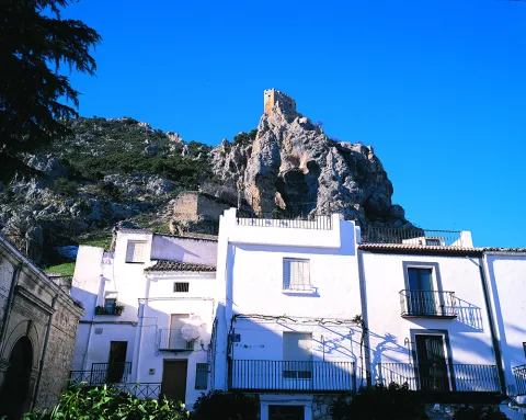
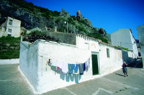
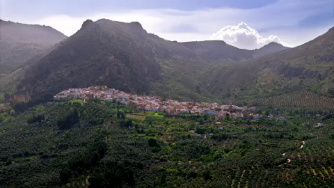
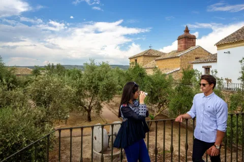
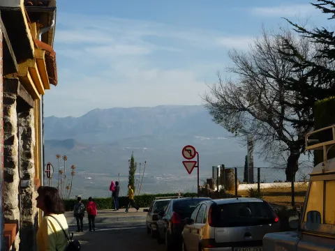
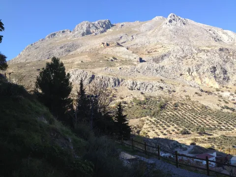
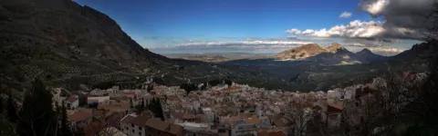
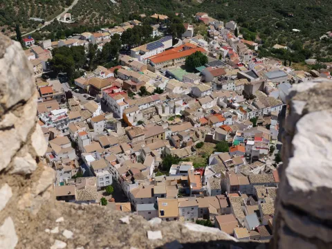
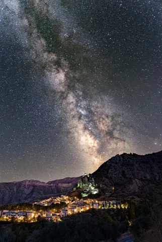
A population located to the south of the province, between soft hills, olive fields and fruit. Its term belongs to the Natural Park of Sierra Magina, which is part of the Subbetica and offers beautiful and spectacular landscapes. In its municipal term is the highest elevation of the province of Jaén, the Pico Magina. In terms of vegetation, there are frequent cobblestones, complaints, carrasco pine and salgareño. Its rich and varied fauna is also important.

Albanchez de Mágina (formerly called Albanchez de Ubeda until 2000) is a municipality in the region of Sierra Magina, in the province of Jaén, Andalusia. Most of the municipal term, as well as the urban core, are within the Sierra Magina Natural Park. In its municipal term is located the highest elevation of the province of Jaén, the Pico Magina, with 2,167 meters of altitude.

Access to the town is made on the A-320 road, with a detour in the population of Jimena on the J-3105 road or from Torres on the Port of Aznaitín (JA-1107). Distance from Jaén, 40 km., Ubeda and Baeza at 35 km., Cazorla at 55 km. and Granada 117 km.
Telecomunicaciones
Teléfono
953 347 009
Sitio web
www.albanchezdemagina.es
Correo electrónico
ayuntalbanchezdemagina@hotmail.com
Ubicación
Nombre
Albanchez de Mágina
Latitud
37.791990
Longitud
-3.467870
Distrito
Ubicación en el mapa
POINT (-3.46787 37.79199)
Imágenes
imagen
Image
albanchez de mágina
Imagen principal
Desactivado
imagen
Image
albanchez-de-magina-poblacion-2-jpg
Imagen principal
Desactivado
imagen
Image
albanchez-de-magina-poblacion-3-jpg
Imagen principal
Desactivado
imagen
Image
mon288-jpg
Imagen principal
Desactivado
imagen
Image
mon126-2-jpg
Imagen principal
Desactivado
imagen
Image
mon484-2-jpg
Imagen principal
Desactivado
imagen
Image
mon095-2-jpg
Imagen principal
Desactivado
Información adicional
Imágenes cabecera
imagen
Image
albanchez de mágina
Imagen principal
Desactivado
Datos de interés

Tourist area: Sierra Magina

Distance to the capital: 45

Altitude over sea level (m): 862

Extension (Km2): 39

Number of inhabitants: 1228

Gentillo: Albanchecinos

Postal code: 23538

Videos
Video file
Cultura
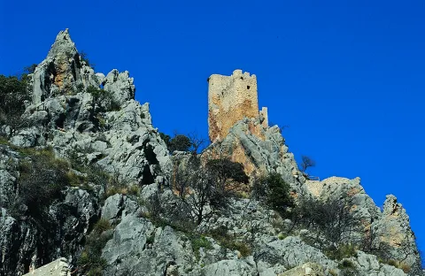
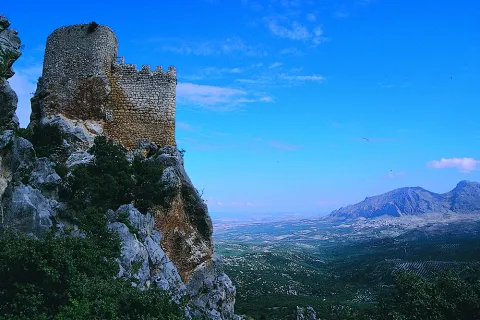
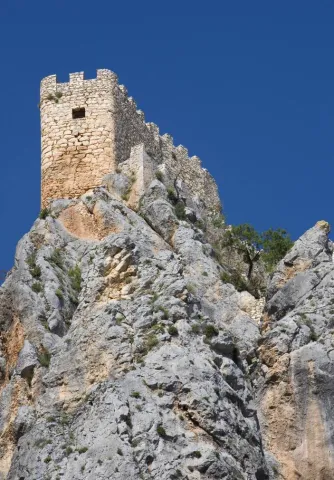
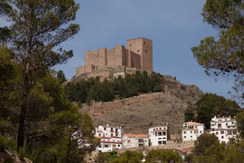
  • Castle.The castle of Albanchez de Mágina dominates and presides the village, which is located on the first ridge of the Sierra de los Castillejos. Despite its small dimensions and its inner narrows, its arriseach position makes it extremely difficult to access. Of presumably Christian origin, its construction was made with argamasa and it had to rise late, in the Middle Ages, in the early 14th century, as an alternative to another Muslim castle from which there are only remains, built with tapial in the lower and closer to the people. The castle was linked to the Order of Santiago, which created the command of Bedmar and Albanchez.

    What is preserved from it is its alcazarejo, built with masonry, which consists of two small, impressive nuclei because of its exterior appearance and the closing of the rock on which it sits, but with little internal capacity to house troops and beings. The highest core is a narrow rectangular platform that enables a small interior space. The entrance opens to the terrace of a rectangular floor turret that housed two cameras: one top, covered with a half-barrel vault, now melted, and one lower, a aljibe, with slightly pointed vault and remains of the stucco that covered it.

    The castle also had a small courtyard of triangular weapons with almond parapet and saetera windows, a square terrace with albarrana to defend over the cliff, protective walls, today practically destroyed, and rounded corners outside as it was a calatravo castle. It was declared Good Cultural Interest in 1985.
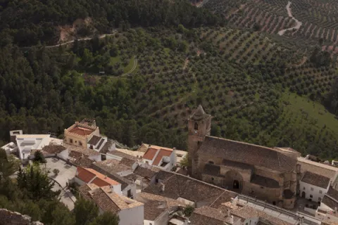
  • Church of the Assumption. The parish church of Albanchez de Magina, a Renaissance church, has the dignity of simplicity and austerity in both design and execution. On the north wall is identified a sober facade with a half-point arch, the key of which is marked by a mensula, and which supports imposts on jambas. The cover is topped by an internment. Its interior structure is marked by three ships, the largest being the central, which also stands out hierarchical in the outer volumetric because it has a higher height. The inner spaces are separated by columns and semi-columns crowned with Tuscan capitals. Its presbytery is flat and covered by a half-barrel vault.
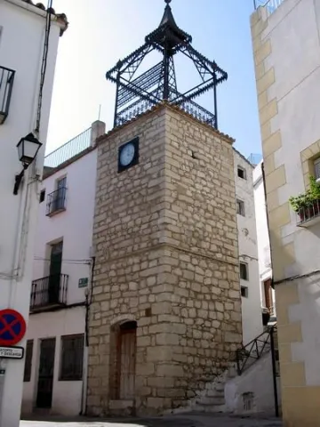
  • Watch tower. XXXTorreon century square floor built with masonry. It is topped by a bell tower of cast iron structure built in 1883.
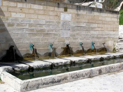
  • Source of the seven years. Pilar abrevadero with front of armchairs, and public laundry, example of traditional rural architecture related to the use of water for the consumption and irrigation of gardens, which possibly goes back to the 16th century. View with excellent views over the garden, olive and saw landscape.
  • Silk source. Source and public laundry that gives name to the area where the bushes were grown. The production and trade of silk, introduced by Muslims, was one of the economic bases of Albanchez until the 18th century.
Naturaleza

  • Source of the Espino. It is a water birth located in the middle of the Mediterranean mountain, with geological and vegetable formations of high natural value.
  • The Boiler of Uncle Wolf and the left-handed.It is a set of river pods and a waterfall inside a cave, all in a very mountainous environment.
  • The Serrezuela and the Port of the Aznaitin.Mountain area with stunning landscape views of the region.
  • Hutar site. Natural site at the birth of the Hútar Arroyo, located 2 km. of the town. Recreational area with barbecues, bar- restaurant, swimming pool and sports court, between springs and abundant vegetation. The waters of Hútar have historically been used for irrigation and as a driving force for the flour mills in Albanchez.
  • The Caño del Aguaderon area. Water birth at 1,800 meters of altitude in a high mountain environment. Area of pastures traditionally dedicated to pasture, so the fountains, pilares- abrevadero and huts or pastor's cabins abound. The altitude of the saw allows the presence of birds that nedify above 1,500 meters, such as the Red Roquer, the Grey Collalba and the Royal Eagle.
  • The Turcal. Geological formation with an abrupt relief of slices and rocky florings containing so-called algal bowls or fossils from the seabed 16 million years ago.
  • Path of Great Tour GR (E4)that crosses the province of Jaén runs through the term of Albanchez.
  • The Dehesa. The site is located in the place where the first limestone rocky outings of the base of Mount Aznaitín, which has a high landscape value, appear. In 2003, ten Escalada Days were opened which with different degrees of difficulty are a great opportunity to encourage and / or practice this sport.

Fiestas y Eventos

  • The Festival of the Candelaria on February 2, also known as Rosca Day. During the Mass there are a few thistles that are spread among the attendees. It is considered that those who take them are protected from the diseases of the throat and stomach.
  • In Albanchez, the habit of overthrowing the mozzas remains. The bordes are the fruit of the enea. They are collected during the summer and stored in the house chambers, in the straits, to dry. The Carnival Sunday They are taken out to throw them at the girls. When peeling them, they take off a white and melosous fuzz that adheres to the hair and clothes. It is said that the more a girl is loved, the more bordered she must throw her suitor in her face, so that that day the streets of the village will be carpeted with the annoying hairchair, in so curious "demonstration" of love.
  • The day 3 of May with the procession of Rosario de Los Hachones the employers' parties of San Francisco de Paulaheld from 3 to 6 May. The participants go through the streets carrying hashons or teas made with spartum and fish. At the passage of the procession, four luminaires, large laces of wood and olive branches, are put on, to which salt is cast to grow and prevent the passage of the comitiva. The light of the hashons and luminaries in the darkness of the night recalls the dawn of the Aurora, in a ritual that synthesizes the character of fire as a magical-symbolic element and the Christian tradition of prayer of the Rosary.
  • Procession in honour of San Francisco de Paula on May 4, Albanchez pattern, crop protector and rain propitiator. During the journey the neighbors cast wheat, from the balconies, on the paths of the throne, as a symbol of thanks for the given and begging harvest for the coming.
  • The night of San Juan a tradition related to falling in love is celebrated. The moors place the hangings on the doors of the mores, with different meaning depending on the type of ornament: the flowers are proof of affection, the branches of fig tree mean that the moose is a little locuel, the parra's sarment indicates that they have seen it drink wine, and a cardo, that its character is hard.
  • The day 1 August the day of the gazhaswhere in most houses the August gazhas are eaten, made with flour, water, pepper and tomato. It is popular belief that eating the hot gaches in the middle of summer, the heat will be kept throughout the winter, especially during the olive collection. In the collection of the olive that is cold is that it has not eaten the gazhas of August 1. At present, there is a competition on that day for the production of gachas in the Natural Area of Hútar, during a holiday and the coexistence of all those who do not want to spend the winter cold.

Gastronomía


Its gastronomy of Moorish origin is rich and varied, preserving the peculiarity of possessing the only Maize stew which can be taken throughout the province of Jaén. It is a summer dish where the corn grains, once crushed in the mortar, will give body to a broth made from a saffrito of peppers, beans, tomato and fresh guindilla, which will then be cooked with pepper, saffron, cumin, garlic and salt.

Another of the traditional Czech Albanian dishes is called flakes, which are only a variant of the rags with hare, in which the mass is threaded laboriously to form small pieces of the size of the swollen corn, accompanied by orchard products such as green peppers, potatoes, eggplants and beans.

The heritage of the Andalusian gastronomy is present in much of the recipes and culinary habits that are preserved in Albanchez, such as the rye, made with lamb blood, and consumed in all relevant celebrations, the bordullos and the peas of corn and wheat. In the chapter of sweets, the almondmade of ground almond, egg, cinnamon, sugar and lemon scraping.

For dessert, the flakes, which can be taken with sugar and cinnamon or honey; or the not less almond almonds, delicious conjunction of meringue, sugar and almonds passed through the oven. Unforgivable as dessert of the traditional weddings of old was the refreshing melon saladand as dessert or snack of the autumn evenings the no less traditional weddings, so called to the pitancero sponsales of a dry fig, preserved in flour, and a piece of walnut, almond or peeled acorn that is placed inside.

Historia

The oldest news in the history of Albanchez is found in the Cueva de los Skeletos, in the The Fuckers' place. It was discovered in the 19th century by peasants. It was the finding of several skeletons, sitting in semicircle and armed with arrows, whose tips were acute pedernals, with knives and spears also of pedernal. The researchers have identified him with a multiple burial of the Age of the Bronze. In the municipal term, several treasuries of coins and several inscriptions have been found, of which some researchers have deduced the existence of a buried Roman city, Campanjana.

The urban core of Albanchez must have originated between the 7th and 9th centuries, when the peasant population used the rock, under which the people lie, to seek refuge. By the 11th century the wall of the population would be built, which was then above the current one. From this primitive fortification remain the remains of a square tower.

After the Spanish conquest the castle was built on the rock, although it is difficult to specify who built it, for during the middle age Albanchez belonged to various lords, although above all it belonged to the Order of Santiagor. In 1309 Fernando IV grants the villa to this Order of Santiago, which created the Bedmar and Albanchezwhose presence lasted, at intervals, until the 19th century. From the news in the leagues we know that he belonged to the Lordship of Jodar, until in 1338 Ruy Fernández He sold it to the Ubeda Council for 1,500 maravedis. Albanchez was dependent on Bedmar until the infant Enrique de Aragón the villa was made independent by privilege given in Valladolid on 18 November 1419, later confirmed by other kings.

After the reconquest there was a demographic increase supported by the repopulation measures and movements, the development of an economy of a marked agricultural character and the raising of partridges and pigeons and goats, lanar and cattle. The economic decline of the state in the 17th century accentuates this situation in Albanchez due to its subsistence economy. The fact that it is evidenced by the state of ruin that the castle had at this time or the sinking of the roof of the parish temple.

The 18th and first half of the 19th century meant a shy attempt to recover. This is demonstrated by the reconstruction of the church giving rise to the current one. Another of the most significant facts is the definitive disappearance of the Enabling to the heat of measures such as the Demortization of Mendizábal in 1836.
Loading map
Preparing points of interest and routes...
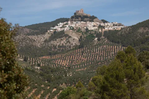
Imagen principal
imagen
Image
albanchez de mágina
Imagen principal
Activado

Almazaras Oleo Turísticas Regional Network

Submitted by brandcode_deweloper on
Id
777503
Descripción
Descripción larga

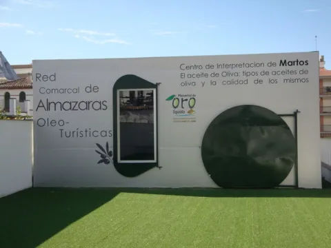
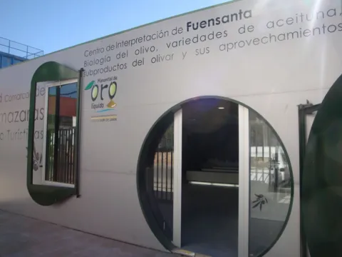
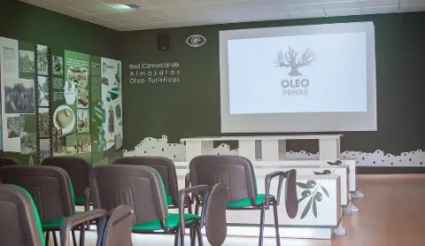
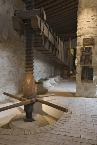
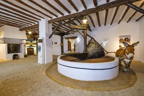
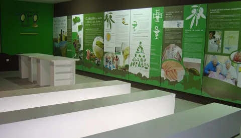
The Network is made up of nine Interpretation Centres in Almazaras Oileteras in the Sierra Sur de Jaén for the promotion of olive cultivation. Each Centre has a different theme on various aspects related to olive oil, such as olive oil production systems and evolution throughout history, olive oil qualities and uses, olive oil cultivation systems, olive oil analysis and olive oil marketing system, olive biology, olive varieties, olive by-products, olive oil and its uses, olive heritage, traditions, olive oil types and olive oil quality and history.

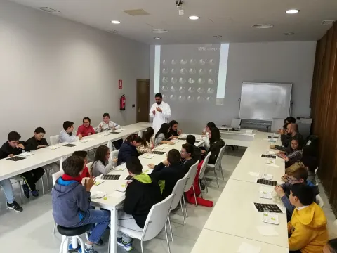
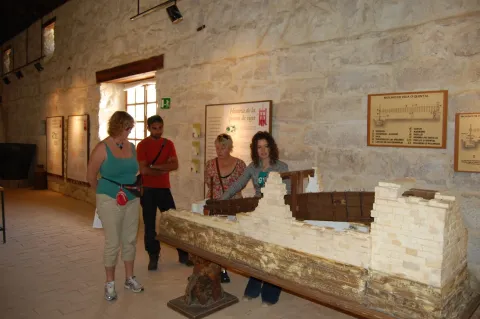
The Interpreting Centres have a space of about 85 square meters arranged for interpretation, teaching and tourism use, equipped with latest technology such as touch screen, and multitactile, to enjoy games and multimedia application, interpretative panels or 3D projection canyon.

It is intended to take advantage of olive oil and olive oil, very abundant resources in the region, such as tourism resources, to value the idle resources (facilities, machinery, documentation etc.) of the almazaras, for as long as they are not in the full process of collecting and producing oil, to promote knowledge about the different uses of the olive and olive oil, to promote knowledge of the culture, traditions and related customs, and to diversify the comarcal tourist offer by taking advantage of the resources available such as the almazaras, olive and olive oil.

Oilticulture will be promoted and disseminated in a didactic, dynamic and attractive way for a wide range of audiences, from thematic staff, professionals from the olive sector, people from school or training ages, to tourists or local audiences. Visitors will be able to connect intellectually and emotionally, through the Network's interpretative script, to the fascinating world of cultural and ethnographic heritage that olive oil and olive oil form around them.

The Comarcal Network of Almazaras Ole- touristic can be visited through the tourist route that connects the nine Interpretation Centres with the main tourist attractions of the municipalities of the Sierra Sur de Jaén: Alcalá la Real, Alcaudete, Castillo de Locubín, Friiles, Fuensana, Jamilena, Martos, Torredelcampo, Valdepeñas de Jaén and Los Villares can be traveled under the enigmas of liquid gold and the sea of olive trees that shape the orography of this territory. On the other hand, the visit to the Centres will be completed with an internal route through the facilities of the milling plants that make up the Network, adapted to the resources, and particular characteristics of each of them and of the visiting public.

The project is funded by the European Agricultural Fund for Rural Development (EAFRD) at 40% in the framework of the Global Action Plan, of the Council for Agriculture, Fisheries and the Environment, and by 60% from the Sustainable Tourism Initiative - Lands of Romance and Legend, of the Council for Tourism and Trade.

Breve descripción

TheComarcal Network of Almazaras Ole- touristis a project promoted by the Association for Rural Development of the South Sierra de Jaén (ADSUR). It is a commitment to economic diversification by taking advantage of the tourist potential that the mills offer as a factor of sustainable development and as an element of territorial identity.

Telecomunicaciones
Sitio web
http://www.redalmazarassierrasurjaen.es/
Correo electrónico
adsur@adsur.es
Ubicación
Latitud
37.770588
Longitud
-3.899727
Distrito
Municipio
Ubicación en el mapa
POINT (-3.899727 37.770588)
Tipos de punto de interés
Imágenes carrusel
imagen
Image
torredelcampoDSC04828.jpg
Imagen principal
Desactivado
imagen
Image
9962afd4d7801adbe96e49a2f2eab69f_8_XL.jpg
Imagen principal
Desactivado
imagen
Image
9962afd4d7801adbe96e49a2f2eab69f_6_XL.jpg
Imagen principal
Desactivado
imagen
Image
museo3.jpg
Imagen principal
Desactivado
Imágenes cabecera
imagen
Image
thb_g_1.jpeg
Imagen principal
Activado
Microsite al que pertenece
Loading map
Preparing points of interest and routes...

Palace of Jabalquinto

Submitted by brandcode_deweloper on
Id
9346866
Descripción
Descripción larga

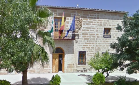
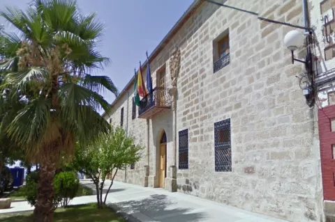
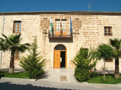
The palace floor is rectangular with built-in garden. It has a large landscaped facade enriched with two sillery covers dated in the last third of the 16th century. The main, south-facing, opens with a half-point arch framed by pilastras with Corinthian capitals on high bases. It is broken to accommodate a balcony of intellized vanity and an ancestor of forged iron. On their sides, there are two large-pack nobility shields held by tenants, carved a century later, which have an oval shape on a parchment and crowned sheet. On the sides are opened new asymmetric voids for windows with forging grille. The other cover is intellized, with large candles, pilasters with basaments, simple cornice and, on the top floor, a shaft window with the cover. In its interior is drawn attention to the vestibule, probably from the 19th century, whose roof is intertwined with small vaults; the railing of the ladder, of forged iron; the grating, subtly decorated; and the slender pillars that hold it.

A funeral monument with the date of 1895, with vegetable ornamentation and composite capitals, and another magnificent Baroque shield in the courtyard, is also preserved in a carved stone. In 1985 it was declared Good of Cultural Interest.

Breve descripción

The most emblematic building of the civil architecture of this municipality is the Jabalfifth Palace, which began to be built in the 15th century, was renovated in the 18th and 19th centuries and throughout the second half of the 20th century has been presagiating ruin. Its promoters were the Benavides, the owner of the lordship after his purchase of Baeza, who decided to symbolize his power by raising the palace in the space previously destined for strength, and centuries later they transferred it to the Counts of Benavente.

Telecomunicaciones
Sitio web
www.jabalquinto.es
Teléfono de contacto
953 617 056
Ubicación
Código Postal
23712
Latitud
38.019367
Longitud
-3.726367
Dirección
Plaza del Ayuntamiento, 1
Distrito
Municipio
Ubicación en el mapa
POINT (-3.726367 38.019367)
Tipos de punto de interés
Imágenes carrusel
imagen
Image
Palacio%20de%20Jabalquinto%2001.jpg
Imagen principal
Desactivado
imagen
Image
Palacio%20de%20Jabalquinto%2002.jpg
Imagen principal
Desactivado
Imágenes cabecera
imagen
Image
Palacio%20Jabalquinto.jpg
Imagen principal
Activado
Microsite al que pertenece
Loading map
Preparing points of interest and routes...
Interés

Terra Oleum Museum

Submitted by brandcode_deweloper on
Id
777264
Descripción
Descripción larga

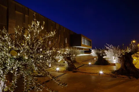
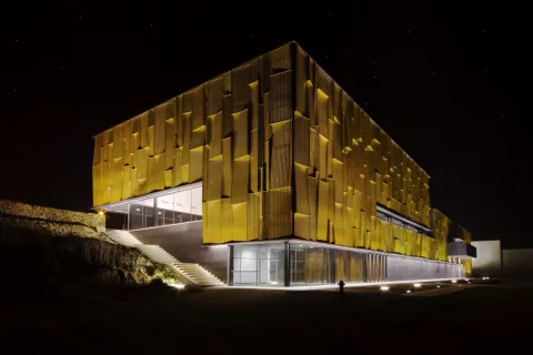
Selected as a reference centre by the European Union for the dissemination of the culture of Olive Oil, the space of knowledge and museum Terra Oleum is spread over an area of more than 11,000 square meters. The largest area of knowledge planned in the Mediterranean basin for a food product.

The Museum, promoted by the Diputación de Jaén, Consejeria de Agricultura de la Junta de Andalucía, and developed by the Fundación del Olivar, is located within the Geolit Technological Park in Mengíbar, the heart of the Andalusian olive tree.

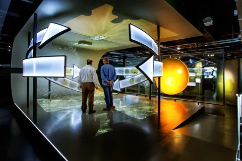
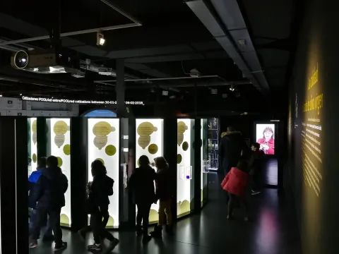
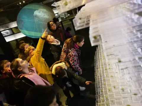
It has a permanent exhibition of modern interactive, audiovisual, machinery and other types of scenography, on olive, olive oil and sustainability. A revolutionary 3D video-aping system makes the visitor a true master of almazara able to direct all processes for obtaining olive juice.

Terra Oleum is framed within the wet area of the Quebracántaros tributary, whose spring is born within the same Olivos Centenarios Forest of the Museum. The outdoor activities, from the collection of the olive, to the recognition of indigenous species in this natural space, are part of the essence of the center: harmony with a humanized forest.

The auditorium becomes the central space of the events that take place in the Museum. It has the most advanced technology in image and sound, equipped with electronic systems of participation that allows a fluid exchange of knowledge with the visitor.

Terra Oleum also offers an extensive programme of parallel activities that combines visits to the permanent exhibition with workshops, courses and seminars through proposals for all audiences. The field and the mill become the central axis of our dialogue with the visitor. An immersion into the world of virgin olive oil by the hand of experts in this science that becomes an authentic art.

The selection of extra virgin olive oils Terra Oleum brings together the best oil in practice all of the jiennese, Andalusian and Spanish olive trees. The green and mature fruits evoke the aromas of nature, in a permanent exhibition that allows the tasting and tasting of all of them in a relaxed environment: the Museum's Oleoteca.

Before the end of the visit we cannot forget Oleaginus, a space for art and culture, located in the area of quality promotion: Denominations of Origin, olive bookstore, contemporary painting and oleary art, demand the attention of the visitor in an atmosphere of light sipped by the solar courts that are born on their terraces.

The avant-garde architecture and its modern proposals for communication with the visitor make Terra Oleum a unique place to feel the culture of virgin olive oil from the first step.

Breve descripción

The Active Museum of Olive Oil and Sustainability is home to a modern exhibition space composed of unique architectural spaces, including its Aurea Box and a natural environment formed by the Centennial Olive Forest. For the dissemination of knowledge related to olive cultivation, olive oil production technology and Mediterranean cuisine, its contents cover the practice of the whole world of olive and virgin olive oil.

Telecomunicaciones
Sitio web
www.terraoleum.es
Teléfono de contacto
953 274 976
Correo electrónico
info@terraoleum.es
Ubicación
Código Postal
23620
Latitud
37.939650
Longitud
-3.793130
Distrito
Municipio
Ubicación en el mapa
POINT (-3.79313 37.93965)
Tipos de punto de interés
Imágenes carrusel
imagen
Image
_MG_7664.jpg
Imagen principal
Desactivado
imagen
Image
oleoturismo-d3-0026.jpg
Imagen principal
Desactivado
imagen
Image
oleoturismo-d3-0028.jpg
Imagen principal
Desactivado
imagen
Image
IMG_3608.JPG
Imagen principal
Desactivado
imagen
Image
_MG_4118.JPG
Imagen principal
Desactivado
imagen
Image
IMG_4027.JPG
Imagen principal
Desactivado
imagen
Image
IMG_20180206_112452.jpg
Imagen principal
Desactivado
imagen
Image
IMG_20180207_125829.jpg
Imagen principal
Desactivado
imagen
Image
IMG_20180403_113655.jpg
Imagen principal
Desactivado
Imágenes cabecera
imagen
Image
_MG_7706.jpg
Imagen principal
Activado
Horario
Tuesday to Saturday: 10: 00 - 14: 00 and 16: 00 - 18: 00. Sundays and holidays: only mornings.
Microsite al que pertenece
Loading map
Preparing points of interest and routes...

Alcalá Oliva Oil Museum

Submitted by brandcode_deweloper on
Id
7161140
Descripción
Descripción larga

At the bottom is the machinery of a 19th century mill, faithful reflection of the production systems of the time, as well as original tools and useful. At the top you can deepen the culture of olive and oil, entering the world of the tasting ofextra virgin. There are rest areas, a projector with audiovisual to learn more about the olive cycle and the current production systems, as well as excellent panoramic views of the Fortaleza de la Mota, which rises imposing on the horizon, surrounded by the olive sea.

Finally we have a "Agro-shop" for sale of products as well as other typical jiennese products and a "Rincón Sensorial" to taste our oils. The entire facility has explanatory panels in English and Spanish. It is designed to be accessible to people with reduced mobility (lift, ramps...) and is heated. Free Wi-Fi is also available for visitors.

Breve descripción

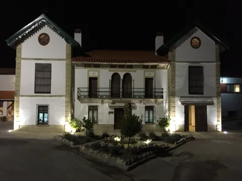
The museum is located in a building that is more than a century old, known as the factory of the Caserías de San Isidro. Alcalá Oliva has carried out a hard work of rehabilitation of all the buildings and their surroundings, returning to this place part of its former charm.

Telecomunicaciones
Sitio web
www.alcalaoliva.com
Teléfono de contacto
953 581 017
Correo electrónico
info@alcalaoliva.com
Ubicación
Código Postal
23680
Latitud
37.463700
Longitud
-3.964290
Dirección
Carretera A-339, Km. 50. Las Caserías de San Isidro
Distrito
Municipio
Ubicación en el mapa
POINT (-3.96429 37.4637)
Tipos de punto de interés
Imágenes carrusel
imagen
Image
Aceitunas.jpg
Imagen principal
Desactivado
Imágenes cabecera
imagen
Image
983fb56032c1ac1b726360eae9dd3d18_XL.jpg
Imagen principal
Activado
Horario
Monday to Friday: 09: 00 - 14: 00 and 16: 00 - 19: 00. Saturday: 10: 00 - 13: 00.
Microsite al que pertenece
Otros servicios

English, French and German.

Loading map
Preparing points of interest and routes...
Marcas de calidad

Museum of the Culture del Olivo

Submitted by brandcode_deweloper on
Id
763157
Descripción
Descripción larga

The museum, considered a Good of Cultural Interest, is divided into several spaces; three buildings that house different models of almazaras, a garden of olive varieties from several countries and the Bodega.

Along the route of the visit, steps are shown to obtain the oil, from the most traditional methods of olive cultivation to the modern marketing and packaging processes.

In the museum you can know the characteristics of olive oil, value its properties and deepen the different aspects that define its quality, gradation, color, etc. You can also physically know the different varieties of olive trees, as it has a garden with trees of each variety, but it deserves special attention, a 19th century winery known as the "Cathedral of Oil." In addition, the complex has a conference room for 230 people. Oil caters are made for groups, tasting and other activities related to the olive tree.

Breve descripción

The Museum of the Olive Culture is part of the "Hacienda La Laguna" complex, located in Puente del Obispo, eight kilometres from Baeza. With an extension of more than 4,000 square meters is the museum on the largest oil in Spain. It contains models of old mills in which the three fundamental processes of oil production are collected: grinding, pressing and decanting.

Telecomunicaciones
Sitio web
https://www.museodelaculturadelolivo.com/
Teléfono de contacto
953 765 142 / 677 461 206
Correo electrónico
info@museodelaculturadelolivo.com
Ubicación
Código Postal
23529
Latitud
37.945310
Longitud
-3.567020
Dirección
Finca Hacienda La Laguna, s/n
Municipio
Ubicación en el mapa
POINT (-3.56702 37.94531)
Tipos de punto de interés
Imágenes carrusel
imagen
Image
oleoturismo-d2-0046.jpg
Imagen principal
Desactivado
imagen
Image
MUSEO%20OLIVO%20BAEZA.jpg
Imagen principal
Desactivado
imagen
Image
_MG_2577.jpg
Imagen principal
Desactivado
imagen
Image
_MG_2578.jpg
Imagen principal
Desactivado
imagen
Image
_MG_2581.jpg
Imagen principal
Desactivado
imagen
Image
baeza-muaseo-cultura-del-olivo-1-jpg
Imagen principal
Desactivado
Imágenes cabecera
imagen
Image
Baeza%20Museo%20olivo%201.jpg
Imagen principal
Activado
Horario
Monday to Sunday: 10: 30 - 13: 30. Late: consult by season. Last access 45 minutes before closing.
Microsite al que pertenece
Loading map
Preparing points of interest and routes...
Marcas de calidad

Natural Monument El olivo de Fuentebuena

Submitted by brandcode_deweloper on
Id
6726352
Descripción
Descripción larga

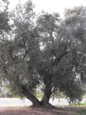
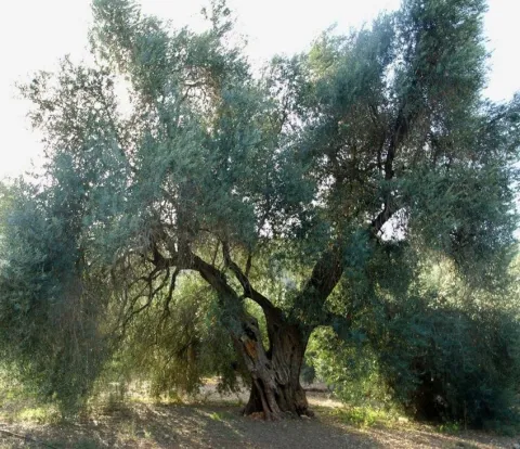
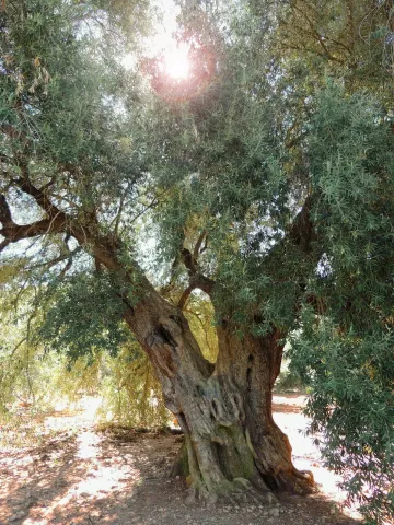
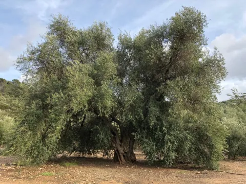
If by anything it is characterized by Jaén it is by its olive trees. There are very old people and there are also large ones (which is not about their age) spread over different municipalities in the provincial geography. The uniqueness of the Arroyo del Ojanco olive tree lies, rather than its age, in its gigantic dimensions, so it has been proposed to be declared a Natural Monument of Andalusia. It is said that it is the largest olive tree in the world, and possibly it is, because the figures that cast its measures, referred to in the tab at the beginning of the article, tell us of a single copy. This should be added to its productive capacity, which is around 600 kg. olive per campaign (an adult irrigated olive tree usually does not reach 70 kg).


The two large branches (2.10 and 2.80 m of perimeter) that are bifurcan from its thick fuse bear all the weight of the cup, which becomes of such magnitude - especially when the fruit develops - which forces its dense foliage to rest on the ground at many ends of the cup. Anyway, everything in this portentous specimen is Guinness record.


So long a centenary history has generated some legendary accounts around this olive tree, as it was planted in the Roman era (which indeed built a magnificent villa a few hundred metres from Fuentebuena) or by friars after the Christian reconquest of these lands. Another version states that its size, so different from that of the olive trees around it, is because it was born from a blessed bouquet on a Palm Sunday.

To access the Fuentebuena olive, you have to go from the urban core of Arroyo del Ojanco to the local road JV-7.005 towards Beas de Segura. As you pass the crossing of Prados de Armijo, the olive tree is about 50 metres from the road.

Breve descripción

The millennial olive tree of Fuentebuena, declared by the Junta de Andalucía Monumento Natural, is one of the symbols of Arroyo del Ojanco. This is a privileged vestige that has resisted so many generations between corns and bandages, between ice of raw winters and summers of extenuating dryness.

Ubicación
Latitud
38.320028
Longitud
-2.905589
Distrito
Municipio
Ubicación en el mapa
POINT (-2.905589 38.320028)
Imágenes carrusel
imagen
Image
olivo.jpg
Imagen principal
Desactivado
imagen
Image
Oliva-de-Fuentebuena.jpg
Imagen principal
Desactivado
imagen
Image
DSCN3042.JPG
Imagen principal
Desactivado
Imágenes cabecera
imagen
Image
Olivo-de-Fuentebuena20180317-01.jpg
Imagen principal
Activado
Microsite al que pertenece
Loading map
Preparing points of interest and routes...

Viewpoint Paseo de Antonio Machado

Submitted by brandcode_deweloper on
Id
7500350
Descripción
Breve descripción

Known as La Muralla, this perimeter street to the city of Baeza offers beautiful views over the olive grove, the Guadalquivir valley and the natural park of Sierra Magina.

Ubicación
Código Postal
23440
Latitud
37.992360
Longitud
-3.469560
Municipio
Ubicación en el mapa
POINT (-3.46956 37.99236)
Tipos de punto de interés
Imágenes carrusel
imagen
Image
Baeza_Paseo_Antonio_Machado_010.jpg
Imagen principal
Desactivado
Microsite al que pertenece
Loading map
Preparing points of interest and routes...

Viewpoint of the Castle of Albanchez de Mágina

Submitted by brandcode_deweloper on
Id
2980294
Descripción
Descripción larga

The town of Albanchez de Magina is accessed from the capital by the A-316 in the direction of Ubeda: After going about 12 km, to the right, we will turn to the A-320 in the direction of Mancha Real. In this town we will take the JA-3106 road towards Torres. Finally, from here we will head for the JA-1107 to Albanchez, which is about 12 km away.

Albanchez de Mágina clings over the rocky skirmish of Mount Aznaitín (1,745 meters), headed towards the vertigo of a wide and deep valley watered by the often-flowing channel of the Albanchez River. On the needle of a sharp farallon lies its rocky castle of Arab origin, becoming an unbeatable lookout over the northern geography of this mountain massif of the Natural Park of Sierra Magina.

Breve descripción

The rise to this rock castle is already worth it. The feeling is to be attached to the nest of a rapacious bird on the walls of Mount Aznaitin, on the valley of the Cuadros River.

Ubicación
Código Postal
23538
Latitud
37.790110
Longitud
-3.468140
Distrito
Ubicación en el mapa
POINT (-3.46814 37.79011)
Tipos de punto de interés
Imágenes carrusel
imagen
Image
miradoralbanchez.jpg
Imagen principal
Desactivado
imagen
Image
63503204d18160dd6a733e989b70c404_L.jpg
Imagen principal
Desactivado
Imágenes cabecera
imagen
Image
19.jpg
Imagen principal
Activado
Microsite al que pertenece
Loading map
Preparing points of interest and routes...

Viewpoint Castle of Segura de la Sierra

Submitted by brandcode_deweloper on
Id
7480918
Descripción
Breve descripción

One of the treasures of the Sierras de Cazorla, Segura and Las Villas natural park, lifts the visitor over the mountains and shows on one side the mountain olive groves and on the other the most extensive forests of the Iberian Peninsula.

Ubicación
Código Postal
23379
Latitud
38.299210
Longitud
-2.649790
Dirección
C/ Castillo, s/n
Distrito
Ubicación en el mapa
POINT (-2.64979 38.29921)
Tipos de punto de interés
Imágenes carrusel
imagen
Image
Segura_de_la_Sierra_PM_091677_E.jpg
Imagen principal
Desactivado
imagen
Image
Segura_de_la_Sierra_PM_091756_E.jpg
Imagen principal
Desactivado
Imágenes cabecera
imagen
Image
Segura_de_la_Sierra_PM_091670_E.jpg
Imagen principal
Activado
Microsite al que pertenece
Loading map
Preparing points of interest and routes...