Saltar al contenido principal

Canena

Submitted by brandcode_deweloper on
Id
726500
Perfil de redes sociales
Facebook
https://www.facebook.com/Canena-Ayuntamiento-797777960269910/
Twitter
https://twitter.com/aytodecanena
Descripción
Breve descripción

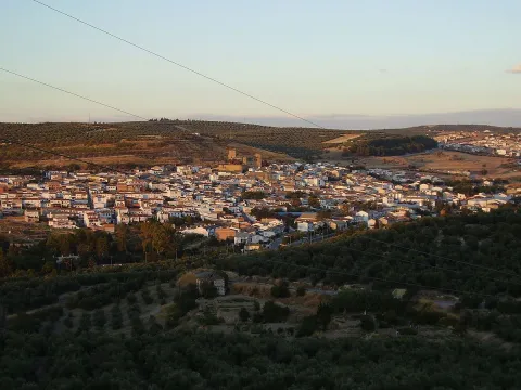
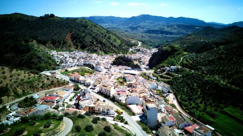
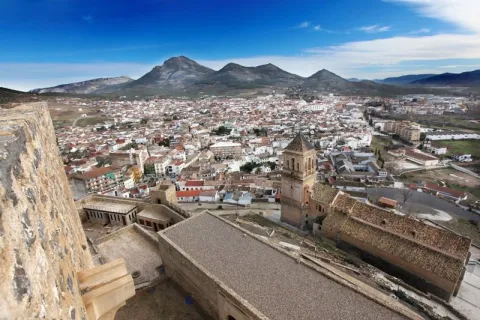
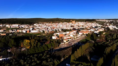
Canine is a small municipality in the province of Jaén, located in theNorth slope of the region called The Loma.

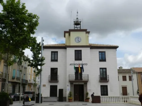
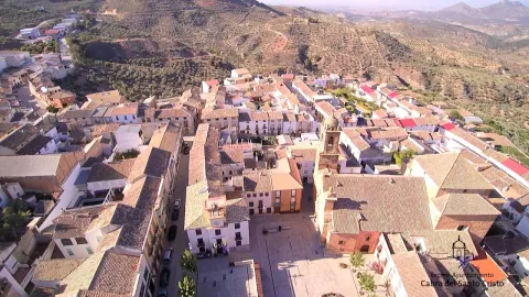
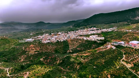
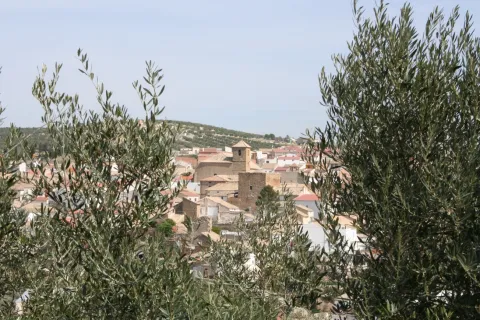
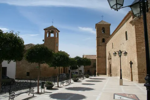
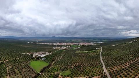
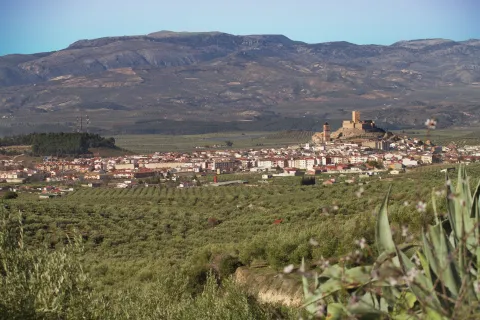
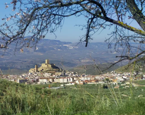
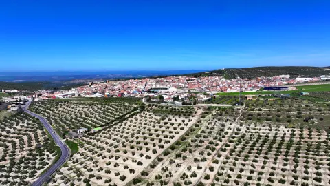
It is an olive town, as the almost whole of its municipal term is dedicated to the cultivation of the olive tree. Canine is a municipality with a 14 km ², very small compared to the villages around him: Ibros, Rus, Baeza or Ubeda.

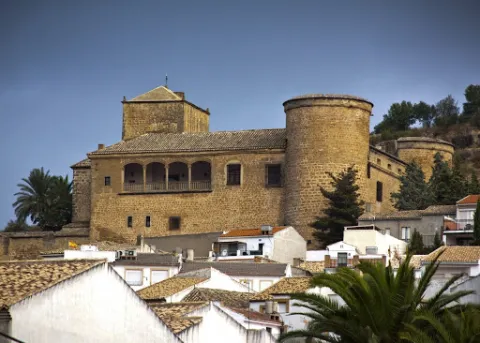
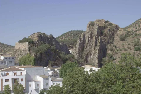
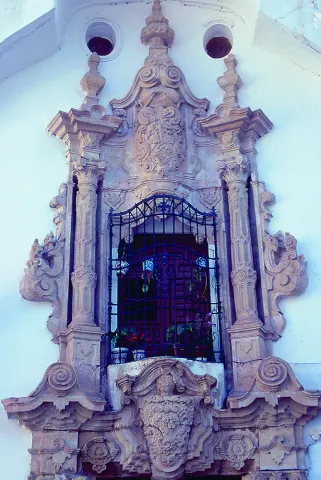
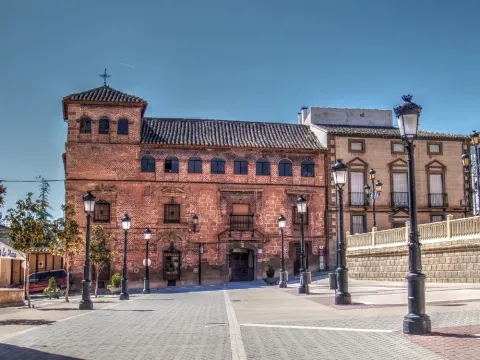
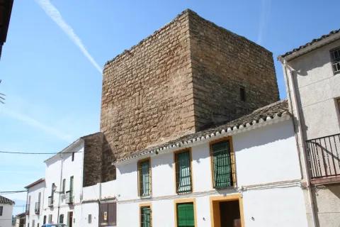
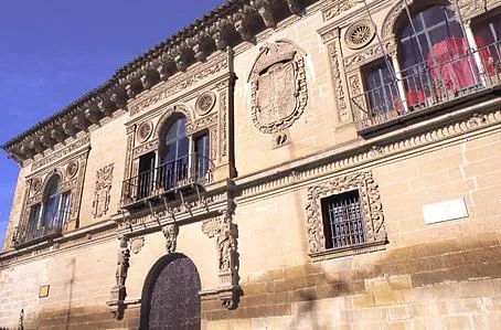
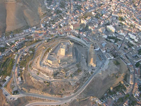
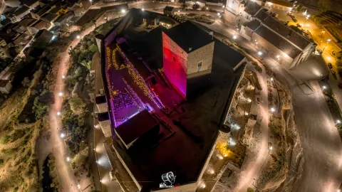
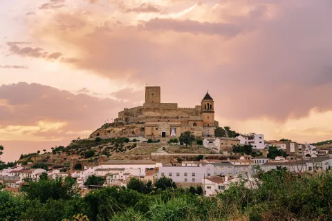
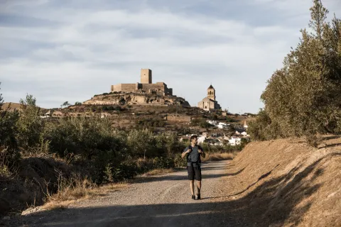
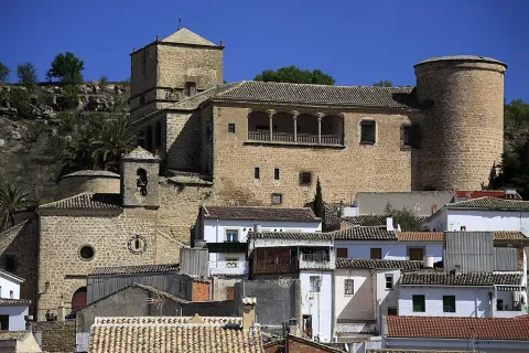
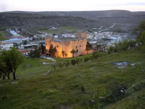
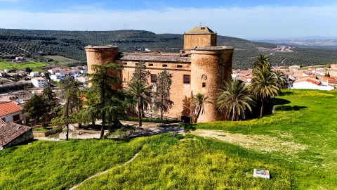
It has an impressive castle - palace of the Renaissance period, ordered to build by Mr Francisco de los Cobos, secretary of King Charles I.

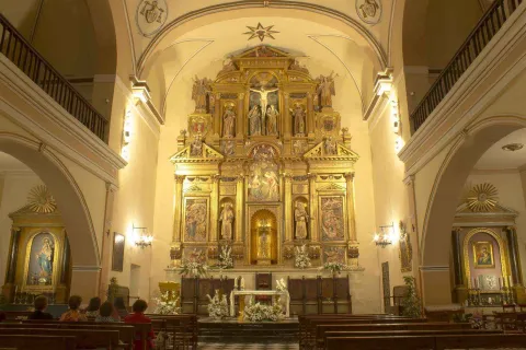
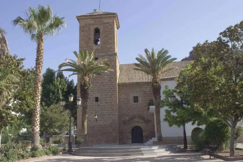
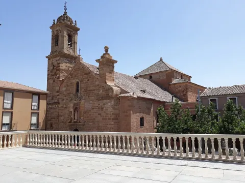
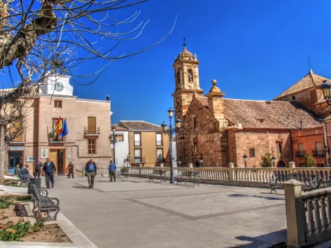
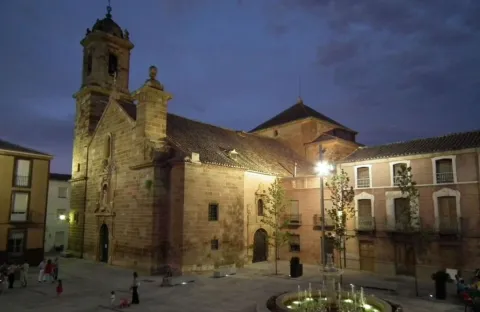
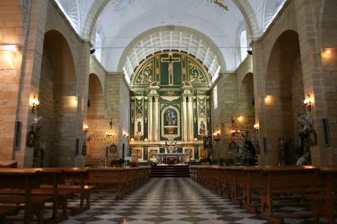
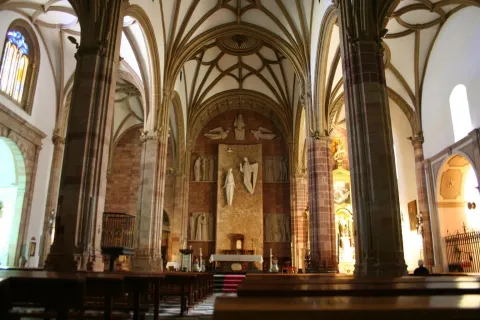
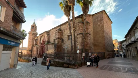
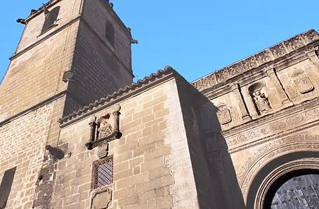
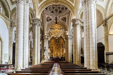
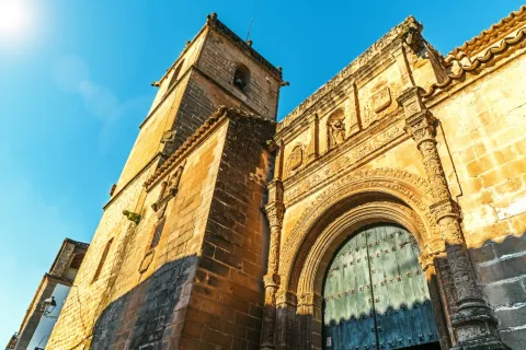
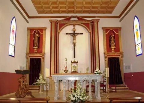
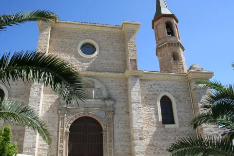
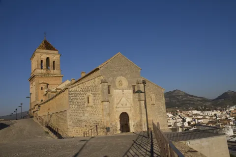
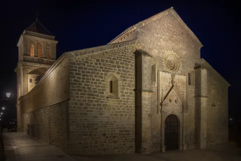
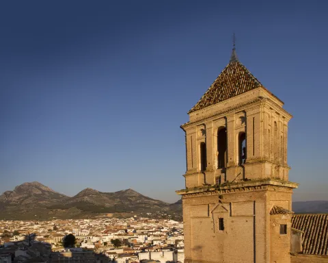
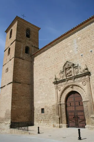
The parish church dedicated to Our Lady of Conception is Renaissance in style and is raised in the first half of the 16th century.

Special mention deserves the interesting spa of thermal waters dating from the Roman era and was officially declared as a spa in 1853. Its mineromimicinal waters were declared public utility in 1948, currently being the only spa in operation within the province of Jaén.
Telecomunicaciones
Teléfono
953 770 161
Sitio web
www.canena.es
Fax
953 770 157
Correo electrónico
canena@canena.es
Ubicación
Nombre
Canena
Latitud
38.048160
Longitud
-3.481680
Municipio
Ubicación en el mapa
POINT (-3.48168 38.04816)
Imágenes
imagen
Image
bcadd46f-d550-47db-93e9-04bf1a97ab12?t=1617622860093
Imagen principal
Desactivado
imagen
Image
7287a0e8-f3ef-ba63-26c4-01565406f663?t=1586302332591
Imagen principal
Desactivado
imagen
Image
52ff6eaf-5b0e-9aaa-cdee-031ee1621868?t=1610987722402
Imagen principal
Desactivado
imagen
Image
8e65ff68-4368-5691-a789-da9cbf865678?t=1610987769453
Imagen principal
Desactivado
imagen
Image
deb4b4cb-b7fa-bb24-46a6-6b78ffc33f0e?t=1610987805783
Imagen principal
Desactivado
imagen
Image
f9119661-9354-8645-7628-9c3c22feab2e?t=1593796058632
Imagen principal
Desactivado
imagen
Image
88783720-57b3-bc14-567e-66e1738fbf73?t=1610987851073
Imagen principal
Desactivado
Información adicional
Curiosidades

ADR La Loma y las Villas: www.adlas.es
Imágenes cabecera
imagen
Image
canena
Imagen principal
Desactivado
Datos de interés

Tourist area: Ubeda / Baeza
Distance to the capital (km): 47
Altitude over sea level (m): 525
Extension (Km2): 14
Number of inhabitants: 2096
Gentilicon: Caneneros
Postal code: 23420

Videos
Video file
Cultura

From its artistic heritage we highlight:

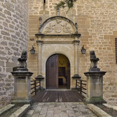
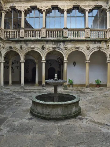
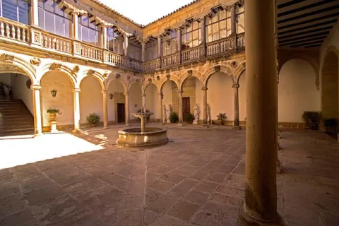
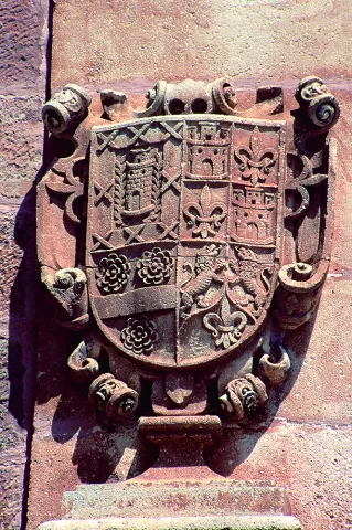
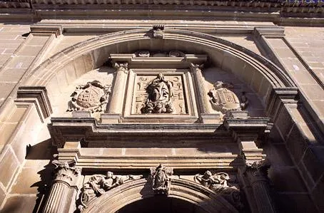
  • The Castle-palace, which belonged to Francisco de los Cobos, and was built in the second half of the 16th century, after the purchase of the town by Francisco de los Cobos. Of almost square floor, with four circular towers on the corners, two larger on the main facade. The tower of tribute, square floor. Antaño was surrounded by a moat, now blinded, the slots are preserved to lift the old lift bridge. The cover, with a half-point arc, it is flanked by Corinthian pilasters, with an architrabed, cold setting decorated with grotesques and a cornice on which the half-point arch is raised, which welcomes, in its eardrum, the shields of the founders, and on its fantastic sides, tenants figures with the lower half of their bodies transfigurated in wing and vegetation. On the facade are scattered windows with conventional-style bars. The castle has a inner courtyard It has double gallery of half-point arches with Ionic columns and claustral staircase. The upper gallery, also Ionian, repeats the intellized structure, with the peculiarity of large zapatas on the columns, which support in plintos decorated with military motifs and, it borders a railing of balaustres. The set offers a constructive sobriety and a balance and harmony that demonstrates the authorship of an artist builder like Andrés de Vandelvira. It was declared a National Monument in 1931. It is currently in private hands.
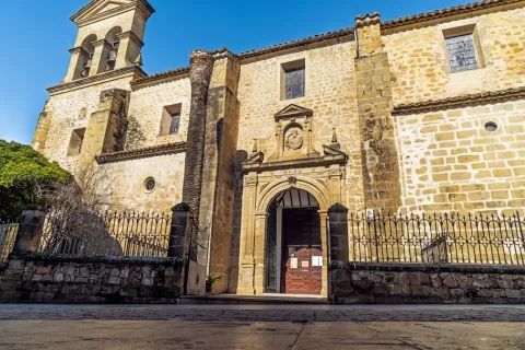
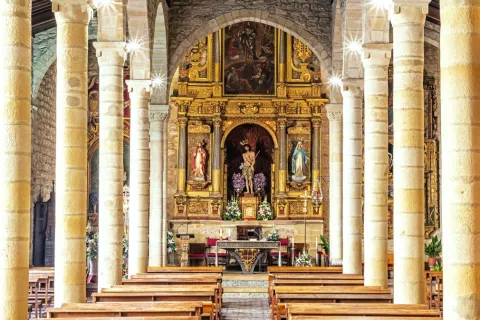
  • Our Lady of Conception parish church, It is built in the first half of the 16th century and is of Renaissance style. It is made up of three ships, the largest central than the sides, separated by half-point arches that are based on columns. It also has a crypto of great robustness, dated around 1000.
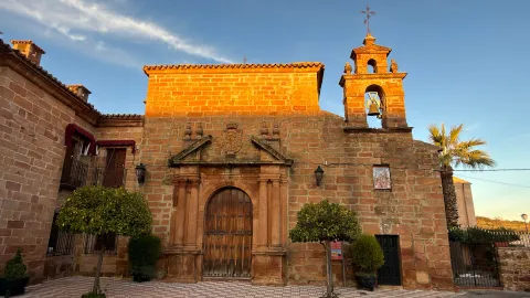
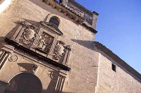
  • Hermitage of Our Lady of RemediesIt was built in the 15th century and finished in the first half of the 18th century thanks to alms, as indicated on the facade. The entrance is protected with a small cancel with three more lower-than-usual carpanel arches and supported by dogrous columns on plintuses.
  • Molinillo. It is a hydraulic construction of the Roman era, intended for the grinding of the cereal, and is located on the left bank of the Yedra stream, about 700 m from the urban centre. It was improved at the time of Carlos V, when the villa was bought by Francisco de los Cobos.
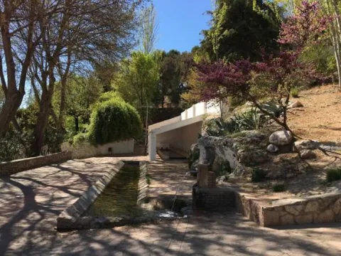
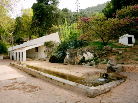
  • Sources, dedicated to the solace of its inhabitants and the irrigation of gardens. There are several of us: New Source, Caño Source, Ark Source and Pilarejo.

Naturaleza

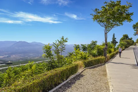
A Canine is considered as the entrance door to the region of La Lomaa plateau above the basins of the two rivers, to the north the river Guadalimar and to the south the Guadalquivir.

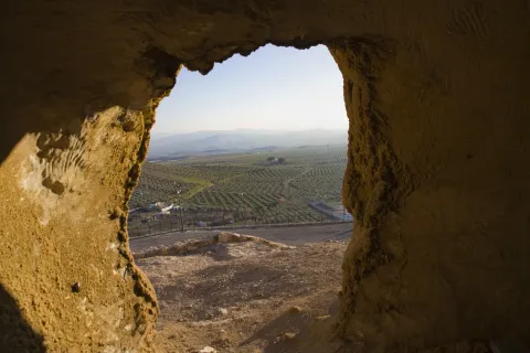
The landscape that is presented to us when we are located in the lands of Canena is really spectacular, a true sea of olive trees, the most representative image of La Loma jiennense. The promontories are low and the earrings are soft. Some small areas are reserved for the cultivation of cereals. In the areas near the Guadalimar the vegetation changes by what we know as the riverbank forest: willows, alms and low bushes.

The small extension of the municipal term, Only 14 km ², compared to the extent of the villages around you. Although in recent years it has been increasing as farmers have to buy other land in the nearby municipalities: Baeza, Ubeda, Ibros, Torreperogil... among others. The agriculture in these places is very mechanized.

The fauna of this municipality is made up of the minor game animals: rabbits, hares, foxes, parrots, codornices... And it is very common to see the silhouette of the rapacious birds fly.

There are many roads and paths that go through the term Canena, with ideal points from which to obtain extraordinary panoramic views of the region of La Loma.

Fiestas y Eventos

The festive celebrations in Canena have as their main reference the celebration of the celebrations of the employers: Saint Mark and the Virgin of Remedies popularly known as the August Virgin.

At the parties of the Virgin of the Remediestogether with the religious spirit, migrants from the town are also received and welcomed who, on these summer dates (August), return to their people on holiday.

In late April, on the 25th, the canaries celebrate the holiday of his pattern, San Marcos. It tells the tradition that in the 17th century,It had to be processed through the streets to free the people from a plague of locusts that devastated their fields, and at the passage of the procession, the locusts were disappearing.

Since then, the grateful people have held the feast in the surroundings of their hermitage, to which they have to come, men, women and children... Barefoot! And it was also stipulated that they would not eat meat that day.

On that day, the superior of the Holy Brotherhood gives the "roscas of charity" to all the neighbors and visitors that there is that day in the town.

The San Isidro holidayin which farmers participate, processing the Holy Labrador to one end of the village to bless the fields.

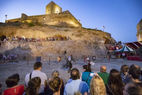
The owner of the Castle lends its dependencies for the celebration of the Music Festival "Villa de Canena" held every year, on the weekends of July.

Gastronomía

The inhabitants of the town retain the custom of distributing "roscos of Charity" to all those present at the feast of their patron, San Marcos, in the times when Canena had vineyards, the neighbors accompanied the roscos with wine from their harvest, and in years of bonanza and prosperity also for stewed meat.

From the Moorish cuisine There's still a relic in the gastronomy, it's the call "sweet omelet."which consists of a light mass of yeast flour, which once made pieces is fried in olive oil, then bathed in honey.

Of the most traditional dishes of the local gastronomy, we list the following:

  • "Migas de breads con torreznos", to which is added chorizo, sardines, herring and other ingredients that we want to add.
  • "Mower soup" that reminds us quite a lot of garlic soups and they were taken in the morning. At lunch time, the refreshing gazpacho was taken, which is prepared with oil, vinegar, bread and grilled garlic, to which pieces of tomato and cucumber were added.
  • "Wink with hare" name known in the region of La Loma to the alrajos.

At the parties, both at the San Marcos and the Virgin of August, the "meatball stew." and take the traditional ones "pigeons" consisting of dry anis mixed with water, accompanied by sugar and lemon juice.

On the Sunday of Resurrection the bakeand for the Saints the "Cucumbers candy."

At Christmas they are unique to this villa the "Home-packed syrup" who are filled with angel hair, and the "Wine doughnuts."

Canena Castle is a family company that offers an exclusive, unique and 360º experience about the exciting world of Extra Virgin Olive Oil, with olive tradition since 1780.

Historia

The origin of the municipality can be traced back to the Prehistory, since in the vicinity have been found stone axes polish.

Although it is in the Roman era that the first stable populations appear in the area of the spa, as shown by the location of mosaics and a hydraulic work of the same time.

The current enclave has its origin in the Arab era. The settlement of the Banu Kinana tribe was produced in this territory around 750. Everything seems to indicate that the name of Canena comes from the name of this tribe.

1226 will definitely be conquered by King Fernando III the Holy as it advances to the lands of the Jaen countryside. After the conquest, he was handed over to the district of Baeza; shortly after, King Alfonso X would hand over these conquered lands to the military orders of Santiago and Calatrava; finally, in 1302, Fernando IV took it to the Order of Calatrava and gave it to the city of Ubeda.

At the end of the 15th century Sancho de Benavides took over from Canena in the context of his dispute over the Calatrava de Canena and began the construction of a castle, without real permission, and with the subsequent complaints of Baeza to the Catholic Kings, who had prohibited new fortresses in the territory to put an end to the struggles between the nobility sides.

In 1538 Don Francisco de los Cobos, secretary of the Emperor Charles V and great patron of the Renaissance in Ubeda and its region, buys the village of Canena. And it will be he who transformed the ruins of a castle into a sumptuous palace, whose path and direction of works were in Andrés de Vandelvira.

From then on, the town became part of an extensive Lordship of the Marquesado de Camarasa until well into the 20th century.

The image of the municipality in the 19th century was marked by the imprint of one for the care in the labour of the crops and by the presence of a property distributed from the Military Orders that exploited them in the form of a colonate, and thus would remain well into the 20th century.

The main crops were olive trees, cereal, vineyards and also orchard.

Otra información

Other points of interest in his artistic heritage:

  • San Andrés Spa, of Roman origin and with waters indicated for therapeutic treatment.
  • Canena Telecommunications Museum. It provides visitors with an overview of the evolution of communications and technologies that have made it possible.
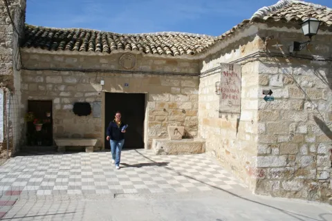
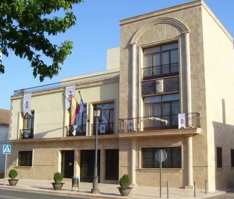
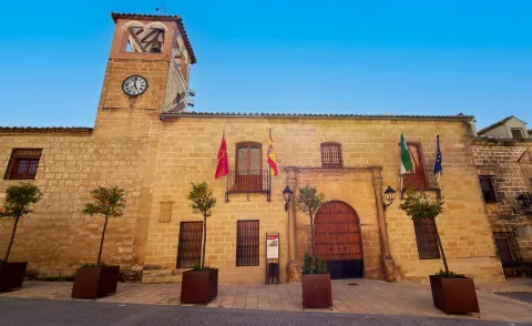
  • House of Culture, located in an ancient house of the 16th century, also restored, with a treadmill arch and framed by the mould and cross of Calatrava.
  • San Marcos Cross, order to rise by the farmers.
Loading map
Preparing points of interest and routes...
Imagen principal
imagen
Image
can
Imagen principal
Activado

Cambil

Submitted by brandcode_deweloper on
Id
726294
Perfil de redes sociales
Facebook
https://www.facebook.com/ayuntamientodecambil/
Twitter
https://twitter.com/aytocambil?lang=es
Descripción
Breve descripción

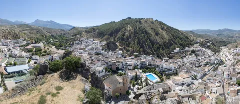
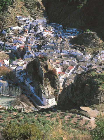
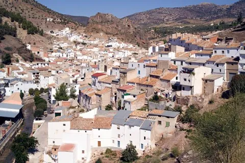
Cambil is a municipality located in the south of the province of Jaén and integrated into the Sierra Mágina region. Its municipal term ascends from the Guadalullon River to the south, to the summit of Mount Almadén, the second highest peak of the province. Regored by the rivers Villanueva, Oviedo and Cambil, between fields of cereals, olive trees and fruit.

It is of great interest that the population centres in its term, such as the village of Arbuniel, with a great wealth of water and good weather in summer, make it an ideal place to spend the summer months; or the corrijada of Matabejid, highlighted by the peculiar historical architecture of its constructions.

From the artistic heritage of Cambil, the church of Our Lady of the Incarnation, from the end of the XVI, built in the Renaissance style, stands out. He keeps an extraordinary Renaissance altarpiece from Sebastián Solís.

And also, the Old Hospital, raised in the second half of the 18th century and which is one of the most baroque examples of the province of Jaén.

    Telecomunicaciones
    Teléfono
    953 961 599
    Sitio web
    www.cambil-arbuniel.es
    Fax
    953 961 696
    Correo electrónico
    ayuntamientocambil@gmail.com
    Ubicación
    Nombre
    Cambil
    Latitud
    37.676840
    Longitud
    -3.564920
    Distrito
    Municipio
    Ubicación en el mapa
    POINT (-3.56492 37.67684)
    Imágenes
    imagen
    Image
    d33bc3a9-f232-f251-6b78-a6f430dc6292?t=1585576072643
    Imagen principal
    Desactivado
    imagen
    Image
    5b0fa44f-ec9b-0367-18d9-37822510cdda?t=1616174025504
    Imagen principal
    Desactivado
    imagen
    Image
    2a8a3d78-9893-da68-8d6f-fdfc326f8dfb?t=1585576072117
    Imagen principal
    Desactivado
    imagen
    Image
    2805d7be-df5e-d332-82d2-1f61e4807f94?t=1585576070079
    Imagen principal
    Desactivado
    imagen
    Image
    e29a7b00-d085-f745-8318-b2651f873861?t=1585152488274
    Imagen principal
    Desactivado
    imagen
    Image
    f5a943c2-8333-043c-1c86-89f0aee44ea5?t=1585576068494
    Imagen principal
    Desactivado
    imagen
    Image
    fab3b723-93e3-911c-2441-ae7a68e69096?t=1585576068162
    Imagen principal
    Desactivado
    imagen
    Image
    b02e8f76-d7f5-a19c-4ddb-d3c9b146d21c?t=1603136354445
    Imagen principal
    Desactivado
    imagen
    Image
    b5660670-8dbf-fba1-e515-08dcc324b28d?t=1603138798603
    Imagen principal
    Desactivado
    imagen
    Image
    68856994-720e-0150-e135-2619d62d9167?t=1603139571321
    Imagen principal
    Desactivado
    Imágenes cabecera
    imagen
    Image
    cambil
    Imagen principal
    Desactivado
    Datos de interés

    Tourist area: Sierra Magina
    Distance to the capital (km): 32
    Altitude over sea level (m): 822
    Extension (Km2): 140
    No. of inhabitants 2,703
    Genuine:
    Postal code: 23120

    Videos
    Video file
    Cultura

    From the artistic heritage of Cambil we highlight the following points of interest:

    • Castles of Cambil and Alhabar. The castle of Cambil It is located on the left bank of the Camil River and above a high rock flask, with a wall that falls vertical on the channel. The castle of Alhabar is located on the right bank of the same river, on another rocky flask and in front of the castle of Cambil. Both castles were declared "Good of Cultural Interest" in 1985.
    • Historical helmet, declared Good of Cultural Interest in 2012: located at the foot of two hills crowned by the castles of Cambil and Alhabar, crossed by the River Cambil, and around a historic road: that of Arbuniel. The image that characterizes its historical ensemble is generated by a set of crouched buildings with steep roofs of Arab tile, solarium houses in the lower area, and narrow and winding streets with straps and adarves in the upper parts.
    • Castle of Mata Bejidit is located between the mountains of Magina and Almadén, it seems to be of Christian construction from the early 14th century. Its function is essentially strategic and, by its size, it had the capacity to accommodate a small garrison. Also declared Good of Cultural Interest in 1985.
    • Our Lady of the Incarnation Parish Churchbuilt in the late 16th century, the exterior is sober and compact. Already inside, the main altar has an extraordinary Baroque altarpiece attributed to Sebastian de Solís.
    • Old Hospital of Poor Passengers, raised in the second half of the XVIII and on whose facade the exuberance of the baroque is noticed, being considered one of the most baroque monuments of the province.
    • Single houses: House of the Salazares and House of the Palace in Calle Real, both of them also show baroque facades of the 18th century.
    • Prehistoric reptile tracks, just a mile from Cambil, we found a trace of eight traces of the arcosaur reptile. Several of them are currently in a ballot box inside the conistory building.

    Naturaleza

    Change is the municipality that brings the most area to the Natural Park of Sierra Mágina, 25% of its territory is within it.

    The municipal term extends all the west side from the Guadabullón River until Almadén peak, with an altitude of 2,036 m, in Sierra Magina. For this reason we will find a great variety of both fauna and flora.

    At the same time, this variety at the altitude of the land will allow us to have places from which we can observe extraordinary panoramic views, both of the Jiennense countryside and of the fertile valleys that form the basins of the numerous river courses that travel these slopes.

    The paths and recreational areas that spatter the territory show the diversity and natural wealth of these lands; among the most interesting are: water route and olive groves, Torrecilla route, the Salt Arroyo or the birth of the Arbuniel River, without forgetting the environment of the gradual birth of the Mata in Mata Bejid. In fact, in its term is one of the two Visitors' Centres of the Natural Park of Sierra Magina, the C. Visitors of Mata Bejidfrom which several signposted paths are based: Up to the Pico Magina and Miramundos, El Peralejo, Puerto de la Mata and Sendero Gibralberca.

    To go through these places is to feel nature in its greatest splendor: thus we will find numerous sources, acequias, charcas, river births that go down the slopes to meet the Oviedo and Villanueva rivers. Also with remains of construction related to agricultural uses and old livestock.
    In addition, climbing routes are availablein the same centre of Cambil; thus, in the rock Castillo there are 7 perfectly equipped ways.

    The vegetation is very varied and we will find oaks, complaints, olive trees, cornicabra, alamos, etc. with examples of considerable bearing the Chopos of Mata Bejid,which exceed 30 m in height and 7.5 m in diameter.

    Something similar can be said of the fauna of the area, because here we can find ourselves: the Hispanic goat, the badger, the boar, the gin, the grubby... while it will be very easy to observe the majestic flight of the royal eagle or other rapes.

    But if there's an identifier of your territory, it's water. Ríos, springs, acequias, fountains, etc., model the area of the valley, both in the same town of Cambil, vertebrated by the river, and in Arbuniel, where the sound of the water as a background soundtrack accompanies the visitor from Birth to the very streets of its urban town, on a spicy tour of acequias, light factories, mills, laundry, etc.

    These heritage elements linked to water, and those that have remained the fruit of past agricultural and livestock activities, give the natural environment of Cambio a predominant ethnographic and landscape character.

    Fiestas y Eventos

    Among the parties with the most roots and tradition are:

    • San Antón, San Sebastián, Candelaria and San Blas. On January 17, the feast of San Antón, is blessed to the animals and become "lumbres," which is extended until the 20th of the same month, the day of San Sebastián, with the procession of the saint and the lumbres are repeated. In the Candelaria, on February 2, the fire returned to the village square made with the branches that carry the bakers. And on February 3, in San Blas, doughnuts are blessed and "lumbres" return.
    • Patrons of the Holy Christ of the Marble. It is celebrated the last weekend of February, when the canvas containing the image of Christ is taken to its hermitage, where it will be veiled all night, as it happened in the legend around the image. The next day, Sunday, the image returns to the parish.
    • Patrons of the Blessed Virgin of the Rosarywhich took place on 15 August, since its original celebration was moved in October. This very day a cattle fair is held.
    • St. Anne's Day. "Cultural Week":The holiday of Santa Ana is celebrated on July 23, and a cultural week begins in which the City Council has a large number of sports and play activities.
    • Tambora, a feast that has been held since time immemorial on the day of the Immaculate Conception. On the night of the 7th, a drum is used to carry out the prayer, hence the name of the holiday. The image of the Virgin is processed at 24, 4 and 6 hours in the morning, accompanying the songs with a sound drum.
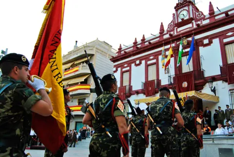
    • Holy Week.With the arrival of Easter, a period of religious and customary acts that make the people full of incense begin in Cambil.
    • "Historical Recreation" Day in Arbuniel: In August, the neighbors starred in a tour of the different historical stages of the town.
    • Top Trail Magina, a mountain race born in Cambil and ascends to the highest peaks of Jaén. It's quite a reference for the most demanding athletes.
    • Magina Bike, in March, andSan Blas Urban Challenge.

    Gastronomía

    In the gastronomy of Cambil, three elements are common: olive oil, present in all its dishes, which most of the ingredients are from its own harvest or from the rivers and mountains of its surroundings, and which are usually dishes with quite a caloric contribution, as the works in the field consume a lot of energy.

    • Carnerete, is a dish with a lot of energy, as it has a pancake, chorizo, morcilla, fried tomato and meat broth.
    • Almorony, a potation of beans to which various vegetables are added.
    • Brown beans with chorizo.
    • Cod.
    • Crab from the Arbuniel River in salsa.
    • CigaretteThis vegetable is added to the chorizo.
    • Migas.
    • Migas of flour.
    • Cake cakes.

    In the pastry shop they highlight:

    • Sweet peas, are made with milk, flour and chickenpox above.
    • Aguacebámade of water, barley, hazelnut, cinnamon, vanilla and sugar.
    • Guides in spirits.

    Historia

    The oldest testimonies of the territory of Cambil are located in the tunnel of Saint Lucia, where they were found Bronze Age burial (II millennium BC)

    From the year 182 to. C. The romanization of this region begins. They've been found. sarcophages, remains of columns and capitals in Arbuniel.

    The core of Cambil takes on importance from Islamic domination and is already cited in the 12th century (Qanbil). It was divided into two small villages separated by the river and protected by two small castles to ensure its defence.

    The town will be definitely taken from the Nazarian Kingdom in the year 1485 by the Catholic Kings, with the help of six thousand men who arrived from Jaén and the first use of artillery. In thanks to this help, the Catholic Kings determined that Camil would become part of the Jaén Council.

    He will be King Philip II, in 1558who emancipates Cambil from the tutelage of Jaen and orders that the lands of Arbuniel be added.

    In 1676 the segregation of Cambil of the population of Carchelejo including Carchel and Cazalla (today, Cárcheles).

    And it will be in 1862 when it is incorporated to Change the territory of Mata Bejid, which until then had been under Jaén's jurisdiction.

    Already in the 20th century, with the proclamation of the 2nd Republic and the beginning of the Civil War, Cambil is occupied by the Republican side, being bombed by Jaén and its surroundings by the "Legion Condor."

    In the 1960s, Cambil, like the other populations of Sierra Mágina, suffered from emigration from many of its people to the industrial centres and large cities of Spain and Central Europe.

    Loading map
    Preparing points of interest and routes...
    Imagen principal
    imagen
    Image
    cambil
    Imagen principal
    Activado

    Cabra de Santo Cristo

    Submitted by brandcode_deweloper on
    Id
    12461093
    Perfil de redes sociales
    Facebook
    http://facebook.com/aytocabradelsantocristo
    Twitter
    https://twitter.com/aytocabrasc
    Instagram
    https://www.instagram.com/aytocabrasc/
    Descripción
    Breve descripción

    It is a municipality in the Sierra Mágina region and occupies the eastern space of it, it is located looking to the Sierra de Cazorla and the Guadiana Menor river, in a space of arid and eroded lands that make up unique natural spaces in the province.

    The municipality consists of three population centres, Cabra del Santo Cristo, Cabra Station and Huesa Station.

    The municipal term combines the landscape of olive and almond trees with large extensions of pine trees, oak trees, with the shrubs, piorns, romals and tumolar, within a geography of contrasts, in part marked by low rainfall.

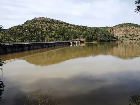
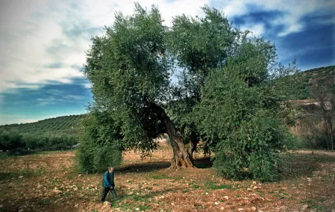
    In the landscape a millennial oak declared Good of Natural Interest and the bridge over the Salado stream is 109 m high and 300 m long.

    The economy of the goats is mainly based on the production of olive oil, there are currently two mills in operation. The cultivation of almond is also of great importance.

    Cabra presents a rich historical past, highlighting its neolithic caves, Roman remains and findings of a small treasure of visigode coins.

    Telecomunicaciones
    Teléfono
    953 397 002 / 670 990 911
    Sitio web
    www.aytocabradelsantocristo.com
    Fax
    953 397 300
    Correo electrónico
    info@aytocabradelsantocristo.com
    Ubicación
    Nombre
    Cabra de Santo Cristo
    Latitud
    37.703620
    Longitud
    -3.286700
    Distrito
    Ubicación en el mapa
    POINT (-3.2867 37.70362)
    Imágenes
    imagen
    Image
    01123155-jpg
    Imagen principal
    Desactivado
    imagen
    Image
    cabra-del-santo-cristo4-jpg
    Imagen principal
    Desactivado
    imagen
    Image
    2018-07-18-jpg
    Imagen principal
    Desactivado
    imagen
    Image
    cabra-del-santo-cristo3-jpg
    Imagen principal
    Desactivado
    imagen
    Image
    nacimiento-de-salvador-gudu-jpg
    Imagen principal
    Desactivado
    imagen
    Image
    olmedo-jpg
    Imagen principal
    Desactivado
    imagen
    Image
    cabra-del-santo-cristo2-jpg
    Imagen principal
    Desactivado
    imagen
    Image
    mon472-jpg
    Imagen principal
    Desactivado
    imagen
    Image
    cabra-del-santo-cristo5-jpg
    Imagen principal
    Desactivado
    Información adicional
    Curiosidades
    Imágenes cabecera
    imagen
    Image
    cabra del santo cristo
    Imagen principal
    Desactivado
    Datos de interés

    Distance to the capital (km): 73
    Altitude over sea level (m): 942
    Extension (Km2): 186
    Number of inhabitants: 1779
    Gentillo: Cabrileño
    Postal code: 23550

    Videos
    Video file
    Cultura
    • Cabra Castle of the Holy Christ. It is located on a rigged hill called Cerro San Juan, where the castle and the old town of Cabra are located. It is of Roman origin, with subsequent Muslim and Christian settlements in the 13th century, to which the remains that can still be seen corresponded. The plateau is currently planted with olive trees and a palomar has been built on the top. It is a polygonal plant construction from which remains of three towers remain. From the walls of the castle there is still a canvas of almost 20 m., built with irregular masonry attached with hard lime and sand argamase. The fortress would be intended only to be a refuge for the population in the event of danger.
    • Our Lady Church of the Expectation and Sanctuary of the Holy Christ. The church dates back to the 17th century. It is a single ship on a Latin cross plant, with half-point hornant chapels on imposts. It has two covers, the main one at the foot of the temple, and a simpler one on a side.The cover The main is three-story, in the lower, half-point vanity on imposta, decorates its transdotes with pearls, beads and an acanto leaf on the key; the second floor is occupied by a hornadine and in its interior an image of the Virgin on shell; on the third floor a triangular front is placed on another curved, and both parties by a shield.The Tower It is a square floor and is divided into three bodies, the first two smooth and the bell tower.Holy Christ of Burgos. The parish church is the sanctuary of the Holy Christ of Burgos, a pilgrimage centre for people from different populations, recalling a tradition dating back to the 17th century. A gothic canvas that was moved 1637, and that from then on the population of the Señorío de Cabrillas would be called Cabra of the Holy Christ.
    • Big House, from the 17th century, Mudejar Baroque style. It is a wide rectangle divided into three floors of height and with a torre-mirador, very common typology in Granada.
    Naturaleza

    The term Cabra from the point of view of vegetation has an enormous variability, because it is found to be part of the last foothills to the east of Sierra Magina and also of the valley of the Guadiana Menor, characterized by its aridity.

    The vegetation is very abundant having to colonize different climate floors from 460 to 1433 m., as well as different types of soils: saline, plaster, limestone, etc.

    It combines the landscape of olive trees and almonds with large extensions of pine and oak trees, with the shrubs, piorns, romals and tumbling within a geography of contrasts.

    The millennial oak and Bridge over the Salado stream with 109 m high and 300 m long.

    Hosges a rich fauna: Torcaz pigeon, abubilla, jineta, badger, boar, rabbit... and is an enabling ground for activities such as hiking, cycling and climbing, among others.
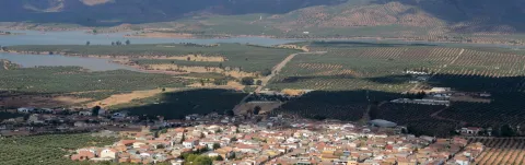
    Among the recreational places of the population, the surrounding area Place of Birth offer an ideal space for sharing a field day and enjoying nature.

    Other locations of interest to visit would be:

    • The centenary oak located at the Cabra Station.
    • Hiking in the Earth Bridge, a badlands landscape of Las Ramblas.
    • Montosa Head Hill, a geological place of interest of underwater volcanic activity.

    Fiestas y Eventos

    The main holiday activities in the town of Cabra, in addition to Christmas, carnival and Easter, are as follows:

    • Saint Anton, January 17. It's traditional to light "Lamps"on the night before.
    • San SebastiánJanuary 20. On this day is celebrated the arrival of the canvas of the Holy Christ from the city of Burgos.
    • La Candelariaon February 2.
    • Romeria of the Virgin of the Immaculate, the day 1 May. This day the transfer of the Virgin to the Cabra Station takes place. And the first Sunday, June, another Romry is done to realize the reverse path, to take the image of the Virgin from the Cabra Station to Cabra of the Holy Christ.
    • Patrons in honor of the Holy Christ of Cabra. They take place from August 14 to 18.
    Gastronomía

    The gastronomy is based on the local products of the orchard, hunting and livestock. In addition, extra virgin olive oil will be the central element of the cabriwood cuisine, an oil with the designation of origin Sierra Magina.
    Among the most characteristic dishes are:

    • Rings with hare, a dish that is made with products and spices of the earth such as peppermint.
    • Pimenton, It is a soup made from bockerons and crutches.
    • Typical products of pig killing: a.

    Historia

    For some remains of joules found in the caves of La Liota and the Barranco de la Sima, in the Sierra Cruzada, we have to assume that the first inhabitants of these lands were associated with Traveller populations dedicated to grazing.

    The villages corresponding to the age of the Copper and Bronze, which would be located in the Kangilones, Montosa head and Barranco mill, they would be located along the stream "Royo" which below will be called Salado.

    These lands were part of the passing area that connected the southern Mediterranean coasts to those of the East (Levante), an important reason for human presence in these places. The finding of metal idols confirms the existence of Iberian populations.

    As well as the finding of coins or a Roman mill, tombs, and even suspicions of the existence of a necropolis, are compelling evidence of the presence of the Roman people.

    From the Visigoda era we know the finding of what has been called the "treasurer," which was a currency with the inscription "Chisdasvinto Rex."

    As far as Muslim domination is concerned, we have little information on the early stages. We know that Fernando III the Holy takes the villa in 1245And it shall be King Alfonso X the Wise, who will give it to him, together with Santiesteban, to the city of Ubeda.

    With the conquest of Granada the instability on this border disappears and Carlos V orders the Council of Ubeda to repopulate the site of the CabrillaThat's the name of the population then. In 1545 there would be the arrival of the first 50 neighbours, and a little later another 100 would arrive. The new rotated and sown lands of cereal begin to bear fruit and it is noted that the demographic increase is noticeable, by the end of the 16th century the town already had 600 inhabitants. The construction of the church of Santa Ana begins, under the title of Our Lady of the O.
    A few years later, without the reasons being clear, the construction of a second church begins, Our Lady of Expectation, the present parish.

    The 17th century will be the aura period for the town of Cabrillas. During this century, forestry (pastures, shrubs...) is moved to rotate these lands and grow them from cereal, with the resulting increase in production.

    And to this modification in cultivation we must add the arrival of the image of the Christ of Burgos, a fact that would change life in this villa. On January 19, the feast of San Sebastián, of 1637, a bartender that carried the belongings of the Guadix Corridor in two mules loses the burden because of a temporary, with the exception of a canvas with the copy of the image of the Christ of Burgos. The waitress where the bartender, who was crippled with one arm, took refuge, healed by just touching the image. The miracle spread through the area and soon the devotees of the most diverse localities came to pray before the image.

    A fact that meant changing the name of "Cabrilla" for "Cabra of the Holy Christ".
    There were so many gains that the church that it was decided to extend the church by its header. The big house is set up on these very dates, the town increases its number of inhabitants and a glass factory is created, which, together with the craft with the spartum, decide to carry the objects produced by the people to sell them.

    The arrival of in 1899 it was a new push for the increase of the population, with jobs in the construction of the roads and in the construction of the new houses in the town, reaching the 6,741 inhabitants.

    The times of bad crops, as well as the industrialization in the manufacture of objects such as glass or spartum, and the post-war years, they assumed the exodus to the great cities for many of the inhabitants, thus the population began to decline to the present 1800.

    Loading map
    Preparing points of interest and routes...
    Imagen principal
    imagen
    Image
    cabra del santo cristo
    Imagen principal
    Activado

    Begíjar

    Submitted by brandcode_deweloper on
    Id
    725851
    Perfil de redes sociales
    Facebook
    https://www.facebook.com/Ayuntamiento-de-Beg%C3%ADjar-647194085411549/
    Twitter
    https://twitter.com/aytobegijar?lang=es
    Descripción
    Breve descripción

    Small olive town located in the western part of the region of La Loma and Las Villas, reaching its end to the same route of the Guadalquivir River. From the historical-artistic point of view, we must highlight the parish Church of Santiago Apostle, built between the 13th and 18th centuries, of which its plateresque cover of the late 16th century stands out. Also interesting are the Torreon del Castillo, declared a Historical Monument in 1985, the Episcopal Palace, of medieval origin, and the City Hall, built in the 16th century.

    Telecomunicaciones
    Teléfono
    953 763 002
    Sitio web
    www.begijar.es
    Fax
    953 763 003
    Correo electrónico
    begijar@begijar.es / fmendoza@begijar.es
    Ubicación
    Nombre
    Begíjar
    Latitud
    37.983850
    Longitud
    -3.535350
    Municipio
    Ubicación en el mapa
    POINT (-3.53535 37.98385)
    Imágenes
    imagen
    Image
    b058382a-5b18-b251-09ba-661ae103993b?t=1616760987668
    Imagen principal
    Desactivado
    imagen
    Image
    c7ffb58f-8dc1-2042-80f4-77cc096dbcf9?t=1586253674305
    Imagen principal
    Desactivado
    imagen
    Image
    08c38892-9326-736c-6703-de971bbbc99a?t=1616760987738
    Imagen principal
    Desactivado
    imagen
    Image
    add829ba-d20f-8f81-43ee-a0753c86a144?t=1616760987810
    Imagen principal
    Desactivado
    imagen
    Image
    e93cfd57-5ae7-eea9-a173-8b8d34959a7a?t=1616760987872
    Imagen principal
    Desactivado
    imagen
    Image
    48241080-9473-c287-ca78-5a1ec011715f?t=1616760987928
    Imagen principal
    Desactivado
    imagen
    Image
    c33f2bb8-f6df-df94-6ff7-92f7035edb2e?t=1616760987976
    Imagen principal
    Desactivado
    imagen
    Image
    3e5a3d3d-da08-e023-8c30-e441d71e3f93?t=1616760988021
    Imagen principal
    Desactivado
    imagen
    Image
    99ba28e0-d79d-7d79-eca2-49d0d862ce8d?t=1616760988072
    Imagen principal
    Desactivado
    imagen
    Image
    3327ee2f-7ae7-667c-cc29-a4ef56993d4c?t=1616760988138
    Imagen principal
    Desactivado
    imagen
    Image
    0a29fe32-94fe-4b51-10dd-bef52e11f6cc?t=1616760988190
    Imagen principal
    Desactivado
    imagen
    Image
    ee8f1541-3360-01f3-36b1-e3213de831f5?t=1616760988347
    Imagen principal
    Desactivado
    Imágenes cabecera
    imagen
    Image
    begijar
    Imagen principal
    Desactivado
    Datos de interés

    Tourist area: Ubeda / Baeza
    Distance to the capital (km): 45
    Altitude over sea level (m): 565
    Extension (Km2): 43
    Number of inhabitants: 3109
    Gentilicon: Begijenses
    Postal code: 23520

    Videos
    Video file
    Naturaleza

    The olive tree is the majority crop, complemented by the cultivated lands of the Vega del Guadalquivir, where industrial irrigation crops are established mainly. The mining industry and the slaughterhouse of the Begíjar Station are the most important industrial activities.

    Gastronomía

    The cebolated cod of the slaughter of the pig has remained as a culinary relic the home-made of the "loin of orza," which is still prepared as before: the meat is cut into large tacos, is made with a mallet of garlic, oregano, pimenton, salt and nail, and after three or four days of maceration the tacos are fried in extra virgin olive oil.

    For the days of Carnival is prepared a cooking of this time prior to Lent, which bears as the main ingredient the traditional "albondidon" or "filler," made with the mass of the meats, minced meat, garlic, parsley, eggs and grated bread, and let cook in the broth of the cooked.
    For Holy Week, the "sour cod" is prepared, where the cod is then fried in the same oil, the same is done with onions, tomatoes, garlic and ground pepper, being a dish that is usually prepared on Thursday to take it the next day, on Good Friday. As a sweet Easter they make the "sponge flowers" or "sponges."

    Two classic ways are in Begijar to prepare the lamb. One of them is to the chickenpox, where the lamb, once chopped, is stew with a lot of onion and tomato, leaving it all to cook until the meat is tender and the broth is reduced with a salsa bottom. The other form is typical of spring, where the lamb is chopped and cold, and in the same oil we fry green beans.
    From the winter days today, the bread crumbs, daily food in the cortijos, and they continue to be accompanied by torreznos, olives, radanillos, sandsardines or melon.

    In heat time, the "pepper salad" is prepared, as a warm piirrana, with tomato, onion, green pepper, and with garlic, oregano, oil, vinegar and water.

    Historia

    From Iberian times are the remains of a fortification, near the station of Begíjar, in which the typical painted ceramic was recorded. In the Roman stage there was an intense human occupation of the territory by agricultural holdings, type of villa, including Piedra Hincada, the Vega del Bishop, Las Delicias or the House of Beautiful Love.

    During the Islamic domination it was named Buxexat and must have passed to Fernando III by 1226, at the same time as Baeza. From this moment on, he will have, for some periods, an extremely agitated life, as it was disputed by the council of the city of Baeza and the bishops of Jaén, eager to take on the income that produced their rich lands. Initially, Fernando III left it attached to Baeza, as a land of realingo.

    Shortly after that, the king himself gave land to the Order of Calatrava, which Alfonso X confirmed in 1254. He also gave another part of the land to the bishopric of Toledo. But the great change happened in 1249 when he gave the whole population to the Bishop of Jaén.

    A century later, the population was in the hands of Enrique Enríquez, a major advance of the border. Alfonso XI decided to recover it and return it to Baeza. In the 15th century Bishop Don Rodrigo de Narváez took over the castle and incorporated it into the possessions of the diocese, despite the protests of the council of Baeza. In this context Begíjar will be seen to be undisturbed in the struggles between the nobility and Henry IV. In this struggle the Bishops and Baeza, on the same side, would turn the town into an advanced bastion against the capital of Jaén controlled by the Constable Luke of Iranzo. The dispute over this town culminated in the recognition by the Catholic Kings in 1477 of the property to the bishop. The bishops maintained the property of the castle until the 19th century, making it one of their main residences. In 1779 Charles III granted him the title of a villa, thus being definitely disconnected from Baeza.

    Otra información

    Crafts

    In Begíjar the wicker craftsmanship is kept alive, which is concentrated in the production of baskets. The articles are made by intertwining the pods, removing the skin or keeping its natural color, unpeeled, resulting in a darker tone. Other local artisan works are dry-rope ceramics and disyarns in clothing.

    Loading map
    Preparing points of interest and routes...
    Imagen principal
    imagen
    Image
    begijar
    Imagen principal
    Activado

    Bailén

    Submitted by brandcode_deweloper on
    Id
    725225
    Perfil de redes sociales
    Facebook
    https://www.facebook.com/aytobailen/
    Twitter
    https://twitter.com/aytobailen
    Instagram
    https://www.instagram.com/aytobailen/
    Descripción
    Breve descripción

    The municipality of Bailén is located to the north of the province of Jaén, at the foot of Sierra Morena.

    It is the natural passage of the communications that link the center and north of the peninsula to the South, and also the east to the west of Andalusia.

    The occupation of its inhabitants alternates between activities related to olive and agriculture and industrial activity, especially in this regard the ceramic sector, both artisanal and industrial.

    Among its monuments is the church of the Incarnation, built in the 15th century in the Gothic-isabelin style. The hermitage of Our Lady of Solitude (S. XV) and Gothic style are also highlighted; that of Jesus and Christ, both of Baroque style, and that of the Virgin of Zocueca, patron of the city.

    Very interesting are the historical recreations that take place on the occasion of the anniversary of the Battle of Bailén, which was waged in the framework of the Spanish War of Independence and which was the end of the Napoleonic hegemony in Europe.

    Telecomunicaciones
    Teléfono
    953 678 540
    Sitio web
    www.ayto-bailen.com
    Fax
    953 671 205
    Correo electrónico
    turismo@ayto-bailen.com
    Ubicación
    Nombre
    Bailén
    Latitud
    38.095220
    Longitud
    -3.786720
    Distrito
    Municipio
    Ubicación en el mapa
    POINT (-3.78672 38.09522)
    Imágenes
    imagen
    Image
    01aef382-40cb-d886-3a48-2ceadc544e65?t=1585570572589
    Imagen principal
    Desactivado
    imagen
    Image
    38d2f669-9fc3-1965-6235-3df7c2d584cb?t=1603123241475
    Imagen principal
    Desactivado
    imagen
    Image
    cfaa8bc2-d8cd-29e7-cc45-974fcd634c81?t=1603123482393
    Imagen principal
    Desactivado
    imagen
    Image
    img55-jpg
    Imagen principal
    Desactivado
    imagen
    Image
    img20-jpg
    Imagen principal
    Desactivado
    imagen
    Image
    62d37cfc-f4e4-6d3b-ef25-b36f16fbae80?t=1616523194958
    Imagen principal
    Desactivado
    imagen
    Image
    4713702d-a158-e4b0-6c7a-fd1626699805?t=1616523195002
    Imagen principal
    Desactivado
    imagen
    Image
    img56-jpg
    Imagen principal
    Desactivado
    Información adicional
    Curiosidades

    Plaza Constitución, 1
    Tfno.: 953 678 540

    http://www.turismobailen.es/es/

    turismo@ayto-bailen.com

    Imágenes cabecera
    imagen
    Image
    bailen
    Imagen principal
    Desactivado
    Datos de interés

    Tourist area: Sierra Morena / Sierras de Andújar and Despeñacolos

    Distance to the capital: (km): 39

    Altitude over sea level (m): 343

    Extension (Km2): 117

    Number of inhabitants: 17667

    Gentilicon: Baileans

    Postal code: 23710

    Videos
    Video file
    Cultura

    In literature, Benito Pérez Galdós gives the name Bailén to the fourth delivery of the National Episodes.

    Within the city we must highlight the church of La Encarnación with more than 500 years old. And there are several hermites that are scattered by the municipal term: that of Soledad, which has a shrimp in plaster of Andalusian baroque; that of Jesus Nazarene, of Saint John the Evangelist and of Holy Christ.

    The most recent construction is the Parish of San José Obrero, which was raised in the 1960s, and with a low relief on its façade by the sculptor José Antonio Rivas Fernández. Inside, a fresco painting by the famous painter Francisco Baños, representing the desposorios of the Virgin with San José.

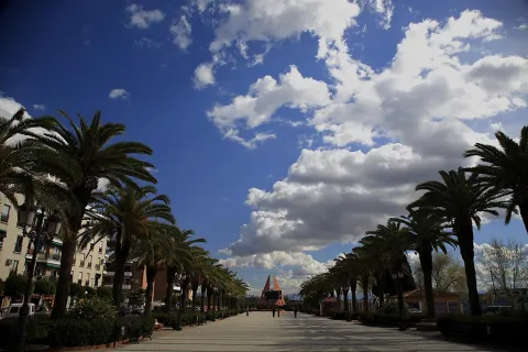
    On the walk known as "de las palmeras" we find the memorial of the Battle of Bailén, also by the artist José Antonio Rivas Fernández.

    And the visit to the Museum of the Battle of Bailén: a striking building that recreates in plant the weapon leading to the battle: the cannon. Two parallel vaults in the adjacent gardens simulate the ammunition used by this artillery weapon. In its interior, six interconnected rooms show in an amena and didactic way the beginnings, causes and consequences of the War of Independence (1808-1814).

    • Parish Church of the Incarnation.We are facing the most emblematic building of local architecture, made of red asperon stone cut into armchairs and started its construction in the 15th century following the canons of the style known as the Catholic Kings or Isabelino, corresponding to the trends marked in other Gothic churches of the province such as that of San Ildefonso de Jaén, Santiago de Andújar or La Concepción de Lopera. Romanesque, Gothic, rebirth and baroque converge in this church declared an Artistic Historical Monument on May 2, 1983. The Mausoleum with the mortal remains of General Don Francisco Castaños and Aragorri, Duke of Bailén and Marqués de Portugalete remain in this church since 1963, when he moved to Bailén from the Pantheon of Ilustrious Men in Madrid.
    • House of Culture.This 19th century house is located in whatever the Jaén Road is; one of the main entrance doors to the city. It was used as a family house since the first third of the 20th century by its owner Don Juan Gracia Alonso, mayor of Bailén at that time, who in 1971 decided to keep inside this house the facade of whatever was the Ducal Palace of the Ponce de León, as the fortress was dismounted stone to stone until it was located on the Street of Our Father Jesus.
    • Hermitage of the Holy Christ. On this occasion we find ourselves in the face of an 18th century building, which at another time did the role of school and which would later be donated by the families of Bailén, Corchado and Barreda to the co-fradry of the Santa Vera Cruz. Through a half-point arch, the cover gives us access to the temple to contemplate the most prominent element of it, the cover of a half-canyon centralized on the cruise and presbyter, with plant motifs such as decoration in which voluminous acanto leaves surround the shields, two of them supported by a few naive children.
    • Hermitage of Our Father Jesus.The street that in the past would unite whatever the Royal High and the Bajo road is known by all with its ancient name as the Cuesta of Jesus, giving greater identity to this 18th century hermitage, which initially responded to the name of the hermitage of the Holy Christ of Nazareth. As we enter the rectangle that delimits its interior, we see two different areas in a presbyter with a half-barrel vault and a quadrangular space with a half-orange dome over four half-point arches. The pechines decorated with baroque plaster next to the oval shields with the symbols of the Passion of Christ adorn the oratory.
    • La Soledad hermitage.The Gothic is reflected in the rectangular ship, segregated in four spaces by three pointed arches, all settled since the end of the XIV. Four centuries later we located the baroque-style camarina tower, where a pointed window serves as a link to the ship, from which in turn you can see that element. The altar presents to its left the access to the sacristy and to its right that of the shrimp, both of stone and intelated, discovering vegetable decorations in the vault.
    • The Hermitage of Clean and Pure.That day of 1808, he would see the Spanish troops parading at his side until they reached the place from which they would defend themselves from the French offensives. A Galo general, known as Dupré, would be killed during the fight when he attacked the Spanish army with his coraceros, so he would be buried in this oratory because of his proximity to the battlefield. It was a small, poor, rustic and encalada hermitage that had been built at the end of the 15th century and whose name would refer to the image of the Immaculate Conception that it guarded within it.
    • Sanctuary of the Virgin of Zocueca.Its building is in the year 1150, when a poor and thick hermitage for the Cross is raised by the MozArab Christians, where a small image of Mary was venerated for having protected its elders and later to them, by winning King Alfonso VII the fields of Bailen. From the end of the 19th century, and annually every last Sunday of September, the people of Bailén celebrate in this place the Romeria in honor of Our Lady the Virgin of Zocueca, patron of Bailen who would intercede in favor of this people in the contest of July 19, 1808.

    Naturaleza

    Just 5 km away. of the city of Bailén, is located Burguillo Dehesa, ideal for the use of livestock (oxen and sheep) and the wood, obtained from pruning and used to make charcoal and pigeon for the braziers. This is the place that best reflects the natural characteristics of the area.

    The Dehesa de Burguillos, next to the Rumblar River, is an ecological lung for the environment, a leisure space and an exemplary place for environmental education. It is located above the valley, in the foothills of Sierra Morena and very close to the natural park Sierra de Andújar.

    It houses a Mediterranean forest in which the oaks, acuches, retamas, jars, and a fantastic riverside forest made up of alarms, willows and strawberries predominate. And in which we can see a varied fauna: nightingale, lavender, martin fisherman, swallows... We can also observe mammals such as the chandelier, the otter, boar, foxes and rabbits. We can also detect the presence of several raptures: leonate vulture, black vulture, real eagle or common mouse.
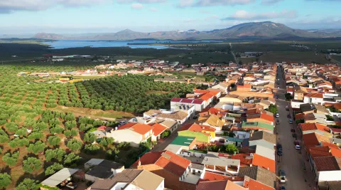
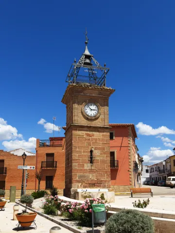
    The presence of round, eroded rocks that are named after "bowling."

    El Vivero or Parque de Eduardo Carvajal
    This park of extraordinary botanical wealth, popularly known as "El Vivero," is worked between 1893 and 1895, when Mr Eduardo Carvajal would be mayor of Bailén and from whom he has inherited his name.

    Inside you will find a wide variety of floral and arborea like the acacia of three thorns, the tree of love, rosals, American cane, cypress, alhelis, cineraria, carraspiques, sage, rosemary...

    In addition, Bailén offers different tourists hiking routes in direct contact with nature:

    • The Mill of Juan de las Vacas: for 9 kilometers by easy-to-reach trails, surrounded by oaks and jars, we will be able to admire the ruins of what was an ancient mill for the cereal while we are accompanied on our walk by a great diversity of birds.
    • The Cerro de las Trincheras: on a comfortable 5 km tour we will observe what, according to popular custom, were trenches used in the Spanish Civil War. With a little luck we'll see some sour eagle or the mud baths of the boar.
    • The Mirador de los Corrales: We increase the difficulty of the route to go from 260 to 400 meters high at a distance of just 3.5 km. As a curiosity as it is not usual, we will see on this path a tumble. Both the leonate and the black vulture will be the usual species on the itinerary, alternating with deer and bravo bulls.
    • Cerro de los Burguillos: We will have to ascend, but soon we will reach this viewpoint, as the journey has only 2 kilometres. We will get a privileged view of the Jaén olive groves, an extensive gardener and animal species such as the field rabbit or the Iberian hare.
    • River Rumblar: a pleasant walk of 6.6 km along a road that divides the dehesa into two portions and that runs in parallel to the seasonal stream of the Garnet, gives us the opportunity to contemplate numerous animal species and botanical relics until we reach the Rumblar River.
    • The Barranco of Uncle Luis: the longest of the tours with 11.2 kilometers of length, allows to make it without any effort, as it is a smooth journey to an impressive descent that offers beautiful panorama of Sierra Morena and provides the possibility to admire deer and bulls.
    Fiestas y Eventos

    The local parties of Bailén are held from July 17 to 22, the 19th being the commemorative day of the battle of Bailén. The presence of military units in the days of the battle is very prominent and traditional. (especially the Guzmán el Bueno X, in Córdoba).

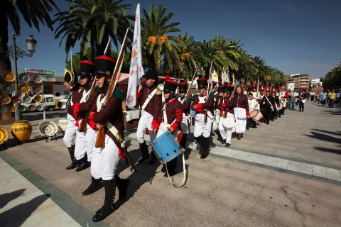
    In October, groups of Historical Recreation from all over Spain move to Bailén to rebuild the battle with uniforms and weapons of the time.

    The patron of Bailén is the Virgin of Zocueca on August 5, and the Romeria on the last Sunday of September, when they prosecute the patron to the Shrine of Zocueca, a village within the municipal term of Guarroman.

    On May 1, San José, the feast of the neighborhood is celebrated.

    Gastronomía

    The location of Bailén has contributed to the fact that for a long time it has been stopped and fused for all those who were passing through this territory, maintaining up to this day an important host tradition.

    In the traditional recipe of the dance cuisine we find the "Guiñapos," also known as "Andrajos," the "Potatoes with Caldo" or the "Popes to the Poor," all made with the oil obtained from the grinding of the olive of the Picual variety, and watered by the wines of this land.

    All year round, you can make "tapestry routes" in which to taste, accompanied by a refreshing drink, the well-known "tapas" of each of the bars, taverns and plateaus that are distributed throughout the city.

    You can also enjoy a formal meal in the city's restaurants, with traditional cuisine dishes incorporating some of them a current touch.

    Historia

    The final Iberian period belongs to the Battle between the Carthaginians of Asdrúbal and the Romans of Scipion, delivered in 208 a. C. in a place called "Baécula," which some historians have identified with Bailén.

    The origin of the present Bailén is in the foundation of the Visigodo Monastery, which according to Rus de la Puerta and Ximena Jurado, would be the origin of the castle, turning the church into a mosque, and attributing its construction to the Omaya period, between 976 and 1002.

    After the conquest of Fernando III in 1127, several are the occasions on which their lands are mentioned during the long process of the conquest of this area; thus, in the 12th century, it appears that it was donated in 1156 by Alfonso VII to be repopulated to Abdelazis de Baeza; then in 1157, it is again mentioned as a fortress not far from Baeza, to whose jurisdiction it belonged to the Alphoz of this area, appearing as one of its parishes in the relationship of 1311. Once again it appears when it was besieged in 1172, appearing on both occasions under the name of Baly; in the chronicle of the Conquista by Almería by Alfonso VII it appears under the name of Bealim, so it is likely that close to these two forms is the name used in Arabic.

    Alfonso XI sold it in 1349 to Pedro Ponce de León, lord of Marchena, for 140,000 Maravedis. In 1481 it would pass to the Montemayor, and in the 16th century it would be the family to which it will belong until the 19th century.

    The main event in his history is the Battle of July 19, 1808the first great defeat in the open field of Napoleon's troops, when the French army of General Dupont faced the Spanish troops of General Castaños. The victory led to a series of honors for Bailén, granting him the Central Supreme Board in 1809 the title "Very Noble and Leal," a distinction that Fernando VII ratified in 1813. In 1850, he received the title "City" by Elizabeth II, providing that all cities with more than 10,000 inhabitants should name "Bailén" as one of its three most important streets. Special mention is worth the Historical recreation of the Battle of Bailénwhich was first held in October 2005, an aperitif and an essay of the great celebration prepared with illusion throughout the town of the Bicentennial of the Battle of 1808.

    Loading map
    Preparing points of interest and routes...
    Imagen principal
    imagen
    Image
    bailen
    Imagen principal
    Activado

    Baeza

    Submitted by brandcode_deweloper on
    Id
    725103
    Perfil de redes sociales
    Facebook
    https://www.facebook.com/aytobaeza/
    Twitter
    https://twitter.com/AytoBaeza
    Instagram
    https://www.instagram.com/aytobaeza/
    Descripción
    Breve descripción

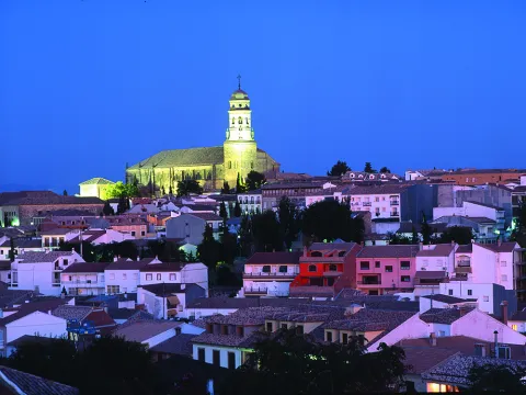
    Baeza is located in the same geographical centre of the province of Jaén, located in the region of the Loma of which its western capital is considered.

    Located near the Guadalquivir River, in a landscape of fertile land of orchards, olive groves and cereal. The absence of non-agricultural land reduces the areas of natural interest to the Guadalquivir River and the wetlands of the Lagoon Grande, of great ecological wealth and the largest in the province.

    Baeza is a city where the Renaissance is shown in all its splendor, in both civil and religious monuments: palaces and churches that alternate with white houses, portades, porticos, towers, squares and fountains.

    Its period of splendor dates back to the 16th and 17th centuries, although the city has been outstanding since remote times.

    Telecomunicaciones
    Teléfono
    953 740 150
    Sitio web
    www.baeza.net
    Correo electrónico
    sac@baeza.net
    Ubicación
    Nombre
    Baeza
    Latitud
    37.995930
    Longitud
    -3.474130
    Municipio
    Ubicación en el mapa
    POINT (-3.47413 37.99593)
    Imágenes
    imagen
    Image
    6b113f25-c234-0491-af2f-c149a865afa8?t=1603923180029
    Imagen principal
    Desactivado
    imagen
    Image
    a65f89b4-654e-e046-fdbd-d44fa6641988?t=1603922557103
    Imagen principal
    Desactivado
    imagen
    Image
    6310a5e2-e849-e7b1-582a-468d48f758f0?t=1586171131274
    Imagen principal
    Desactivado
    imagen
    Image
    1f236e61-7713-a025-2f0d-35391af76a7d?t=1603922557227
    Imagen principal
    Desactivado
    imagen
    Image
    8a202e8f-385a-5f9e-3afe-569acec987a4?t=1616522299103
    Imagen principal
    Desactivado
    imagen
    Image
    795a0c33-4ee3-408e-1c13-b816123adc64?t=1586171132490
    Imagen principal
    Desactivado
    imagen
    Image
    b6010740-bf62-6b8e-ab23-6d9f76897f5b?t=1586171132143
    Imagen principal
    Desactivado
    imagen
    Image
    750eeda9-773d-709d-2383-372d10701650?t=1586171130098
    Imagen principal
    Desactivado
    imagen
    Image
    a78c862d-3c74-cde9-6ff9-b69630560ce4?t=1586171131756
    Imagen principal
    Desactivado
    imagen
    Image
    beac10cd-9668-0c22-7db3-9966e5eda5b3?t=1586171132006
    Imagen principal
    Desactivado
    imagen
    Image
    479bc6c3-babf-eaef-7fb3-b4ad8b635e5b?t=1616522299289
    Imagen principal
    Desactivado
    imagen
    Image
    f361a4e0-b515-6e7c-a7dc-ff14c67688ec?t=1616522299347
    Imagen principal
    Desactivado
    imagen
    Image
    81e8d636-ef0d-91e5-2750-3f56d6d04808?t=1616522299408
    Imagen principal
    Desactivado
    imagen
    Image
    b1ddae0a-a5ee-4323-53d3-54bc68526d9a?t=1616522299473
    Imagen principal
    Desactivado
    imagen
    Image
    0dee5670-1fe0-cbf4-5867-9147345e2afe?t=1616521131504
    Imagen principal
    Desactivado
    imagen
    Image
    81d1e198-9d29-279e-149f-081024b27891?t=1586171130396
    Imagen principal
    Desactivado
    imagen
    Image
    39a7fbfd-9aa2-1cac-c7d3-238c006f5a28?t=1616522299547
    Imagen principal
    Desactivado
    imagen
    Image
    e016a9da-4297-fc04-4d3c-dfa579da9552?t=1586171130697
    Imagen principal
    Desactivado
    imagen
    Image
    2b452c6d-15df-a819-aa50-e54921bbd0de?t=1616522299619
    Imagen principal
    Desactivado
    imagen
    Image
    805356f8-60e7-d8f0-2e25-1edd5ebffa4d?t=1602694728132
    Imagen principal
    Desactivado
    imagen
    Image
    7172efae-cdfc-d5aa-a347-037b6d6b16aa?t=1616522299688
    Imagen principal
    Desactivado
    imagen
    Image
    36d285cc-5d64-d9a0-6e84-7ad58f539a76?t=1616522299749
    Imagen principal
    Desactivado
    imagen
    Image
    bc9f53d4-3a83-f0a9-e1da-c486d747724b?t=1616522299815
    Imagen principal
    Desactivado
    imagen
    Image
    0da7acd2-1162-bbf8-8c3d-d3a3d8140eaa?t=1603105398568
    Imagen principal
    Desactivado
    imagen
    Image
    f1c392af-765a-3f53-d9a0-c0b6b9acfb77?t=1603105767022
    Imagen principal
    Desactivado
    imagen
    Image
    2c724b20-61d7-99b1-e423-f4292a646491?t=1603106229722
    Imagen principal
    Desactivado
    imagen
    Image
    eaa9f592-f374-8747-0f22-1cadb4e98585?t=1603106434496
    Imagen principal
    Desactivado
    imagen
    Image
    02cdf257-dfc8-6b82-5816-a0ba6ba51dc1?t=1603106654931
    Imagen principal
    Desactivado
    imagen
    Image
    8791fed9-36c1-40e4-b1a6-95e267986d8d?t=1603106857711
    Imagen principal
    Desactivado
    imagen
    Image
    62bf1f22-afbd-c0da-1f93-ce52788b8636?t=1603107417445
    Imagen principal
    Desactivado
    imagen
    Image
    79f98f41-2429-b937-f94c-827a88cb386c?t=1603107482920
    Imagen principal
    Desactivado
    imagen
    Image
    086c140f-fab0-c0f1-595b-9eeda08b0616?t=1616522299958
    Imagen principal
    Desactivado
    imagen
    Image
    59d90e88-c35f-3adb-7dbd-d51422bb9b63?t=1644243699085
    Imagen principal
    Desactivado
    Información adicional
    Curiosidades

    Oficina de Turismo
    Plaza del Pópulo, s/n, 23440
    953 779 982
    otbaeza@andalucia.org

    Imágenes cabecera
    imagen
    Image
    catedral-de-baeza176-2-jpg
    Imagen principal
    Desactivado
    Datos de interés

    Tourist area: Ubeda / Baeza
    Distance to the capital (km): 48
    Altitude over sea level (m): 769
    Extension (Km2): 194
    Number of inhabitants: 16012
    Gentilicon: Baezanos
    Postal code: 23440

    Videos
    Video file
    Cultura

    To understand today's Baeza, we have to go back to the first inhabitants who settled in the place known as the Alcázar hill, in the Bronze Age, evolving to the Iberian city Viatia or Vivatia, passing to the Roman era, when Biatia was one of the most important cities.

    It would be the Muslims who made up the city's murary limits, some of which were remade in the 16th century. After the Christian conquest the epoch of splendor of Baeza begins. The new Christian Baeza begins to grow out of the world, where religious buildings are the most representative.

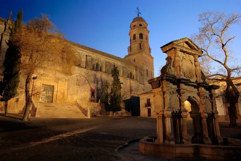
    • The Cathedral. It is the most representative building in the square. In this enclave there could have been a Roman temple, over which Muslims raise a mosque and, in 1227, under the Marian advocation of the "Nativity", the cathedralicia headquarters is erected. In the 16th century, a reform is carried out, which will be the one that prints the Vandelvirian Renaissance seal to the building. The cover was drawn in 1587 by Juan Bautista Villalpando with "relief of the Nativity of the Virgin." The base of the tower is believed to be the mosque's miner, adding in time of Vandelvira the body of the bells and the deck.
    • Church of Santa Cruz. This work dates from 13th century, of late Romanesque style and preserved after the Christian conquest. The exterior is austere, highlighting its two covers with half-point arquivolts. The interior consists of three ships.
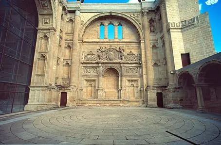
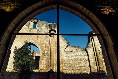
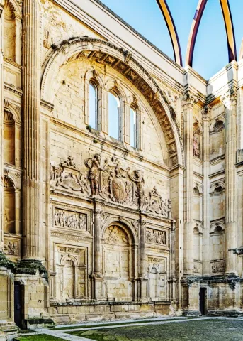
    • Ruins of the convent of San Francisco(extracamides). This work could have been one of the most important of the Andalusian Renaissance, but a number of misfortunes have prevented it, among these, the Lisbon earthquake of 1775 that brought down the vault of the major chapel. In this funeral and conventual complex, Vandelvira developed all its genius. The Latin cross church, which is accessed by a half-point arch that frames the entire cover, still remains with the relief of San Francisco and a tondo with the Virgin, which now give way to a large auditorium.
    • Old House of Correction and Prison, current City Hall(extracamides). It was built in 1520 as a prison at the request of Charles I. Since 1867 it has been home to the City Council. It is composed of the prison, with a more sober cover on which Justice and Charity are represented, and the house of the corridor with rich silver decoration. On the upper floor we find tripartite balconies with the shields of Philip II, the corridor and the city. It is topped with cornice decorated with membranes highlighted with figures. The Salon de Plenos has a Renaissance potter (horizontal and intertwined wooden ceiling) from the convent of San Antonio.
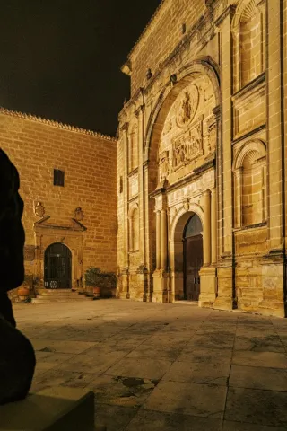
    • Church of St. Andrew. Building from the early 16th century, which held the title of a schoolgirl from 1764 to 1852. The silver-style cover, next to the square tower, stands out. The interior is a large main ship made up of arches pointed with side chapels.
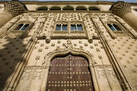
    • Jabalfifth Palace.In front of the church of Santa Cruz, the Jabalfifth palace, one of the highest exponents of the isabelin Gothic style, was built in the late 15th century. The isabelin Gothic We find it on the outside, with decoration based on diamond tips, pineapple nails, fronts, florons, ties, pinacles, mocaronas and heraldic shields. The facade it is overcome with five arches of half-point Renaissance period, as well as the courtyard of the late 16th century. Today it is the seat of the Antonio Machado International University.
    • The St. Mary's Square, Baezan monumental heart, concentrates the largest number of monuments: the cathedral, the conistorial houses, the fountain of Saint Mary; the seminary of St. Philip Neri, with its picturesque facade plagued with cheers, current headquarters of the International University of Andalusia or the house-palace of Rubin de Ceballos, behind the cathedral.
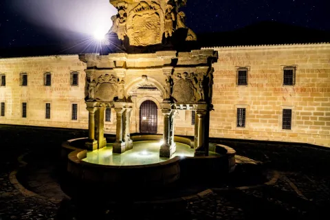
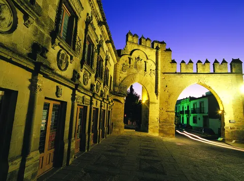
    • The Populo Square, framed by the door of Jaén and the arch of Villalar, is one of the most emblematic squares of the city, where we find the plateresque cover building of the old Escribanías, today the headquarters of the tourist office of the Junta de Andalucía, the old Carnicerías and the source of the Lions in the center.
       
    Naturaleza

    Baeza is located in a dominant place in the region of the Loma and on the right bank of the Guadalquivir River. The city is located on three hills and the small valley that remain in the middle, in a rather high position over the Guadalquivir valley, a situation conducive to being a very important square in ancient times. It is surrounded by the Guadalquivir rivers to the south and Guadalimar to the north.

    A site that as we walk through the walls allows us to contemplate the immense sea of olive trees that is presented to us all around us. From the sights of this walk, you can see the beautiful picture of the Guadalquivir valley, the extensive olive trees, the Cazorla saw, the Segura and Sierra Mágina saw, with the villages of Jimena, Mancha Real, Bedmar and Garciez in the distance.

    The predominant vegetation is the olive tree, but next to the river and the lagoon Grande we find what we call the gallery forest: white, mimberas, tarais, black, and other species of bushes. A vegetation that with the change of the seasons draw a color brush in the landscape, especially in the autumn season.

    The fauna of the town is the one of the Jienese countryside: hares, rabbits, deer, foxes, parrots, quail... They are also easy to see the storks and a wide variety of prey birds. Without forgetting the fauna that lives next to the river line and in the vicinity of the lagoon Grande.

    The absence of non-agricultural land reduces areas of natural interest to the river margins and to the wetlands of the Great Lagoon with a special ecological interest.

    • Laguna Grande: This permanent lagoon that suffers significant level fluctuations, is fed from the Torres River through irrigation channels. Precisely for maintaining water during summers, this wetland is particularly important for waterbirds, it is an ideal place for food and shelter. Around the water, in addition to the vegetation of carrizos, spadañas and juncos stands out the presence of tarajes, alamos, fresnos and zarzas, where there is plenty of the visitor and I shelter the fauna of the place, among which we can mention: common fence, real anade or common porron, highlighting the fly bird, where we can see the nests of this small bird, hanging from the trees of this natural place. The locals of both the Bishop's Bridge and Baeza are willing to visit this beautiful natural site.


    Fiestas y Eventos

    Among the parties with the most roots among the neighbors of Baeza, we highlight:

    • La Candelariaon February 2. On the eve of the feast of the Holy One celebrates the Candelaria, typical of the blessing of the donuts of Saint Blas, protector of the throat, in the parish of El Salvador.
    • Holy Week. Between Andalusian and Spanish, the Holy Week of Baeza, declared of National Tourist Interest, stands out for the artistic richness of its steps. About 20 cofradies process through its streets and squares, in this jewel of the Andalusian Renaissance. Its creation dates back to the 16th century, when the co-fradia of the Vera Cruz, one of the oldest in Andalusia and Spain, emerged. One of the most beautiful moments of Baezan Holy Week, occurs on the morning of Good Friday, with the departure of the fellowship of Our Father Jesus Nazarene and the Cross of St. Helena, better known by the name "El Paso"; when the Nazarene Christ gives the blessing to his mother, through an articulated mechanism, when the images are crossed.
    • May CrossesMay 1. In different plazoletas and neighborhoods of the old town, altars are covered with the only theme of the exaltation of the Holy Cross.
    • Annual city fair. It is celebrated on August 15, the feast of its patron saint, Santa María del Alcázar.
    • Romeria de la Yedra. It is celebrated around the feast of the Nativity of the Virgin (8 September).
    • The Yedra, a pastry of Baeza, located 7 km. to the north of this, and where there is the Marian sanctuary of Our Lady of the Rosel and the Holy Christ of the Yedra. The Romeria itself is celebrated on Saturday day 7, the day when the Virgin travels through the city of Baeza and goes back to her shrine of La Yedra, accompanied by horses, carriages, reels and carrots, all covered with flowers.
    • Corpus Christi. With reminiscent of the 15th and 16th centuries. Procedural custody is certainly the goldsmiths of the city.

    The annual calendar of celebrations is completed with the festivities of San Isidro Labrador, the pattern of farmers, Saint Christopher, pattern of the driving industry,Our Lady of Carmen and Council parties of Baeza in honor of San Andrés.


    Gastronomía

    The gastronomic culture is based on its history and geography. In many of its dishes you can find cultivated influences of Roman, Jewish, Islamic, Moorish and Mudejar cuisine.

    The traditional cuisine is merged with the seasons and with the festivities, as well as the basic raw materials of the earth and all irrigated with the liquid gold of the olive fields of Baeza.

    Among the indigenous dishes are:

    • The orza loin. It is a typical dish of the slaughter, which is used as a preservative, frying the fresh back on a slow heat in its own butter to which different spices, nails, cinnamon, pepper... are added... and then introduced into the orza. It is also done with the chorizos of the slaughter and thus are preserved all winter.
    • Cod to the baezan. In a saffrito of onion, tomato, peas and roasted peppers made from strips, you will add the already fried cod.
    • Pipirrana. In which peppers, tomatoes, garlic, onions and olive oil are used. A refreshing dish that can't be missed in summer.
    • Andrajos. Red pepper, green pepper, onion, garlic, laurel, olive oil, pepper, white wine, vegetables and hare or rabbit. All flavoured with peppermint. For the dough, flour and water.
    • "Sick-cooked"or" dizzy chickpeas, "a dish that tries to take advantage of the remains of another meal. In a pan with oil we chopped onion and added the chickpeas, which when mixed with the spoon are broken. It is added fried tomato and eggs that are mixed and cut.
    • "Eyes." or "Masoil". It consists of a bread of extra virgin oil, pepper and anise. The name comes from being the eighth part of the mass of a bread.

    Warehouse:

    • Virolos, typical pebbles.
    • Butter cakes with nuts.
    • Torrijas, a way to take advantage of the bread left over.
    • Fried milk: It's about bounced and fried milk.
    • Papajotes, It's a frying pan. A mass of fried flour and bounced with sugar and cinnamon.
    • Oil ice cream, with milk, sugar, egg yolks and oil ingredients.


    Historia

    Atalaya over the Guadalquivir valley, its alcázar assured the Spanish rear in the constant threat of the Islamic kingdoms located to the west and south of Guadalquivir.

    Baeza is now known for its olive production, its abundant monumental legacy (declared World Heritage by Unesco in 2003) and for hosting the International University of Andalusia.

    Its main economic activity is agriculture, linked to the olive and the olive industry, although monumental tourism has developed the activity of the hotel.

    Its churches, palaces and towers are a monumental set in which the different architectural styles take place, although the Renaissance and the Gothic isabelin are of particular importance. From its rich architectural heritage, it stands out the cathedral (16th century), the church of Santa Cruz (13th century), the convent of San Francisco, the City Hall and the church of San Andrés, all of the 16th century.

    In short, the historic centre of Baeza is one of the most important monumental ensembles of the world renaissance.


    Culture

    To understand today's Baeza, we have to go back to the first inhabitants who settled in the place known as the Alcázar hill, in the Bronze Age, evolving to the Iberian city Viatia or Vivatia, passing to the Roman era, when Biatia was one of the most important cities.

    It would be the Muslims who made up the city's murary limits, some of which were remade in the 16th century. After the Christian conquest the epoch of splendor of Baeza begins. The new Christian Baeza begins to grow out of the world, where religious buildings are the most representative.

    • The Cathedral. It is the most representative building in the square. In this enclave there could have been a Roman temple, over which Muslims raise a mosque and, in 1227, under the Marian advocation of the "Nativity", the cathedralicia headquarters is erected. In the 16th century, a reform is carried out, which will be the one that prints the Vandelvirian Renaissance seal to the building. The cover was drawn in 1587 by Juan Bautista Villalpando with "relief of the Nativity of the Virgin." The base of the tower is believed to be the mosque's miner, adding in time of Vandelvira the body of the bells and the deck.
    • Church of Santa Cruz. This work dates from 13th century, of late Romanesque style and preserved after the Christian conquest. The exterior is austere, highlighting its two covers with half-point arquivolts. The interior consists of three ships.
    • Ruins of the convent of San Francisco(extracamides). This work could have been one of the most important of the Andalusian Renaissance, but a number of misfortunes have prevented it, among these, the Lisbon earthquake of 1775 that brought down the vault of the major chapel. In this funeral and conventual complex, Vandelvira developed all its genius. The Latin cross church, which is accessed by a half-point arch that frames the entire cover, still remains with the relief of San Francisco and a tondo with the Virgin, which now give way to a large auditorium.
    • Old House of Correction and Prison, current City Hall(extracamides). It was built in 1520 as a prison at the request of Charles I. Since 1867 it has been home to the City Council. It is composed of the prison, with a more sober cover on which Justice and Charity are represented, and the house of the corridor with rich silver decoration. On the upper floor we find tripartite balconies with the shields of Philip II, the corridor and the city. It is topped with cornice decorated with membranes highlighted with figures. The Salon de Plenos has a Renaissance potter (horizontal and intertwined wooden ceiling) from the convent of San Antonio.
    • Church of St. Andrew. Building from the early 16th century, which held the title of a schoolgirl from 1764 to 1852. The silver-style cover, next to the square tower, stands out. The interior is a large main ship made up of arches pointed with side chapels.
    • Jabalfifth Palace.In front of the church of Santa Cruz, the Jabalfifth palace, one of the highest exponents of the isabelin Gothic style, was built in the late 15th century. The isabelin Gothic We find it on the outside, with decoration based on diamond tips, pineapple nails, fronts, florons, ties, pinacles, mocaronas and heraldic shields. The facade it is overcome with five arches of half-point Renaissance period, as well as the courtyard of the late 16th century. Today it is the seat of the Antonio Machado International University.
    • The St. Mary's Square, Baezan monumental heart, concentrates the largest number of monuments: the cathedral, the conistorial houses, the fountain of Saint Mary; the seminary of St. Philip Neri, with its picturesque facade plagued with cheers, current headquarters of the International University of Andalusia or the house-palace of Rubin de Ceballos, behind the cathedral.
    • The Populo Square, framed by the door of Jaén and the arch of Villalar, is one of the most emblematic squares of the city, where we find the plateresque cover building of the old Escribanías, today the headquarters of the tourist office of the Junta de Andalucía, the old Carnicerías and the source of the Lions in the center.
       

    Nature

    Baeza is located in a dominant place in the region of the Loma and on the right bank of the Guadalquivir River. The city is located on three hills and the small valley that remain in the middle, in a rather high position over the Guadalquivir valley, a situation conducive to being a very important square in ancient times. It is surrounded by the Guadalquivir rivers to the south and Guadalimar to the north.

    A site that as we walk through the walls allows us to contemplate the immense sea of olive trees that is presented to us all around us. From the sights of this walk, you can see the beautiful picture of the Guadalquivir valley, the extensive olive trees, the Cazorla saw, the Segura and Sierra Mágina saw, with the villages of Jimena, Mancha Real, Bedmar and Garciez in the distance.

    The predominant vegetation is the olive tree, but next to the river and the lagoon Grande we find what we call the gallery forest: white, mimberas, tarais, black, and other species of bushes. A vegetation that with the change of the seasons draw a color brush in the landscape, especially in the autumn season.

    The fauna of the town is the one of the Jienese countryside: hares, rabbits, deer, foxes, parrots, quail... They are also easy to see the storks and a wide variety of prey birds. Without forgetting the fauna that lives next to the river line and in the vicinity of the lagoon Grande.

    The absence of non-agricultural land reduces areas of natural interest to the river margins and to the wetlands of the Great Lagoon with a special ecological interest.

    • Laguna Grande: This permanent lagoon that suffers significant level fluctuations, is fed from the Torres River through irrigation channels. Precisely for maintaining water during summers, this wetland is particularly important for waterbirds, it is an ideal place for food and shelter. Around the water, in addition to the vegetation of carrizos, spadañas and juncos stands out the presence of tarajes, alamos, fresnos and zarzas, where there is plenty of the visitor and I shelter the fauna of the place, among which we can mention: common fence, real anade or common porron, highlighting the fly bird, where we can see the nests of this small bird, hanging from the trees of this natural place. The locals of both the Bishop's Bridge and Baeza are willing to visit this beautiful natural site.


    Celebrations and Events

    Among the parties with the most roots among the neighbors of Baeza, we highlight:

    • La Candelariaon February 2. On the eve of the feast of the Holy One celebrates the Candelaria, typical of the blessing of the donuts of Saint Blas, protector of the throat, in the parish of El Salvador.
    • Holy Week. Between Andalusian and Spanish, the Holy Week of Baeza, declared of National Tourist Interest, stands out for the artistic richness of its steps. About 20 cofradies process through its streets and squares, in this jewel of the Andalusian Renaissance. Its creation dates back to the 16th century, when the co-fradia of the Vera Cruz, one of the oldest in Andalusia and Spain, emerged. One of the most beautiful moments of Baezan Holy Week, occurs on the morning of Good Friday, with the departure of the fellowship of Our Father Jesus Nazarene and the Cross of St. Helena, better known by the name "El Paso"; when the Nazarene Christ gives the blessing to his mother, through an articulated mechanism, when the images are crossed.
    • May CrossesMay 1. In different plazoletas and neighborhoods of the old town, altars are covered with the only theme of the exaltation of the Holy Cross.
    • Annual city fair. It is celebrated on August 15, the feast of its patron saint, Santa María del Alcázar.
    • Romeria de la Yedra. It is celebrated around the feast of the Nativity of the Virgin (8 September).
    • The Yedra, a pastry of Baeza, located 7 km. to the north of this, and where there is the Marian sanctuary of Our Lady of the Rosel and the Holy Christ of the Yedra. The Romeria itself is celebrated on Saturday day 7, the day when the Virgin travels through the city of Baeza and goes back to her shrine of La Yedra, accompanied by horses, carriages, reels and carrots, all covered with flowers.
    • Corpus Christi. With reminiscent of the 15th and 16th centuries. Procedural custody is certainly the goldsmiths of the city.

    The annual calendar of celebrations is completed with the festivities of San Isidro Labrador, the pattern of farmers, Saint Christopher, pattern of the driving industry,Our Lady of Carmen and Council parties of Baeza in honor of San Andrés.


    Gastronomy

    The gastronomic culture is based on its history and geography. In many of its dishes you can find cultivated influences of Roman, Jewish, Islamic, Moorish and Mudejar cuisine.

    The traditional cuisine is merged with the seasons and with the festivities, as well as the basic raw materials of the earth and all irrigated with the liquid gold of the olive fields of Baeza.

    Among the indigenous dishes are:

    • The orza loin. It is a typical dish of the slaughter, which is used as a preservative, frying the fresh back on a slow heat in its own butter to which different spices, nails, cinnamon, pepper... are added... and then introduced into the orza. It is also done with the chorizos of the slaughter and thus are preserved all winter.
    • Cod to the baezan. In a saffrito of onion, tomato, peas and roasted peppers made from strips, you will add the already fried cod.
    • Pipirrana. In which peppers, tomatoes, garlic, onions and olive oil are used. A refreshing dish that can't be missed in summer.
    • Andrajos. Red pepper, green pepper, onion, garlic, laurel, olive oil, pepper, white wine, vegetables and hare or rabbit. All flavoured with peppermint. For the dough, flour and water.
    • "Sick-cooked"or" dizzy chickpeas, "a dish that tries to take advantage of the remains of another meal. In a pan with oil we chopped onion and added the chickpeas, which when mixed with the spoon are broken. It is added fried tomato and eggs that are mixed and cut.
    • "Eyes." or "Masoil". It consists of a bread of extra virgin oil, pepper and anise. The name comes from being the eighth part of the mass of a bread.

    Warehouse:

    • Virolos, typical pebbles.
    • Butter cakes with nuts.
    • Torrijas, a way to take advantage of the bread left over.
    • Fried milk: It's about bounced and fried milk.
    • Papajotes, It's a frying pan. A mass of fried flour and bounced with sugar and cinnamon.
    • Oil ice cream, with milk, sugar, egg yolks and oil ingredients.


    History

    It's in the Copper age, 3rd millennium BC, when they appear the first villages. Most of them were walled and their economy was based on agriculture and livestock.

    In the Iberian period, 7th century BC, the hill of the Alcázar is considered a consolidated town.

    During the 2nd and 1st centuries BC, in full Roman Empire, appears in several sources as Vivatia or Biatia. It acquires great importance due to its location, as it is a mandatory step on the commercial route Catulo - Málaga.

    The territory of Biatia would be occupied in the second decade of the eighth century by Muslim troops. This time the city is known as Bayyasa.

    Christian kings will take the city and lose it again on several occasions. But it will be Fernando III "the Holy One" who finally conquered it in 1227, and considered it as a bridge head in the reconquest of Al-Andalus, for this reason it is given to the city of privileges and a court, the "Fuero de Cuenca."

    The presence of the Catholic Church is restored, establishing in Baeza the episcopal seat in the 13th century. From this date on, the most important religious and conventual orders were present in the city.

    It will be in the 16th century when Baeza reaches its maximum architectural splendor with the foundation of the University, among other public buildings of interest. The apogee will continue in the 17th century, is the century of the greatest conventional apogee.

    The 18th century will be of decline. With the war of Baeza Independence, he suffers considerable human and economic losses. Excessive demands and contributions would also help. The deamortization of Mendizábal, which brought the disappearance of the convents, was very remarkable.

    The mainly agricultural economy, increases production and increases the area dedicated to olive trees to the detriment of other arable crops.

    In 1966Baeza was declared "Historical-Artistic Set", which was a take-off in tourism services, increased by the Declaration in 2003 by UNESCO, in Baeza as World Heritage.

    University tradition is recovering with headquarters Antonio Machado of the International University of Andalusia.
     

    Otra información

    Other monuments that form part of their heritage are:

    • Old college.
    • Old Seminary of San Felipe Neri.
    • Casa Estudio de Manuel Garrido.
    • Museum of Baeza.
    • Casa-studio Diego Lozano, Father Sifon.
    • Antonio Moreno Museum.
    • Museum of the Olivo Culture.
    • Old Carniceries.
    • Civil Audience and Public Writings 16th Century.
    • Gaspar Becerra Exhibition Room.
    • Church of El Salvador
    • Church of St. Paul
    • Forgiveness door and streets adjacent to the Cathedral.
       
    Loading map
    Preparing points of interest and routes...
    Imagen principal
    imagen
    Image
    c1150e7f-a3ee-92c6-f4dd-7d7b9b44728d?t=1603979507918
    Imagen principal
    Activado
    Literatura

    The city has had a great influence on distinguished authors such as Antonio Machado and Federico García Lorca, who had a momentous meeting here.

    Not forgetting the important presence of San Juan de la Cruz in Baeza and the family ties linking Jorge Manrique to this town.

    Arroyo del Ojanco

    Submitted by brandcode_deweloper on
    Id
    12460917
    Perfil de redes sociales
    Facebook
    https://www.facebook.com/Ayuntamiento-Arroyo-del-Ojanco-925593310834653/
    Descripción
    Breve descripción

    Arroyo del Ojanco (Jaén) is surrounded by a sea of olive trees, and located in an immense plain is the best located municipality of the Sierra de Segura region by its strategic enclave of the N-322, which crosses its urban centre. The people and services have been growing in this important way of communication.

    It is the magical point that unites Andalusia and Levant from the Antiquity, a cross of roads and a cross of cultures. Arroyo del Ojanco, a serrano municipality, welcoming, dynamic, entrepreneurial and cultural with little more than a lustro of life as independent (constituted in 2001). I presume to be the youngest municipality in the province and certainly one of those facing the future with the greatest optimism.

    Telecomunicaciones
    Teléfono
    953 420 002
    Sitio web
    www.arroyodelojanco.es
    Fax
    953 420 645
    Correo electrónico
    municipiotest@innopulse.es
    Ubicación
    Nombre
    Arroyo del Ojanco
    Latitud
    38.320700
    Longitud
    -2.895200
    Distrito
    Municipio
    Ubicación en el mapa
    POINT (-2.8952 38.3207)
    Imágenes
    imagen
    Image
    ayuntamiento-jpg
    Imagen principal
    Desactivado
    imagen
    Image
    centro_interpretacion-jpg
    Imagen principal
    Desactivado
    imagen
    Image
    embalse-jpg
    Imagen principal
    Desactivado
    imagen
    Image
    olivo-centenario-fuentebuena-jpg
    Imagen principal
    Desactivado
    imagen
    Image
    retablo_iglesia-jpg
    Imagen principal
    Desactivado
    Información adicional
    Imágenes cabecera
    imagen
    Image
    arroyo del ojanco
    Imagen principal
    Desactivado
    Datos de interés

    Distance to the capital (km): 125
    Altitude over sea level (m): 540
    Extension (Km2): 63
    Number of inhabitants: 2,550
    Gentilicon: Arroyense
    Postal code: 23340

    Videos
    Video file
    Naturaleza

    The cultivation of the olive tree overwhelmingly occupies almost all of its municipal territory. High quality oils are obtained, protected by the designation of origin Sierra de Segura. Among the olive trees are natural jewels such as the Olivo de Fuentebuena, a millennial tree erected as a symbol of the municipality.

    The Guadalmena and Guadalimar rivers extend their municipal term, giving away a landscape of Vega to the Guadalimar, with its characteristics of plain and hydrographic wealth that is part of the orographic set of the Sierra de Segura. Near the municipality, in the direction of Puente de Génave, is the reservoir of Guadalmena, the third large swamp of the province.

    The urban fabric of this municipality, before the Sierra de Segura, was formed at the beginning of the last century, by the febrile activity that caused the construction of the Baeza- Utiel railway. Its streets are elongated and its layout completely flat.

    Historia

    Although Arroyo del Ojanco is a newly founded town - its current population core dates back to the end of the XXth century - there have always been villages from the oldest age living in its area of influence. In fact, there are remains of the Stone and Iberian Age in the surroundings, but the most important are those of the Roman villa of Los Baños.

    With the arrival of the Arabs this one disappeared, with towers left on both sides of the stream of this name. During the 19th century, he was called in different ways and also with the "Sales" appeal, as well as Arroyo de los Ancos. Even in the early 20th century it is sometimes named as the Sales of the Camposina, at the same time as Arroyo del Ojanco.

    From 1950 onwards the segregationist movement of Beas de Segura began, to which it has been united until 2001.

    Otra información

    Villa Romana de Los Baños
    The Cortijo de Los Baños is the place where a great Roman villa is located. This site, located on the occasion of an olive plantation, was the subject of an emergency excavation whose results demonstrated the existence of other cultural horizons, between the Calcolitic and the Old Bronze, although the most significant is the one corresponding to a Roman, low-imperial villa dedicated to agricultural exploitation.

    The development of the villa begins around the second half of the 1st century of our era to judge by the existence of some Roman ceramics of the type terra sigillata. From this time dates a brick structure from which remains are barely preserved.

    A restructuring was then carried out with the construction of new buildings and new pavements. Finally, a third phase from the historical point of view is the one called Baños III, bajoimperial, which is extended until the fourth century, and to which correspond the structures of a large villa with extraordinary mosaics corresponding to the area of a marked agricultural settlement.

    The site is currently protected by a cover of land deposited after emergency excavations.

    Church of the Immaculate Conception
    It is a temple of the early last century, though restored in the mid-1950s. On the main altar are the two patrons of the village, San Francisco and La Immaculada and, on a side, a size of the Holy Family. It has a ceramic altarpiece with the image of The Immaculate.

    Fuentebuena olive
    The millennial olive tree of Fuentebuena is one of the symbols of Arroyo del Ojanco. This is a privileged vestige that has resisted so many generations between corns and bandages, between ice of raw winters and summers of extenuating dryness. What characterizes this great tree are its dimensions, as it reaches 10 meters high and its trunk exceeds four meters of perimeter, from the base to the cross, after which it is fork in two thick branches whose contours are 2.10 and 2.80 meters. Its size is 260 cubic meters.

    The weight of its numerous ramifications and the high olive production it throws in a normal campaign, force its dense foliage to rest on the ground at many ends of its cup. To access the Fuentebuena olive, you have to go from the urban core of Arroyo del Ojanco to the local road JV-7.005 towards Beas de Segura. As you pass the crossing of Prados de Armijo, the olive tree is about 50 metres from the road.

    Among the legends that have been forged around this tree, the one that claims that it was planted by a few begging friars after the Reconquist, ensuring that the olive oil for the Holy Ones was not lacking. Others believe that he was born of a blessed branch on the day of Palm Sunday and planted the next, Easter Monday, an uncertain year.

    Loading map
    Preparing points of interest and routes...
    Imagen principal
    imagen
    Image
    arroyo del ojanco
    Imagen principal
    Activado

    Arquillos

    Submitted by brandcode_deweloper on
    Id
    723845
    Perfil de redes sociales
    Facebook
    https://es-es.facebook.com/AytodeArquillos/
    Descripción
    Breve descripción

    A population located at the foot of Sierra Morena, next to the Embalse de Guadalén, in a landscape of olive-populated lomas.

    It is a small municipality founded by Carlos III in the 18th century and located to the south-west of the region of El Condado, where the areas of cultivation, in which the olive grove dominates, are alternated with those of pastures and dehesas dedicated to livestock and small hunting. The saw area has natural areas of interest, especially those located next to the Guadalén reservoir, where you can also practice the fishing of cyprinids.

    Among its historical-artistic heritage is the Church of the Immaculate Conception, which was built in 1769 following the model implanted in the rest of the temples of colonization. It has a simple neoclassical façade on which an angry swordsman is placed in two bodies. The Clock Tower, on the other hand, was built in the 18th century and arouses great interest among visitors.

    Telecomunicaciones
    Teléfono
    953 633 000
    Sitio web
    www.arquillos.es
    Fax
    953 633 236
    Correo electrónico
    ayuntamiento@arquillos.es
    Ubicación
    Nombre
    Arquillos
    Latitud
    38.181380
    Longitud
    -3.426740
    Distrito
    Municipio
    Ubicación en el mapa
    POINT (-3.42674 38.18138)
    Imágenes
    imagen
    Image
    10fac7d9-62a1-494b-da97-8e0657c1409a?t=1610982640405
    Imagen principal
    Desactivado
    imagen
    Image
    0f5047a5-8e97-e36e-34dc-3b8e7ec31734?t=1610982640455
    Imagen principal
    Desactivado
    imagen
    Image
    e5509d24-0416-c2a7-50ed-d81b3bc0d5b4?t=1610982640586
    Imagen principal
    Desactivado
    imagen
    Image
    a290ffb0-6531-820d-6b6a-ab40ab774828?t=1610982640982
    Imagen principal
    Desactivado
    imagen
    Image
    bb41bdbe-3148-4978-145c-419a687936ec?t=1610982641174
    Imagen principal
    Desactivado
    imagen
    Image
    b2718552-ae04-8c00-1195-a35e929cd700?t=1610982641311
    Imagen principal
    Desactivado
    imagen
    Image
    ac98228f-2488-787d-db70-e97367bff288?t=1603734785201
    Imagen principal
    Desactivado
    Información adicional
    Imágenes cabecera
    imagen
    Image
    arquillos
    Imagen principal
    Desactivado
    Datos de interés

    Tourist area: Sierra Morena / Sierras de Andújar and Despeñacolos
    Distance to the capital (km): 83
    Altitude over sea level (m): 378
    Extension (Km2): 65
    Number of inhabitants: 1767
    Gentillo: Articuleros
    Postal code: 23230

    Videos
    Video file
    Historia

    Although the birth of this municipality is linked to the Sierra Morena colonization project, launched by Charles III in the 18th century, this foundation was made on another settlement of remote origins. The oldest documents in which the town of Arquillos is mentioned date from 1254, in which Alfonso X the Sage gives the village to Baeza for protection and defence. On another document, in which the king grants Ubeda the villages of Cabra and Santiesteban, and indicates that he had taken Arquillos to this city to deliver it to Baeza, it follows that the village would have at least one Islamic origin. In the 13th century it was occupied by Fernando III and handed over to the Council of Ubeda.

    The belonging to the Arcipregamiento de Baeza still attests to the Ximena Jurado in its 1852 Anals. Arquillos, located on the county gate, forced passage on the roads from Granada to Cuenca and Valencia to Sevilla, met from ancient times the conditions for the settlement of a population based on agricultural and livestock development. For the same reason it is not surprising that he was chosen by the superintendent Pablo de Olavide for the location of one of the colonisation cores, whom he had the desire to call Campomia, although he did not finally succeed.

    This project of colonization of Sierra Morena in the 18th century was a great urbanizing company that saw the creation of forty-four towns and eleven cities in Yermos places of the Parrilla and Sierra Morena. It was intended to both populate and plant semi-desertic areas, and to make the journey Cadiz- Madrid for travellers and goods safer.

    The territory was ordered according to a preconceived plan and the new villages and villages were designed a priori following the classicist patterns that prevailed at the time. One of the places that have best maintained this urbanism is Arquillos, a route in damer, governed by principles of symmetry, uniformity and order, with a varied set of squares and with the civic and religious center on the western edge, next to the crossing of roads. Arquillos was a long time dependent on Santiesteban from the Port until, in 1833, Queen Elizabeth II granted her independence for having given, ten years earlier, to General Riego, a symbol of revolutionary liberalism, refugee there in the last insurrection.

    Otra información

    Clock Tower

    The tower is square and starts from a zocalo. The whole factory is a bartender. Of its two bodies, the first has twice its height and in it is opened a half-point arch with pillows. On this door a flask window opens that gives light to its interior and is repeated on the other three sides. A triple molding separates the first from the second body, in which the clock appears, a small square window and docile pilasters at the ends. On the ledge there is an artisan iron structure, added in 1884 to house the bell and the veleta. In the 18th century the hours were marked by the bells of the churches. To raise a municipal tower with the sole function of indicating the hours was unusual at the time and symbolizes the confrontation between the civil and ecclesiastical powers that stars the reign of Charles III.

    Church of the Immaculate Conception

    Built in 1769, it has a typical facade of the 18th century colonized villages. It has a simple neoclassical front-crowned cover that maximizes its straight lines. On it is raised an angry swordsman that has the particularity of articulating in two bodies: on the bottom two twin holes are opened to blow up bells, while the upper body, with a single bell hole, is losing thickness to culminate in a triangular front that, in turn, hosts a tiny bell.

    Loading map
    Preparing points of interest and routes...
    Imagen principal
    imagen
    Image
    arquillos
    Imagen principal
    Activado

    Arjona

    Submitted by brandcode_deweloper on
    Id
    723497
    Perfil de redes sociales
    Facebook
    https://www.facebook.com/AytoArjona/?ref=hl
    Twitter
    https://twitter.com/AytoArjona
    Descripción
    Breve descripción

    Arjona is a municipality located in the north-west of the province, 44 km. of the capital and belongs to the region of the countryside of Jaén. It has a population of 6,000 and its municipality has an area of 158, 45 km ².

    It is an eminently agricultural town with a predominance of olive cultivation. Its economy is based on agricultural activity and the olive industry, although the furniture and pastry industry has a recognized prestige and tradition.

    Minor hunting is another of its attractions and the banks of the Salado stream make up areas of natural interest.

    In its historical-artistic heritage is the Sanctuary of the Reliquias, designed by Juan de Aranda Salazar in the 17th century; the church of Santa María, from the 15th century and of an isabelin style, built on the remains of a medieval castle of which a aljibe is preserved, included in the Route of the Castles and the Batallas.

    Other buildings are: the church of Carmen, from which stands out its Mudejar tower and the church of San Martín and San Juan with a plateresque cover.

    Telecomunicaciones
    Teléfono
    953 523 325
    Sitio web
    www.arjona.es
    Fax
    953 523 641
    Correo electrónico
    consistorio@ayto-arjona.com
    Ubicación
    Nombre
    Arjona
    Latitud
    37.935590
    Longitud
    -4.054460
    Distrito
    Municipio
    Ubicación en el mapa
    POINT (-4.05446 37.93559)
    Imágenes
    imagen
    Image
    14c228fb-4685-0007-ab13-56b94d334c04?t=1585584681223
    Imagen principal
    Desactivado
    imagen
    Image
    5bfca9c9-f954-26af-ee99-4eaafdaff3da?t=1616519266775
    Imagen principal
    Desactivado
    imagen
    Image
    ebbdbbbb-4195-e5cf-7332-98a1d7deea28?t=1585584680906
    Imagen principal
    Desactivado
    imagen
    Image
    a991b45b-b46e-144c-a1a0-6f8db1f98f41?t=1585584680776
    Imagen principal
    Desactivado
    imagen
    Image
    85d5220c-799b-d2ce-fce5-36f886b68605?t=1616519266819
    Imagen principal
    Desactivado
    imagen
    Image
    506fd5fd-463b-1599-e49f-303e3c4dbadb?t=1602871305320
    Imagen principal
    Desactivado
    Información adicional
    Imágenes cabecera
    imagen
    Image
    a575386f-120b-ebd2-537c-d68fb2875bba?t=1606405208504
    Imagen principal
    Desactivado
    Datos de interés

    Tourist area: Sierra Morena / Sierras de Andújar and Despeñacolos

    Distance to the capital (km): 44

    Altitude over sea level (m): 458

    Extension (Km2): 158

    Number of inhabitants: 5826

    Gentillo: Arjoneros or Urgavonenses

    Postal code: 23760

    Videos
    Video file
    Cultura

    From its abundant and rich monumental heritage, we highlight:


    • Aljibe Almohade. It is built on the 13th century, work of the pillows and is the oldest building that is preserved in Arjona. It is in the noble area of the ancient alcaza of Aryuna, under what could be the Major Mosque. It is rectangular with 3 canyon vaults, supported on half-point arches that rise on Roman alabaster baseswhich supported Roman sculptures.
    • Church of Santa Maria del Alcázar. It is an isabelin-style temple (16th century) with a single ship and short-arms cruise. Located on a sacred place since ancient times (Roman remains, Visigoths and Muslims), it was built on the remains of the primitive Arab mosque. The church custody since 1843 the images of the patrons of the town: San Bonoso and San Maximiano, next to that of Santa Maria del Alcázar, who was also a patron of the city.
    • Sanctuary of the Saints and the Sagrada Reliquias. The sanctuary was erected during the bishopric of Moscoso and Sandoval to guard the alleged remains of the martyred saints Bonoso and Maximilian, found in this villa in the early 17th century, as well as the remains of more than 3,000 martyrs of the first Christians during the Roman era. He rose between 1617 and 1619 with stone from Santiago de Calatrava and, as John of Aranda and Salazar planned, who also worked in the cathedral of Jaén, two churches were overtaken. At the bottom a camera was billed to be seen from the outside, as a crypt, with access to the cemetery of the Saints. It has a polychrome plaster altarpiece, baroque decoration, which was not finished until the mid-19th century, tombstones with the stories of the martyrs and a silver cover. The upper part has its entrance from the Plaza de Santa María, by a cover of 1659, and its plant is of a single ship covered with canyon vault with lunetes and architrabed pilasters that hold half-point arches. The upper floor was intended to house the stone images of San Bonoso and San Maximiano, which were never placed. In the year 1843, with the Decriminalization of Mendizábal, the images are moved to the church of Santa Maria, and the relics of the martyrs to the upper floor. The lower floor is not functional. This space currently houses the Religious Museum of the parishes of Arjona, where much of the heritage of the fellowship, as well as ancient drawings and photographs are displayed.
    • Church of St. John the Baptist. Building that began to be built in the 16th century, although it was destroyed in the Civil War. His reconstruction was in the hands of Devastated regions which quite changed the plant, adding a more framed crunch over two towers. The inside is of a neo-Gothic style with a three-ship plant separated by pointed arches. Of its primitive construction only remains a cover, of silver style, which gives access to the interior of the temple that was carved by Juan Marquina in 1531. Next to imagining should be noted the sacred made thanks to the donations of gold and silver delivered by the parishioners in donations around 1950. Under the temple of St. John is the Rhipta del Baron de Velasco, covered by a dome made up of thousands of neoByzantine-style tesels.
    • Church of Our Lady of Carmen. It began to be built in 1898. A historical style, with a tarootic plant on its only central ship. Neobarroca on its stone cover, with tile for the image of its headline in curved front. The presbytery welcomes in its central altarpiece a magnificent image of the Virgin of Carmen. The Neomudéjar tower, slender and elegant, with brick and tile masonry.
    • Church of San Martín. It was built on the pillars of an old Roman temple. Its foundations are gothic, but the remodeling of the last centuries changed its physionomy. The tower was erected in the 16th century.
    • City hall and old town hall. The building takes a seat over the old San Miguel hospital. The most important is the room of the former mayor's office, a neo-Arab stay that evokes the palatine dependencies of the Alhambra of Granada and whose decorative elements were brought from the house-palace of the Baron of Velasco. Today it is used as a reception place for official visits and one of the main tourist claims.
    • Stone of desires. This enigmatic sphere, which in Arjona is popularly known as "La Piedra de los Deseos" or "Las Casualidades," was incorporated into the city of Arjona in 1995. Despite these "titles" with which the stone currently counts or is known, it is a bethyl or sacred stone. This type of "Sacred Stone," comes from an excavation that took place in the ancient Gothic Cathedral of Jaén, which reaches Arjona by the well-known writer Juan Eslava Galán.


    Naturaleza

    The lands of Arjona are soft lomas with moderate slopes that are mostly dedicated to agriculture, the cultivation of the olive tree being the most occupied area, followed by cereals. The forest area is non-existent and it is only possible to observe small spots of Mediterranean bushes in the rocky areas of difficult access, in the margins of the streams and in the godparents or liners.

    In the term of Arjona we can distinguish three ecosystems: the olive tree, the banks of the streams with its riverside vegetation and the godparents or liners.

    The olive tree: The olive tree has an important ecological function. To be the main ecosystemIt's the one that determines most of its fauna. In the old logs of the centenary olive trees find numerous refuge birds, mammals and reptiles. Its fruits are a food of great energy value that takes advantage of the species that live in the olive grove as well as those migratory birds that replenish forces for their long traverses. Among the species that live in a continuous way are: the green and the green in the months of spring and summer, and in winter the curled curled, the red petrored and the common zorzal.

    Patrons and banks of the streams: The biodiversity of the olive tree increases when, along with it, streams and godparents or lines of Mediterraneanwhere the thick vegetation can develop: carrizos, telfas and tarajes. In this case the number of species increases, both of nesting species and greenhouses: sparrow, common pinzón, jilguero, nightingale, defeat, golondrin, lettuce, corneja... To the list of birds join others amphibians looking for moisture: common toad, green frog, salamander...Reptiles Like the ripple, stair, common lizard...Mammals Like the rabbit, hare, hedgehog, fox, badger...Fish have disappeared because of the pollution of the streams, especially the Salado stream, the most cuddly.

    Arjona presents to the visitor as Balcony of the Jiennense countryside. As you walk through the historical ensemble it offers the visitor four viewpoints well-cared with panoramic views to the north and south of the Jiennense countryside.


    Fiestas y Eventos

    Among the local parties, we highlight:

    • Fiestas de los Santos Patronos: San Bonoso and San Maximiano. These are Arjona's most important parties. They are celebrated in honor of the patron saints San Bonoso and San Maximiano, which were given by the neighbouring city of Andújar in 1629. They are known by the name of "Festivals." They take place between 11 and 24 August, when day 21 the most important dayin which the procession of the images and relics of the saints takes place. These days take place different traditions who are kept alive from their origins: the repeat of the Campanica del turrón, the transfer of the Sagradas Reliquias to the church of Santa María (August 11), the Pesos to collect donations weighing people in a Roman, to then deliver the equivalent of its weight in wheat, the procession of the luminaire, the Burn of Daciano and, to finish, the transfer of the Sagradas Reliquias to its place of origin (August 22)
    • Real Fair. The old livestock fair that has been held since the 18th century has become the only party "Arjonera" which does not develop around a religious figure. It takes place around to 15 September, celebrating the closest weekend to the date, from Thursday to Sunday. Among other activities is an exhibition and sale of livestock, especially equine. But, above all, they are four days in which the neighbors enjoy four days where singing, dancing and gastronomy are the center of the celebration.
    • Feast of San Isidro. On the 15th of May, in honor of the farmers' pattern, a parade of carrots with tallying tools and cavalers is organized to accompany the saint during the procession. It ends with the blessing of the field on the New Paseo. In this day's vergena, the City invites the typical "singing": bread with olive oil, beans and cod.


    Gastronomía

    Among the most characteristic dishes of Arjona's gastronomy are the following:

    • Migas: The crumbs, Roulera crumbs or shepherd crumbs, they are a culinary preparation that has been common for people who are engaged in Spanish transhumanism, are made from pieces of the roasted bread miga accompanied by minced meat and vegetables.
    • Pipirrana: Also called pimpirrana or pirirach, is a salad whose basic ingredients are onion, tomato, green pepper and cucumber. Sometimes it is added cooked egg, some kind of fish, meat priet or even sausages.
    • Bake: They receive this name a number of food preparations that have in common that are made in the oven with fat bread mass. They are usually eaten from Carnivals until shortly after Easter.

    It's often a kind of Empanada filled with butcher products: loin, ham, chorizo, etc., which are cooked together with the oven mass.

    • Gachas: It is a dish that is made by cooking oats or other cereals or vegetables in water, milk or a mixture of both. They usually serve hot in a bowl or dish.

    In the pastry The following are highlighted: Biscoco de los Santos (is the traditional biscuit covered with ballast sugar), Chocolate millets, Sweet sephardi of nuts, orange and spices, Oil cake and Filled peppers. We must highlight the Christmas products produced by the firm Campos.


    Historia

    In Archaeological Museum of Arjona, opened in 2012, we can observe more than 3,000 pieces found at the end of the town and ranging from the fossil remains to pieces related to modern archaeology. Visiting this museum will be a extraordinary lesson of the History of Arjona and the different peoples and cultures that have passed through this town.

    Of the three rooms that make up the museum the first of them is dedicated to the Prehistory, where we can find material remains of the Paleolithic, Neolithic, Calcolytic and the Age of Metals. Among these remains are: Protro-Bifaces to argaric arrows of the type "Palmeta," made at the time of the Metals.

    We also find the reconstruction of a Paleolithic cave and a Neolithic cabin, they become the didactic bet of this first room.

    In the second room, dedicated to history, shows us some epigraphic remains Iberians, Romans and Muslims. Another type of ceramic utensils are added, in glass and marble that make this room the most complete of the Museum.

    Arjona corresponds to the old Urgavo or Urgao Alba, from Roman times. After Caesar's victory in Monda (year 45 BC), Urgabo received a privileged legal status for his support to the cesarian side, as well as Lliturgi, Isturgi and Obulco.

    Important epigraphic remains have been found that demonstrate the importance of the city in the imperial high time, together with the existence of temples dedicated to Augustus and Plotina, wife of Trajano.

    After the conquest Muslim becomes called Oal'at Aryuna, controlled by the family Bann Bayila. After the fall of the Califate of Córdoba, the city participated in the inner struggles of the period of taifles, a time when the walls are reinforced.

    Here he was born in 1149, Mohamed ibn Yusuf ibn Nâzar, known by the name of Alhamar (the Red), first futureKing Nazarí of Granada. He was born in the alcázar where today the San Miguel hospital rises. It preserves the ruins of a medieval castle. With the Christian conquest carried out by Fernando III, In 1244, the city was besieged and destroyed.

    In 1430, King John II gave it to D. Fabrique de Castro with the title of ducacy. Four years later it would be sold to the constable Mr Alvaro de Luna. In Year 1891Get it. the city title. The third of the rooms is dedicated to the illustrious characters of the History of Arjona: King Alhamar and Helvia Paulina. The room is covered with a collection of audiovisual services that aim to make known the history of the city of Arjona to the visitor. An excellent way to make the history of the city of Arjona known in a friendly and well-founded way.

    Loading map
    Preparing points of interest and routes...
    Imagen principal
    imagen
    Image
    b8afc11d-6ba5-ac68-85db-33e46223f3c5?t=1603889351626
    Imagen principal
    Activado

    Alcaudete

    Submitted by brandcode_deweloper on
    Id
    722589
    Perfil de redes sociales
    Facebook
    https://www.facebook.com/AyuntamientoAlcaudete/
    Twitter
    https://twitter.com/aytoalcaudete
    Descripción
    Breve descripción

    Alcaudete is located at the foot of the Sierra Achillos, on the south-west end of the province of Jaén, in the region of the Sierra Sur. Its geographical location allows it to be half an hour from Jaén, less than an hour from Granada and Córdoba and two short hours from Malaga and Seville.

    In Alcaute the story is breathed in all its corners. Its home is poured in the form of a ring on the hill side, embracing its two most important buildings: the Church of Santa Maria la Mayor and the Calatravo Castle, from which its rich olive lands and orchards are seen. It has three villages: La Bobadilla, Los Noguerones and El Sabariego, where the target of their houses stands out among the green olive tree.

    The urban centre of medieval origin has an important architectural heritage since the villa has had a great expansion between the 16th and 18th centuries, building a large number of civil and religious buildings of many different styles, which embellish and embellish the streets of its historic town.

    Its landscape is determined by strong slopes and areas of Vega around river courses, between the Guadalquivir countryside and the Subbetic Serras, which conditions the predominant type of crops: orchards and a "sea" of olive trees. In its term are the natural reserves of the Laguna Honda and La Laguna del Chinche, endemic complex of great ecological interest for the avifauna that inhabits it (evil, flamenco, anade real, squid...).

    For its municipal term it runs the Green Way of Oil and is integrated into the route of "Castles and Battles," as well as the route of the Caliphate, belonging to the Andalusian Legate Routes.

    Telecomunicaciones
    Teléfono
    953 560 000
    Sitio web
    www.alcaudete.es/index.php/es/
    Correo electrónico
    ayuntamiento@alcaudete.es
    Ubicación
    Nombre
    Alcaudete
    Latitud
    37.590980
    Longitud
    -4.086670
    Distrito
    Municipio
    Ubicación en el mapa
    POINT (-4.08667 37.59098)
    Imágenes
    imagen
    Image
    80e747f2-e97c-94df-583a-42e6306567b4?t=1583262294673
    Imagen principal
    Desactivado
    imagen
    Image
    castillo-desde-sierra-ahillos-jpg
    Imagen principal
    Desactivado
    imagen
    Image
    img_0645a-jpg
    Imagen principal
    Desactivado
    imagen
    Image
    img_0910a-2-jpg
    Imagen principal
    Desactivado
    imagen
    Image
    img_0913a-2-jpg
    Imagen principal
    Desactivado
    imagen
    Image
    img_1469-2-jpg
    Imagen principal
    Desactivado
    imagen
    Image
    img_1594-2-jpg
    Imagen principal
    Desactivado
    imagen
    Image
    img_1655-jpg
    Imagen principal
    Desactivado
    imagen
    Image
    panorama_sin_titulo1-2-jpg
    Imagen principal
    Desactivado
    imagen
    Image
    00716363-1d29-daf1-c47e-14878f00a61c?t=1585328067736
    Imagen principal
    Desactivado
    imagen
    Image
    dji_0002-1-jpg
    Imagen principal
    Desactivado
    imagen
    Image
    1w9a5696-1-jpg
    Imagen principal
    Desactivado
    imagen
    Image
    1w9a1663-jpg
    Imagen principal
    Desactivado
    Información adicional
    Curiosidades

    Plaza de Santa María, s/n (Junto Iglesia de Santa María la Mayor)
    Tlf: 953 560 304 
    E-mail: turismo@alcaudete.es

    Imágenes cabecera
    imagen
    Image
    alcaudete
    Imagen principal
    Desactivado
    Datos de interés

    Tourist area: Sierra Sur and Campiña de Jaén
    Distance to the capital (km): 48
    Altitude over sea level (m): 676
    Extension (Km2): 238
    Number of inhabitants: 11015
    Gentillo: Alcaudetés
    Postal code: 23660

    Videos
    Video file
    Cultura

    The urban centre of medieval origin has an important architectural heritage since the villa has had a great expansion between the 16th and 18th centuries, building a large number of civil and religious buildings of many different styles, which embellish and embellish the streets of its historic town.

    • Church of Santa Maria la Mayor. The temple of Santa María de Alcaudete is a faithful exponent of the plurality of aesthetic offers that characterize the Spanish art of the 16th century, which explains the coexistence in its plant of two spaces or defiant structures: a Gothic body of three ships and a major Renaissance chapel. In the preserved factory book, the intervention of Vandelvira around 1558 is mentioned, when a rostrum is commissioned by Bishop Diego Tavera. It is declared BIC (Good of Cultural Interest), published in the Gazette of June 4, 1931.
    • Church of the Incarnation or of Carmen.At present, the early convent of the Incarnation only remains the church known as the Church of Carmen. In its interior it houses images of great artistic importance, such as Our Father Jesus Nazarene, the Holy Inlay, a lying, articulated Christ possibly attributed to Joseph of Mora or St. Elijah, attributed to the famous sculptor Peter of Mena and currently the most important work of imagination of Alcaudete.
    • Church of St. Peter.The Parish Church of San Pedro was created on an ancient hermitage, in the new arrabals, as a result of the spectacular increase of the population that Alcaudete experienced from the 16th century. The author is the architect Francisco del Castillo, although he was finished by his collaborator Juan de la Monja in the second half of the 16th century. A simple exterior gives way to an interior of great beauty and harmony, which also reflects an atmosphere of austerity, accentuated by the outer counterstrengths of the walls of the silery.
    • Convent and Church of Santa Clara.The convent of Santa Clara belongs to the order of the clarisas, within the order of San Francisco. The convent is made up of a set of buildings that rise in the neighborhood of its own name, highlighting among all that of its church. In the province of Jaén is the only example of full cover in stone that exists, appearing overlaid on two floors The building is rectangular, drawer type. It can be placed on the border between the 16th and 17th centuries.
    • Cemetery and Chapel of Santa Catalina: Although the oldest reference is that of its chapel, dated 1511, as regards the municipal Cemetery, in 1807 it was built to extramuras of the villa, next to the hermitage of Santa Catalina, is considered one of the oldest in Spain, and surely in the province of Jaén. The Cemetery of Alcaudete, on the occasion of the third prize in the category "Best Cemetery of Spain as a whole" of the 3rd Cemetery Contest 2016 of the Cultural magazine Adios, is included in the Spanish Cemetery Route.
    • Castle-Palacio de Alcaudete. El Castillo- Palacio, declared a historic monument in 1985, defended the population and controlled the communication route that links Córdoba with Granada. It is one of the highest examples of the power that, in the Middle Ages, reached the Order of Calatrava, to which King Fernando III the Holy entrusted the protection of the western border of the kingdom of Jaen in front of the Nazari kingdom of Granada. The castle has a centre of interpretation dedicated to its historical evolution and, in particular, to the stage occupied by the nuns-warriors.

      The enclosure has three aljibes, on one of them, the one located next to the main door, is located the guard body, in charge of controlling access to the castle and connected directly with the adarve of the walls. In the southern area of the walled perimeter are the cavalry and above them, the capitular room. But, among all these buildings, in the center of the fortress and at the highest point of the hill, the spectacular Tower of Tribute, a symbol of the power of the Order, is prominent for its dimensions (22 meters high and walls up to three meters thick) and is practically inexorable for the difficulty of its access. In it, in addition to the aljibe and the warehouse to store the food, on the last floor, the residence of the planner was located.
    Naturaleza

    To the perfect comfort of a rich historical-cultural heritage and an extraordinary natural heritage. The visitor who approaches our city can enjoy beautiful walks in the heart of nature a few minutes away.

    Surrounded by a mountain belt, Alcaudete is the ideal place to practice sports such as hiking or paragliding.

    Within the municipal term of Alcaudete, there are two protected natural spaces: the natural reserve of the Lagoon del Chinche and Honda lagoon (natural, endorreic lagoons).

    The highest heights located in the municipality are: the Sierra Ahillo with 1,455 m, Morron Redondo with 1,020 m, Morron Largo with 957 m, Cerro de los Santos with 831 m, Sierra de la Caracolera (de Codes) with 1,285 m, Sierra de San Pedro with 1,043 m, Caniles with 839 m, Torre Maestra with 812 m, Sierra Orbes with 787 m, Calvary with 688 m, Villodres with 615 m, Sierra Chircales with 1,205 m and Utrera with 979 m

    In Alcaudete the aromatic plants are of great importance for their family use: (food condiments, sausages, etc.) These include: thyme, rosemary, fangs, etc. There are also another series of plants that are in a way profitable such as the oak (pig feeding); zarzals (white or red purple producers, which are very much appreciated fruits in Alcaudete); arbulagas (characterized by its large number of thorns, which makes it almost impossible to pass between them); the olive tree (species of olive whose fruit is olive, but in small size, and which is used as bait for the hunting of certain birds).

    The most characteristic wild animals of Alcaudete are: the common badger, who live in almost all of the municipal term (Sierra Orbes, Ahillos, Chaparral, etc.), the hedgehog which is also common in all areas of Alcaudete and which is especially abundant in Los Noguerones, the montés cat, of which are increasingly less and less exemplary in Alcaudete, with an estimated 3 to 7 couples, most of them in the Sierra Achilos and some in the Sierra Orbes, being in extinction in the municipality. The hare that is found throughout the term Alcaudete. In addition to all the animals named in this section, it deserves special attention due to their low frequency, not only here but throughout Spain, the real eagles that are located in Alcaudete at certain times of the year, establishing themselves in the Sierra Achillos and the Sierra Orbes. There are also very small hawks in Alcaudete, but in greater numbers than eagles, because they are more extensive: Sierra Achillos, Sierra Orbes, Los Morrones, Sierra de Chircales, etc.

    Víboras River. It is born in the urban centre of Fuensanta de Martos, having at the beginning the name of Arroyo de Fuensanta, to which other streams are joined, which, by thickening its waters, give it true character as a river.

    San Juan River. It is born in the municipal term of the Castle of Locubin, although its birth is not very clear, it seems that it is born in the Gracia and Cerro Marroquí mountains, near Valdepeñas. It enters the Alcaudete border on the Alcalá bridge, continues on Saltobazos leaving the Ajos Tower and other places to its left.

    Source Amuña. Its flow rate is very irregular, it has a very high flow rate with the rains and it decreases considerably in times of drought. The municipality for the public supply of Alcaudete, which had a private character, is part of this water source. Hence the importance of this source, which was a decisive factor in the establishment of Alcaudete in this area.

    Fiestas y Eventos
    • Fruit fair: The hortellans of the region, present their best, melons, watermelons, pumpkins, apples, pears, tomatoes... and as not their excellent and odorous peaches, in all its varieties, to meet with some prizes, where the most important thing is to be winners. The participating fruits are exposed in a peculiar Fruit Exhibition. At night, on the 18th, the fruit is popularly auctioned.
    • Festivals through:will be held on Friday, Saturday and Sunday of the second week of July. The parties will take place mainly around the Calatravo Castle of Alcaudete. The parties begin with a pasacalles with gentlemen, comics, phonies, juclars, jugarists, acrobats, balancers... The Calvia Fiestas also have a prepondero, a market, tournaments, concerts and medieval dinners, theatrical and didactic visits for schoolchildren to the castle, and as they could not miss, musical performances. The weekend before the Mediaval party is the Medieval Viandas Fair where you can taste the most exquisite Medieval tapas irrigated with good wine and beer.
    • Real Fair:originally from cattle, which is held from 15 to 19 September in the incomparable framework of the Park of Our Lady De la Fuensanta, highlighting its day fair, as well as its horticultural region competition. Another local party is the celebration of Santiago and Santa Ana on July 25 and 26.
    • Romeria Virgen de la Fuensana.The night of the 14th to the 15th of August is celebrated "La Velada," a night rosary in honor of the Virgin, and at dawn is celebrated the "Mass of the dawn." The hortellans heard this mass earlier after having processed the Virgin for her gardens accompanied by torches, then beginning the rosemary.
    • Holy Week:where about thirty steps process associated with thirteen cofradies and with images like that of St. Elijah of the 17th century. It highlights the staging of liturgical steps, such as the passage of Abraham, the Sale of the Lord, Repentance of Judas, Good and Bad Thief, Veronica, Apostles, with texts dating back to the 13th century. A characteristic element is the Roman band parade.

    Gastronomía
    • Typical dishes. Typical Alcaudete dishes are the bathrobe (potato salad, beans, eggplant and spices), the overbony (green beans with artichokes and spices) and the Easter potage (chickpeas with spinach and cod).
    • The orchard will cause:Products of its gardens are the artichokes, light green, tight, soft and juicy, which are prepared in the Alcaudete style, filled with a mass of bread, egg, parsley, minced meat and wine, and boiled with a sauce made with garlic, parsley and flour. They also highlight the very used green beans in the overbone and types of salad
    • Delicious desserts.The sweet tradition of the city, of long conventional tradition and decisive Arab influence, is manifested in two large companies Doña Jimena with its excellent line in chocolates and Mata with its famous Hojaldrinas, both also with the manufacture of Christmas sweets. Not in vain, Dean Mazas, at the end of the 18th century, glossed, in his "Portrait to the Natural," something as diverse as the sugar capers who used to eat on this land. These exquisite desserts, such as peaches that are usually accompanied by resol or risoli, herbal liquor that in its origin was prepared with the grass "ros solis," that is, dew of the sun, and that in its various varieties accompanied the desks of our Golden Century. It is usually prepared with spirits in which coffee, lemon, sugar and some herbs, such as chamomile, peppermint or mejana are made
    Historia

    In Alcaudete, the oldest population remains date from the Paleolithic and Neolithic, identifying themselves with camps in the nearby mountains. Its occupation dates back to the third century BC, as a result of the colonization carried out by the Iberians.
    The romanization of the area is sufficiently demonstrated by the presence of dozens of rural settlements. At this time belongs the Paleocristic sarcophagus of the time of Constantine, of the 4th century, found in the gardens around the street Torres Ortega at the end of the 19th century and preserved today in the National Archaeological Museum.
    The Muslims will call it hoss al-Qabdaq or al-Qibdaq, attached to the Cora de Ilbira (Granada), forming part of its defensive structure along with other castles and athalayas distributed throughout the territory. After the triumph of 'Abd al-Rahman III and the implementation of its policy of Islamization, Alcaudete became the head of an administrative district (Iqlim), under the supervision of officials representing the Omeya State, whose main task was the control of the territory and the tax collection of the region.
    It was conquered in 1246 by Fernando III and given to the military order of Calatrava, becoming the most advanced point of the Christian border with the Nazari Kingdom of Granada. The Calatravos carried out profound reforms in the Almohade alcázar, not only to adapt it to the conventional life of the freires, but to enhance its unbeatable or unbeatable character.
    In 1312, both the fortress and the villa become part of the realingo lands and since then very close to the family Fernández de Córdoba and Montemayor. Alcaudete became a Lordship in 1385 and later, in the 16th century, Charles V transformed him into a county.
    The villa had a large expansion between the 16th and 18th centuries, building a large number of civil and religious buildings of many different styles, which embellish and embellish the streets of its historic town.

    Loading map
    Preparing points of interest and routes...
    Imagen principal
    imagen
    Image
    alcaudete-baena-3-jpg
    Imagen principal
    Activado