Saltar al contenido principal

La Cueva

Submitted by brandcode_deweloper on
Id
1908346
Descripción larga

Where to sleep. -There is a camping area (meringeros) a few kilometers later, in the Cañada de las Azadillas. We have to ask the day care center for permits. The proximity of the city of Jaén offers accommodation and restaurants of all categories.

Where to drink. -In the cave itself or in the meringers.

Information and books. -www.usuarios.lycos.es / atope / otinar.htm

Notes and warnings. -As a livestock area, under no reason should one climb when he has won in the cave. High difficulty area. Recommended for climbers that reach sufficient level.

How to get there. -From Jaén capital you take the road to Puente la Sierra, to continue to the Pantano de Quiebrajano. Before you get to the recreational area, a lane goes right. We have to park at the bottom without obstructing the track. In this area interesting climbing areas are concentrated.

Breve descripción

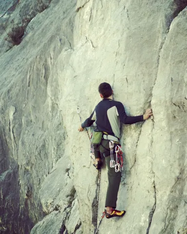
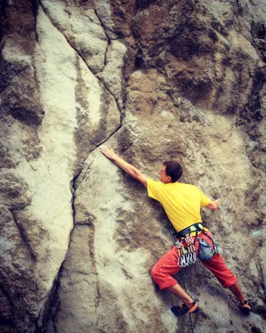
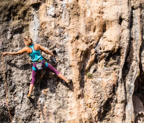
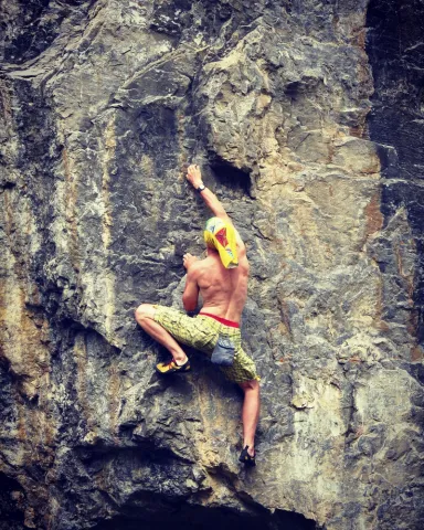
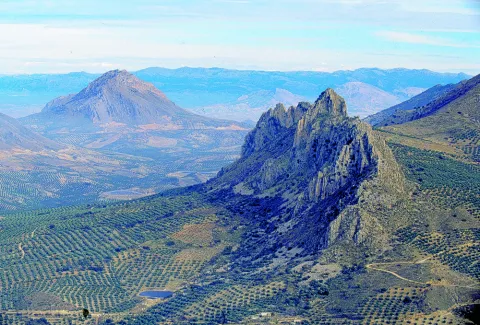
Probably one of the most interesting climbing schools in Andalusia. Their interest is increased by being placed in a area of high landscape value. It is a cave with high difficulty itineraries on ball formations, stalactites and giant jets. A complete collection of karmic formations (shaped in limestone) This school is a paradise of continuity. The tracks have reliable anchorages for sports climbing. The average height is: 25 meters. The maximum is 30 meters.

Latitud
37.674288
Longitud
-3.749732
Distrito
Municipio
Ubicación en el mapa
POINT (-3.749732 37.674288)
imagen
Image
shutterstock_1386587255%20%281%29.jpg
Imagen principal
Activado
imagen
Image
shutterstock_532809607.jpg
Imagen principal
Desactivado
imagen
Image
shutterstock_527300206.jpg
Imagen principal
Desactivado

Friends

icon-intereses-amigos

Nature

icon-intereses-naturaleza

Adventure

icon-intereses-aventura

Solo travel

icon-intereses-viajar-solo

Gastronomy

icon-intereses-gastronomia

Sport

icon-intereses-deporte

Municipality

icon-intereses-municipio

For couples

icon-intereses-en-pareja
Alta
La Cueva
Desactivado

Number of routes:50

You're up to V:0%

V + to 6c + routes: 0%

Vies from 7a to 7c +:30%

Eight-way:70%

Best time:From spring to autumn

Coordenadas / Huso 30S
30S x = 433885 and = 4169942
Tramo de asfalto o cemento
 
Tramo de pista o camino forestal
 
Tramo de vía pecuaria
 
Tramo de senda
 

La Cantera

Submitted by brandcode_deweloper on
Id
1908295
Descripción larga

For water, food and accommodationYou can take advantage of the city of Jaén, next to which is this climbing area.

Notes and warnings.- The estate is an olive grove, so it is not appropriate to get close to the walls. We must also park in places that do not stop the passage.

How to get there.- From Jaén capital you take the road of Los Villares (C-3221). At kilometer two, a small lane that takes directly to the area is on the right. In Jaén this area is known as the Fuente de la Peña, an old laundry area on the outskirts of the city. The scarves go from there to the quarry.

Breve descripción

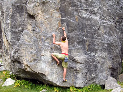
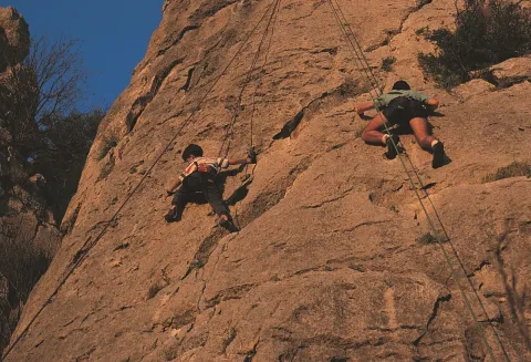
They are not too many tracks and some of the older ones have a veiled equipment, but the slightly collapsed and good quality orange wall offers itineraries with many holes and rigs. This is a sports climbing school, where most of the fixations are reliable. The characteristics of these walls make the tracks explosive. The rock is limestone. The maximum height of the walls is 15 meters. It is a good area of boulder, sometimes very powerful.

Latitud
37.751413
Longitud
-3.804531
Distrito
Municipio
Ubicación en el mapa
POINT (-3.804531 37.751413)
imagen
Image
rendered%20%281%29.jpg
Imagen principal
Activado
imagen
Image
shutterstock_105196313.jpg
Imagen principal
Desactivado
imagen
Image
shutterstock_528238198.jpg
Imagen principal
Desactivado

Friends

icon-intereses-amigos

Nature

icon-intereses-naturaleza

Adventure

icon-intereses-aventura

Solo travel

icon-intereses-viajar-solo

Gastronomy

icon-intereses-gastronomia

Sport

icon-intereses-deporte

Municipality

icon-intereses-municipio

For couples

icon-intereses-en-pareja
La Cantera
Desactivado

Number of routes:26

You're up to V:0%

Votes from V + to 6c +:70%

Vies from 7a to 7c +:30%

Eight-way:0%

Best time:From autumn to spring

Coordenadas / Huso 30S
30S x = 429126 and = 4178539

Cerro Golondrina

Submitted by brandcode_deweloper on
Id
1908278
Descripción larga

For water, food and accommodation.- Water should be brought, as the nearest water is in Bedmar or Jodar. The accommodation and restaurants of the immediate villages are ideal for finding supply.

How to get there.- The area is 60 kilometres from Jaén capital. From this city you have to go to Bedmar (C-328). After that municipality we turn right through the crossing with the C-325. We arrived shortly after the area. The walls have no loss. They get up in the middle of the hill. There's enough space to park on both sides of the road.

Breve descripción

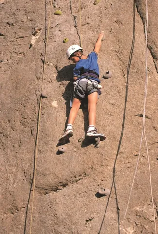
It is a very bright wall, which is integrated into an interesting relief formation and surrounded by a landscape with magnificent views. It is located at the limits of the Natural Park of Sierra Magina. Although it is a school of local interest, it may be of interest for a short visit. His inclination is quite vertical. The insurance system allows sports climbing with a certain technical character. The limestone walls reach 25 meters of level, with an average height of 15 meters.

Latitud
37.813578
Longitud
-3.340539
Distrito
Municipio
Ubicación en el mapa
POINT (-3.340539 37.813578)
imagen
Image
Natu010.jpg
Imagen principal
Activado
imagen
Image
2.jpg
Imagen principal
Desactivado
imagen
Image
1.jpg
Imagen principal
Desactivado

Friends

icon-intereses-amigos

Nature

icon-intereses-naturaleza

Adventure

icon-intereses-aventura

Solo travel

icon-intereses-viajar-solo

Gastronomy

icon-intereses-gastronomia

Sport

icon-intereses-deporte

Municipality

icon-intereses-municipio

For couples

icon-intereses-en-pareja
Cerro Golondrina
Desactivado

Number of routes:16

You're up to V:60%

Votes from V + to 6c +:40%

Vies from 7a to 7c +:0%

Eight-way:0%

Best time:spring and autumn

Coordenadas / Huso 30S
30S x = 470026 and = 4185186
Tramo de asfalto o cemento
 
Tramo de pista o camino forestal
 
Tramo de vía pecuaria
 
Tramo de senda
 

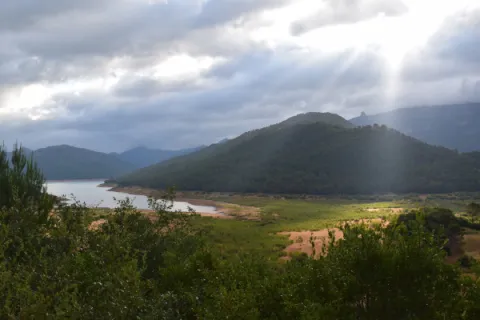
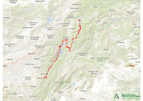
1. Viewpoints and forest landscapes of the Sierras de Cazorla, Segura and Las Villas Natural Park. A general tour of its forest legacy.

Submitted by brandcode_deweloper on
Id
13767729
Descripción larga

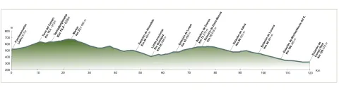
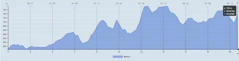
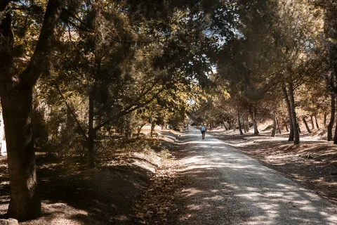
The tour begins at the edge of the city centre of Jaén, next to the municipal sports complex Las Fuentezuelas. The first 2 km, used by hiking and cycling, have several rest areas. From here on, we will cross, on a service road, the north-west circumvalation of Jaén to resume the trail to the town of Torredelcamp. After passing through a new alternative road that saves the A-316 motorway, we arrive at the Torredelcampo station (km. 11,100) located in this urban nucleus.

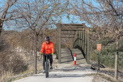
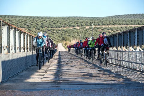
After two tunnels (the first lit 333 meters long), two viaducts and the rest area of the Quebradas, we will reach the nearby town of Torredonjimeno. From Torredonjimeno Station (Km. 1,600) we will continue in the direction of Martos, for which we will have to cross two long metal walkways that allow the crossing with the road A-316. La Via Verde crosses the city centre of Martos and offers the possibility to make interesting visits to the city.

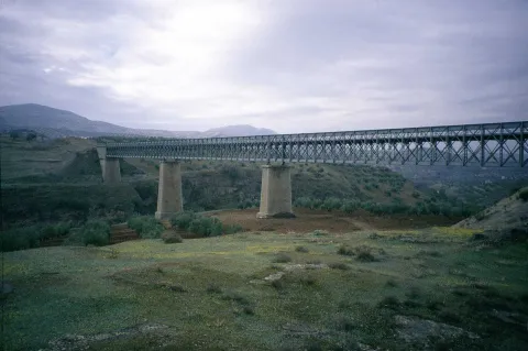
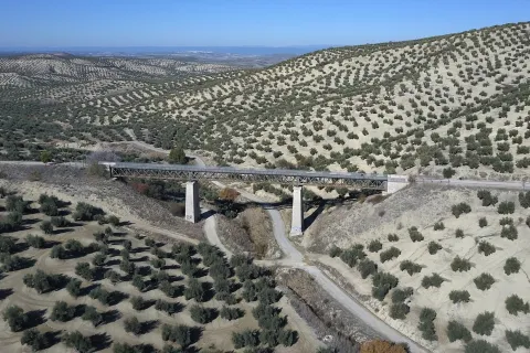
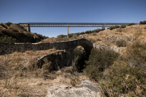
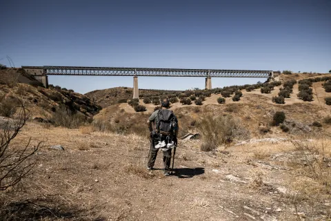
We left Martos, in a southwestern direction, towards the border with the province of Córdoba. New intersections with the national road are resolved by installing a lower step and a new gateway. In Km. 33, coinciding with the proximity of the Salado stream, the landscape changes and becomes more abrupt and serrano, already in the foothills of the Sierra Sur massif. The railway crosses rivers and streams in the middle of impressive ravines, through metal viaducts with lengths between 70 m and 224 m. These complex engineering works, which were designed by the French Alessandre and Delapierre, date back to the end of the 19th century, magnificent examples of oblonted architecture, and which constitute extraordinary views on the rural landscapes of the province of Jaén.

The rest area of the isolated station of Vado-Jaén is located at km 37. The old railway platform continues its course in the direction of the Alcaudete Station, passing the impressive viaduct on the Víboras River (224 m long and 80 m high), the remains of an abandoned balast quarry, called La Muela, and some sections of lush Mediterranean vegetation in which they stand out oak, retama and majajelos, as well as old almonds.

Leaving the Alcaudete station behind, at 48,400 km, we will reach a crossing with the A-316 road, saved by a high gateway.

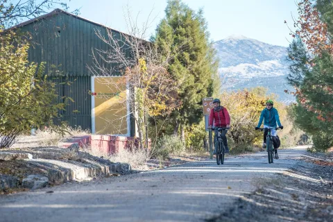
After passing through the building for the railway houses, the Green Way of Oil connects with the Biking Routes of Sierra Sur de Jaén (signposted), which enter the cycloturist in the heart of the massif of the same name, and runs right next to the Laguna Honda Natural Reserve (Km. 50,500); at this point you can see the abundant and rich avifauna that dwells in this 65 Has. wetland of extension: evil, real anade, squid or small zampullin.

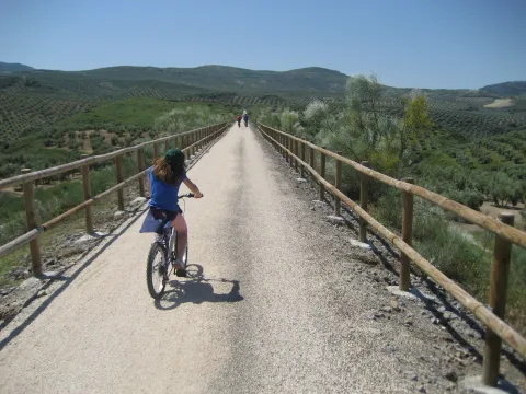
On the right bank of the Green Way, a road leads to another natural space protected from the environment: the Natural Reserve of Laguna del Chinche, of 6.5 Has. of extension and with an interesting perilagunar vegetation. The last miles pass through a very eroded site where deep ravines are frequent, in whose slopes the thyme and the spartum occupy a land, not suitable for the olive tree, which sometimes offer excellent panoramic views of the Vadomojón reservoir. The jiennese part of the Green Way of Oil concludes on the great iron bridge over the Guadaljoz River, right in the tail of the reservoir, 199 m long.

From this point the green track connects with that of the Cordobese Subbetic.

Latitud
38.2167
Longitud
-2.7228
Distrito
Municipio
Ubicación en el mapa
POINT (-2.7228 38.2167)
imagen
Image
foto-4_rncc_2540-jpg
Imagen principal
Activado
imagen
Image
perfil-aceite-fusion-1-jpg
Imagen principal
Activado
imagen
Image
vva-jpg
Imagen principal
Desactivado
imagen
Image
patricia-aybar-en-via-verde-jpg
Imagen principal
Desactivado
imagen
Image
vva-1-jpg
Imagen principal
Desactivado
imagen
Image
vva-2-jpg
Imagen principal
Desactivado
imagen
Image
vva-3-jpg
Imagen principal
Desactivado
imagen
Image
vva-4-jpg
Imagen principal
Desactivado
imagen
Image
vva-5-jpg
Imagen principal
Desactivado
imagen
Image
vva-6-jpg
Imagen principal
Desactivado
imagen
Image
74422248_140452477303677_4407740479924338688_o-jpg
Imagen principal
Desactivado
imagen
Image
vva-7-jpg
Imagen principal
Desactivado
imagen
Image
vva-8-jpg
Imagen principal
Desactivado
imagen
Image
aceite08-jpg
Imagen principal
Desactivado
imagen
Image
aceite10-jpg
Imagen principal
Desactivado
imagen
Image
aceite13-jpg
Imagen principal
Desactivado
imagen
Image
rcc_2082-1-jpg
Imagen principal
Desactivado
imagen
Image
cantera-de-la-muela-1-jpg-1
Imagen principal
Desactivado
7 h 30 min

Friends

icon-intereses-amigos

Nature

icon-intereses-naturaleza

Solo travel

icon-intereses-viajar-solo

Gastronomy

icon-intereses-gastronomia

For couples

icon-intereses-en-pareja

Family

icon-intereses-familia

Adventure

icon-intereses-aventura

Culture

icon-intereses-cultura

Sport

icon-intereses-deporte

Municipality

icon-intereses-municipio

Low-cost tourism

icon-intereses-turismo-low-cost

Eco-friendly

icon-intereses-eco-friendly
Baja
Document
Image
fc880c76-e19a-7c1e-4cfb-785b4441a694?t=1604415740731
1. Miradores y paisajes forestales del Parque Natural Sierras de Cazorla, Segura y las Villas. Un recorrido general por su legado forestal.
115 km
892m
All year round
Desactivado
Image
perfil-aceite-fusion-1-jpg

6, from Jaén (The Fuentezuelas' polysports complex) and from each of the five stations.

Users: cyclists, walkers and wheelchair people.

Regardless of the way you decide to travel this route, it is recommended to use comfortable clothes and footwear and adapted to the time of the year. Although it is not convenient to do so in the middle of summer due to the heat. You must not forget to wear enough water and, if you go on a bike, it is always recommended to wear a helmet.

For more information visit:http: / / www.viasverdes.com

Cultural heritage: Monumental set of Jaén. The medieval castle of Alcaudete. Medieval Bridge of the Vipers. Archaeological route of the Torreones. Urban assemblies of Luque, Zuheros, Doña Mencía, Cabra and Lucena. Cueva de los Murcielagos en Zuheros.
Ramal a Baena: Urban complex of Luque and Baena, archaeological park of Torreparedones, the Historical and Archaeological Museum of Baena, church of the ancient Convent of the Agustinos Descalzo in Luque.

The starting point is located in the village of Vadillo-Castril. The latter is followed by the A-319 road that links the towns of Peal de Becerro and Hornos de Segura. We must take the detour located at the kilometer 31.7 and continue for 5 km by the JF-7091 until the entrance detour to Vadillo-Castril and the Training and Forest Experiment Centre.

The route has been broken down in stages, assuming that it will be of interest to cycloturists, although it could be carried out by car as it travels on roads open to traffic.

  1. Km 115 - Sequero de Siles.

Coordinates 38.39197, -2,58255

Siles is a village of 2200 inhabitants located on the north end of the Natural Park. There is an old artificial pineapple sequero, which has been musealized and transformed into the current Centre for Interpretation and Reception of Visitors of the Sierra de Segura. It is located in the street Carretera de Hellín no. 21, and has several exhibition spaces that report on the natural values of the Sierra de Segura, the history of the human population in the territory, the serrano trades and, in an outstanding way, on the sequero itself, from which the original machinery is preserved.

Tramo de asfalto o cemento
97.39%
Tramo de pista o camino forestal
2.61%
Tramo de vía pecuaria
0
Tramo de senda
0

1. Viewpoints and forest landscapes of the Sierras de Cazorla, Segura and Las Villas Natural Park. A general tour of its forest legacy.

Submitted by brandcode_deweloper on
Id
13767377
Breve descripción

This stage is part of Mount Navahondona, one of the areas of the Natural Park with the highest concentration of elements of the forest legacy, mainly because here the mountain engineer don Enrique Mackay worked during the first quarter of the 20th century. After descending through the Guadalquivir valley, following the route of the woods, it reaches the reservoir of the Tranco, where we can see a very unique artifact.

Latitud
37.91676
Longitud
-2.95436
Municipio
Ubicación en el mapa
POINT (-2.95436 37.91676)
imagen
Image
01-1-jpg
Imagen principal
Activado
imagen
Image
mapa_01-jpg
Imagen principal
Activado
7 h 30 min

Sport

icon-intereses-deporte
Image
mapa_01-1-jpg
1. Miradores y paisajes forestales del Parque Natural Sierras de Cazorla, Segura y las Villas. Un recorrido general por su legado forestal.
115 km
892m
Desactivado
Image
mapa_01-jpg

The route runs within a natural protected space rich in flora and fauna, which can be damaged by incivious and unenvironmentally friendly behaviour. The regulations of the Natural Park prohibit both the collection of plants and the capture of animals. You can't light fire either. Along the course, there are different accommodation and restoration options.

Elements of the Forest Legacy Catalogue to be visited: Sheet number 1, 6, 9, 12.17, 32 and 44.

The starting point is located in the village of Vadillo-Castril. The latter is followed by the A-319 road that links the towns of Peal de Becerro and Hornos de Segura. We must take the detour located at the kilometer 31.7 and continue for 5 km by the JF-7091 until the entrance detour to Vadillo-Castril and the Training and Forest Experiment Centre.

The route has been broken down in stages, assuming that it will be of interest to cycloturists, although it could be carried out by car as it travels on roads open to traffic.

Coordenadas / Huso 30S
37.91676, -2.95436
Tramo de asfalto o cemento
97.39%
Tramo de pista o camino forestal
2.61%
Tramo de vía pecuaria
0
Tramo de senda
0

Section Jaén - Torredelcampo

Submitted by brandcode_deweloper on
Id
13070861
Breve descripción

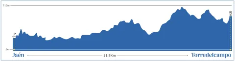
The stretch of the Mozarto Road that extends from Jaén to Torredelcampo is a journey of approximately 13 km, with an accumulated gap of + 350 m and -200 m. Classified as of moderate difficulty, this stage offers an accessible challenge that allows pilgrims to immerse themselves in an experience that combines the urban environment of Jaén with the natural landscape of the South Sierra de Jaén.

_

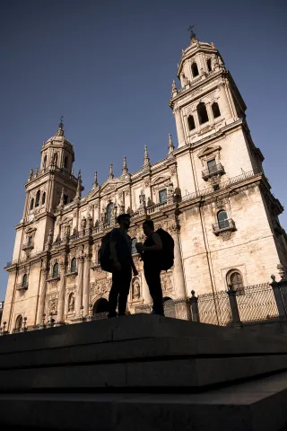
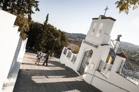
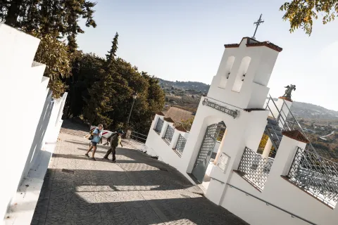
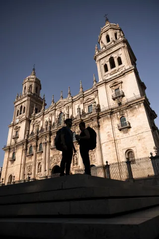
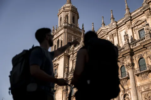
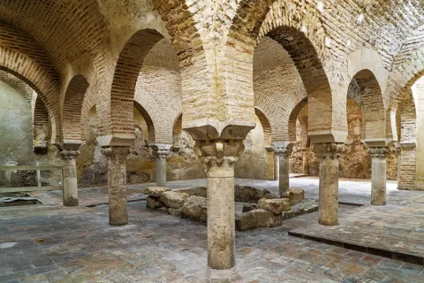
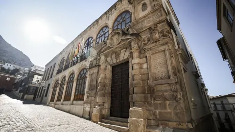
The stage begins in the Plaza de Santa María, pressuring it is the Cathedral that houses one of the most important relics for Christianity: "the Holy Face." Following the yellow arrows we enter the street Maestra, entering into ancient neighborhoods where the memory of the Arab, Jewish and Christian cultures persists. The tour takes us to the Arc of San Lorenzo, the Plazoleta of Santiago, the Church of San Juan, the Palace of Villardompardo, which conserves important Arab Baths of the 10th century, the Convent of Santo Domingo or the Church of the Magdalena with its recollect courtyard. The information centres of the Pilgrim are located in the Office of Tourism of Jaén, Centre of Tourism Dynamization of the Province of Jaén and Palacio Villardompardo - Baños AArabs.

From here we will continue on the road of Córdoba following our way to the city of Torredelcampo.

TRANSITION TO RURAL ENVIRONMENT

As you leave Jaén, the road is headed for the Cordoba road. The pilgrims will follow the old road to Torredelfield, gradually ascending through residential areas until leaving behind the last buildings of Jaén. Once outside the urban core, the road enters the South Sierra, offering a change of landscape towards a more natural and rural environment.

The tour includes the downhill of several streams, which mark the beginning of a more ascending section. The pilgrims will pass through roads leading to the Vicar's House and the Sierra de Jabalcuz before facing a rise to a highway fence. Continuing, you reach a crossing with the Megatin road. After going down about 1 km, the route goes up again, taking the pilgrims to Torredelcamp.

LLEGATE AND EXPLORATION OF TORREDELCAMPO

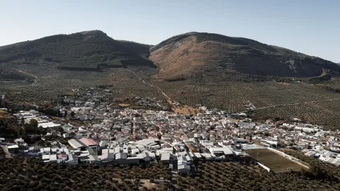
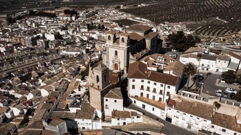
As you approach Torredelcampo, the road enters through Andalucia Street, you will go through this welcoming town until you meet the Church of San Bartolomé, and the City Hall (Punto de Información al Peregrino), to continue to search for the exit to the old road of Santa Ana to which you will arrive in a short but pending rise. The origin of the present municipality is very related to the former Iberian inhabitants of Cerro Miguelico, in the I and II A.D. part of the population is moved to the present site of Torredelcampo. After the end of the conflicts at the end of the emirate, the inhabitants of the area are forced to concentrate on a single settlement. Near the Hermitage of the Patrona is the plain of Santa Ana, a recreational area with water and shadows that will bring you a well-deserved rest. But not only, but we will also find part of the legacy of his story with the remains of a Visigoda Necropolis and an old Oppidum Ibero.

The itinerary continues on the ancient road to Jamilena.

CONCLUSION OF THE RECORRID

The Jaén to Torredelcampo stage offers an experience that balances the urban environment with the natural landscape of the Sierra Sur de Jaén. The moderate difficulty of the journey makes it an accessible option, providing an opportunity to experience the beauty and history of the region. During this stage, pilgrims not only enjoy a challenging journey, but also have the opportunity to connect with the cultural heritage and tranquility of this part of the Mozarian Way.

Latitud
37.7796
Longitud
-3.7849
Distrito
Municipio
Ubicación en el mapa
POINT (-3.7849 37.7796)
imagen
Image
jaen-web-01-jpg
Imagen principal
Activado
imagen
Image
imagen-principal-jaen-torredelcampo-jpg-1
Imagen principal
Desactivado
imagen
Image
torredelcampo-web-10-jpg
Imagen principal
Desactivado
imagen
Image
jaen-web-69-1-jpg
Imagen principal
Desactivado

Nature

icon-intereses-naturaleza

Adventure

icon-intereses-aventura
Moderada
Tramo Jaén - Torredelcampo
11,5 km
400m
350m
Desactivado
Image
perfil_topografico_jaen_torredelcampo-jpg

Jaén

Torredelfield

Tramo de asfalto o cemento
 
Tramo de pista o camino forestal
 
Tramo de vía pecuaria
 
Tramo de senda
 

Section Torredelcampo - Jamilena

Submitted by brandcode_deweloper on
Id
13070649
Breve descripción

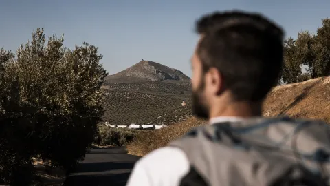
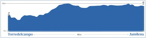
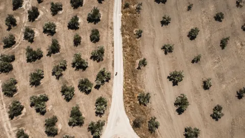
The Mozarto Road that connects Torredelfield with Jamilena is a short and accessible stage of approximately 2.5 km. With a level of approximately + 150 m and -100 m, this stage is ideal for those who want to enjoy a quiet and easy to navigate through the rural landscapes of the Sierra Sur de Jaén.

_

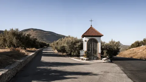
After having access to this municipality through Avenida de Andalucía, the starting point for this section will be the City Hall Square, where we will find the Office of Help to the Pilgrim. We recommend that before leaving this municipality you visit its three famous towers, the Tower of the Muña, the Forgotten Tower and the Tower of the Aldehuela, clear exponents of the great number of fortresses existing in the Jiennese province.

Starting from the Church of San Bartolomé, located in the same City Hall Square, we will follow the signs of the Mozarto Road, which will allow us to walk the streets and lead us to the outskirts of this town, leaving behind its cozy squares and small buildings typical of the area. As we go through the centre of Torredelcampo, we will go out of the urban core and we will find a rise on a steep road to the Hermitage of Santa Ana, patron of Torredelcampo.

_

Near the Hermitage we will find an explanade where we can take a short break enjoying the wonderful views and a good water source. It should be noted that very close to this explanade is preserved an old Oppidum Ibero and a Visigoda Necropolis that is well worth visiting.

The oppidum was a fortified city used by the Iberian peoples. Located in what is known as Cerro Miguelico, this site dates back to the 1st and 2nd centuries BC, when the Iberians dominated much of the southern Iberian peninsula.

On the other hand, necropolis is a cemetery of the Visigodic era that was probably used between the V and VII centuries AD. The presence of this necropolis indicates that the area continued to be inhabited or at least used for funeral rites long after the disappearance of the ipidum ibero.

_

The road follows its course through a stretch of road that will take us to Jamilena, having a detour to enter a small Humilladero where it is sold to the Patron of the town, Our Father Jesus Nazarene. The road will enter us in the urban core of Jamilena, among its narrow streets, with white houses typical of Andalusian architecture. Jamilena is known for its quiet environment and for the hospitality of its inhabitants, which makes this small town a welcoming stop for pilgrims.

CONCLUSION OF THE RECORRID

The Torredelcampo to Jamilena stretch offers a pleasant and uncomplicated walk, with a slight slope that is being overtaken with the excellent views and being an excellent opportunity to enjoy the tranquility of the rural landscapes of the Sierra Sur de Jaén. Despite its short distance, this stage gives pilgrims the opportunity to connect with nature and enjoy the history and culture of these small municipalities.

Latitud
37.7483
Longitud
-3.8778
Distrito
Municipio
Ubicación en el mapa
POINT (-3.8778 37.7483)
imagen
Image
imagen-principal-torredelcampo-jamilena-jpg
Imagen principal
Activado
imagen
Image
imagen-principal-jaen-torredelcampo-jpg
Imagen principal
Desactivado
imagen
Image
torredelcampo-jamilena-2-jpg
Imagen principal
Desactivado
imagen
Image
torredelcampo-jamilena-1-jpg
Imagen principal
Desactivado

Nature

icon-intereses-naturaleza

Adventure

icon-intereses-aventura
Moderada
Tramo Torredelcampo - Jamilena
22 km
400m
400m
Desactivado
Image
perfil_topografico_torredelcampo_jamilena-jpg

Torredelfield

Jamilena

Section Castle of Locubín - Alcaudete

Submitted by brandcode_deweloper on
Id
13070094
Breve descripción

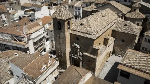
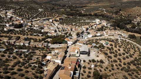
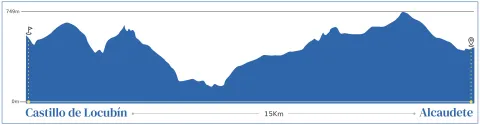
The stretch between Castillo de Locubín and Alcaudete is a 15-kilometre stage with a positive level of 300 meters and negative of 250 meters. Starting from Castillo de Locubín, famous for its Cherry Festival, we will find a path that will lead us to one of its pedanias, Sales of the Carrizal. Famous for its agriculture, we will be able to acquire typical products of the jiennese gastronomy and that will be a point of union with the coming stage from Alcalá la Real to Alcaudete.

_

We leave from the hostel of Castillo de Locubín, following to the City Council, information point to the pilgrim. From here, we take a narrow street that will take us to a wider road, where we begin to ascend. On the way, we will find an impressive Milenary Olive, which stands out not only for its antiquity, but as a symbol of the importance of olive cultivation in this region.

The road continues along a lane that will take us to the centre of Ventes del Carrizal, a small town surrounded by olive fields. Here, we can make a stop at the Social Services Centre, which also serves as an information point for pilgrims. In addition, there are often street points where we can buy vegetables and vegetables typical of the area.

_

From Ventes del Carrizal, we follow our tour of La Fuente Street and go down to the San Juan River. We crossed its bridge and followed the "Cañada Real de Fuente Amuña," an old road that crosses a rural landscape full of charm. As we approach Alcaudete, we pass through Fountain Amuña and arrive at the Sanctuary of La Fuensanta, an important religious and cultural reference point of the area, where if we find it open, we can seal our credential.

The tour follows a park, descending to the left until we reach a roundabout, from where we ascend on Avenida de Andalucía. Finally, we arrive at the Plaza del Ciudad de Alcaudete, where the city centre is located and where you can inform us about the municipal shelter of pilgrims.

_

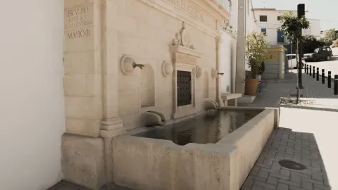
Alcaudete is a heritage-rich town, where its imposing Castle of the Order of Calatrava stands out, which rises on a hill and offers stunning views of the environment. The city also houses the Church of Santa Maria la Mayor and the Fuente de la Villa, among other historical places that tell us about its importance over the centuries.

In Alcaudete, pilgrims will be able to rest in the municipal hostel and enjoy the hospitality of their inhabitants, before continuing their way to the next destination.

CONCLUSION OF THE RECORRID

The stretch between Castillo de Locubín and Alcaudete combines the natural beauty of the Andalusian olive groves with the rich cultural heritage of the region. This municipality, in addition to surprising us for its profound historical value, are of great importance its Fiestas Calvia declared of Andalusian tourist interest and that they turn around the Castle Calatravo and its importance as a medieval border between the Kingdom of Castile and the Kingdom of Granada.

Latitud
37.5289
Longitud
-3.9147
Distrito
Municipio
Ubicación en el mapa
POINT (-3.9147 37.5289)
imagen
Image
castillo-de-locubin-alcaudete-web-16-jpg
Imagen principal
Activado
imagen
Image
castillo-de-locubin-alcaudete-1-jpg
Imagen principal
Desactivado
imagen
Image
castillo-de-locubin-alcaudete-2-jpg
Imagen principal
Desactivado
imagen
Image
castillo-de-locubin-alcaudete-web-05-jpg
Imagen principal
Desactivado

Nature

icon-intereses-naturaleza

Adventure

icon-intereses-aventura
Moderada
Tramo Castillo de Locubín - Alcaudete
17 km
400m
400m
Desactivado
Image
perfil_topografico_castillo_locubin_alcaudete-jpg

Castillo de Locubín

Get lost.

Tramo de asfalto o cemento
 
Tramo de pista o camino forestal
 
Tramo de vía pecuaria
 
Tramo de senda
 

Stage Jaén - Martos

Submitted by brandcode_deweloper on
Id
13069818
Breve descripción

This stage marks the beginning of the Mozarabic Way of St James, starting in the city of Jaén, passing through the municipalities of Torredelcampo and Jamilena, and ending in Martos.

This stage of the Mozarabic Way of St James, which runs from Jaén to Martos, covers approximately 20 kilometres. Classified as moderately difficult, it provides an accessible challenge that allows pilgrims to enjoy an experience combining the urban surroundings of Jaén with the natural landscape of the Sierra Sur de Jaén.

START OF THE ROUTE IN JAÉN

The stage begins in Plaza de Santa María, dominated by the Cathedral, which houses one of Christianity’s most important relics: the “Holy Face”. Following the yellow arrows, we enter Calle Maestra and continue through historic neighbourhoods where the legacy of Arab, Jewish and Christian cultures still survives. The route takes us past the Arco de San Lorenzo, Plazoleta de Santiago, the Church of San Juan, Villardompardo Palace, which contains important 10th-century Arab Baths, the Convent of Santo Domingo and the Church of La Magdalena, with its secluded courtyard. Pilgrim information centres can be found at the Jaén Tourist Office, the Province of Jaén Tourism Development Centre and Villardompardo Palace–Arab Baths.

From here, we continue along the Córdoba road, following our route towards the town of Torredelcampo.

TRANSITION TO THE COUNTRYSIDE

On leaving Jaén, the route heads towards the Córdoba road. Pilgrims follow the old road to Torredelcampo, gradually ascending through residential areas until the last buildings of Jaén are left behind. Once outside the urban area, the route enters the Sierra Sur, where the landscape changes to a more natural and rural setting.

The route includes descents through several stream valleys, marking the beginning of a steeper section. Pilgrims follow paths leading towards Casa del Vicario and the Sierra de Jabalcuz before climbing towards a motorway fence. Continuing onwards, the route reaches a junction with the Megatín road. After descending for approximately one kilometre, it begins to climb again, leading pilgrims towards Torredelcampo.

ARRIVAL AND EXPLORATION OF TORREDELCAMPO

As the route approaches Torredelcampo, it enters along Calle Andalucía. You will pass through this welcoming town until reaching the Church of San Bartolomé and the Town Hall, which serves as a Pilgrim Information Point. The route then continues towards the old Santa Ana road, reached after a short but steep climb. The origins of the present-day municipality are closely linked to the ancient Iberian inhabitants of Cerro Miguelico. During the 1st and 2nd centuries AD, part of the population moved to the location now occupied by Torredelcampo. Later, following the conflicts at the end of the Emirate period, the inhabitants of the area were forced to gather in a single settlement. Near the chapel dedicated to the town’s patron saint is Llano de Santa Ana, a recreational area with water and shade where you can enjoy a well-deserved rest. The area also contains part of the town’s historical heritage, including the remains of a Visigothic necropolis and an ancient Iberian oppidum.

DEPARTURE FROM TORREDELCAMPO

Having entered the town along Avenida de Andalucía, the starting point for this section is Plaza del Ayuntamiento, where the Pilgrim Assistance Office is located. Before leaving the municipality, we recommend visiting its three famous towers: Torre de la Muña, Torre Olvidada and Torre de la Aldehuela, clear examples of the large number of fortifications found throughout the province of Jaén.

Starting from the Church of San Bartolomé, located in Plaza del Ayuntamiento itself, we follow the signs for the Mozarabic Way. These take us through the streets and towards the outskirts of the town, leaving behind its welcoming squares and small buildings typical of the area. As we cross the centre of Torredelcampo and leave the urban area, we begin an ascent along a cobbled track towards the Chapel of Santa Ana, the patron saint of Torredelcampo.

ARRIVAL IN JAMILENA

The route continues along a section of road towards Jamilena, with a short detour leading to a small wayside shrine where Nuestro Padre Jesús Nazareno, the town’s patron saint, is venerated. The route enters the centre of Jamilena through its narrow streets, lined with white houses typical of Andalusian architecture. Jamilena is known for its peaceful atmosphere and the hospitality of its residents, making this small town a welcoming stop for pilgrims.

DEPARTURE FROM JAMILENA

This section begins in the peaceful town of Jamilena, the municipality with the smallest administrative area in the entire province. It is known not only for its extensive olive groves, but also for another product that drives its economy: garlic. Some of its most characteristic landmarks include Plaza del Ayuntamiento and the Parish Church of Nuestra Señora de la Natividad.

As we leave the urban area, the Peña de Martos appears on the horizon, dominating the landscape and accompanying us for almost the entire journey towards Martos. This section offers a perfect combination of nature and panoramic views over the vast olive groves that are so characteristic of the province.

The route towards Martos follows a historic path that connects the two municipalities and has been used for centuries. Although most of the route is relatively gentle, it includes several moderate climbs, particularly when approaching the town. However, the effort is rewarded by the views, the fresh air and the sense of tranquillity offered by the surroundings.

ARRIVAL IN MARTOS

The first landmark on arriving in Martos is the Chapel of Santa Lucía, an emblematic site marking the entrance to the town. From here, we begin an ascent towards the historic centre, passing the Parish Church of San Amador and Santa Ana, dedicated to the town’s Mozarabic patron saint. On reaching the old quarter, we encounter its rich heritage.

Among the places of interest that should not be missed in Martos are the former prison and council building, which is now used as the Town Hall and Pilgrim Information Point, the castles of La Peña and La Villa, and the Roman Bridge. The town also preserves part of its historic defensive walls.

Its most emblematic religious buildings include the Royal Parish Church of Santa Marta, the Sanctuary of María Santísima de la Villa and the Monastery of the Holy Trinity. The chapels of San Bartolomé and Santa Lucía are also well worth visiting.

For a well-deserved rest after completing the stage, the Convent of the Trinitarian Sisters offers welcoming accommodation for pilgrims in the heart of the town.

CONCLUSION OF THE ROUTE

The stage from Jaén to Martos offers an experience that balances the urban environment with the natural landscape of the Sierra Sur de Jaén. Its moderate level of difficulty makes it an accessible option, providing an opportunity to experience the beauty and history of the region. Throughout this stage, pilgrims not only enjoy a rewarding route but also have the opportunity to connect with the cultural heritage and tranquillity of this part of the Mozarabic Way of St James.

ACCESS THE OFFICIAL WEBSITE

Latitud
37.7796
Longitud
-3.7849
Distrito
Municipio
Ubicación en el mapa
POINT (-3.7849 37.7796)
imagen
Image
jaen-web-01-jpg
Imagen principal
Activado
imagen
Image
imagen-principal-camino-mozarabe-1-jpg
Imagen principal
Desactivado
imagen
Image
banos-arabes-jpg
Imagen principal
Desactivado
imagen
Image
jaen-web-67-jpg
Imagen principal
Desactivado
imagen
Image
jaen-web-69-jpg
Imagen principal
Desactivado
imagen
Image
martos-web-12-1-jpg
Imagen principal
Desactivado
imagen
Image
martos-web-38-jpg
Imagen principal
Desactivado

Nature

icon-intereses-naturaleza

Adventure

icon-intereses-aventura
Moderada
Etapa Jaén - Martos
20,69 km
700m
500m
Desactivado
Image
perfiljaenmartos-png

Jaén

Martos

Stage Martos - Alcaudete

Submitted by brandcode_deweloper on
Id
13069554
Breve descripción

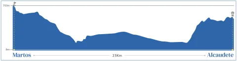
The stretch between Martos and Alcaudete is a 23 km stage with a moderate level. This is an ideal way for those looking for an immersion into the rural and historical landscape of Jaén, as we will find one of the best preserved medieval bridges in the province or enter the mythical Via Verde del Oil.

_

We leave from Martos, across the city on Avenida de los Olivares. We left the "old" Martos behind and headed towards its newest area, until we reached a roundabout that marks the beginning of our road to Alcaudete. Once the roundabout has been saved, we move on to the right-hand side, taking the Belda Friar Road.

This stretch enters us into the extensive olive tree that characterizes the region, considered the largest in the world. During the tour, two "pinets" serve as a reference, announcing the cortijo that gives name to this road. We left the cortijo to our left and continued to reach a tree, where we will meet the Green Way of Oil. Without deviating from this route, we continue straight, moving forward among large trees.

When we reach a crossing, we turn left to wade the Salty Arroyo. Here we begin a slight rise, in which two paths are presented: we take the one on the right to finally join the Green Way of Oil.

_

The Green Way of Oil accompanies us for several kilometers, allowing us to enjoy meringers where pilgrims can rest. We passed under the old N-321 road, and continued to reach an old railway building, at which time we must turn left to leave the green road.

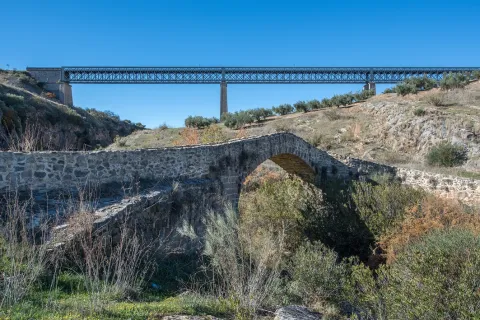
From here on, the road becomes a peculiar way, leading us to a cortijo and later to the impressive "Ponton del Río Víboras," a medieval bridge that served as a link of union in an old royal canyon. This is one of the best preserved medieval bridges in the province and a perfect place to stop, enjoy the landscape and lunch surrounded by nature.

_

After crossing the bridge, we started a rise of about 4 kilometers that will take us to Alcaudete. This stretch requires a moderate effort, but is rewarded with the impressive views of the environment and the satisfaction of approaching our destination. After the rise, we are expected a smooth down of almost 3 km that will allow us to reach the town.

As we enter Alcaudete, we seek the signage of the Way that leads us to the City Hall Square, information point to the pilgrim. Among its most prominent points of interest are the Calatravo Castle, the Church of St. Peter and the Sanctuary of the Virgin of the Fuensanta. The city offers a rich historical heritage and a quiet environment for pilgrims.

CONCLUSION OF THE RECORRID
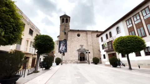
The arrival in Alcaudete is the link of union with the other way of the Mozarto road that comes from Granada and that will take us to Córdoba. This municipality not only offers us an important tour of historical and natural heritage, but we will be able to find rest in the city's pilgrims' hostel or just take a break in Fuente Amuña before continuing our journey.

ACCESS TO OFFICIAL PAGE

Latitud
37.7206
Longitud
-3.9726
Distrito
Municipio
Ubicación en el mapa
POINT (-3.9726 37.7206)
imagen
Image
imagen-principal-martos-alcaudete-jpg
Imagen principal
Activado
imagen
Image
martos-alcaudete-1-jpg
Imagen principal
Desactivado
imagen
Image
martos-alcaudete-2-jpg
Imagen principal
Desactivado
imagen
Image
martos-alcaudete-3-jpg
Imagen principal
Desactivado
imagen
Image
martos-web-12-jpg
Imagen principal
Desactivado
imagen
Image
martos-web-38-jpg
Imagen principal
Desactivado
imagen
Image
alcaudete-web-39-jpg
Imagen principal
Desactivado

Nature

icon-intereses-naturaleza

Adventure

icon-intereses-aventura
Moderada
Etapa Martos - Alcaudete
25 km
400m
400m
Desactivado
Image
perfil_topografico_martos_alcaudete-jpg

Martos

Get lost.

Tramo de asfalto o cemento
 
Tramo de pista o camino forestal
 
Tramo de vía pecuaria
 
Tramo de senda