Saltar al contenido principal

Stage Alcaudete - Baena

Submitted by brandcode_deweloper on
Id
13069337
Breve descripción

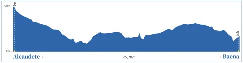
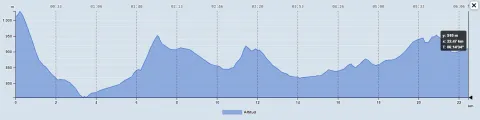
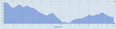
The stretch of the Mozarto Road between Alcaudete and Baena is a 25.4-kilometre journey between centuries-old olive groves before leaving the province of Jaén to reach Córdoba. With a moderate level of + 350 m and -250 m, this stage represents an accessible and attractive challenge for pilgrims, as they travel a mix of rural roads, streams and secondary roads.

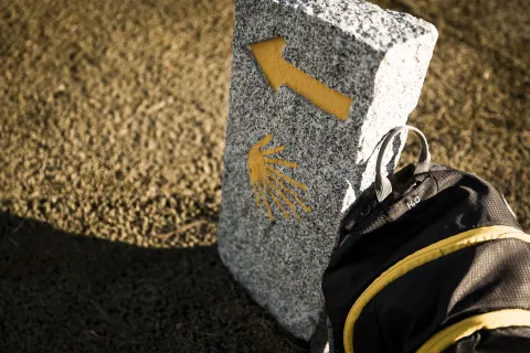
The stage begins at the Plaza 28 de Feb. next to the City of Alcaudete. Another option is to start at the roundabout near the hospital, continuing on the N-432 towards Córdoba. Following the Jacobea signs, the tour will take us to the Zaide Source, an important point of reference.

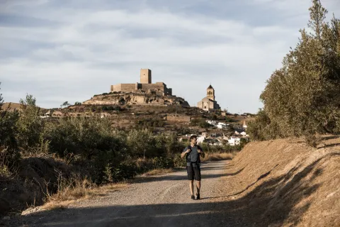
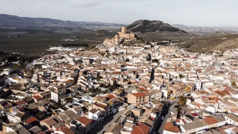
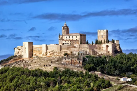
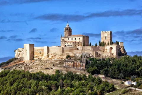
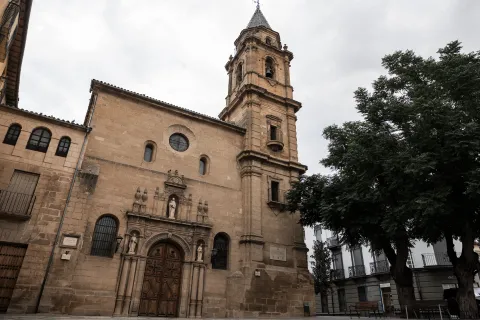
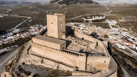
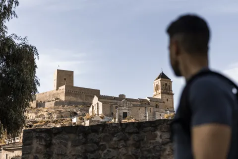
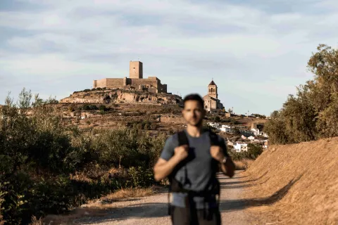
From this fountain we will have beautiful views of the Castle of Alcaudete, located in its historic centre of medieval origin. We recommend that you visit it before leaving this municipality and enjoy its important architectural heritage, in which apart from the Castillo-Palacio de Alcaudete, you can find the Church of Santa María la Mayor, the Church of the Incarnation or of Carmen, the Church of San Pedro, the Convent and Church of Santa Clara and the Cemetery and Chapel of Santa Catalina among others.

Right after the Zaide Fountain we will find the starting point of the old road to Baena.

_ AND ARROYOS

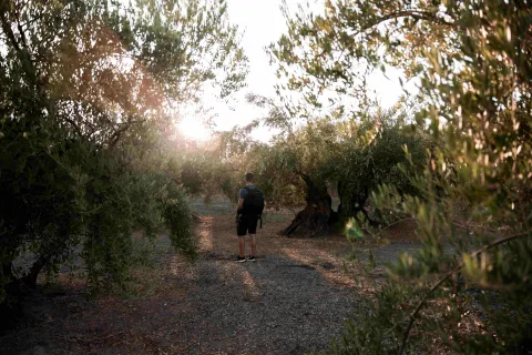
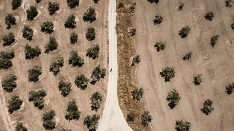
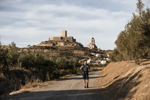
Crossing an impressive centenary olive tree with large olive trees, the pilgrims will advance through this agricultural landscape to meet a small stream, usually with little flow. After crossing the stream, a cortijo will be left to the right and, shortly thereafter, a second stream will mark the beginning of a gradual ascent that will lead to the national road.

Once the N-432 has been reached, you should walk with caution through the left arm. At a crossroads with good visibility, we move to the right bow, at which time we will have crossed the Salado and San Juan rivers. From this point on, the union of both rivers is called the Guadajoz River. The road continues on a narrow path that will take us to an agricultural ship and, following the course between olive groves, will reach the Laguna del Salobral, a natural reserve that offers a visual rest in the meantime olive trees. Then the road will cross the route of the old railway known as "Train of Oil," a vestige of the industrial past of the area.

The descent to a stream leads to a secondary road, which the pilgrims will leave when they reach a cordial. Here, you take a path to the left that continues to soften among the olive groves. About 1 km from this detour, a house known as "El Barranco" will be on the right. The tour continues to cross another road to continue to face a track that crosses olive fields and leads up to an almazara, an unequivocal sign of the importance of the oil industry in this region.

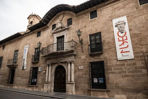
After passing on the route of the N-432, the route enters Baena by the olive cooperative "Our Lady of Guadalupe." As pilgrims approach the urban core, they will notice the contrast between the rural environment and agricultural activity. Baena, known for its olive oil and historical heritage, offers several points of interest for pilgrims before continuing their journey to Córdoba.

CONCLUSION OF THE RECORRID

The stage between Alcaudete and Baena is a journey that combines the natural beauty of olive fields with the historical heritage of the region. At this stage, our tour of the Mozarto Road in the province of Jaén ends, continuing our tour of Córdoba until we reach Santiago de Compostela.
Latitud
37.5953
Longitud
-4.0864
Distrito
Municipio
Ubicación en el mapa
POINT (-4.0864 37.5953)
imagen
Image
imagen-principal-alcaudete-baena-jpg
Imagen principal
Activado
imagen
Image
alcaudete-baena-1-re-jpg
Imagen principal
Desactivado
imagen
Image
alcaudete-baena-2-re-jpg
Imagen principal
Desactivado
imagen
Image
alcaudete-baena-3-jpg
Imagen principal
Desactivado
imagen
Image
alcaudete-web-41-jpg
Imagen principal
Desactivado
imagen
Image
alcaudete-web-21-jpg
Imagen principal
Desactivado
imagen
Image
alcaudete-web-39-jpg
Imagen principal
Desactivado

Nature

icon-intereses-naturaleza

Adventure

icon-intereses-aventura
Moderada
Etapa Alcaudete - Baena
25 km
600m
300m
Desactivado
Image
perfil_topografico_alcaudete-baena-jpg

Get lost.

Baena
Stage Moclín - Alcalá la Real

Submitted by brandcode_deweloper on
Id
13069129
Breve descripción

At this stage is the continuation of the Mozário Road of Granada, so that we will leave the granadine lands and enter the province of Jaén, with its landscape of endless extensions of olive trees. We will finish the day in Alcalá la Real, capital of the Sierra Sur region, located under a great fortress worth visiting.

On the street Real and the street Estas we will leave Moclin, passing by the Center of Commercial Interpretation, we go down about 700 m and we arrive at the Fuente de Malalto. At this point we left the asphalt and continued on a dirt lane leading to the road. We will turn left, extreme the caution during the 2 km tour before linking with the N-432, take a short path behind a house and cross the N-432 with caution.

When we cross, we take the royal canyon "Cordel de la Gallina." We ascend 400 m to the "Coto de los Pedernales." We're still on a lane until we get to a milestone. We must continue among the olive trees but the closest to a barranquera left to us, reaching a new lane we will follow to the left, and after a rise we will link with a particular road by accessing the cortijo "Cañada Alta."

We will continue to the right, we will return to the N-432, next to the San Antonio Oil Cooperative, we will continue to the left argon for 1 km, (HAY THAT I BE PRUDENT IN THIS KILOMETRO OF ARCEN), to turn left on a road that leads to Cequia, then to Pilillas and then to Ermita Nueva, we leave the village descending and straight, crossing the Palanaches stream, we continue on the Paseo de los Almondrales arriving to the N-432.

We get to some ships, it's the place to cross the N-432 with extreme care, once in the other arson we get diverted on a road to the right. Then when we reach a fork we will choose to the left, we will cross an old cortijo and at the next new fork we will also choose to the left, the lane will take us to cross a tunnel under a road, just after leaving the tunnel a lane to the right for bicycles and walkers will take us to a new crossing where a milestone points to the left. By going up the lane and across some vineyards we will arrive after passing a roundabout to the entrance on a path to the city. We will leave the bus station to the left and a long avenue will leave us in the park, city center.

ACCESS TO OFFICIAL PAGE

Latitud
37.3356
Longitud
-3.7739
Distrito
Municipio
Ubicación en el mapa
POINT (-3.7739 37.3356)
imagen
Image
mochilacamino-jpg
Imagen principal
Activado
imagen
Image
camino-olivos-jpg
Imagen principal
Desactivado
imagen
Image
alcala-la-real-web-19-jpg
Imagen principal
Desactivado
imagen
Image
alcala-la-real-poblacion-5-1-jpg
Imagen principal
Desactivado

Nature

icon-intereses-naturaleza

Adventure

icon-intereses-aventura
Moderada
Etapa Moclín - Alcalá la Real
22,47 km
1000m
755m
Desactivado
Image
perfilmoclinalcala-png

Moclin

Alcalá la Real

Tramo de asfalto o cemento
 
Tramo de pista o camino forestal
 
Tramo de vía pecuaria
 
Tramo de senda
 

Stage Alcalá la Real - Alcaudete

Submitted by brandcode_deweloper on
Id
13068933
Breve descripción

A pleasant stage, with a wavy profile but with no large slopes, which runs mostly on land roads between olive groves. In the equator of the same is Ventes del Carrizal, only intermediate town that has some service. We will end the day in the historic village of Alcaudete, which, as usual in these border lands, grew around the walls of its medieval castle, whose silhouette dominates the landscape.

It is part of the Plaza Pablo de Rojas de Alcalá la Real, we pass through Palacio Abacial (Point of Information to the pilgrim), continuing through the race of the Mercedes, to the street Tejuela. We leave the City of Mota on the street Camino Nuevo to link with the "Cordel de Córdoba a Guadix." At 1.5 km we find a small medieval bridge that crosses a stream and follows the old road, by which after 3 km we will reach the village of Puertollano.

We continue the "Vereda de Granada" parallel to the right of the N-432. We follow that path almost 4 km., we will find an underground passage, on a stream with pinets to cross it in times of rain, which allows us to cross the road to its left and follow the path until we reach Sales del Carrizal to which we enter by crossing a light. The Social Services Centre is an information point. We go down La Fuente Street and go down to the San Juan River, cross the bridge and turn immediately to the left, to follow the "Cañada Real de Fuente Amuña."

We continue in front of Alcaudete, we enter through Fountain Amuña. We go down the asphalt street about 600 m., we turn left and we reach the Sanctuary of La Fuensanta, we go down the park and we go left, on the roundabout we ascend right through the Avd. of Andalusia, to the City Hall Square.

In the town of Alcaudete there is a pilgrimage hostel on the Camino de Santa Catalina, where you can stay and take a well-deserved break to enjoy this wonderful municipality, with a wide variety of leisure and cultural services.

ACCESS TO OFFICIAL PAGE

Latitud
37.4614
Longitud
-3.9222
Distrito
Municipio
Ubicación en el mapa
POINT (-3.9222 37.4614)
imagen
Image
alcala-la-real-poblacion-5-jpg-1
Imagen principal
Activado
imagen
Image
alcaudete-baena-3-jpg
Imagen principal
Desactivado
imagen
Image
alcala-la-real-web-14-jpg
Imagen principal
Desactivado
imagen
Image
alcala-la-real-web-19-jpg
Imagen principal
Desactivado
imagen
Image
alcaudete-web-41-jpg
Imagen principal
Desactivado
imagen
Image
alcaudete-web-21-jpg
Imagen principal
Desactivado
imagen
Image
camino-olivos-jpg
Imagen principal
Desactivado

Nature

icon-intereses-naturaleza

Adventure

icon-intereses-aventura
Moderada
Etapa Alcalá la Real - Alcaudete
23,3 km
900m
500m
Desactivado
Image
perfilalcalaalcaudete-png

Alcalá la Real

Get lost.

ALTERNATIVE GR 247.1 STAGE 1: Prado Maguillo and Forestrand House Refuge El Bodegón - Río Madera

Submitted by brandcode_deweloper on
Id
8165149
Breve descripción

This first stage of the GR 247.1 Variant unites two of the most emblematic small inhabited nuclei of the deep interior of the Natural Park, in the Sierra de Segura. The first is the village of Los Anchos and Prado Maguillo, and the second is the village of Arroyo Canales and Rio Madera.

They are isolated, lonely and surrounded by a very beautiful environment. The first, at the highest altitude, draw attention to the good conservation of popular architecture, of great simplicity and with an aesthetics fully integrated into the landscape. The Recreative Area of La Morringa, which is a very pleasant and shaded space with fountain and tables next to the River Madera, whose waters run manly between the riverside vegetation, stands out.

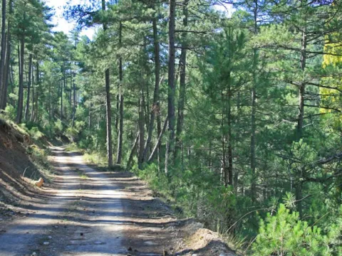
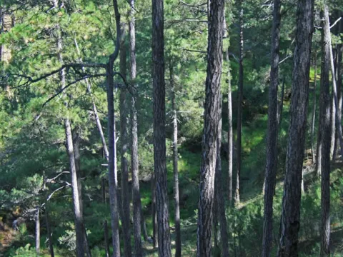
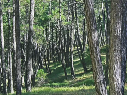
Most of the route runs through the forest track that runs through the Valley of Arroyo de las Tres Aguas, linking the valleys of Los Anchos and Río Madera through thick forests of pine laricio or salgareño. The Stage is short, and it is possible to chain it in the same day with one of the other steps of the Southern Forest Path with which it links, or with a stretch of them, but we recommend to do so without haste and to remain at any of the two ends of it, because they have left-over attractions for it.

Latitud
37.8351
Longitud
-3.1403
Distrito
Municipio
Ubicación en el mapa
POINT (-3.1403 37.8351)
imagen
Image
1.jpg
Imagen principal
Activado
imagen
Image
1.jpg
Imagen principal
Desactivado
imagen
Image
2.jpg
Imagen principal
Desactivado
imagen
Image
4.jpg
Imagen principal
Desactivado
imagen
Image
5.jpg
Imagen principal
Desactivado
imagen
Image
6.jpg
Imagen principal
Desactivado
imagen
Image
7.jpg
Imagen principal
Desactivado
imagen
Image
8.jpg
Imagen principal
Desactivado
imagen
Image
9.jpg
Imagen principal
Desactivado
imagen
Image
10.jpg
Imagen principal
Desactivado
imagen
Image
11.jpg
Imagen principal
Desactivado
imagen
Image
12.jpg
Imagen principal
Desactivado
imagen
Image
13.jpg
Imagen principal
Desactivado
imagen
Image
14.jpg
Imagen principal
Desactivado
imagen
Image
15.jpg
Imagen principal
Desactivado
imagen
Image
16.jpg
Imagen principal
Desactivado
imagen
Image
17.jpg
Imagen principal
Desactivado
imagen
Image
18.jpg
Imagen principal
Desactivado
imagen
Image
19.jpg
Imagen principal
Desactivado
2 h 12 min

Nature

icon-intereses-naturaleza

Friends

icon-intereses-amigos

Adventure

icon-intereses-aventura

Culture

icon-intereses-cultura

Sport

icon-intereses-deporte

Eco-friendly

icon-intereses-eco-friendly

For couples

icon-intereses-en-pareja

Family

icon-intereses-familia

Gastronomy

icon-intereses-gastronomia

Municipality

icon-intereses-municipio

Low-cost tourism

icon-intereses-turismo-low-cost

Solo travel

icon-intereses-viajar-solo
Medium
Prado Maguillo y Refugio Casa Forestal El Bodegón - Río Madera
7,78 km
248m
241m
416m
1
1
1
2
On foot
All year round
Activado
Some strong reels shortly before the end of the Stage in Rio Madera
Prado Maguillo, La Morringa Recreative Area, Arroyo Canales, Río Madera

On the path: No
Near the path: Segura de la Sierra

In the beginning: Refugio Casa Forestal El Bodegón (1.4 km from the beginning of Etapa).
In the end: there is no.

The serrano cortijo, a combination between the practical and the simple

The Valley of Los Anchos, from which this route is part, is perhaps the area where what is left of the popular architecture of these mountains is best preserved. Joaquín Gómez Mena, an excellent connoisseur of the Natural Park, sums up its main features.
The serrana house, as a general rule, is rectangular and has thick walls ranging from 50 to 70 centimeters, made of stones and toves attached with argamase, which serves as protection against summer heat and the cold of winter. The surface of this rectangle ranges from 25-35 meters wide by 30-40 meters long.

On the lower floor there are usually three rooms that are aligned. The first is a kitchen-dining room, where there is the access door to the house and it has one or two windows not very large. In this kitchen-dining room is the home or fireplace, which has the double function of heating the room in winter and serving to cook the food and heat the water.

In most of the houses, on both sides of the fireplace are two fitted cupboards on the wall, where the cooking tools are kept. Sometimes in one of these holes the quarries were placed with the water that was brought from the source.

The other two rooms are single bedrooms, one for marriage and one for children. They have small ventilation windows and are very austere, for in them there is only one bed and a harpoon to keep the clothes. From one of the bedrooms leaves the staircase that gives access to the upper floor, where the camera is located.

The roof of this plant is of descending height, or as we say today, overstretched, because the roof becomes inclined, usually to a water, to run the rainwater. This camera has one or two small windows to air the stay, where the products of the killing are cured and stored. The roof of the camera is unglued, with the wooden rolls that make of beams and the wooden boards placed above them. Finally, a clay layer and tiles are available on the boards.

Next to the human stays, but separated by a wall and with independent entrances, the blocks for the cattle are located, which have freckles for mules and donkeys. In some corijos these blocks are separated from the house, in front of it or on one side of it. Other buildings of the cortijo separated from the family house are the corrals and aprines for the goats and sheep, the cochineas and the hens.

There are also other common-use infrastructure for different families in a corijada. Among them are the ages to pull the grain, which are usually on high and well ventilated grounds to take advantage of the effect of the air, are almost always circular and its soil is made with rolling edges, perfectly placed as if of a mosaic. Many of these ages are currently abandoned and it is regrettable that they end up being lost in the near future, because they are part of the cultural heritage of the natural park.

Another element of common use is the bread oven, built of stone and mud and in a vaulted form. It can be found standing out of the walls of the house to which it is located or, more often, as an independent construction among other buildings of the cortijo. The plant of these furnaces is usually circular or square, and is covered with Arab tile.

Also the fountains and lavatories, which were essential elements in the daily life of the village, are another heritage that in many places is being lost and that, even if the installation of running water in the houses makes them barely used, should be kept perfectly preserved.

Prado Maguillo and Refugio Casa Forestal El Bodegón

Wood River

Coordenadas / Huso 30S
According to Projection UTM Datum ETRS89
Tramo de asfalto o cemento
2.19%
Tramo de pista o camino forestal
87.79%
Tramo de vía pecuaria
0
Tramo de senda
10.02%

Route card

Km 0

Prado Maguillo

Nuestra ruta comienza en Prado Maguillo, una pequeña aldea de montaña muy cerca de Los Anchos. Ambas están en un entorno de extraordinaria belleza y conservan bastante bien la arquitectura popular. Salimos entre huertas, la mayoría ya abandonadas, y a los 500 metros, a la izquierda hay un pequeño cerro al que es imprescindible subir (son muy pocos metros) para recrearse en las maravillosas vistas que se contemplan desde él: el valle de Los Anchos en primer plano y, al fondo, las crestas de El Calarico, Poyo Gavilán y Poyo Alto.

Km 0,75

A la izquierda sale un camino que, al cabo 650 metros, nos lleva a la Casa Forestal El Bodegón, una de cuyas construcciones auxiliares ha sido rehabilitada como refugio. La Casa y el almacén –al que se llamaba barraca- ya están en ruinas, pero el paraje, que es un amplio claro en pleno bosque, es encantador.

Volviendo a nuestra ruta, continuamos bajando por la solitaria pista forestal en medio de un gran bosque de pino laricio o salgareño con sotobosque de encina, un paisaje cautivador que nos acompañará hasta el final de la Etapa. Vamos entre la Loma del Mirandante y el Calar de Peña Rubia, por el encajado valle del Arroyo del Prado de los Fresnos.

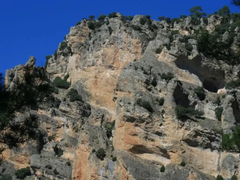
Pronto oiremos el rumor de sus aguas, mezclado con el canto de la abundante avifauna forestal. A la derecha, al otro lado del valle, aparece la inconfundible silueta de Peña Rubia, con sus paredones verticales que, haciendo honor a su nombre, tienen un llamativo color dorado y sepia que se acentúa con las últimas luces de la tarde.

A la altura del kilómetro 3, aproximadamente, en el fondo del valle confluyen las aguas del Arroyo del Prado de los Fresnos con las de los Arroyos de La Cerecera y La Cuesta del Majano. Por eso, a partir de ese punto, el cauce que resulta tiene el bello nombre de Arroyo de las Tres Aguas.

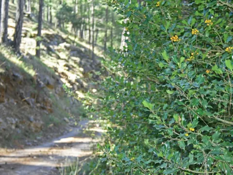
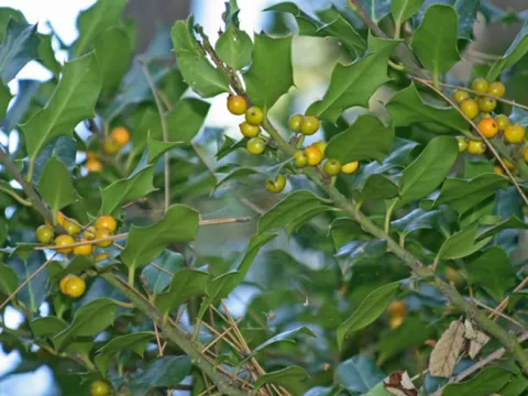
El ambiente fresco y umbrío del valle propicia la existencia de acebos aislados, pudiendo admirar un pequeño grupo de ellos en el kilómterom 3,8. Un poco más adelante vemos abajo las ruinas del Molino de Peña Rubia y su antigua conducción de agua, que nos hablan de un pasado en el que se trabajaba para sobrevivir, pero donde el agua era mucho más abundante, porque la que circula en la actualidad apenas podría mover la rueda de un molino con la necesaria continuidad.

En el kilómetro 4,4 hay un manantial de agua que sale a través de una conducción por el lado derecho de la pista forestal.

Km 5,9

Puente sobre el Arroyo de Las Tres Aguas

La ruta llega al fondo del valle y cruzamos sobre este río, que poco después afluye al Río Madera. Es un lugar refrescante con abundancia de mimbreras y juncos, al igual que el cruce sobre el Río Madera por un vado unos 400 metros más adelante. La lámina de agua que tenemos que atravesar suele ser muy delgada, pero si ha llovido mucho puede tener alguna dificultad. También hay que tener prudencia en invierno, época en la que puede tener una capa de hielo. A partir del vado, y ya por el Valle del Río Madera, caminamos otros 400 metros con el río a nuestra derecha. En este tramo apreciamos que la vegetación es abundante, pero además hay que saber que las condiciones de frescor y humedad convierten a la zona en un enclave con una relevante importancia botánica. Hay, por ejemplo, una población de un equiseto (similar a la cola de caballo) denominado Equisetum palustre, planta propia del norte cuyas escasas poblaciones andaluzas sólo están en este Parque Natural. También se puede ver la centaurea (Centaurea nevadensis), exclusiva de las sierras calizas del este y sureste de España, y la ajonjera de Cazorla (Carlina baetica), una planta de distribución restringida al Parque Natural y sierras cercanas.

Km 6,7

Área Recreativa de La Morringa

Este Área es un buen lugar para descansar e incluso para echarse una siesta, tal vez por eso los serranos le pusieron este nombre, que en el habla local es sinónimo de soñarrera. Es un espacio muy agradable y sombreado que dispone de fuente y mesas junto al Río Madera, cuyas aguas discurren mansamente entre la vegetación de ribera. Después salimos a la carretera del valle de Río Madera y caminamos por ella apenas 200 metros para tomar un camino que sale a nuestra izquierda. Se trata de un jorro (vía de saca de madera) con algunos repechos que al poco se convierte en senda. En el kilómetro 7, 4 llegamos a un collado donde se abren vistas hacia el pequeño Valle de Arroyo Canales, donde vemos la aldea del mismo nombre en la que finalizará nuestra Etapa. En este mismo collado cruzamos una pista forestal que, hacia la izquierda, nos llevaría a los cortijos de Los Jarales y Los Asperones.

Km 7,7

Arroyo Canales y Río Madera

La Etapa termina en la pequeña aldea de Arroyo Canales, unos metros después de atravesar el arroyo del mismo nombre y las huertas que riega. Por la carreterita que pasa por la aldea, a la derecha, llegaríamos en unos minutos a la aldea de Río Madera, que tiene menos casas, pero que con su ermita, su venta, su plazuela y su antigua casa forestal ha sido siempre y sigue siendo el lugar de referencia del frondoso y seductor valle de Río Madera. Si en vez de bajar a la aldea de Río Madera queremos continuar por la Etapa 2 de la Variante GR 247.1, solo hay que cruzar Arroyo Canales, y al llegar a la carretera seguir por el camino que arranca enfrente.

Route: Cambil-Mata Bejid-Centro Visitantes Natural Park-Huelma-Arbuniel-Cambil

Submitted by brandcode_deweloper on
Id
7395615
Descripción larga

In the first section we go through three points of interest: the corrijada of Mata Bejid, set of regional-style constructions, the Centre of Visitors of the Natural Park and the bosquet with meringeros area of the Sanctuary of the Fuensanta. In addition in this first part of the route we will find conveniently marked the beginning of the most interesting trails of the massif: Torres Ports and Ascension to the Magic Pico. To the Ctra. A-324 will circulate for 17 km to Huelma. We advise to stop at the Mata Bejid Visitors Center, which in addition to an interesting presentation on the environmental and cultural values of the Natural Park and an audiovisual, has a small shop and meringero area adapted for people with reduced mobility. The Visitors' Centre is open from Thursday to Sunday (check time per season).

You will continue to Huelma, where you can visit two Renaissance monuments that perfectly explain the grandiosity of this population, of these mountains in the 16th century: the Church of the Immaculate Conception, the work of Andrés de Vandelvira, and the castle that watches the people from above.

The second section of the route runs on horseback in the provinces of Granada and Jaén. From Huelma we'll take the Ctra. JA-4204 for four kms. We'll continue for 4 km. More for the Ctra. GR-3100. These are the landscapes of the mountain cereal, increasingly reduced in extension due to its low profitability, but that in times not so far away were the sustenance of the families of the area. The feeling that is perceived in the contemplation of these moors is of remoteness, of isolation, a rural world that is extinguishing.

Attention because you have to turn right on the Ctra. JA-3205, by which you will go down a steep slope towards Arbuniel. To this point you take 35 kms. since you left Cambil. Arbuniel is known for its water spring that feeds the irrigations of the area, through a system of waterfalls that remains active, and that passes through this small population belonging to the municipality of Cambil. The spring is surrounded by a little park, a magnificent place to rest.

From Arbuniel, and in only 8 km. from a road that passes through olive landscapes, we will reach Cambil by the Ctra. JA-3204. Cambil has sufficient restoration services. Do not stop walking through its urban town and be surprised with some Baroque facades, such as the Hospital (18th century).

Breve descripción

A route to know endangered landscapes, this route crosses some of the most interesting forest masses of Sierra Magina, but also the mountain cerealist landscapes that remain hidden in this corner of Andalusia. It is a circular route that begins and ends in Cambil, so it can be done in both ways.

Latitud
37.6681
Longitud
-3.5742
Distrito
Municipio
Ubicación en el mapa
POINT (-3.5742 37.6681)
imagen
Image
Castillo_de_Alhabar01.jpg
Imagen principal
Desactivado
imagen
Image
cambil%20%281%29.jpg
Imagen principal
Desactivado
1 h (sin incluir paradas)

Nature

icon-intereses-naturaleza

Culture

icon-intereses-cultura
Medium
Ruta: Cambil-Mata Bejid-Centro Visitantes Parque Natural-Huelma-Arbuniel-Cambil
44 km
All year round
Desactivado

Start in Cambil direction Huelma.

It ends in Cambil.

GR-7

Submitted by brandcode_deweloper on
Id
6485714
Descripción larga

The explanations offered here are very brief, and do not go from being a presentation of this great itinerary, with the aim of locating its different stages as it passes through our province. The most important localities and reference steps are mentioned, but the explanation does not stop to inform about each and every detail of the road, actually formed by different types of roads, landscapes and conditions.
The entire route in the province of Jaén will take a week to ten days of long walks, with the most recommended support of one or two vehicles for the transport of material. Its passage through villages makes its division possible and allows it to make stages of less journey, depending on the interest of the group of hiking people. The GR-7 was marked and beheaded by the Andalusian Mountain Federation and the Tourism, Trade and Sport Council. Years later, some of the milestones have been lost, but by using traditional roads, their realization remains possible.
The path crosses the provincial border Cordoba-Jaén in Pilas de Fuente Soto, reaches Alcalá la Real and continues, in the direction of the village of Santa Ana, coinciding with a Royal Canyon adorned with stone crosses that crosses a moor with the Castle of La Mota on the horizon. It passes through Santa Ana, takes us to Fries and then to Los Rosales, from where it follows a paved road and then to rural roads.
It traverses several ports among which is that of Los Alamillos, goes down to the river Valdearazo and comes up again by seeping the Stone of the Palo, between Camillo de Arenas and Carchelejo, giving view to the Embalse of Quiebrajano. The road continues to ascend to a few plains before the town of Carchelejo, which is accessed by a steep road, by the upper part of the town, by the deposits.
The road leaves the Sierra Sur and leaves Carchelejo following a path that descends in search of the old road N-323, passing through a rock needle to which they refer by "The Old Tooth." In the N-323 it continues to the highway, the cross below and goes back the river line between orchards and choperas to access Cambil next to the debugger of the population. From here we go in the direction of the Corrijada of Matabejid, in the direction of Huelma, to enter the Natural Park of Sierra Magina, with the highest summits of the province of Jaén. We pass through Matabejid and follow a track towards the Port of La Mata, passing through the area of the Castillejo, a magnificent landscape characterized by the ruins of a castle of the ancient medieval border. This mountain of oaks and complaints is kept by one of the most emblematic mountains of the province, La Peña de Jaén. This landscape has the particularity of being the dehesa of complaints on a limestone mountain, higher in Spain. Crossing the Port the road runs between pine trees in the direction of Torres, where we can refresh with the water of the Fuenmayor, and already in the village in the Pila Pellenda, at the entrance to the village, before continuing to Albánchez de Magina by means of pecuaria roads, used as pedestrian roads between populations, accompanied by almonds and cherry trees characteristic of this area, which offers an image of whitened valley during its flowering.
Once again, we pass through Fuente de la Fresneda and through the recreational area of Cuadros until we reach Bedmar, from where we will suddenly go up to El Portillo by one of the most pronounced ramps of the GR to go down to Jódar through the Serrezuela. We left Jódar for the Jódara-Quesada railway station, we crossed the Minor Guadiana looking for Peal Furnaces, then Toya, and continued on the Vega to Quesada.
We are already in the Natural Park of the Serras de Cazorla, Segura and the Villas. As we leave Quesada we will pass under the site known as El Chorro, in search of the Monastery of Monte Zion, and from here to the hermitage of San Isicio, near Cazorla. We will leave Cazorla on one of the most beautiful roads of the whole route, we will see the hermitage of the Virgin of the Cabeza, on a road between pine trees we will pass by the Fountain of the Bear in search of the village of Vadillo Castril, then the village of Loma de Mª Ángeles, later on, through the Natural Park of the Sierra de Cazorla, Segura and Las Villas, Catorrios, and through the avenue of the Guadalquivir, passing near the Aguamulas River, we will go to the Fountain to Segura to reach Pontones. From Pontones we continue to Poyotello, we go down next to the channel of the young Rio Zumeta to the village of the Ruices, Santiago de la Espada, and finally we cross the provincial limit towards the Puebla de D. Fadrique, in Granada.

Breve descripción

The path GR-7 is just over 300 km. of the province of Jaéngoing throughthree of the most important Sierras in the province:Sierra Sur, Sierra Magina and Sierras de Cazorla, Segura and Las Villas. This is a stretch of this great road that runs through the European continent. It begins in Tarifa (Cadiz, Spain) and through Brussels (Belgium), it ends in Athens (Greece). As you pass through the province of Jaén, you will find a network of local, no less interesting, small tour trails.

Latitud
37.4614
Longitud
-3.9222
Distrito
Municipio
Ubicación en el mapa
POINT (-3.9222 37.4614)
imagen
Image
gr7malaga1.jpeg
Imagen principal
Activado
imagen
Image
gr7malaga1-1-jpeg
Imagen principal
Desactivado
Unas 100 h de andadura a una media de 3 km/h

Friends

icon-intereses-amigos

Nature

icon-intereses-naturaleza

Solo travel

icon-intereses-viajar-solo

Gastronomy

icon-intereses-gastronomia

For couples

icon-intereses-en-pareja

Family

icon-intereses-familia

Adventure

icon-intereses-aventura

Culture

icon-intereses-cultura

Sport

icon-intereses-deporte

Municipality

icon-intereses-municipio

Low-cost tourism

icon-intereses-turismo-low-cost

Eco-friendly

icon-intereses-eco-friendly
GR-7
150 km
11000m
11000m
Desactivado
Tramo de asfalto o cemento
 
Tramo de pista o camino forestal
 
Tramo de vía pecuaria
 
Tramo de senda
 

GR-247 Bosques del Sur

Submitted by brandcode_deweloper on
Id
6480311
Breve descripción

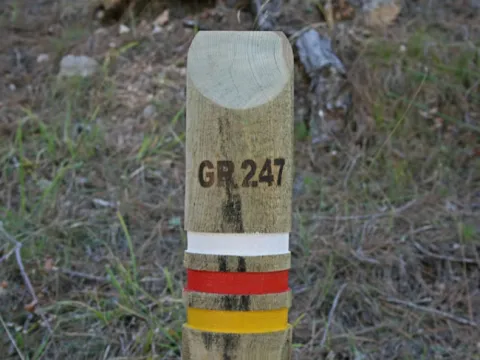
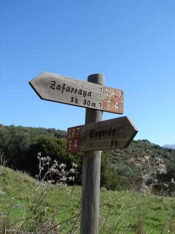
The GR247is the largest hiking route in the largest natural space in Spain. The GR247 Forest of the South path offers you 478 km marked, along 21 main stages and 11 derivations to places of interest. The GR also has 3 variants, composed of two sections each, that will help you subdivide the layout, and make a version adapted to your interests and time available. You decide how to do it! Its tour will take you to the births of the Guadalquivir and Segura rivers, it will enter you by the mosaic of landscapes of this mountain: high mountain peaks, castles, forests, rivers and waterfalls, traditional roads, altiplanicies, villages and villages still inhabited, historical sets, olive groves and orchards. A great way to discover the flight of the broken bones, the cleanest waters, the conversation with the transhuman pastors, the way to live in the mountain villages..., a collection of experiences and the authenticity of the most extensive saws of Andalusia, await you on the verge of this road. Most of the stages start and end in places with basic services - sources, villages or villages, campsites and other accommodation, camping areas or near carts. Other sections have only emergency shelters, without services, built to provide these areas of the GR. It well plans your journey because some stages go through very remote places, without telephone coverage, often subject to high mountain conditions that can leave you isolated (snow, wind and low-zero temperatures in winter, or lack of water and permanent insolation in summer), so you must be informed of the conditions before you start the route; in addition to having enough of your breath. You decide where to start the road, how many steps you will make on this visit to the park, how to divide the walk or, if you prefer, dedicate all your holidays to the full tour. Never leave the route, always follow the rules of use of the GR and the shelters as well as the instructions of the natural park staff. It respects all the rules of protected space as you walk the path and use its equipment. Landscapes full of memory await the steps and the complicit look of the walker, in one of the most interesting natural spaces in southern Europe.

Latitud
38.1547
Longitud
-2.5612
Distrito
Municipio
Ubicación en el mapa
POINT (-2.5612 38.1547)
imagen
Image
image_162532.jpeg
Imagen principal
Activado

Nature

icon-intereses-naturaleza

Friends

icon-intereses-amigos
Image
GR-247 Bosques del Sur
478 km
Desactivado

Recommendedalways long pants (even in summer), boots or non-slip shoes, hat or cap, drinking water and some kind of food and clothing adaptable to variable weather. It is also advisable to carry protection cream for the sun and air, to be provided with a mobile phone and to carry a small medicine with disinfectant, tirite, gauze, some bandage, anti-inflammatory and against bites. In rainy days or where there are sources or rivers it is also recommended to wear a complete mute of clothes.
You can't forget the photo camera!

Hiking Route Cerrada del Utrero and Cascada de Linarejos

Submitted by brandcode_deweloper on
Id
5725805
Breve descripción

The site known as Cerrada del Utroo-Linarejos is an amazing natural work sculpted by the Guadalquivir in the limestone that surrounds it. The path is on foot, and it will allow you to appreciate the sharp rocks and objades created by water over hundreds of thousands of years. It is a charming walk where the labiérnago, the cornicabra, and the willow accompany you to one of the most photographed places in the Park: the "horse tail" or Cascada de Linarejos.

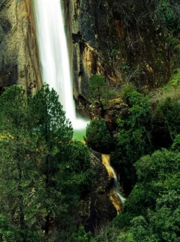
The Guadalquivir made this canyon narrow and deep, leaving some streams - like that of Linarej- hanging on the heights. When this stream is at the throat it forms the spectacular Cascade of Linarejos, which after standing in some pozas joins the Guadalquivir to descend to the valley.

The path is 1.6 km and on its circular route it surrounds the "Peñón del Lanchón" to return to the road in a pleasant walk of about 45 minutes.

In the final part of the road - just before returning to the asphalt - you reach a pine-resinero or black forest (Pinus pinaster) that was used to obtain the resin with which the water used to be made. In these trees you will see the furrows that the resineros opened to allow the exit of this sap.

We suggest:

  • Observe the numerous rupicular birds that nest on the rocky wall in front of our path, as we pass the waterfall of Linarejos. You will see small species, such as the victor, the lone rocher or the white lavender, sharing space with much larger ones like the leonate vulture.
  • Get to know the small town of Vadillo-Castril, where the old Rife sawmill was and today it is the home of two agencies of great importance for the Natural Park: the School of Forest Capataces and the Forest Defense Center.

LOCATION

In Cazorla take the Sierra road (A-319) until the crossing known as the Empalme del Valle. Turn right on the JF-7092 road and just before passing the bridge over the Guadalquivir River (4 km from the Empalme) begins the Cerrada del Utrero path.

Latitud
37.9052
Longitud
-2.9551
Ubicación en el mapa
POINT (-2.9551 37.9052)
imagen
Image
676_img.png
Imagen principal
Activado
imagen
Image
575_image_4.jpg
Imagen principal
Desactivado
imagen
Image
575_image_5.jpg
Imagen principal
Desactivado

Nature

icon-intereses-naturaleza

Friends

icon-intereses-amigos

Adventure

icon-intereses-aventura

Culture

icon-intereses-cultura

Sport

icon-intereses-deporte

Eco-friendly

icon-intereses-eco-friendly

For couples

icon-intereses-en-pareja

Family

icon-intereses-familia

Gastronomy

icon-intereses-gastronomia

Municipality

icon-intereses-municipio

Low-cost tourism

icon-intereses-turismo-low-cost

Solo travel

icon-intereses-viajar-solo
Ruta de senderismo Cerrada del Utrero y Cascada de Linarejos
All year round
Desactivado
Tramo de asfalto o cemento
 
Tramo de pista o camino forestal
 
Tramo de vía pecuaria
 
Tramo de senda
 

Hiking Route el Aguardentero (La Osera)

Submitted by brandcode_deweloper on
Id
5714747
Descripción larga

The most recommended option is to make the path down. From the reservoir of Aguascebas, the walk is 4.5 km, from the km 18.8 of the road JH-7155 (Transversal de las Villas). At this point, to our left are the houses of the reservoir and, right behind you, we can observe an old quarry, where you walk the path.

Breve descripción

This path will allow you to discover one of the most charming environments in the Las Villas mountains. It runs along the natural channel of the river Aguascebas Chico, where we will discover unusual and unexpected corners. Following him, on our right, we found fenced land of ancient crops and a small cortijo half-melting. This place is known as "Las Ramblillas." In the deep valley you can see the river Aguascebas Chico.

We deviate from the road, in order to see, upstream, a spectacular leap of water, with a large poza in its base, whose waters look an emerald green by the reflection of the lush vegetation surrounding it. Let us take our way back, to reach a small hill, with a very particular silhouette. It is the Paso del Aguartedo, place of impressive views towards the countryside.

The path is conditioned and low, with a serpentating route, on a steep and rocky slope. On our left we found a striking oquity - an ashtray - where the shepherds used to keep their cattle. Below we reach a small lookout, where the path is fork. We follow the one on the right, until we get back to the channel to contemplate the majestic cascade of the Osera, perhaps one of the highest and beautiful waterfalls of Andalusia.

We continue along the path marked, by the narrow and steep ravine, enjoying the multiple pozas of the channel, to a walkway that crosses the river and back the path to the Odera lookout. If at this point we continue along the road that goes parallel to the channel, we will reach the explanade of La Osera, place where the vehicles are left when it is accessed from Mogón.

For these wonderful places it is very easy to observe the flight of the leonate vulture. The real eagle is also present and, if we look well, we can even see the little perdicular eagle.

Latitud
38.1904
Longitud
-2.6902
Municipio
Ubicación en el mapa
POINT (-2.6902 38.1904)
imagen
Image
668_img.png
Imagen principal
Activado
imagen
Image
shutterstock_1060474277.jpg
Imagen principal
Desactivado

Nature

icon-intereses-naturaleza

Friends

icon-intereses-amigos

Adventure

icon-intereses-aventura

Culture

icon-intereses-cultura

Sport

icon-intereses-deporte

Eco-friendly

icon-intereses-eco-friendly

For couples

icon-intereses-en-pareja

Family

icon-intereses-familia

Gastronomy

icon-intereses-gastronomia

Municipality

icon-intereses-municipio

Low-cost tourism

icon-intereses-turismo-low-cost

Solo travel

icon-intereses-viajar-solo
Baja
Ruta de senderismo el Aguardentero (La Osera)
Spring
Desactivado

The path can also be done in the ascending sense, starting from Mogon.

Scenic Drive Santiago de La Espada-Juntas de Miller

Submitted by brandcode_deweloper on
Id
5713957
Descripción larga

Among the options we propose to you:

Km 0.Santiago de la Sword. Located at 1350 m of altitude, its main economic activity is extensive livestock. It has the parish church of Santiago Apostle (16th century), built on an earlier hermitage dedicated to the same saint and which has a beautiful major altarpiece of Baroque style. In the square of the City Hall we find an old 16th century inn with a vistose wooden balconade.

Km 10.Mirador del Salto de la Nova or del Zumeta; 10 km from Santiago we find on the right hand side this mirador from which we see the limit of the Park and the province of Jaén. Watch out for hats, they can fly a long way.

Km 12.Tobos village. Compulsory stop to buy good bread and delicious cakes. Next to the road there is a simple laundry room that circulates the Tobos stream, with fresh and clean waters.

Km 13.Vites village. To get to the village of Vites you have to turn left and drive 2 km. In this village are raised magnificent white grapes, large and sweet, from which a powerful spirit is distilled. Ask the local neighbors.

Prado Moro.At the end of the village of Vites a left road ascends to Prado Moro. Here a centenary oak resists at the time that gives us a vision of the vegetation that in the past existed in the area.

Km 16.Embalse de la Vieja. A prominent peak called the Morrison announces the beginning of the Old Age reservoir. After the village of Morrión, a lane - not marked - goes down on the left to the reservoir.

Km 18.The Vadico. Two km from the reservoir there are houses on the right side of the road with a wall in front. Right across the street we found a way up to the Vadico. It's a nice walk, by a real vergel, which deserves to be made on foot. On the way there are sources to be able to refresh and collect water.

Km 18.5.Entrance to the villages of La Muela, Marchena and Marchenica. The Muela is 5.4 km from this point. In its vicinity is Hoya Somera, an important archaeological site of the bronze age. Later on there are Marchena and Marchenica. In its surroundings, there were Roman remains and an Arab necropolis.
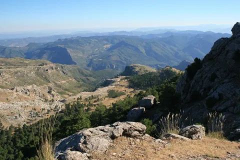
Km 22.Miller's together. At this point the Zumeta River has come with us all the way and the Segura. A natural stone tunnel announces the arrival at this meeting place.

Miller village.From Las Juntas there is another road that reaches this historic village with more than 20 water births. It is a starting point for several routes that will make us known beautiful areas of the Sierra de Segura. When you pass the stone tunnel you have to follow the indication "Central and Miller."

Breve descripción

The Zumeta Valley, through which this route runs, is a true journey in time. By the river there have been settlements from the Neolithic to today. We will find archaeological sites, rock paintings, small castles and villages that are authentic ethnic museums in the open air. In them it is still easy to see their inhabitants doing work of other times.

The morphology of the land also tells us of the thousands of years in which water has been the artisan hand that has built the landscape. As we go down this road, the oak and pine trees make way for lush riverside forests.

Latitud
38.0764
Longitud
-2.5222
Distrito
Municipio
Ubicación en el mapa
POINT (-2.5222 38.0764)
imagen
Image
Ruta%20en%20coche%20Santiago%20de%20La%20Espada%20-%20Juntas%20de%20Miller%20%281%29.jpg
Imagen principal
Activado
imagen
Image
Ruta%20en%20coche%20Santiago%20de%20La%20Espada%20-%20Juntas%20de%20Miller.jpg
Imagen principal
Desactivado
imagen
Image
Ruta%20en%20coche%20Santiago%20de%20La%20Espada%20-%20Juntas%20de%20Miller2.jpg
Imagen principal
Desactivado
1 día

Nature

icon-intereses-naturaleza

Friends

icon-intereses-amigos

Adventure

icon-intereses-aventura

Culture

icon-intereses-cultura

Sport

icon-intereses-deporte

Eco-friendly

icon-intereses-eco-friendly

For couples

icon-intereses-en-pareja

Family

icon-intereses-familia

Gastronomy

icon-intereses-gastronomia

Municipality

icon-intereses-municipio

Low-cost tourism

icon-intereses-turismo-low-cost

Solo travel

icon-intereses-viajar-solo
Baja
Ruta en coche Santiago de La Espada-Juntas de Miller
By car, on foot
All year round
Desactivado

Santiago de la Espada village

Tramo de asfalto o cemento
 
Tramo de pista o camino forestal
 
Tramo de vía pecuaria
 
Tramo de senda